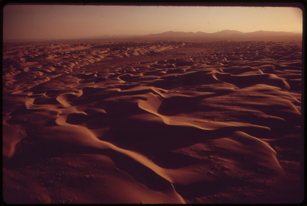
A modern erg, similar to those that dominated the Jemez area in the Mesozoic.. NARA
The table of contents may be found here.
A modern erg, similar to those that dominated the
Jemez area in the Mesozoic.. NARA
The Mesozoic was the Age of the Dinosaurs. Its beginning and end
were bookended by mass extinctions, in which a large fraction of
the families of fossils disappeared in a geological blink of an
eye. Life took millions of years to recover its diversity
afterwards.
In this chapter, we will look at the Jemez area during the Mesozoic Era.
For behold, there are many worlds that have passed away by the word of my power.
— The Pearl of Great Price
The oldest Permian formations in the Jemez area are separated
from the youngest Triassic formations by a significant
unconformity. As a result, there is no direct record in the Jemez
of one of the greatest catastrophes in the history of the Earth.
Starting about 252 million years ago, some 96% of marine species
and 70% of land species went extinct in a geologically brief
period of time, a dramatic enough change in the fossil record that
it was chosen by geologists to mark the boundary between the
Paleozoic Era and the Mesozoic Era. This was the worst loss of
biological diversity in the geologic record. It took around ten
million years for the diversity of life to recover.
Geologists long debated just what went wrong. However, the clues
have continued to accumulate. There is evidence that global
temperatures abruptly rose, by 8C (14F), accompanied by a sharp
increase in atmospheric carbon dioxide levels, to over seven times
its modern preindustrial value. There is also evidence of a surge
in the ratio of biologically active carbon-12 to less biologically
active carbon-13. This suggests a massive release of biological
carbon into the atmosphere, which could have been caused by a
global fire storm or some other massive destruction of vegetation.
There is weaker evidence of repeated explosions of the fungus
population, and it has been suggested that the fungus were fed by
large quantities of dead vegetation. There is also evidence of an
increased mutation rate in plant spores, which some geologists
interpret as evidence of increased ultraviolet light reaching the
Earth's surface. Oxygen levels appear to have plummeted, from the
high of 35% at the start of the Permian to a low of 15% in the
early Triassic. Oxygen levels would not return to the present
value of 21% until the mid-Jurassic, 170 million years ago.
The exact timing of this extinction took some time to sort out, with some geologists pointing to evidence of a single massive extinction pulse and others pointing to repeated pulses of extinction over a period of up to 10 million years. Part of the difficulty is that the gap in the geologic record in the Jemez at this time is not at all unusual. Sea levels were nearly as low as at any time in the geologic record, reducing opportunities for sediments to accumulate. This is reflected in the 87Sr/86Sr of oceanic rock, a signature of continental weathering, which had reached nearly its minimum value in the geologic record in the late Permian but began to rise steeply at the very end of the Permian. There are few places on Earth where the rock beds span the Permian-Triassic boundary, which is one reason why there is uncertainty just what took place. However, the geologic record for this time is reasonably complete in Sichuan province, China, and very precise dating of zircon grains in ash beds suggests the extinction took place between 251.941 ± 0.037 and 251.880 ± 0.031 million years ago.
We now have a reasonably good picture of what happened. The
catastrophe opened with a preliminary extinction event, the
Capitanian Crisis, about 258 million years ago. This is precisely
the age of the Emeishan Large Igneous Province in southwestern
China. A large igneous province is a region of flood
basalts erupted within a relatively short geologic time span and
covering a vast surface area. The Emeishan LIP is heavily eroded,
but covered an area of about 250,000 square km (100,000 square
miles), or about the same area as the U.S. state of Oregon.
A large igneous province likely arises from a mantle plume
arriving at the base of the crust. A mantle plume is a localized
upwelling of unusually hot rock from deep in the mantle, perhaps
all the way from the core-mantle boundary. Seismic measurements
reveal an irregular thin layer at the very base of the mantle, the
D'' layer, that averages just 200 km (125 miles) in
thickness. This is thought to be a graveyard of subducted
slabs of oceanic lithosphere. The subducted slabs are so cold,
compared with the mantle into which they sink, that they do not
regain buoyancy before arriving at the core-mantle boundary.
Because oceanic crust is enriched in potassium compared with
mantle rock, and potassium is very slightly radioactive, the
subducted crust eventually becomes hotter than the surrounding
mantle rock and begins to rise again towards the surface. The
resulting mantle plume may be as large as 500 km (300 miles) in
diameter, and once it hits the base of the crust, it may spread
out to 2000 km (1200 miles) in diameter. Vast quantities of
basaltic magma produced by the plume then repeatedly penetrates
the crust to flood the overlying surface.
Each pulse of volcanism would have released vast quantities of
carbon dioxide, methane, and sulfur oxides into the atmosphere.
Unlike the comparatively minor flood basalt eruptions we see
in places like Iceland today, which erupt through oceanic crust,
the Emeishan eruptions penetrated continental crust bearing a
thick sequence of carbonate rocks, and the heat of the eruption
released quantities of carbon dioxide dwarfing anything seen
today. Methane was likewise released from coal beds cooked by the
rising lava, causing the isotope ratio C13/C12
to plummet. The sulfur dioxide initially reflected solar
radiation, cooling the Earth drastically for up to a decade. The
effects of the carbon dioxide and methane would then kick in,
creating long-term warming. The warming tended to release
additional methane frozen into polar permafrost and in deep ocean
basins, enhancing the warming yet further. The carbon dioxide and
sulfur oxides acidified the ocean, killing marine organisms
through acid poisoning, carbon dioxide poisoning, and anoxia. Land
plants suffered from acid rain, and from an increasingly arid
climate as the temperatures rose. At sea, reefs were
devastated, with corals and other multicellular forms being
replaced by unicellular reef builders. Reefs prior to the
Capitanian crisis were dominated by desmosponges, whose highly
calcified skeletons proved vulnerable to acid waters. Fusulinids
and many other sea organisms with calcite shells were driven to
extinction.
But this was only the dress rehearsal.
_2_(17338266745).jpg)
Native iron produced by iron-rich magma of the Siberian
superplume coming in contact with coal beds. Via
Wikimedia
Commons.
252 million years ago, a mantle plume so large it can only be
described as a superplume reached the base of the
lithosphere under the Tunguska Basin of Siberia. Some 5 to 16
million cubic kilometers (1.2 to 3.8 million cubic miles) of magma
penetrated the overlying crust, covering an area of five million
square kilometers (1.9 million square miles), equal to 62% of the
area of the contiguous states of the United States. The thick beds
of basalt are known today as the Siberian Traps.
As if this was not bad enough, the superplume could not have chosen a worse spot to arrive under the crust. The Tunguska Basin has some of the oldest petroleum reservoirs known, dating back 635 million to a billion years old. The petroleum-bearing rocks are up to eight km (five miles) thick. These are overlain by up to 2.5 km (1.5 miles) of early Paleozoic carbonate and evaporite rocks. These in turn are overlain by relatively shallow Carboniferous coal beds. The hot magma released carbon dioxide and methane from the deep petroleum reservoirs that blew out over 6400 blast pipes, each typically over 1.6 km (a mile) in diameter. Some 250 of these contain magnetite deposits, some of which are now being exploited as iron ore. Another 500 are filled with basalt. The pipes emitted as much as 160 trillion tons of carbon dioxide and 46 trillion tons of methane. By comparison, the entire release of carbon dioxide by all human industrial activity since 1750 is estimated at about 2 trillion tons. The vast amounts of carbon released produced an enormous drop in the C13/C12 ratio.
Coal ash from burning coal beds ignited by the blasts, rich in
toxic chromium, arsenic, mercury, and lead, blanketed northern
Canada. The evaporite beds, containing salt and gypsum from a
long-vanished ocean, became a source of hydrochloric acid, methyl
chloride, and methyl bromide, as well as over 5 trillion tons of
sulfur dioxide. The superplume itself contained considerable
carbon dioxide and sulfur dioxide from its origins as oceanic
crust that had been subducted.
The Emeishan plume was catastrophic; the Tunguska superplume was apocalyptic. Based on oxygen isotope ratios, global average sea water temperatures first rose from 21 C (70 F) to 36 C (97 F). There was a brief drop to 32 C (90 F), possibly from a burst of sulfur dioxide emissions, then a rise to 38 C (100 F), the highest ever seen in the geologic record. Temperatures this high are lethal to most marine organisms. Temperatures did not fall back to 32 F (90 F) for another 5.1 million years. Land plants have difficulty continuing to photosynthesize at temperatures above 35 C (95 F), begin to die off at 40 C (104 F), and animals begin dying off at 45 C (113 F). The Earth's equatorial zone became a dead zone.
Carbon dioxide added to heat stress. The Paleozoic ocean floor
lacked the fine-grained carbonate sediments produced by modern
carbonate-producing plankton. This reduced the rate at which
carbonate could dissolve to counter acidification. This hit all
organisms producing calcium carbonate shells hard. Brachiopods
having carbonate shells were replaced with brachiopods having
phosphate shells; calcareous sponges were replaced with siliceous
sponges; and unskeletonized corals replaced skeletonized corals.
Organisms with well-buffered physiologies had a big advantage.
These include three dominant lineages of subsequent geologic time,
the molluscs, arthropods, and chordates. Those organisms that
survived tended to be smaller. Lystrosaurus, a small
burrowing tetrapod, became the dominant land animal at high
latitude, with lystrosaurs making up 90% of all surviving land
vertebrates in the early Triassic. Conifers did not proliferate
again for millions of years, and then only in the higher
latitudes, with lycophytes again briefly dominating lower
latitudes.
Oxygen levels dropped to 15%, suffocating many marine organisms and producing black shale beds rich in organic matter and pyrites. These may also reflect high hydrogen sulfide levels. The release of vast amounts of hydrogen chloride, methyl chloride, and methyl bromide was devastating for the ozone layer, reducing ultraviolet shielding by as much as 85%. Mutations and incomplete development of pollen and spores in sedimentary beds spike at this time This would have favored lycophytes with their capacity for asexual reproduction.
Jack Seposki of the University of Chicago argues that there are three evolutionary faunas in the fossil record. Each has distinctive characteristics. The animals of the Cambrian Explosion were largely replaced by those of the Ordovician, which in turn were large replaced by the modern fauna after the Permian extinction event. To these we may add the anaerobic world that surely preceded the Great Oxygenation Event in the Paleoproterozoic. Survivors of the the previous three worlds remain a part of our modern world, living in ecological niches to which they are peculiarly adapted, but our modern world is biologically the world of the early Triassic.

The Triassic opened with Pangaea fully assembled and a large island arc in the act of merging with southwest North America. The collision produced the Sonoma Orogeny, in which up to 300 km (200 miles) of crust was sutured onto the west coast. The force of the collision produced great thrust sheets, layers of rock driven eastward many kilometers over the existing crust. Though these sheets did not reach as far east as the Jemez area, the disturbance marked the beginning of renewed subsidence throughout much of the western United States, including the Jemez region.
Later in the Triassic, Africa began to split away from eastern North America, and vast red bed deposits were laid down in the Appalachian area. The Gulf of Mexico began to open late in the Triassic. The breakup of Pangaea would continue for another 150 million years.
Conifers became the dominant form of land vegetation, and the
first true mammals emerged late in the Triassic from a group of
mammal-like tetrapods called therapsids.
The Antler Orogeny and Sonoma Orogeny were the first of a series
of orogenic events on the western boundary of North America that
lasted nearly 250 million years. These events ensured that the
Jemez would be part of a foreland basin from the Triassic
until the Laramide Orogeny, 70 million years ago.
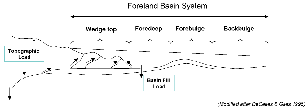
Continental lithiosphere is stiff. When an orogeny thickens the
crust to create a mountain range, the weight of the mountains
causes the crust to sink into the underlying mantle. This results
in plate flexure as the stiff lithosphere inland of the
mountains is also pushed down into the mantle. This produces a
foreland basin consisting of four zones: A wedge top that
constitutes the mountain front, where faulting throws up new
mountains; a foredeep where the crust subsides inland of the
wedgetop; a forebulge where the ductile mantle rock,
squeezed from under the foredeep, piles up in the next zone
inland; and a backbulge representing the furthest inland zone of
subsidence. These zones move back and forth over time with pulses
of orogenic activity and convection in the underlying mantle, as
if the earth itself was breathing. As a result, the Mesozoic
history of the Jemez is episodic, recorded in sets of rock beds
separated by significant unconformities.
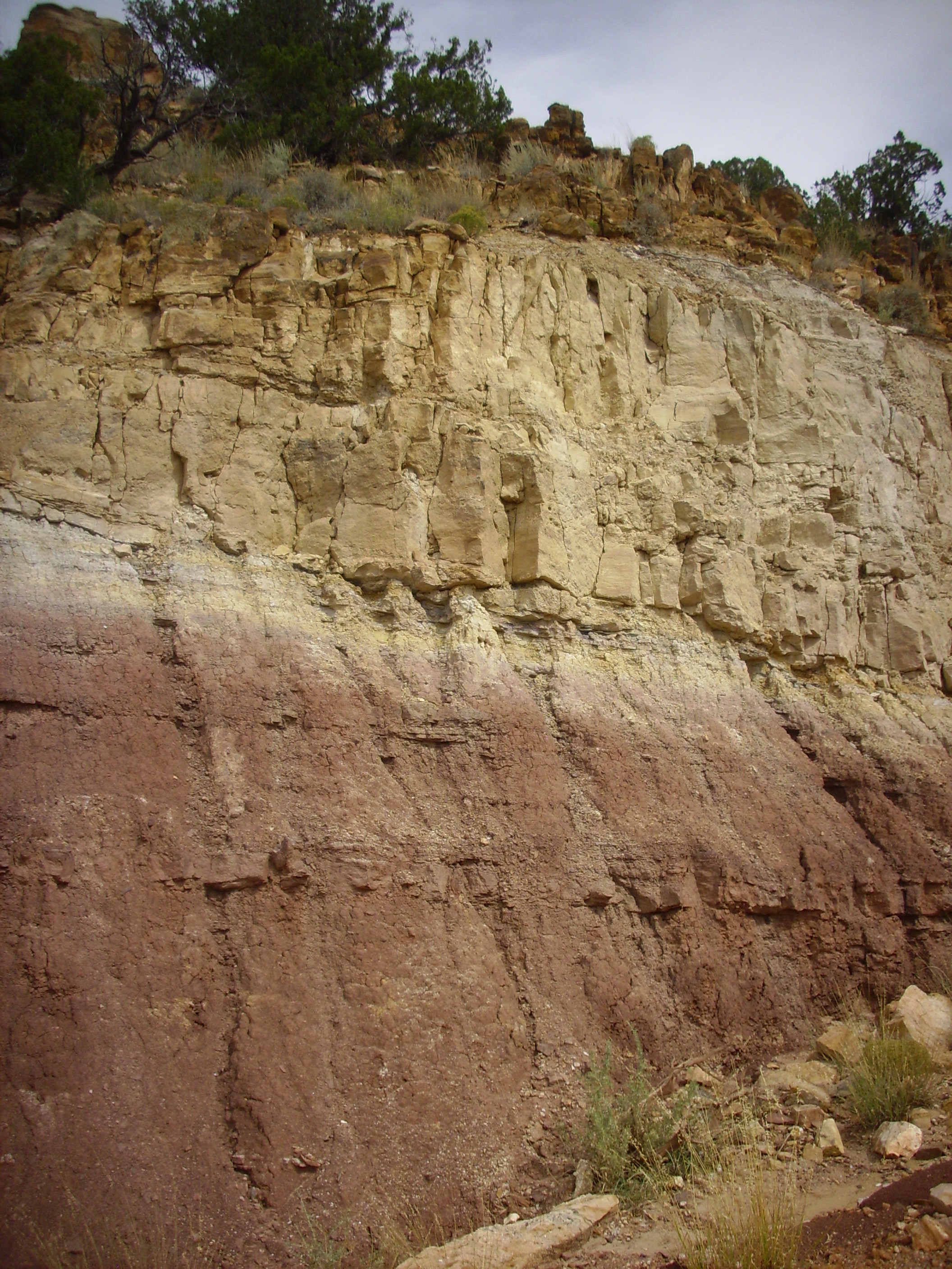
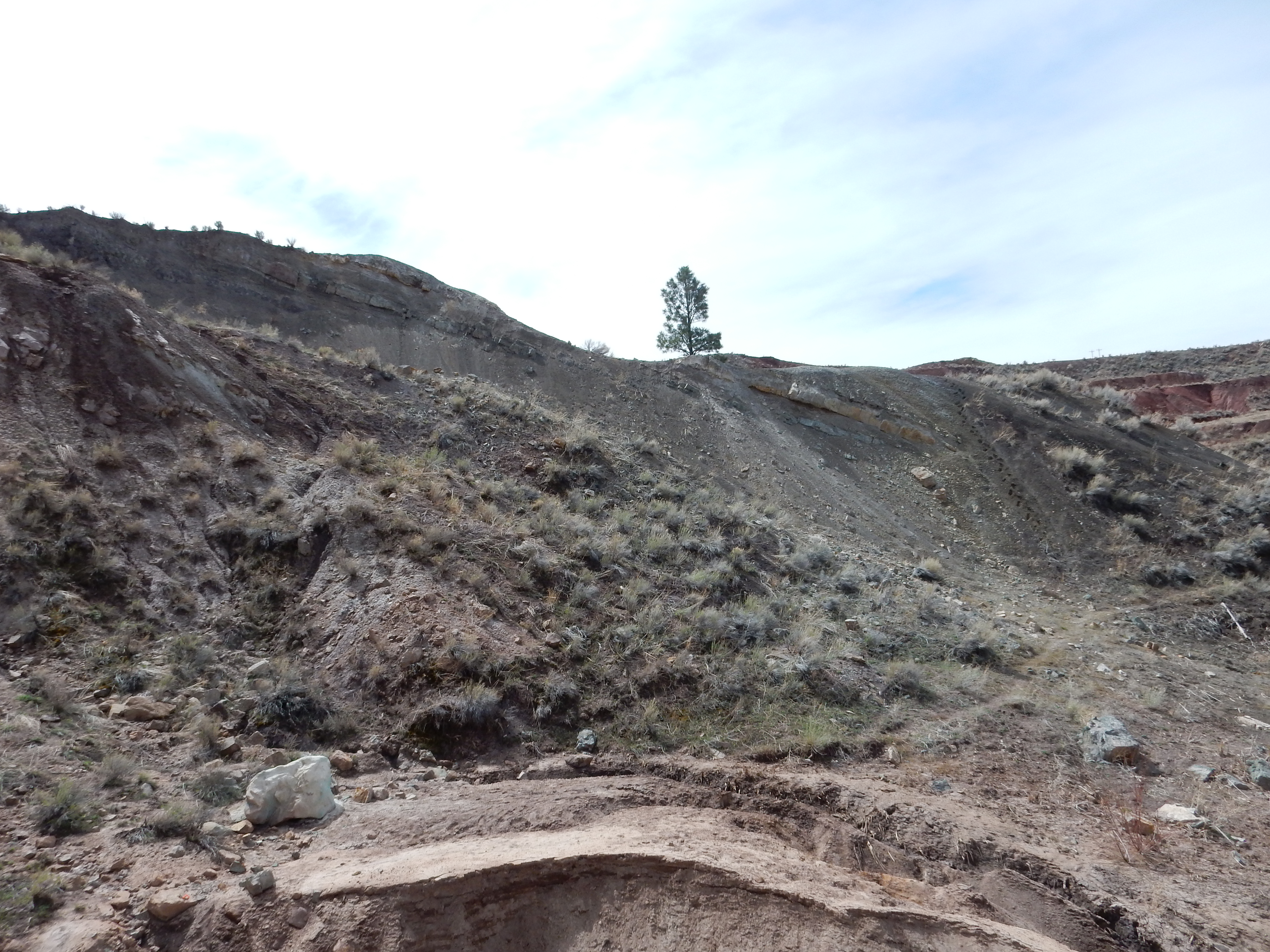
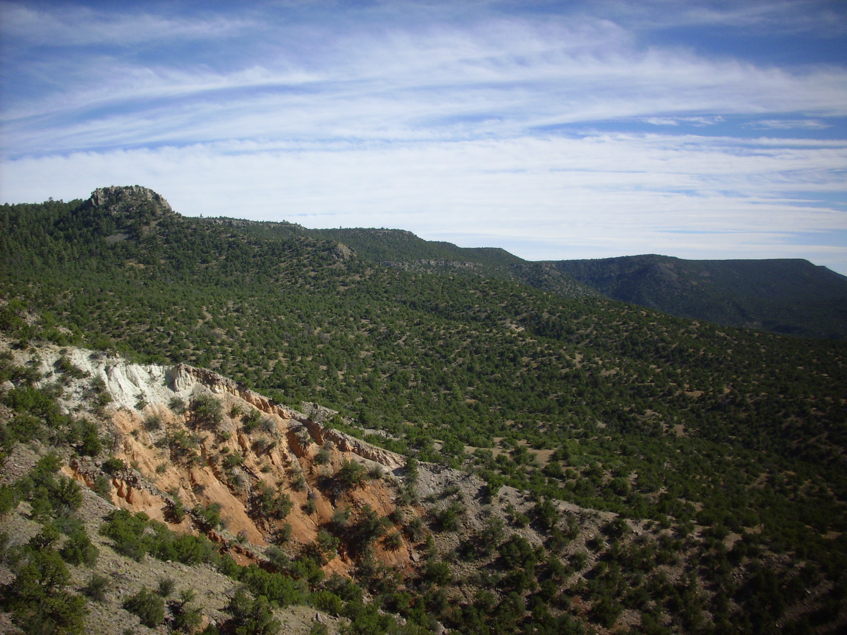
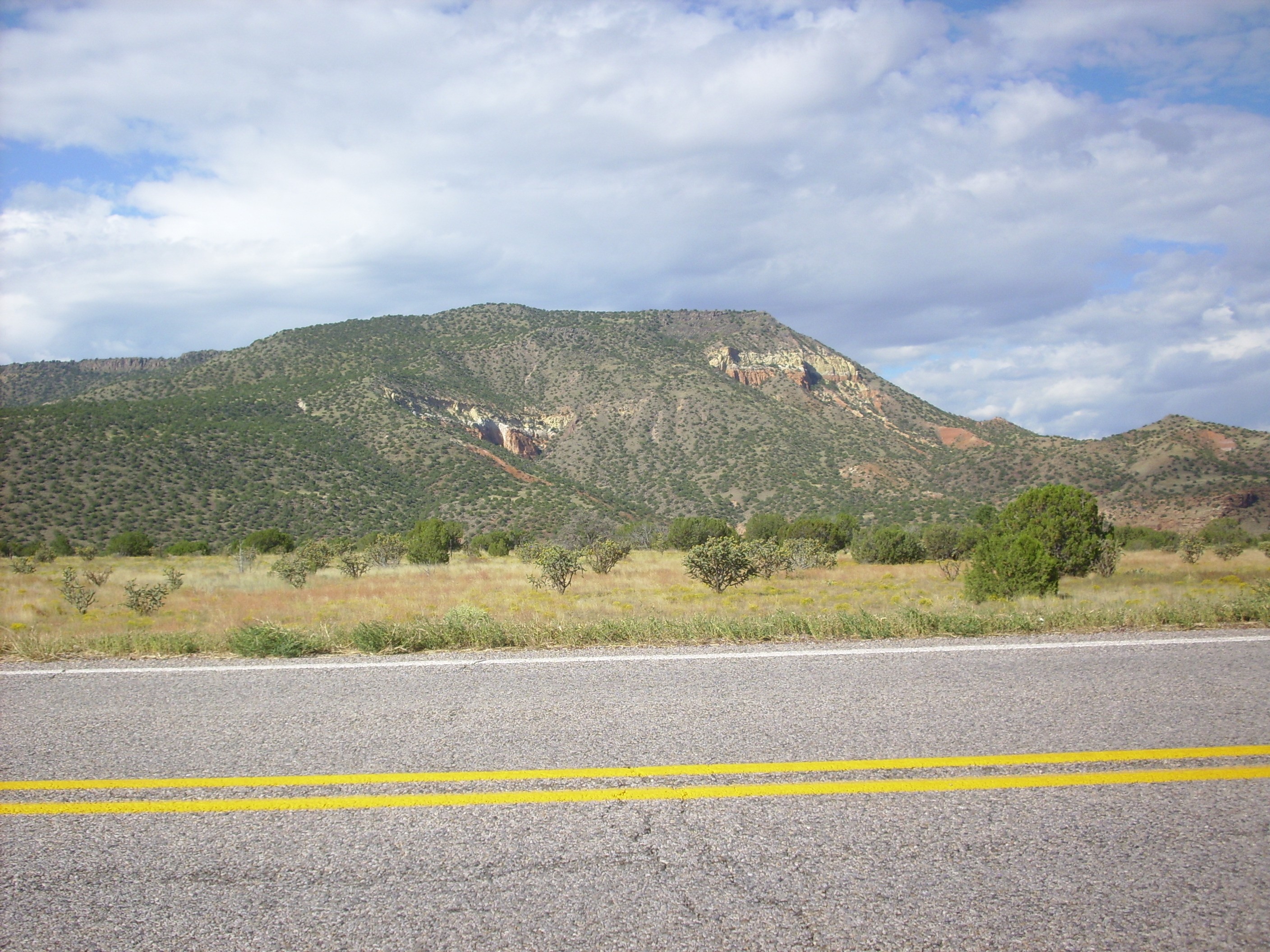
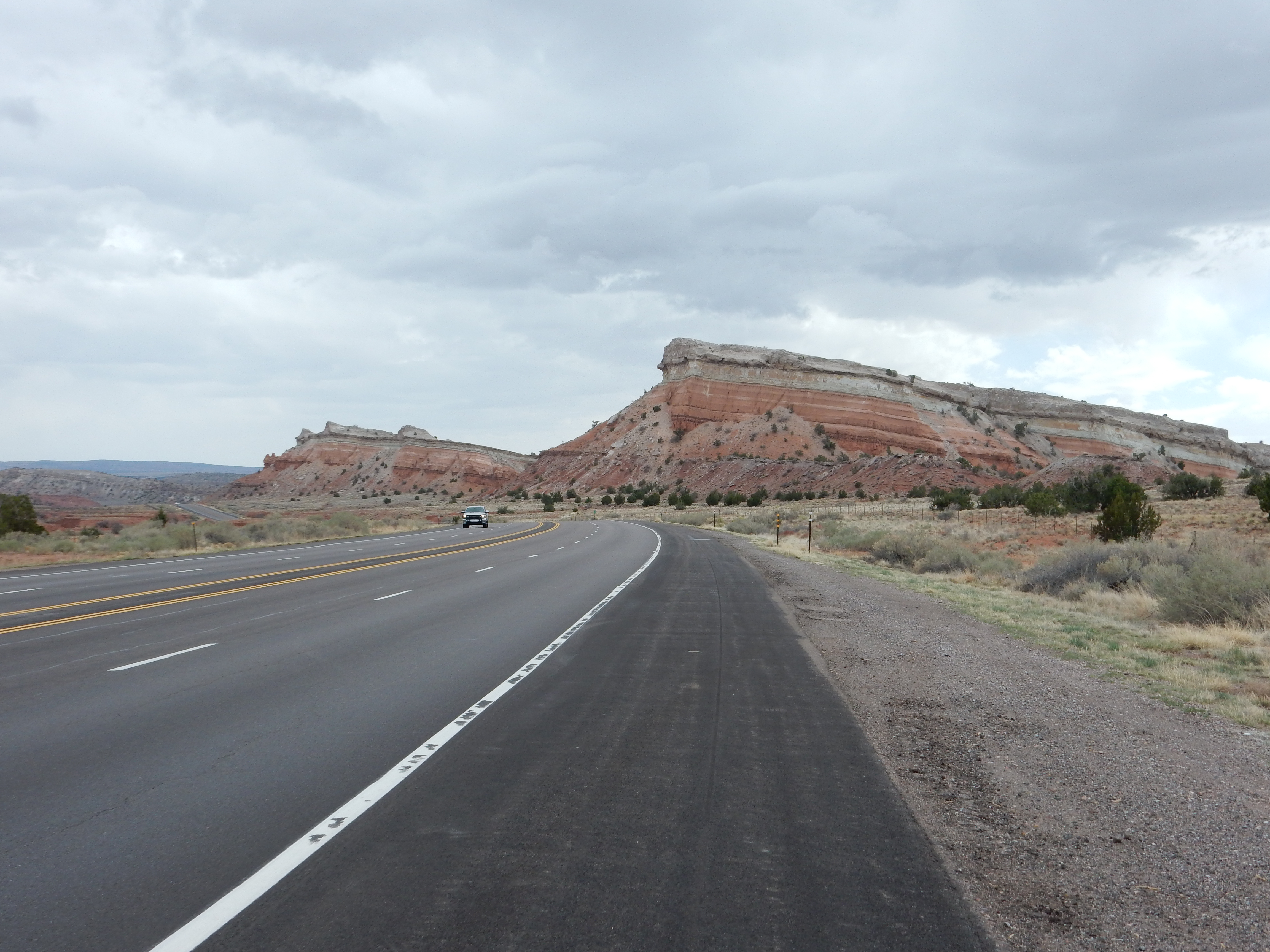
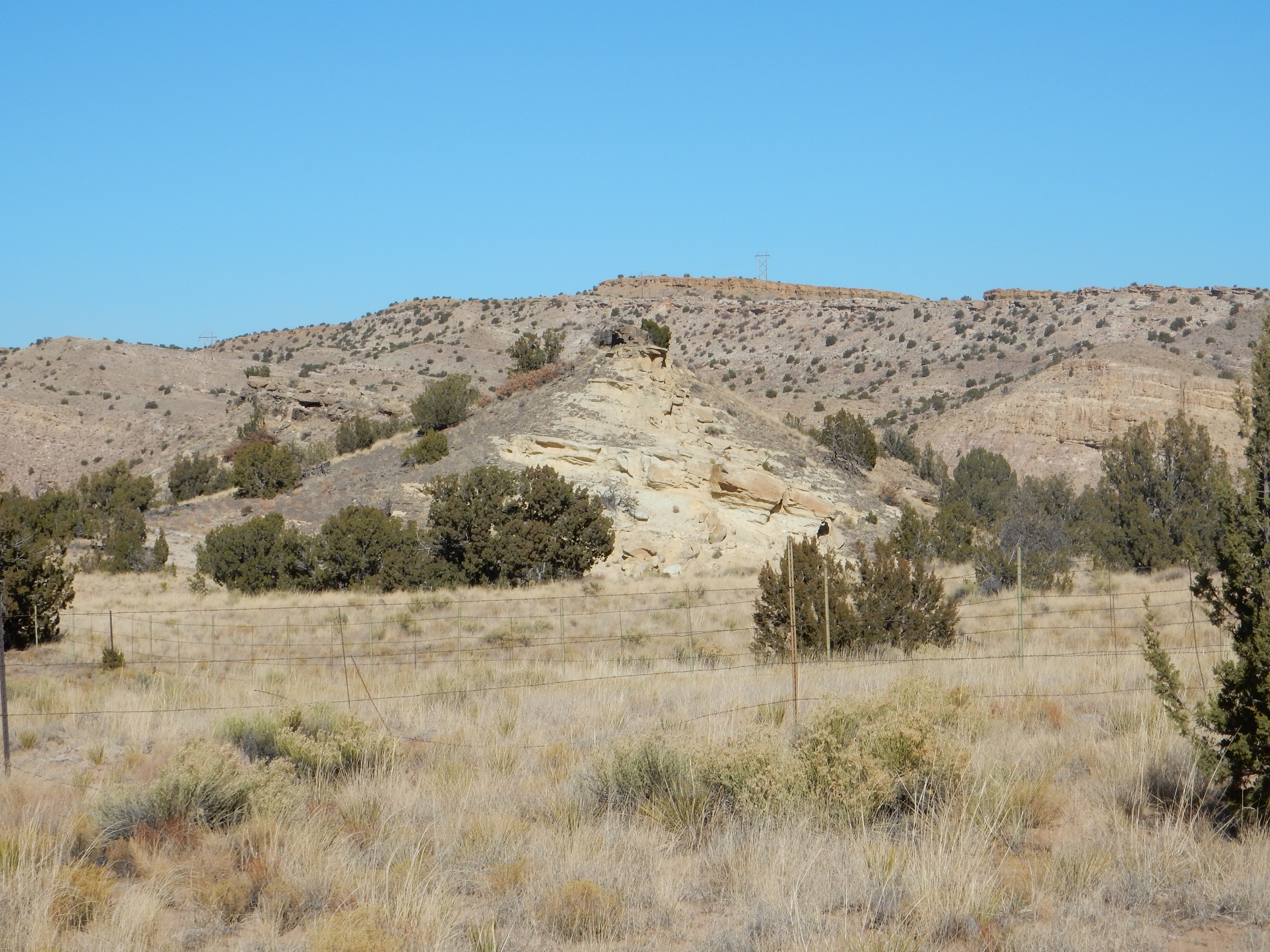
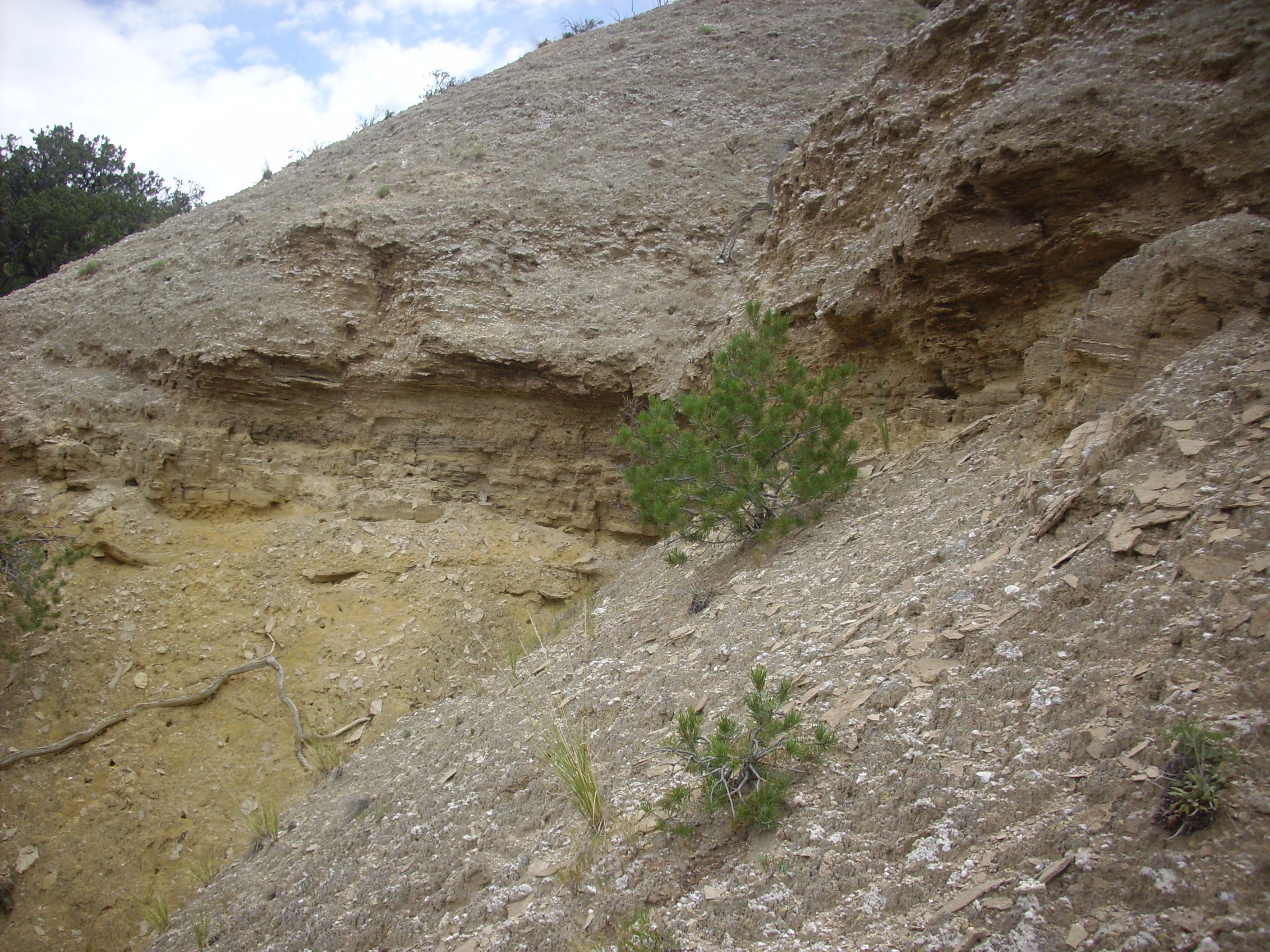
We pick up our story in lower Cañon de San Diego, where the upper
Permian and lower Triassic columns are well displayed in the sides
of Meseta Blanca.
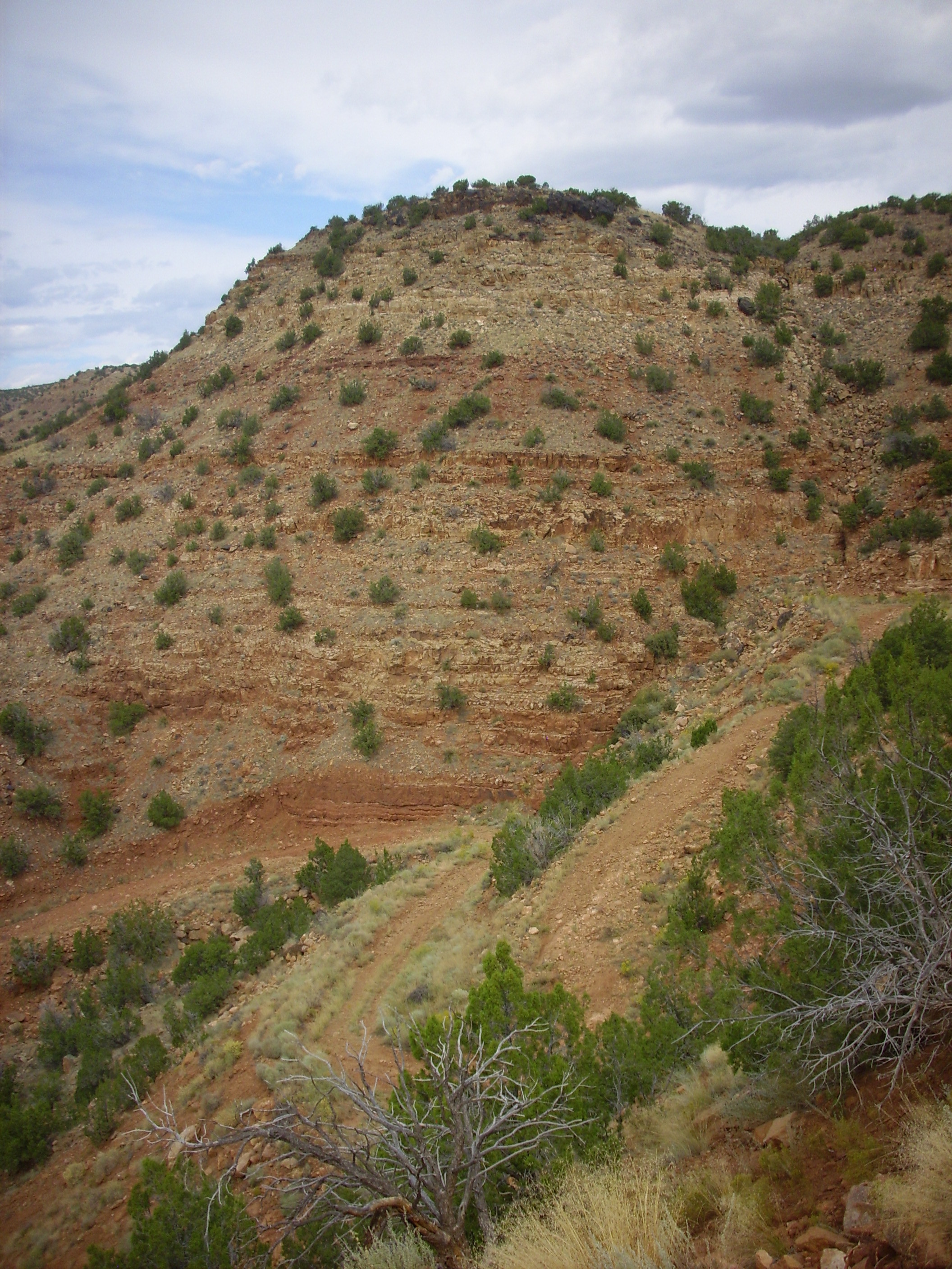
Meseta Blanca. Looking north from 35
39.979N 106 42.869W
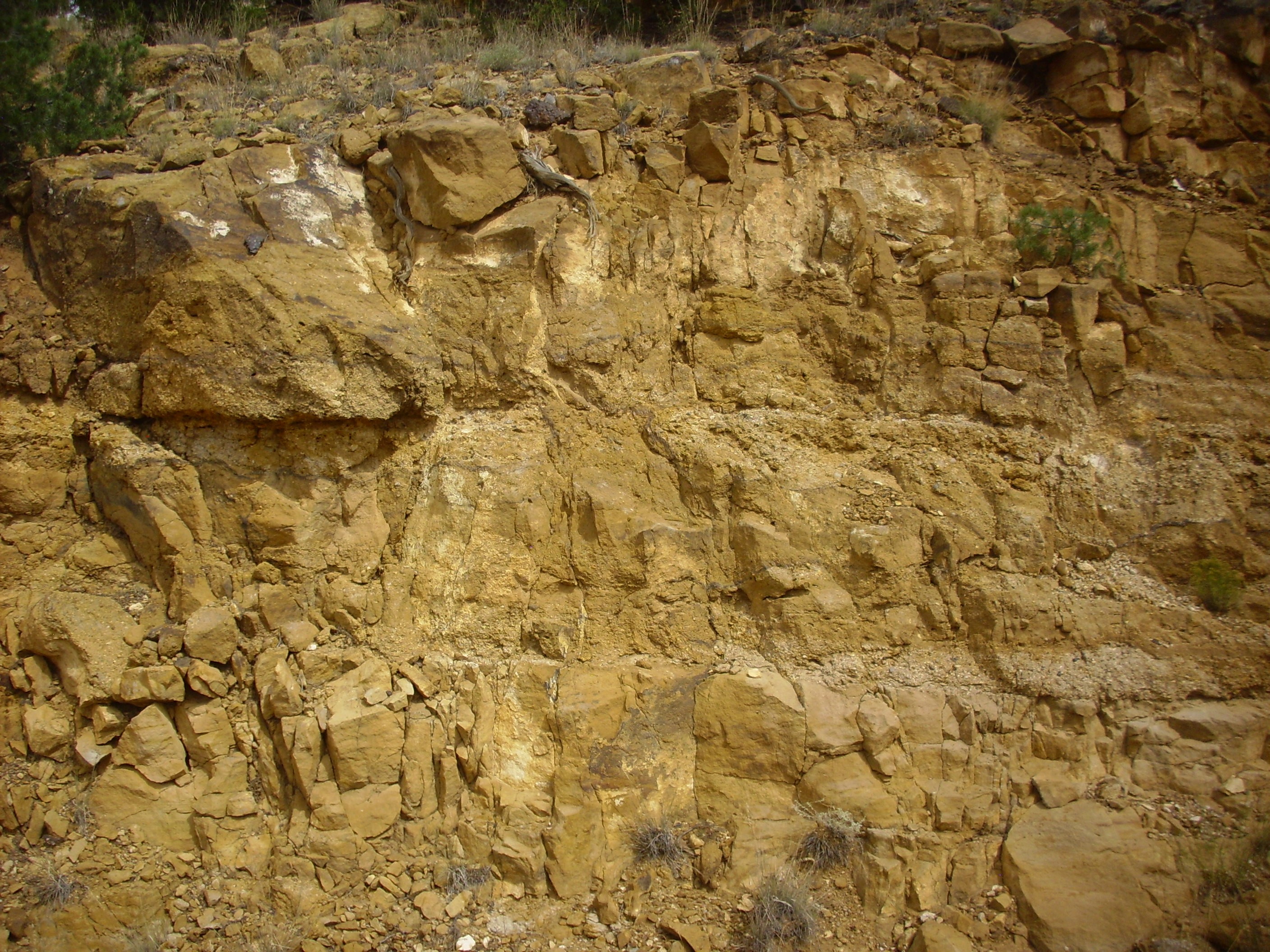
At the bottom are the red beds of the Permian San Ysidro Formation, Yeso Group. Above these are lighter beds of the Glorieta Formation. Then comes a discontinuity and the gentler slope and darker beds of the Triassic Moenkopi Formation, and finally the steep slope and lighter beds of the Shinarump Formation, with a cap of dark ferruginous conglomerate.
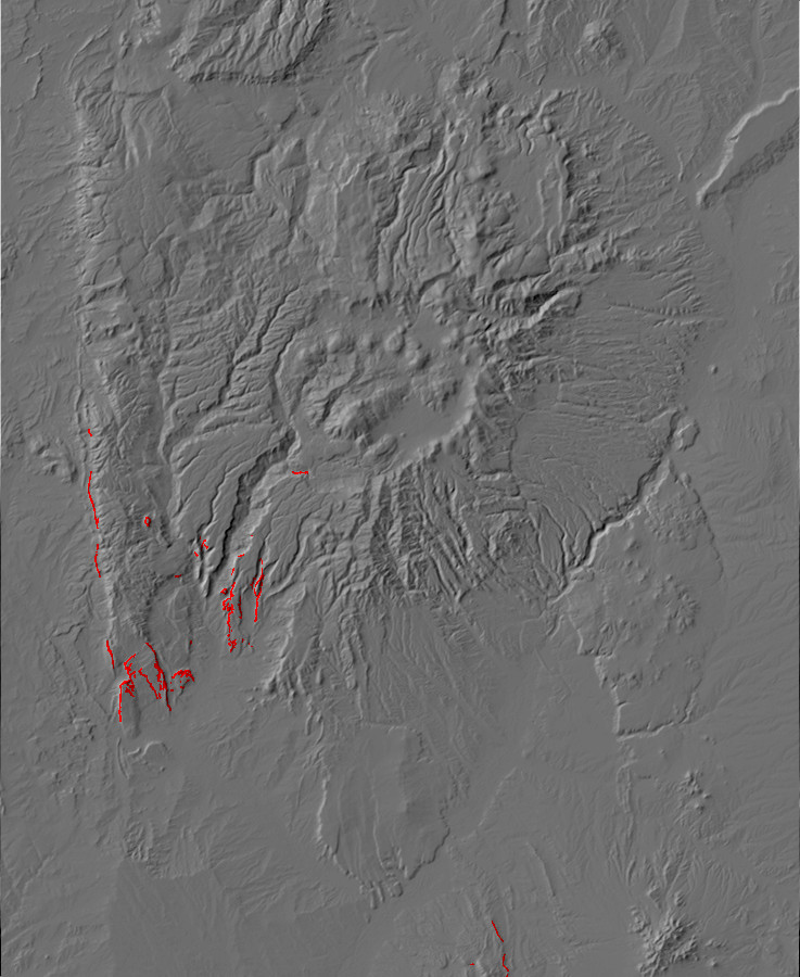
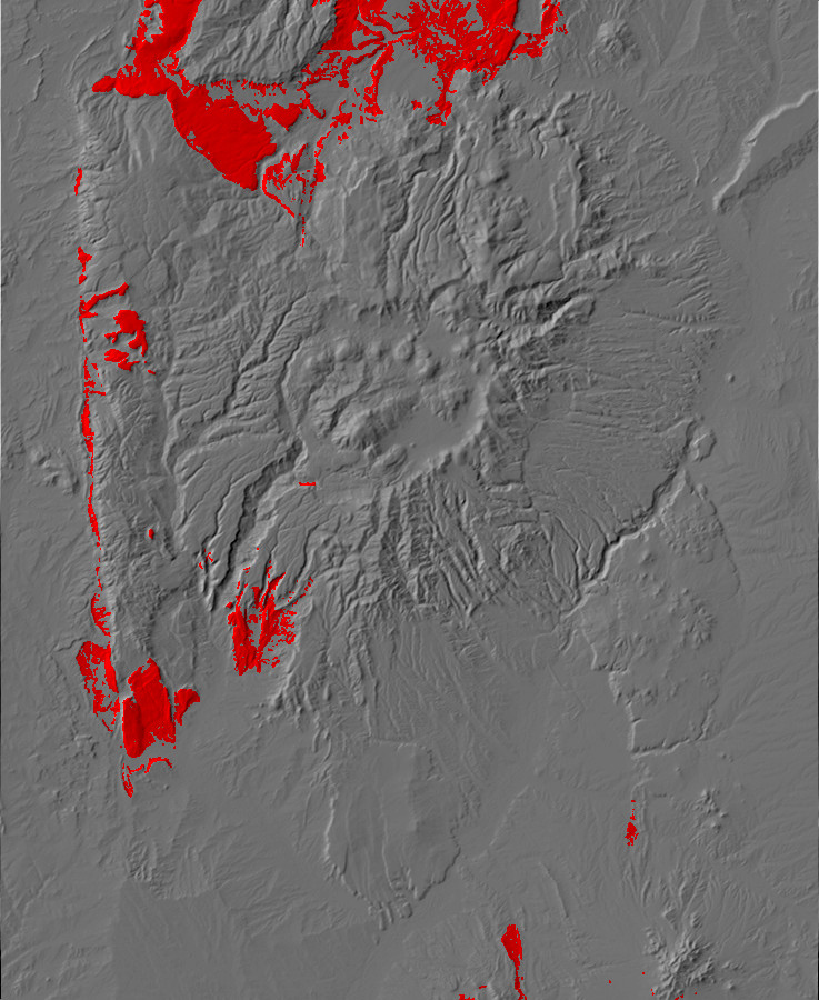
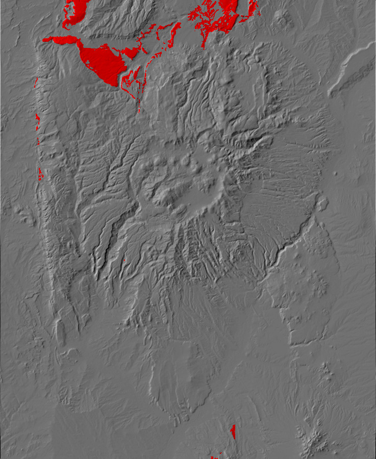
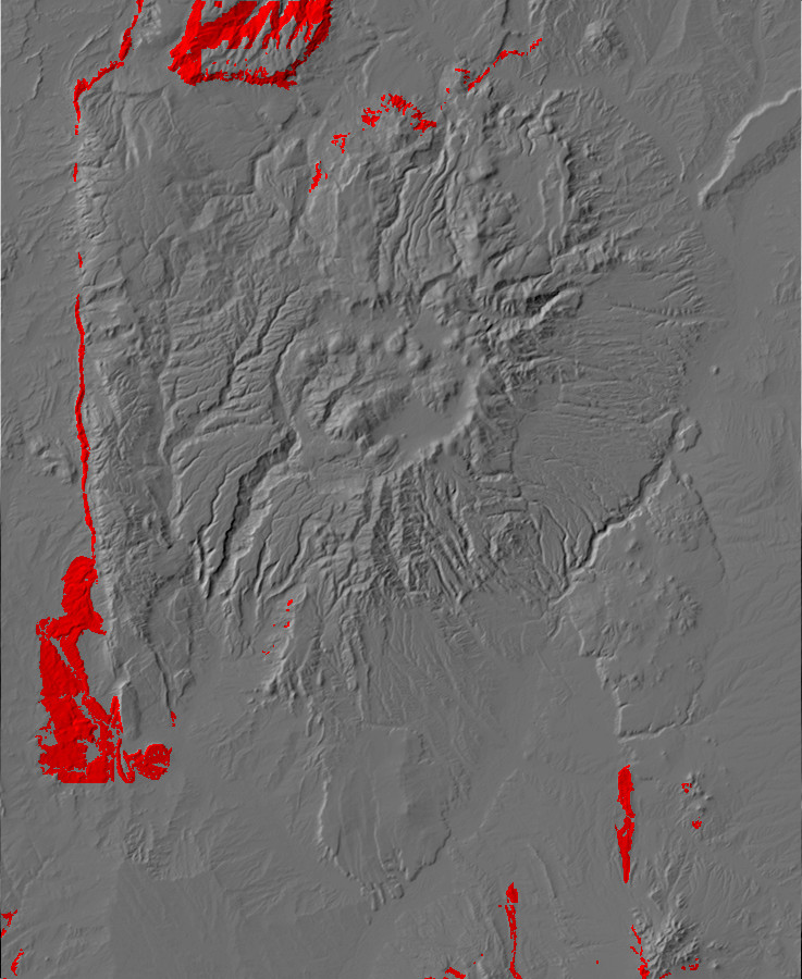
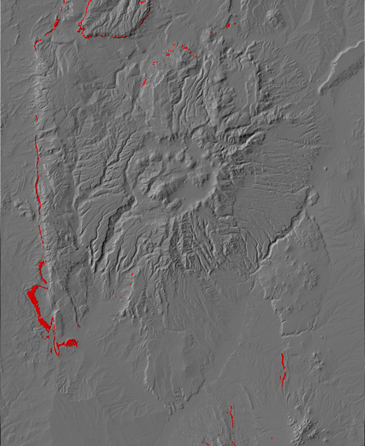
Relief map of the Jemez with Moenkipi Formation
outcroppings highlighted in red.
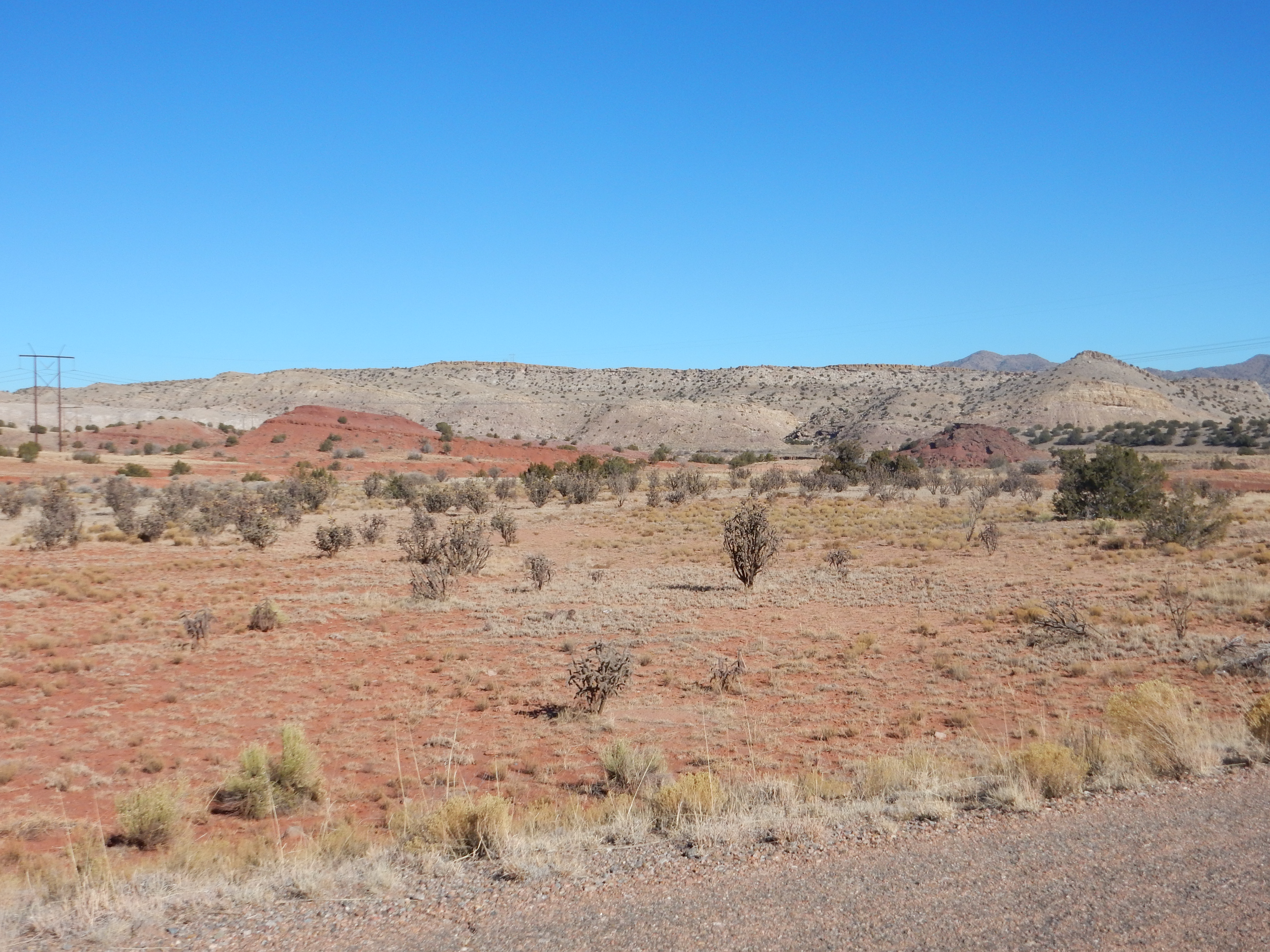
240 million years ago, the Jemez region lay at low latitude. To the east, the Appalachians were a mighty mountain chain, and great rivers flowed west from their foothills towards the Pacific. The Sonoma Mountains on the west coast wrung out what moisture came inland from the ocean, creating a rain shadow. The Jemez region was very flat and arid, and only the largest rivers made it clear to the coast. The flat terrain ensured that small changes in sea level, or just the fluctuating tides, shifted the shoreline back and forth by many miles. The shifting rivers laid down the mudstone of the Moenkopi in what was likely a tidal flat environment. This was a time when life was just recovering from the Permian-Triassic extinction, and the lack of vegetation cover likely mean intense weathering of sediments poor in organic matter.
The Moenkopi beds are relatively thin in the Jemez, but are up to
300m (1000') thick in parts of southern Utah. Particularly good
exposures are visible in the Hite
area. Here the formation is divided into numerous members.
The beds in the Jemez likely belong to the Anton Chico Member of
the Moenkopi, which is composed of thin beds of dark brown
mudstone and sandstone and tends to form slopes between cliffs of
the harder sandstones of the underlying Glorieta Formation and the
overlying Shinarump Formation. It is separated from both by
unconformities.
The lower contact with the Glorieta Sandstone is known as the
regional Tr-1 unconformity, and it is very widespread in what is
now the western United States. This discontinuity represents an
interval of 20 million years in which subsidence reversed itself
over a large region and there was a hiatus in sediment
deposition.

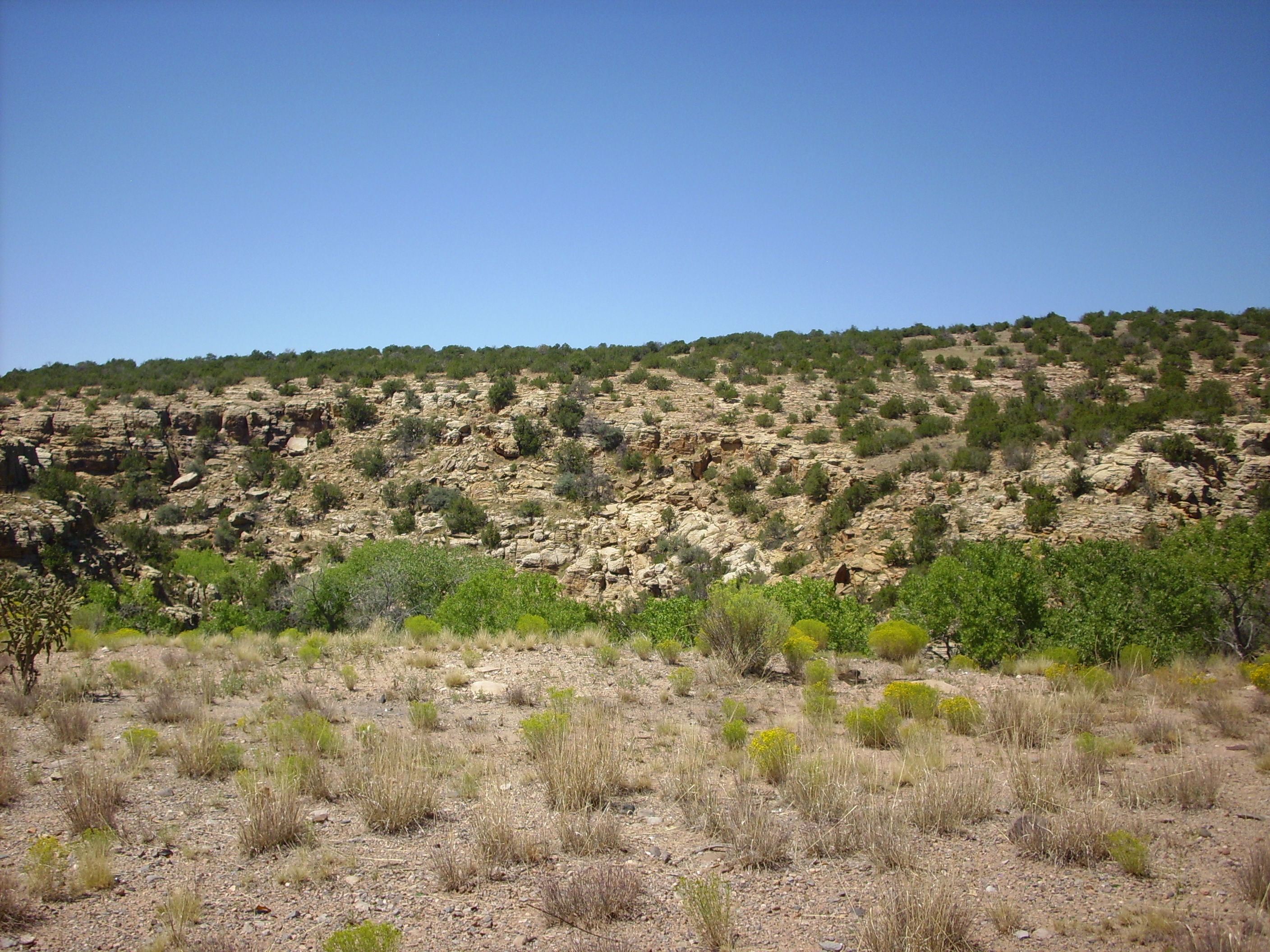
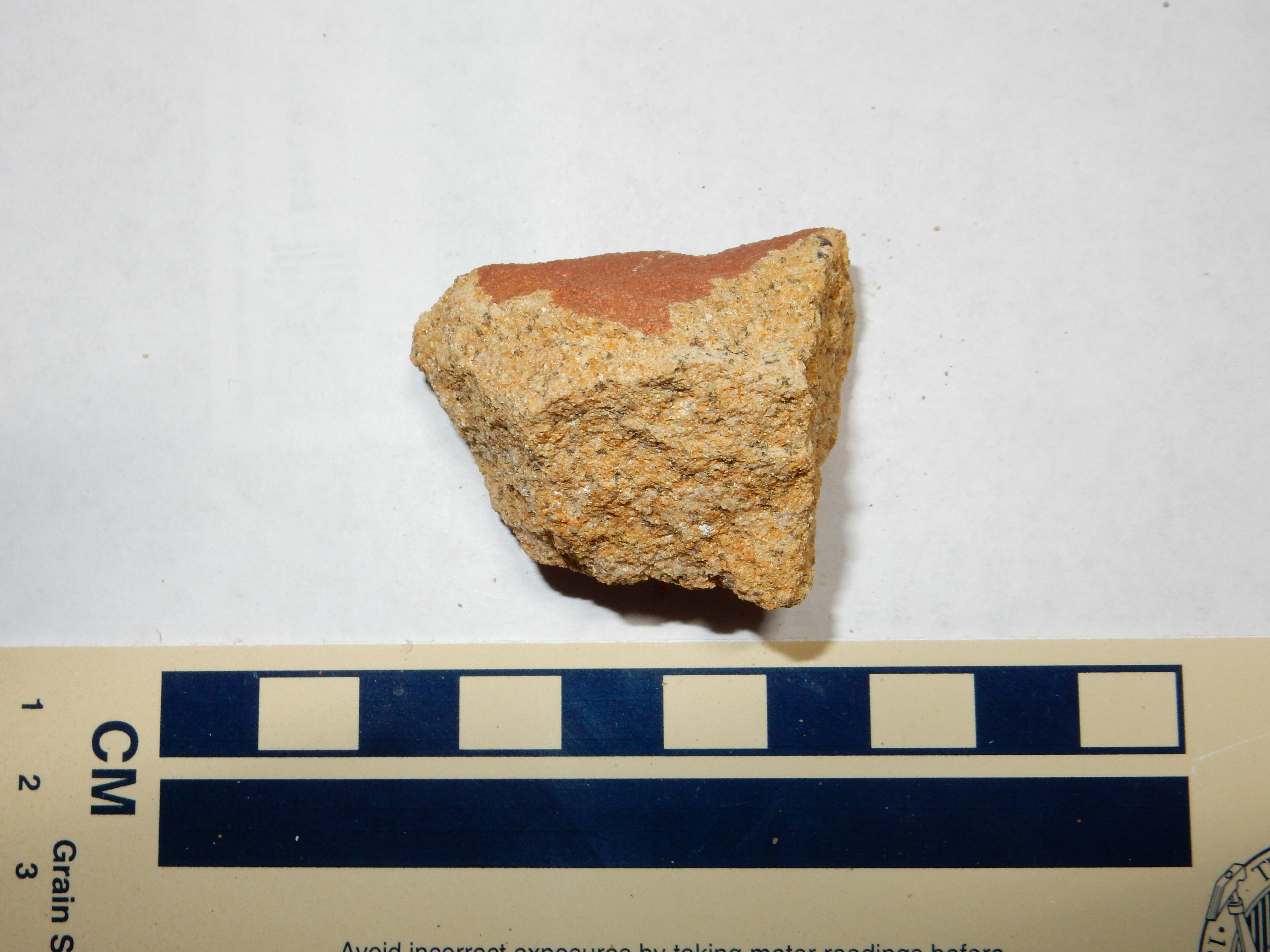
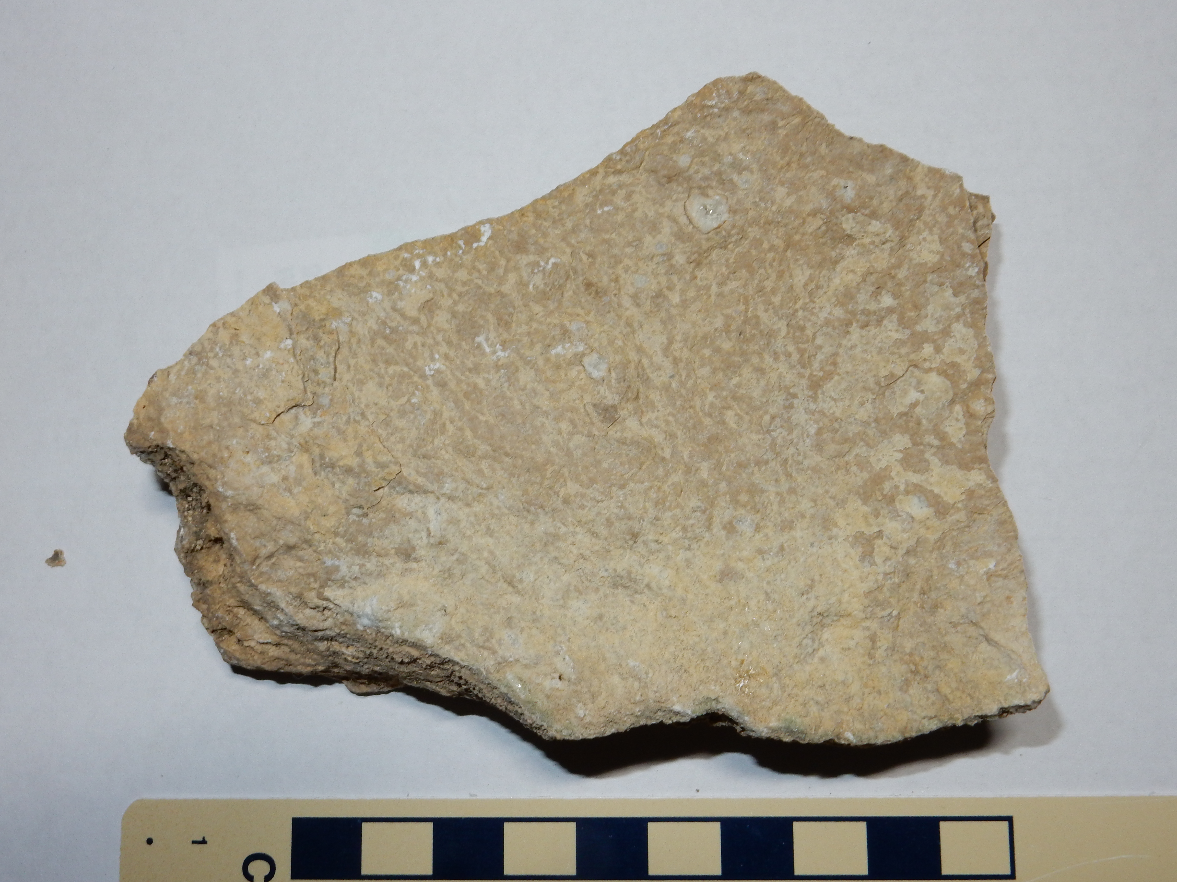
Moenkopi Formation. 35
39.987N 106 42.866W

Moenkopi Formation. 35
39.975N 106 42.877'W
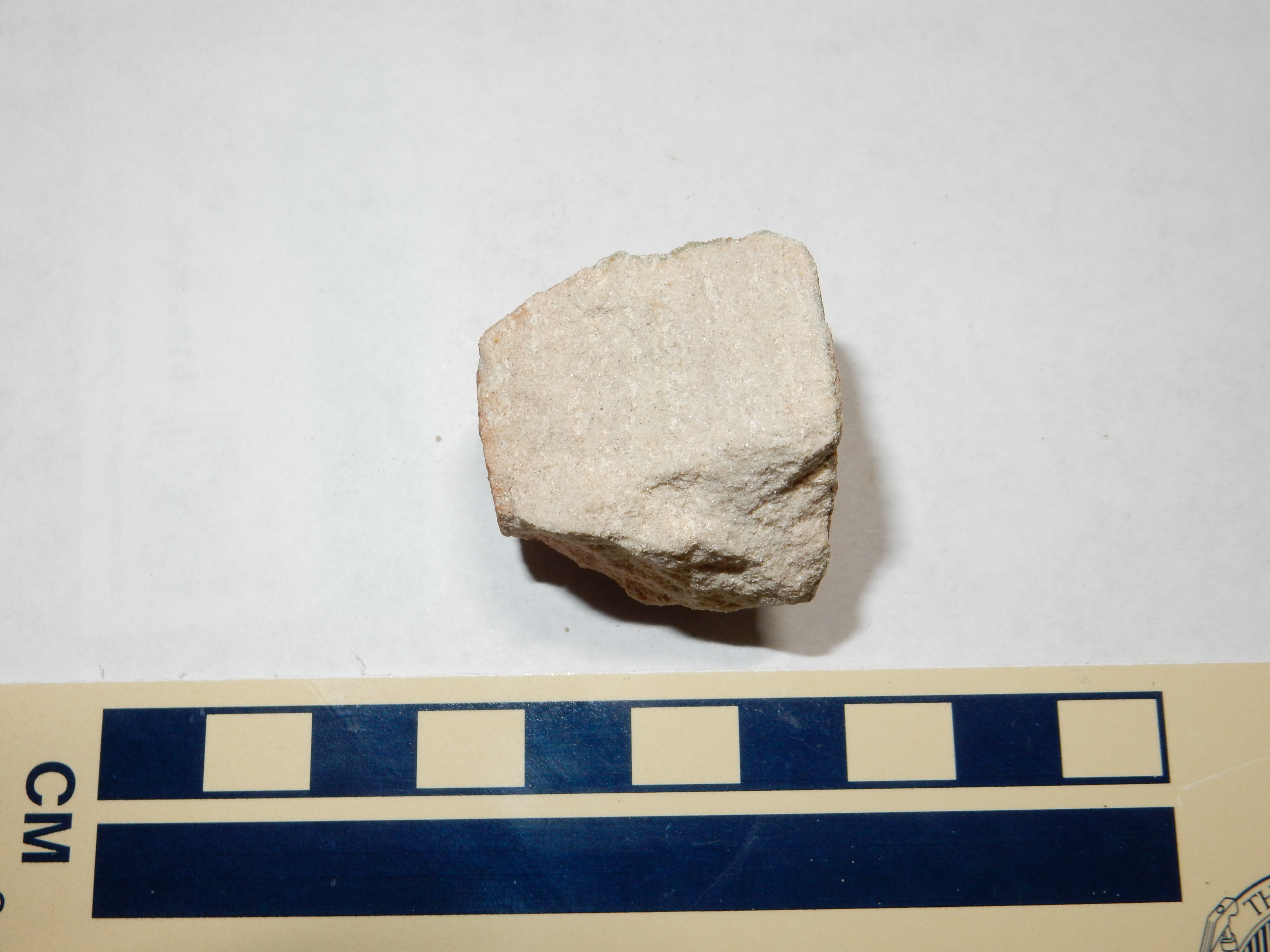
Under the loupe, the sample here is revealed as a poorly sorted coarse sandstone of well-rounded quartz and lithic grains with abundant cement filling the pore spaces. There is probably enough matrix that the rock is matrix-supported rather than clast-supported: A lithic wacke.
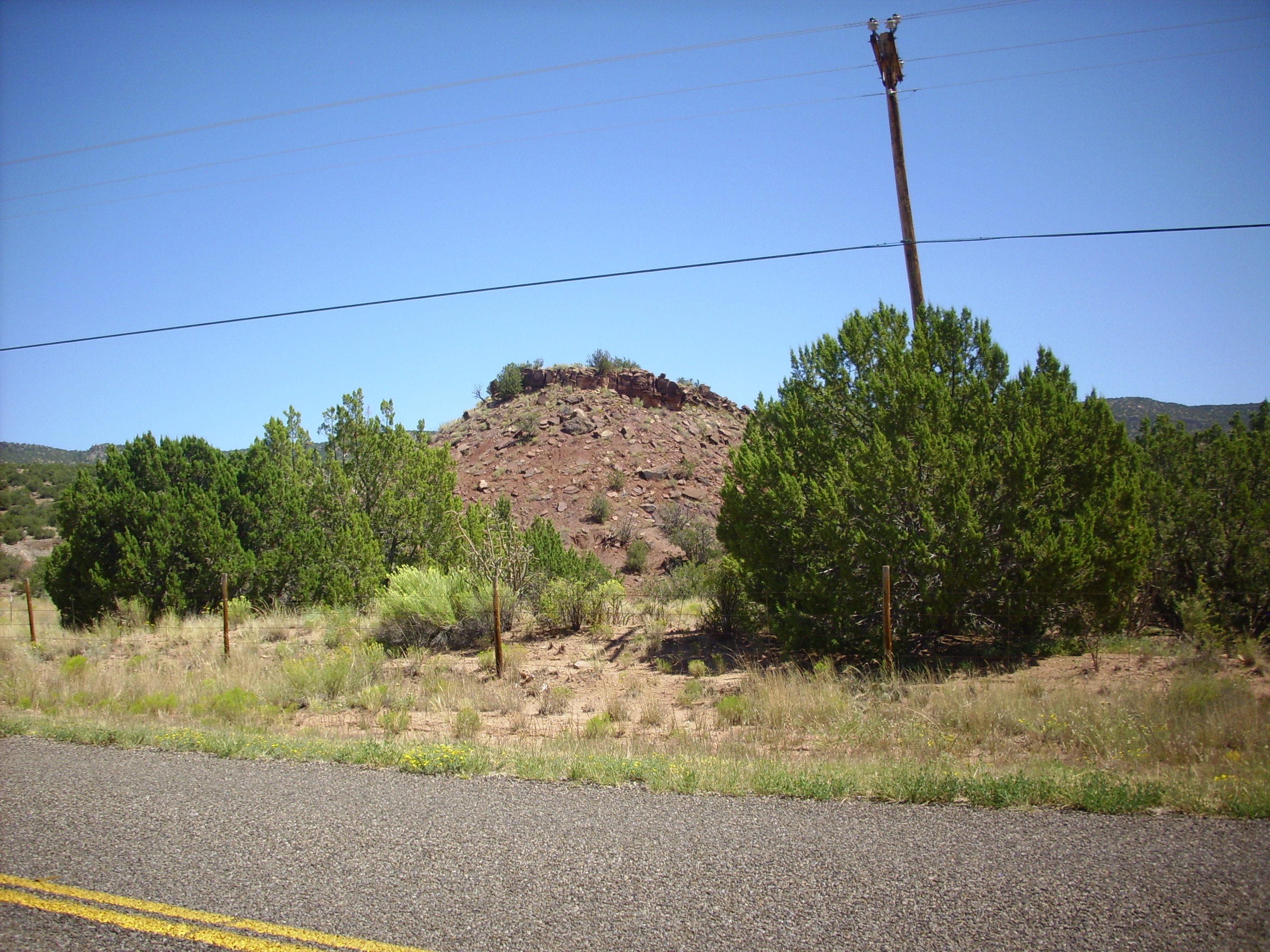
The contact with the overlying Shinarump Formation is dramatic.
Moenkopi and Shinarump Formations. 35
39.851N 106 42.844W
This transition is visible even on the satellite view of Google Maps. This unconformity, known as the Tr-3 regional unconformity, can be mapped throughout the Colorado Plateau, and marked a brief period of mild tectonic uplift and erosion. The entire Jemez area was high ground at this time.
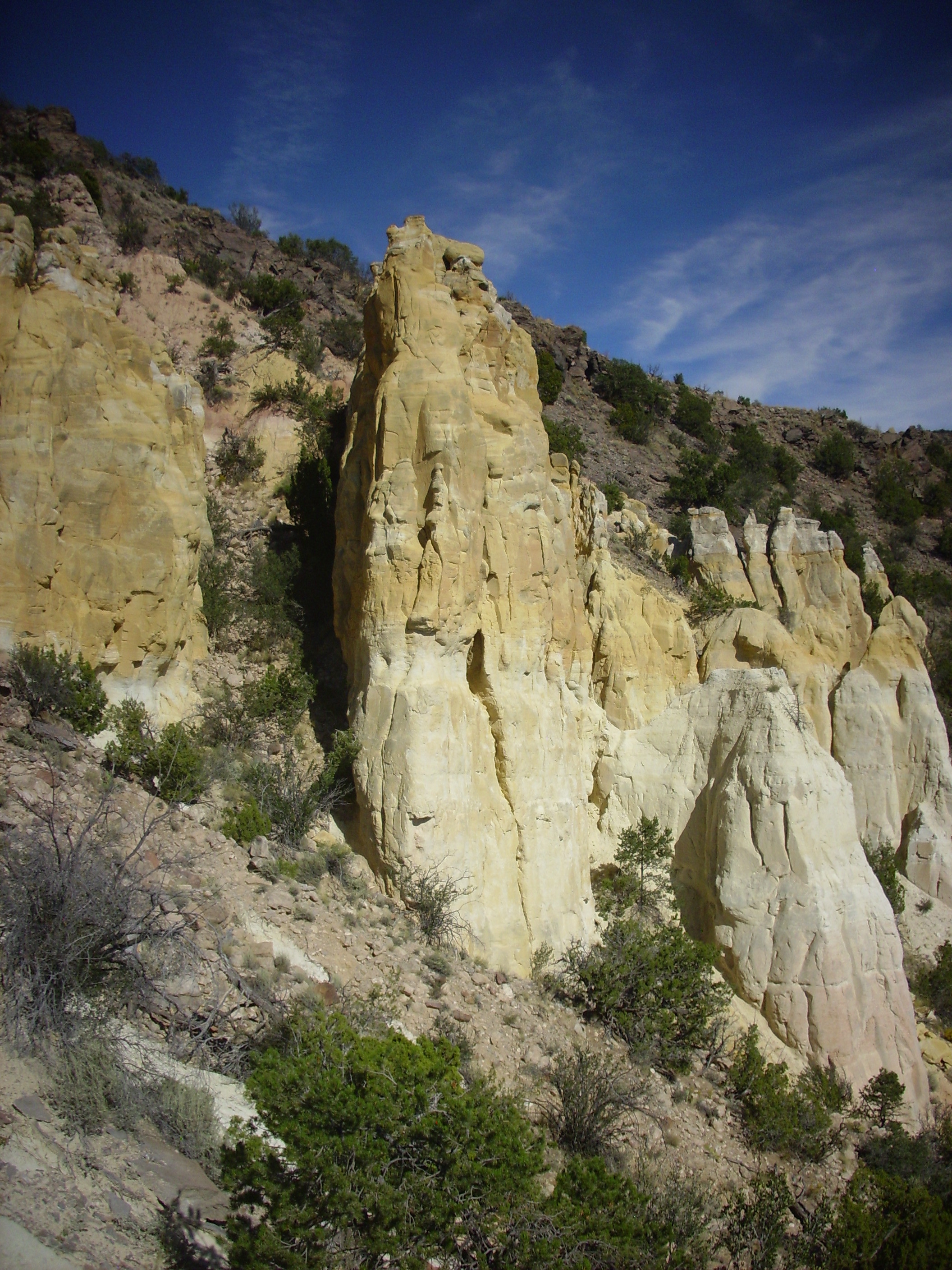
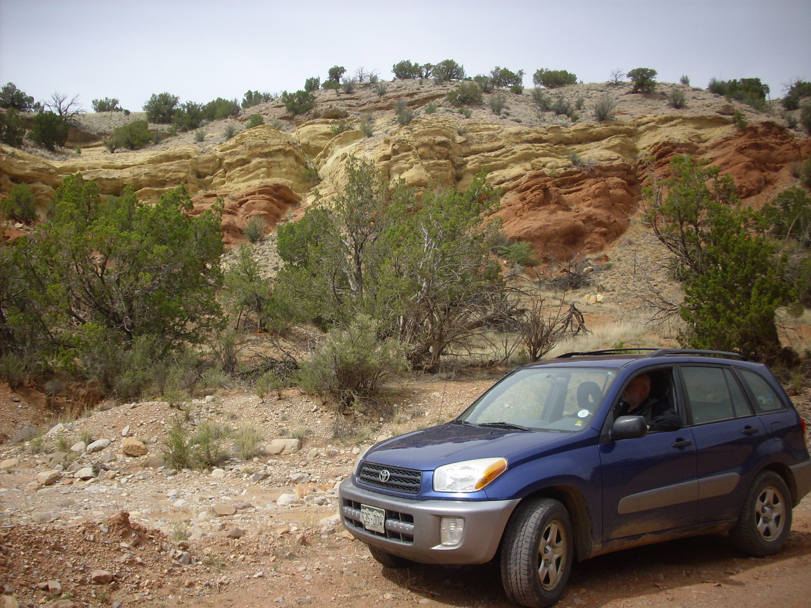
Perhaps the most spectacular exposure of the Permian and Triassic rock column in the southwest Jemez is on the western slopes of Guadelupita Mesa southeast of Guadelupe Box.
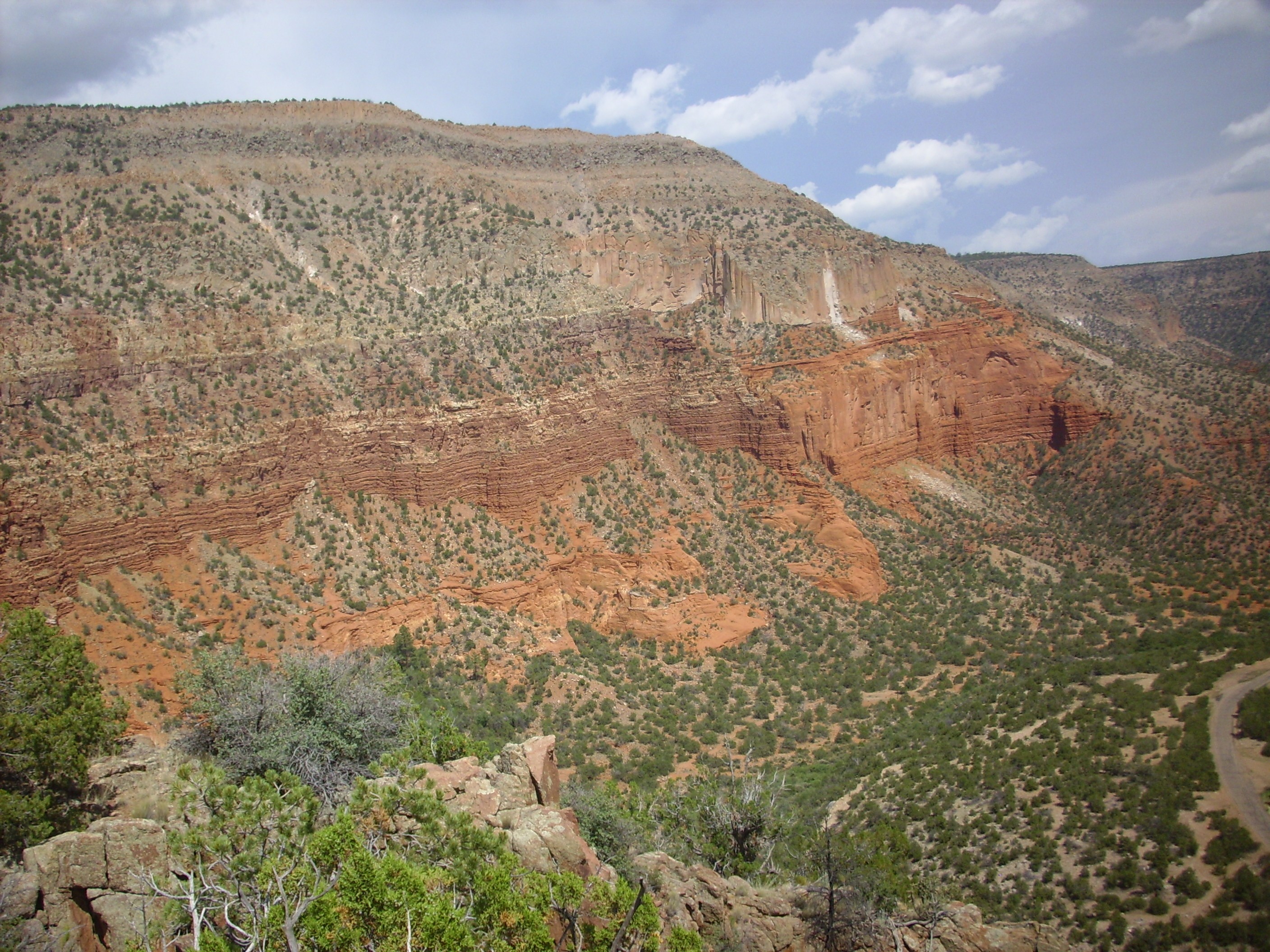
Permian red beds on the west side of Guadelupita Mesa.
Looking southeast from 35
43.982N 106 45.840W
At right, at the base of the mesa, there are thin beds of the Abo
Formation. Above these are massive beds of the De Chelly
Sandstone, Yeso Group. To the left, a fault has thrown the De
Chelly Sandstone down by a good hundred feet or so, and thin beds
of San Ysidro Formation, Yeso Group, are visible above. Then comes
a thin lighter layer of Glorieta Sandstone, then more red beds of
the Moenkopi Formation, topped by Shinarump Formation and much
younger Bandelier Tuff.
The Moenkopi Formation here and to the north was originally
mapped as Bernal Formation. In the Glorieta area, where the
Glorieta Formation was first described, the Bernal Formation is a
mudstone formation overlying the Glorieta Formation, and it
resembles the Moenkopi Formation enough for the two to be easily
confused. It took some time for geologists to correctly identify
the muddy beds immediately above the Glorieta Formation in the
Jemez. However, the Bernal Formation is a late Permian formation,
while the Moenkopi Formation is a middle Triassic formation.
Ironically, the Bernal Formation beds of Glorieta Pass are now
assigned to the Artesia Formation.
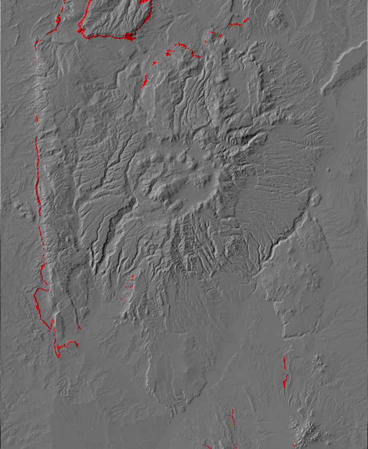
Relief map of the Jemez with Chinle Group outcroppings
highlighted in red.
The top of the Moenkopi Formation records another unconformity,
a brief but vigorous spell of erosion that beveled most of the
coastal plain and cut deep channels in what is now northwestern
Arizona. However, deposition soon resumed with the development of
a great river system, the Chinle, which stretched from the young
southern Appalachian Mountains to the sea coast somewhere in
eastern Nevada. The formations of the Chinle Group record the
development of the Chinle River.
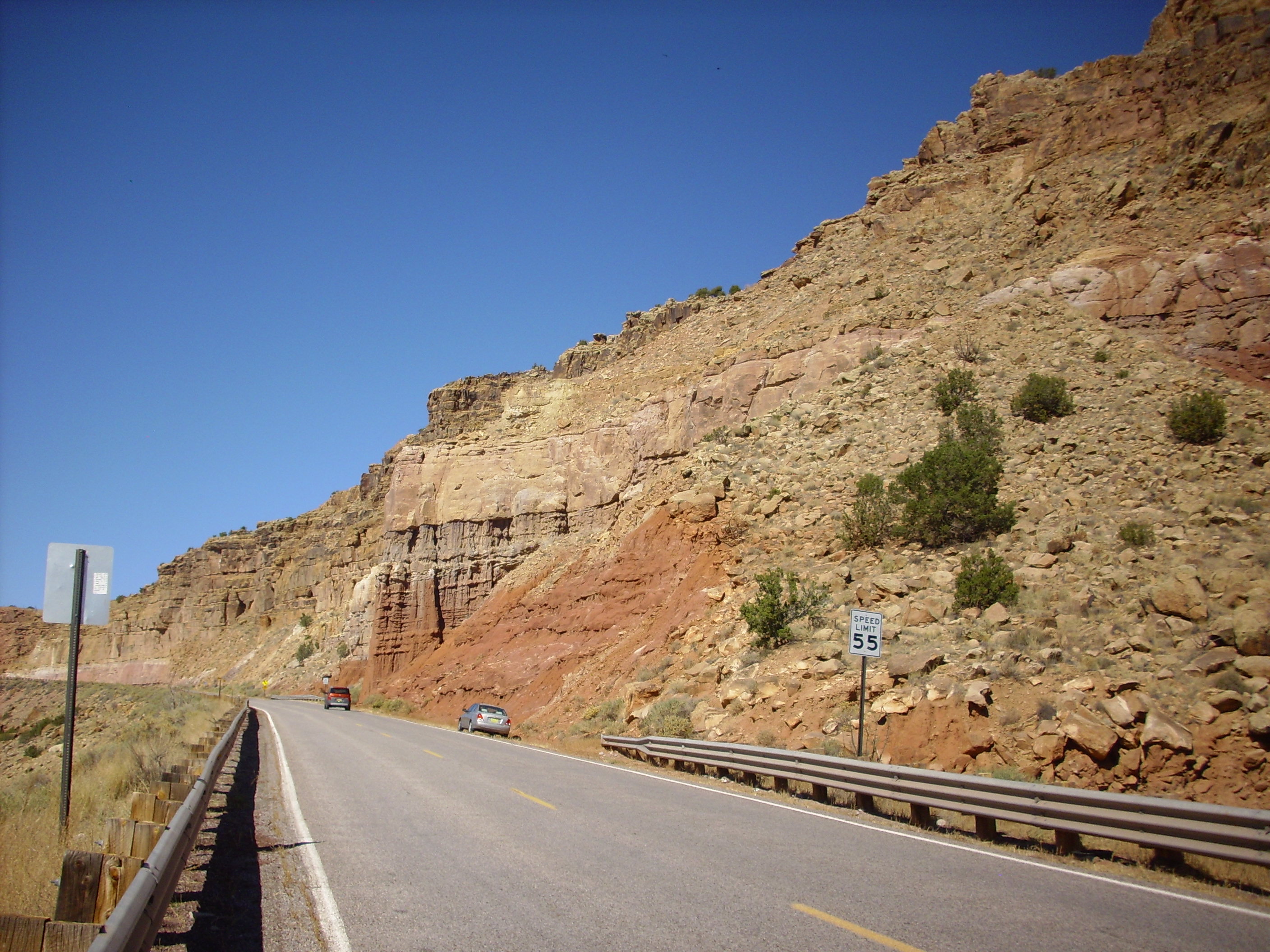
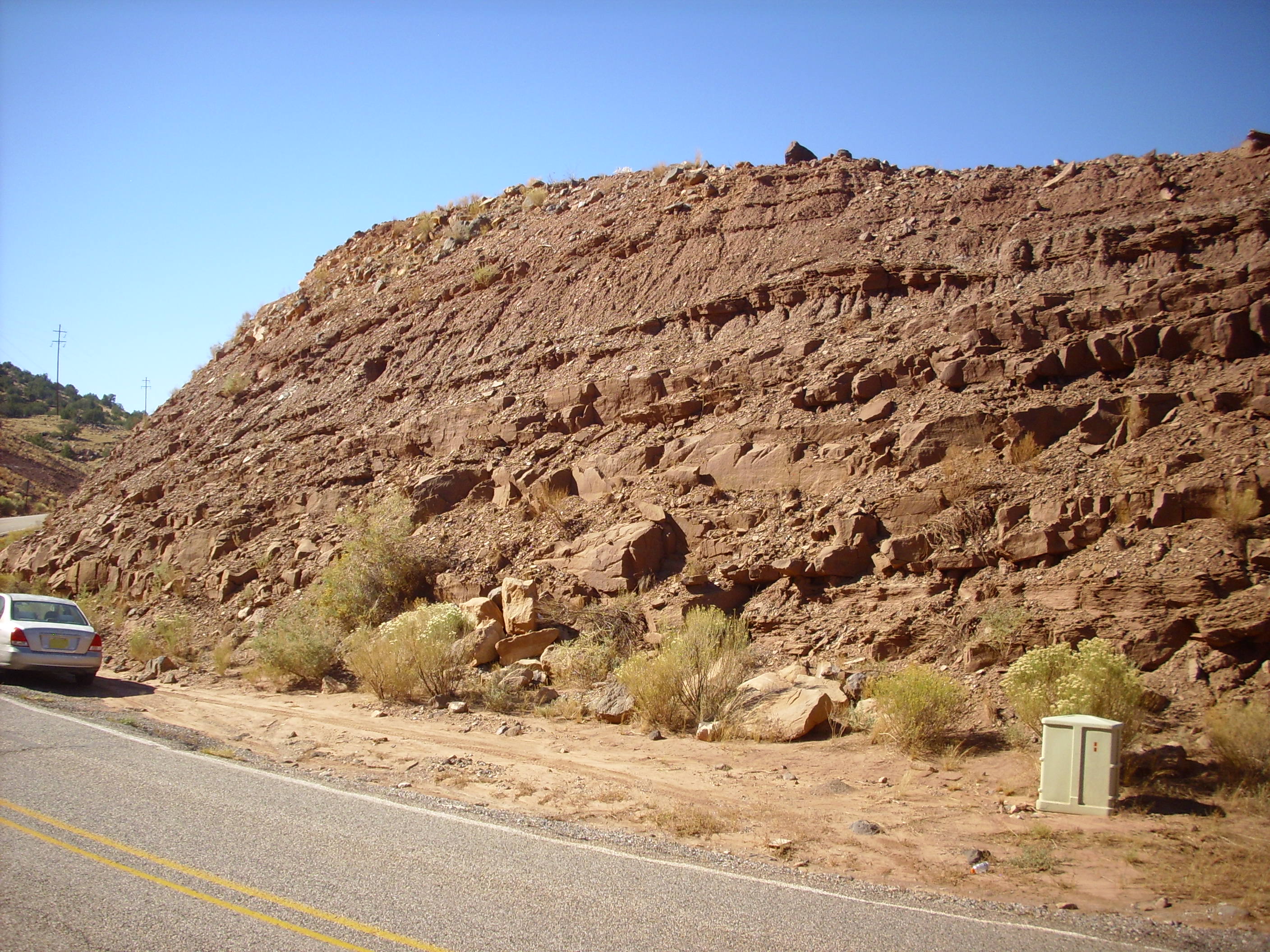
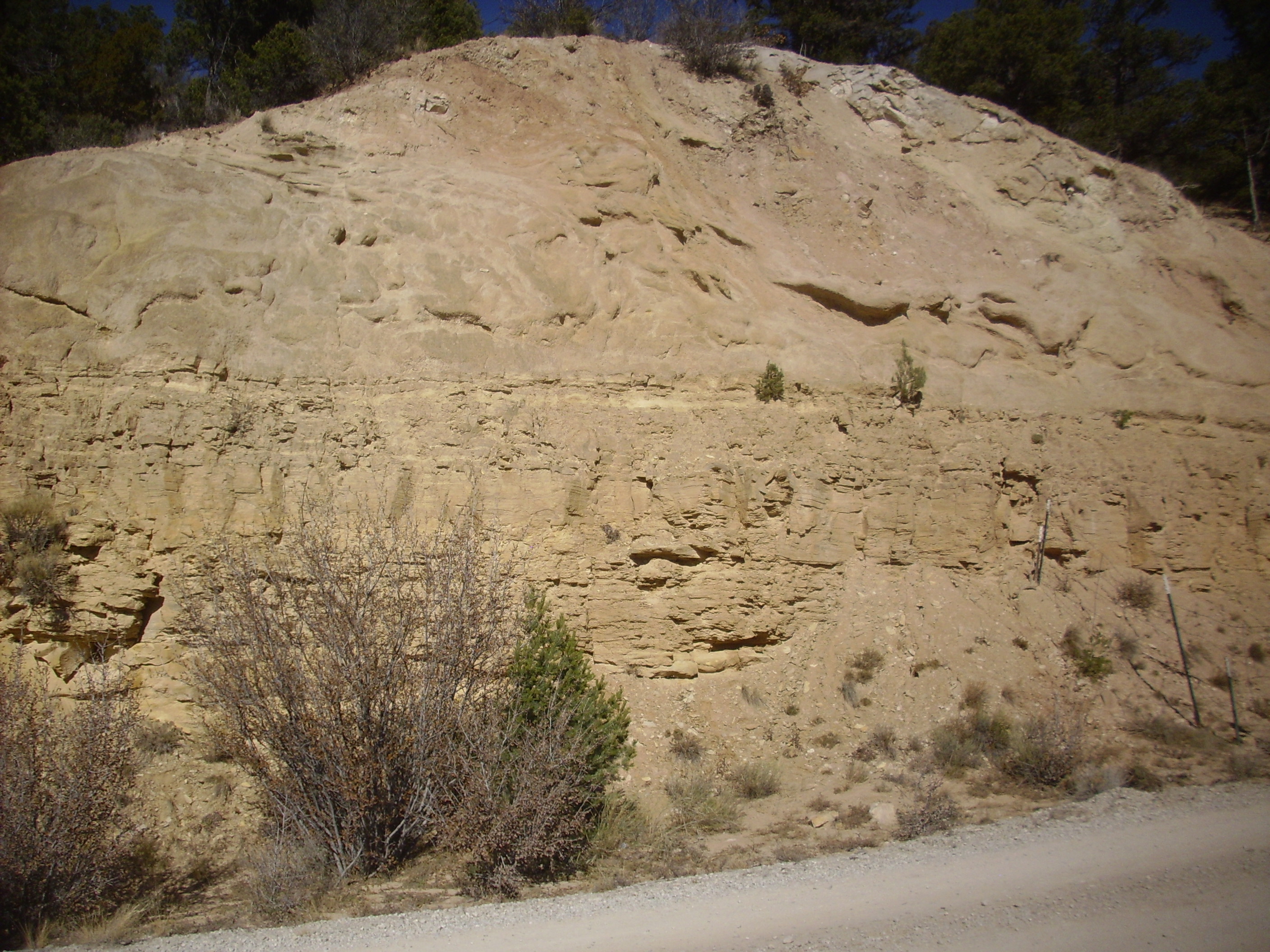
The formations of the Chinle Group vary considerably across the Jemez. The lower formations in the northern Jemez are visible in the road cut west of Canones.
Lower Chinle Group. 36.2356743N
106.3960087W
The dark muddy beds at bottom are the uppermost beds of the
Arroyo del Agua Formation of the Permian Cutler Group. Then comes
an unconformity and the massive pinkish sandstone beds of the
Shinarump Formation, around 230 million years old. Then comes a
thin mudstone layer of the Salitral Formation and, at the top of
the road cut, conglomerate and sandstone of the Poleo Formation.
In 1872, Congress authorized a survey to map the United States
west of the 100th meridian on the scale of eight miles to the
inch. The Wheeler Survey focused on the southwestern United
States, and in 1873 it produced some of the first good topographic
maps of New Mexico. With the Survey was G.K.Gilbert, who assigned
some of the first formation names to beds exposed on the Colorado
Plateau. Among these was a sandstone and pebble conglomerate of
Triassic age, which he named the Shinarump Conglomerate in 1875.
In 1957, John H. Stewart reassigned these beds to the Shinarump
Member of the Chinle Formation. The Chinle Formation was
controversially promoted to group status by Lucas in 1993, and New
Mexico geologists accordingly tend to speak of the Shinarump
Conglomerate as a formation in its own right.
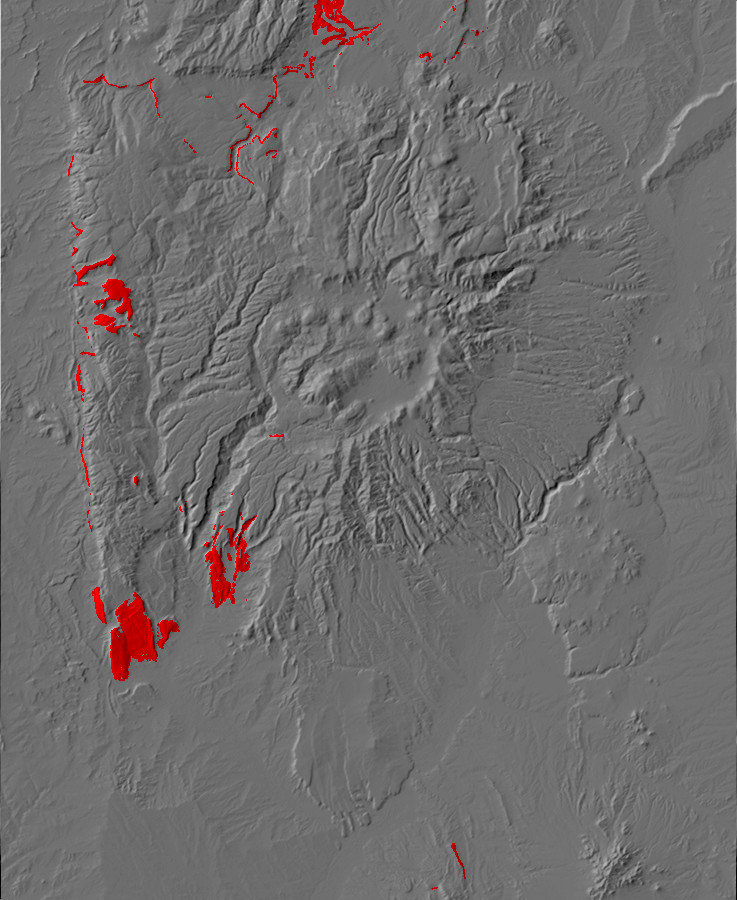
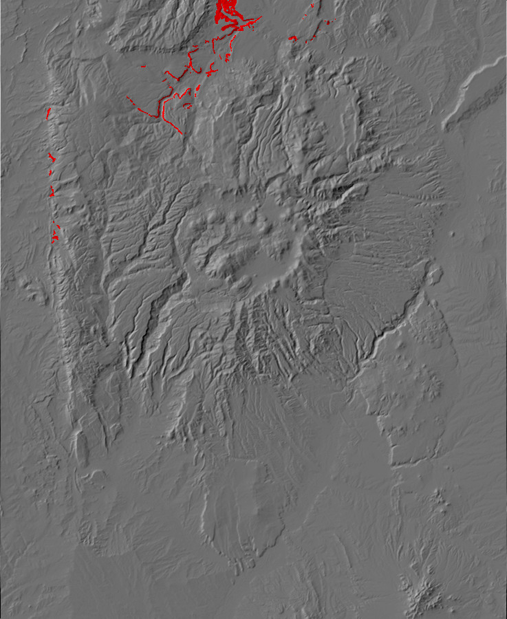
Relief map of the Jemez with Shinarump Formation
outcroppings highlighted in red.
230 million years ago, northern New Mexico was part of a broad,
nearly featureless river plain located between the eroded remnants
of the Umcompahgre Highlands to the north and a newly raised
volcanic arc, the Mesozoic Mogollon arc, in what is now southern
Arizona and northern Mexico. The climate was far wetter than it
had been during Moenkopi time. A wet season of drenching
rain alternated with a long dry season to produce a monsoon
climate, typical of continental regions just north of the tropical
rain belt. The river plain was crossed by a network of braided
streams quite different from the sluggish streams of the Moenkopi.
These carried a heavy load of coarse sediments that was deposited
in a nearly uniform sheet across the entire region. Just what
rejuvenated the river system remains uncertain, but one
possibility is that the formation of the Mogollon arc was
accompanied by rapid subsidence further inland. This increased
river gradients throughout the region.
In the Jemez region, the rejuvenation of the river system is
recorded by the Shinarump Formation, the lowest formation of of
the Chinle Group. In the southern Jemez, it takes the form of
massive sandstone beds with lenses of conglomerate, which fills
valleys and other low spots cut into the Moenkopi Formation.
Because the Shinarump Formation is highly resistant, and is
overlain by much more poorly cemented sediments, it often caps
mesas, as at Meseta Blanca.
Shinarump Formation. 35
39.844N 106 42.814W
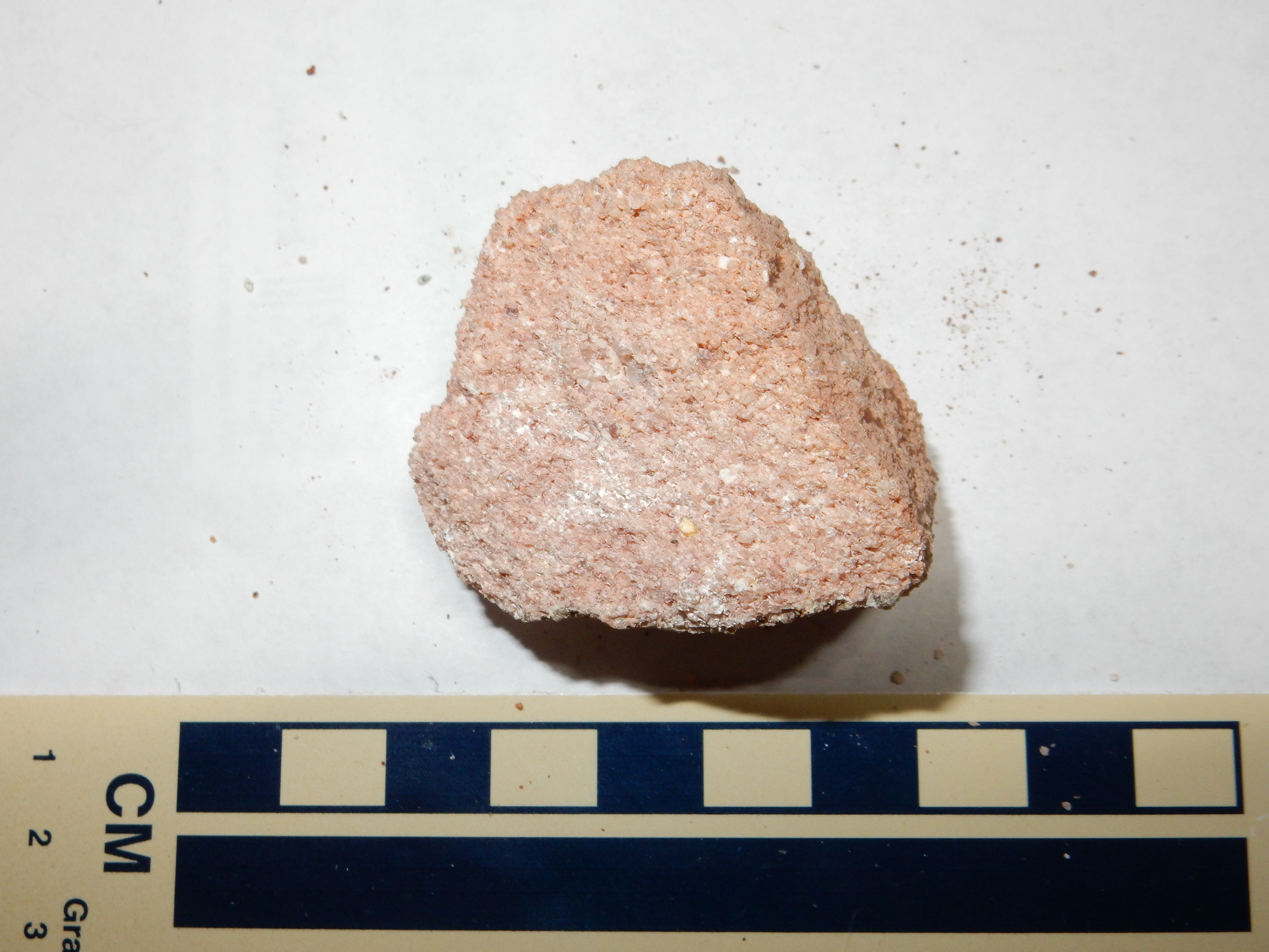
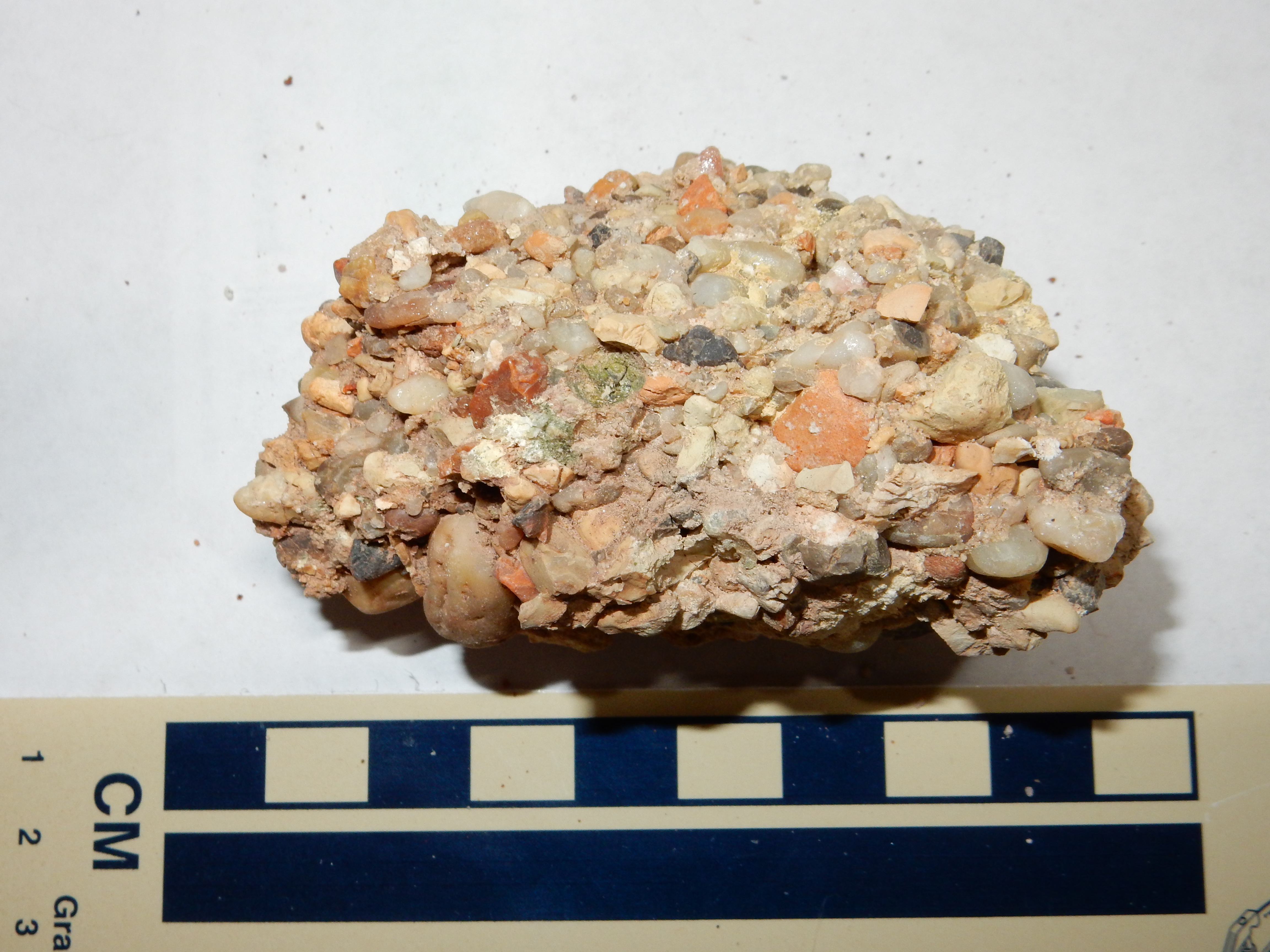
A sample of a conglomerate lens:
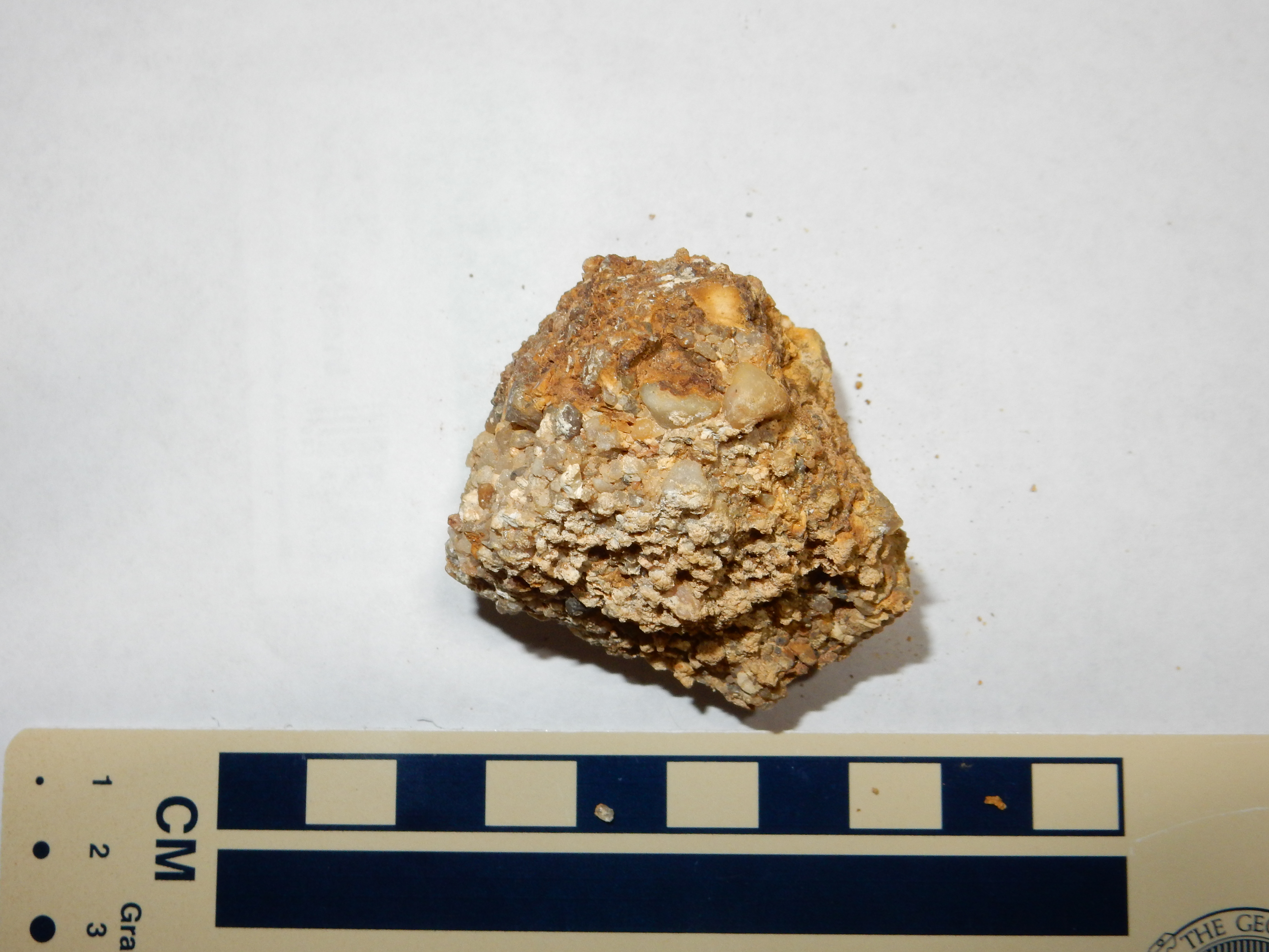
Shinarump Formation conglomerate. 35
39.844N 106 42.814W
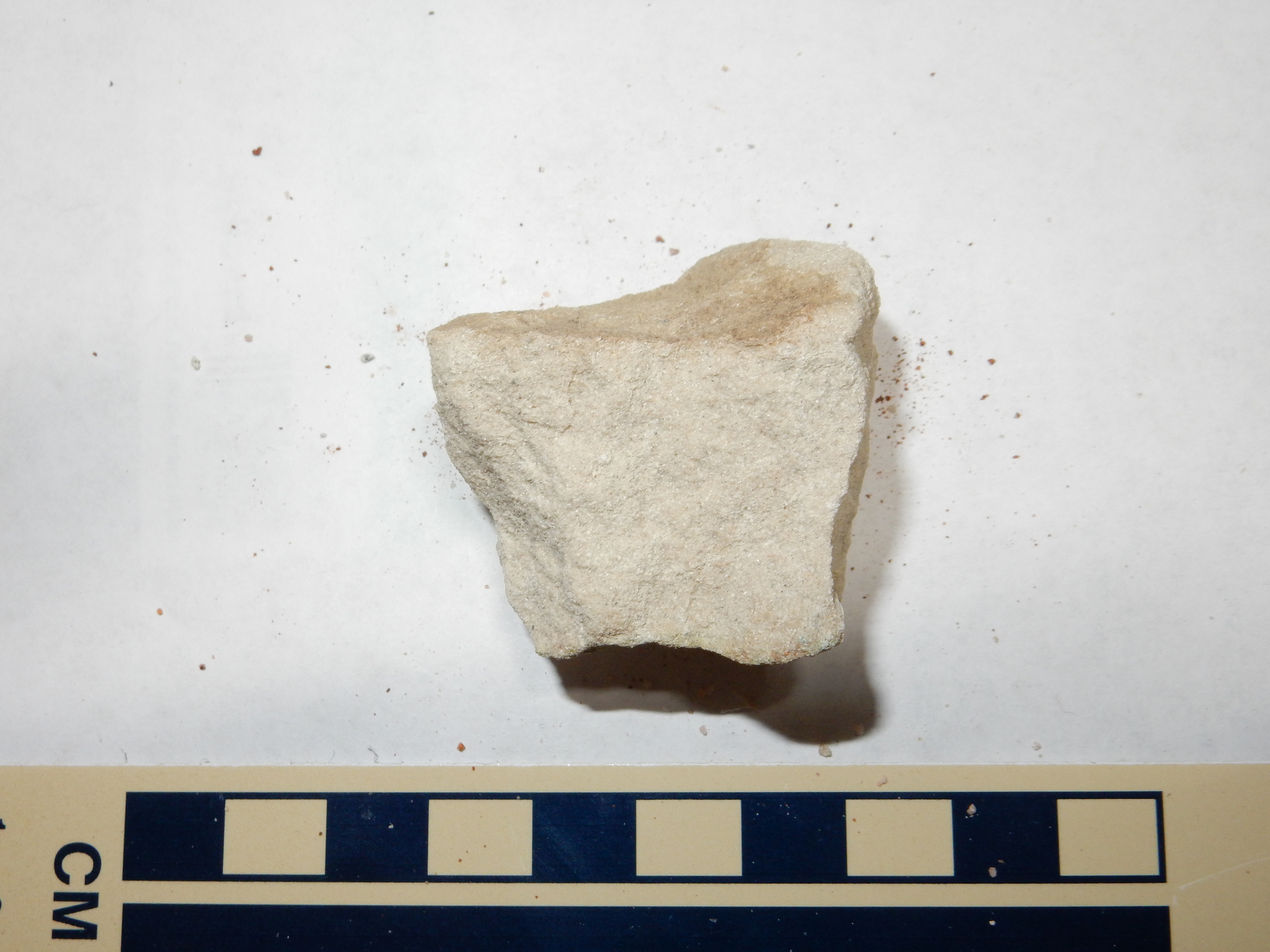
Under the loupe, this is seen to be a moderately well-sorted fine
conglomerate of well-rounded quartzite pebbles cemented together
with abundant tan matrix. A sample of the sandstone:
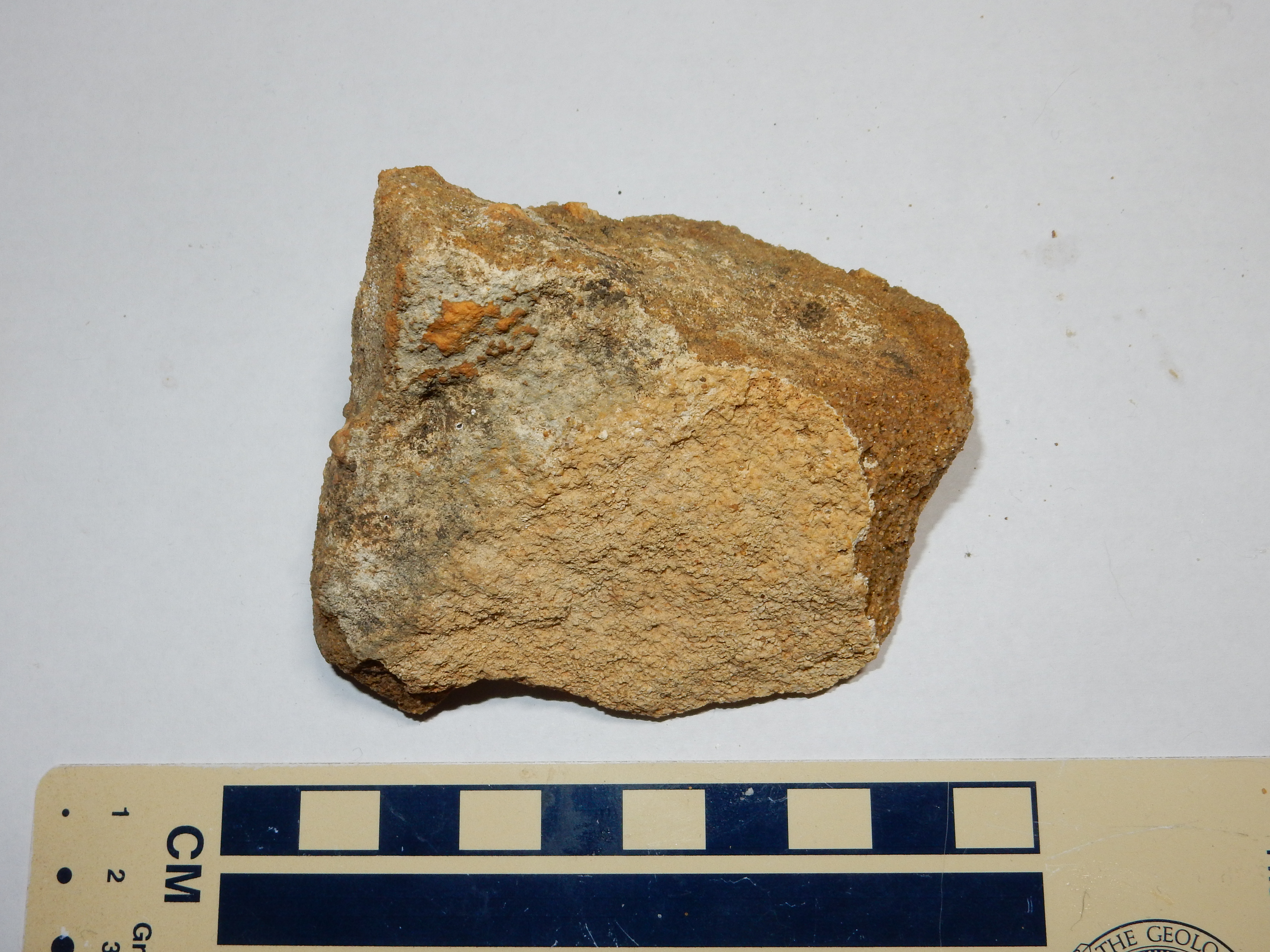
Shinarump Formation sandstone. 35
39.844N 106 42.814W
The sandstone is a well-sorted, coarse sandstone composed of
angular quartz grains with a modest amount of cement.
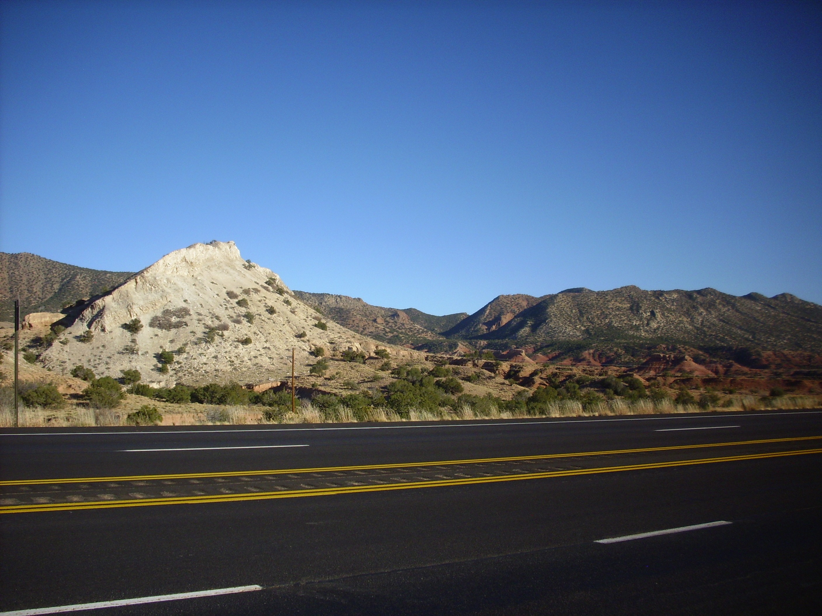
One of the most extensive exposures caps a downwarped plateau at the southern end of the Sierra Nacimiento. The downwarp is mapped as Jack Rabbit Flats, while the escarpments bounding the plateau to east and west form Mesa Chuchilla and Red Mesa, respectively. Red Mesa displays an impressive Permian rock column capped with Moenkopi Formation and Shinarump Formation.
Red Mesa. Looking east from 35
35.830N 106 53.489W
The near terrain is red beds of the Triassic Petrified Forest
Formation, which we will come to shortly. These younger beds are
thrown down many hundred feet by the Pajarito Fault, which lies at
the base of Red Mesa.
Further north, the Moenkopi is not present, and the Shinarump Formation sits directly on Permian red beds. The Shinarump continues to be a prominent formation in the western Jemez, where it caps a number of mesas. These include Eureka Mesa.
Eureka Mesa. 35
59.409N 106 52.648W
Underneath are beds of the Permian Yeso and Abo Formations.
Further north, the Yeso Group thins and disappears, and the
Shinarump sits directly on Cutler Group beds.
Older papers and maps, such as Wood and Northrop's 1946 map,
identify the Shinarump as the Agua Zarca Sandstone Member of the
Chinle Formation in the western Jemez. Some more recent writings
attempt to reconcile terminology by designating these thick
sandstone beds as the Agua Zarca Member of the Shinarump
Formation.
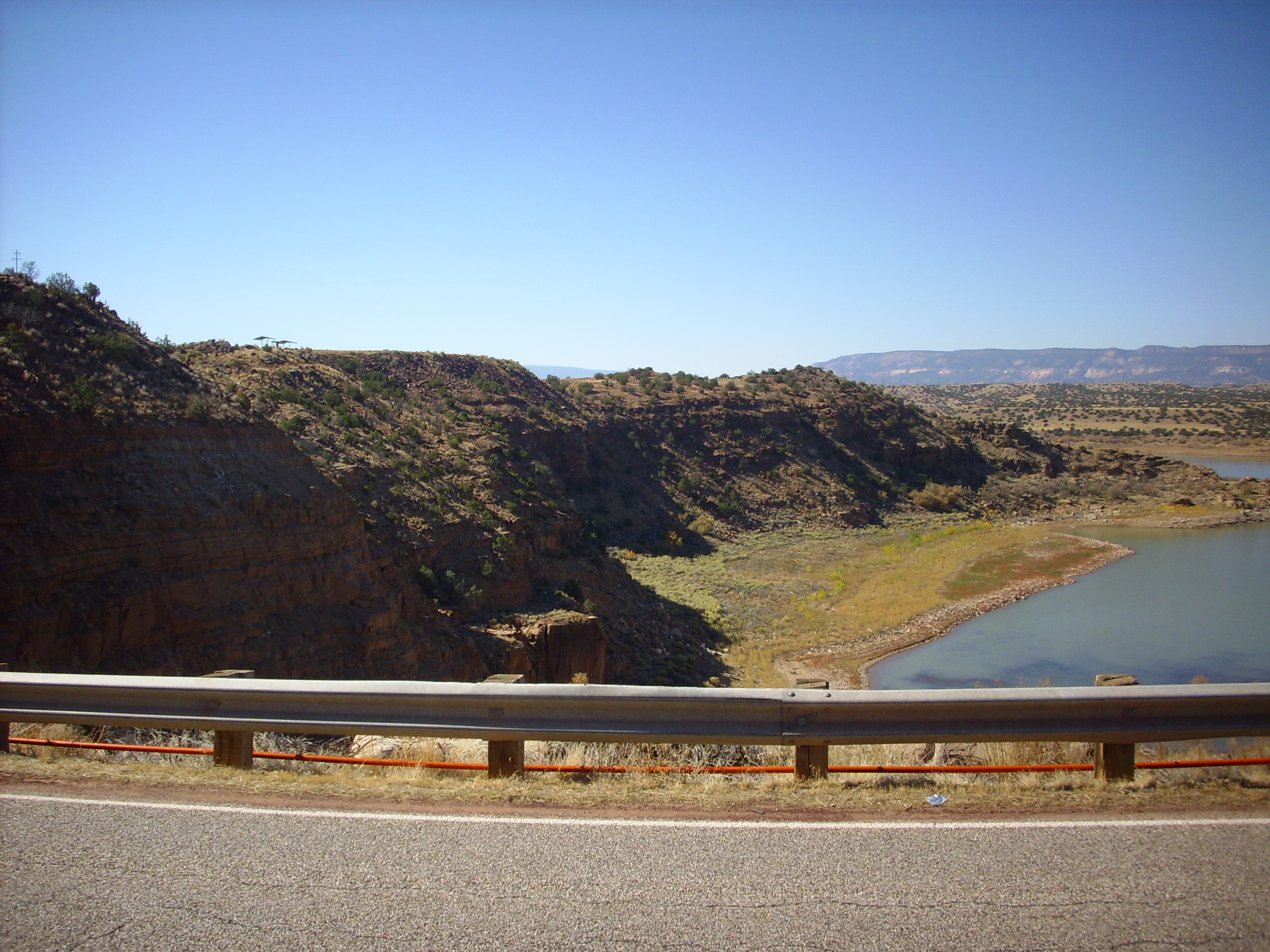
The west end of Eureka Mesa is the location of the Nacimiento Mine, where the Shinarump Formation was once mined for copper ore.
Nacimiento Mine showing Shinarump
Formation beds. 35
59.543N 106 54.077W
Here the Shinarump beds begin to dip steeply into the Nacimiento
Fault, located just west of the mine. The Shinarump forms the
light beds to the left and the partially excavated beds and large
boulders near the center of the panorama. The underlying Yeso and
Abo beds are exposed in the reddish area directly across the lake,
while the younger Triassic Salitral Formation forms the reddish
beds at extreme left and right.
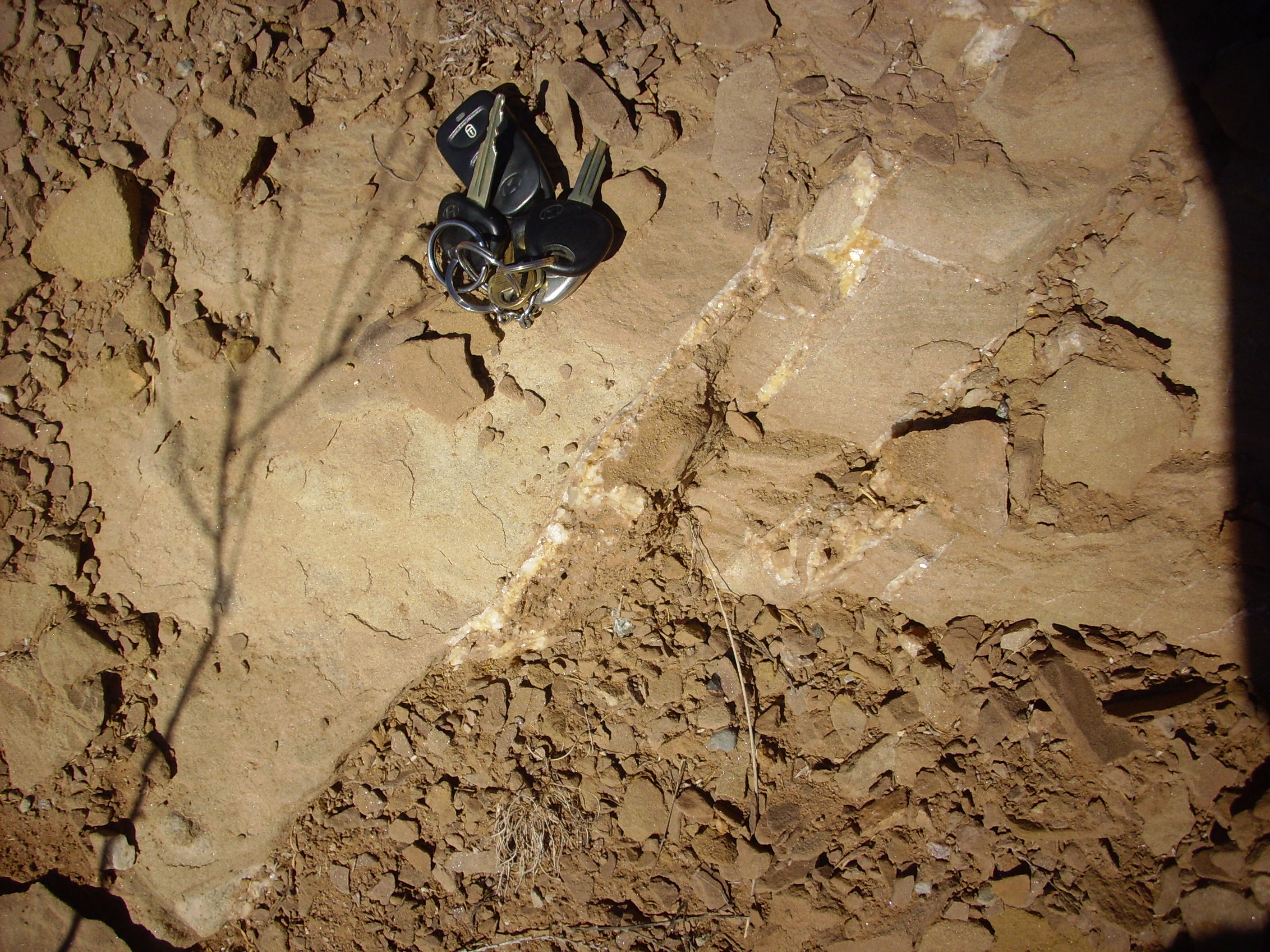
The Shinarump is locally rich in petrified wood.
In some locations, the wood has been replaced by copper minerals
such as chalcocite, Cu2S, rather than the usual silica.
The chalcocite was mined as copper ore.
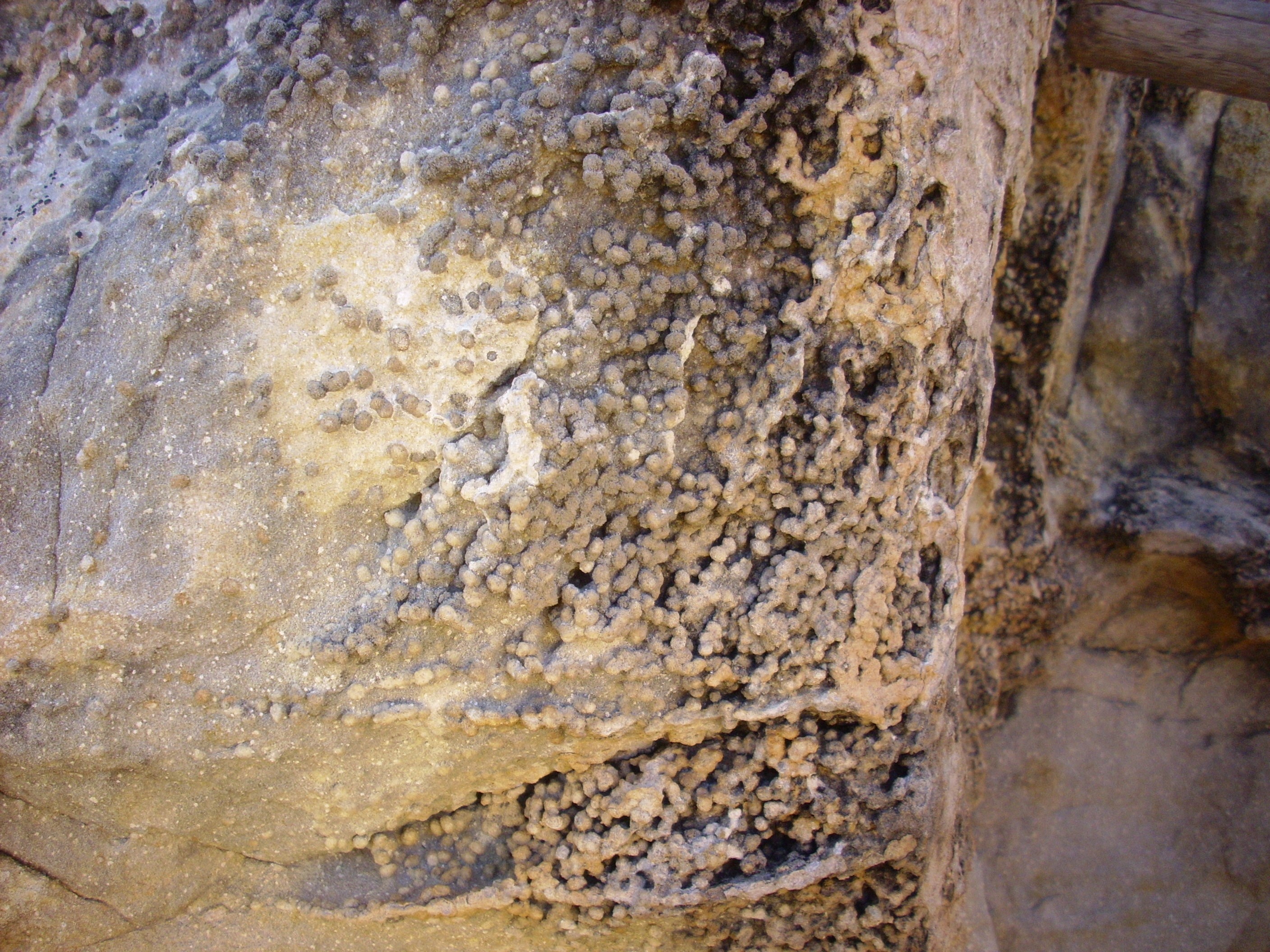
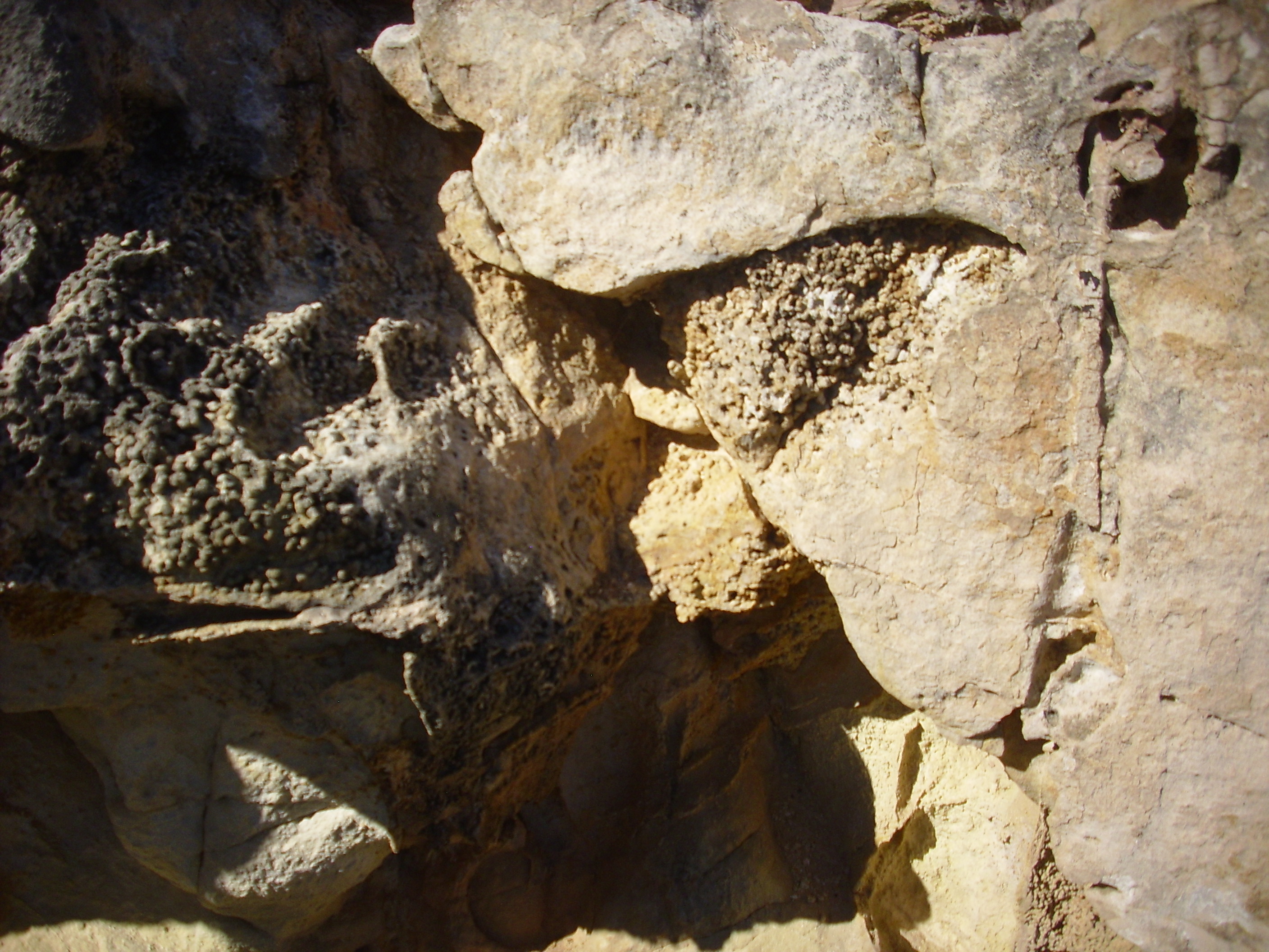
The Shinarump also shows local concretions.
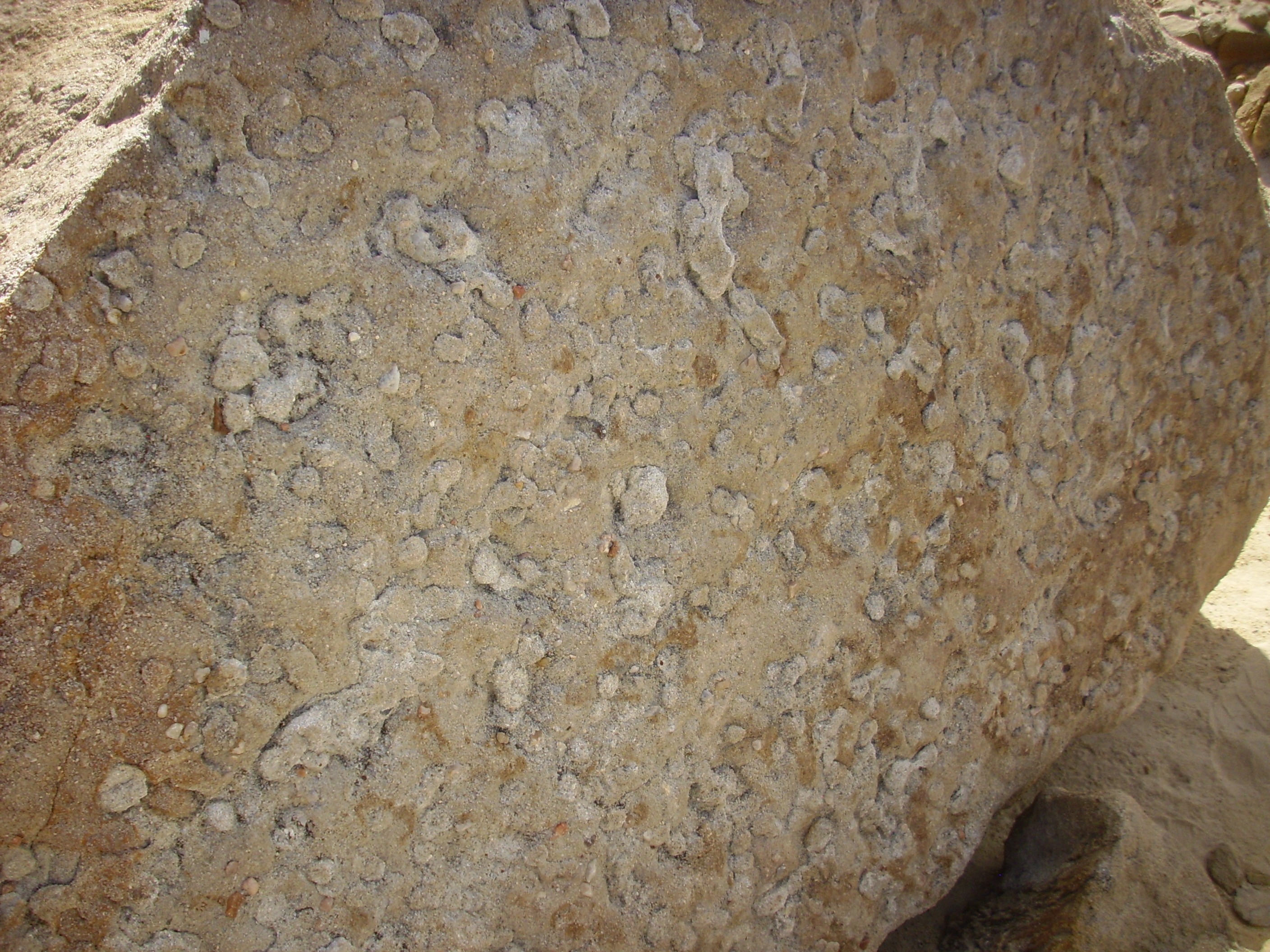
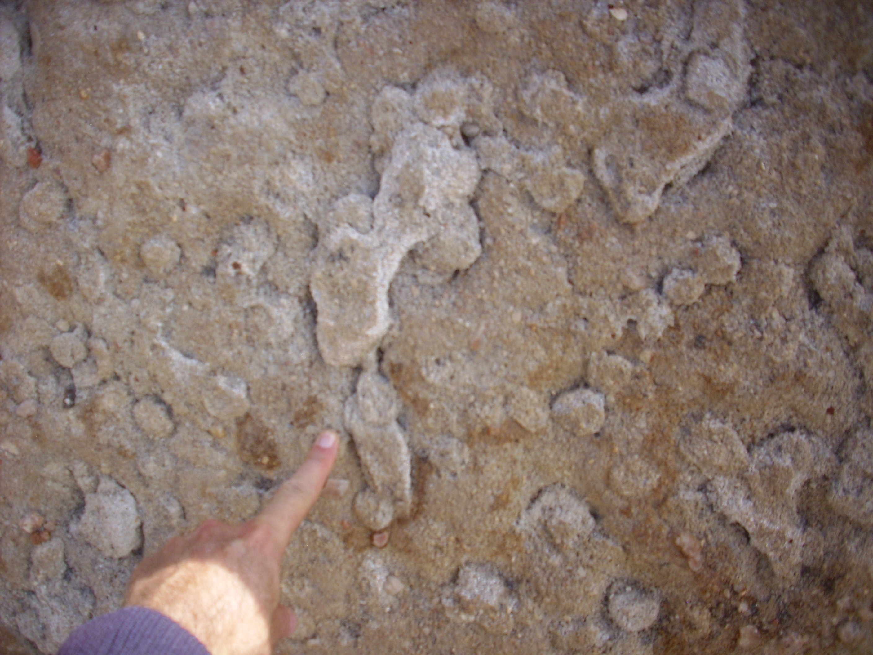
These are localized deposits of particularly large quantities of cement in the sandstone. We will see many further examples in this chapter.
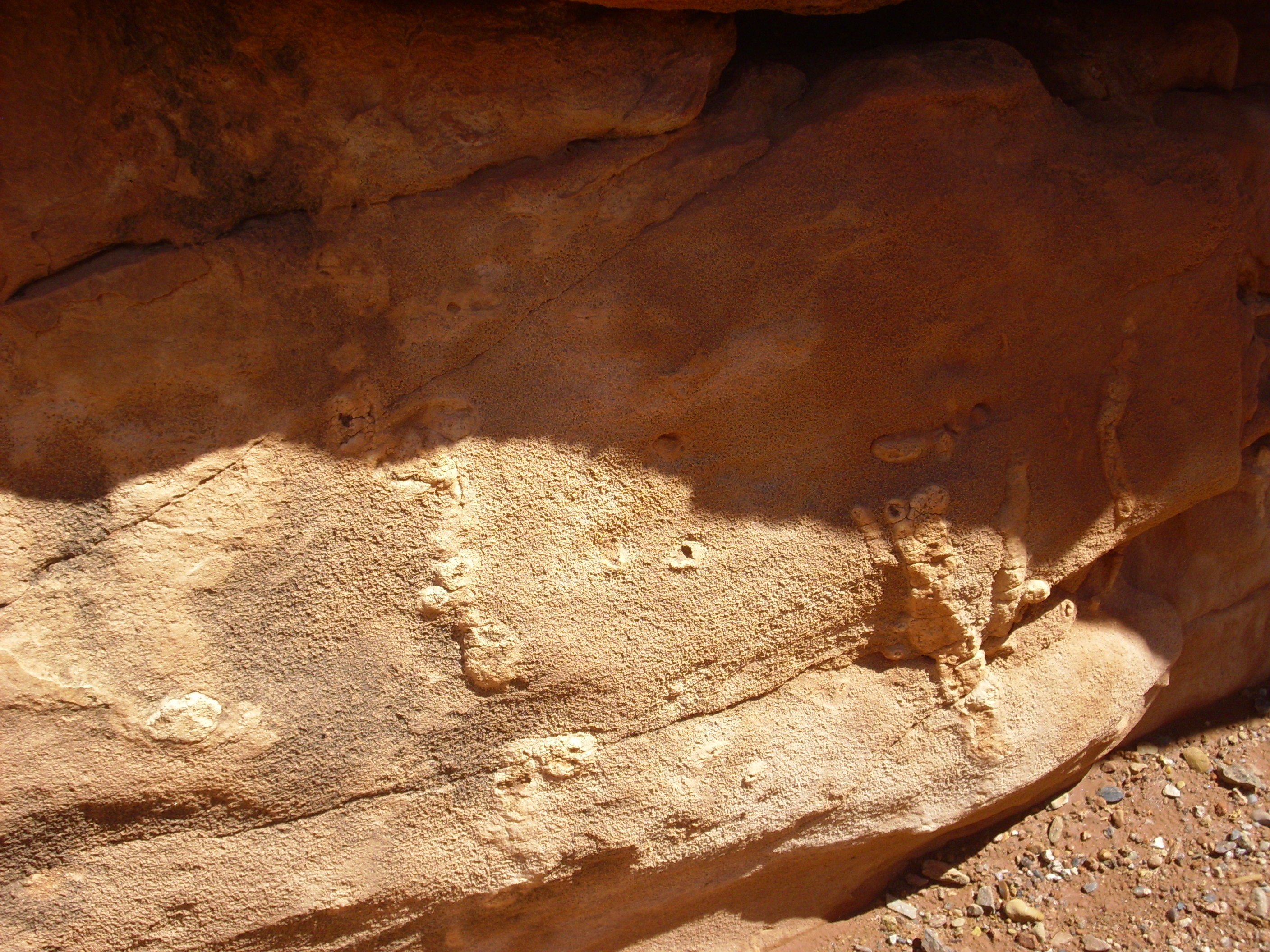
These may be flute casts.
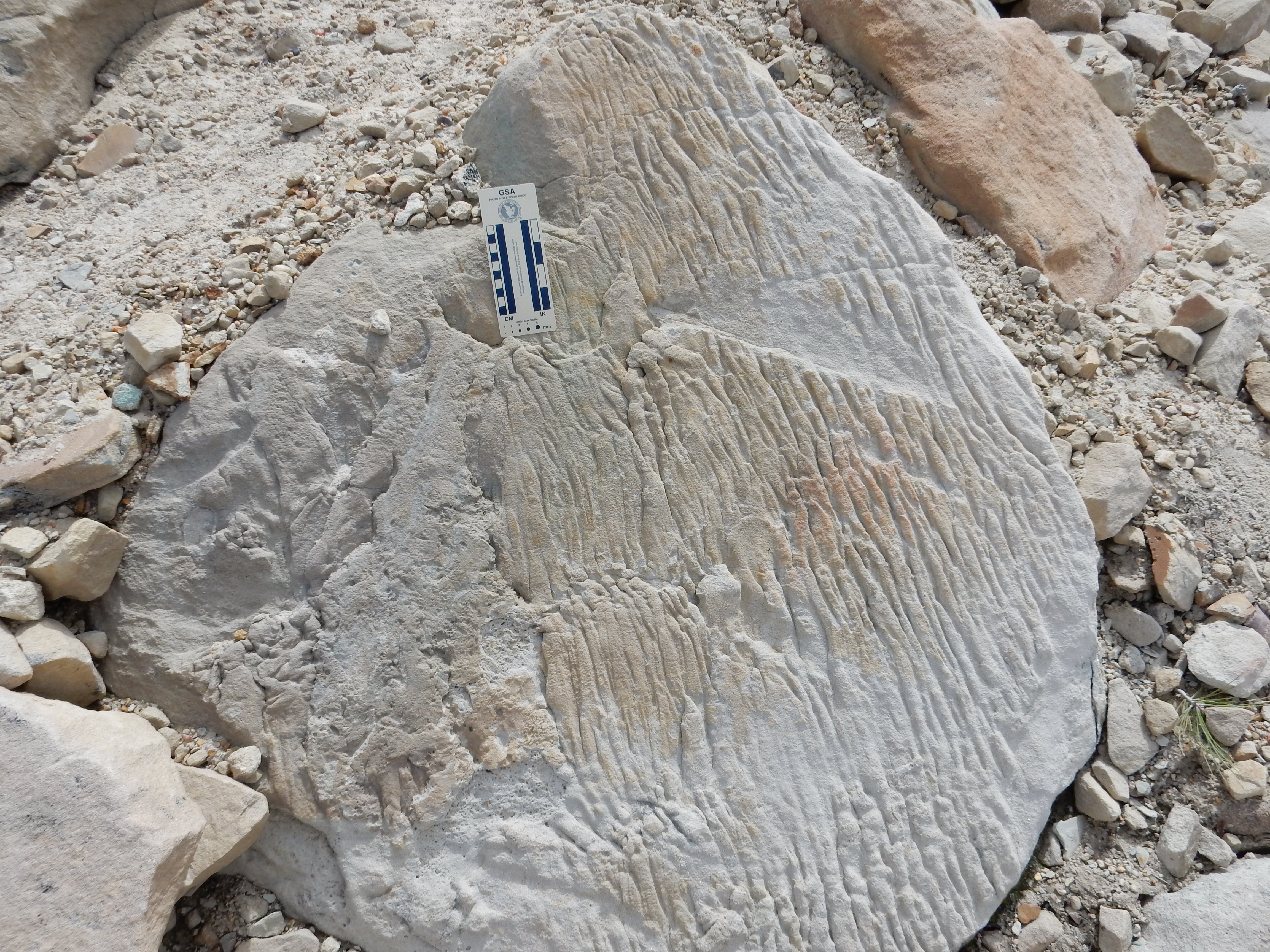
Flute casts are a form of sole mark, formed by water flowing over the surface of a mud bed and eroding channels in the mud. These are later filled in with sand or silt. If the marks here are in fact flute casts, then the face of the boulder was once at the bottom of the bed and the flow was towards what is now the bottom of the boulder. However, the boulder has obviously been disturbed (it is part of the landslide area) so it’s not possible to reconstruct the original orientation and flow direction from this example.
Some of the conglomerate in the Shinarump is very coarse.
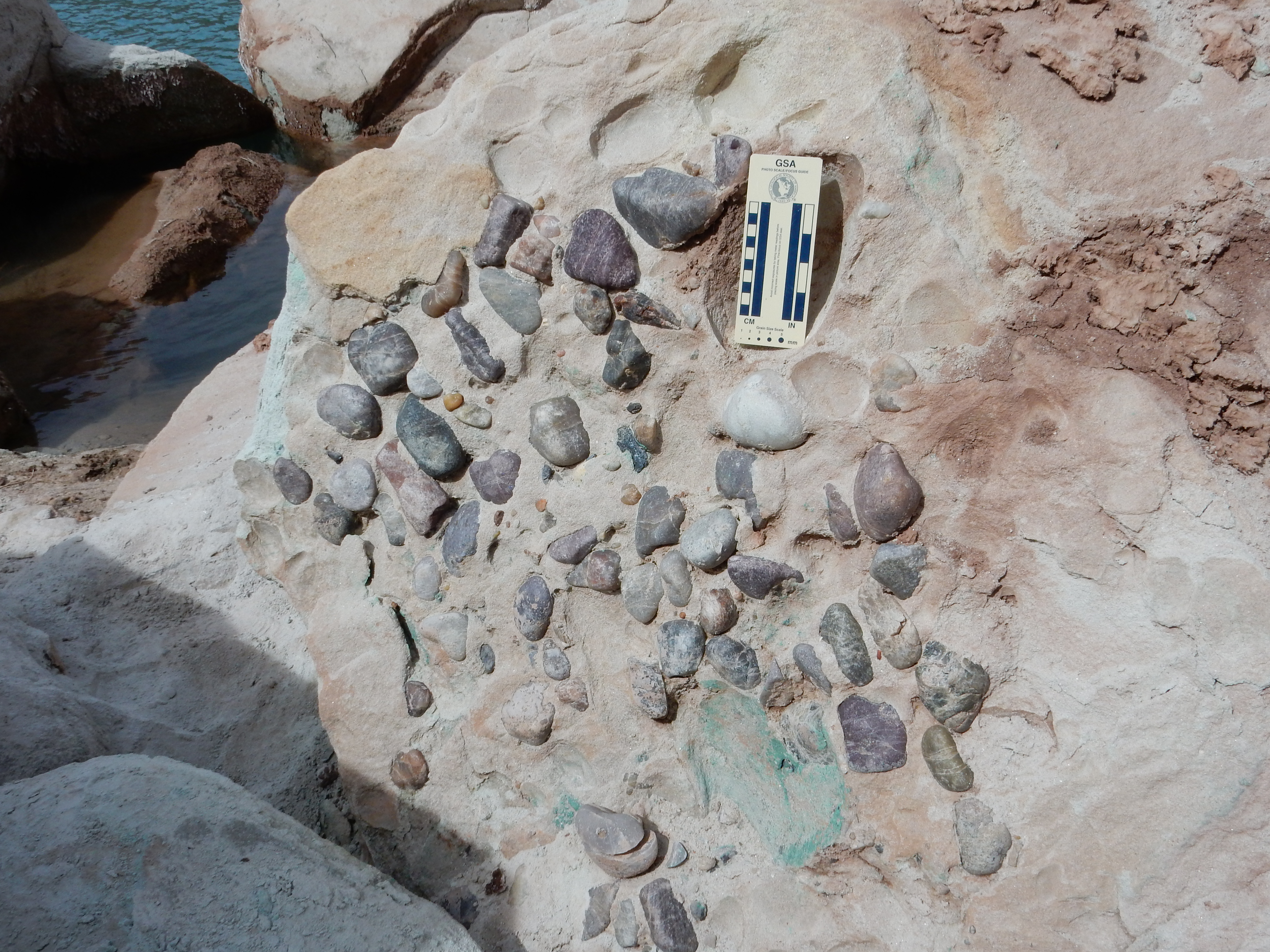
This may be from the axis of a river channel, and the associated
petrified wood may be a fossil log jam in the river,
possibly at one end of a point bar.
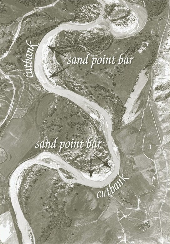
Aerial photograph of river with point bars. U.S. Geological
Survey
A point bar is an accumulation of sediments on the inner
downstream side of a meander in the river. Point bars tend to
accumulate organic debris as well.
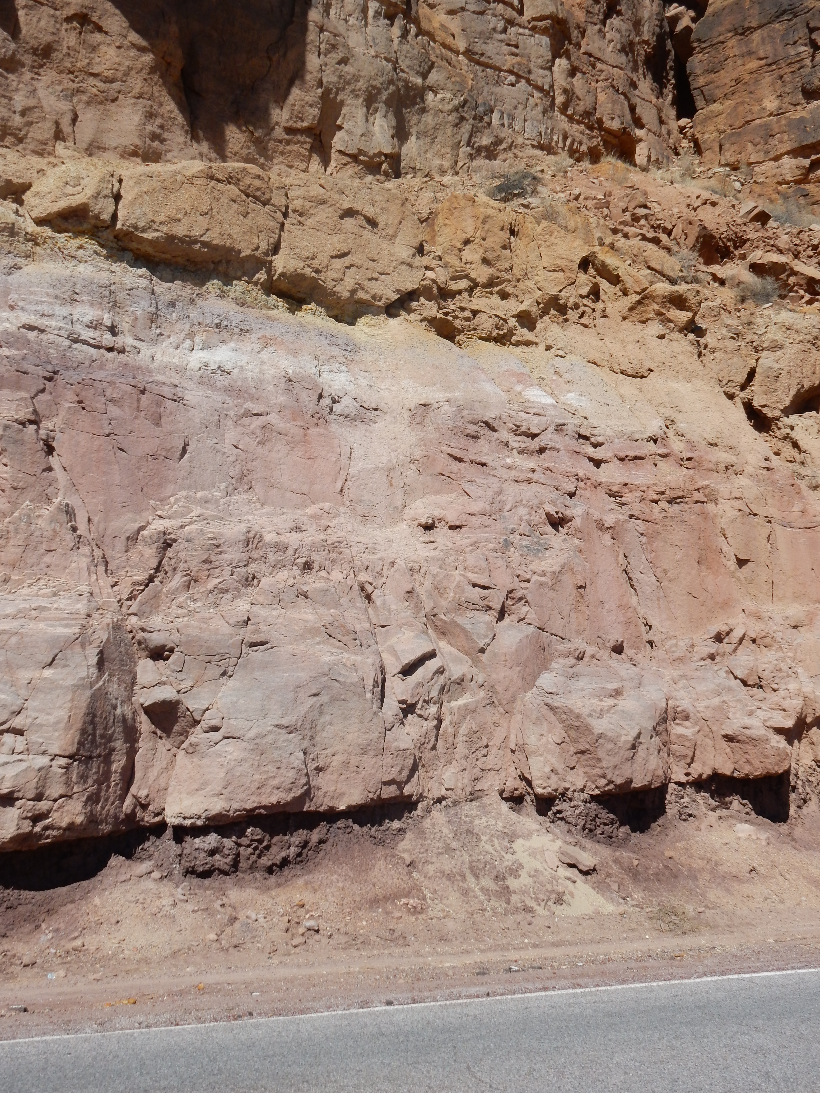
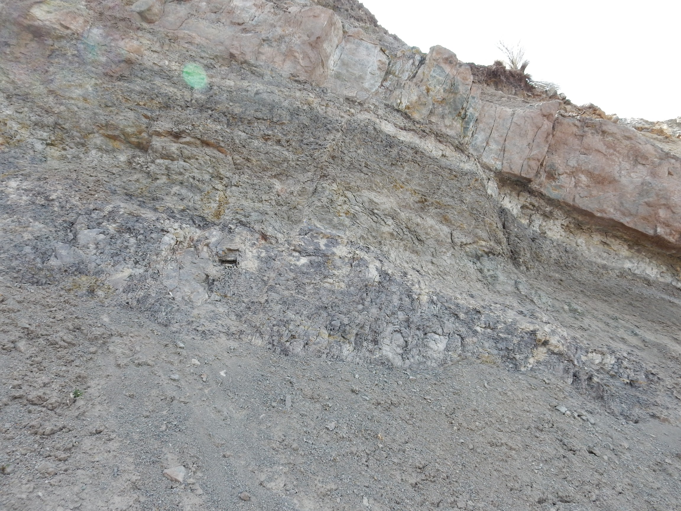
The unconformity dividing the Permian from the Triassic is
beautifully exposed In the Canones
fault zone along the western boundary of the Rio Grande
Rift. We visited this area in the last chapter, but it's time to
look again.
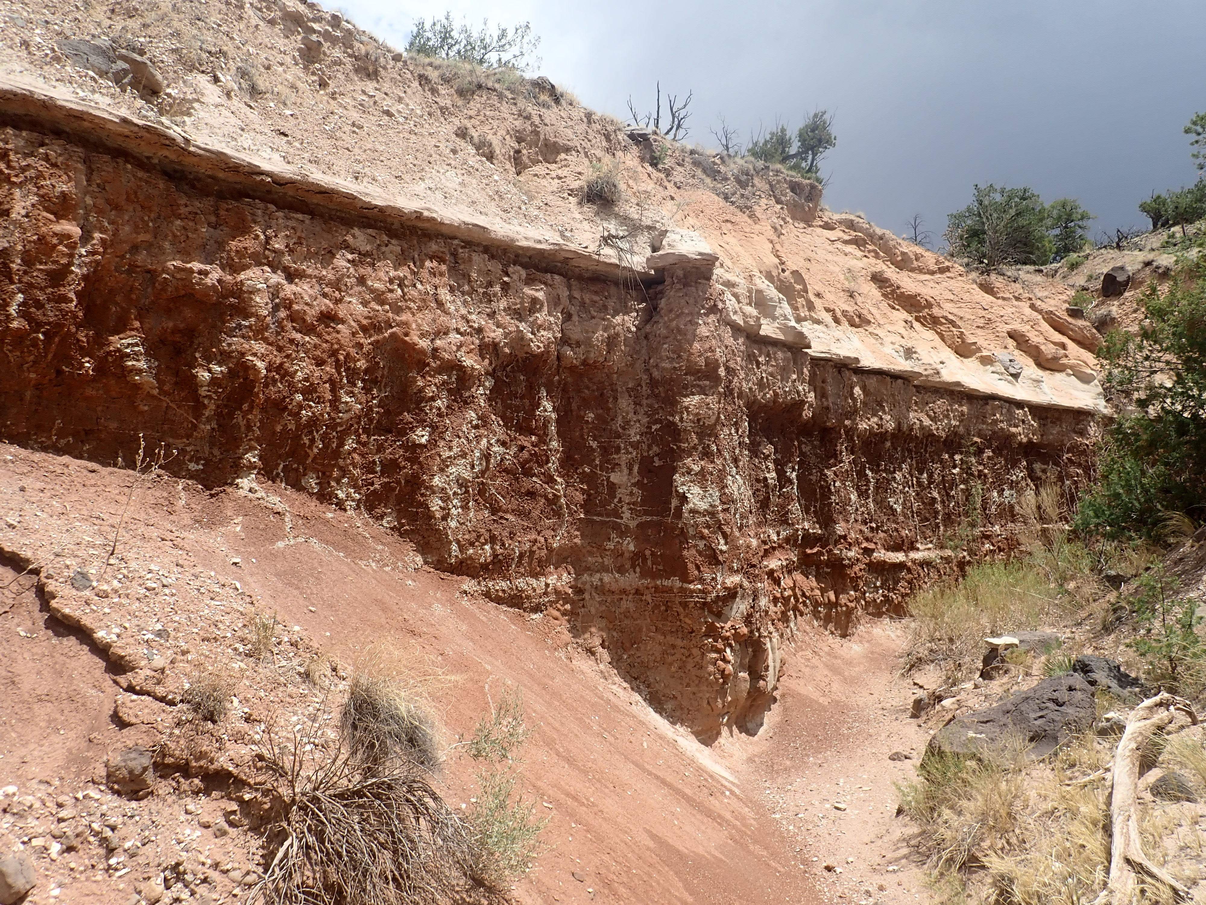
Permian and Triassic sedimentary beds. As with all
photos here, click to enlarge. 36
14.033N 106 23.336W
The lowermost red rocks, with the many layers and the column-like
structures, belong to the Arroyo del Agua Formation of the Cutler
Group. We examined this in the last chapter. The massive bed above
the Arroyo del Agua Formation is the Shinarump Formation.
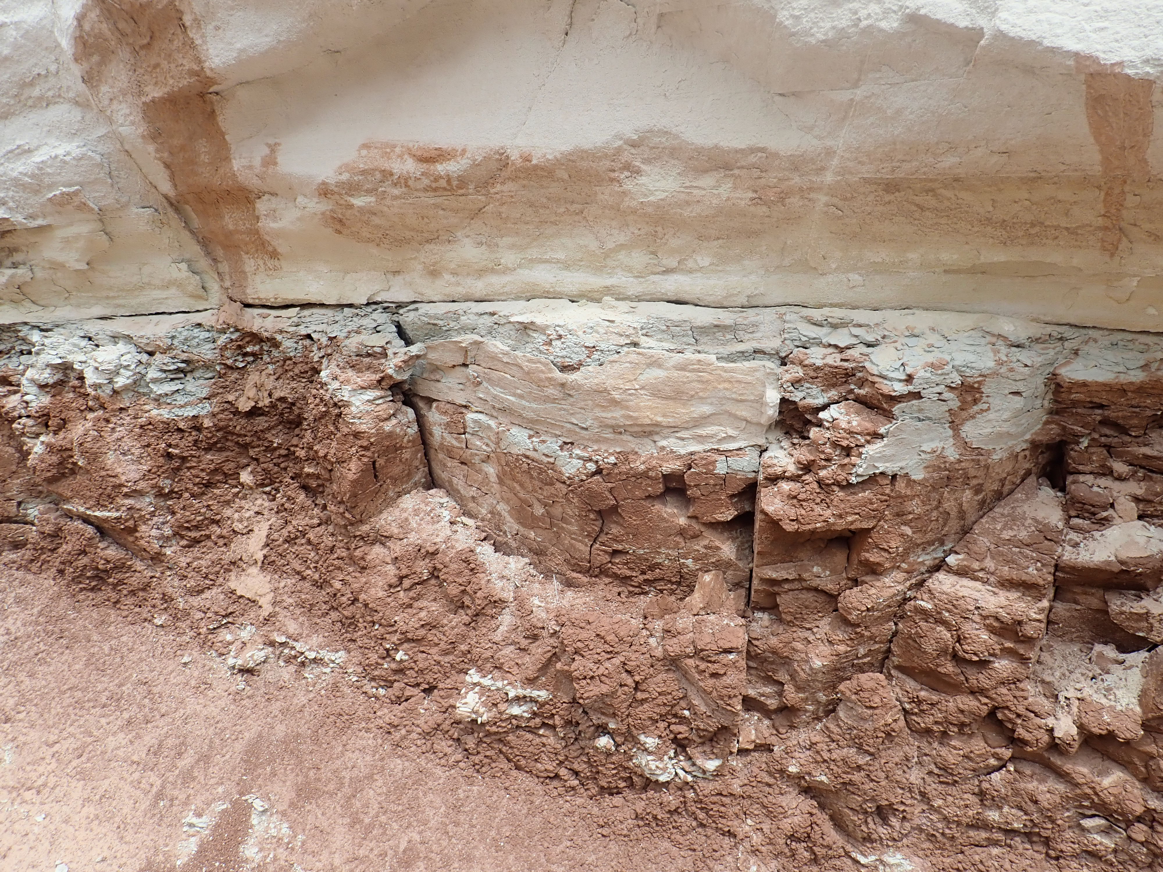
Here is the contact between the Arroyo del Agua and the Shinarump close up:
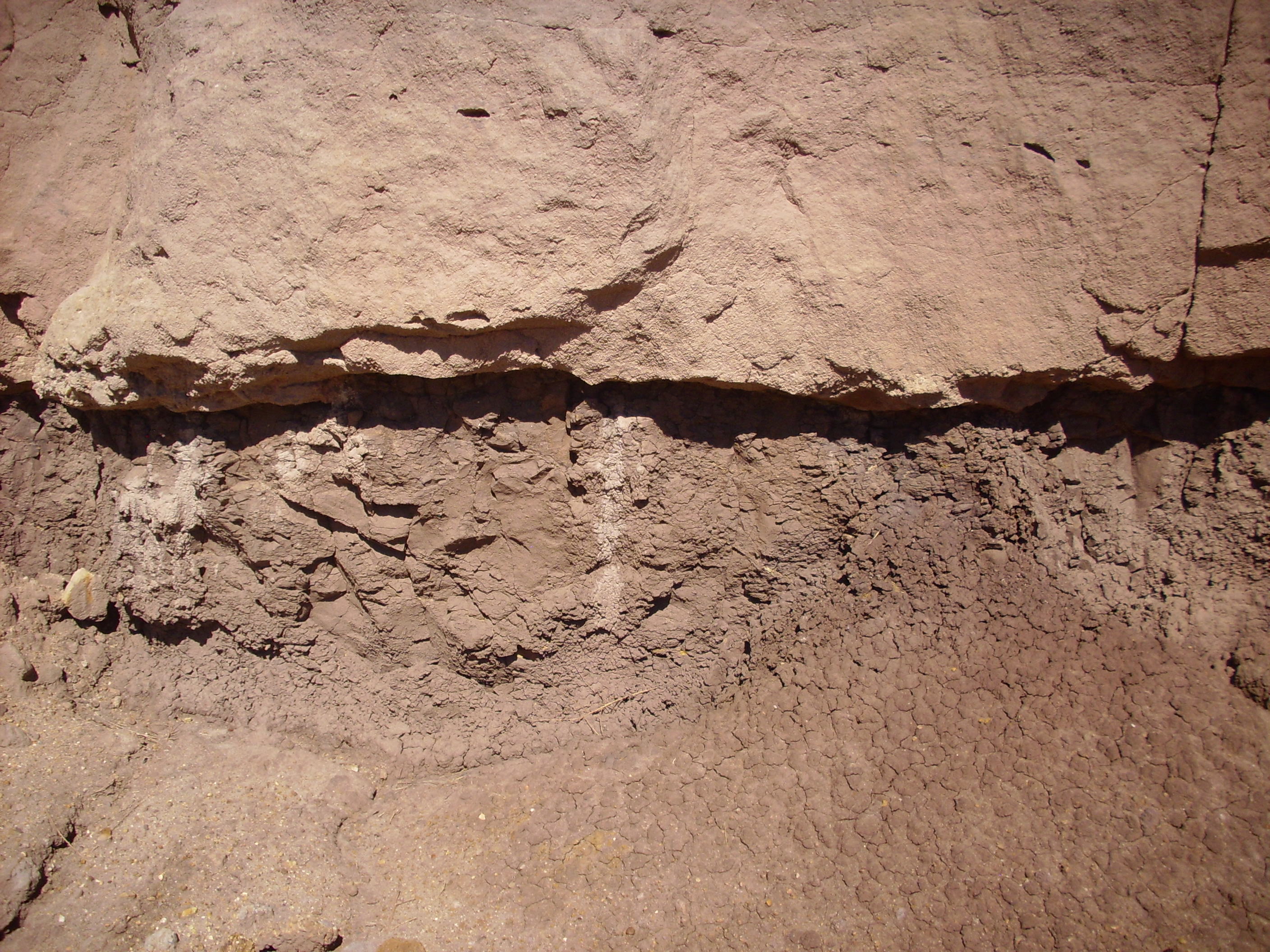
Perrmian-Triassic discomformity
The lower part of the Shinarump Formation is a thick bed of
sandstone.
This stands out clearly in the outcrop photographs earlier. The
sandstone is a well-sorted coarse quartz arenite. Somewhat to my
surprise, there is little or no calcite, the cement apparently
being additional silica.
Just above the thick sandstone is an impressive bed of
conglomerate.
The clasts resemble those in the Shinarump conglomerate beds south of the Jemez, but there is much less tan matrix between the clasts.
The Shinarump Formation can be traced into northwest Arizona, but
it thins to the north, although it can still be mapped in
Canyonlands National Park.
Conglomerate is a clastic sedimentary rock containing a
substantial number of clasts that are larger than 2mm in diameter.
Thus the coarsest sandstones grade into fine conglomerate. At the
other end of the size scale, conglomerates may be dominated by
clasts the size of boulders, and we'll see some striking examples
later in this book. The spaces between the large clasts are almost
always filled with a matrix of finer sediments, such as
sand or clay. A well-consolidated, highly indurated
conglomerate resembles nothing so much as a slab of concrete, and
concrete may be thought of as artificial conglomerate.
If the matrix is scanty enough that the clasts touch each other,
the conglomerate is described as clast-supported, because
the clasts take up the weight of the overlying rock. If the matrix
is more abundant, so that it actually separates the clasts, the
conglomerate is spoken of as matrix-supported. As with
sandstones, a conglomerate can be well-sorted (with clasts
mostly the same size) or poorly sorted (containing a
jumble of clasts of various sizes), though well-sorted
conglomerates are not common. Manufactured concrete is strongest
when it has just enough sand and Portland cement in the mix to
correspond with a conglomerate that has abundant matrix but is
still clast-supported. (Manufactured concretes also tend to be
well-sorted.)
Geologists distinguish conglomerates having rounded, polished
clasts from breccias, which have angular, broken clasts.
Conglomerates are typical of a very high-energy environment, such
as a fast-running river bed, where very large rocks are tumbled
and polished. This is rarely found far from the source outcrop.
Breccias are almost always found very close to their source rock,
since they have not been transported far enough even to round and
polish the clasts. They tend to form from catastrophic events,
such as landslides, earthquakes, meteor impacts, or volcanic
activity.
The large clasts in a conglomerate can easily be examined to determine their rock type and thus identify their source. In young conglomerates, the source rock may be an obvious nearby outcropping or highland. In ancient conglomerates, the source rock may long have eroded away or been buried, and the conglomerate then provides the best information we have on the rock composition of an ancient uplift.
The Shinarump conglomerate sample shown above is a moderately well-sorted clast-supported conglomerate composed of bits of quartzite that weathered from the flanking uplifts of the Ancestral Rocky Mountains.
Below is a paleogeologic map of the Tr-3 surface on which the
Shinarump was deposited.
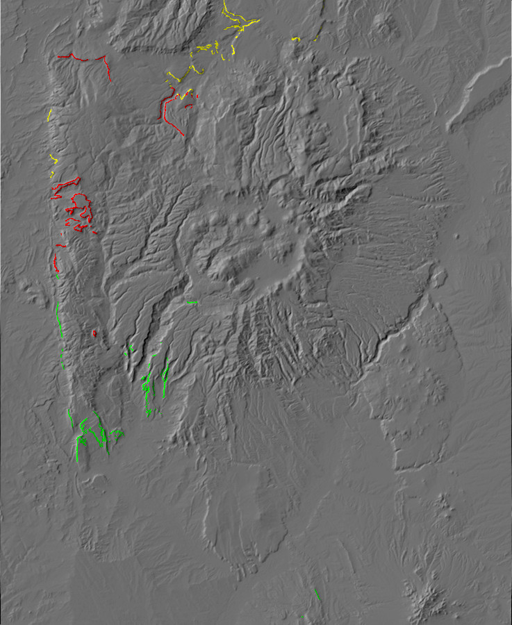
Paleogeologic map of the lower Shinarump Formation
surface in the Jermez.region
This map shows the age of the formations immediately under the
Shinarump. Green shows areas where the Shinarump lies on the
Moenkopi Formation, the next youngest formation in the Jemez. Red
is the Yeso Group (typically De Chelly Sandstone) and yellow is
the Abo Formation or Cutler Group. This map shows that the younger
formations are present under the Shinarump to the south and east
while the older formations are present to the north, with the
oldest formations of all (Abo and Cutler Group) present directly
north and to the northwest of the Jemez. Beyond the north
edge of the map, at Chavez
Box, the Shinarump sits directly on Precambrian basement,
showing that the San Luis uplift was finally buried only in the
early Triassic. Other parts of the Ancestral Rockies would persist
clear into the Jurassic.
Relief map of the Jemez with Salitral Formation
outcroppings highlighted in red.
As the Mogollon volcanic arc continued developing to the south,
the braided streams of the Shinarump began to be choked with
volcanic ash. This rapidly weathered to clay as the river system
slowed and matured, becoming a sheet of mud that would become the
Salitral Formation.
The greatest thicknesses of the Salitral Formation in the Jemez occurs to the northwest, where it takes the form of red to brown mudstone. The type section is located at the Youngsville town dump.
Salitral Formation at its type section. Looking south from 36.1882229N 106.5897165WThe grayish beds at the very bottom of the cliff are the Piedra
Lumbre Member. The thin conglomerate bed capping this member is
the El Cerrito Bed. The thick reddish-brow section above the El
Cerrito Bed is the Youngsville Member.
We've seen a photograph of the Nacimiento Mine that shows Salitral Formation atop the Shinarump and along the south side of the lake filling the former open pit mine. The Salitral here is notable for septarian nodules, formed when mud concretions in the beds dry and crack internally. The cracks are later mineralized by groundwater.
This photograph shows a septarian nodule from the Nacimiento Mine
that has been cut in half and polished.
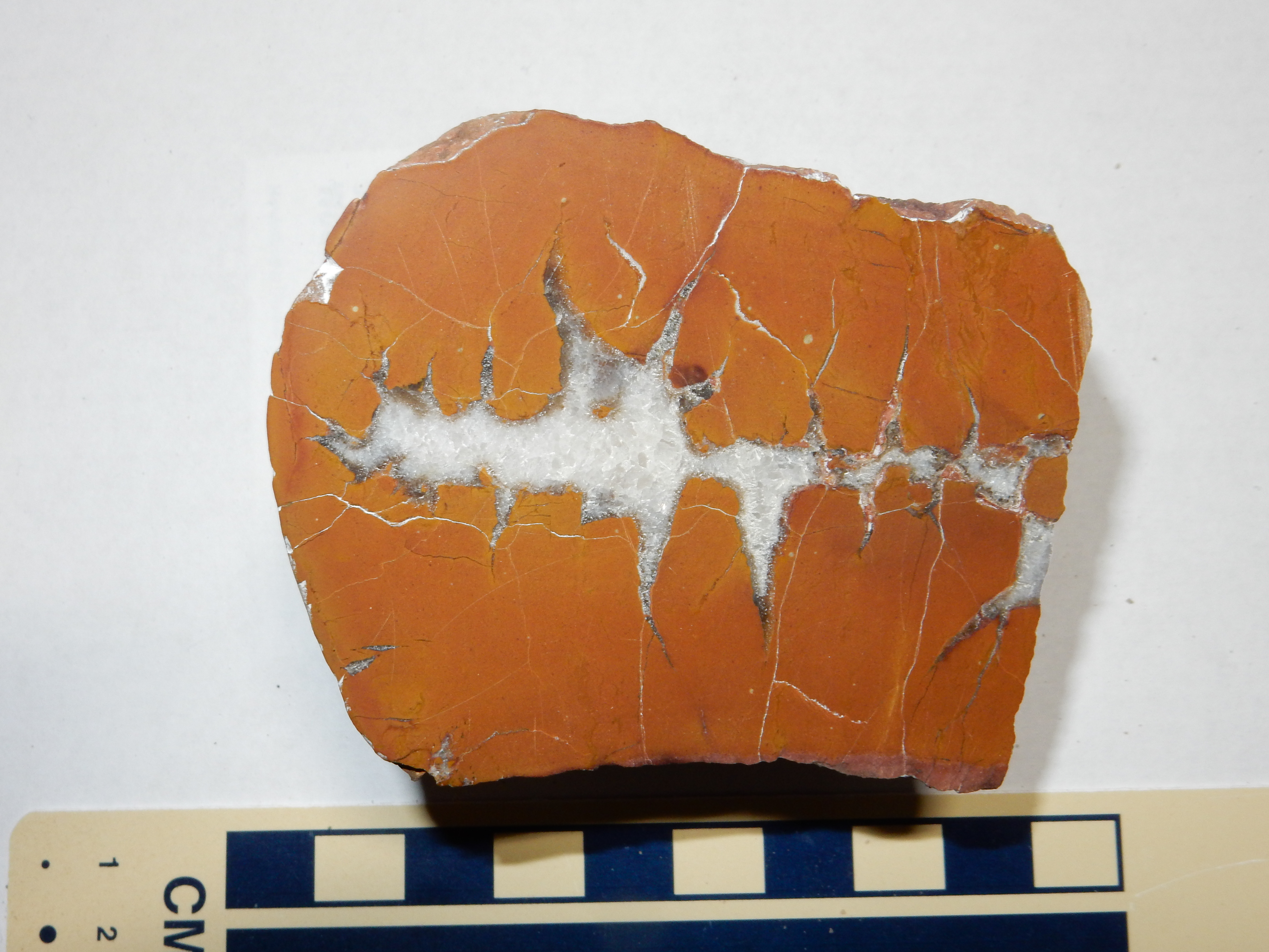
The white crystalline filling is made of calcite. This glows a
beautiful blood red when exposed to ultraviolet light, like all
but the purest calcite. The color likely comes from traces of
manganese replacing calcium ions in the calcite. Manganese is a
moderately abundant element whose ions typically have the same
charge (+2) and roughly the same radius as calcium ions. However,
manganese is a transition metal, with unpaired electrons in its
inner shells that scatter and absorb both visible and ultraviolet
light. This gives many manganese compounds bright colors and
allows minerals containing traces of manganese to fluoresce under
ultraviolet light.
The Salitral Formation is a very weak shale where it crops out
just above the Shinarump Formation at the Nacimiento Mine.
This is likely Piedra Lumbre Member capped by the El Cerrito Bed.
Salitral Formation is mapped in the northern Jemez as far east as the Canones fault zone, but it is not prominent.
In the southern Jemez, the upper beds of the Shinarump Formation transition into a very coarse ferruginous conglomerate. These ferruginous beds are suggestive of the dark mudstones of the Salitral Formation, though this formation is not mapped in the southern Jemez.

A ferruginous sedimentary rock is one containing large quantities of iron oxides. These give the rock a dark color and a high density. Like the older ferruginous Log Springs Formation further west, these beds probably formed from prolonged leaching of soil in a tropical climate.
Relief map of the Jemez with Poleo Formation
outcroppings highlighted in red.
Tectonic processes may be slow, but they are not steady. As the
river system draining the southern Appalachians continued to
develop, another sheet of coarse sediments was laid down in the
Chinle Valley. This second sheet resembled the Shinarump, but was
much more localized and irregular in thickness. This suggests it
was laid down near the main channel of the Chinle River or its
tributaries, so that the Chinle must have passed very close to the
Jemez region. This sand sheet became the Poleo Formation, which is
very prominent north of the Jemez.
The Poleo Formation tends to cap mesas, since it is very resistant to erosion. It forms the cliff capping the road cut in the Canones Fault Zone that we have visited before. In a few places along this road cut, the Poleo Sandstone overhangs enough to provide a nice nesting spot for swallows.
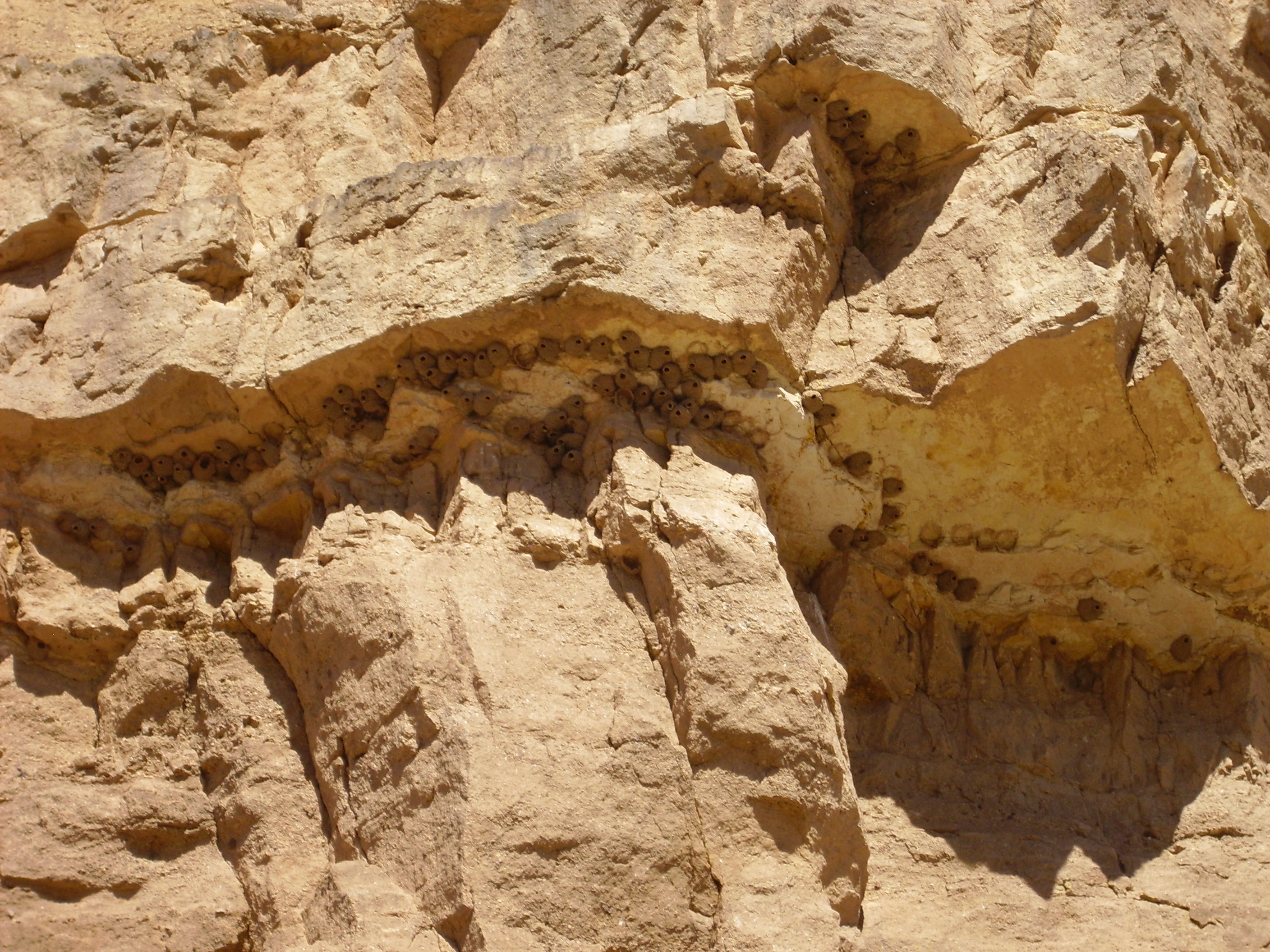
These are likely nests of Petrochelidon pyrrhonota, the
American cliff swallow.
A little further up the highway, there is a turnoff to a gravel
road leading to a bench of Poleo Sandstone along the Chama River.
Here's a sample of the sandstone from this area.
Poleo Sandstone from 36
13.965N 106 23.871W
It's a very clean sandstone composed of nearly pure quartz. The grains are fine, well-rounded, and well-sorted. It looks very much like a supermature quartz arenite.
The mature sandstone of the Poleo Formation tells us that the
climate in the Jemez area became arid enough for windblown dunes
to accumulate. Such supermature sandstones are also typically the
product of sand cycling. The Chinle River and other rivers
draining west carried sediments, including sand, that were
deposited on the shoreline. The prevailing westerly winds then
blew the accumulated sand back across the area, further winnowing
it. Repeated cycles of fluvial transport to the shore, then eolian
transport back onto the continent, thoroughly cleaned, polished,
and sorted the sand grains.
The view south from this bench takes in rocks of very different ages.

At the left, the Rio Chama winds around a mesa capped with Poleo
Sandstone. The reddish area in the drainage to the south is an
outcrop of the Painted Desert Member of the Petrified Forest
Formation of the Chinle Group, which sits atop the Poleo
Formation. To the right is more Poleo Formation. There is a strand
of the Canones Fault on the west (right) side of the drainage that
has dropped the Petrified Forest Formation down on the east.
The mesa on the skyline is Canones Mesa.
The zone of faulting and deformation along the southeast margin of the Colorado Plateau has been traced as far west as Coyote.
At Abiquiu Dam, the Poleo Sandstone is particularly thick.
The Poleo Formation grades into the overlying Mesa Montoso Member of the Petrified Forest Formation, without a very sharp transition. We see this just south of the dam, where the sandstone beds of the Poleo Formation begin to be interbedded with red mudstone.
Crossbedding is particularly prominent in a road cut along a maintenance road east of the main highway.
East of Abiquiu Dam. 36
14.427N 106 25.691W
The vertical structures are drill holes where engineers blasted
out the road bed.
Still further west, the Poleo Formation underlies La Joya del Pedregal ("Jewel of the Stony Ground":
La Joya del Pedregal. 36
13.477N 106 30.703W
The flat plain here is likely not an erosional surface, but a surface underlain by the resistant Poleo Formation. Basalt clasts from the Jemez volcanic field to the south accounts for the “stony ground”; “jewel” is a conceit.
At left is Cerro Pedernal, one of the most prominent landforms of the northern Jemez, and a favorite subject for the paintings of artist Georgia O'Keefe. We'll learn more about this relatively young feature several chapters on.
The Poleo Sandstone is also prominent on the mesas west of Coyote, but begins to thin to the south. It is just a few meters thick at the Nacimiento Mine west of Cuba, where it is also strikingly thinly bedded.
Poleo Sandstone at Nacimiento Mine. 35
59.499N 106 53.988W
The Poleo Formation becomes spotty in the southwest Jemez, where
the Salitral Formation pinches out and the Poleo becomes difficult
to distinguish from the uppermost beds of the Shinarump Formation.
In general, the Poleo Formation is thick wherever the underlying
Salitral Formation is thin. This suggests it fills valleys eroded
into the Salitral Formation.
Relief map of the Jemez with upper Chinle Group
outcroppings highlighted in red.
As the Chlnle River matured and become a mighty river, comparable with today's Mississippi River, it carried increasing quantities of fine sediments. These were supplemented with ash from the volcanoes of the Mogollon volcanic arc to the south, which quickly weathered into bentonitic red clay in the hot climate. This was deposited as the Petrified Forest Formation, sometimes mapped in the Jemez simply as the upper Chinle Group. Silica from the volcanic ash replaced organic matter in logs buried in the sediments to form petrified wood, which is most abundant in eastern Arizona in the Petrified Forest. However, the formation is prominent as far east as the Jemez.
A volcanic bed in the Petrified Forest Formation in eastern
Arizona has been dated at 213 million years in age. This is our
best direct age control on the Chinle Group. We know that
the Shinarump Formation has fossils characteristic of the Carnian
Age, which lasted from 227 to 237 milliion ago. The volcanic bed
dates the Petrified Forest Formation directly dates it to 213
million years ago. This brackets the ages of the formations in
between, which lack both distinctive fossils and volcanic beds.
Like the Shinarup and Salitral Formations, the Poleo and Painted Desert Formations are thought to represent the growth of a river delta through the area. All these Triassic formations are assigned to the Chinle Group. At this time, much of western North America was covered with flood plains and swamps, with the Four Corners region being what geologist Robert Fillmore has described as "a vast tropical lowland, lush with well-watered ferns and trees."
In some locations, there is a thin bed of the Mesa Montosa Member of the Petrified Forest Formation atop the Poleo Formation.. The highway cuts through such a bed here.

In this location, at least, the Mesa Montosa Member is much better consolidated than the overlying Painted Desert Member. There are numerous veins lined with calcite crystals through this bed. I picked up a particularly pretty example.

The bulk of the Petrified Forest Formation north of the Jemez is
assigned to the Painted Desert Member. This is found above the
Mesa Montosa Member where the latter is present, or else sits
directly on the Poleo Sandstone.

The Painted Desert Member is a distinctive red from all the hematite it contains. It is almost nowhere very well cemented. The outcropping here is basically red dirt, and my sample has already almost crumbled away:
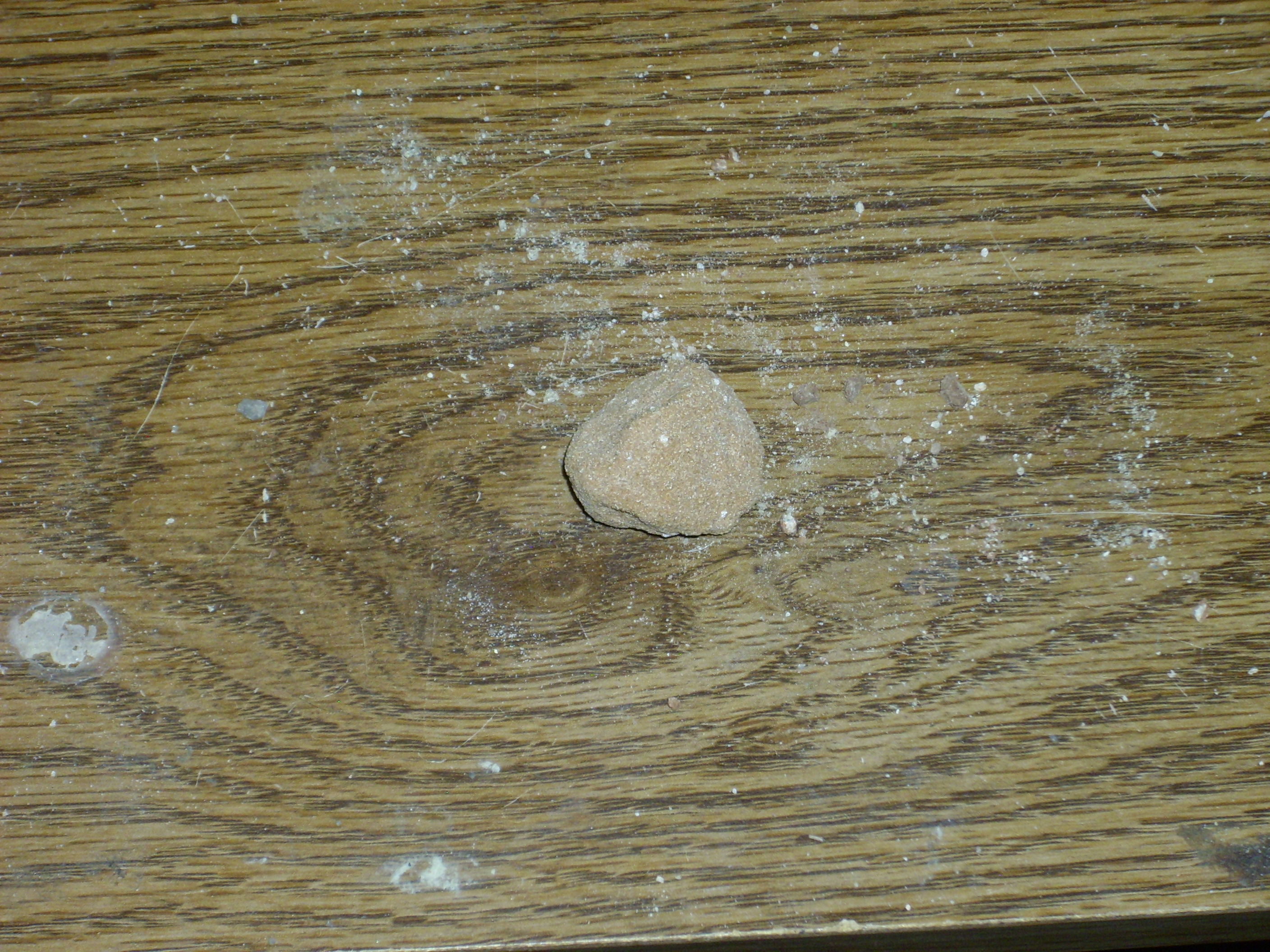
Under the loupe, the grains look very much like those in the
Poleo Sandstone, but the pore space is much more open, and the
rock is obviously much less thoroughly cemented. There are also
more feldspar grains in among the quartz, though not enough to
make this an arkose.
West of Abiquiu Dam, there is a road cut through a thick and spectacular section of the Painted Desert Member.
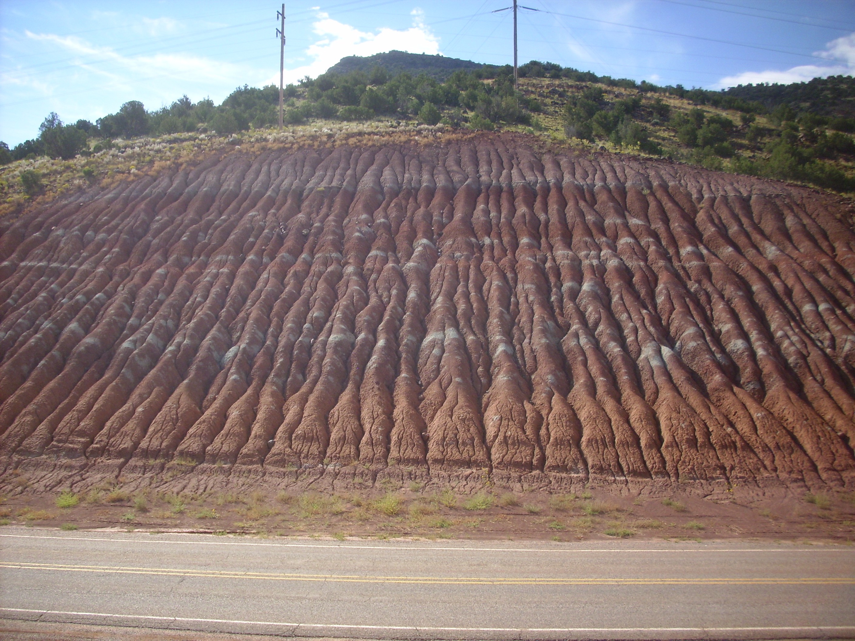
Painted Desert Member in roadcut south of Abiquiu Dam. 36
14.046N 106 25.824W
The formation is easily eroded to form a gullied surface. The
gray-green layers are most likely beds unusually rich in organic
matter, so that the red ferric iron was reduced and leached away
to leave whitish clay.
Here is a close up view of the formation, showing that it is a thinly bedded red shale that easily weathers into red mud.
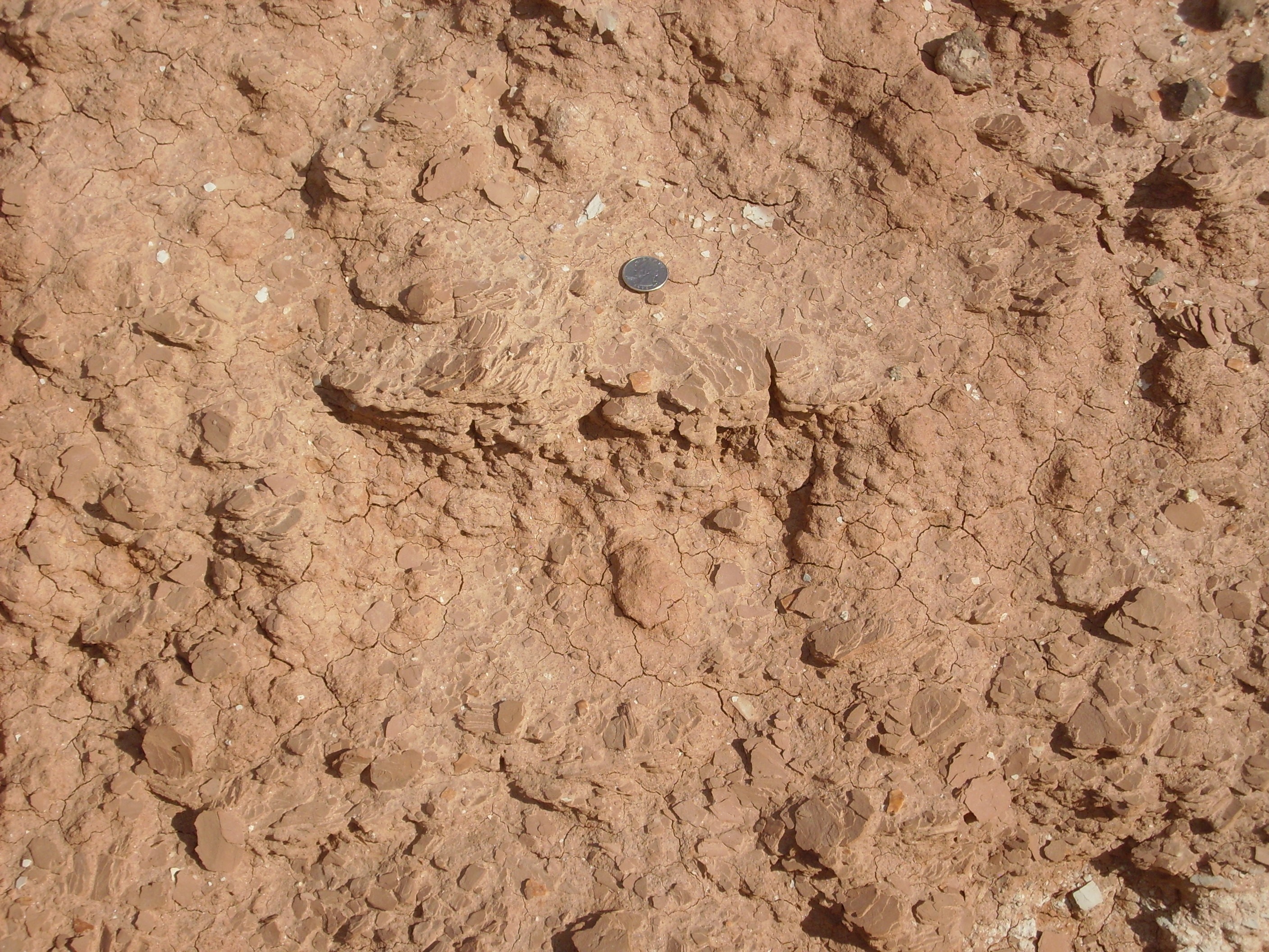
Painted Desert Member in roadcut south of Abiquiu Dam.
Quarter for scale. 36
14.046N 106 25.824W
Mudstone is actually more typical of the Painted Desert Member
than the dirty sandstone shown earlier, which may be transitional
with the underlying Mesa Montosa Member.
The road curves around south of the reservoir and at a pullout one has a nice view of the Abiquiu Reservoir.
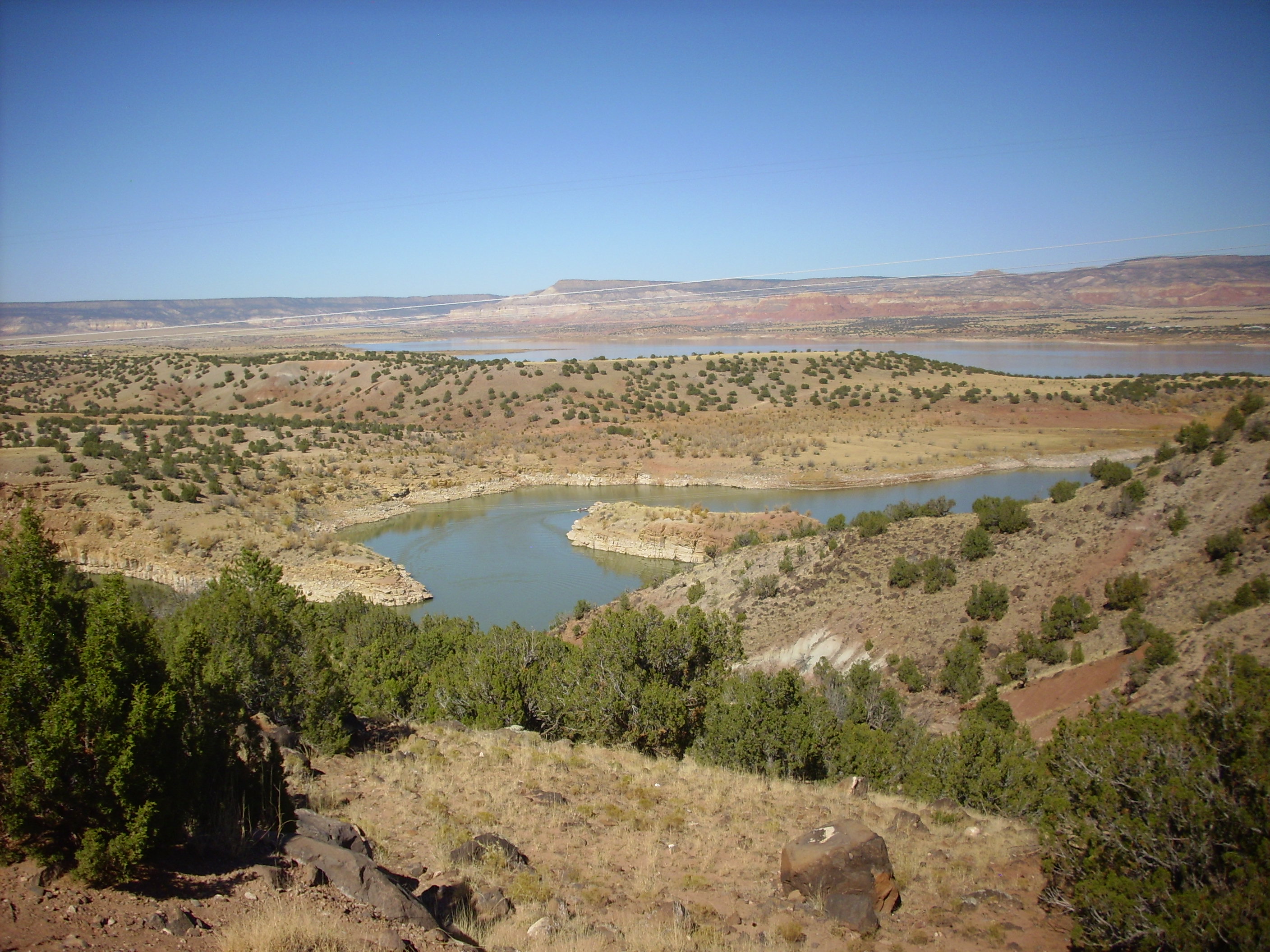
In the distance are cliffs of Mesozoic rocks of the Colorado Plateau. In the middle distance is the reservoir, whose shores are mostly Poleo Formation under rounded hills of Painted Desert Member. In the foreground, dark boulders are Lobato Formation basalt. The Painted Desert Member and other formations underlying the Lobato Mesa Formation basalt flows to the south lack strength, and this makes for landslides. A large landslide appears to cover the entire area immediately south and east of this point.
So the rock column in the northern Jemez for the Mesozoic that
we've seen so far is: Permian Arroyo del Agua Formation, Cutler
Group; Shinarump Formation, Chinle Group; Poleo Sandstone, Chinle
Group; Mesa Montosa Member, Petrified Forest Formation, Chinle
Group; and Painted Desert Member, Petrified Forest Formation,
Chinle Group.
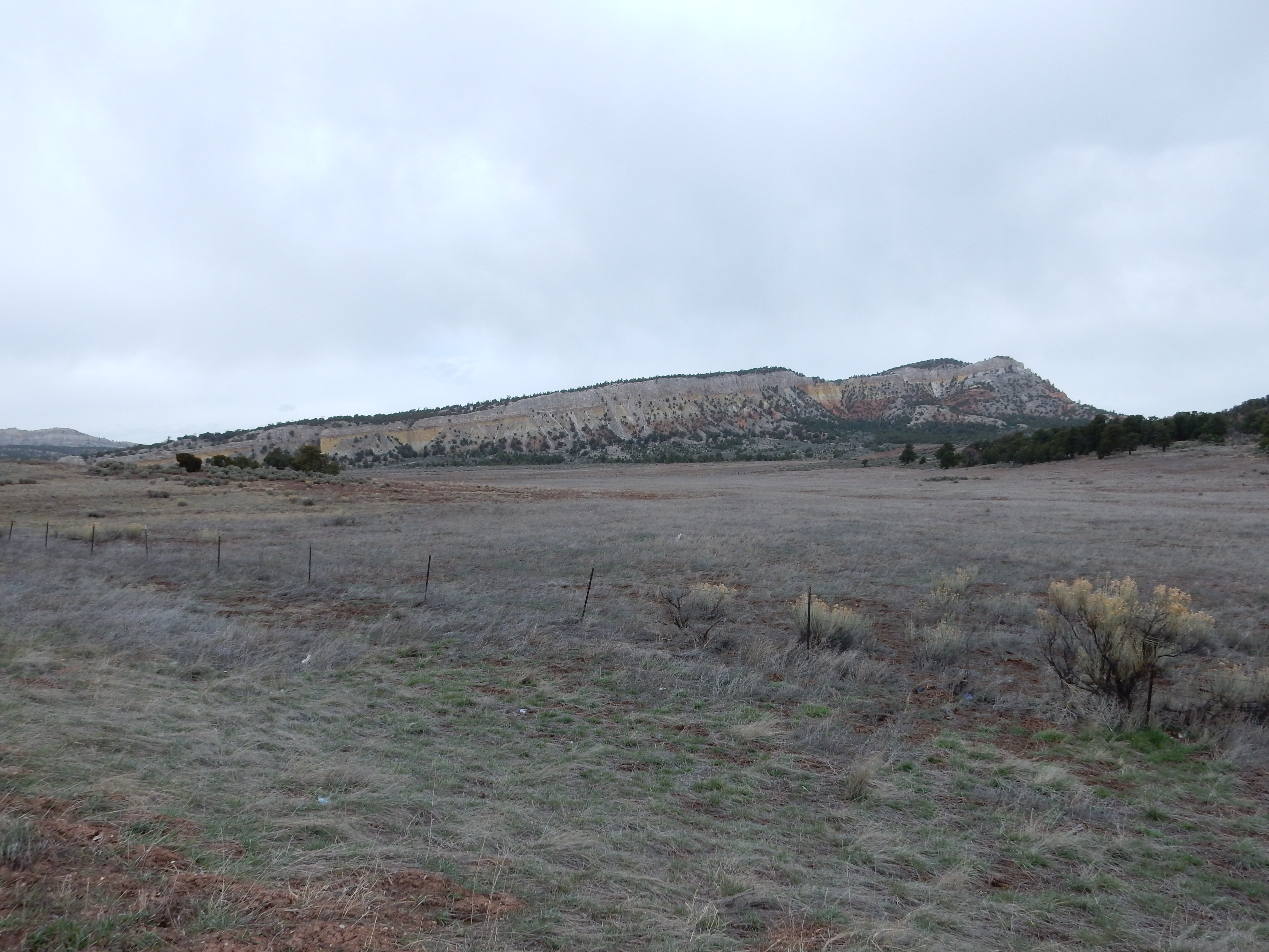
West
of Youngsville one sees the same sequence of beds exposed,
at Mesa Naranja.
The lower red portion of Mesa Naranja is Arroyo del Agua Formation, and the thin white band near the top is the Shinarump Formation. Above this is soft shale of the Salitral Formation on which rest fractured beds of the Poleo Formation. This is the same sequence we saw back at the Canones road cut, but here the Salitral is much thicker.
In the southern Jemez, the upper Chinle beds are all assigned to the Petrified Forest Formation. This is especially well exposed along White Mesa.
The uppermost beds of the Chinle Formation north of the Jemez
were long described simply as the upper siltstone member. With the
promotion of the Chinle Formation to group status, these beds were
reassigned to the Rock Point Formation. The Rock Point
Formation is exposed in a few locations in the northern Jemez,
including near the entrance to "Mushroom
Canyon" along Forest Road 100 south of Youngsville.
Here the contact between the Rock Point Formation and the Jurassic
Entrada Sandstone is exposed in the canyon wall.
The Rock Point Formation is aged about 205 million years. The overlying Jurassic Entrada Sandstone has an age of about 160 million years. The intervening 45 million years are missing from the geological record here. This discontinuity is one of the most widespread in what is now the western United States, and is known as the J-2 regional unconformity. This is one of the best preserved erosional surfaces in the geologic record. It records a time in the middle Jurassic, very close to 169 million years ago, when almost the entire western interior of the United States was beveled almost completely flat.
The Rock Point Formation is fairly hard siltstone
This distinguishes it from the soft mudstone of the underlying
Painted Desert Formation.
The J-2 contact with the Entrada Formation is very sharp and
level throughout this area.
Rock Point Formation.
36.1794609N
106.5460348W
This is typical of the J-2 surface throughout the Jemez region.
Some of the beds of the Rock Point in this area have a concretionary structure.

Rock Point Formation. 36.1794609N
106.5460348W
The upper portions of the Rock Point Formation included numerous dessication cracks that have been filled in by sandy sediments identical with the overlying Entrada Sandstone.
Rock Point Formation. 36.1794609N
106.5460348W
Exposures of the Rock Point Formation near Ghost Ranch have yielded hundreds of fossilized skeletons of Coelophysis, the oldest dinosaur for which complete skeletons have been recovered in North America.The most important dinosaur quarry in this area is the Whitaker quarry, discovered in 1948. Other fossil quarries are found at Canjilon, Hayden, and, most recently, the rich Snyder quarry, discovered in 1998. The Snyder quarry has abundant carbonized wood, suggesting the fossils there were from a mass death attributable to a forest fire, some 210 million years ago.
The Rock Point Formation likely correlates with the Owl Rock
Member in southeastern Utah. This was a time of increasing aridity
as the relatively moist Late Triassic drew to a close.
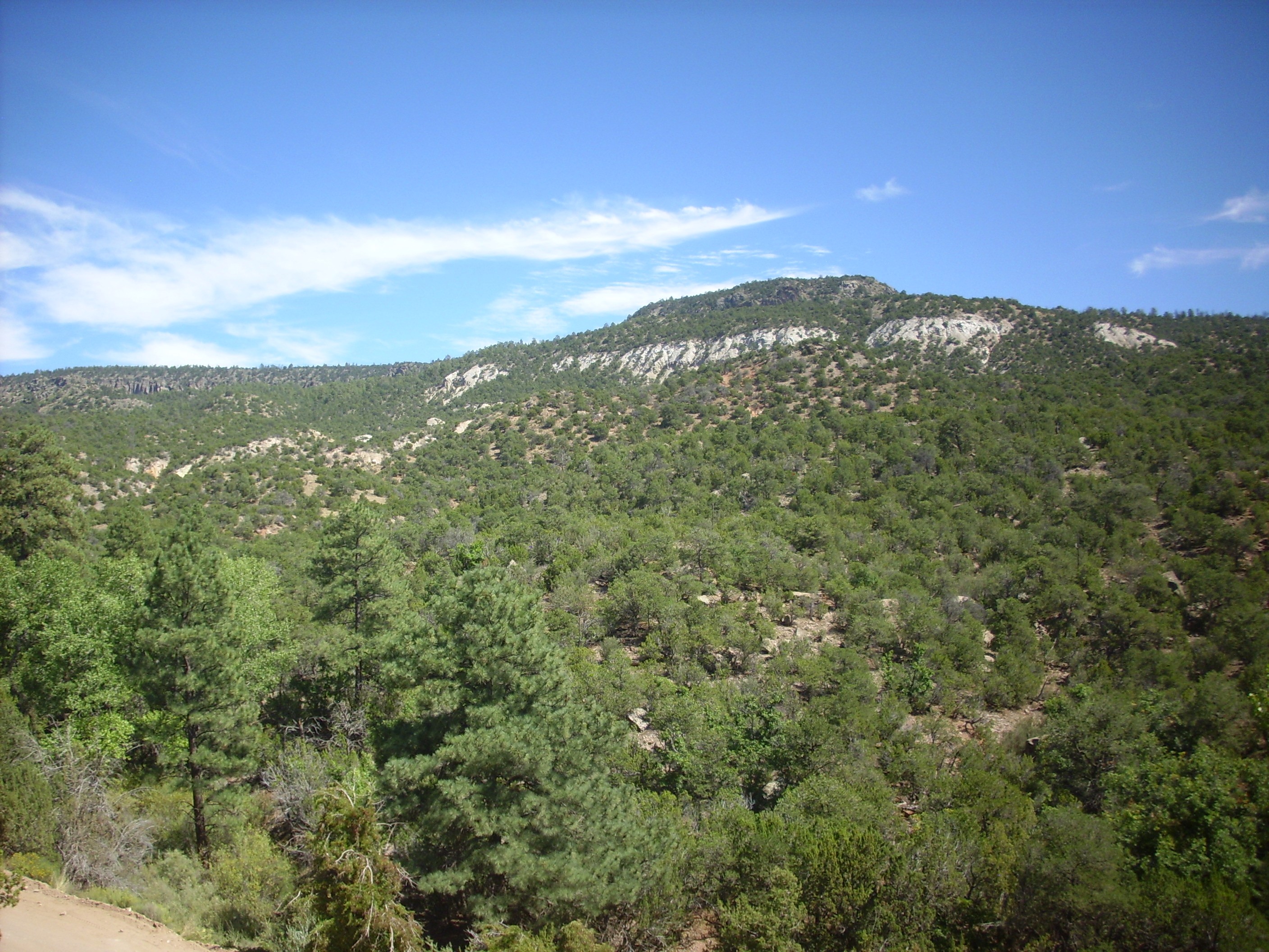
The Chinle Group disappears to the south under the volcanic rocks of the Jemez Mountains, but reappears south of the Valles caldera in the Valle de los Indios and in the area around Ponderosa. The geological column from Permian to nearly the present day is displayed on the south wall of the Valle de los Indios as seen from its the north rim, a location reached by a short hike from Jemez Falls Campground:
In the foreground, close to the camera, are outcrops of very young South Mountain Rhyolite. We'll revisit this again towards the end of this book. This is also visible in the cliffs to the left across the canyon. Here we see part of the south rim of the Valles Caldera. The prominent red to white cliffs in the lower half of the canyon wall are probably Permian Glorieta Sandstone, although there are outcrops of brighter orange Yeso Group sandstones just visible under the Glorieta Sandstone right of center. The heavily forested middle slopes, above the sandstone cliffs, are Moenkopi Formation and Chinle Group beds. These are very poorly exposed in this location. The prominent white cliff at top center is Otowi Member, Bandelier Tuff.
Still further south, near Paliza
Canyon Campground, the Petrified Forest Formation underlies
Bandelier Tuff on the north side of the canyon.
This poorly consolidated formation underlies much of the
Ponderosa area. It also found below younger formations on the west
face of Borrego
Mesa, and here there are very
large landslide deposits where the mudstone has given way
from under the lava flows capping the mesa. Chinle mudstones are
exposed in some of the landslide scarps along the face of
the mesa.
Petrified Forest Formation exposed in landslide scarp. 35
40.571N 106 38.48W
A landslide scarp is a portion of an unstable slope left behind
when the lower part of the slope breaks loose and slides
downslope. The scarp is typically cliff-like and concave, as you
see in this photograph.
Just north of Ponderosa there are impressive outcroppings of the Agua Zarca Sandstone of the Shinarump Formation, Chinle Group, exposed west of the road.
Agua Zarca Sandstone, Shinarump Formation. 35
40.225N 106 39.774W
Under the loupe, this rock appears almost identical with the
Poleo Sandstone north of the Jemez.
Across the road is a knob
topped with what my road log identifies as Poleo Sandstone.
If this has been correctly identified, then the red mudstone
beneath is Salitral Formation.
Consider the differences from the northern Jemez. There the
Poleo Sandstone is thick and impressive, while the Shinarump
Formation, while not insignificant, is decidedly less impressive.
Here in the southern Jemez, the Shinarump has become much
thicker and the Poleo Formation has become much less significant.
In fact, there is some debate among geologists over whether the
Agua Zarca Member and the Poleo Sandstone are really the same
formation, just in different locations, interbedded with a tongue
of the Salitral Formation. However, even where the Salitral is
absent, there are subtle lithological differences between the two
sandstone formations.
Petrified Forest Formation beds are also exposed on the east side of the Rio Grande Rift, near the La Bajada Escarpment.
Petrified Forest Formation near Galisteo Dam.. 35
27.755N 106 14.049W
Here Galisteo Creek has eroded back the La Bajada Escarpment to
expose these beds.The more resistant beds capping the hills may
belong to the Correo Sandstone Member of the Petrified Forest
Formation, but this identification is uncertain.
About 201 million years ago, the supercontinent of Pangaea began
to rift apart to form the Atlantic Ocean. This rifting was
accompanied by a pulse of intense volcanic activity that is
probably responsible for an extinction event that geologists use
to divide the Triassic Period from the Jurassic Period. Though not
nearly as dramatic as the "Great Dying" at the end of the Permian
Period, this extinction event wiped out 20% of taxonomic families
of life.
The western edge of North America continued to sit over a
subduction zone, with the associated mountain building and
volcanic activity. From about 163 to 143 million years ago, the
great batholiths of the Sierra Nevada were formed, an episode
geologists have named the Nevadan Orogeny. The weight of the
mountains thrown up in western California and eastern Nevada
greatly deepened the foreland basin east of the Sierra Nevada, and
Jurassic formations generally increase in thickness from east to
west. Geologists Christian Bjerrum and Rebecca Dorsey of Northern
Arizona University have modeled the Nevadan orogeny by computer,
and estimate that the mountain belt was 300 km (180 miles) wide
and at least 2500m (8000') in height. The front of the orogenic
belt was then located in eastern Nevada.
Northern New Mexico experienced enough subsidence during the
Jurassic to continue accumulating sediments. These were
predominantly deposited in one of the most extensive ergs (sand
seas) in geologic history. This bordered the Sundance Sea, an arm
of Arctic Ocean whose shoreline moved back and forth across
western North American throughout the Jurassic Period. Southern
New Mexico was dominated by the high terrain of the Mogollon
highlands. The cliimate had again become highly arid after the
wetter spell in Chinle time.
There are only spotty exposures of Jurassic rocks in the southern
Jemez, but there are more extensive outcrops west of the Sierra
Nacimiento and in the northern Jemez. These become very extensive
to the northwest, across the Colorado Plateau. They reappear
southeast of the Jemez on the east margin of the Rio Grande Rift,
and extend as far east as Oklahoma.
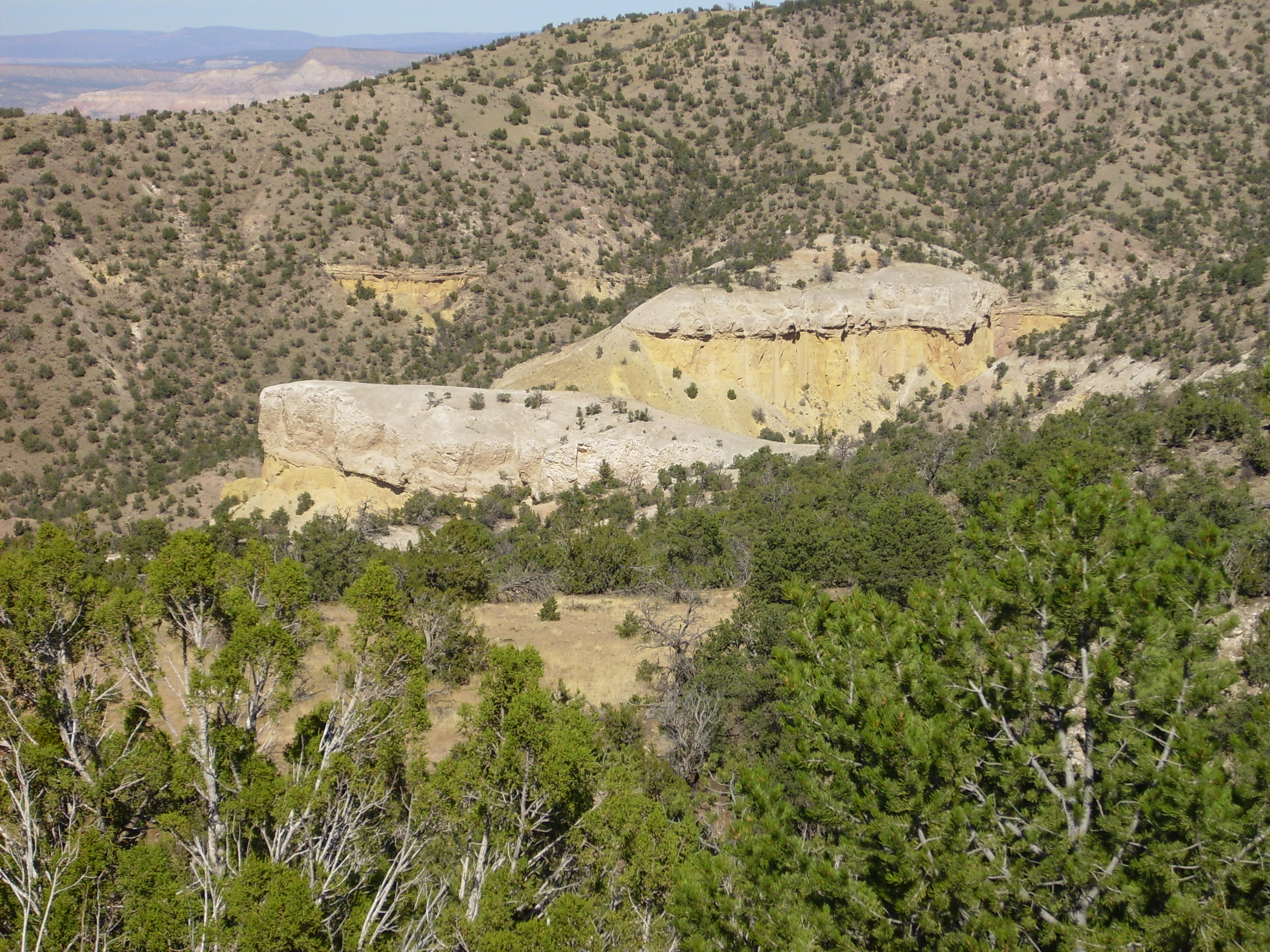
South of Youngsville, Forest Road 100 winds south into the Jemez Mountains, past landslide deposits and outcroppings of the Petrified Forest and Rock Point Formations. Ahead is Cerro Pedernal and the mouth of "Mushroom Canyon".
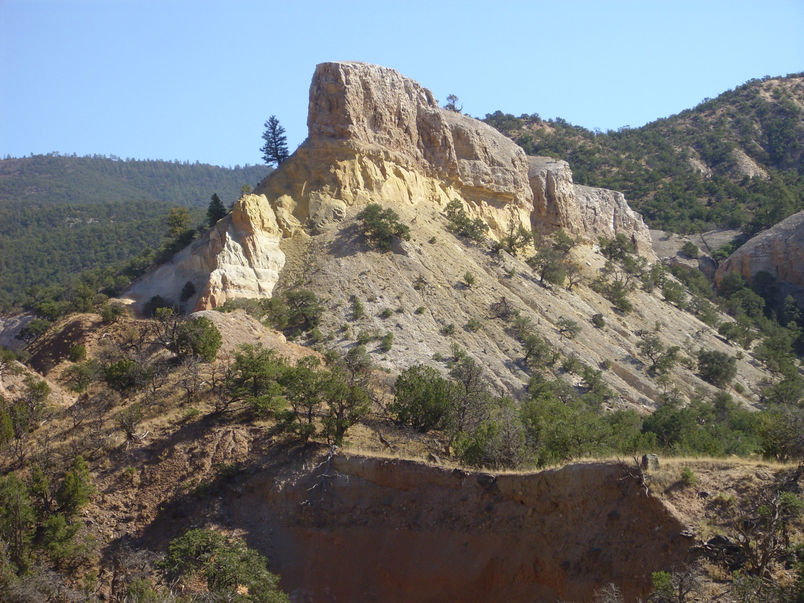
This photograph shows the entire Jurassic column in the northern Jemez, which is well exposed in this area. The foreground and the bank of reddish sediments at the foot of the prominent bluff are Rock Point Formation of the Triassic Chinle Group. The bluff itself is Entrada Sandstone capped by Todilto Formation, which also appear in the slopes to the left and right. The middle skyline is Beclabito Formation, with a thin rim of Morrison Formation on the ridge to the right of the prominent bluff.
Missing from the base of this column, in the 45-million-year J-2 gap between the Rock Point Formation and the Entrada Sandstone, is the entire Glen Canyon Group, consisting of the Wingate, Kayenta, and Navajo Formations. Geologists believe these were laid down in a giant dune sea that covered much of Utah, Arizona, and large parts of Colorado and New Mexico. However, the Glen Canyon Grouop was subsequently deeply eroded, and none is left in the Jemez area. Substantial beds still exist on the Colorado Plateau to the northwest.
This gap in the rock record coincides with the lowest ratio of 87Sr to 86Sr in marine carbonates in all of known geologic time. This suggests that weathering of continental crust was unusually slow, which is consistent with a time of continental rifting in which few new mountain ranges were thrown up. The low-relief world of the Jurassic would continue through the subsequent Cretaceous Period and most of the Paleogene Epoch, with rates of continental weathering beginning to rise sharply again just 30 million years ago.
Relief map of the Jemez with Entrada outcroppings
highlighted in red.
Some 165 million years ago, another dune sea marched across almost as large a region as the Navajo Sandstone had once covered. This dune sea deposited the Entrada Sandstone, which forms many of the arches in Arches National Monument. As the first formation deposited after the J-2 unconformity, the Entrada Sandstone finally buried the eroded remnants of the Ancestral Rocky Mountains, some 145 million years after they first rose.
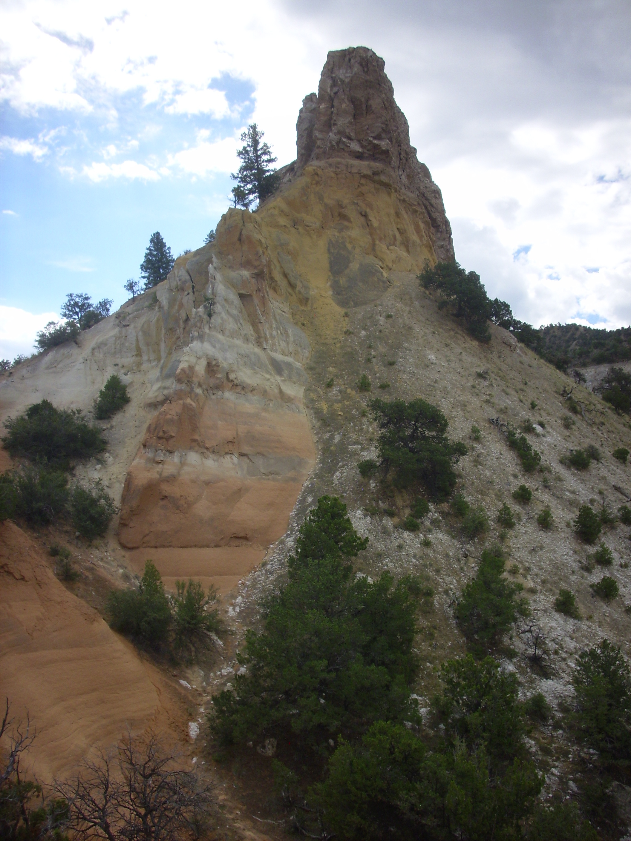
Here's a close up up of the
isolated outcropping from the mouth of "Mushroom Canyon."
The Entrada Sandstone forms the yellow beds in the lower half of
this small butte. This formation is fairly well cemented when
fresh, but it weathers quickly in this climate, so that exposed
surfaces become so soft that they easily crumble when touched. In
some parts of the Colorado Plateau, the Entrada Sandstone is
thoroughly indurated and forms prominent cliffs, while in other
areas (particular further west) it is a muddy siltstone.
The road turns between two banks of Entrada Sandstone.
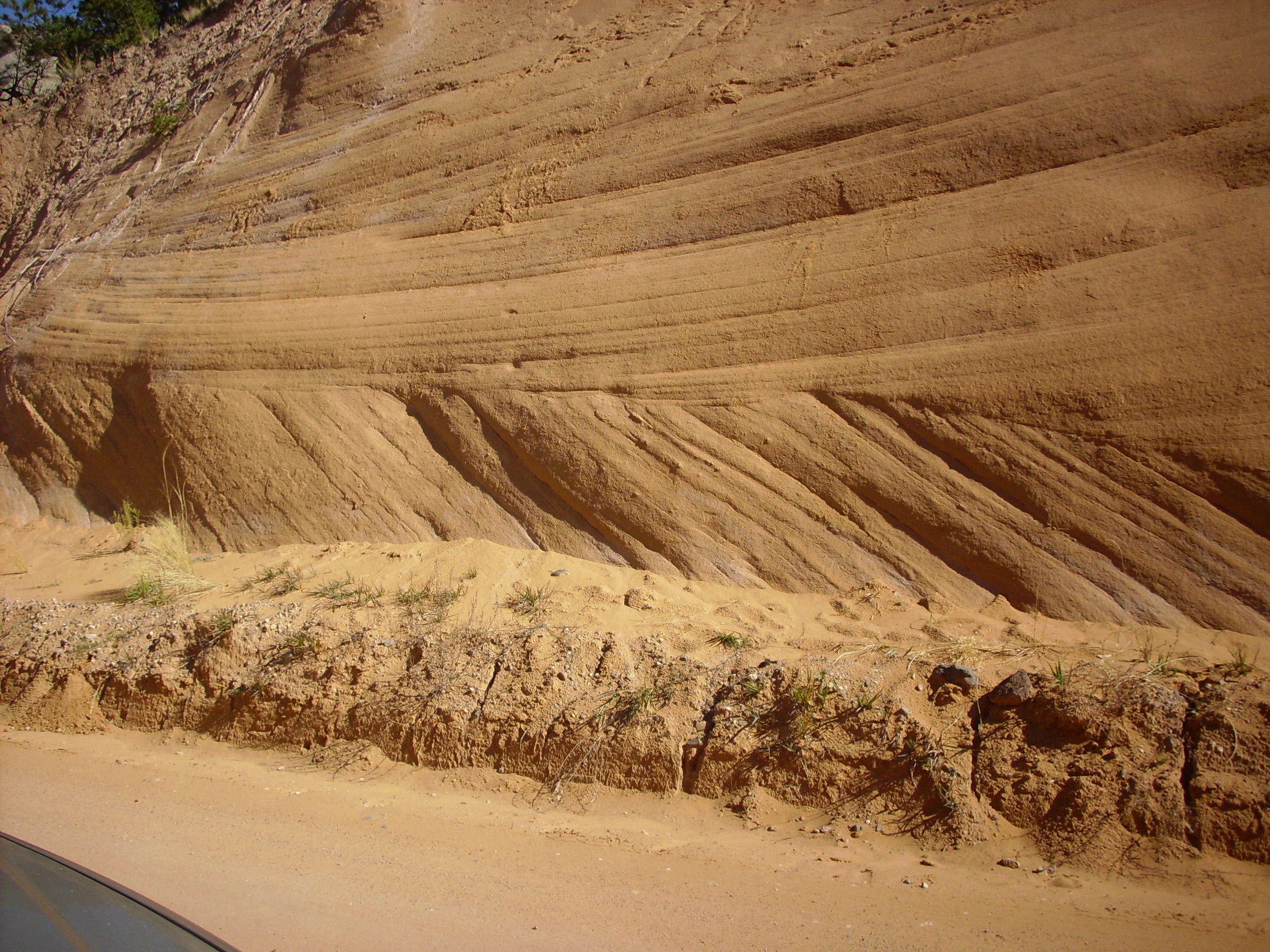
You can see a considerable amount of sand that has crumbled off the face of the road cut into the road bed. There is also quite a lot of grafitti scratched into the Entrada Sandstone in and around this road cut. This illustrates how weakly indurated the sandstone is in this area.
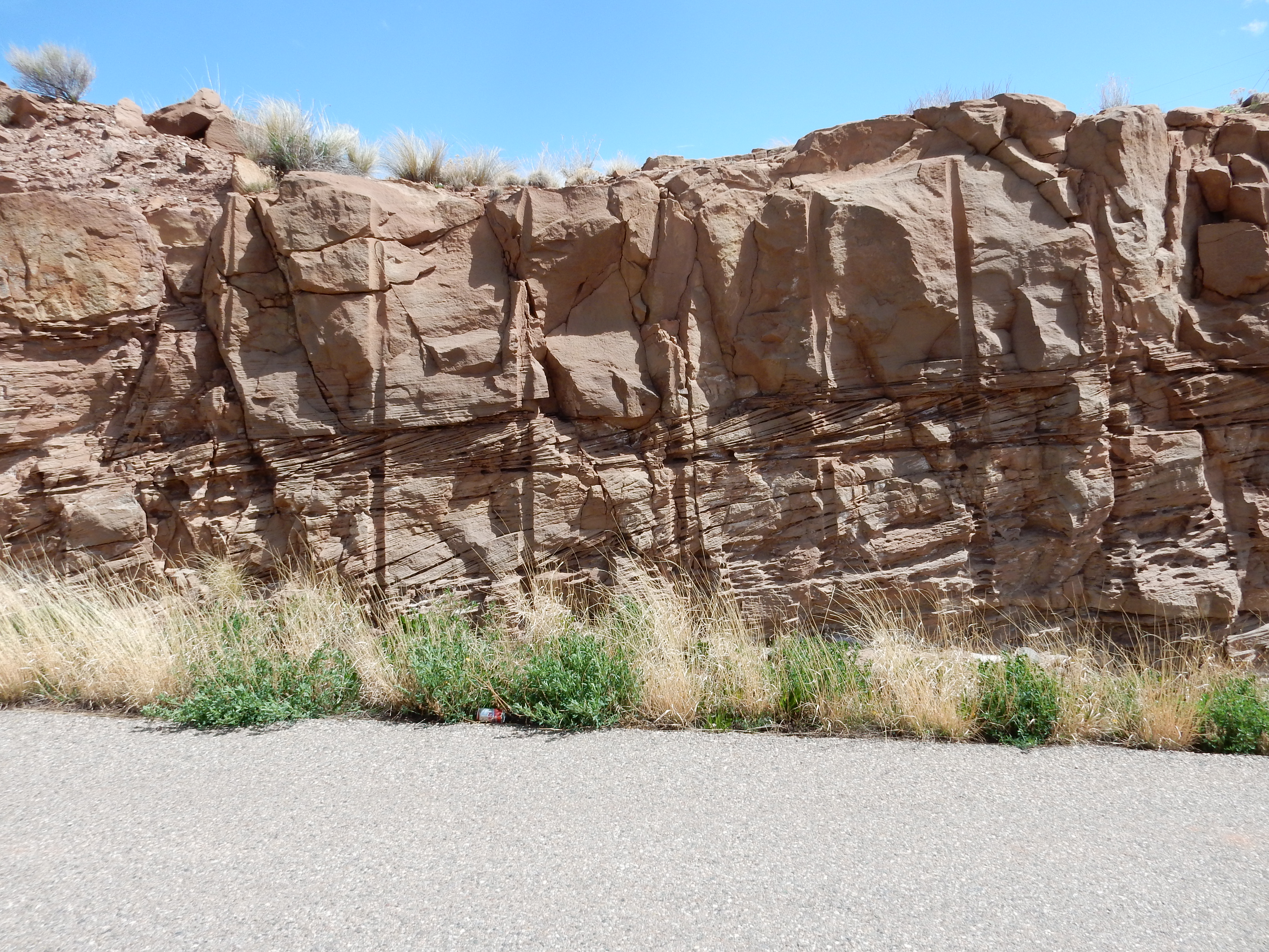
The road cut also shows obvious cross bedding. You can see this
in the large bed at the base of the road cut. Cross bedding is an
indication that the sediments were laid down in a strong current,
either of air or water. In the case of the Entrada Sandstone,
which was laid down as sand dunes in a desert environment, the
cross bedding is a consequence of strong prevailing winds. In this
case, the tilt of the cross beds suggests the wind was from the
northeast (left in this picture) consistent with other evidence
that the Jemez area lay in the trade wind belt during the
Jurassic, at a latitude about 20 to 30 degrees north of the
equator. In the wider Entrada erg, wind directions seem generally
to have come from the north, where there was a source of sand
along the Sundance Sea in Wyoming. The wind direction from the
north meant that the heavily eroded remnants of the Ancestral
Rocky Mountains, now nearly ground away, did not pose even a minor
topographical barrier to the movement of sand.
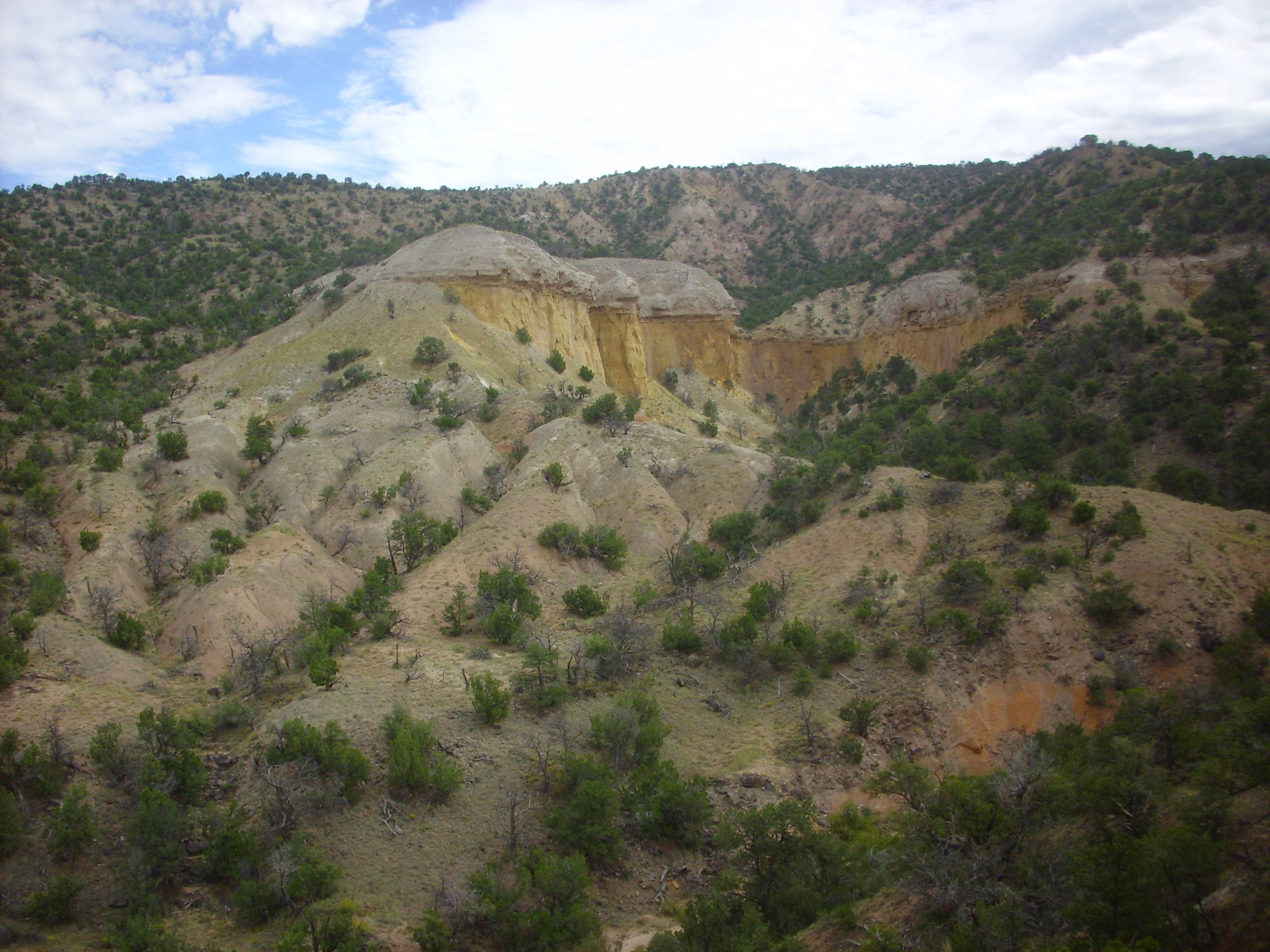
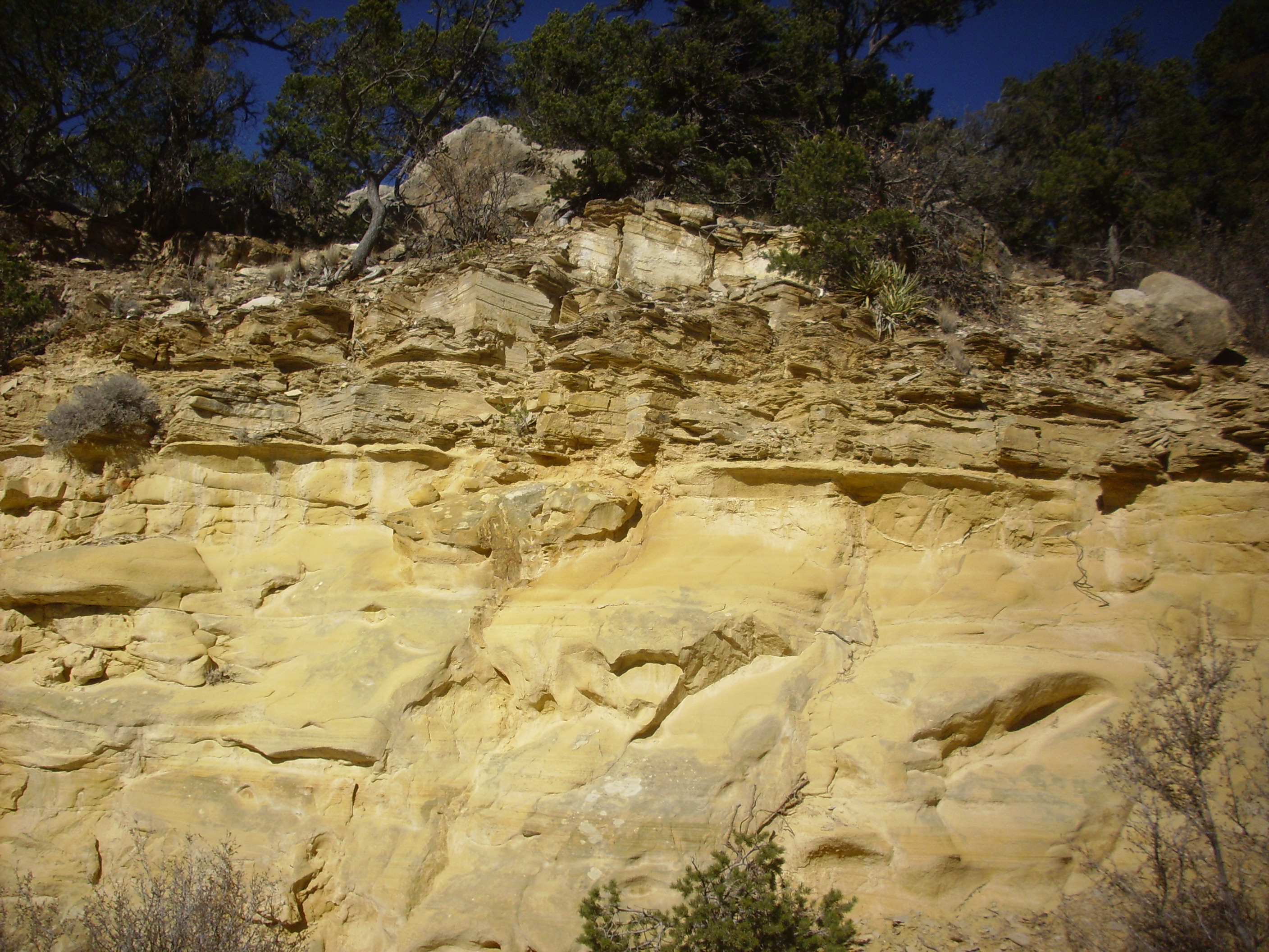
Here is a closer view of the butte, taken on a cloudier day, showing the Entrada beds that form its slopes.
Entrada Sandstone. 36
10.730N 106 32.615W
The lower beds of the Entrada Sandstone are pink. Above this is a
white bed, then a nearly mustard-yellow bed beneath the cap of
Todilto Formation. The pink is the original, unaltered, color of
the Entrada Sandstone, while the white and yellow zones reflect
chemical alteration from the alkaline and anoxic waters in which
the Toldilto Formation was deposited.
To the east of this bluff, the Entrada Sandstone underlies most of the hillside.
Entrada Sandstone. Looking east from 36
10.730N 106 32.615W
The soil cover and vegetation partially obscures the underlying beds, but one can make out the lower pink, middle white, and upper yellow beds of the Entrada Sandstone, the latter well exposed under a cap of grey Todilto Formation. The slopes above the Todilto forming the skyline are Beclabito Formation.
The lower red beds of the Entrada Sandstone are present in the arroyo at the bottom of the canyon, and here I took a moderately fresh, well-indurated specimen from a recent rock fall.

Entrada Sandstone. 36
10.784N 106 32.481W
This is a well-sorted sandstone with considerable calcareous cement between the grains, which appear to be mostly quartz but with significant lithic fragments.
There are exposures of the Entrada Sandstone and the overlying Todilto Formation along much of the northern slopes of the Jemez Mountains, and corresponding exposures become spectacular in the Colorado Plateau country to the north. The easternmost exposures in the northern Jemez are found on the northernmost tongue of Canones Mesa, where they are dramatically offset by a strand of the Canones Fault.
Entrada and Todilto Formation offset by fault through
Canones Mesa. Looking southwest from 36
14.149N 106 24.029W
Red and white beds of the Entrada Formation, capped with a thin bed of Todilto Formation, crop out on either side of a landslide down the north face of the mesa. On the east (left) the beds are thrown down at least 70 meters (200 feet) by the fault passing between the two outcrops. This fault does not displace the lava on top of the mesa, showing that this particular strand of the Canones Fault Zone has not been active in at least three million years. Further east, additional faults drop the beds to below the surface in the Rio Grande Rift.
The Entrada Sandstone north of the Jemez occasionally shows some interesting local features.
"Bluberries" in Entrada Sandstone. 36
14.849N 106 22.358W
These are calcite concretions, sometimes called “blueberries”
(though the term is more often applied to hematite concretions.)
A few feet away:
The structures in the upper right corner may be rhizoliths, a form of fossilized plant root.
Here are some more examples of possible rhizoliths from a point further south:
Possible rhizoliths or worm tubes in
Entrada Sandstone. 36
14.376N 106 22.518W
Near here, there is evidence of some tectonic rumblings in Jurassic time.

These are clasts of limestone embedded in the sandstone. This
suggests that some final spurt of activity in the Ancestral Rocky
Mountains caused limestone fragments to be shed locally in this
area.
The Jurassic beds have been entirely eroded away in the western
Jemez, reappearing only on the west side of the Sierra Nacimiento.
A few remnants remain in the southwestern Jemez, on the west face of Borrego Mesa. The largest exposure is visible from Paliza Canyon.
Jurassic outcrops on Borrego Mesa. Looking from 35
41.256N 106 39.031W
The white band is the Jurassic Todilto Formation, while the red slope beneath is the Entrada Formation. Beneath are landslide deposits that include large blocks of the Jurassic formations. There is also a dramatic exposure a short distance further south, visible from the village of Ponderosa.
Entrada Sandstone on Borrego Mesa. Looking northeast
from 35
39.678N 106 40.038W
The outcrop is the white patch to the left. A somewhat strenuous hike up the hills to the left gives one a closer look.
Entrada Sandstone on Borrego Mesa. 35
40..647N 106 38.539W
Additional very small outcrops of Jurassic rocks are found along the mesa for some miles south.
In the southeastern Jemez the Jurassic beds disappear into the Rio Grande Rift. They reappear south of Interstate 25 in the Hagan Basin north of the Sandia Mountains. Here Entrada Formation is exposed along La Bajada.
Entrada Formation near La Bajada.
35
27.532N 106 13.351W
There are especially spectacular exposures east of the settlement of Puertocito.
Jurassic Park. 35
16.504N 106 17.147W
The red formation at bottom is Chinle Group, probably Correo Member of the Petrified Forest Formation. Or that's what our road log tells us; I find myself wondering if this isn't the same lower red beds of the Entrada Sandstone that appear in the northern Jemez. Above is yellow Entrada Sandstone, and at top is gray Todilto Formation. All are well-indurated here. Here's a sample of the Entrada Sandstone.
Entrada Sandstone from Hagan Basin..
35
16.504N 106 17.147W
The color and grain size are the same as in the northern Jemez, but the grains are here cemented tightly together. The grains are medium in size, mostly quartz, but with enough lithic fragments to make this a lithic arenite. You can see some of the lithic fragments as dark spots in the image.
As with the previous Chinle Group beds, the Entrada Sandstone
always rests on Chinle Group wherever it is found in the Jemez.
Thus, the paleotopography map shows no hints of high ground. This
will be true of almost every formation in the Jemez through the
remainder of the Mesozoic, a time of great tectonic stability in
northern New Mexico.
We first heard of the Washington Punitive Expedition of 1849 in
the previous chapter. After leaving Jemez Pueblo, the expedition
headed towards the general vicinity of Chaco
Canyon. Lieutenant Simpson continued his detailed
observations of the geology along the expedition's route, while
R.H. Kern produced drawings of such prominent features as Cabezon
Peak. Simpson took particular interest in the white beds of
gypsum west of San Ysidro, remnants of a shallow Jurassic sea that
briefly inundated the Jemez region.
Relief map of the Jemez with Todilto outcroppings
highlighted in red.
165 million years ago, the Jemez region was a shallow basin in
which lay a scattering of low sand dunes. A few sluggish creeks,
descending from the low remnants of the Ancestral Rocky Mountains,
wandered out into the mud flats between the dunes, where their
waters quickly evaporated in the hot and arid climate. To the
northwest, the Sundance Sea had penetrated to southern Utah.
Only a low ridge near what is now Moab, Utah, separated the
Sundance Sea from the basin to its southeast. As the region
continued to subside, it was only a matter of time until the sea
overtopped the barrier and flooded the basin beyond.
The Todilto Formation was laid down in a geologically brief
period of time in a short-lived embayment of the Sundance Sea.
This likely formed what geologists call a barred basin.

Seawater enters a barred basin across a shallow bar like that shown in the diagram. If the climate is hot and arid, as it was in northern New Mexico 160 million years ago, water rapidly evaporates from the seawater in the basin, concentrating dissolved salts and increasing the density of the seawater. This dense brine sinks to the bottom of the basin, where it is trapped by the bar. As more saturated brine accumulates, substantial amounts of evaporites begin to crystallize out of the brine onto the floor of the basin. Meanwhile, more seawater flows across the bar to contribute its dissolved solids to the basin. This process can produce far greater thicknesses of evaporites than could be produced by simply evaporating a single body of seawater one time.
Fossil marine algae in the lower limestone beds indicate that
there was at least one episode of marine flooding of the Todilto
basin. However, isotope studies suggest that the bar was more
often exposed than submerged, so that marine flooding was
episodic. Addition recharge came from rivers flowing into the
basin.
Evaporites are minerals that are more or less soluble and which
are present in significant quantities in seawater. In the early
stages of a barred basin, limestone may be deposited on the basin
floor through processes little different from those that produce
limestone in other shallow marine environments. Initially, this
limestone may include marine fossils, but as brine accumulates the
basin bottom becomes inhospitable to life. As the process
continues, additional carbonate minerals are deposited from the
brine, followed by gypsum, CaSO4.2H2O, then
halite, NaCl, then potassium and magnesium minerals.
The most celebrated evaporite deposits near the Jemez area, in
the Paradox Basin of Utah and Colorado and the Permian Basin of
southeastern New Mexico and west Texas, show repeated cycles of
flooding and evaporation corresponding to cyclic changes in sea
level from glaciation, with the sequence proceeding to the point
of potassium deposition in many of the cycles. By contrast, the
Todilto Formation shows the early stages of a single evaporite
sequence. There is typically a limestone bed at the base of the
formation, here named the Mesa Luciano Member, which in some
places contains fossils. For example, there is a particularly rich
bed of fossils at Warm
Springs, near San Ysidro, noted for its insects and
ostrocods (seed shrimp). The overlying gypsum is so easily
dissolved that it is missing in many locations, leaving only the
limestone. There are no halite beds; either the evaporation
sequence did not progress that far, or the halite beds have
entirely dissolved away.
We've seen several photographs showing the Todilto Formation as a
grey bed on top of the Entrada Sandstone. These beds are difficult
to get to, since they tend to be found at the top of high cliffs.
However, I was able to get fairly close to the contact in Mushroom
Canyon after some scrambling around the north wall of the canyon.
Contact of Todilto and Entrada Formation.
36 10.819N 106 32.497W
The yellowish topmost beds of the Entrada Formation are visible to lower left. Above this is the basal calcareous shale of the Luciano Mesa Member. (Calcareous shale is shale containing substantial calcite.) The thick cap on top, with a more irregular texture and visible nodules of gypsum, is the Tonque Arroyo Member. Here's a sample of the Luciano Mesa Member.
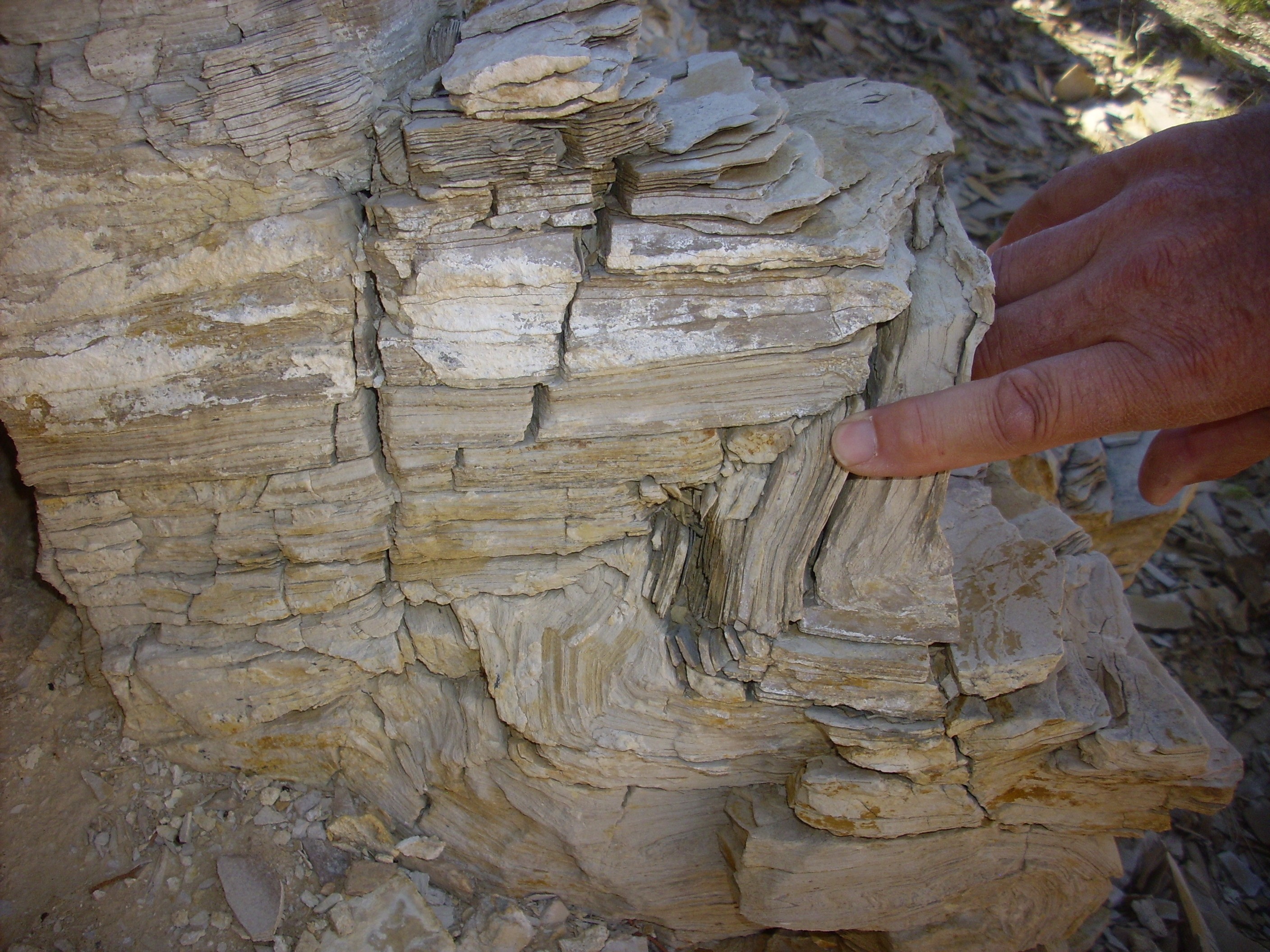
Luciano Mesa Member, Todilto Formation.
36 10.819N 106 32.497W
You can see that the rock is very thinly layered. These layers
are called varves and reflect seasonal climate change, so
that a single layer corresponds to a single year. During part of
the year, clay and organic matter settled on the bottom of the
Todilto Embayment. At other times of the year, calcite
predominated. The varves show a 10 to 13 year cycle that is
interpreted as the solar sunspot cycle, which shows this cycle has
been present in the sun for at least the last 160 million years.
Counts of the number of varves suggest that the Luciano Mesa
Member was deposited in a geologically brief time of about 14,000
years.
The Tonque Arroyo Member consists of shale containing numerous nodules of gypsum and limestone. Here's an example.
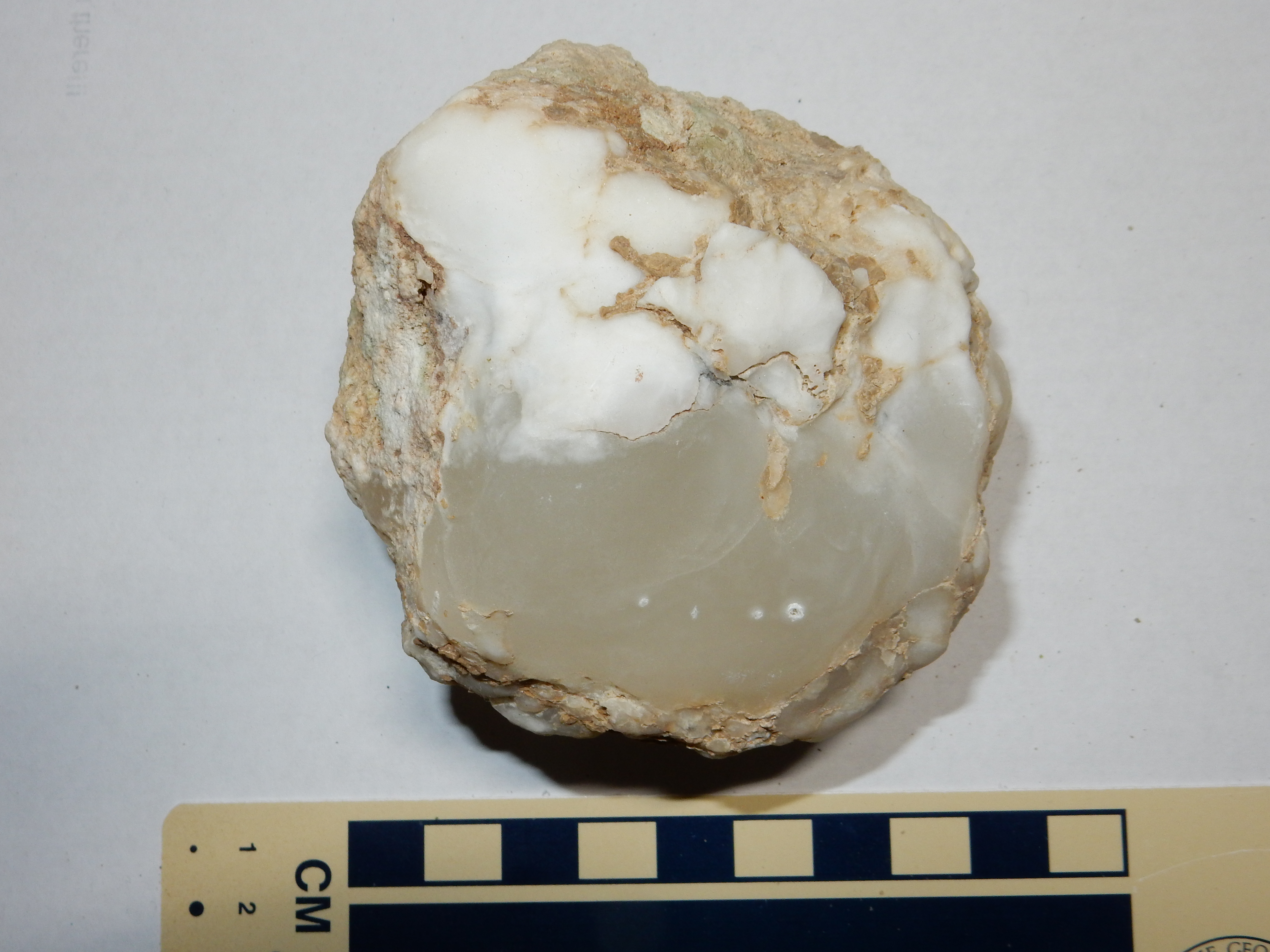
The translucent part of this nodule is easily carved with a knife, but does not foam under acid; the only plausible mineral identification is gypsum, CaSO4·2H2O. The more opaque sections are both harder and foam under acid; this identifies them as calcite. In some places, the gypsum forms quite large lenses. Here is an example.
Gympsum lens weathered from Todilto Formation. 36
10.784N 106 32.481W
Note the head of my walking stick, for scale. This large gypsum lens weathered from the Todilto Formation and is located in the arroyo beneath. Its distinctive texture is sometimes described as chicken wire gypsum.
Calcite begins precipitating from sea water when about half its
original water content has evaporated. Gypsum begins precipitating
when 80% of the original water content is gone, and halite when
90% of the original water content is gone. This tells us the
Todilto Sea reached the 80% point, but we do not know for certain
whether it reached the 90% point, since it's possible some salt
was evaporated that has since been dissolved away. Gypsum also has
the property that, when it is mildly heated, it gives up its water
content to become anhydrite, CaSO4, a harder,
more dense mineral than gypsum. Burial to a depth of 700m (2000')
is typically sufficient to drive the transition from gypsum to
anhydrite, and the Todilto Formation was almost certainly buried
at least this deeply at some point in the past. When the anhydrite
beds were again brought to the surface by erosion, they absorbed
water to convert back to gypsum. In the process, the beds became
highly distorted due to the changes in volume.
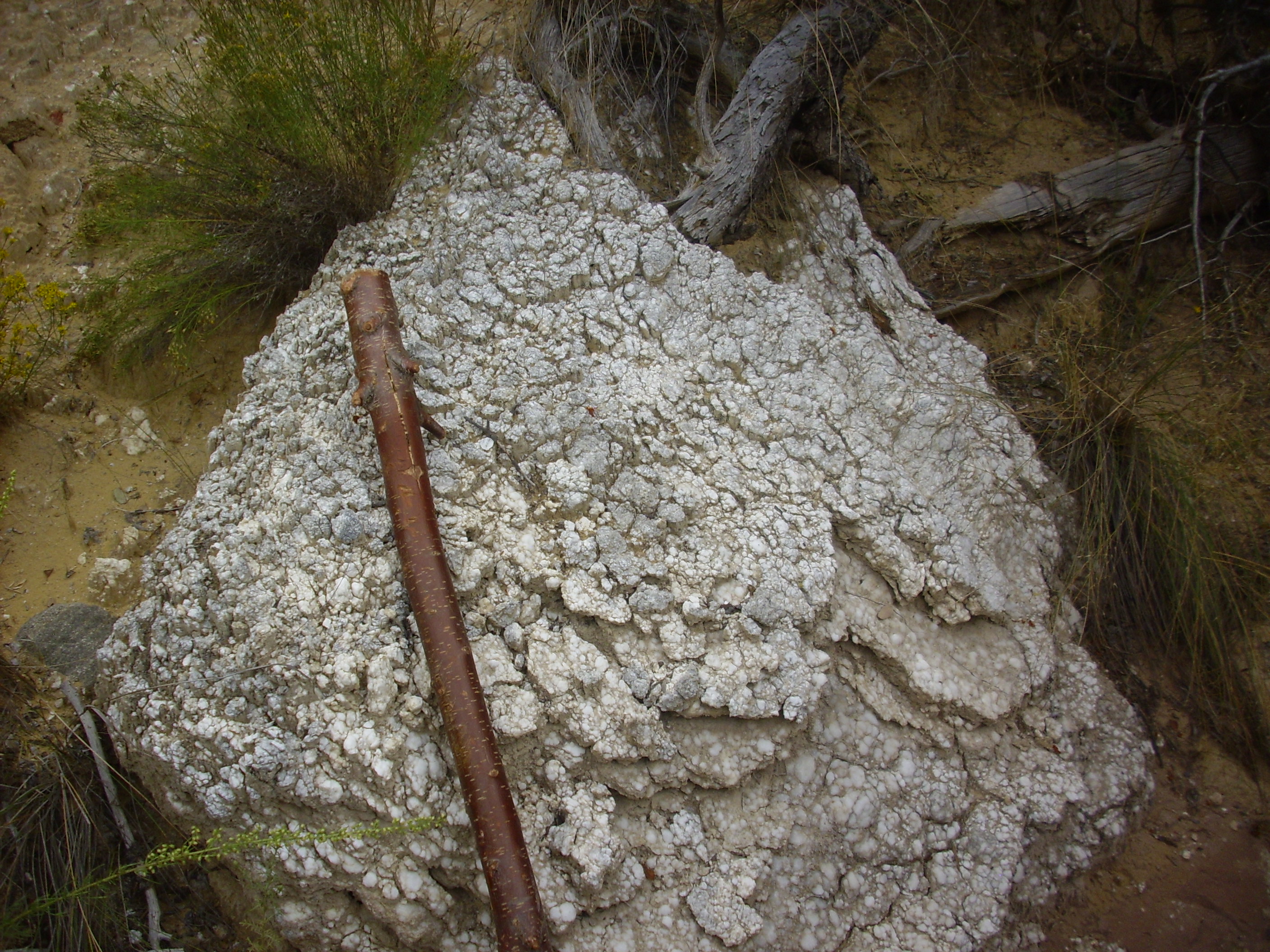
The gypsum weathered from the Todilto is slightly soluble in water, and repeated wetting and drying cycles in a dry climate in loose, sandy soil with abundant gypsum produces a distinctive texture.
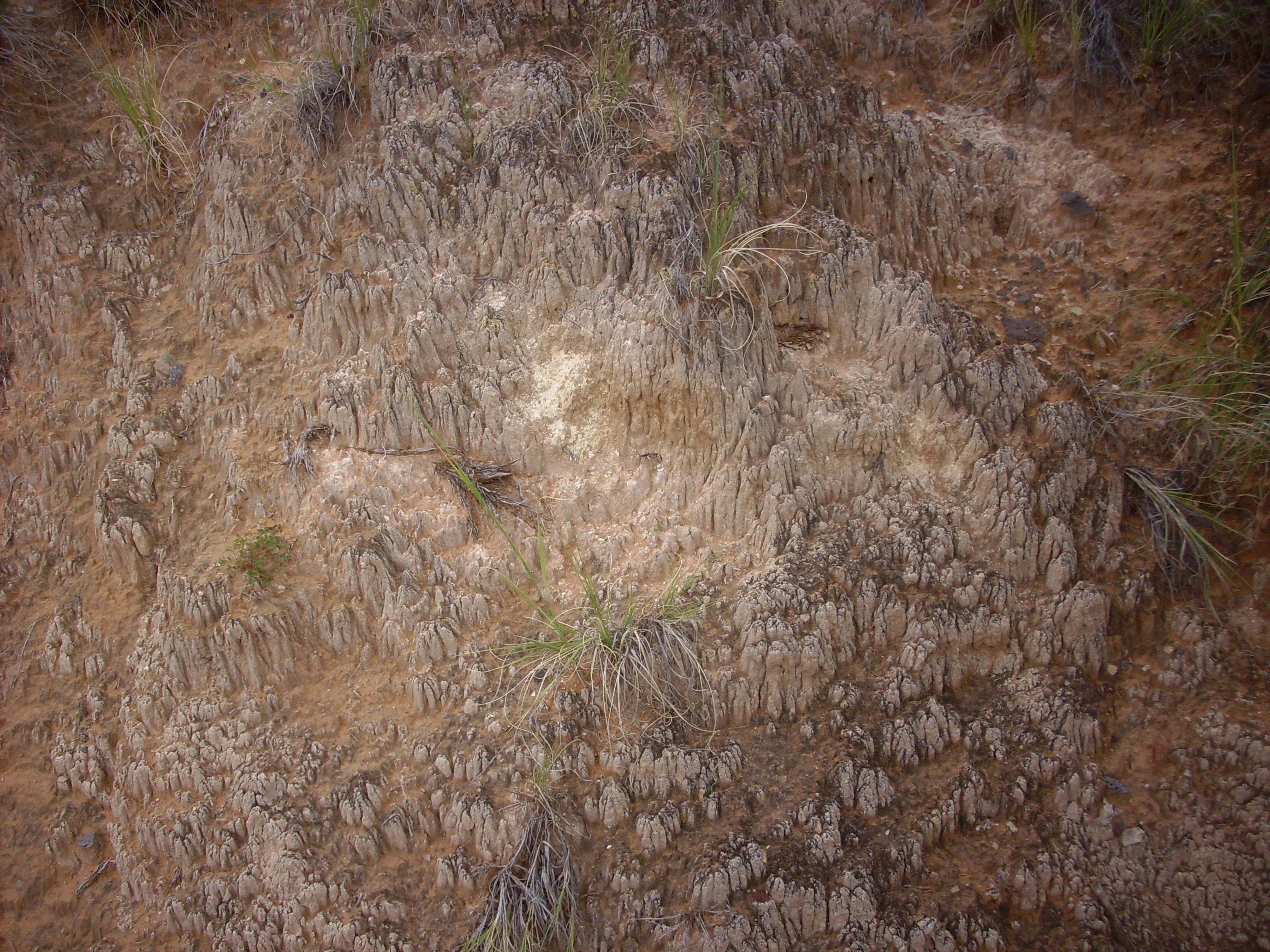
Gypsum-rich soil showing distinctive texture. Near 36
10.784N 106 32.481W
It is possible that the crust here also contains a cryptobiotic
film of fungi and algae. Such films are common in desert climates
but are quite delicate. However, I've seen crusts of this form
only in areas close to exposures of Todilto Formation, suggesting
that high sulfate levels are crucial to its formation.
Continuing east into Mushroom Canyon, one sees how it got its name.

Mushroom Canyon at its finest. Looking east from 36
10.798N 106 32.509W
The upper yellow beds of the Entrada Sandstone form the "stems" of the "mushrooms", the Mesa Luciano Member forms the "gills", the Tonque Arroyo Member forms the "caps", and the background hills are underlain by Beclabito Formation.
Where the road climbs to the rim of the canyon one gets a nice view back at "Mushroom Canyon".
If you visit this area, please be aware that the western half of Mushroom Canyon is located on private land belonging to a nature conservancy. Only the eastern half is on Forest Service land, with a barbed wire fence marking the boundary. I was careful to collect my samples from the Forest Service side.
Todilto Formation can also be visited further north, across the main highway through Abiquiu at Red Wash Canyon. No gypsum is present here, but the limestone beds remain.
Todilto Formation near Red Wash Canyon.
36
14.787N 106 22.471W
The deformation being pointed to likely arises from the nearby
Canones Fault Zone. There is a salt spring along the main strand
of the fault zone, suggesting buried salt beds in the subsurface.
The Todilto Formation is the most likely candidate.
Perhaps the most accessible good exposures of Todilto Formation
are found along Forest Road 77, or Mesa Alta Road, which runs to
the top of Mesa Alta. The road cuts through the Entrada Sandstone
and overlying Todilto Formation.
Here is the contact between the Entrada Sandstone and the Luciano Mesa Member.
The contact is very sharp and the uppermost bed of the Entrada Sandstone is unusually well cemented. This supports the idea that the Todilto Sea formed catastrophically, from erosion breaching the barrier between the Todilto Basin and the Sundance Sea. Further along the road is the contact between the Luciano Mesa Member and the Tonque Arroyo Member.
The Luciano Mesa Member is the thinly bedded lower section. I could find no fossils in this particular location. The massive gypsum rich beds above are Tonque Arroyo Member. Further still are some very impressive beds of massive gypsum.

Note the obvious vertical fault trace in the middle of the road cut. This is a local enough fault to not appear on the geologic map for this area. The downthrown side is to the right and is massive gypsum of high purity, sometimes called alabaster.
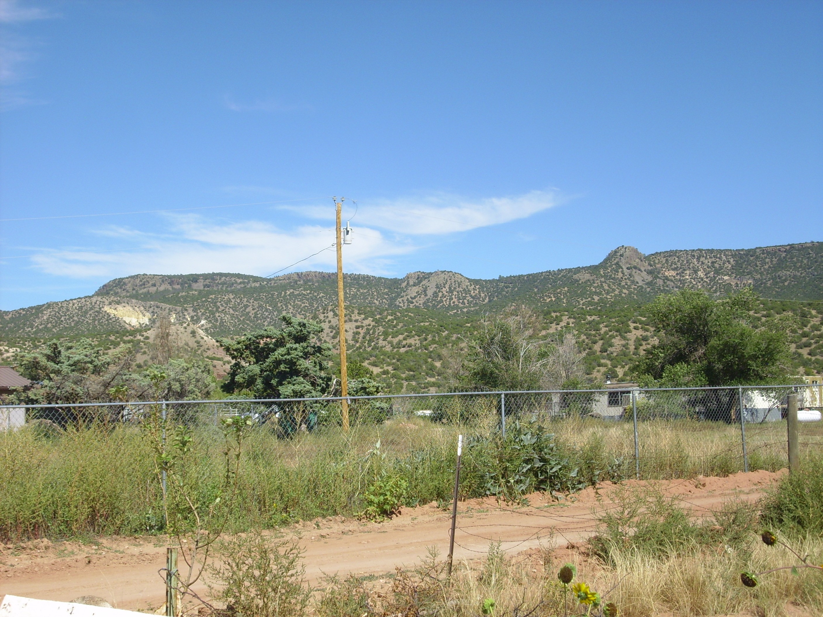
Further west, the Todilto Formation is again well exposed at Cerro Blanco.
Impressive exposures of the Todilto Formation continue west and southwest of the Sierra Nacimiento, where they have been exposed by the deformation that elevated these mountains. The most striking of these may be Cuchilla Blanca Hill.
Cuchilla Blanca Hill. Looking east from
35
39.444N 106 53.547W
The hill is topped with Todilto Formation which dips sharply to the north (left). Underneath is Entrada Formation, and beneath that is Triassic upper Chinle Group red beds. The distant ridge to the right is underlain by Agua Zarca Member of the Shinarump Formation, and the ridge partially hidden behind it is underlain by more Precambrian gneiss.
Like the Entrada Formation, the Todilto Formation is absent east of the Sierra Nacimiento and north of Borrego Mesa. There are some beds along Borrego Mesa, but the first really large exposure south of the Jemez is at White Mesa. Here enough of the gypsum remains that it can be economically mined.

White Mesa. Looking northwest from near 35.48N
106.709W
The Todilto forms the white cap that gives the mesa its name.
Additional gypsum mines are located south of I-25 on the east side of the Rio Grande Rift. One of these is the Rosario gypsum mine, which exploits Toldilto beds along the La Bajada escarpment.
Rosario. Looking southest from 35
29.206N 106 15.229W
The reddish slopes at left are Chinle Group, while the yellowish
bed forming a shelf above that is the Entrada Sandstone. The
Entrada Sandstone is much thinner here than further to the
northwest. At right, the Entrada Sandstone is overlain by thick
beds of Todilto Formation mined for its gypsum content. The
locally thick beds may fill a gully or other depression eroded
into the surface of the Entrada Fornation before the Todilto
Formation was laid down.
The hills in the background are underlain by Jurassic Morrison Formation under a rim of Cretaceous Dakota Formation. We'll learn about both of these younger formation presently. The escarpment here, the La Bajada escarpment, marks the east boundary of the Rio Grande Rift in this region.
Gypsum is calcium sulfate, CaSO4.2H2O, and is not uncommon in sedimentary rock in arid climates. It is soon dissolved in more damp climates, being much more soluble in water than limestone (2.4 grams per liter). However, unlike calcite, the solubility of gypsum does not increase in acid water. It is a very soft mineral, fairly easily scratched with a fingernail, which together with its lack of any reaction to dilute acid distinguishes it from calcite. It is found as white masses of interlocked crystals, as in the best exposures of the Todilto Formation, but it also forms thin plates or sheets that are slightly flexible or thicker veins with a fibrous or silky appearance. Its crystals consist of layers of strongly bonded calcium and sulfate ions, joined by layers of water molecules. The bonding between layers is weak, so that gypsum easily splits into layers that can be mistaken for transparent mica. However, gypsum does not have the metallic luster of mica.
Gypsum is mined for a number of uses, of which the greatest
amount is probably for construction. When heated to drive off the
water, it becomes plaster of Paris, used in wall plaster, in
Portland cement, and especially in drywall. I live in a
house of daub and wattle, like my ancestors of four centuries ago,
but the daub is now high-tech drywall and the wattle is kiln-tried
pine two by fours. Gypsum is also used in soil reclamation, where
its calcium content displaces sodium (which is toxic to plants)
and allows the sodium to be flushed away. Calcium sulfate is also
used in foods, since it is nontoxic and is an effective firming
agent for cheeses and tofu.
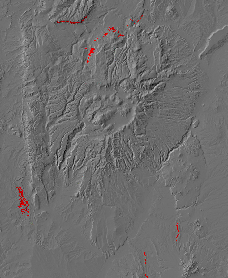
Relief map of the Jemez with Beclabito Formation
outcroppings highlighted in red.
160 million years ago, the Todilto salt pan had filled with
sediments, the Sundance Sea had retreated to the north, and tidal
flats again stretched from eastern New Mexico to the coastline in
Utah. The climate was still exquisitely hot, and the accumulating
sediments were rich in gypsum. The tidal flats accumulated eolian
sand during times of drought, which were subsequently worked into
thin, flat beds by wave action in ephemeral saline lakes. These
became the Beclabito Formation.
This was a time when the major rivers of the area began slowly
shifting their courses, from the southeast to northwest flow of
the Triassic and early Jurassic to the southwest to northeast flow
that would prevail throughout the rest of the Mesozoic. This was
largely a consequence of continuing mountain building to the west
and southwest (the Nevadan Orogeny and Mogollon volcanic arc),
which also emplaced the great granite masses of the Sierra Nevada.
Bone fragments and teeth of Camarasaurus, a large herbivorous dinosaur, have been found in the Beclabito Formation in the Hagan area.
The Beclabito Formation beds were once mapped as Summerville
Formation, a similar formation that was first identified in
central Utah. Like the Beclabito, the Summerville is underlain by
beds rich in gypsum (the Curtis Formation). However, more recent
work has shown that the ages likely are slightly different, and
there are significant differences in lithology.
The Beclabito Formation is exposed in several locations in the northern Jemez. The exposure south of Mushroom Canyon is best viewed from along the road out of the canyon.
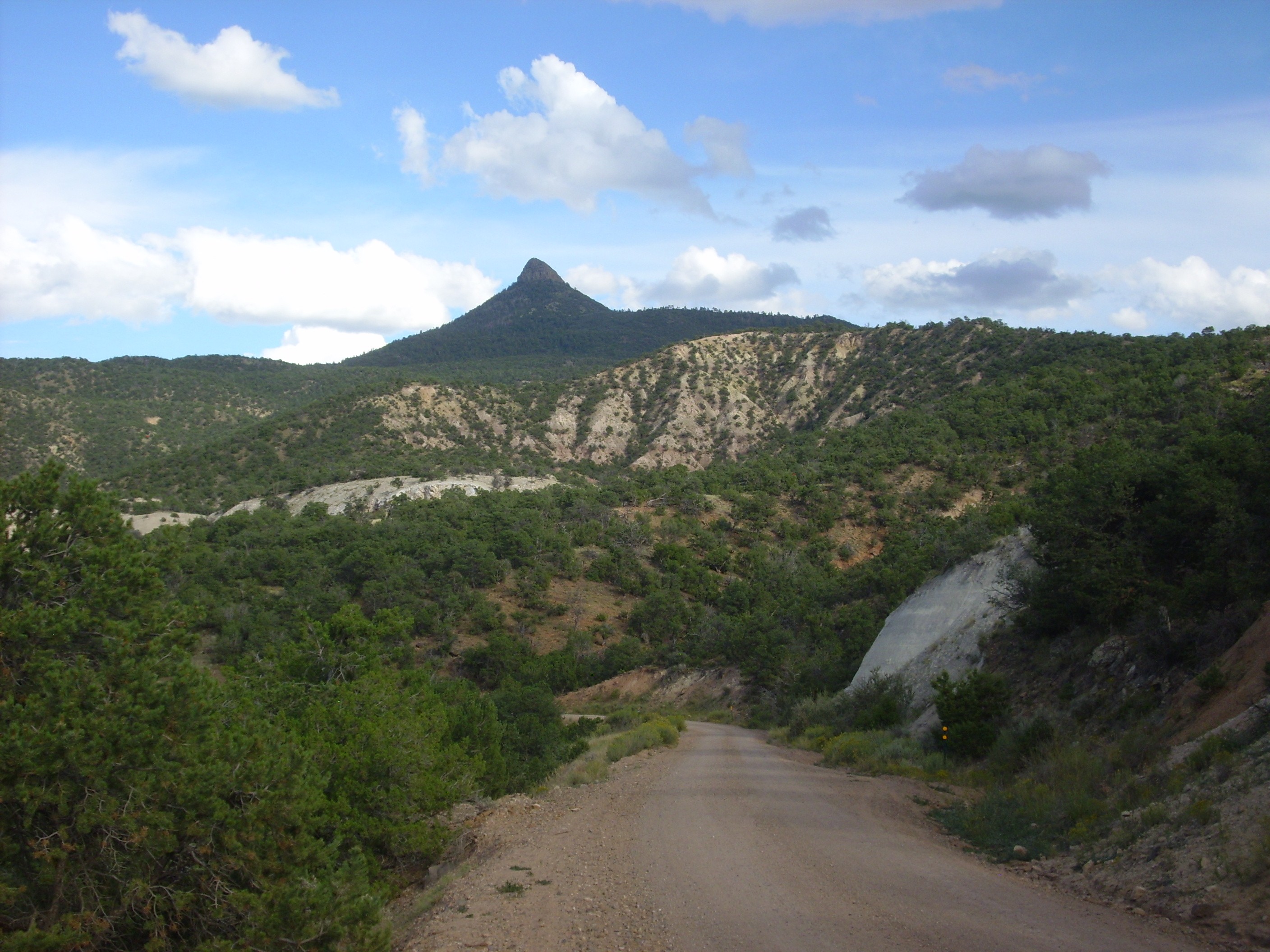
Beclabito Formation in Mushroom Canyon. Looking
southeast from 36
10.662N 106 32.947W
The gray beds to the left, just peeking over the foreground ridge, are Todilto Formation. Above are the pinkish tan beds of the Beclabito Formation. The very top of the ridge is a thin bed of Morrison Formation. The gray bed in the road cut to the right is Entrada Sandstone, while Cerro Pedernal looms on the skyline.
Beclabito Formation is also exposed on the north rim of the
canyon, above the gray Todilto beds.
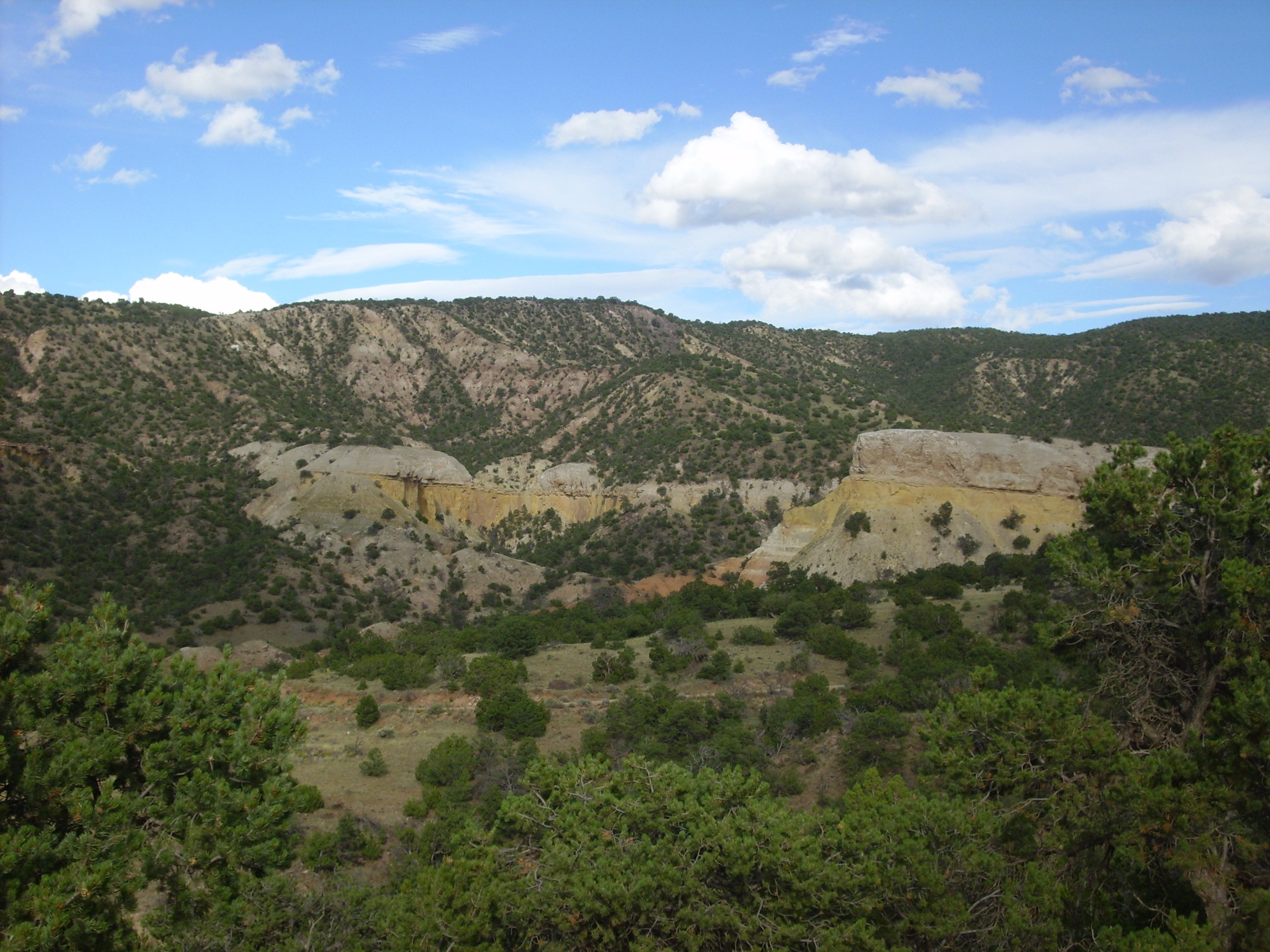
Beclabito Formation in Mushroom Canyon. Looking
southeast from 36
10.662N 106 32.947W
The entire skyline here is Beclabito Formation. You can see that the beds dip slightly to the east (right), as do the underlying beds of Todilto Formation and Entrada Formation.
Another exposure of Beclabito Formation is found just north of the Jemez, along Red Wash Canyon.
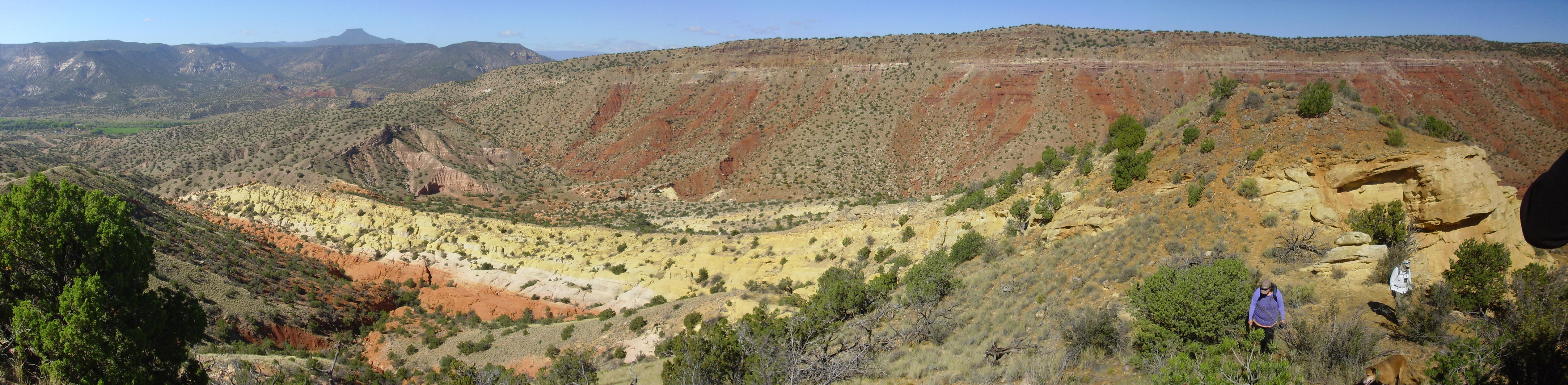
Jurassic beds east of Red Wash Canyon. 36
14.789N 106 22.261W
The canyon wall is red beds of the Arroyo del Agua Formation of the Cutler Group. This is capped with a thin bed of Shinarump and Salitral Formations and a thicker bed of Poleo Sandstone. The red to yellowish beds in the foreground are Entrada Sandstone, capped with a thin layer of limestone of the Todilto Formation. Above this to the left is a pinkish exposure of the overlying Beclabito Formation. Though not well exposed, my geologic map shows that the Morrison Formation is present at the top of the hill, as well as some thin beds of Cretaceous Burro Canyon Formation.
Here's a close view of the Beclabito beds.
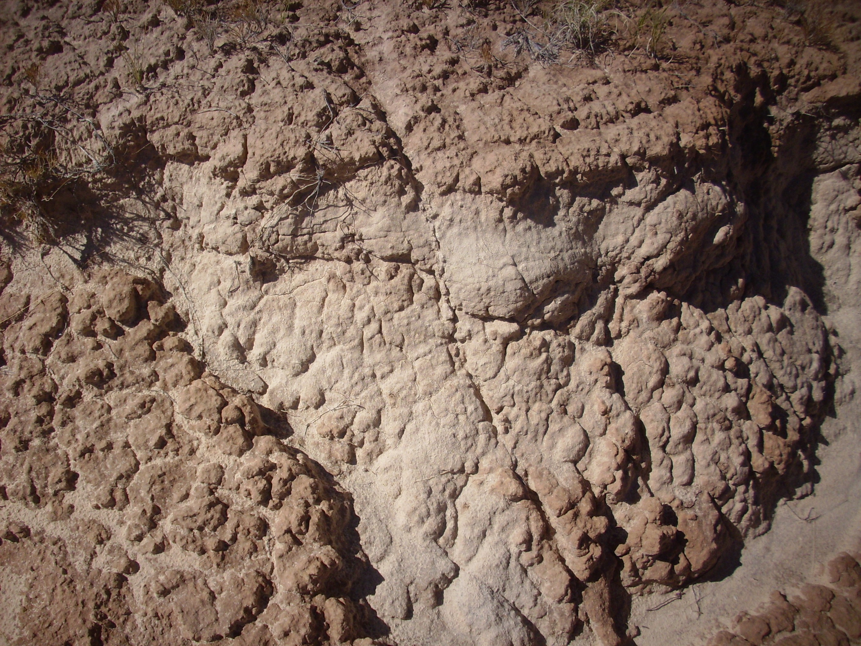
Beclabito Formation. 36
14.588N 106 22.643W
It's basically muddy sand, quite poorly cemented. It reminds me a little of the much younger Ojo Caliente Member of the Tesuque Formation, and it seems likely that exposures of the Beclabito Formation were a major source of sediments for the Ojo Caliente.
There are only a few small exposures of Beclabito Formation in the southern Jemez, along the west face of Borrego Mesa.
The beds immediately above the Todilto Formation south and
southwest of the Jemez tend to be assigned to the Morrison
Formation in older maps. However, more recent maps assign these
beds to the Summerville Formation, and they would likely now be
assigned to the Beclabito Formation in the area north of Chuchilla
Blanca Hill.

For comparison, here are beds of the Summerville Formation in southern Utah.
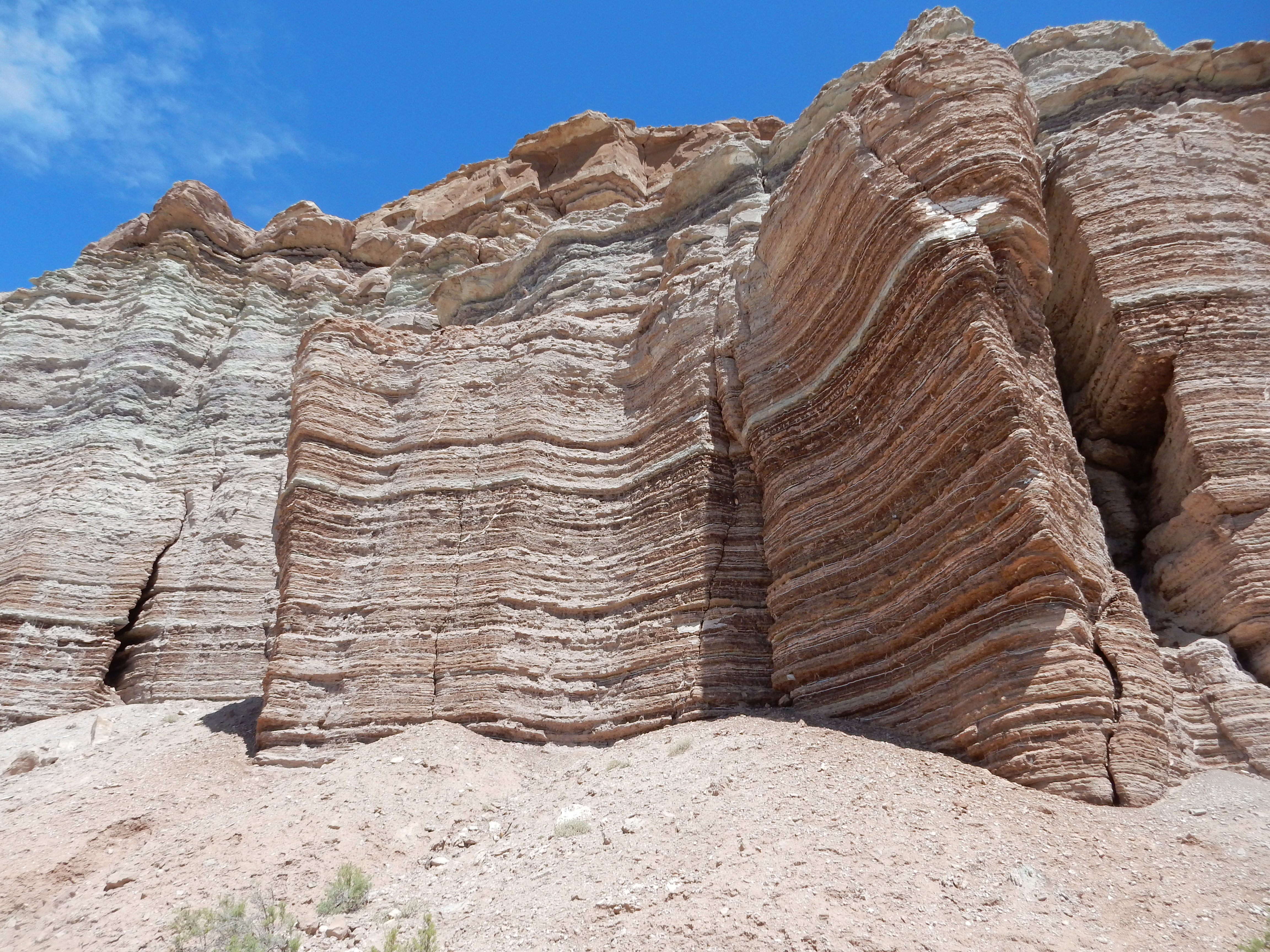
The beds here contain considerable gypsum. Gypsum seems to be
absent from the Beclabito Formation, an important lithological
distinction.
The exposure map for Beclabito Formation appears to show that it
is much less extensive than the underlying Jurassic formations.
This should be taken with a grain of salt. The geologic maps
showing the next formation, Morrison Formation, lying directly on
Todilto Formation are all older maps, and many describe a lower
unit of the Morrison Formation whose description is much like that
of the Beclabito Formation. It is likely that this lower unit
would be mapped as Beclabito Formation if these areas were
remapped today.
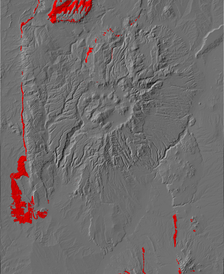
Relief map of the Jemez with Morrison Formation
outcroppings highlighted in red.
150 million years ago, North America had just split off from
Europe and was drifting north. The climate in the Jemez region was
cooling and becoming significantly wetter. The tidal flats were
gone, replaced by a swampy lowland crossed by sluggish streams
draining the growing highlands to the west. This was part of
an enormous foreland basin stretching from New Mexico to Canada.
This time period is recorded by the Morrison Formation, which is
a fluvial formation laid down as the Sundance Sea continued to
retreat to the north. It is the oldest formation in the Jemez area
composed largely of sediments eroded off the highlands along the
west coast of North America. The Morrison Formation is highly
variable, with up to three distinct members mapped in some
locations in the Jemez region, and in many places it is rich in
fossils, including over 70 dinosaur species. It is a source of
uranium in other locations, particularly in the Grants area.
The Morrison Formation is exposed around Mushroom Canyon, though the exposures are not easily reached. This is as close as I could get:

Morrison Formation in upper Mushroom Canyon. Looking
east from 36
10.282N 106 32.116W
Here the Morrison Formation takes the form of easily eroded
multihued sandstone.
The Morrison Formation is also exposed back at the Canones fault
zone with which we began this chapter. This exposure occurs on the
east side of the fault. Here the fault has thrown up the contact
between the Morrison Formation and the El Rito Formation.
The geology in this spot is quite interesting. All the beds above
the Morrison Formation were eroded away over 50 million years ago.
Sometime between 50 and 30 million years ago, the El Rito
Formation was laid down on the erosion surface, some time prior to
the opening of the Rio Grande Rift.
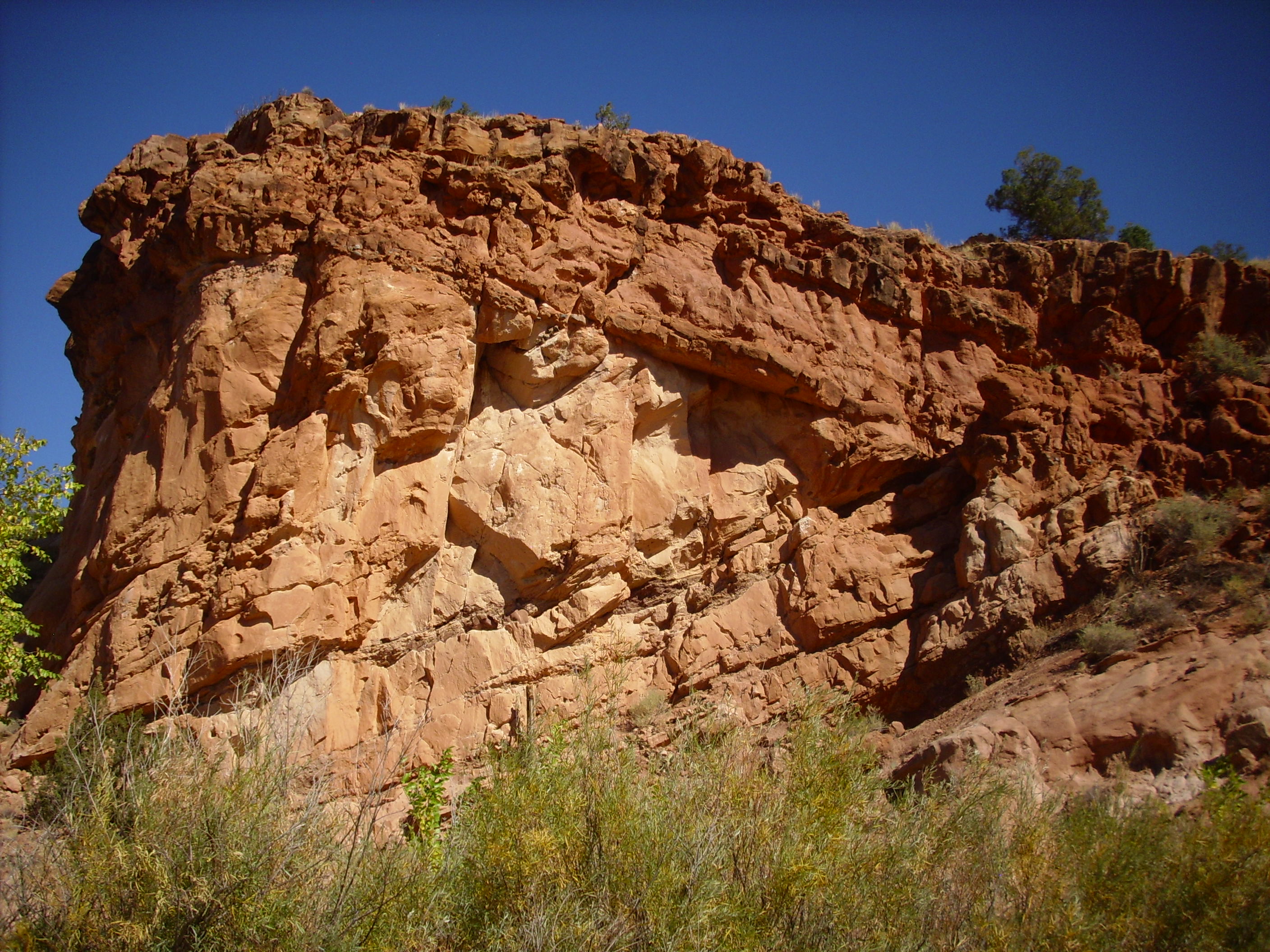
The contact is clearly visible near the top of the cliff, where the beds of the two formations lie at an angle to each other. This is a good example of what geologists call an angular unconformity.
Here is a close up of the point of contact between the Morrison and the El Rito Formations, where it comes close to the road level.
This contact represents a gap in the geological record of at
least 100 million years. Here's a sample of the Morrison Formation
from this exposure.
I mentioned earlier that the Morrison Formation is famous for its fossils. Sure enough, there are biological traces in this outcropping.

The species involved is of course Homo sapiens, possibly
a college geology class practicing the skill of taking core
samples of a rock outcrop, judging from the large number of
boreholes.
Here is a close up of the uppermost part of the Morrison Formation, showing some very thin bedding.
The entire Jurassic and and much of the Cretaceous column of the northern Jemez is exposed on the south slopes of Mesa Alta, northwest of Coyote.
Mesa Alta. Looking north from. 36
10.954N 106 52.368W
Mesa Alta is a broad anticline, or upwards warp in the
Earth's crust, roughly aligned with the Sierra Nacimiento and
likely thrown up by the same tectonic forces. The entire structure
is known as the Archuleta Anticlinorium. The by now familiar
Entrada and Todilto Formations form the lower cliffs of the mesa.
Above are cliffs of Beclabito and Morrison Formation, capped with
Cretaceous Burro Canyon Formation and isolated hills of Dakota
Formation. The Beclabito Formation forms thick beds in the lower
half of the upper cliffs, while the Morrison Formation is more
massive.
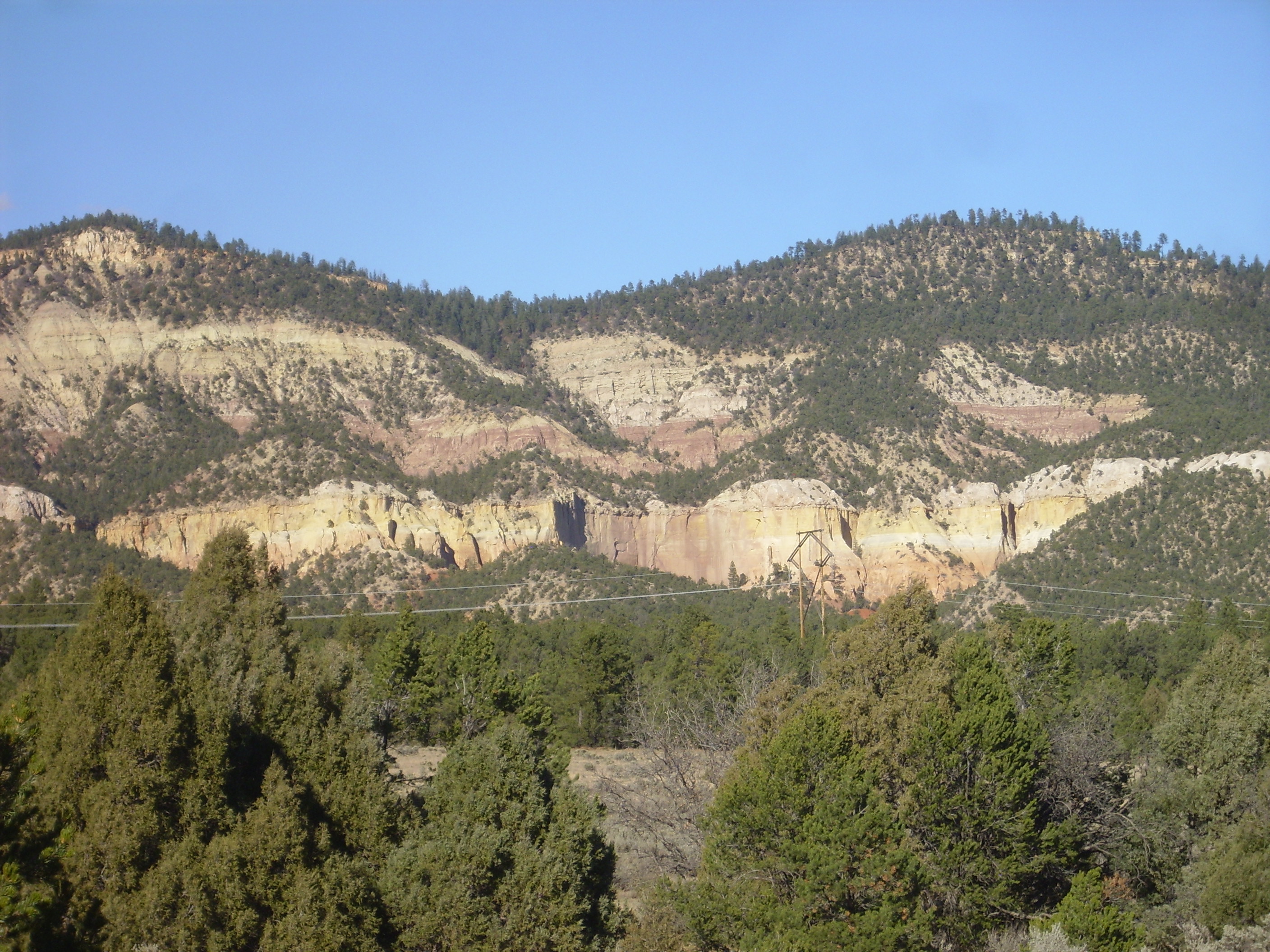
Mesa Alta. Looking north from. 36
10.954N 106 52.368W
The Morrison forms extensive and well-cemented sandstone beds west of the southern Sierra Nacimiento.

Morrison Formation west of the southern
Sierra Nacimientos 35
40.134N 106 54.756W
The Morrison Formation is famous for its varied hues, which are
evident in the beds in the lower slopes of the ridge. This is
likely the Jackpile Member of the Morrison Formation.
This is not far from the area where the giant sauropod dinosaur,
Seismosaurus, was discovered. Camarasaurus fossils
have also been found in this area.
Morrison Formation is exposed along the La Bajada escarpment south of I-25, where it forms part of the eastern boundary of the Rio Grande RIft. The road to the Galisteo Dam cuts through beds of the Jackpile Member of the Morrison Formation.
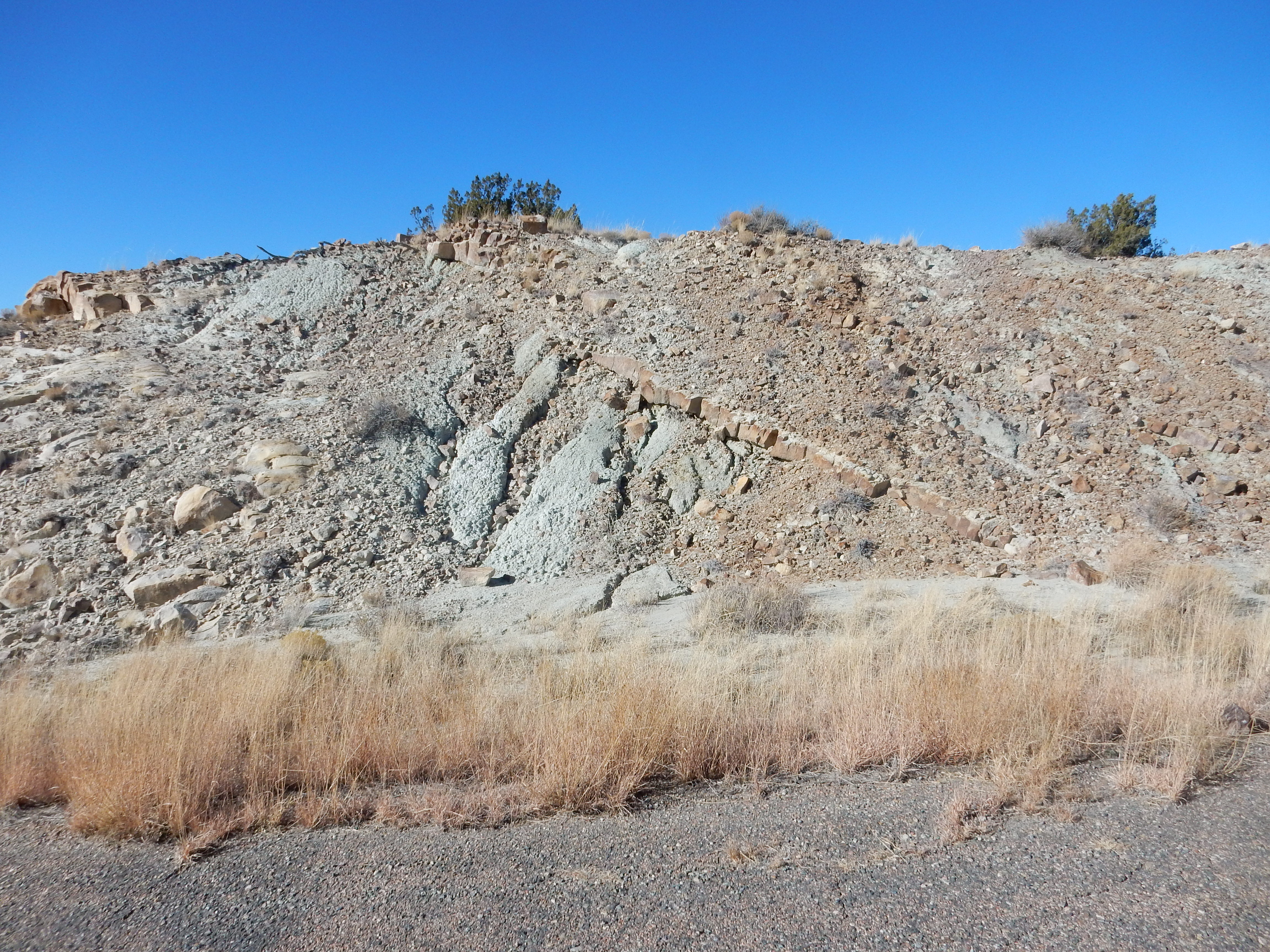
The Jackpile Member is described as being mostly crossbedded kaolinic subarkosic sandstone (sandstone rich in clay and feldspar grains) with some beds of greenish mudstone. One such mudstone bed is obvious in this photograph.
Three members of the Morrison Formation are mapped in this area.
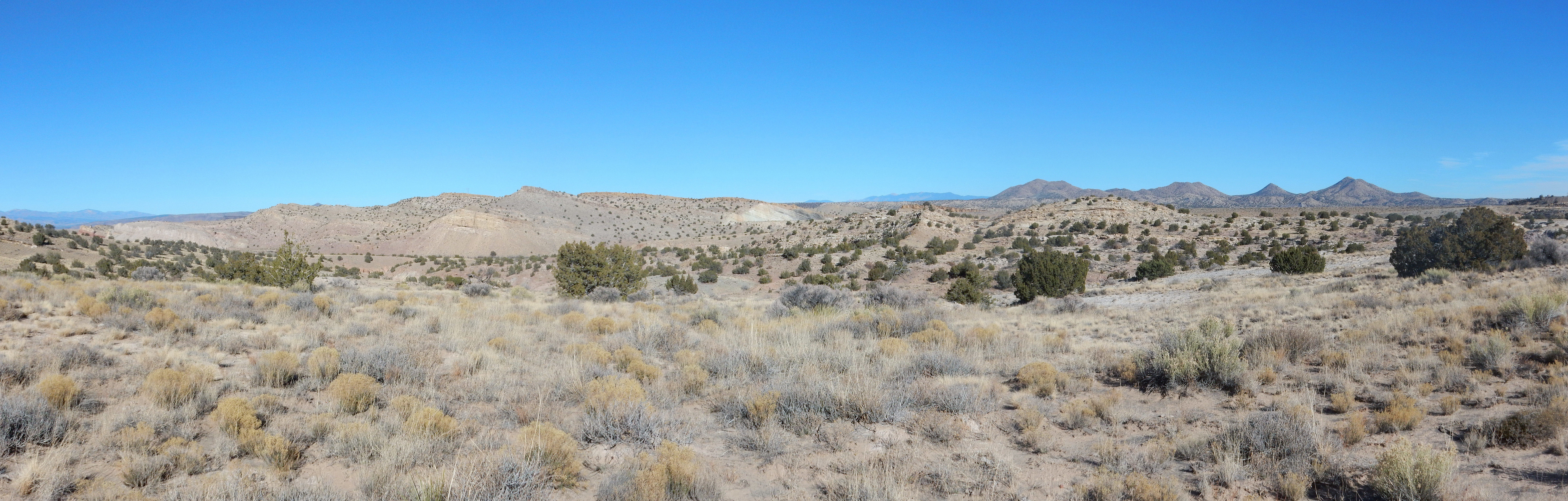
The knoll left of center and below the skyline is the lowermost Salt Wash Member of the Morrison Formation, which is composed here of fairly resistant sandstone and conglomerate. Above it are the Brushy Basin Member (mostly mudstone) and Jackpile Member (mixed sandstone and mudstone), both less resistant and therefore forming a gentler slope.
The Salt Wash Member is found throughout the Colorado Plateau and
represents deposition by a system of rivers off the highlands to
the south and west. It is coarser northwest of the Jemez, where it
becomes rich in conglomerate beds. North of the Jemez, it
transitions to mudstone. The river paleocurrents indicate a
reversal of river directions prevailing earlier in the Mesozoic,
which were dominated by the now-buried Ancestral Rocky Mountains.
Throughout its extent, the mudstone lenses and beds are
bentonitic, rich in weathered volcanic ash from the Mogollon and
Sierra Nevada volcanic arcs.
The Brushy Basin Member is mostly mudstone, and in the area
immediately around Four Corners, a giant, shallow alkaline lake,
Lake T'oo'dichi', deposited unusual alkaline minerals. The Jemez
region was well east of the shores of this lake.
The Jackpile Member is well exposed in the spillway cut for Galisteo Dam.
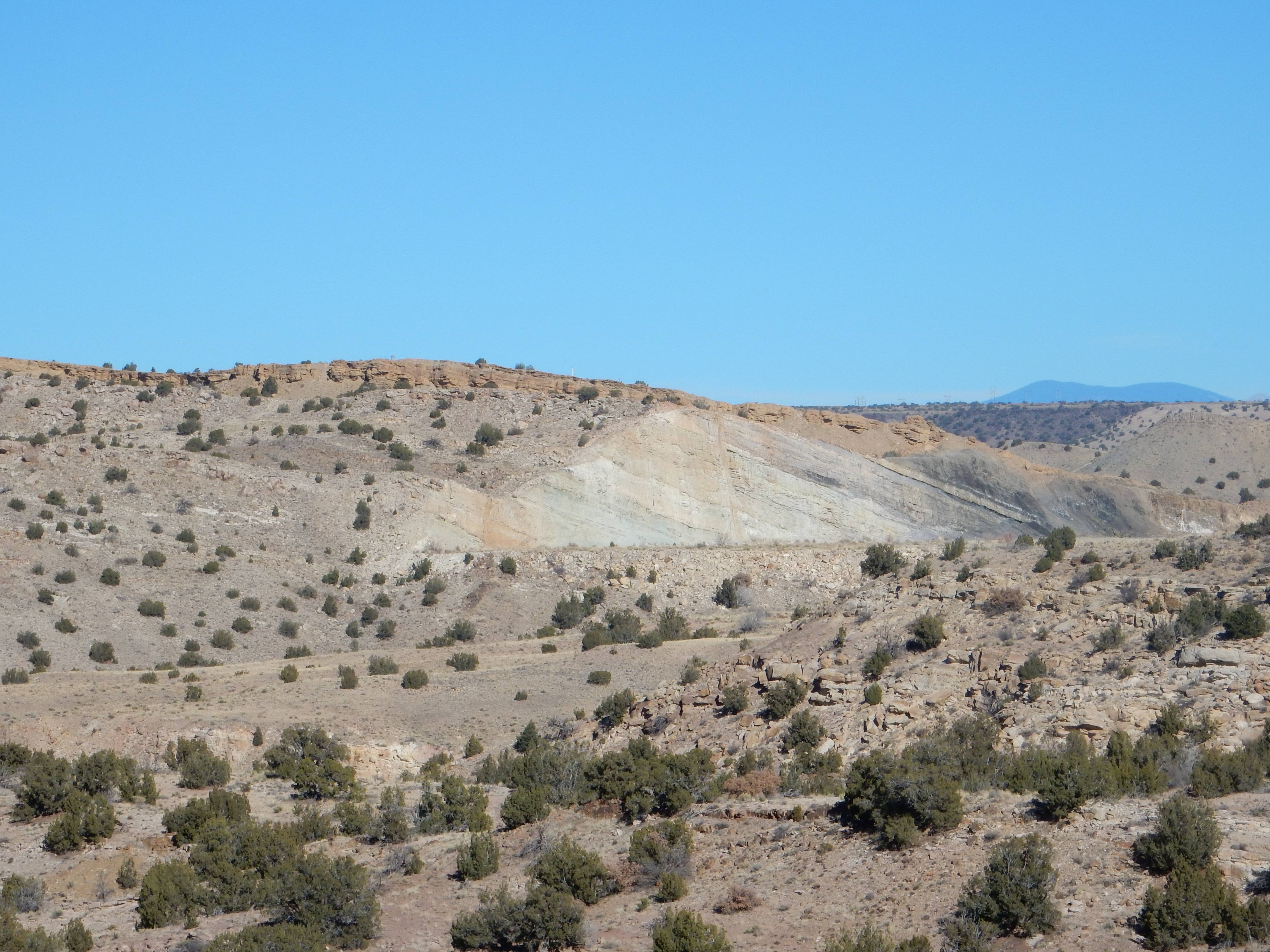
The entire thickness of exposed rock is Jackpile Member, except
for a very thin rim of Dakota Formation. We’re viewing this at a
highly oblique angle, which exaggerates the dip of the beds to the
east. However, you can see (if you click to zoom in ) that the
surfaces between Jackpile beds are fairly irregular, and the beds
are at a slightly different dip than the overlying Dakota
Formation. The irregular surfaces between beds may be typical of
fluvial deposits. The contact with the Dakota Formation is a
fine example of an angular unconformity. It tells us that the
Jackpile beds were already slightly tilted and partially eroded
when the Dakota Formation began to be laid down. This is typical
of the entire northern New Mexico region, where the Dakota
Formation lies on progressively younger beds from south to north.
The Jackpile Member is not found to the northwest, on the
Colorado Plateau, but extends south of the Jemez. Its type section
is the Jackpile
Mine southeast of Mount Taylor, a former uranium mine
that is now a Superfund cleanup site. The age and position of this
member has recently come into serious question; I'll say more
about that presently.
The dip of the rocks at Poblazon is to the west, or from the Rocky mountains; and this proves that these mountains have been elevated since the deposit of the cretaceous beds. It is, therefore, probable that the cretaceous beds on both sides of the Rocky mountains were made by the same ocean.
— Lieutenant James W. Abert, 1847
The Mexican-American War of 1847 brought a virtually unopposed
invasion of New Mexico by the U.S. Army. The Army, in turn,
brought in officers of the Corps of Topographical Engineers, who
were well trained in scientific disciplines, including geology.
These officers made the first reports to the outside world of the
geology of New Mexico, previously an impoverished backwater
province of Mexico which had apparently never been visited by a
trained scientist. James W. Abert was one such officer-scientist,
who had previously (and illegally) reconnoitered the Canadian
River in northeastern New Mexico. After the U.S. Army passed
through Santa Fe, Abert and a fellow officer, Lieutenant William
G. Peck, were ordered to survey and map central New Mexico.
Among other activities, Abert visited the Cretaceous beds along
the Rio Puerco, which arises in the north Sierra Nacimiento and
runs south to join the Rio Grande north of Socorro. Abert
recognized both ammonite and Inoceramus fossils, typical
of the Cretaceous Period, and sent samples to J.W. Bailey, a
professor at West Point. Abert's observations about the dip of the
Cretaceous beds and his speculations about the existence of an
ocean covering the entire region are among the first to point to
the existence of the Western Interior Seaway, the great
epicontinental sea that invaded central North America as the Age
of the Dinosaurs began to draw to its close.
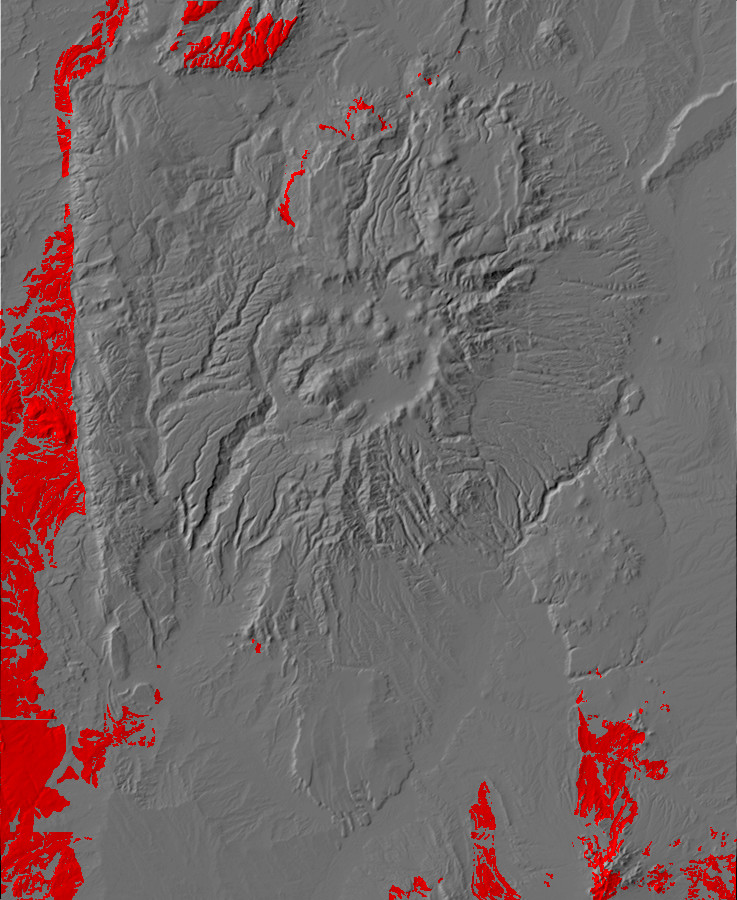
At the start of the Cretaceous, South America rifted away from Africa, and the vigorous new mid-ocean ridge displaced enough sea water to raise sea levels to the highest levels we know of in the geological record. Fully a third of the continental land masses were submerged in shallow oceans, and ocean temperatures were 15 C (27 F) warmer than similar latitudes today. This produced coal beds second only to the massive coal beds of the Carboniferous. At the same time, vigorous subduction under the western edge of North America began another episode of mountain building, the Sevier Orogeny. This produced characteristic shallow faulting in which the surface sedimentary beds detached from the underlying basement (décollement) and rode up over younger beds further east. The associated faults are sometimes described as "sled-runner" faults because of the way that nearly horizontal faults turned abruptly upward near their terminations.
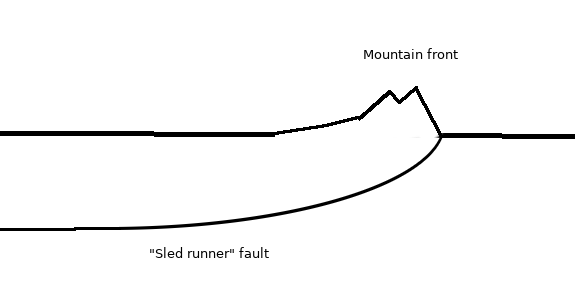
The Sevier Orogeny shortened the crust in the Nevada-Utah area by
over 100 km (60 miles).
As a result of the Sevier Orogeny, subsidence of the foreland basin west of the Sierra Nevada accelerated during the Cretaceous. As the climate warmed and sea levels rose, this basin was flooded by a shallow sea, the Western Interior Seaway, in an event called the Zuni Transgression. The Jemez area was thus in a coastal or shallow marine environment during the Cretaceous, and coal beds were laid down in many locations in northern New Mexico, including the Madrid area southeast of the Jemez. The record of oceanic transgressions and regressions is particularly complete in northwestern New Mexico, where sandstone beds in the prevalent shale shows the passage of shorelines over time. The Jemez area was above sea level at the start and end of the period, but was submerged for around 20 million years in its middle.
The Western Interior Seaway is unusual in the geologic record in
that ample runoff from the mountains to the west reduced the
salinity of the water significantly. The runoff also carried
considerable organic matter, which produced many black shale
beds of the Cretaceous in the western United States. Sediment
accumulation was rapid, as much as 195 meters per million years in
some locations in southwestern Colorado. Some Cretaceous sequences
are up to 7000m (20,000') thick.
During the Cretaceous, true flowering plants (angiosperms) appeared and rapidly proliferated. Foraminifera and diatoms dominated the ocean plankton and produced great beds of chalk and chert in some parts of the world; "Cretaceous" is derived from the German Kreide, chalk. The nearest such chalk beds to the Jemez are in Kansas, far enough east to be away from the heavy sedimentation off the Sevier mountains.
New families of molluscs proliferated, including the distinctive
oyster-like Inoceramus. Ammonites were also diverse and
abundant, and their rapid evolution allows beds to be correlated
with high precision. The climate was as warm as any in the
geologic record, with subtropical vegetation extending clear to
the Arctic Circle. Petrified palm stumps have been found in the
upper Cretaceous near Cuba, New Mexico, in spite of the fact that
New Mexico was at about 45 degrees north latitude, compared with
36 degrees latitude today.
As Forest Road 100 ascends the narrow canyon of the Rio Encino,
on the way to the La
Grulla Plateau, it passes Cretaceous rocks of the Burro
Canyon and Dakota Formations.

Cretaceous exposures in Rio Encino canyon. Looking east
from 36
9.813N 106 31.990W
That's Cerro Pedernal on the skyline. The foreground cliffs are
rimmed with Dakota Formation, and the slopes beneath are exposures
of Burro Canyon Formation. Above the cliff, on the plateau, is
Mancos Formation and Tertiary El Rito Formation.
Climbing the hillside, one gets an excellent view of the opposite side of the canyon and its corresponding exposures.

Panorama of Rio Encino canyon. 36
9.829N 106 31.878W
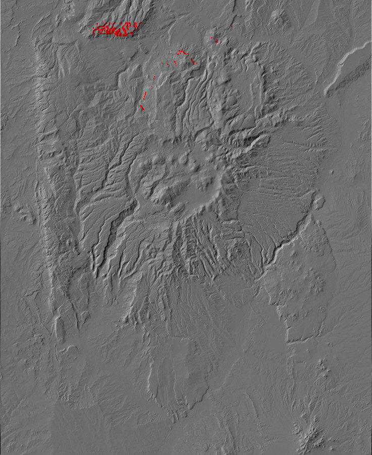
Relief map of the Jemez with Burro Canyon Formation
outcroppings highlighted in red.
120 million years ago, the river system in the Jemez area was
once again rejuvenated, with braided streams depositing coarse
sediments along the coastal plain of the Western Interior Seaway.
This is recorded in the Burro Canyon Formation, whose base is
placed at the first bed of conglomeratic sandstone above the
mudstone beds of the Bushy Basin Member of the Morrison Formation.
Ascending the slopes in the previous photograph, one comes to outcroppings of this formation.

Burro Canyon Formation. 36
9.833N 106 31.876W
A sample:
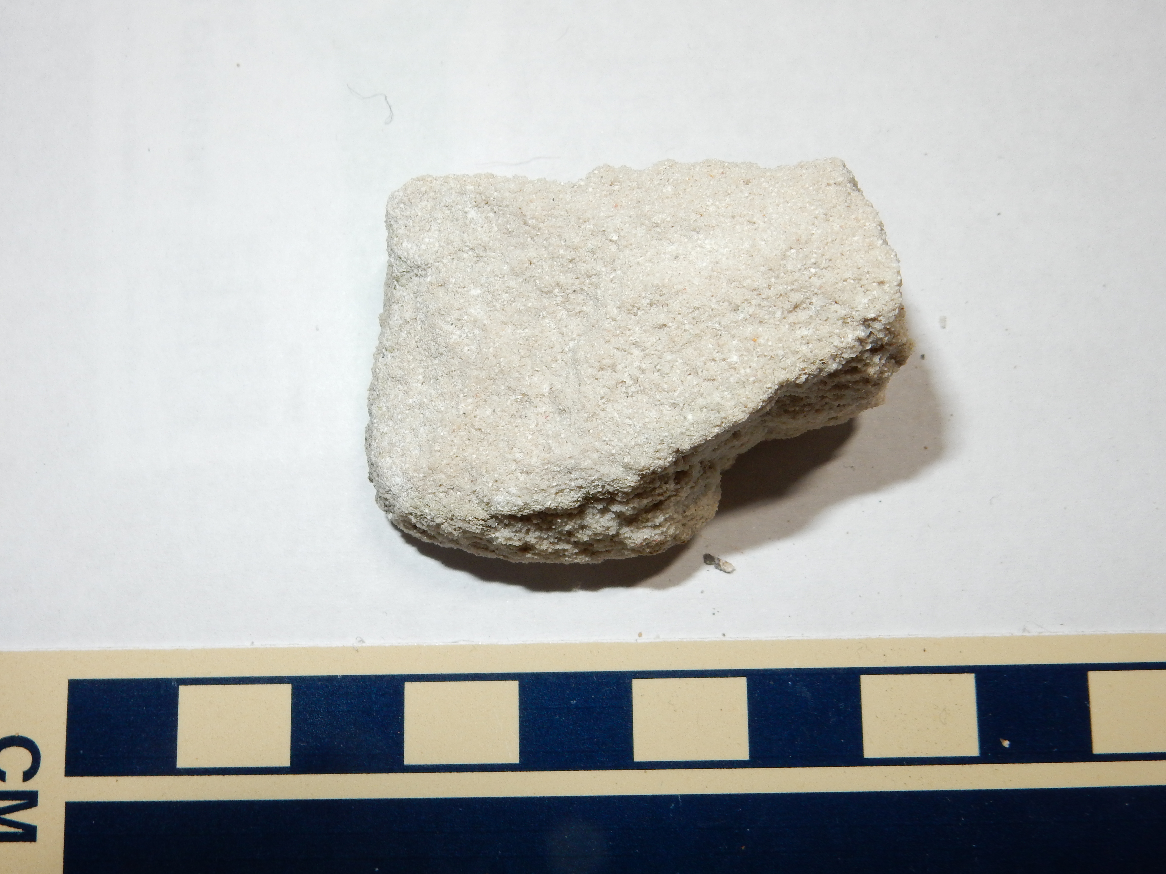
Burro Canyon Formation. 36
9.833N 106 31.876W
Under the loupe, this is revealed as a well-sorted sandstone composed almost entirely of angular quartz grains, with significant calciferous cement in the pore spaces -- though not enough to make it a wacke. A fairly mature quartz arenite.
Nearby is another outcropping.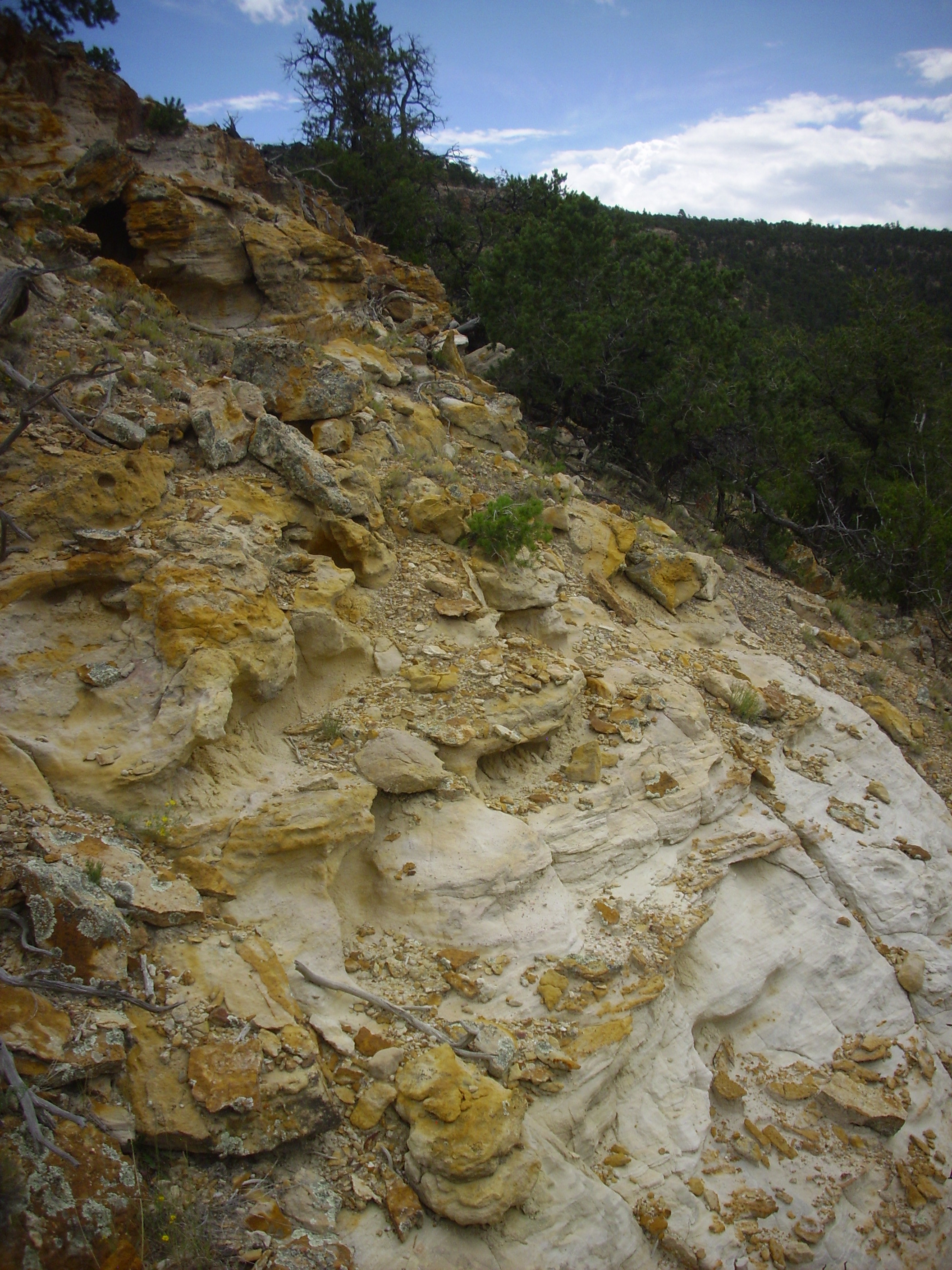
Burro Canyon Formation. 36
9.829N 106 31.878W
This outcrop reveals thin conglomerate beds, characteristic of the Burro Canyon Formation. For the most part, though, the exposures of Burro Canyon Formation in the northern Jemez are poor, typically mantled by soil or colluvium. My identification of these beds as Burro Canyon Formation is based on matching my GPS coordinates with the geologic map and assuming that the sandstone beds of the Burro Canyon will tend to stand out in exposure more than the mudstone beds. But it is possible I am actually looking at the lowermost beds of the Dakota Formation here, which might be assigned to the Cubero Member.
To see a decent exposure of the formation, one must look beyond
the Jemez. Here is the formation in the spillway for Heron Lake,
southwest of Chama.
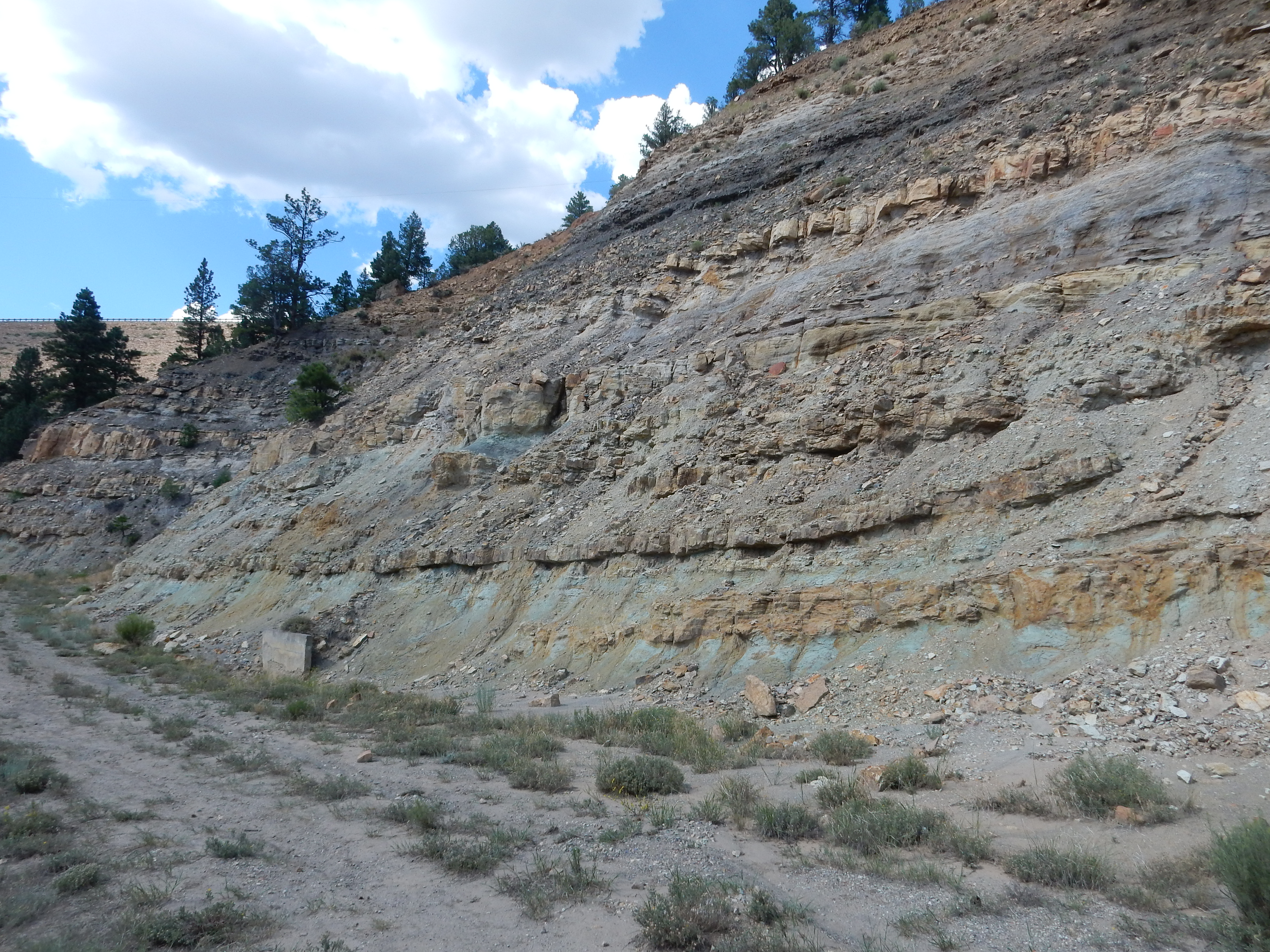
Burro Canyon Formation. 36.6633573N
106.704652W Public domain
Here the alternating sandstone and gray or greenish mudstone,
reminiscent of the Jackpile Member of the Morrison Formation, are
well displayed.
The exposure map shows that this formation is restricted to the
northern Jemez. The formation pinches out at about the latitude of
Cuba. Since the next youngest formation, the Dakota Formation, is
found atop Morrison Formation in almost every other exposure of
Cretaceous rocks in the Jemez Area, the area north of the Jemez
may have been relatively low ground with higher terrain to the
south. This is consistent with the picture of the Burro Canyon
Formation as fluvial sandstone deposited close to the shore of the
Western Interior Seaway while the latter was still relatively
limited in extent. However, the upper surface of the Burro Canyon
Formation is an erosional surface, so it likely extended somewhat
further to the south than it is now found before being partially
eroded away.
All this assumes that the Jackpile Member of the Morrison Formation and the Burro Canyon Formation are actually distinct units. Geologists have their doubts about this, and the complete lack of fossils in the Burro Canyon Formation in the Jemez makes it hard to date the units precisely enough to be sure. They certainly look a lot alike to me. And if they are the same unit, the lack of Burro Canyon Formation mapped south of the Jemez means nothing; the geologists are simply mapping it as something else.
Another strike against the Jackpile Member is detrital zircon
geochronology, the technique that proved so useful in identifying
the Picuris Orogeny. Detrital zircons have been reported in the
Jackpile Member that are Cretaceous in age. If this is verified,
it pretty much settles the matter: The Jackpile Member belongs to
the Burro Canyon Formation, not the Morrison Formation.
To further confuse matters, the Burro Canyon Formation is essentially continuous with the Cedar Mountain Formation in southeastern Utah. As with the Cutler Group and Abo Formation, the dividing line is more or less arbitrarily set along the Colorado River. However, the Cedar Mountain was deposited closer to the Sevier Mountains, and some geologists see enough differences in the detailed lithology to justify two separate formations. The two formations have been interpreted as interfingering alluvial fans from separate source regions, with the Cedar Mountain Formation receiving sediments from the Sevier belt and the Burro Canyon Formation receiving sediments from southern Arizona.
Alluvial fans are deposits of sediments shaped roughly like a
section of a shallow cone, with the tip of the cone located at a
source of sediments. This is typically a canyon emerging from a
mountain front. Sediments washed out of the canyon spread out over
the cone and are deposited there. We'll have more to say about
alluvial fans later in the book. For the moment, it suffices to
know that alluvial fans vary enormously in size, from a few meters
across to hundreds of kilometers. The alluvial fans of the Burro
Canyon and Cedar Mesa Formations would have been enormous.
The upper part of the Cedar Mountain Formation contains the first
examples of the so-called Asian fauna in North America. These
include tyrannosaurids, hadrosaurids (duckbilled dinosaurs), and
ceratopsians (the family that includes Triceratops), which
would become numerous in the uppermost Cretaceous. Their
appearance is interpreted as the time of the appearance of the
first land bridge between Alaska and Siberia. An ash bed near the
top of the Cedar Mesa has been radiometrically dated to precisely
98.39 million years in age, almost precisely on the boundary
between the lower and upper Cretaceous.
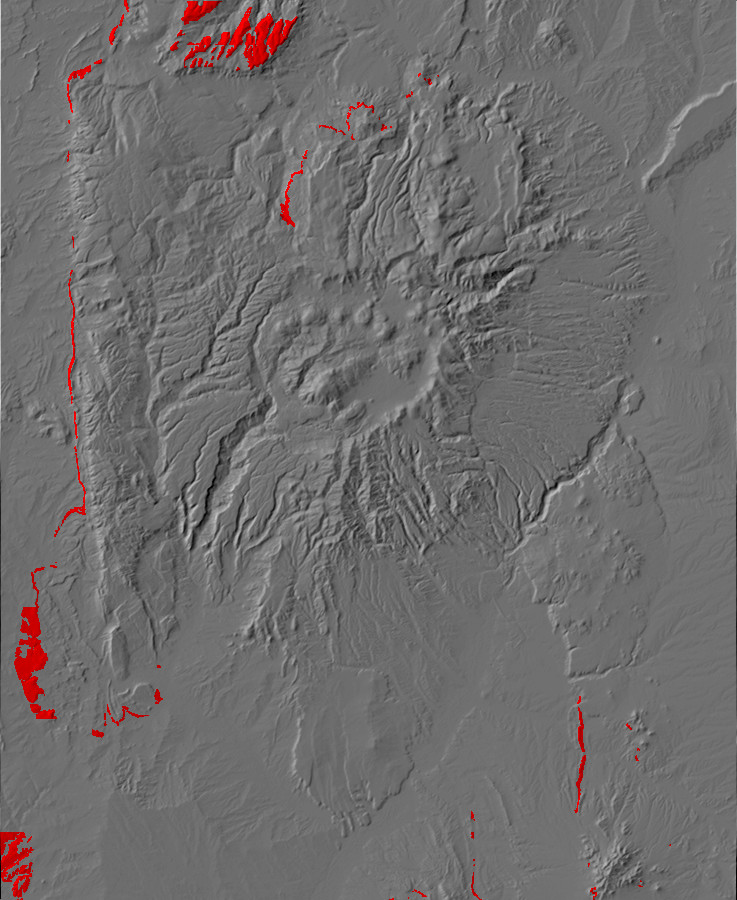
Relief map of the Jemez with Dakota Formation
outcroppings highlighted in red.
105 million years ago, the Western Interior Seaway had reached
the Jemez region. The advancing sea deposited a deep blanket of
sand, in which countless worms and crustaceans dug their burrows
just off shore. This period of time is recorded in the beds of the
Dakota Formation.
The Dakota Formation extends from Arizona to Wisconsin,
reflecting the full development of the Western Interior Seaway,
which completely flooded the interior of North America in the
middle Cretaceous. This coincides with a rise in sea level
recorded in the geologic record worldside. At its peak, the
transgression advanced westward at a rate of 15 cm (6") per year.
The base of the formation is placed at the top of the last
greenish mudstone of the Burro Canyon Formation, or the first bed
containing carbonaceous material, whichever comes first. The two
are separated by a significant discontinuity, but this is
lithologically subtle.
Cliffs of Dakota Formation dominate the rim of Rio Encino canyon,
as we saw in the earlier photographs. Here's the formation up
close.

Paguate Sandstone, Dakota Formatin. 36
9.859N 106 31.839W
This prominent cliff is the Paguate Sandstone, the most prominent bed of the Dakota Formation in this area. It is an extremely well-indurated sandstone, accounting for its resistance and tendency to form cliffs. Here's a sample.
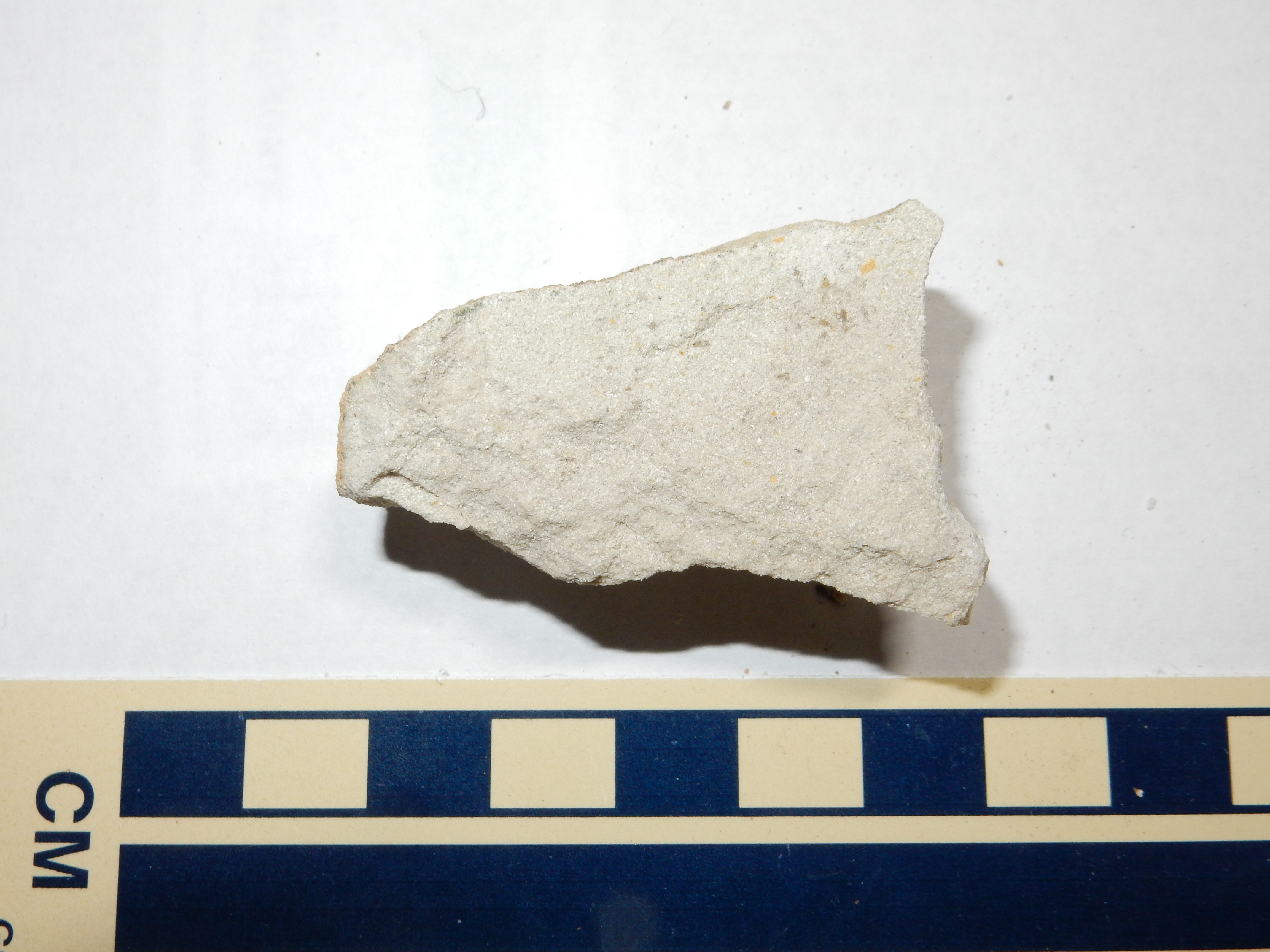
Paguate Sandstone, Dakota Formatin. 36
9.859N 106 31.839W
This is similar to the Burro Canyon Formation, but the grains are smaller, better rounded, and more strongly cemented together.
The Paguate Sandstone shows significant cross bedding.

Cross bedding in Paguate Sandstone, Dakota Formation.
Click to enlarge. 36
9.859N 106 31.839W
The cross bedding is evident towards the bottom of this boulder.
Like many sandstones, the Paguate Sandstone also preserves some ichnofossils,
or trace fossils.

Ichnofossils in Paguate Sandstone, Dakota Formation.
Click to enlarge. 36
9.859N 106 31.839W
Ichnofossils are fossil traces of living organisms that are not the organisms themselves. Obvious examples are dinosaur footprints, some of which have been found in other locations in the Dakota Formation. Because trace fossils are often highly distinctive, but the organisms that produced them may not always be known with certainty, ichnofossils are given their own ichnogenera and ichnospecies names. In this case, we are looking at trace fossils of the ichnogenus Thalassinoides, which are believed to have been most commonly produced by sediment-dwelling crustaceans. Sedimentary rocks that formed from sediments that were extensively tunneled by living organisms are described as bioturbated, and the Dakota Formation in northern New Mexico is noted for its high degree of bioturbation.
Sheets of clean, bioturbated sandstone like the Paguate Sandstone
dominate the upper part of the Dakota Formation throughout its
extent.
As one continues ascending into the Jemez along Forest Road 100, the road reaches the level of the Paguate Sandstone.
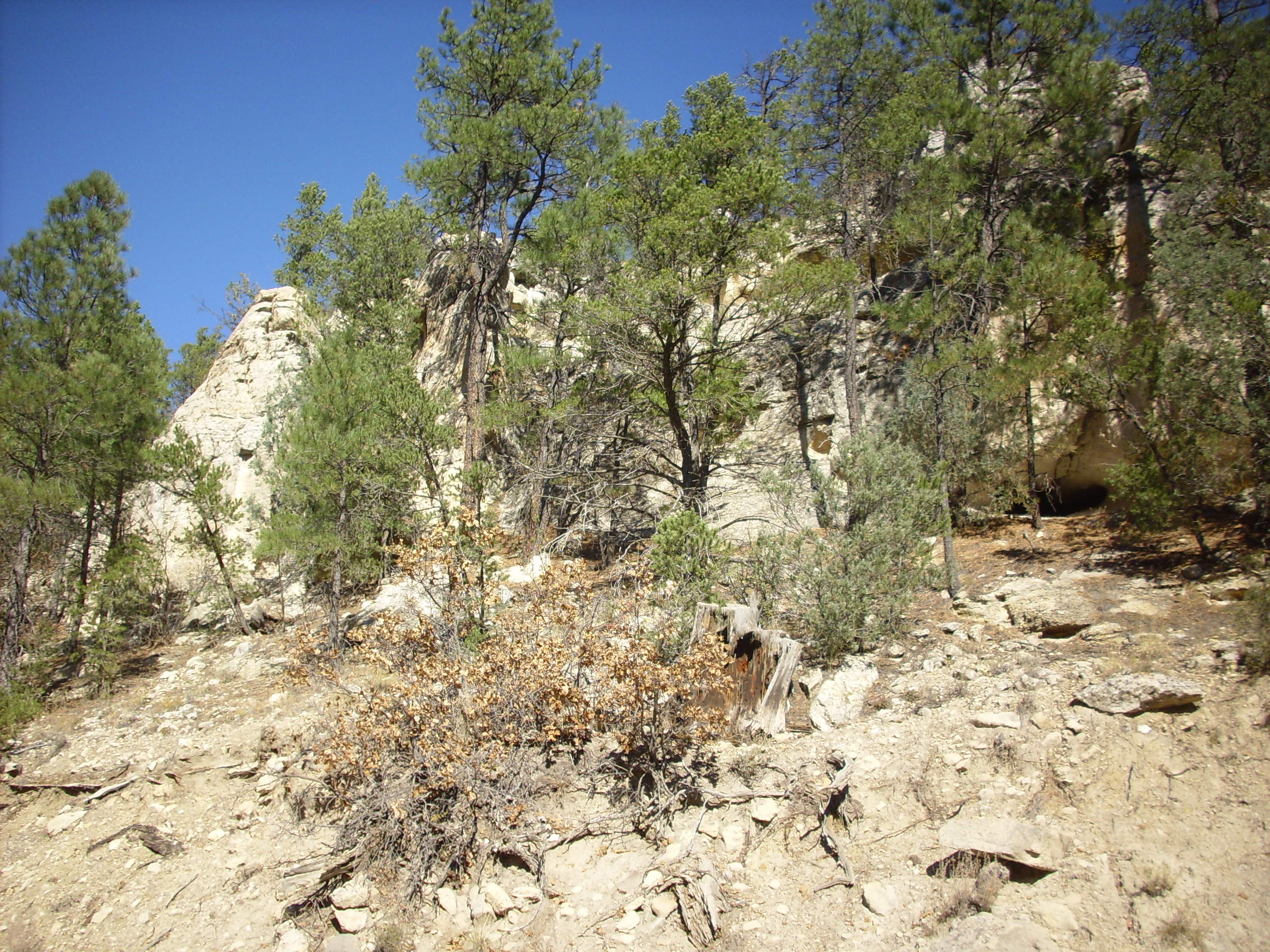
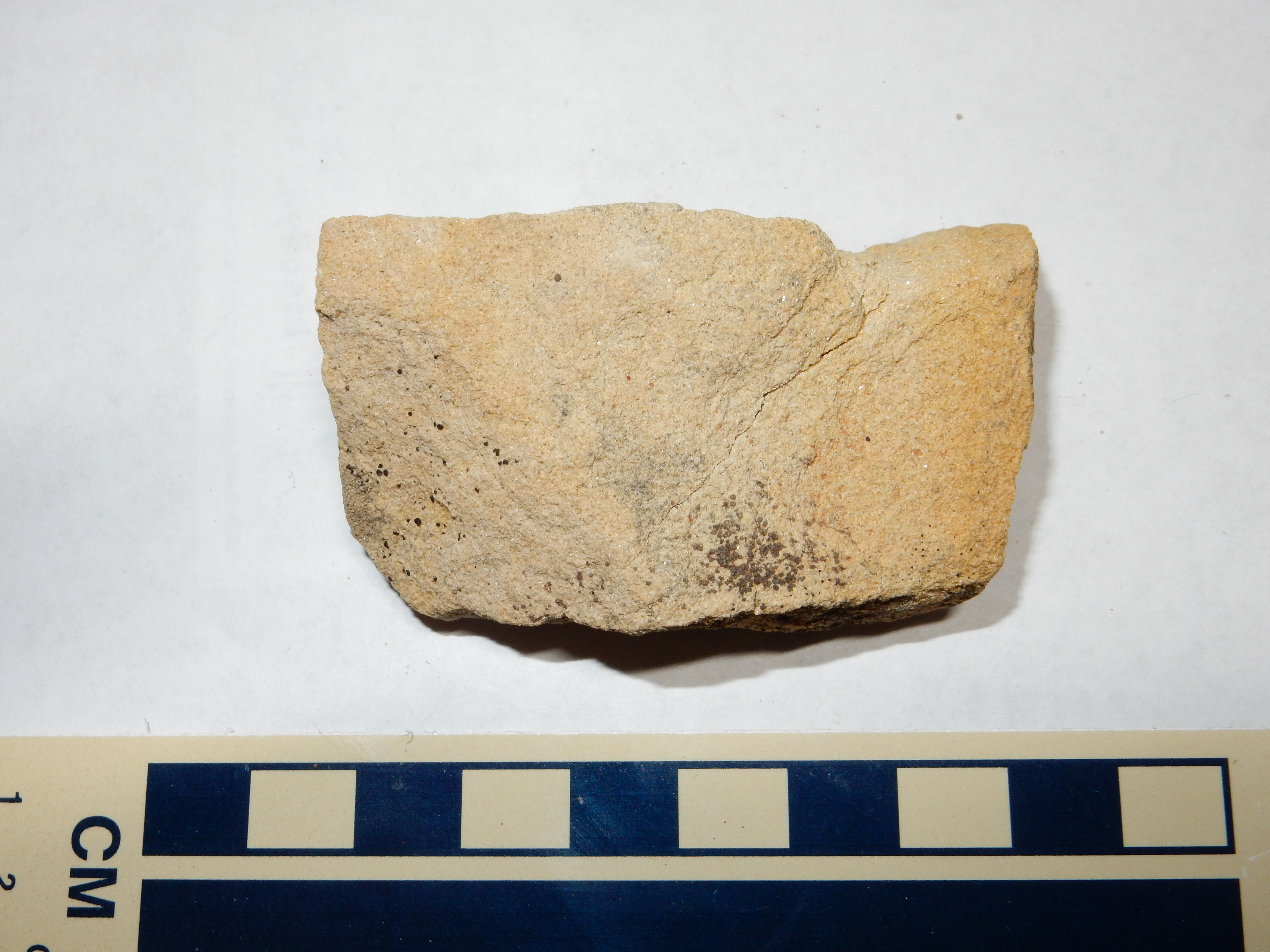
Unsurprisingly, this look identical to the previous sample under
the loupe.
The Dakota Formation also forms the lip of the La Bajada
escarpment south of I-25, as we saw earlier.
Here the Oak Canyon Member of the Dakota Formation sits directly
atop the Jackpile Member of the Morrison Formation; no Burro
Canyon Formation is mapped in this area.
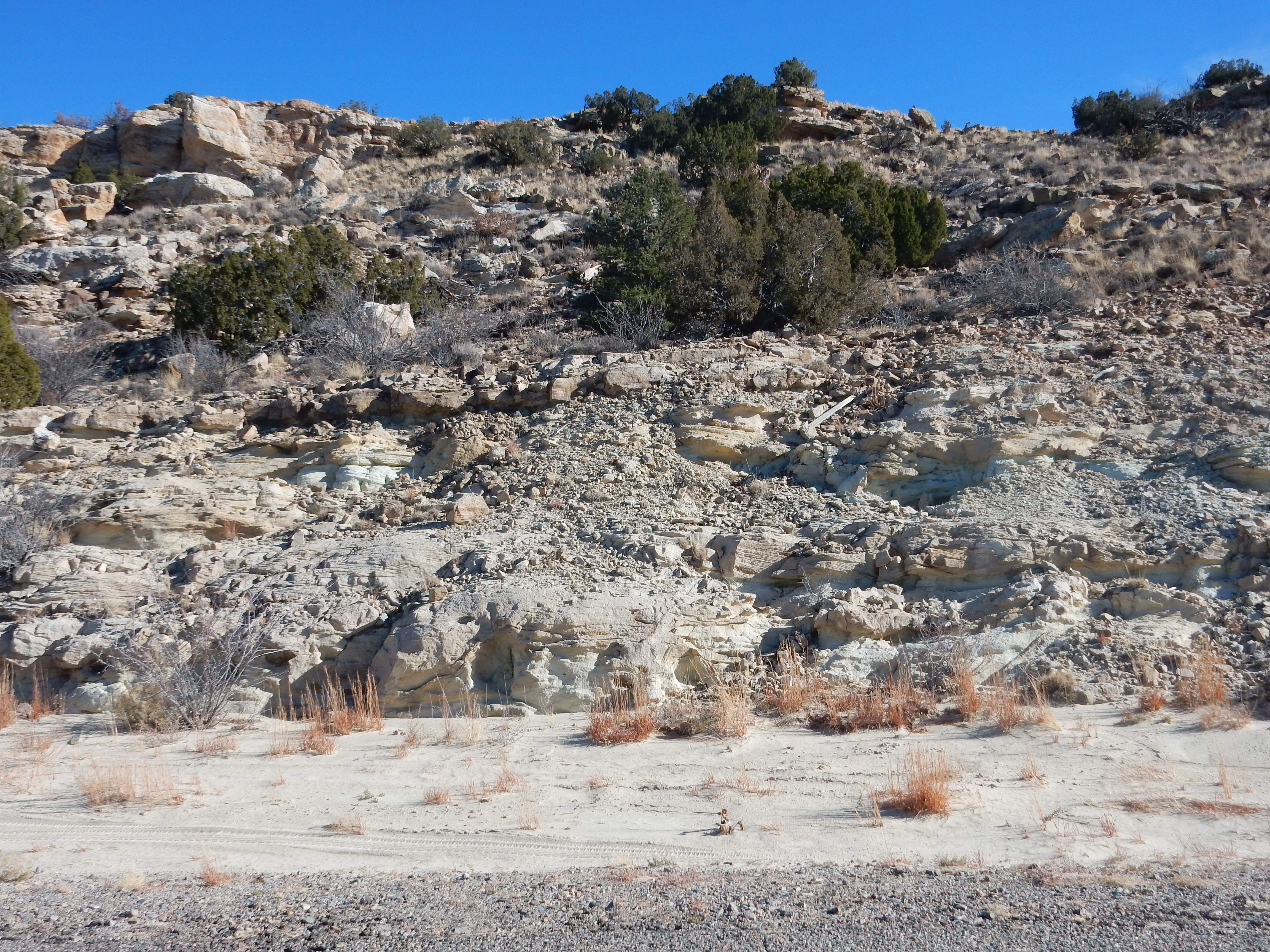
Dakota Formation atop Morrison Formation south of I-25.
35
27.357N 106 12.777W
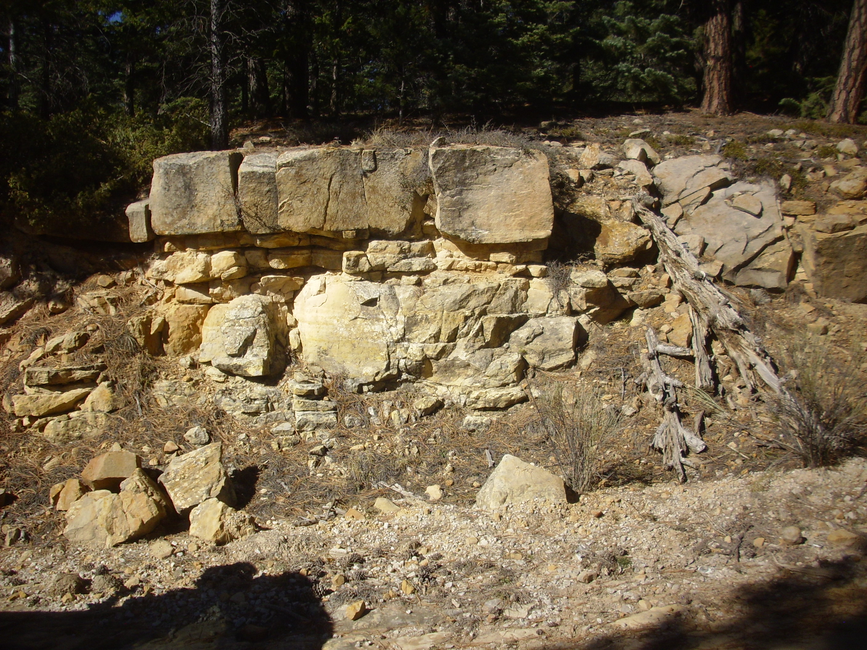
Dakota Formation atop finger ridge on Mesa Alta. 36.2371376N
106.7418887W
The Dakota Formation is not all massive sandstone. In some locations, such as near White Mesa south of San Ysidro, there are significant shale sequences within the formation.
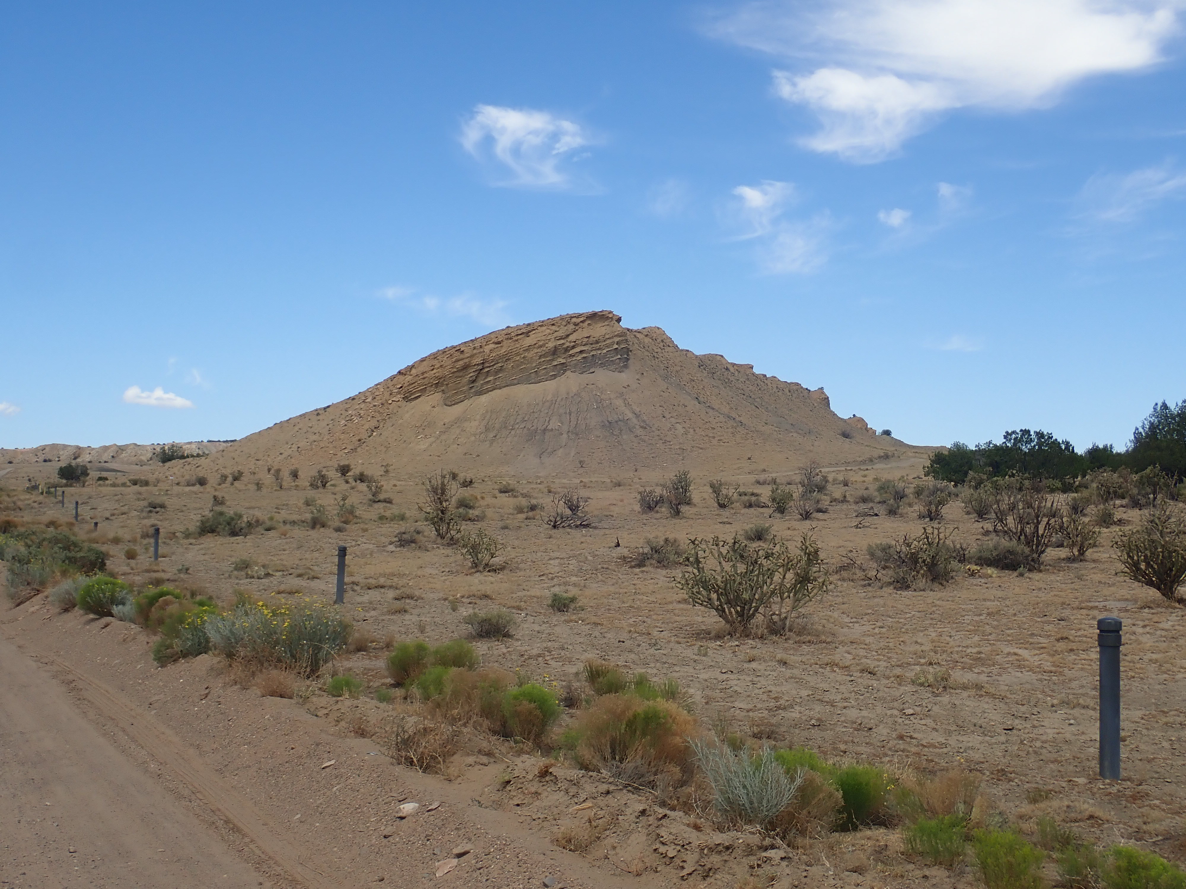
Dakota Formation south of White Mesa. 36.2371376N
106.7418887W
Here a silty sandstone caps a dark shale sequence. Some such
sequences represent intertonguing with the overlying Mancos Shale,
but others are part of the Dakota Formation itself.
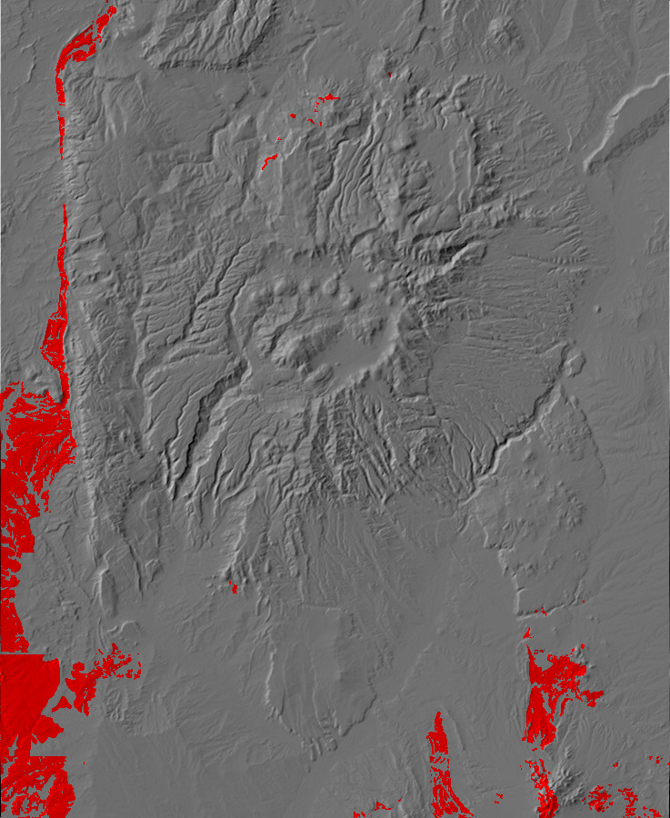
Relief map of the Jemez with Mancos Formation
outcroppings highlighted in red.
95 million years ago, the Western Interior Seaway had completely
flooded the Jemez area. Black mud that weathered off the
highlands to the west, and was rich in organic material,
accumulated on the sea floor across western North America. This
time period is recorded by the beds of the Mancos Shale.
Deposition of the Macos Shale took place between 95 and 80
million years ago. The area of deposition was enormous, with
equivalent shale extending well east of the Rockies (the Pierre
Shale) and to southwest Utah (the Tropic Shale.) In places it is
over 1600 meters (4800') thick. However, it rapidly weathers in
exposures to a nondescript gray to brown mud. Areas underlain by
Mancos Shale tend to quickly erode into low relief, sparsely
vegetated terrain.
Although there are exposures in the northern Jemez, they tend to be rather poor. Here is an exposure above the cliffs of Paguate Sandstone on the east side of the Rio Encino valley. The mudstone has weathered to yellowish-gray mud, mantled with basalt boulders from the La Grulla beds.

Badly weathered Mancos Shale in the northern Jemez. 36
9.859N 106 31.839W
However, there are extensive exposures in the Cerrillos
area of New Mexico, southeast of the Jemez, a historically
important mining district. In this drier climate, and with some
baking from the underlying intrusions, these are better preserved.
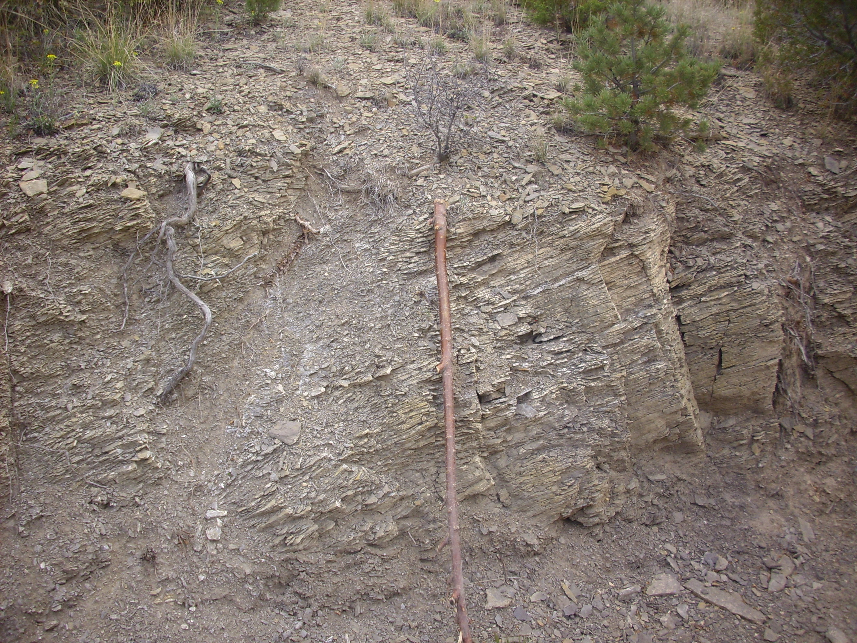
Mancos Shale in the Cerrillos mining district.
35
26.881N 106 7.153W
The exposures extend for a considerable distance around the Cerillos area, including well to the south and west, such as this dramatic contact in a road cut near Placitas.
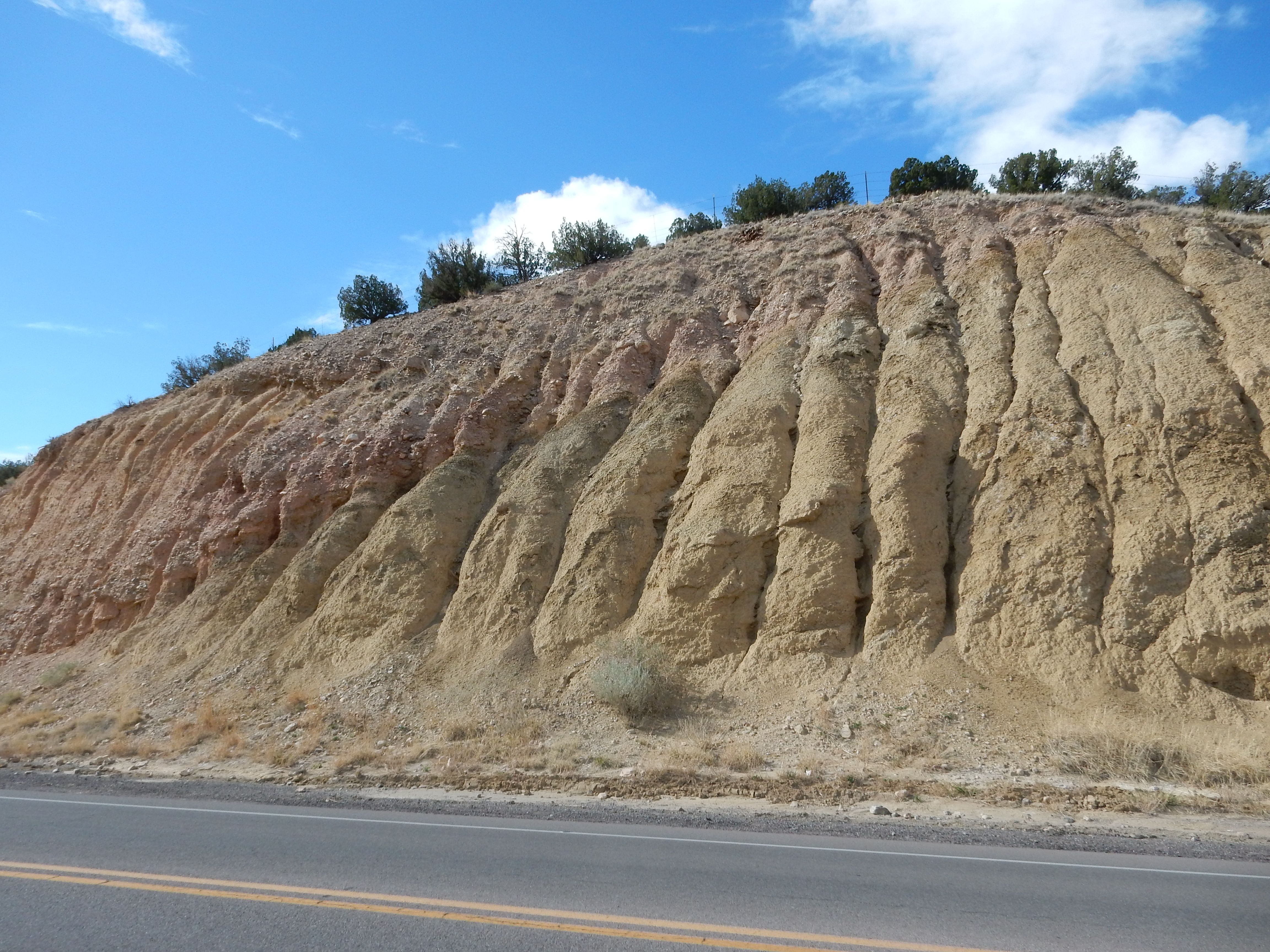
Mancos Shale underlying piedmont gravels near Placitas.
35
18.013N 106 28.537W
The somewhat weathered Mancos Shale to the lower right is
overlain by piedmont gravels eroded off the Sandia uplift.
The Mancos Formation has been divided into a number of members. The most prominent member west of the Cerillos Hills is the Niobrara Member, which is divided into upper and lower sections by a distinctive sandstone bed.
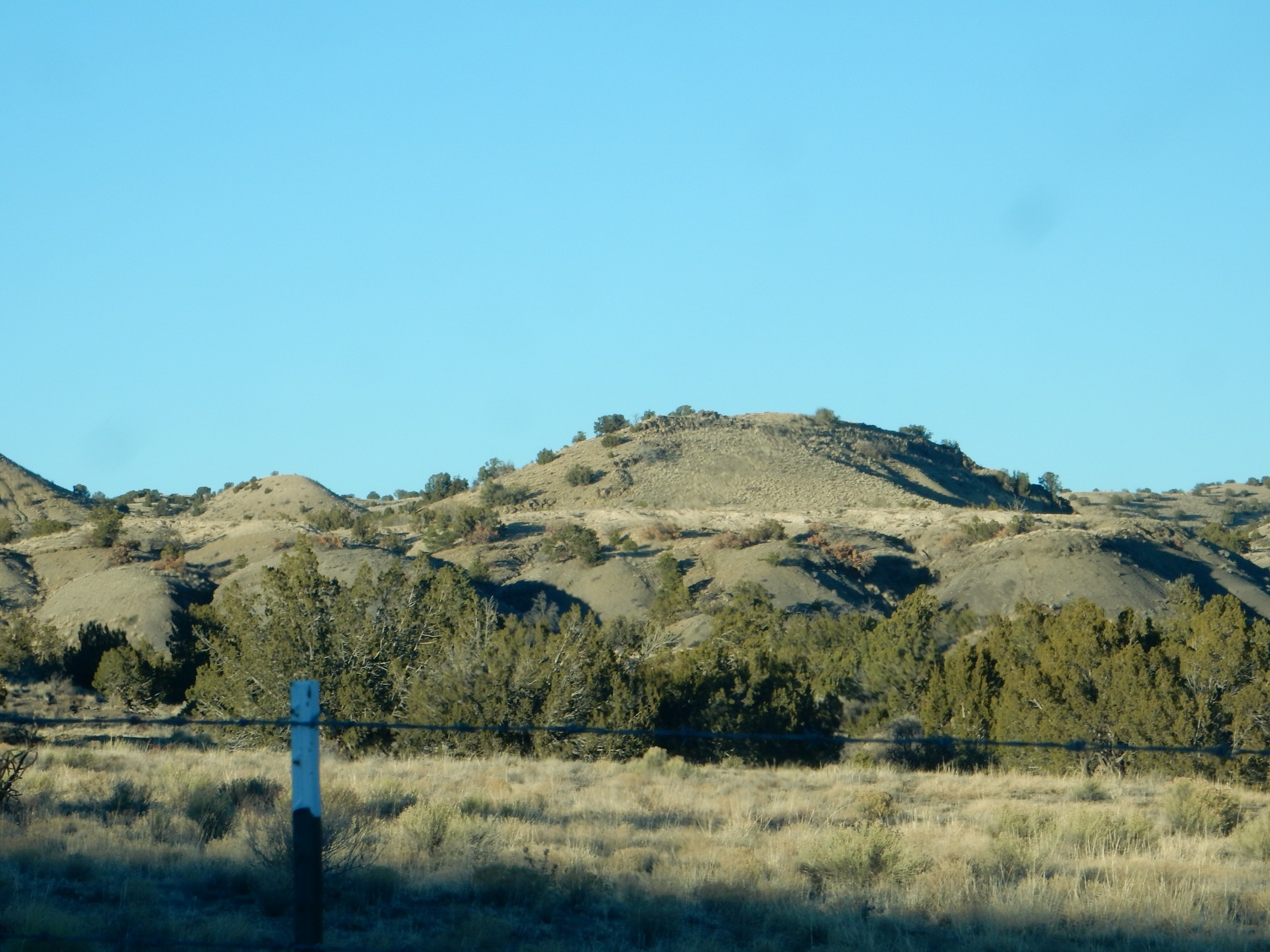
Sandstone marker bed in Niobrara Member. Looking
northeast from 35
28.521N 106 10.449W
This is well exposed in a road cut nearby.
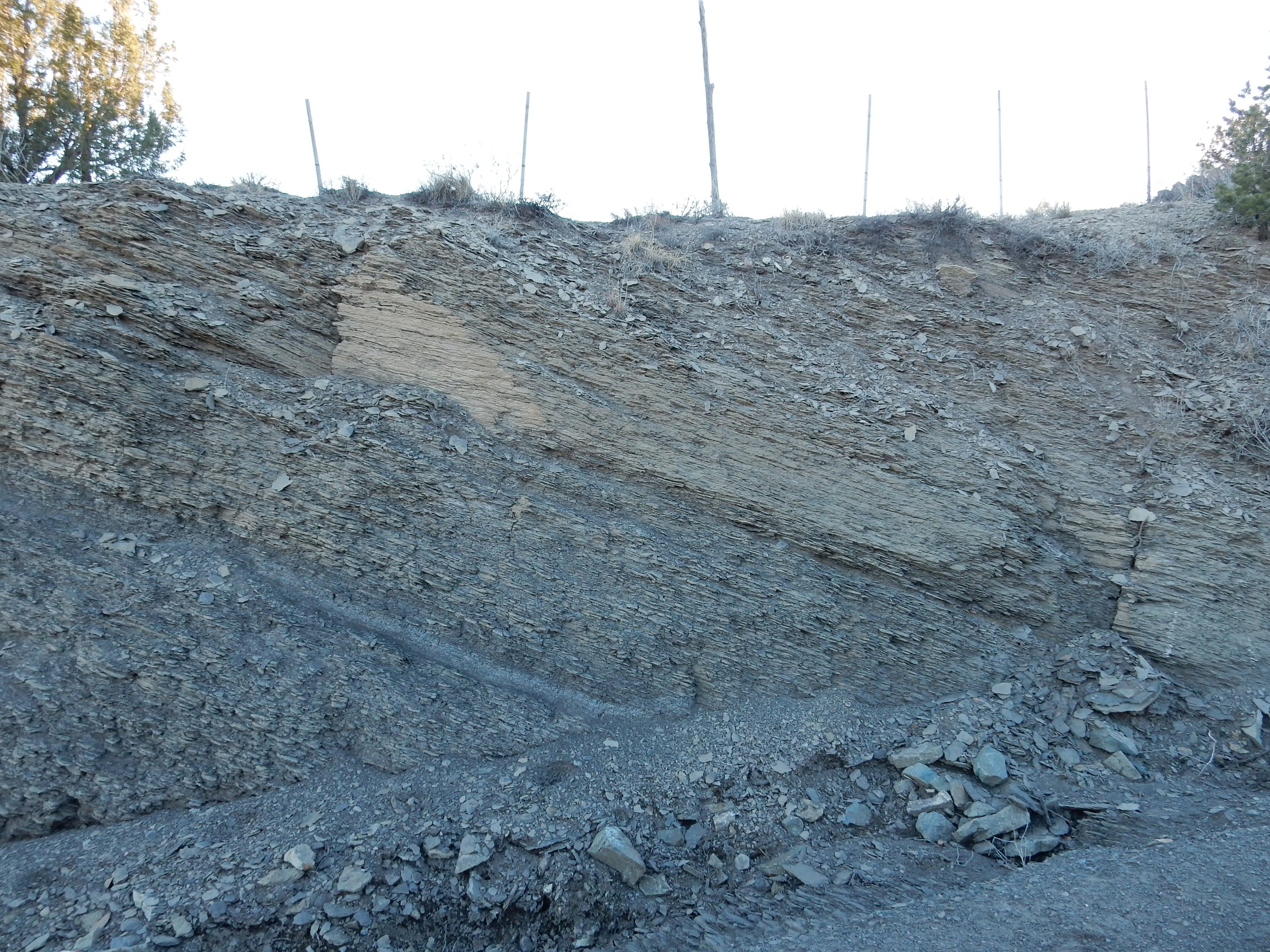
Niobrara Member. 35
28.569N 106 10.502W
This sandier bed may correlate with the Ferron Sandstone Member
prominent to the northwest, in southern Utah.
My wife and her brothers probably find this very familiar-looking, and not necessarily in a happy way. The Mancos Formation gets its name from its type location at Mancos, Colorado, and the stuff is all over the place, including the valley outside Pagosa Springs where my in-laws have owned a time share on a cabin for over forty years. The kids probably skinned a few knees on vacation by trying to scramble up slopes of this stuff. It is slippery and crumbly and just made to send you tumbling when you try to walk across it.
And, as I mentioned earlier, exposures tend to weather to nondescript piles of mud in geologically short intervals of time, so it isn't usually even much to look at. The most boring part of the drive from Los Alamos to central Utah, which my family made at least annually from the time we were kids clear through my college days, was the stretch between Green River and Price that passed over miles and miles of nondescript muddy Mancos Shale.
But I haven't really got it in for the Mancos Shale. It's rich in fossils. It's also one of the more promising source rocks for future oil exploration, and that counts for a lot.The best exposures in the Jemez area are west of the Sierra Nacimiento Mountains. Here's a nice exposure in a road cut.

Mancos Shale west of the Sierra Nacimiento.
35
45.838N 106 56.338W
You can see some variety in the bedding. There is a layer with some reddish limestone in the middle of the photograph, and above it are two layers richer in whitish limestone. These are interbedded with shale.
The Mancos Formation exposures west of here include some prime
fossil beds on public lands.
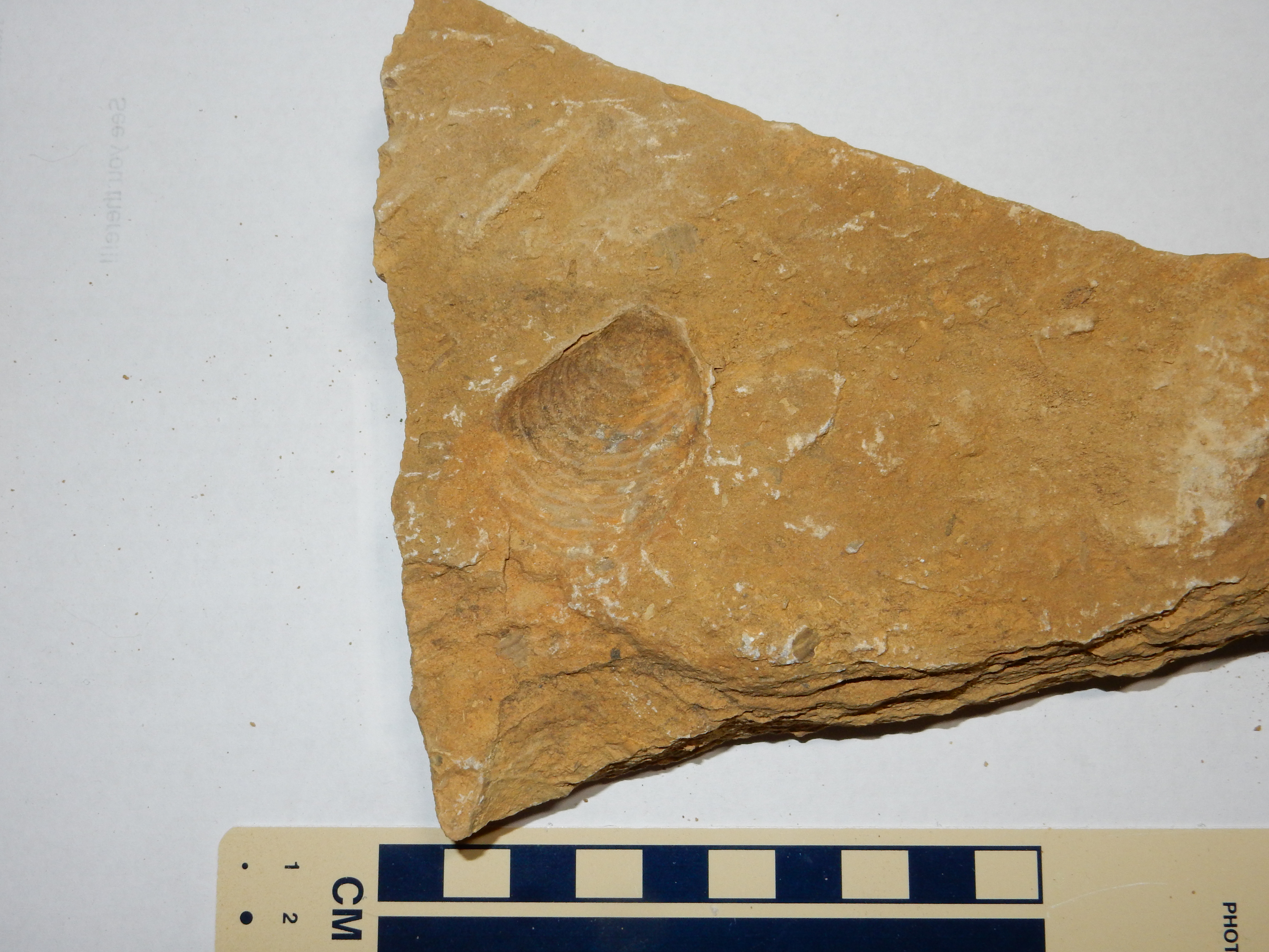
This fossil is likely Inoceramus, which is very common in Cretaceous rocks of the Western Interior Seaway. It resembles a modern oyster but paleontologists now believe it is a distinct lineage of mollusc.
This is an ammonite cast.

Ammonites were shelled molluscs resembling the modern nautilus, but more closely related to squids. Appearing in the Devonian, they became extinct at the end of the Cretaceous, at the same time as most families of dinosaurs. They evolved rapidly, so that well-preserved ammonite fossils are excellent index fossils useful for determining the relative ages of different sedimentary formations. For example, the start of the Cretaceous is placed at the first appearance of the ammonite Berriasella jacobi.
Some of the bivalve shells are preserved at this fossil bed, but there are no examples where the actual shell of an ammonite was preserved; only casts. This may be because the shells are chemically different. The bivalve shells are composed of calcite, while ammonite shells are aragonite. Both are calcium carbonate minerals, but calcite is more stable than aragonite. Aragonite dissolves below a certain depth of ocean water, called the aragonite compensation depth, while the calcite compensation depth is considerably greater. This suggests that the floor of the Western Interior Seaway managed to get below the aragonite compensation depth at some point, dissolving all the aragonite ammonite shells while leaving the calcite bivalve shells intact.
The beds from which these fossils were collected are assigned to
the Juana Lopez Member of the Mancos Formation. This member is
composed of sandy limestone rather than the shale making up most
of the Mancos Formation, and may correspond to a brief interval of
drier, hotter climate in which the waters of the Western Interior
Seaway were clearer and more conducive to the kind of marine life
than generates limestone deposits.
The visit to the Santa Fe area by Jules Marcou in 1853 was not immediately followed up. Tensions were building back east between the slaveholding South and the free states of the North, and these exploded into civil war in 1861. The end of the war in 1865 was followed by Reconstruction, and the U.S. Congress did not fund further geologic expeditions to the Jemez area until 1869.
In that year, F.V. Hayden, who had studied both geology and
medicine and served as a Union medical officer during the Civil
War, led an expedition along the Front Range of the Rockies. This
covered the area from Denver to Santa Fe, and Hayden produced a
lengthy report on his observations of all aspects of geology along
his route. The chapter dealing with the Santa Fe area begins with
a description of the geology of the Los Cerrillos area, southwest
of Santa Fe. Hayden noted the presence of Cretaceous beds
containing coal, a finding of considerable interest for refueling
trains along any transcontinental railroad passing nearby. His
report describes the dip and character of the coal beds in great
detail, noting the presence of nearby igneous dikes that had
converted part of the coal to anthracite. He correctly identified
the sandstone beds beneath the coal seams as Cretaceous in age and
noted the abundance of deciduous leaf fossils, including palm
leaves, in the lowest coal seams. However, he incorrectly
identified the coal itself as Tertiary in age.
Hayden was not the discoverer of the beds, which had been mined
since 1835, but his report doubtless influenced the decision to
route the southern transcontinental railway, which became the
Atchison, Topeka, and Santa Fe Railway, close to the area.
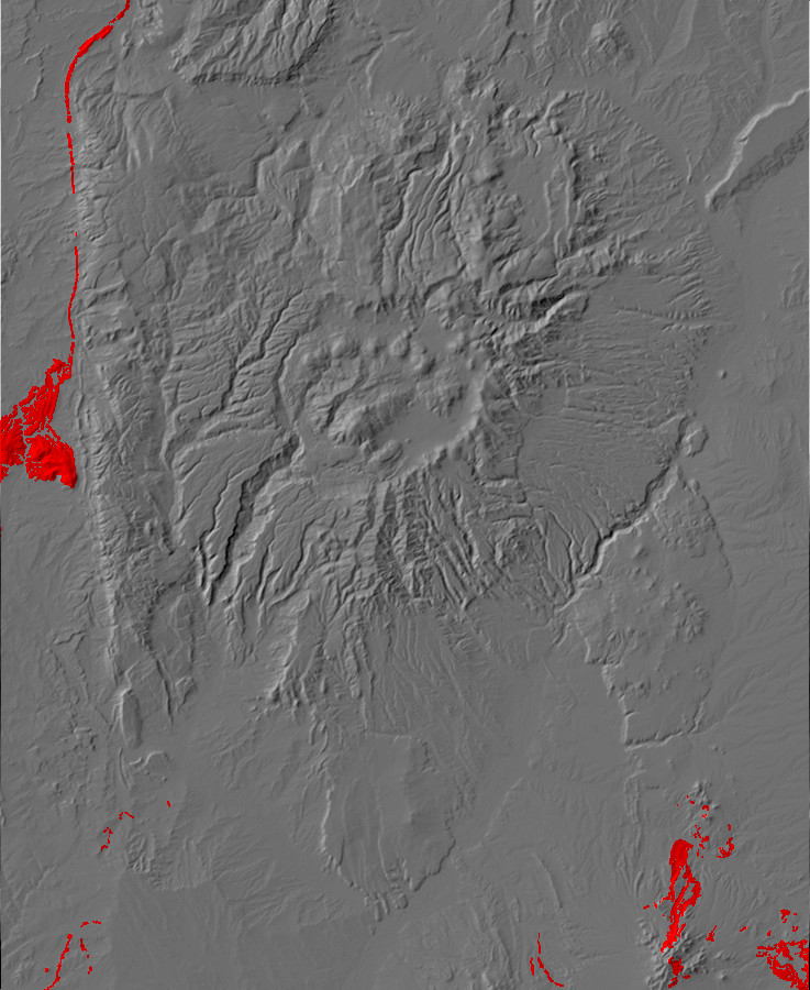
Relief map of the Jemez with Mesaverde Group
outcroppings highlighted in red.
During the mid-Cretaceous, around 84 million years ago, the
Western Interior Seaway briefly retreated from northern New
Mexico. This left a regression/transgression sequence
whose formations are assigned to the Mesaverde Group.
The retreating sea first left behind beach deposits of sand, which became the Point Lookout Formation. As the shoreline retreated, the area behind the shore became swamps in which the shales and coal deposits of the Menefee Formation were laid down. When the sea returned to the area, a second beach sand deposit became the Cliff House Formation. These formations are well exposed at La Ventana Mesa west of the Sierra Nacimiento.
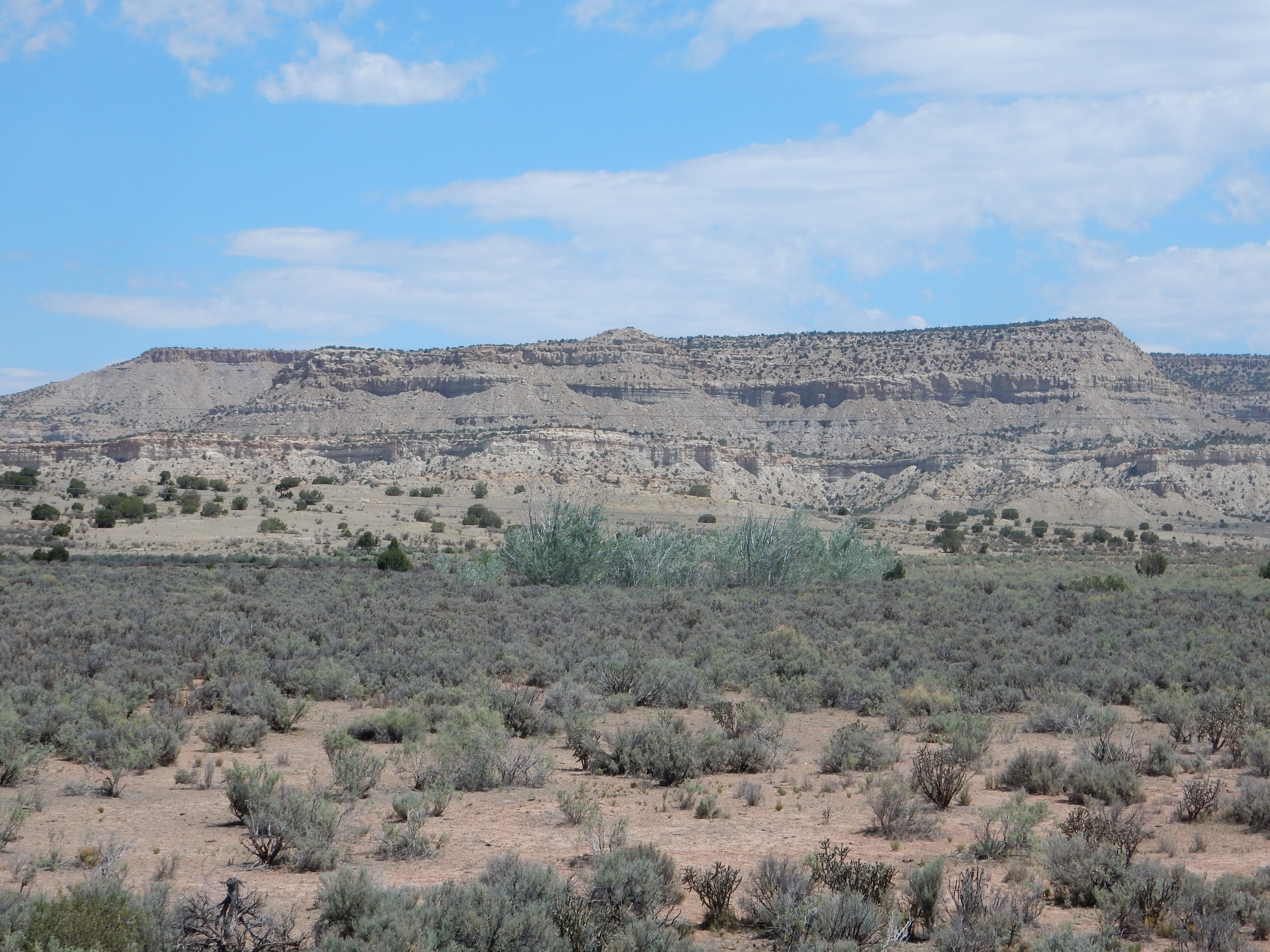
La Ventana Mesa South. Looking east from 35
47.668N 106 57.388W
La Ventana Mesa is capped with resistant sandstone of the Cliff House Formation, underneath which is less resistant Menefee Formation, another resistant sandstone layer of Point Lookout Formation, and soft beds of Mancos Formation at the base of the mesa.
Near La Ventana Mesa, the Point Lookout Sandstone consists of a lower sandy shale and an upper sequence of sandstone beds.

Point Lookout Sandstone. 35
48.928N 106 58.158W
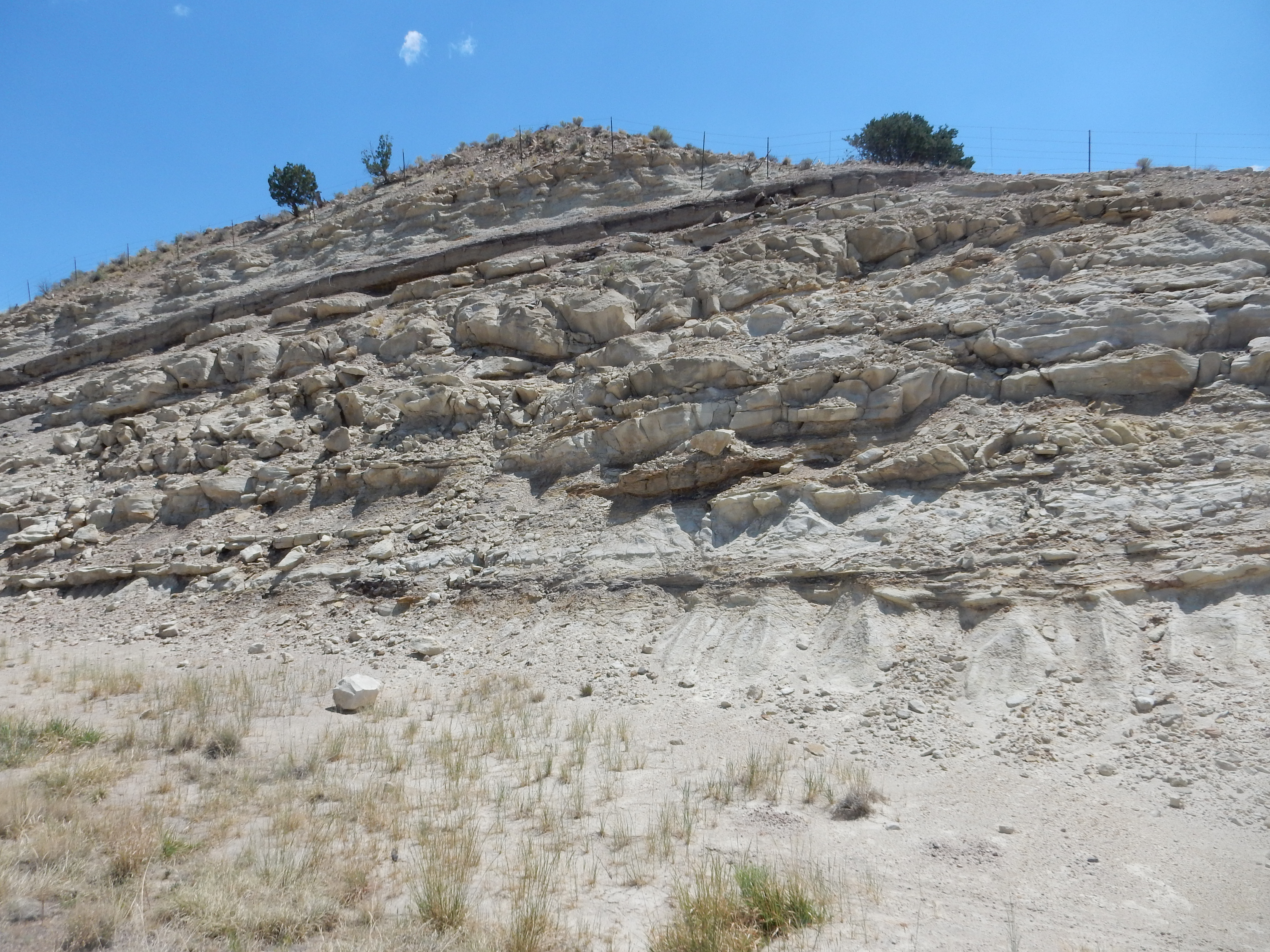
Point Lookout Sandstone. 35
50.068N,-106 58.104W
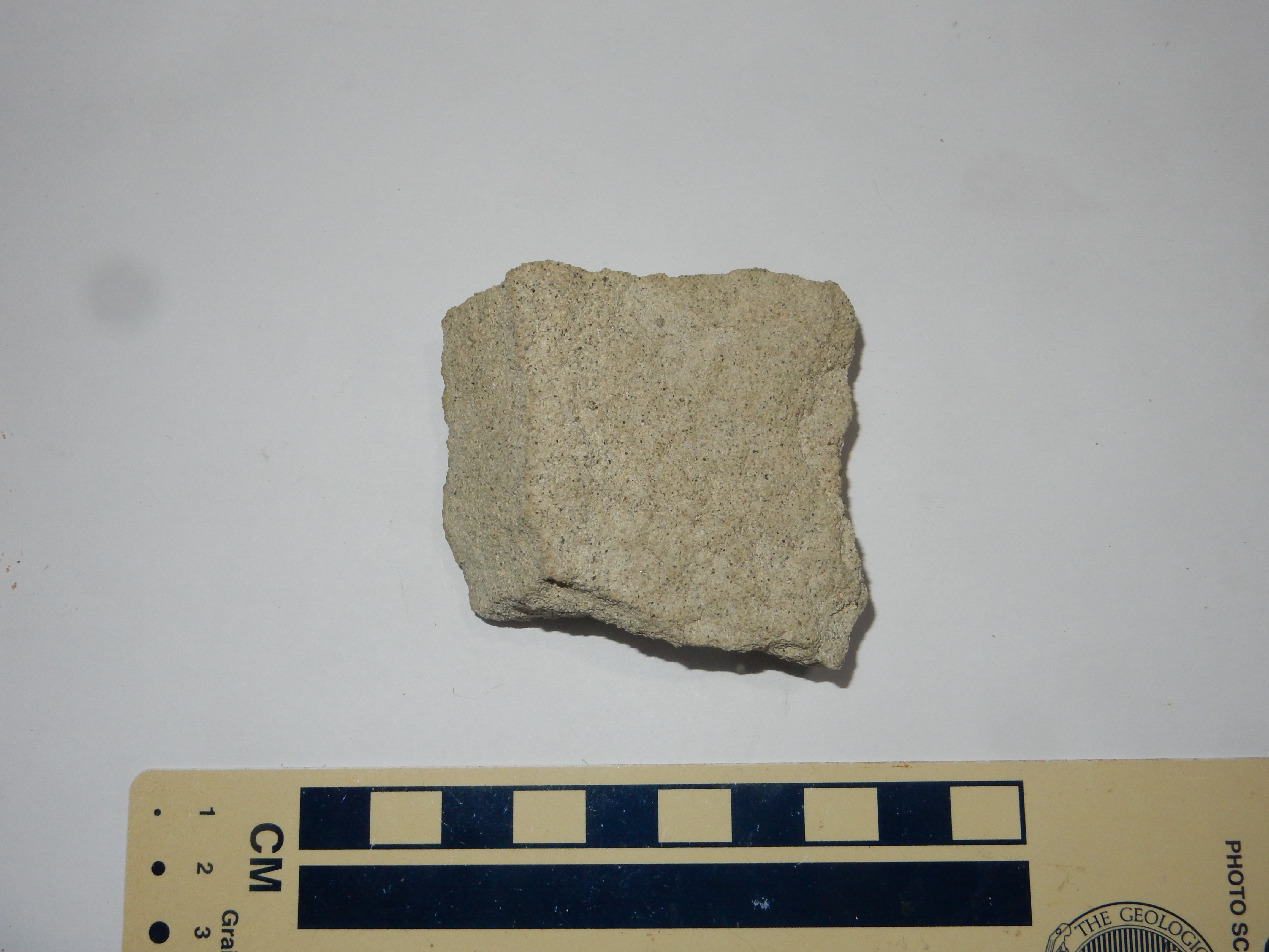
Point Lookout Sandstone. 35
50.068N,-106 58.104W
The sample shows a “salt and pepper” appearance typical of both
the Point Lookout Sandstone and the Cliff House Sandstone. The
“pepper” appears under the loupe to be lithic grains — small bits
of dark volcanic rock. This suggests that volcanoes were active
somewhere in the watershed of the rivers that drained into the
Western Interior Seaway here. These point to the existence of a
volcanic arc to the southwest, the Mogollon Highlands.
The Menefee Formation is exposed in the area around Cerillos and Madrid, where it includes thick coal beds formed in the coastal swamps. Some exposures, such as this road cut through overturned beds of the Menefee Formation, reveal a quartz arenite composed of medium, moderately rounded, moderately sorted quartz grains, with just a few lithic grains. In other words, a fairly clean sandstone.
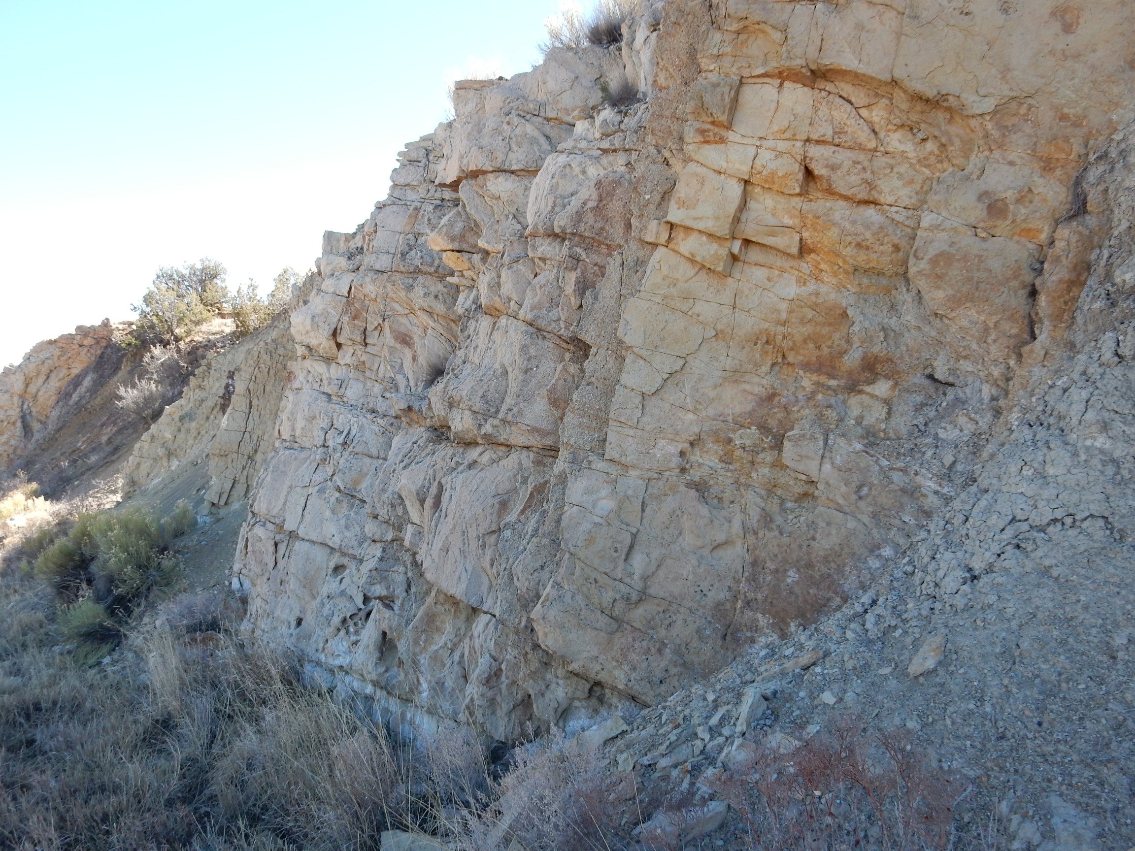
More typical of the Menefee are exposures of shale, often carboniferous. For example, a hogback ridge near Regina in the northwest Jemez exposes carboniferous shale of the Menefee Formation.
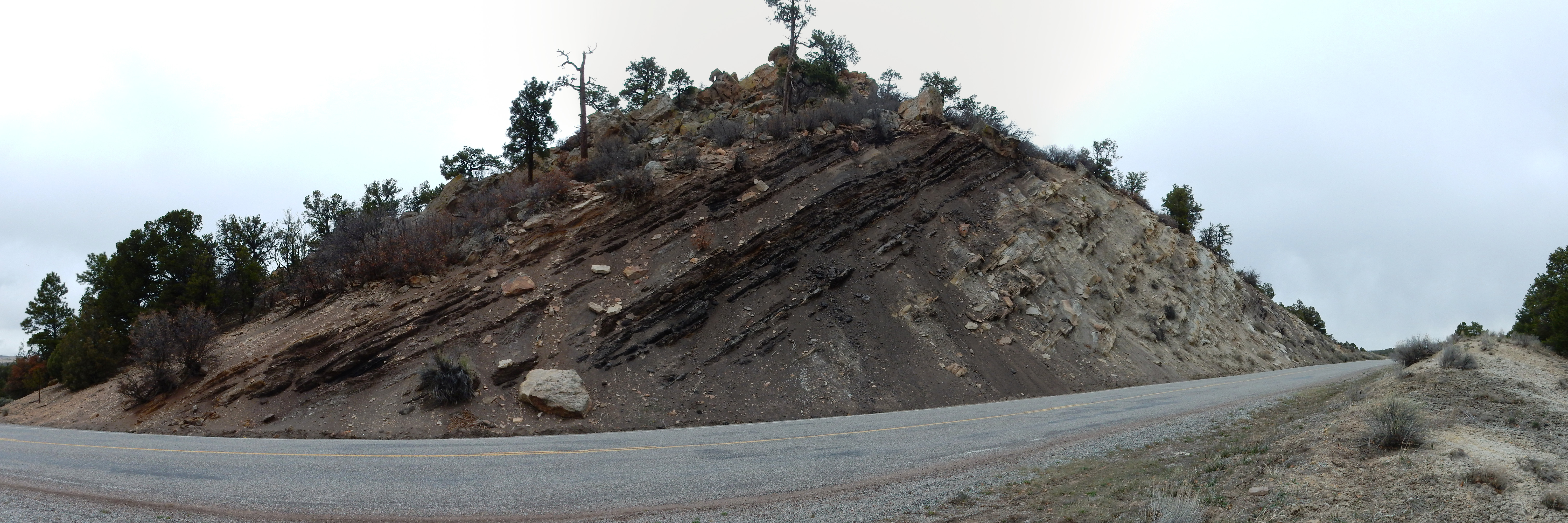
This is part of a hogback ridge underlain by Mesaverde Group beds. Most of the rock here is from the Menefee Formation, with just a thin cover of the younger Cliff House Sandstone at left. The upper and lower parts of the Menefee Formation are coal-bearing; here, the beds are not rich enough in carbon to be worth mining, but in other locations in the San Juan Basin, great quantities of coal are mined to power the Four Corners power plant.
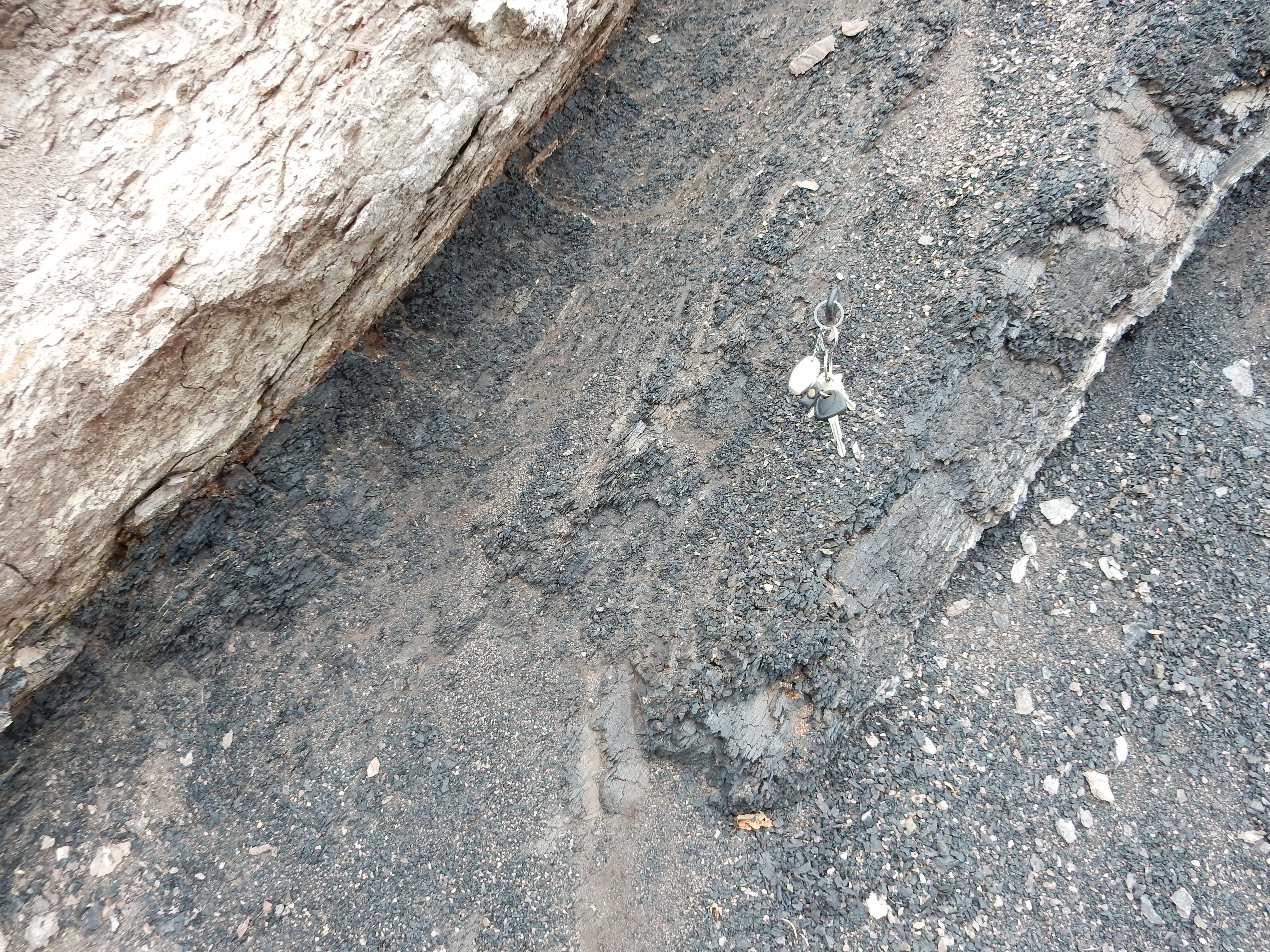
Notice how distinct the contact of the Menefee Formation, at right, with the Cliff House Formation, at left, is.
Middle Menefee Formation:
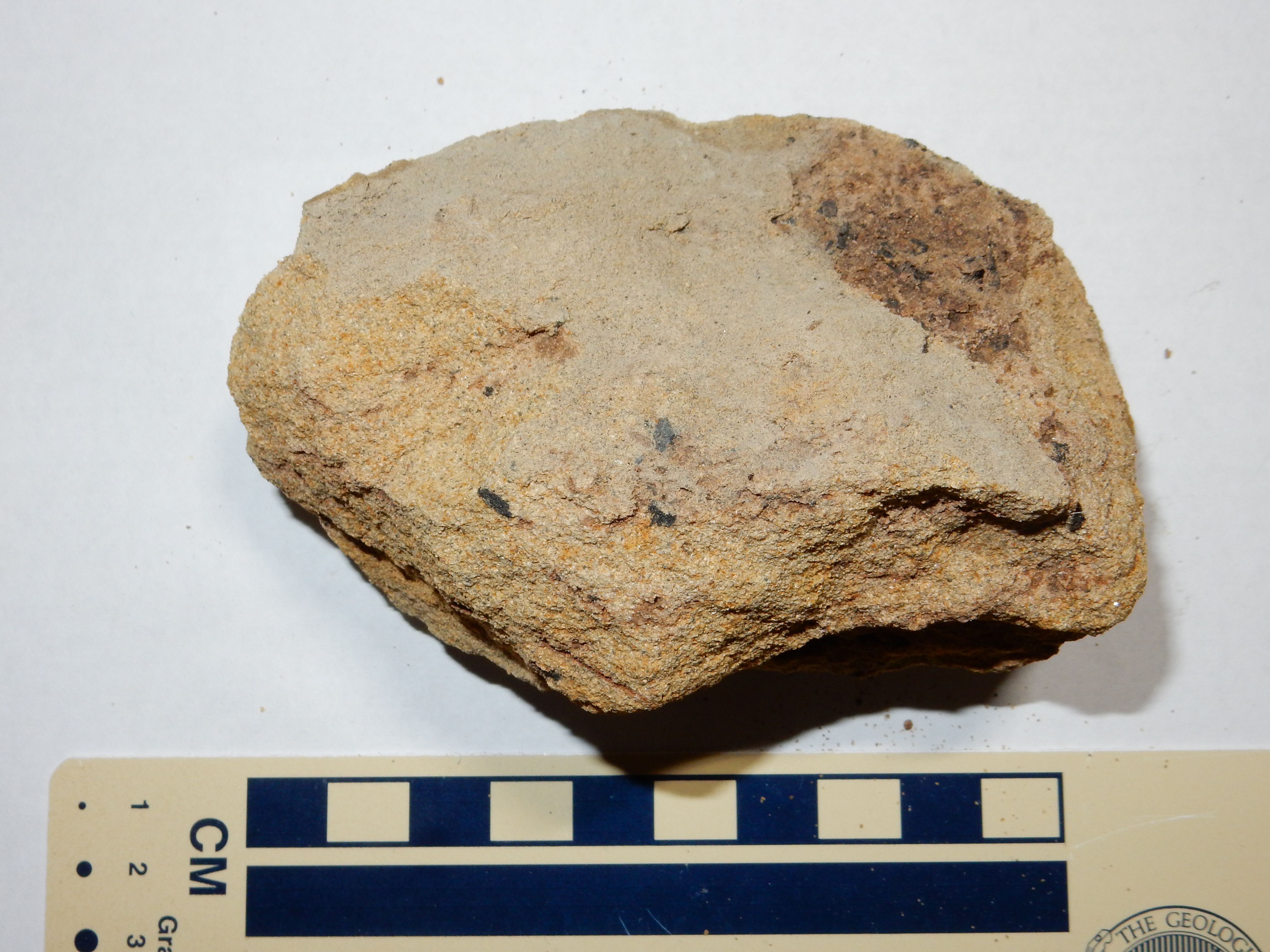
Notice the bits of fossilized wood in the sample.
Upper Menefee formation:
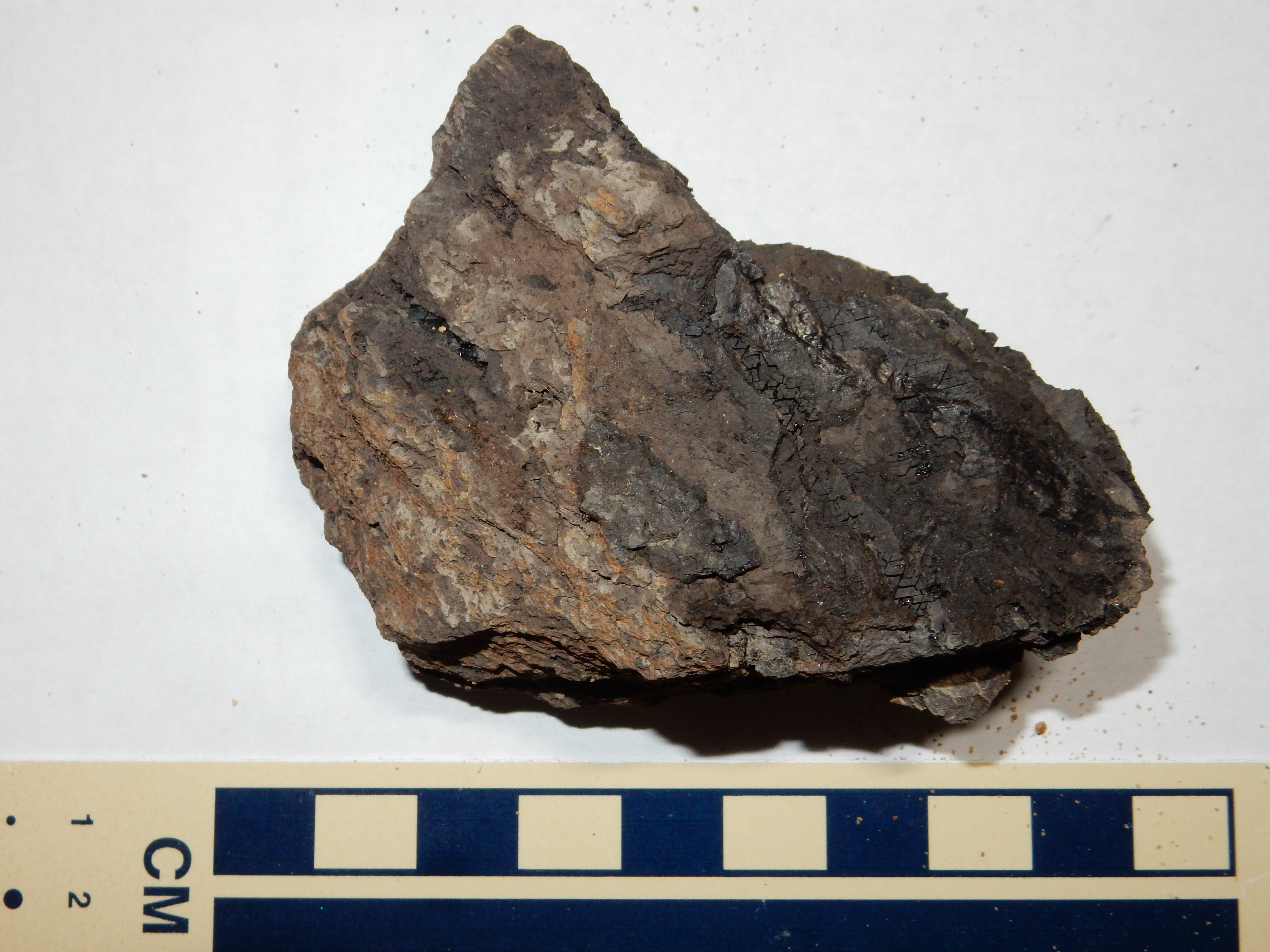
This is some not-quite-coal, shale rich in carbon but with too much clay admixture to be useful. I could not get it to ignite in a flame.
This hogback ridge extends along much of the west side of the
Sierra Nacimiento. It is prominent in the Cuba area.
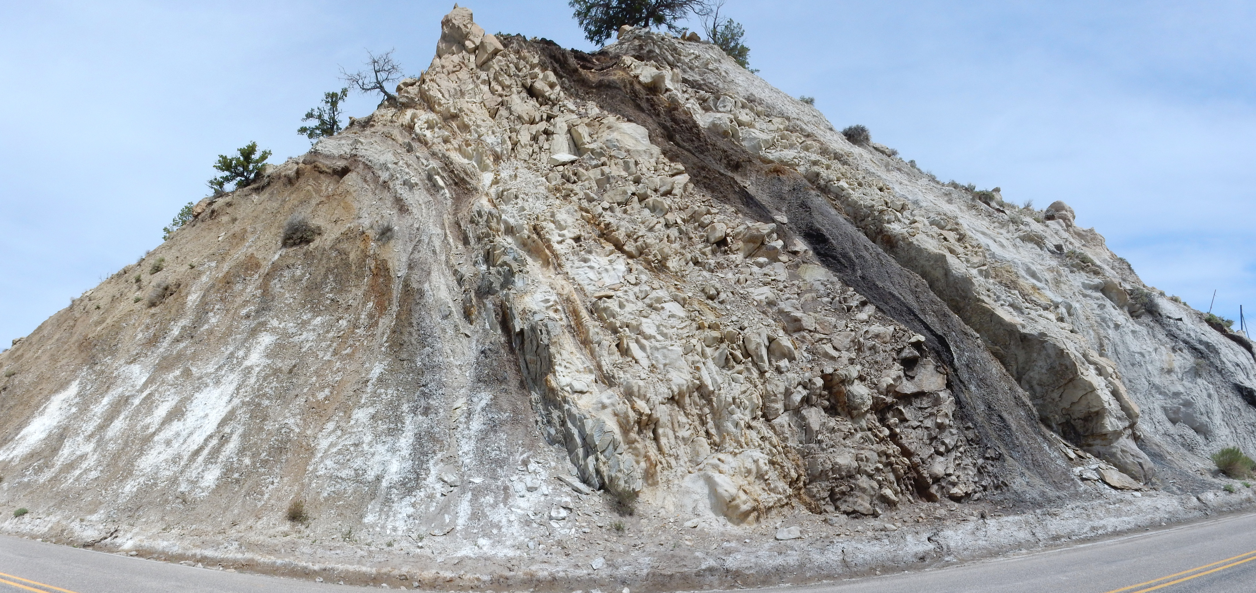
Menefee Formation southeast of Cuba. 35
58.877N 106 55.055W
Movement along the Nacimiento Fault, a major fault to the east,
has deformed the beds so much that they are slightly overturned
here, with the Cliff House Sandstone to the left underlying the
older Menefee beds to the right. The formations are also
significantly thinner here, close to the Sierra Nacimiento, than
at La Ventana Mesa. This suggests that the Sierra Nacimiento was
already beginning to be uplited at the time of the Mesaverde
regression.
The retreat of the sea in the middle Cretaceous was only
temporary. The return of the sea deposited another layer of beach
sand, the Cliff House Sandstone. We saw photographs of this in the
previous section, capping the Menefee Formation. Here's a sample
from the road cut shown there:

This is a moderately well sorted sandstone, with angular grains and many lithic fragments. Not a particularly mature sandstone.
Here's the Cliff House Formation north of Ventana Mesa, where the road approaches the formation.
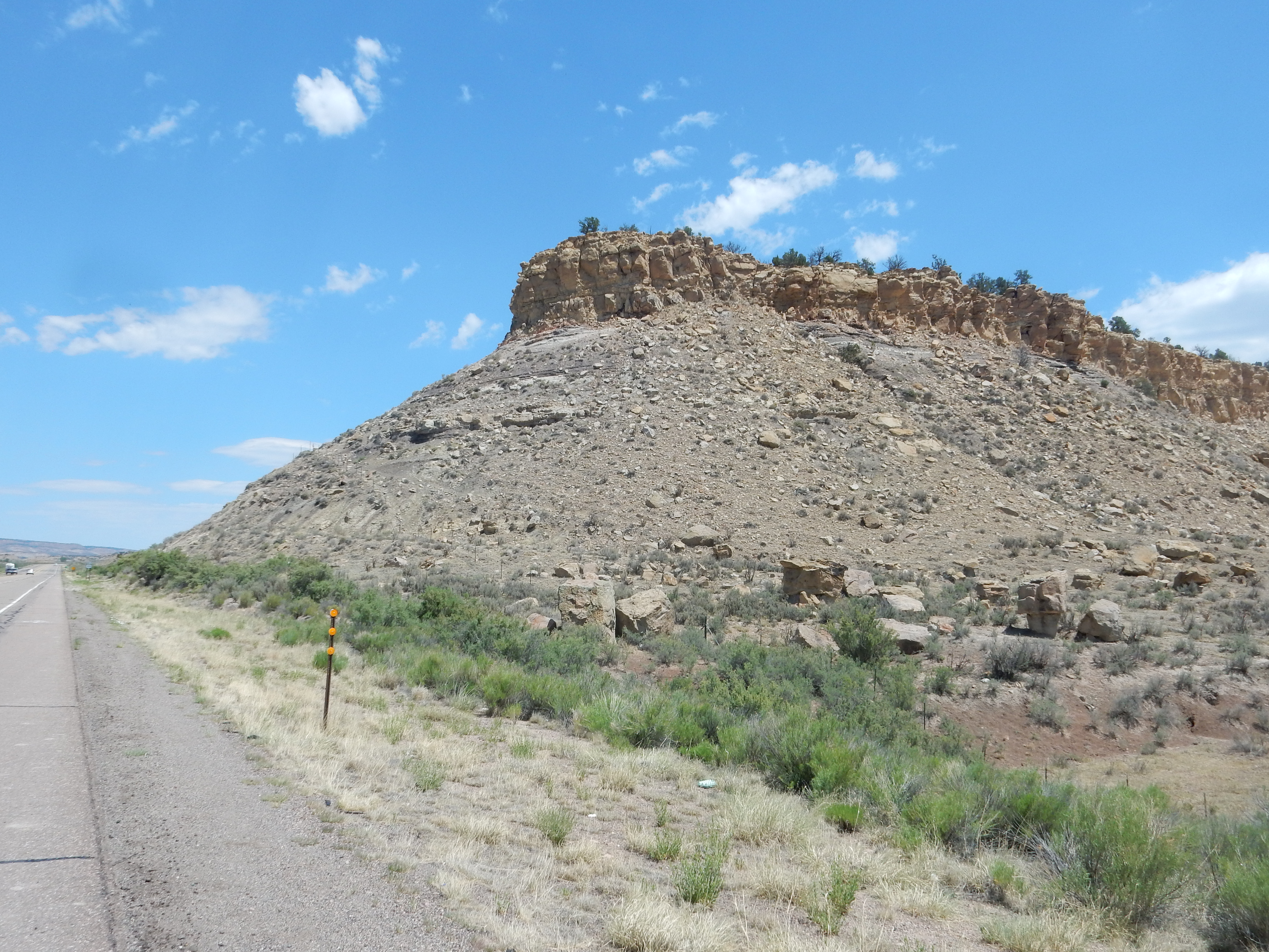
Cliff House Formation north of La Ventana Mesa.
35
51.572N 106 58.303W
The mesa is capped with Cliff House Formation, over softer beds of Menefee Formation. Blocks of Cliff House Formation have broken off and litter the lower slopes, where they can be sampled.
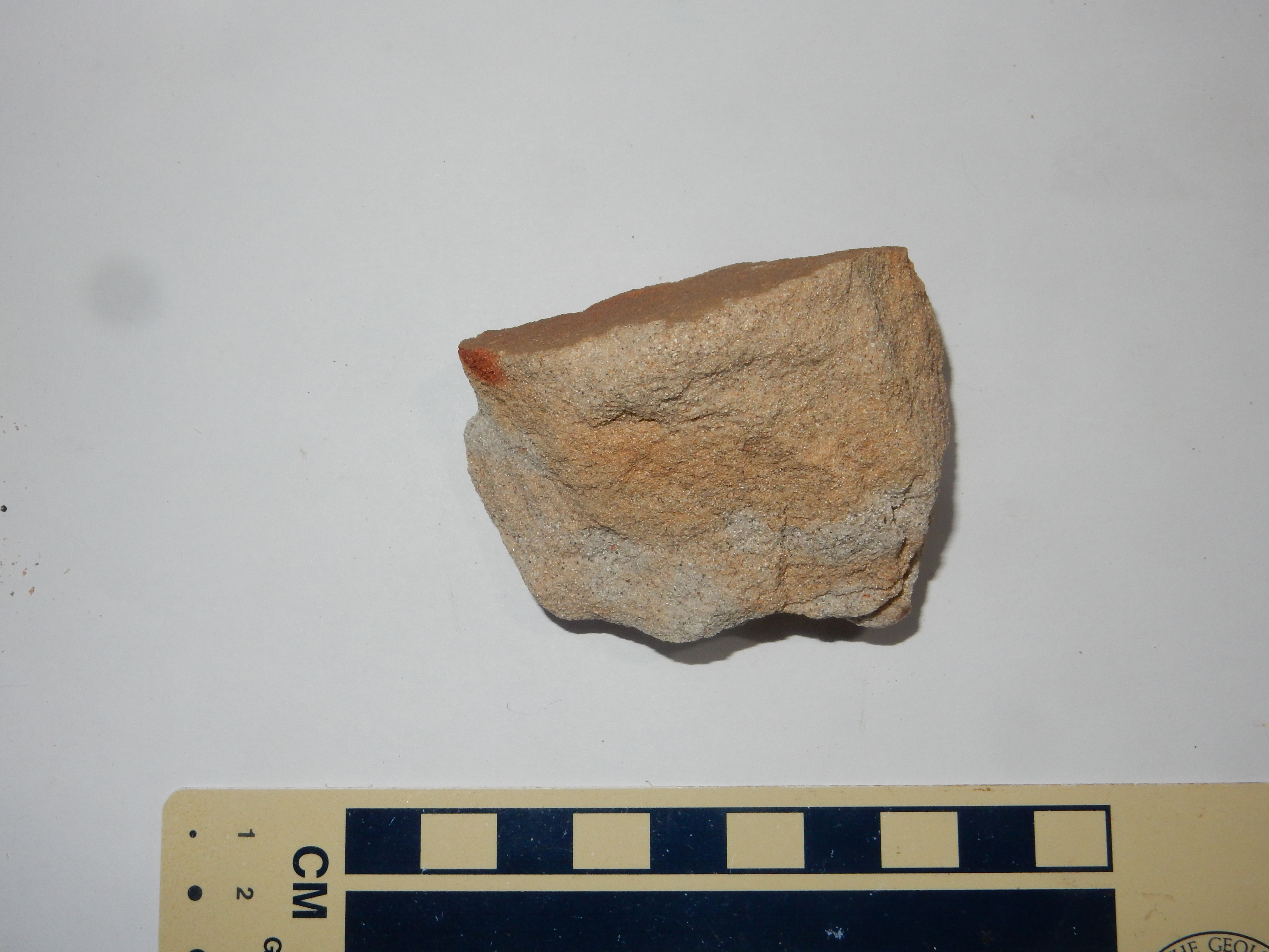
Cliff House Formation north of La Ventana Mesa.
35
51.572N 106 58.303W
This sandstone is dirtier than the Point Lookout Sandstone. It is
richer in the “pepper” lithic grains, and it has considerable
content of feldspar grains, now weathered into clay nodules. I saw
no feldspar grains in the Point Lookout Sandstone. These suggest
that granitic bedrock was exposed somewhere in the watershed by
this point in time — about 75 million years ago.
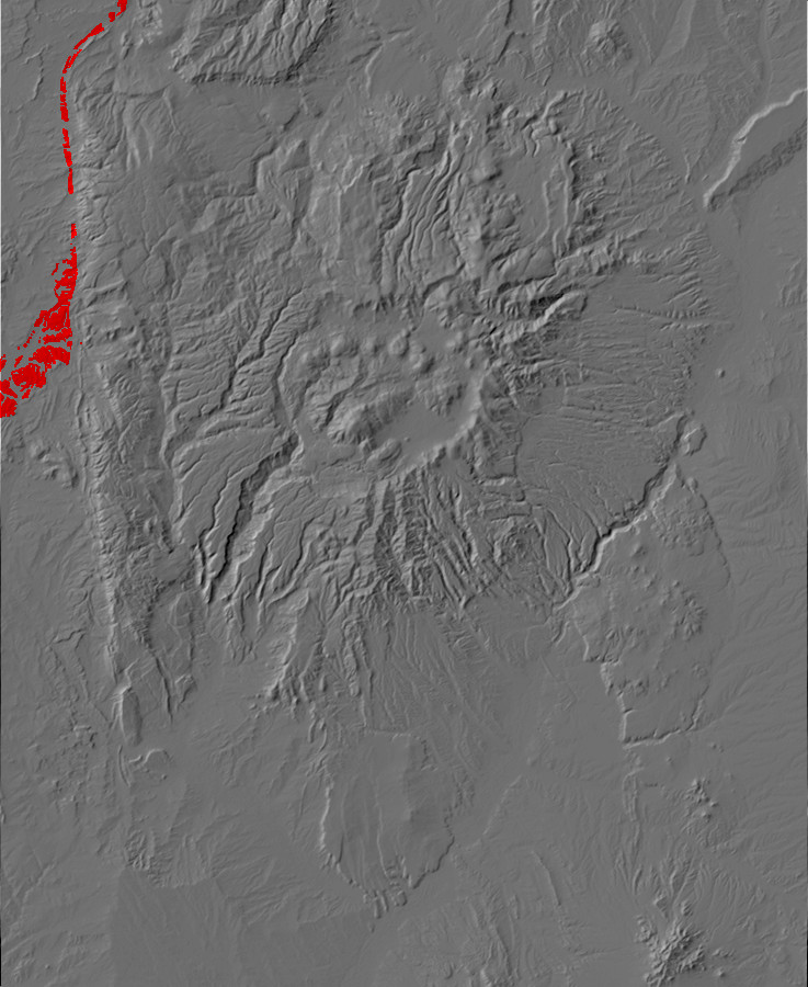
Relief map of the Jemez with Lewis Formation
outcroppings highlighted in red.
With the return of the sea, marine shale began to be laid down
again, closely resembling that of the Mancos Formation except for
its marker fossils and stratigraphic position. This is the Lewis
Shale. It is exposed southeast of Cuba
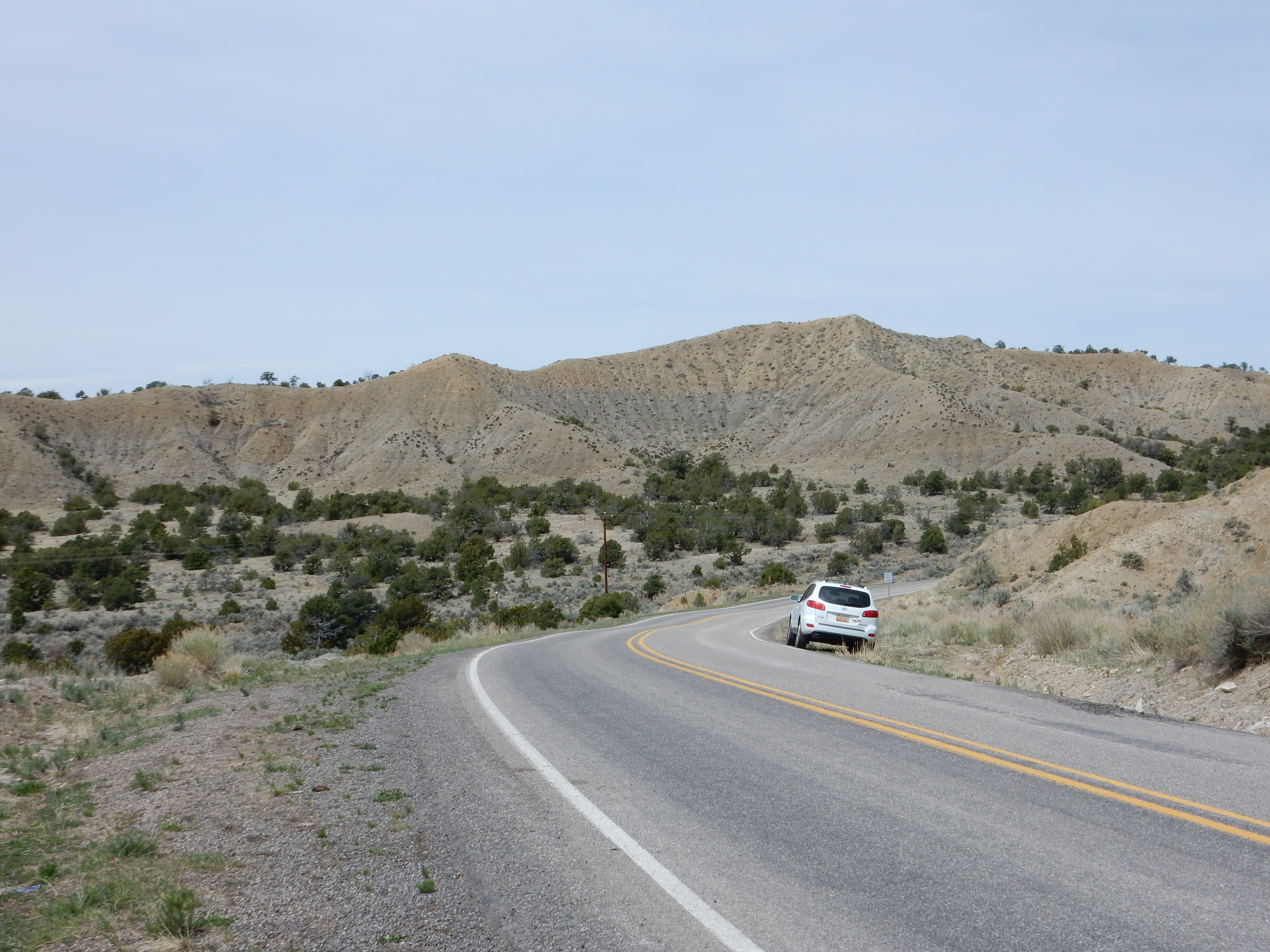
and south and southeast of Portales Mesa
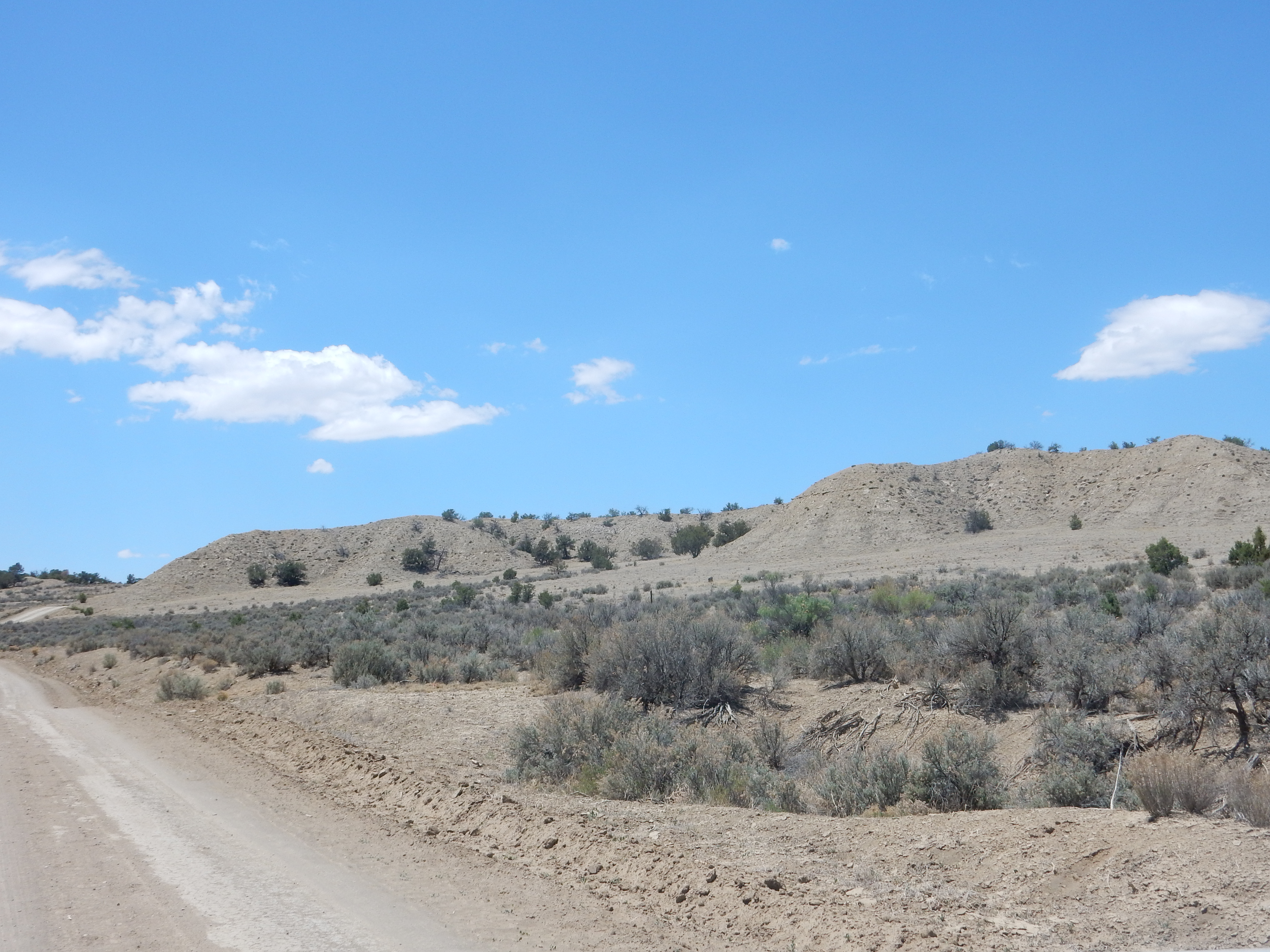
Lewis Shale southeast of Portales Mesa. Near 35
52.294N 107 00.508W
I am sometimes pretty down on marine shales, which tend to form low, drab hills that turn into mud at the least excuse, but darned if the beds here aren’t almost pretty. On the other hand, it is not nearly as rich in fossils as the Mancos Shale.
Here is an exposure in a road cut.
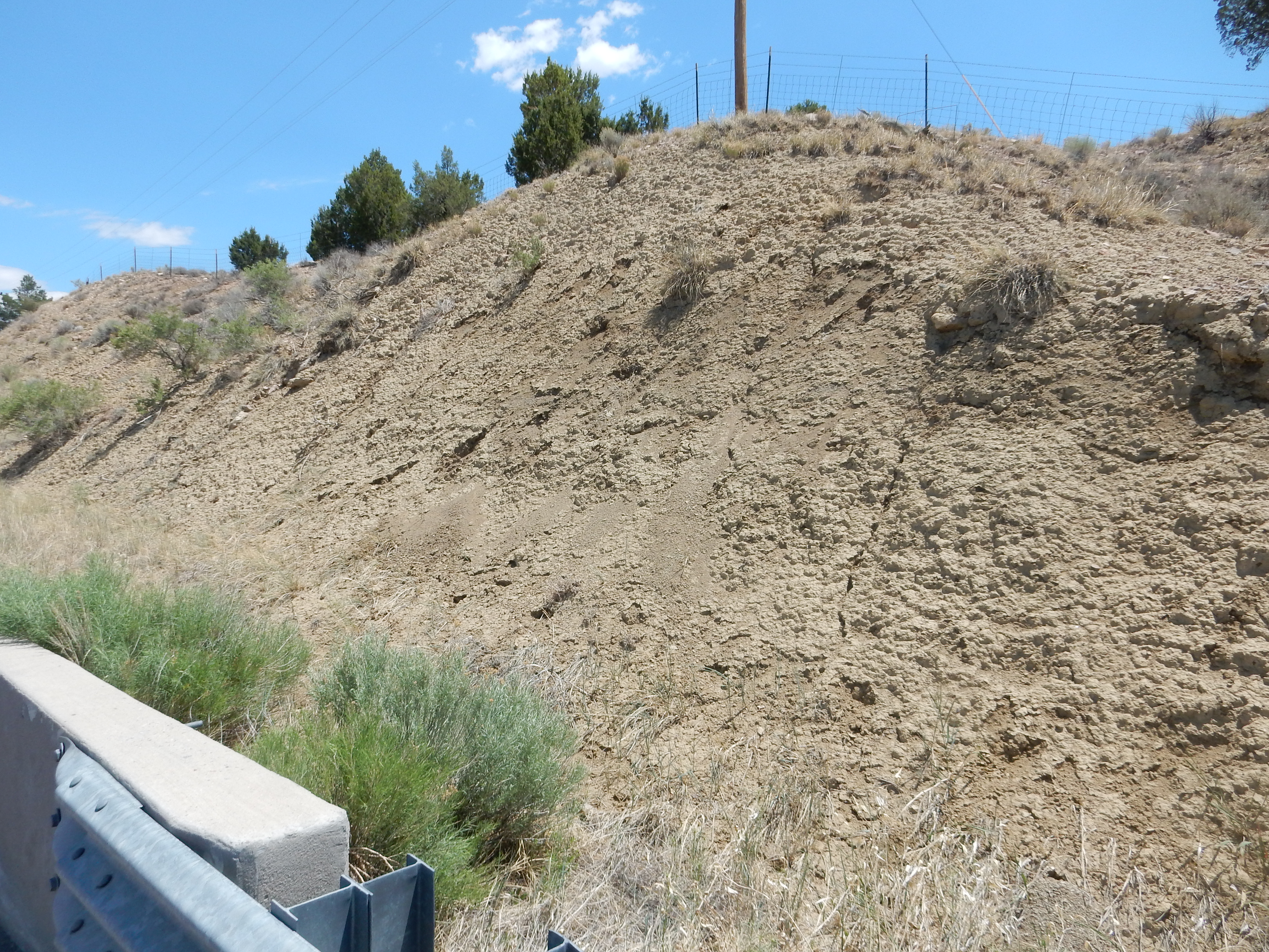
Lewis Shale. 35
53.496N 106 58.619W
Notice the distinctive "popcorn" texture of the weathered surface. This is characteristic of sediments containing large quantities of bentonite, which we learned in the last chapter is clay rich in the mineral, montmorillonite. This form of clay expands significantly when it is moistened and shrinks when dry, which produces the popcorn texture. Popcorn texture is common in the Mancos Shale, but seems more so in the Lewis Shale.
Here is a sample from southeast of Portales Mesa.
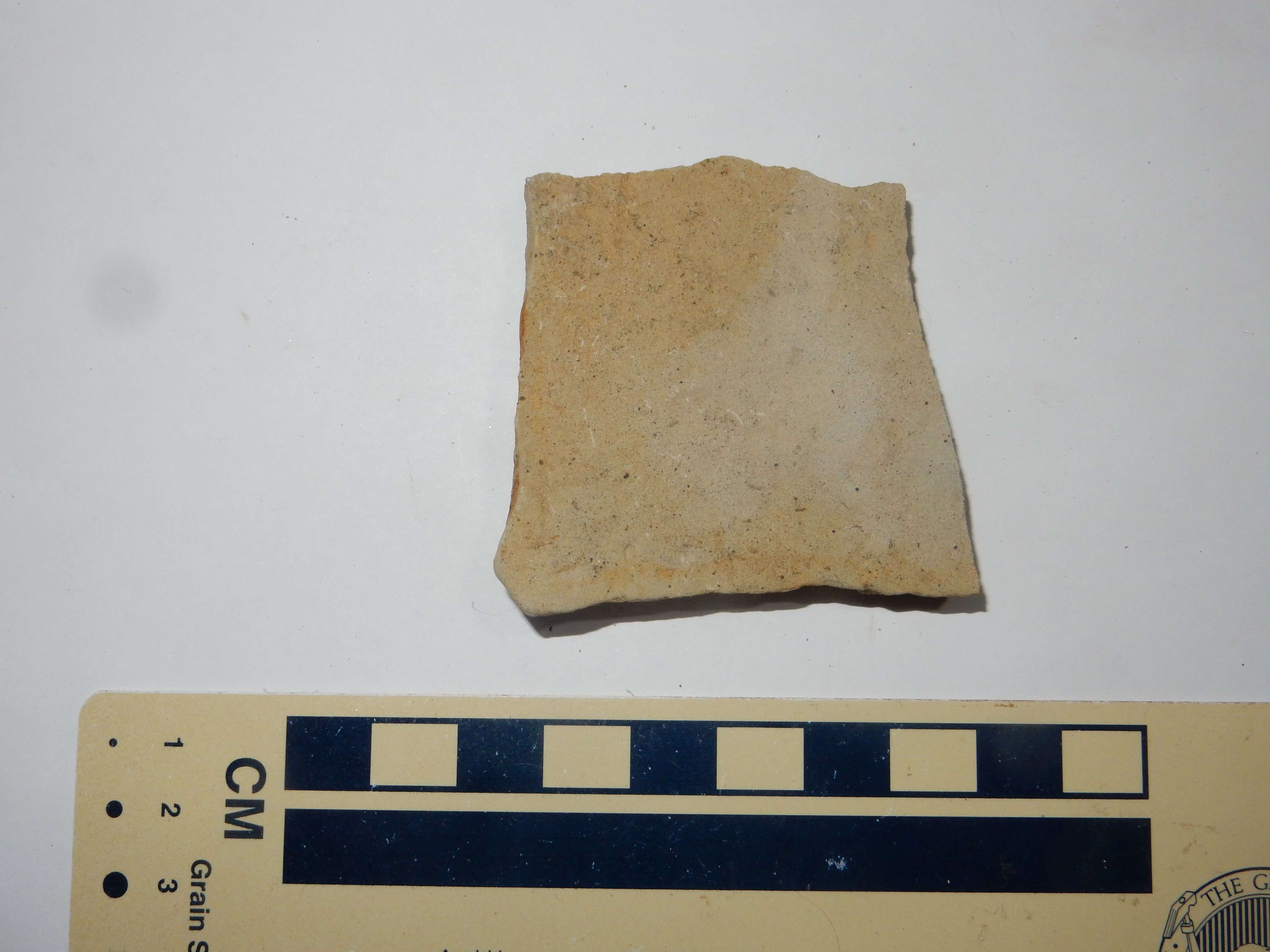
Lewis Shale southeast of Portales Mesa. Near 35
52.294N 107 00.508W
This sample is calcareous shale (or shaly limestone) interbedded
with the more predominant muddy shale of the Lewis Formation. A
notable feature of these beds is the almost complete absence of
any fossils.
In addition to surveying part of the Colorado Plateau in
1873-1875, G.K. Gilbert gave some of the first accurate
descriptions of the mountain ranges bordering the Colorado Plateau
in New Mexico. Gilbert realized that the Sandia Mountains were a
fault block: "a great, but simple, monoclinal mass, bounded on the
west by a profound fault, along the line of which is the river
valley." He estimated the displacement along the fault on the
western face as at least 11,000' (3,300 m), not much less than the
modern estimate. Gilbert concluded that the Rocky Mountains had
been uplifted only after the end of the Cretaceous. Gilbert was
only a little off: The first stirrings of the Laramide Orogeny
were in the late Cretaceous, and the effects were not felt in the
Jemez region until near the start of the Tertiary.
The Lewis Shale was laid down around 72 million years ago. By this time, the Jemez area had been tectonically quiet since the Ancestral Rocky Mountains were thrown up, 300 million years earlier, and so had experienced 230 million years of slow accumulation of sediments on the basement rock. However, the slow subsidence of the area was beginning to reverse, due to tectonic changes leading to the Laramide Orogeny.
Some 124 million years ago, just before the Burro Canyon Formation began to be laid down in New Mexico, a mantle plume rose into a triple junction located somewhere southwest of North America. This was the meeting point of the Pacific Plate, the Farallon Plate, and a third plate, the Izanagi Plate, The heat of the plume enhanced the magma production already taking place at the triple junction, creating a vast underwater plateau.
Because the plateau was formed over the triple junction, it soon
rifted into three sections. One section still exists today as the
Shatsky Rise, a group of three underwater massifs located in the
deep ocean basin midway between Hawaii and Japan. Another section
likely was carried into Mexico. The third is thought to have been
subducted under western North America, starting around 80 million
years ago.
Oceanic crust of the Farallon Plate had been subducting under the
western margin of North America since the Antler Orogeny of the
Mississippian. The subduction zone was much like most subduction
zones seen today, with the subduction crust going into the mantle
at an angle around 45 degrees. However, the thickened oceanic
crust created by the Shatsky plume made the plate more buoyant,
and it began to subduct at an unusually shallow angle, less than
25 degrees. There is also evidence of a sharp rise in the
spreading rate at about this time, from 7-8 cm per year to 15
cm/year.
This put powerful compression forces on the overlying crust. The crust began to buckle, becoming deeply faulted and throwing up high mountains separated by deep basins. Most of the mountain ranges we see in New Mexico today formed along fault lines established during the Laramide Orogeny. The shallow subduction also produced volcanism far inland from the continental margin. This began sweeping east around 70 million years ago, producing volcanic fields in what is now southwestern New Mexico (the Mogollon-Datil volcanic field) and other locations in western North America. This burst of volcanism is known as the mid-Tertiary ignimbrite flareup.
The Sierra Pampeanas of South America may be a modern analogue of
Laramide-style compression.
The beginning of the Laramide Orogeny marked the end of the
Western Interior Seaway, which began its final retreat to the
northeast.
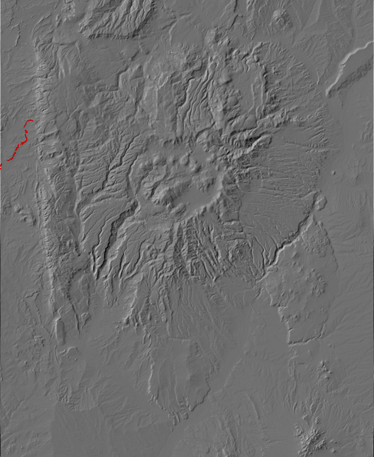
Relief map of the Jemez with Pictured Cliffs Formation
outcroppings highlighted in red.
The final regression of the Western Interior Seaway, around 77
million years ago, is marked by the Pictured Cliffs Formation,
another sandstone bed. This formation is mapped in the Cuba area,
but it is very poorly exposed compared with the thicknesses to the
north, in the Mesa Verde area, or to the west, along Chaco Canyon.
This formation is not particularly well cemented in this area and
rarely forms the hogbacks or mesa caps formed by other sandstone
formations. There are poor exposures at the foot of Mesa Portales,
just west of the Jemez region.
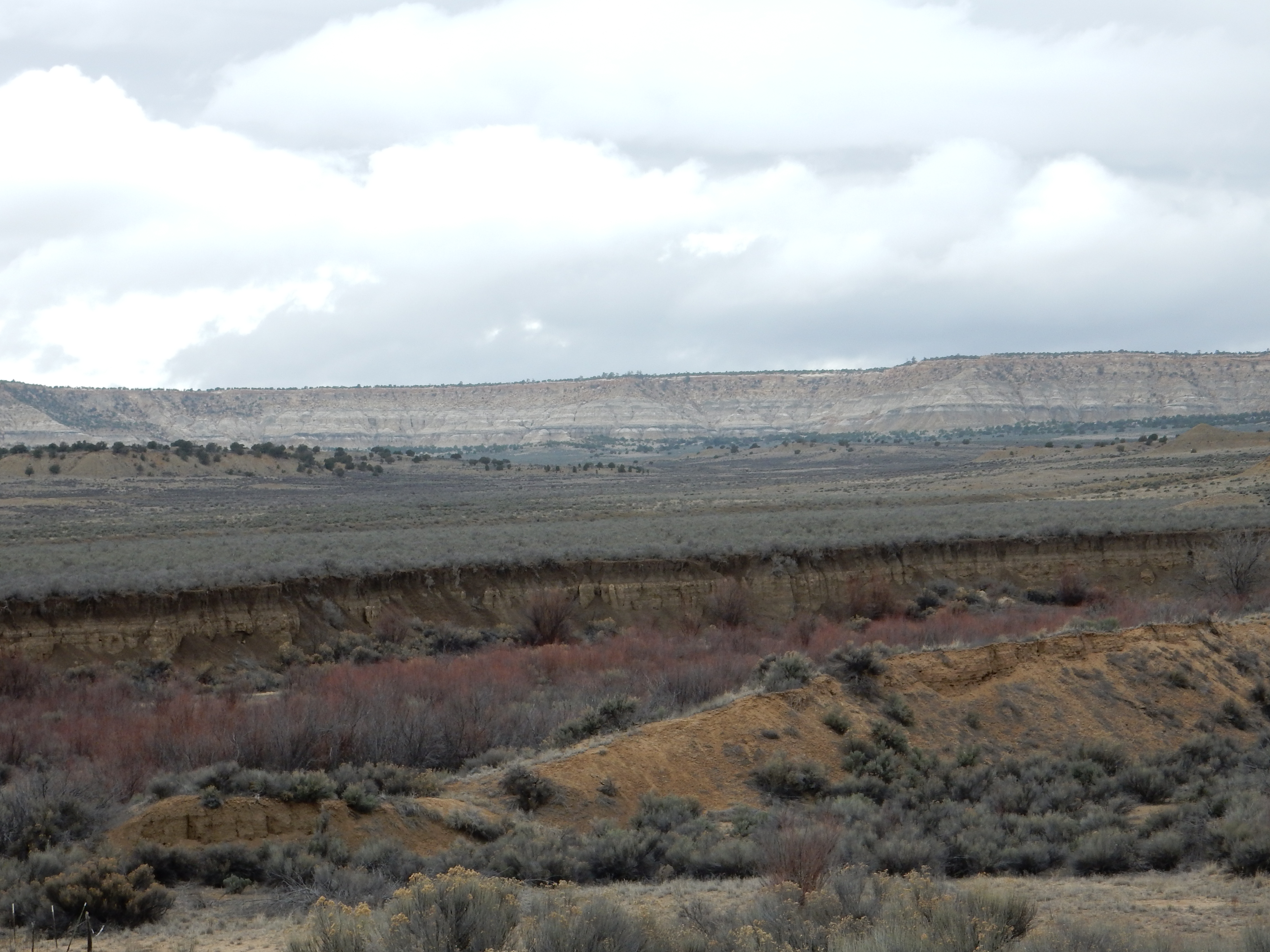
Mesa Portales, Looking northwest from 35
53.658N 106 58.497W
The mesa exposes the upper column of the Cretaceous in this area. In the foreground is Lewis Shale, while the Pictured Cliffs Formation is found at the very foot of the mesa. Above this formation are the Fruitland and Kirtland Formation, while the mesa cap is the Ojo Alamo Formation, thought to straddle the Cretaceous-Tertiary boundary.
Part of the difficult is that, in the Cuba area, the Pictured Cliffs Formation seems to consist largely of sandy shale, difficult to distinguish either from the underlying Lewis Formation or the overlying Fruitland Formation. For example, the geologic map places this road cut squarely in the Pictured Cliffs Formation
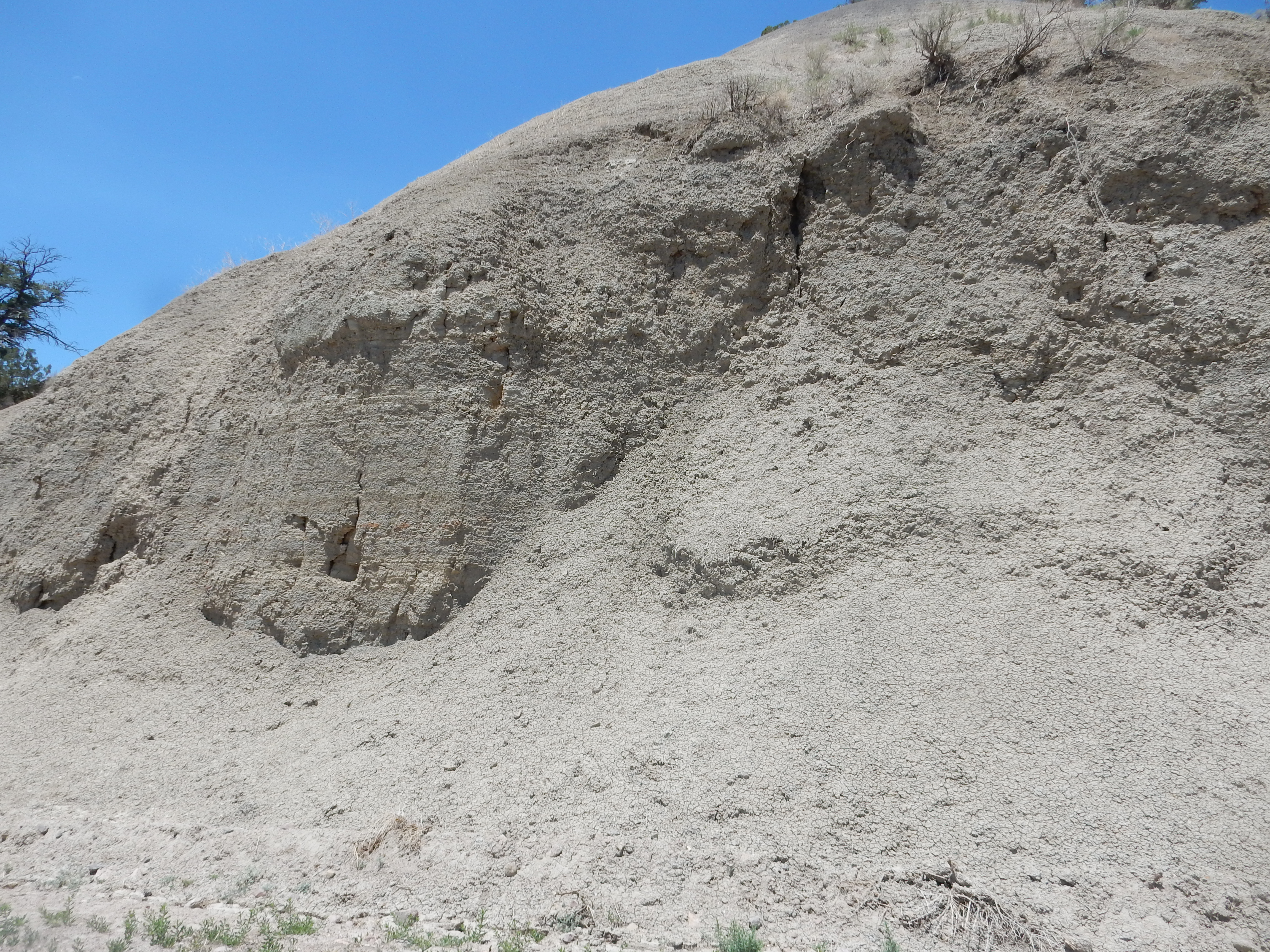
Pictured Cliffs Formation or Lewis Shale? 36
01.641N 106 55.964W
but this looks like a fine exposure of shale of the Lewis
Formation.
This deep telephoto shot looks at a sequence of increasingly
older beds tilted by the Nacimiento Fault.

Pictured Cliffs Formation in middle distance. 36
00.597N 106 56.318W
The white beds at center are the Fruitland and Kirtland
Formations. The brownish ridge behind is mapped as Pictured Cliffs
Formation. Beyond that is a melange of distorted beds of Lewis
Shale and Mesaverde Group disturbed by the Nacimiento Fault.
Beyond the fault are red beds of the Abo Formation lapping onto
the San Pedro Quartz Monzonite that underlies much of the northern
Sierra Nacimiento.
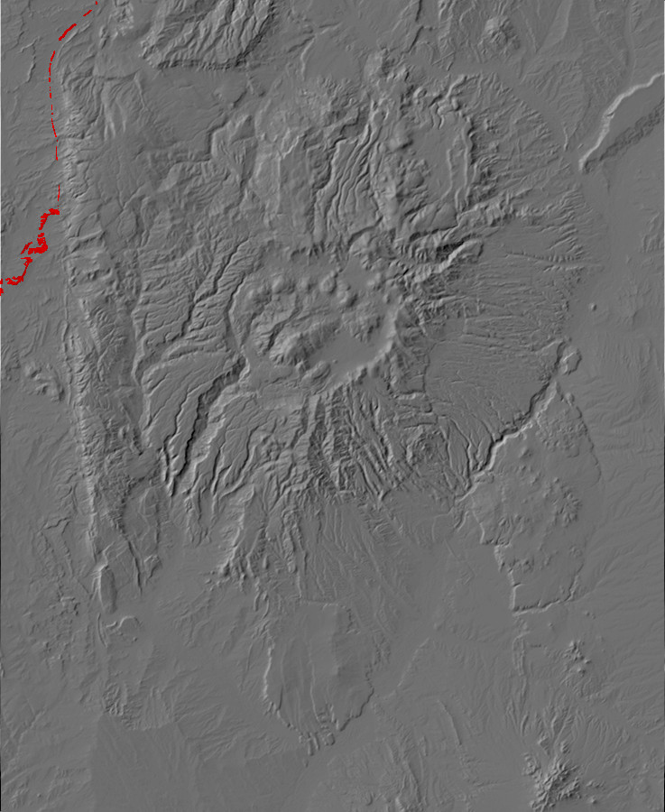
Relief map of the Jemez with Kirtland and Fruitalnd
Formation outcroppings highlighted in red.
With the retreat of the sea, New Mexico again was covered with
coal swamps, and coal beds in the Fruitland Formation are mined in
the Four Corners area. There are spectacular exposures of
the Fruitland Formation in the Bisti/De-Na-Zin
Wilderness Area in the San Juan Basin west of the Jemez
area. These include bright red beds of cinder, formed when coal
was ignited by lightning or wildfire and heated the surrounding
rock to high temperature.
The formations are exposed along Route 126 southeast of Cuba.
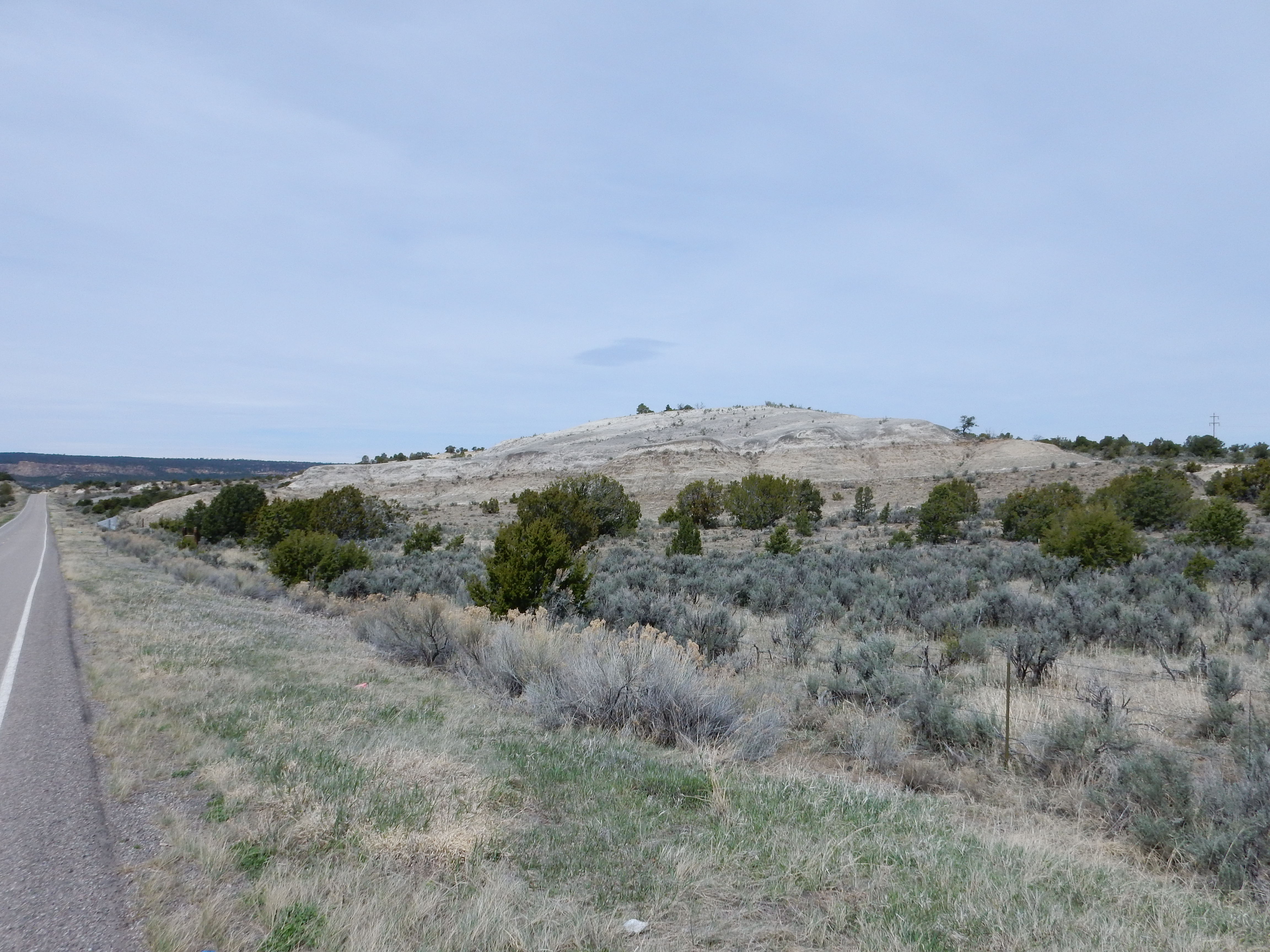
These are the youngest Cretaceous formations in the San Juan
Basin. They’re lumped together on the geologic map of this area
which, as you might guess, means they’re hard to tell apart in the
field. One team of geologists concluded that the Kirtland
Formation is actually missing from this area; another concluded
otherwise. The beds in this photo are likely Fruitland Formation.
The Fruitland/Kirtland Formations are often capped with resistant Ojo Alamo beds in the Cuba area.
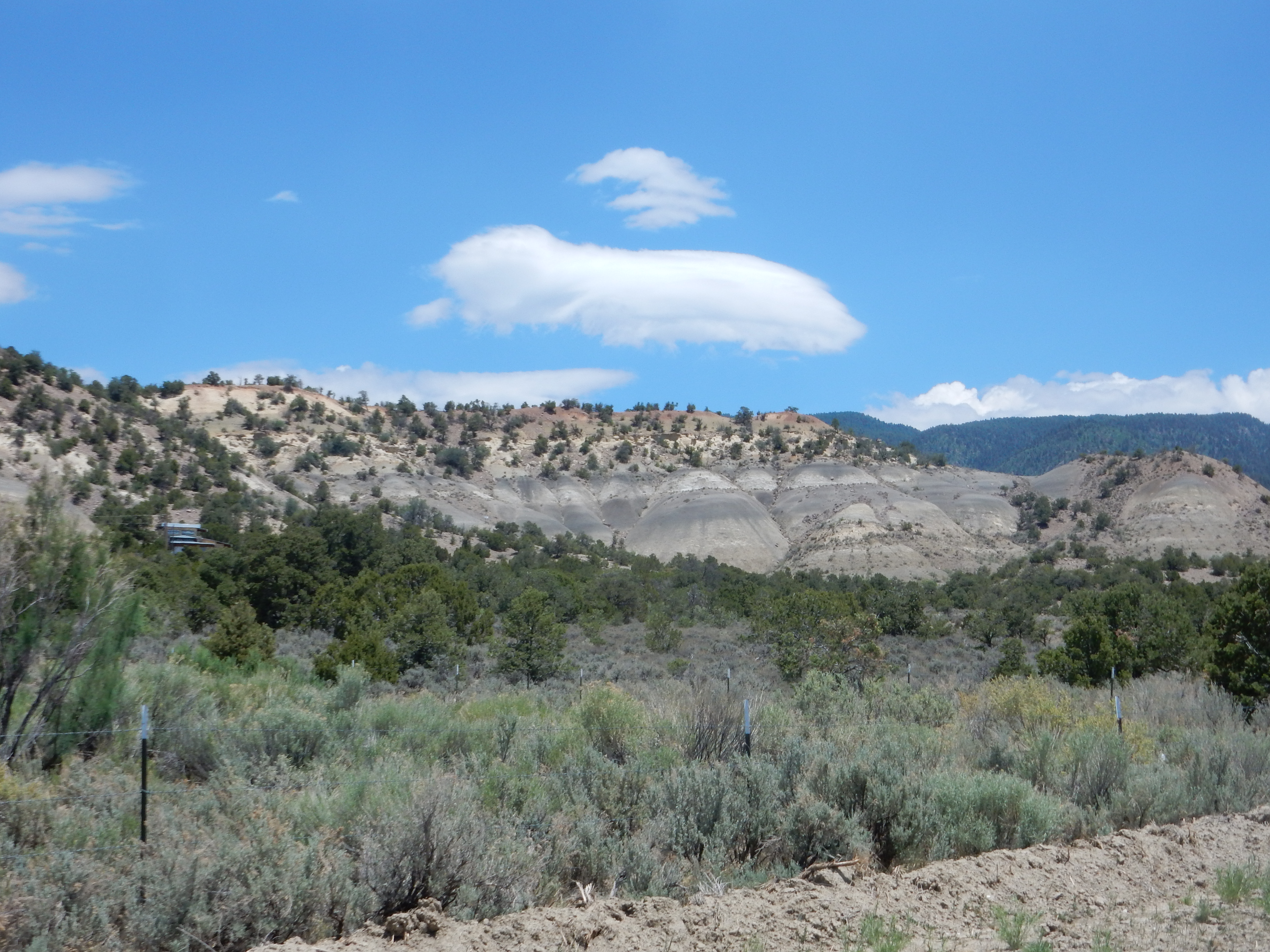
Fruitland and Kirtland Formations capped with
Ojo Alamo Formation. 36
01.630N 106 56.223W
The end of the Cretaceous was marked by the most famous mass
extinction in the fossil record. Unfortunately, no record of this
is preserved in the Jemez area, because the uppermost Cretaceous
and lowermost Tertiary beds were destroyed in the birth of the
Rocky Mountains during the Laramide Orogeny.
Next page: The end of (most of) the
dinosaurs and the rise of the mammals
Copyright ©2014-2017 Kent G. Budge. All rights reserved.
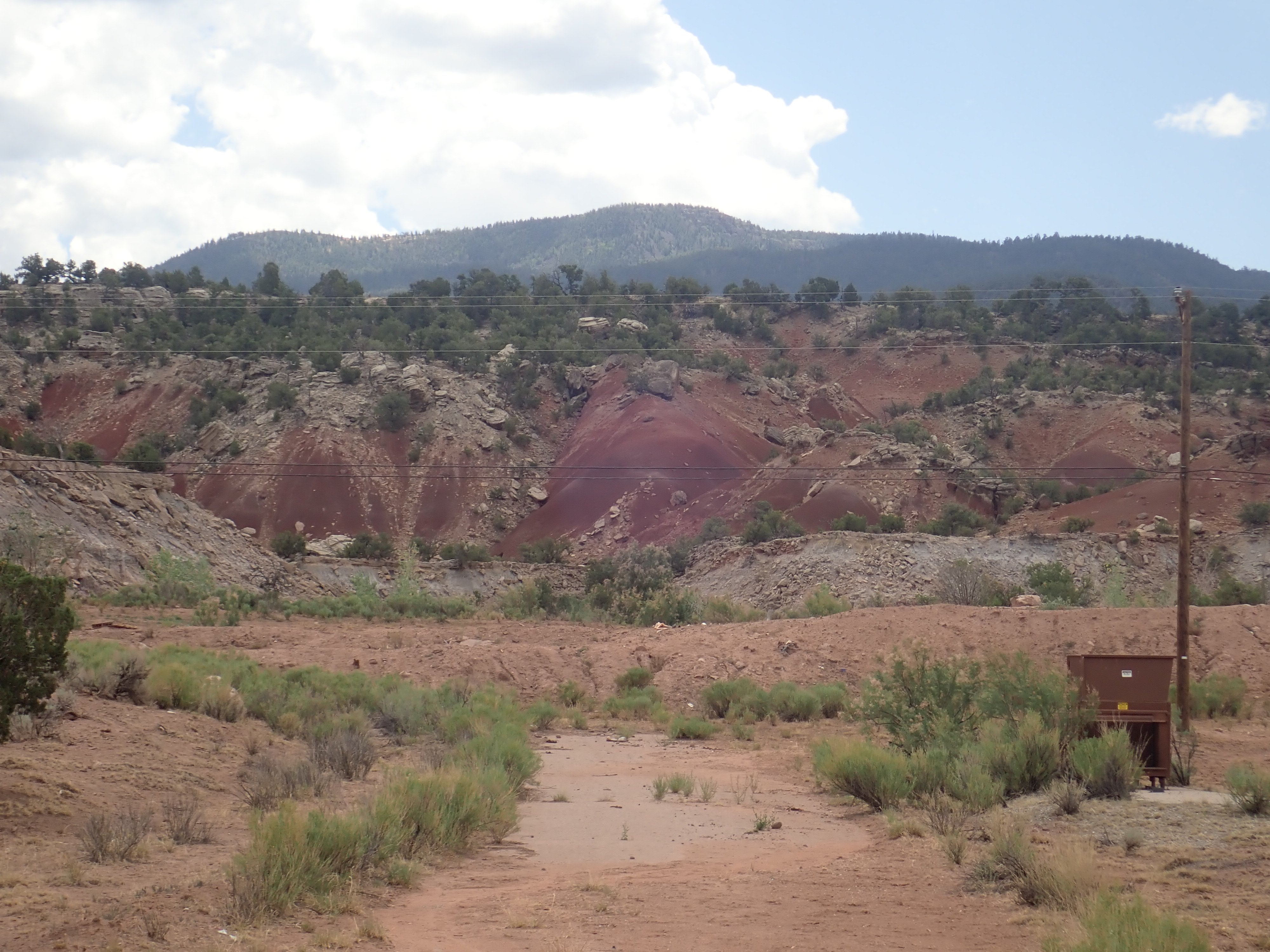
_2_(17338266745).jpg)