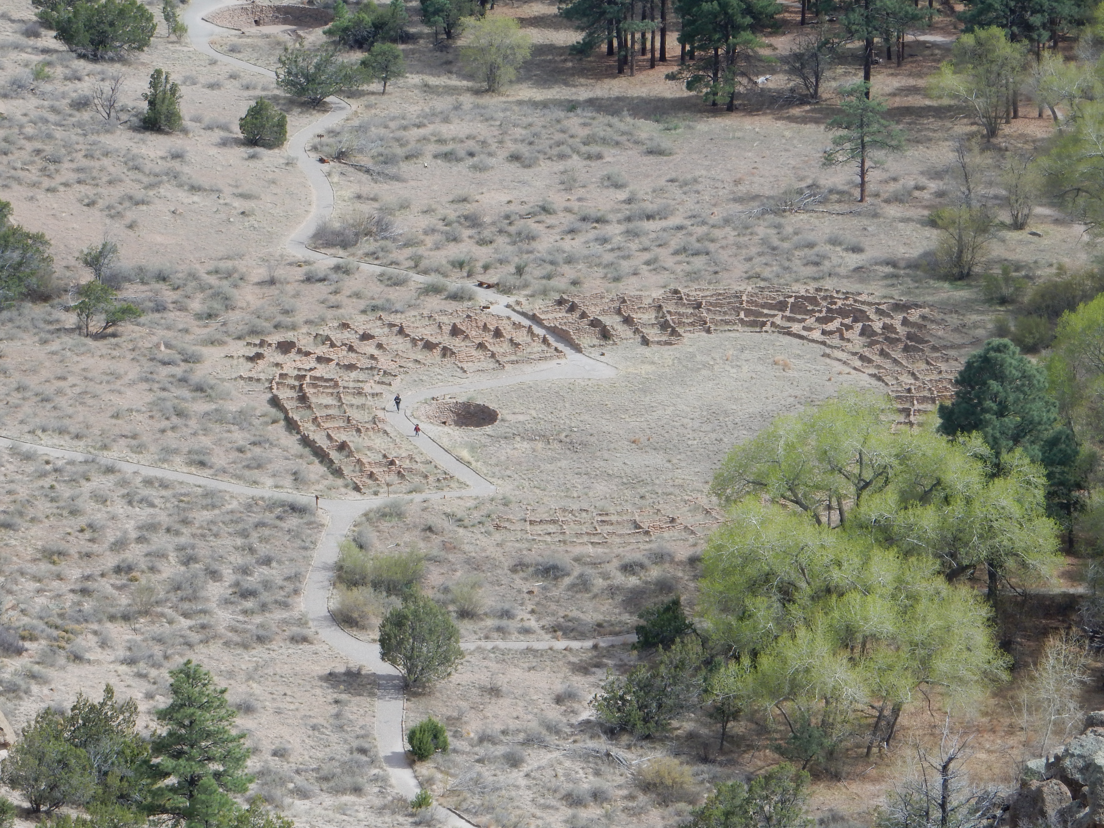
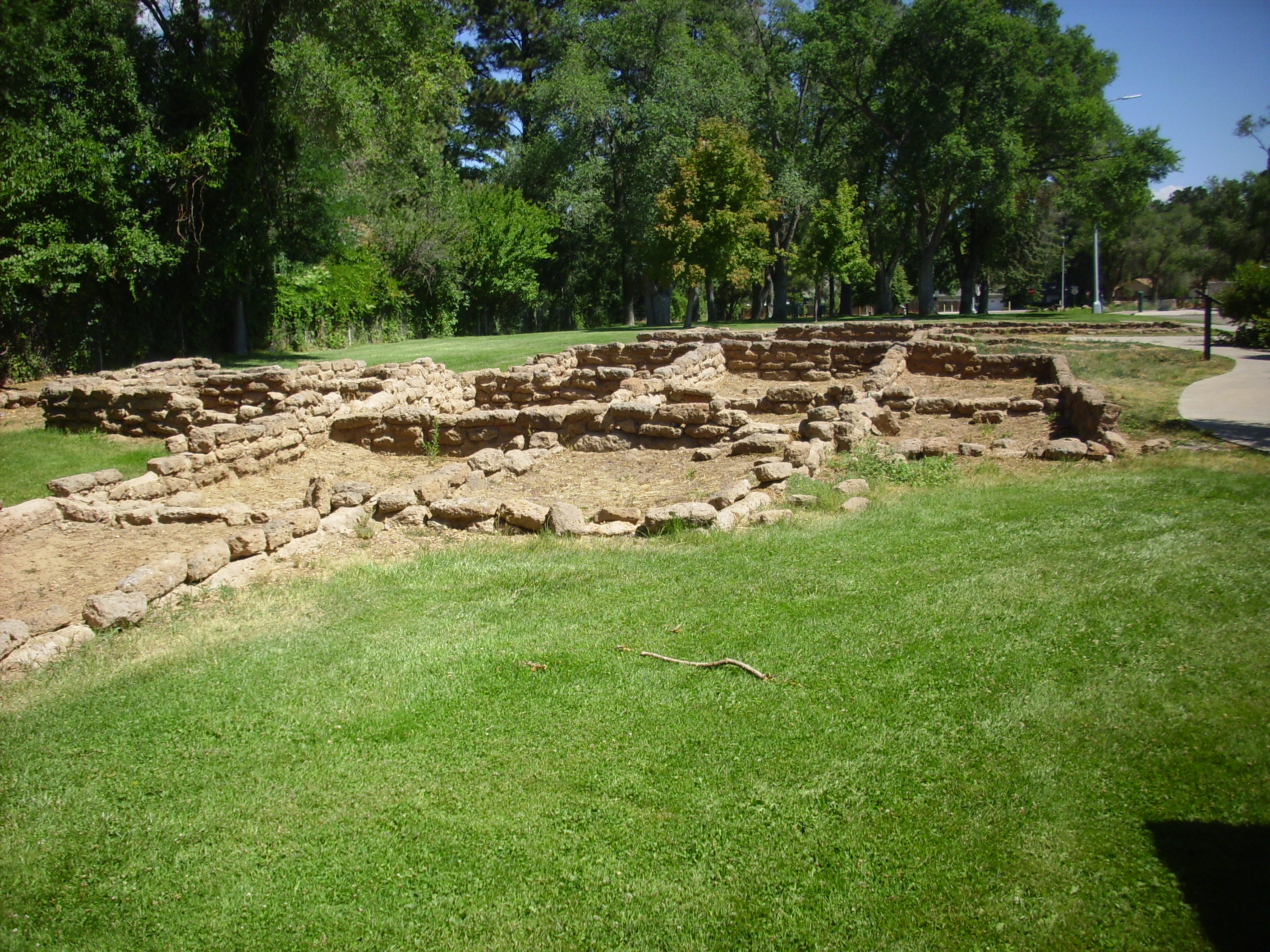
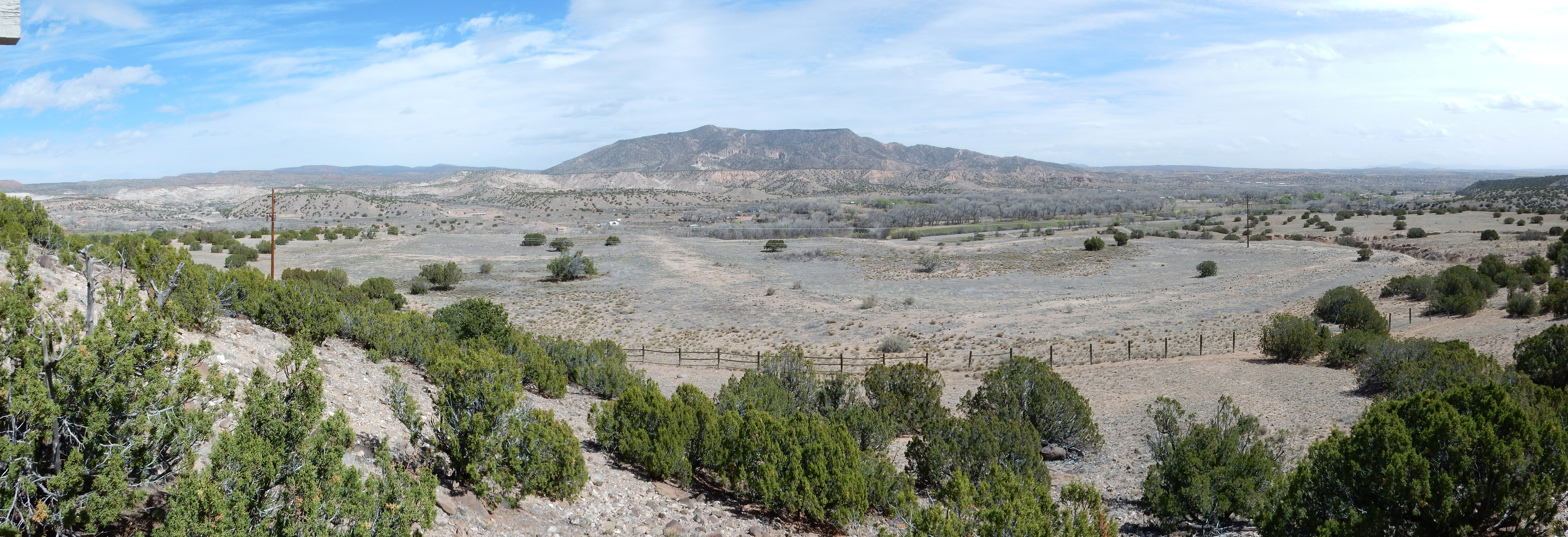
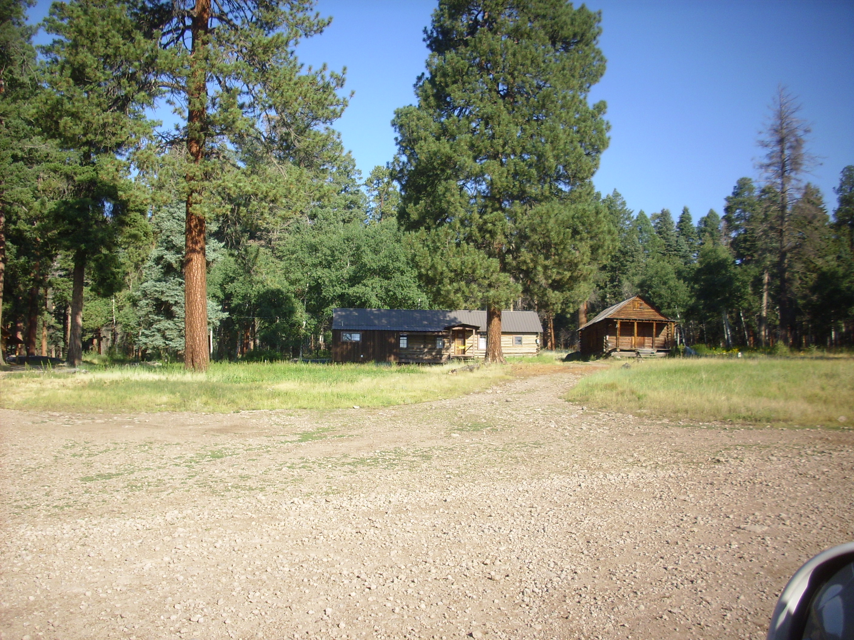
Tyuonyi Ruin at Bandelier National Monument. Looking south from 35 47.121N 10616.585W
The table of contents may be found here.
Tyuonyi Ruin at Bandelier National Monument. Looking
south from 35
47.121N 10616.585W
We do not know exactly when the first humans settled in the Jemez area. Humans, Homo sapiens, are a relatively young species; the genus Homo is thought to have emerged perhaps 2.8 million years ago, close to the start of the Quaternary, and Homo sapiens is perhaps 200,000 years old. The first humans to cross over the Bering Straits into North America arrived somewhere between 40,000 and 16,000 years ago. The oldest human artifacts in New Mexico, discovered at Clovis, are around 13,500 years old, or near the start of the Holocene.
In this chapter, we emerge from deep time into the Holocene, the age of historic Man.
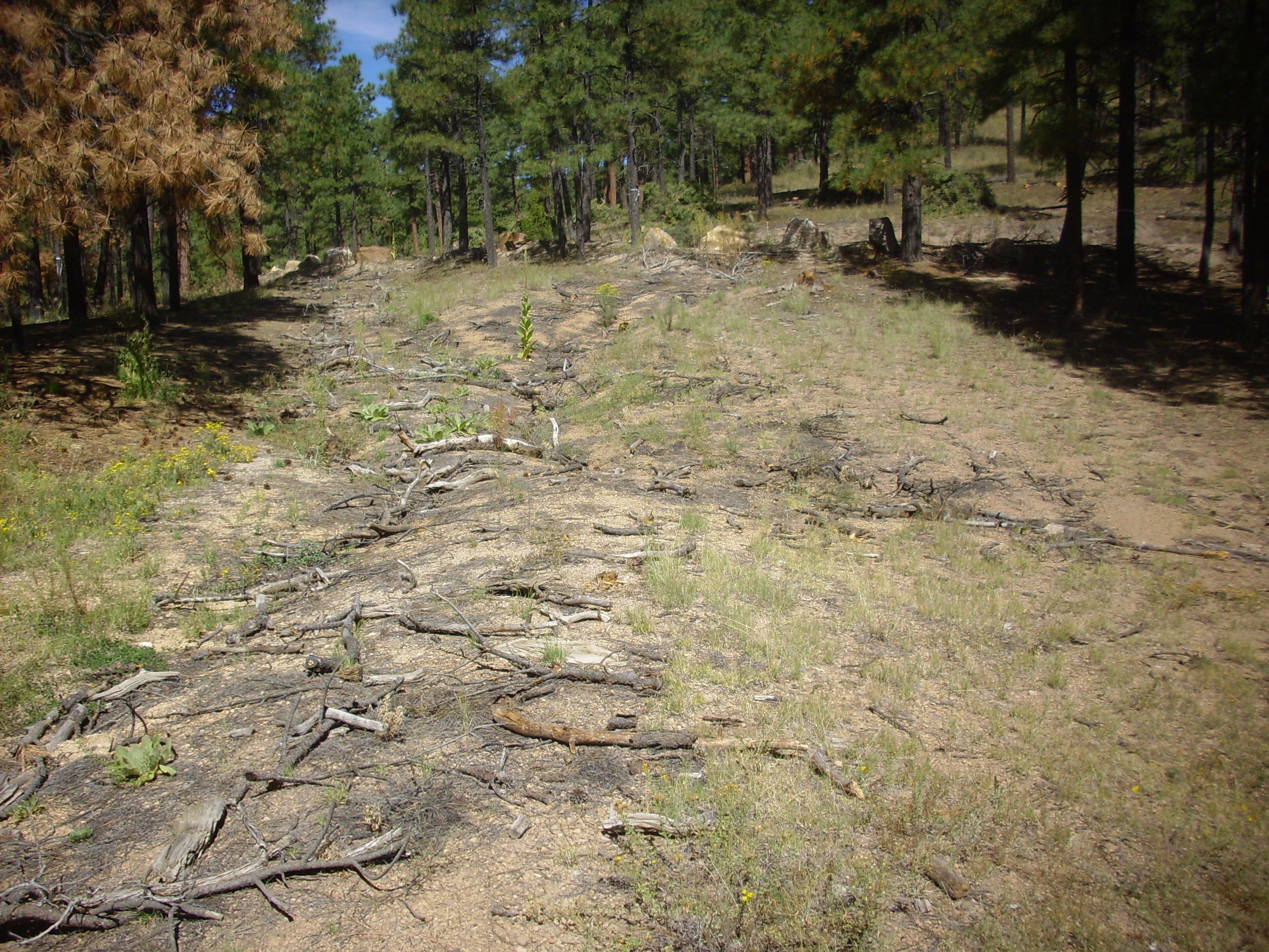
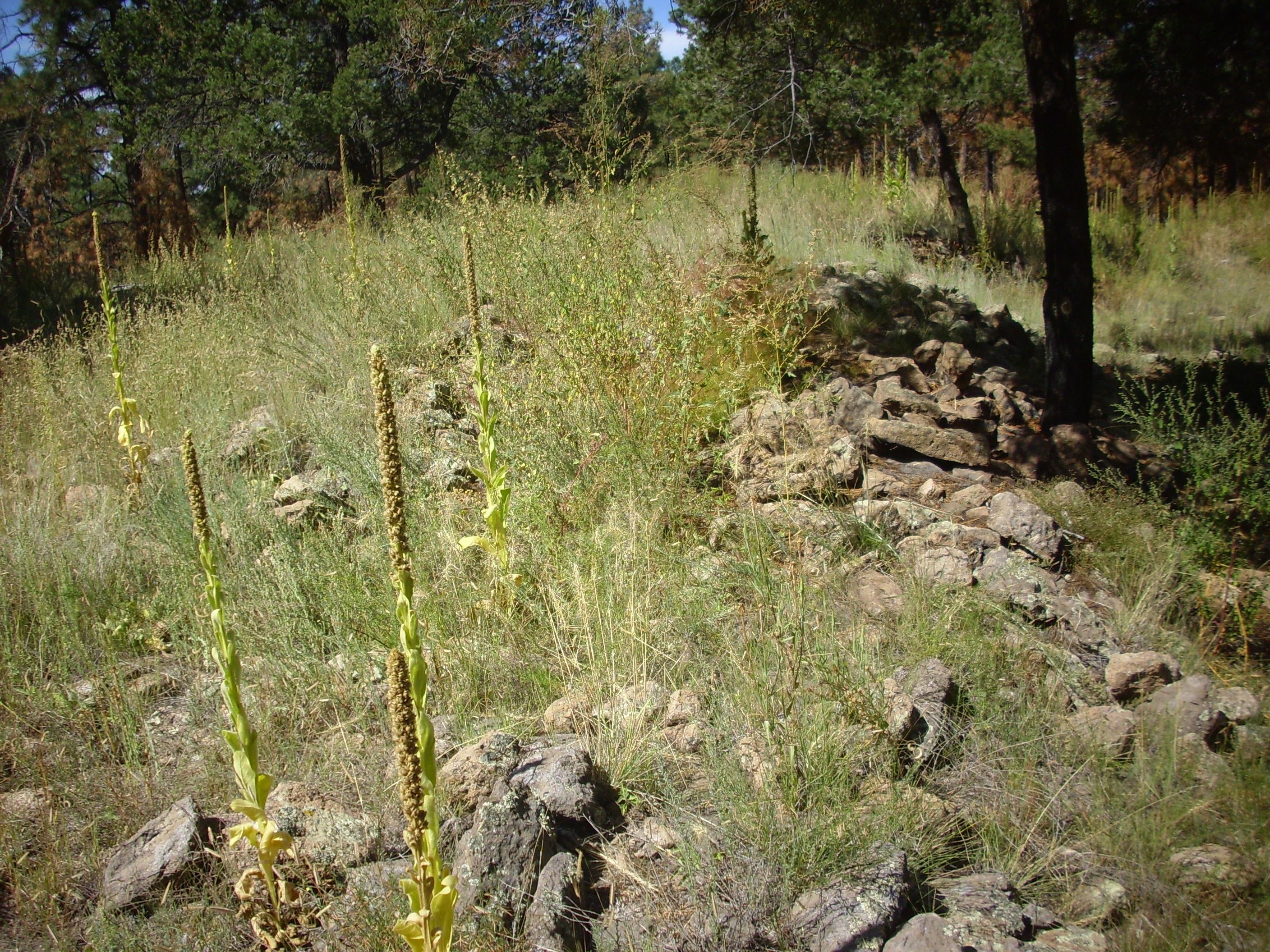
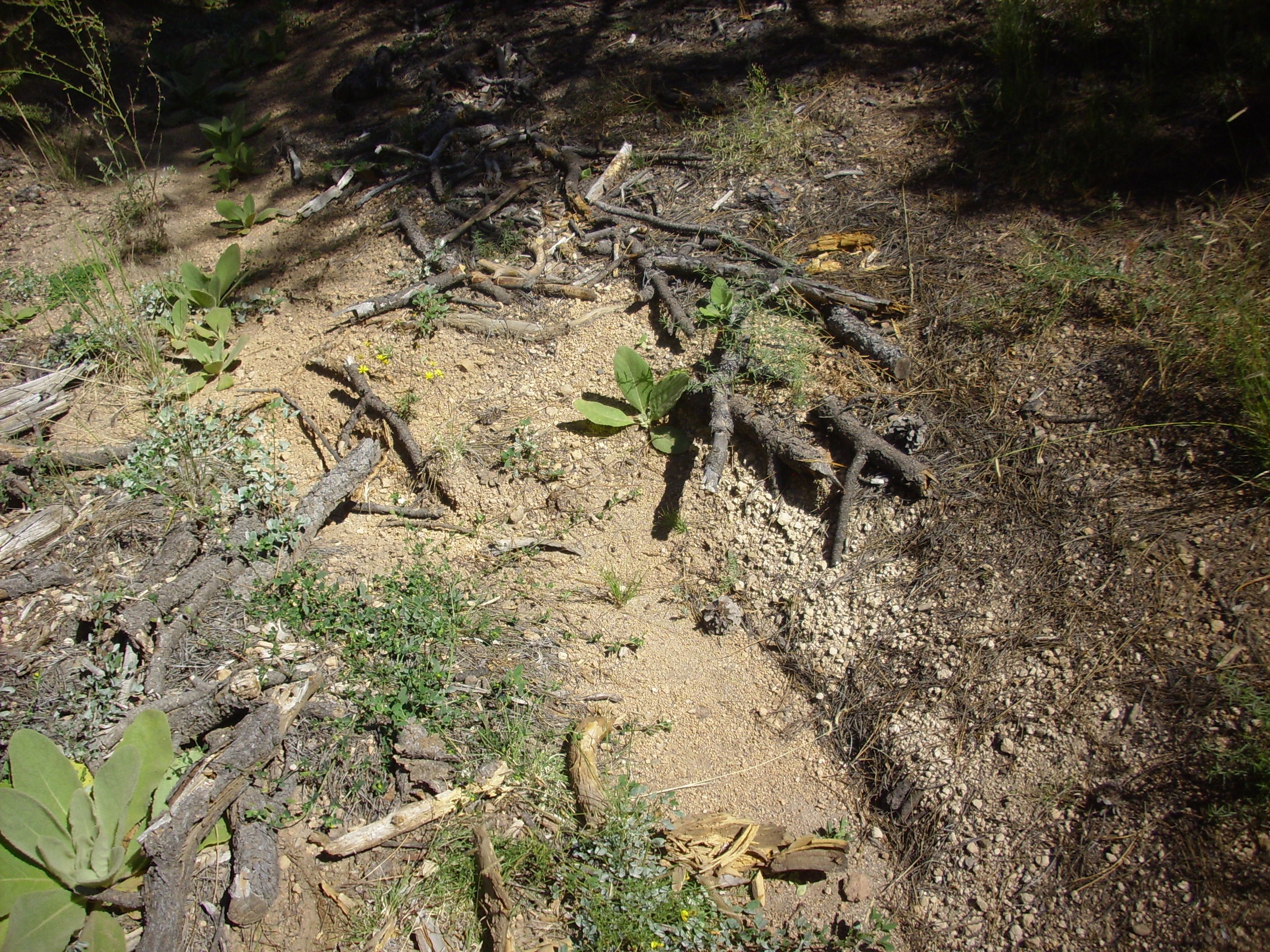
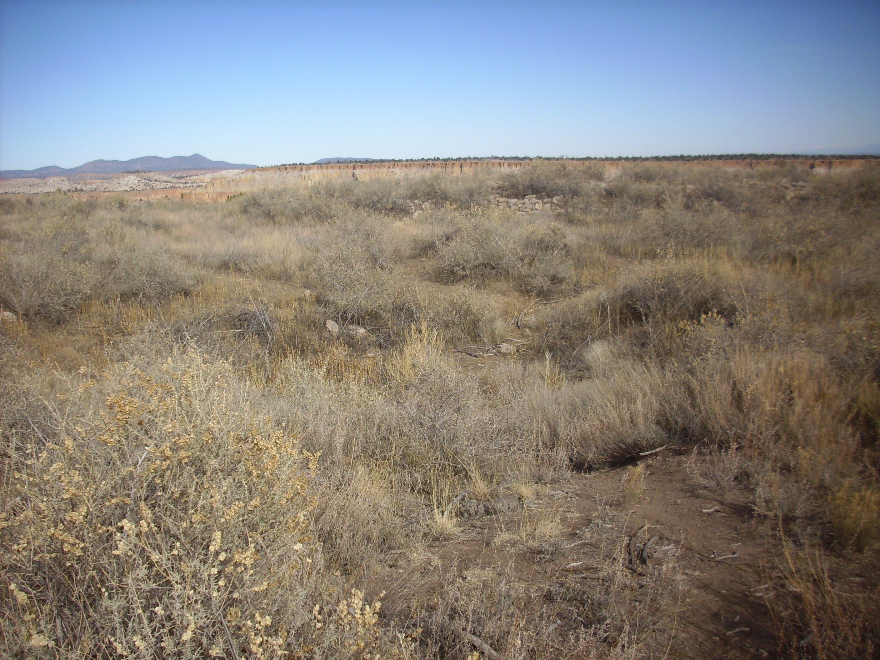
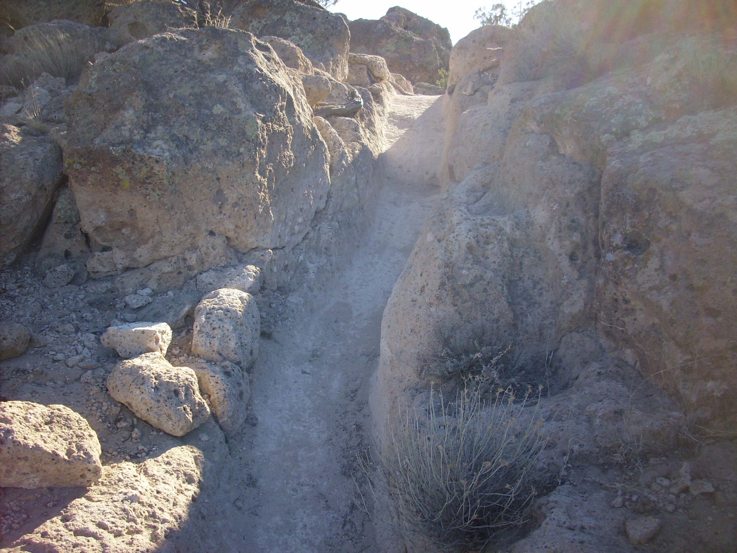
Old road to Kiatsukwa Ruins
The oldest archaeological sites in the Jemez date back about
11,000 years and consist of obsidian quarry sites and isolated
structures called field houses. These reflect a culture that was
still largely a hunter-gatherer culture that characteristically
hunted big game. At this time, New Mexico had a significant
population of megafauna, or large mammals, such as
mammoths, musk oxen, mastodons, and camels, and their predators,
lions and saber-tooth tigers. The megafauna abruptly disappeared
around 10,900 B.C. for reasons still not agreed among
archaeologists, though over-hunting by paleoindians is widely
thought to have played an important role.
Among the last of the paleoindians was the Cody culture, which hunted along the major rivers of New Mexico around 7500 B.C. Climate change drove the Cody out of the area within two millennia.
The Archaic people arrived on the Rio Grande around 5500 BC and
were the first farming culture of New Mexico. The earliest flint
tool found in the Cerro Pedernal region is characteristic of the
Bajada Phase, 4800 to 3200 B.C.
Maize (Indian corn) appeared around 2100 B.C. and was the major
crop by 500 A.D. Beans and squash may have arrived around 1000
B.C., while cotton became a crop around 400 A.D. These were farmed
using dry land farming methods that relied on rainfall, which is
more abundant at higher elevations.
By 1150 A.D., the first permanent communities began to be
established in the Jemez, by what are now known as the Ancestral
Puebloans. (The older term "Anasazi" is considered a pejorative by
the modern Puebloans and its use is discouraged.) These
settlers likely included the principal ancestors of the Keresians,
who now live in the southern Jemez pueblos of Cochiti,
Santo
Domingo, San
Felipe, Zia,
and Santa
Ana, as well as the more distant pueblos of Acoma
and Laguna.
The remains of their settlements are found throughout the
periphery of the Jemez and are particularly well known at
Bandelier and Puye Cliffs. The large settlement found within the
Valles caldera itself was in Valles de los Indios, a relatively
sheltered location, and a few field houses on the south slopes of
Banco Bonita. The remainder of the caldera can become very cold in
the winter due to its topography forming a natural trap for cold
air. This makes it unsuitable for maize culture. Pottery shards in
the caldera are few but diverse, suggesting that the caldera was
regularly visited by almost all the neighboring cultures.
In addition to establishing large permanent settlements, the Ancestral Puebloans produced pottery, of a type archaeologists describe as Red Mesa black-on-white.
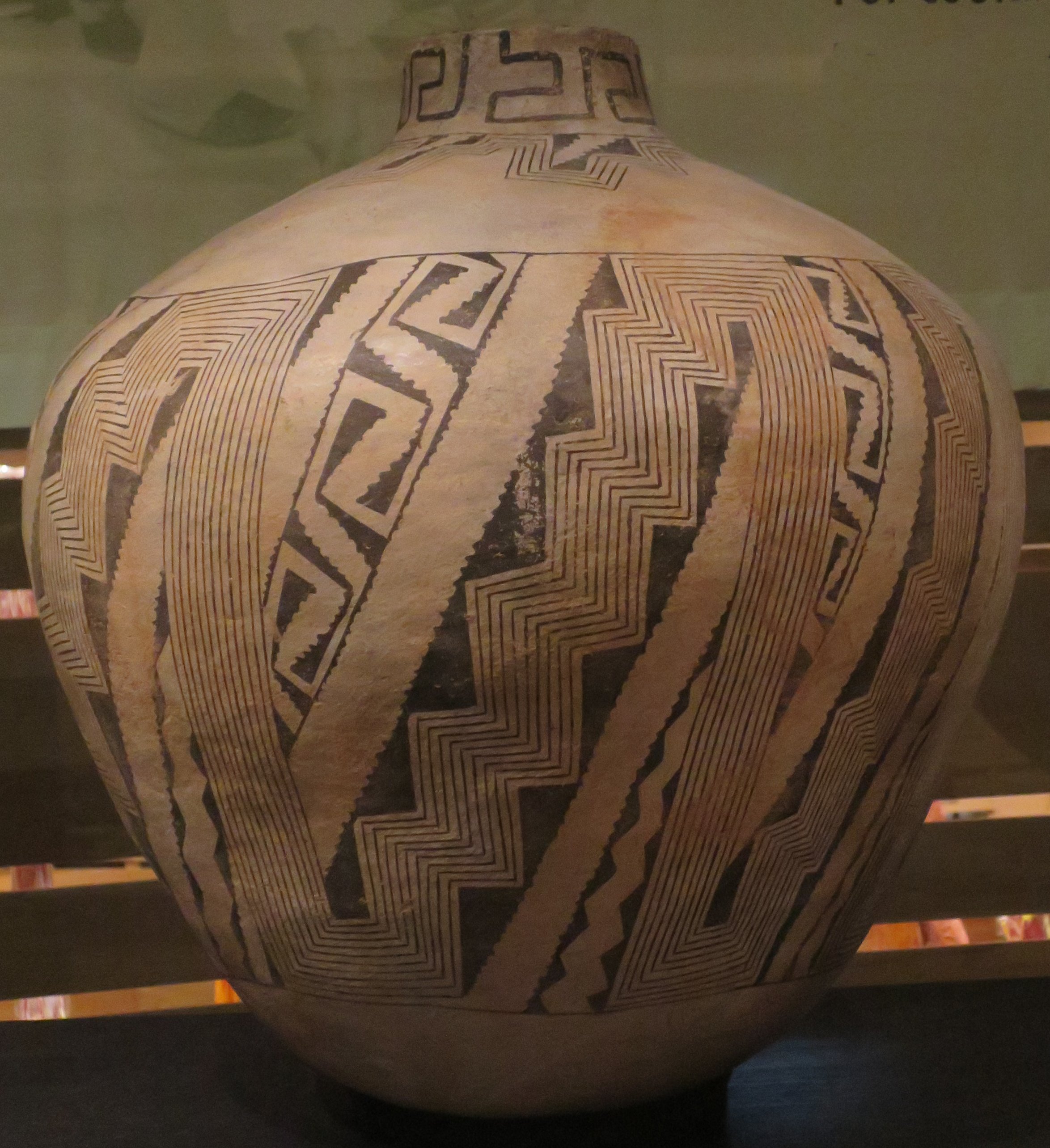
Red Mesa black-on-white storage jar. Wikimedia
Commons
Although some of the Ancestral Puebloans adopted Ak Chin farming, which utilizes runoff to water fields, the only culture of this period to adopt true irrigation was the Chacoan, which flourished between 1020 and 1125 A.D. in the San Juan Basin northwest of the Jemez. The Chacoan civilization constructed sophisticated irrigation systems and built large masonry cities, but seem to have had no written language, nor are there any indications that they smelted the fragments of metal ore found around their settlements, apparently prizing them instead for their ornamental value. Turquoise was particularly prized and turquoise beads have been found in pecked basins (excavated circular pits, about a foot across and half as deep) atop the nearby mesas, which are believed to have been offerings to the gods. The civilization abruptly collapsed around 1130 A.D. Possible causes include drought or civil war; infant mortality appears to have been nearly twice as great in the outlying areas as in the central cities, pointing to increasing social stratification. Regardless of the actual cause, the collapse of the Chacoan civilization seems to have left the ancestral Puebloans with a deep distrust of attempts to control nature.
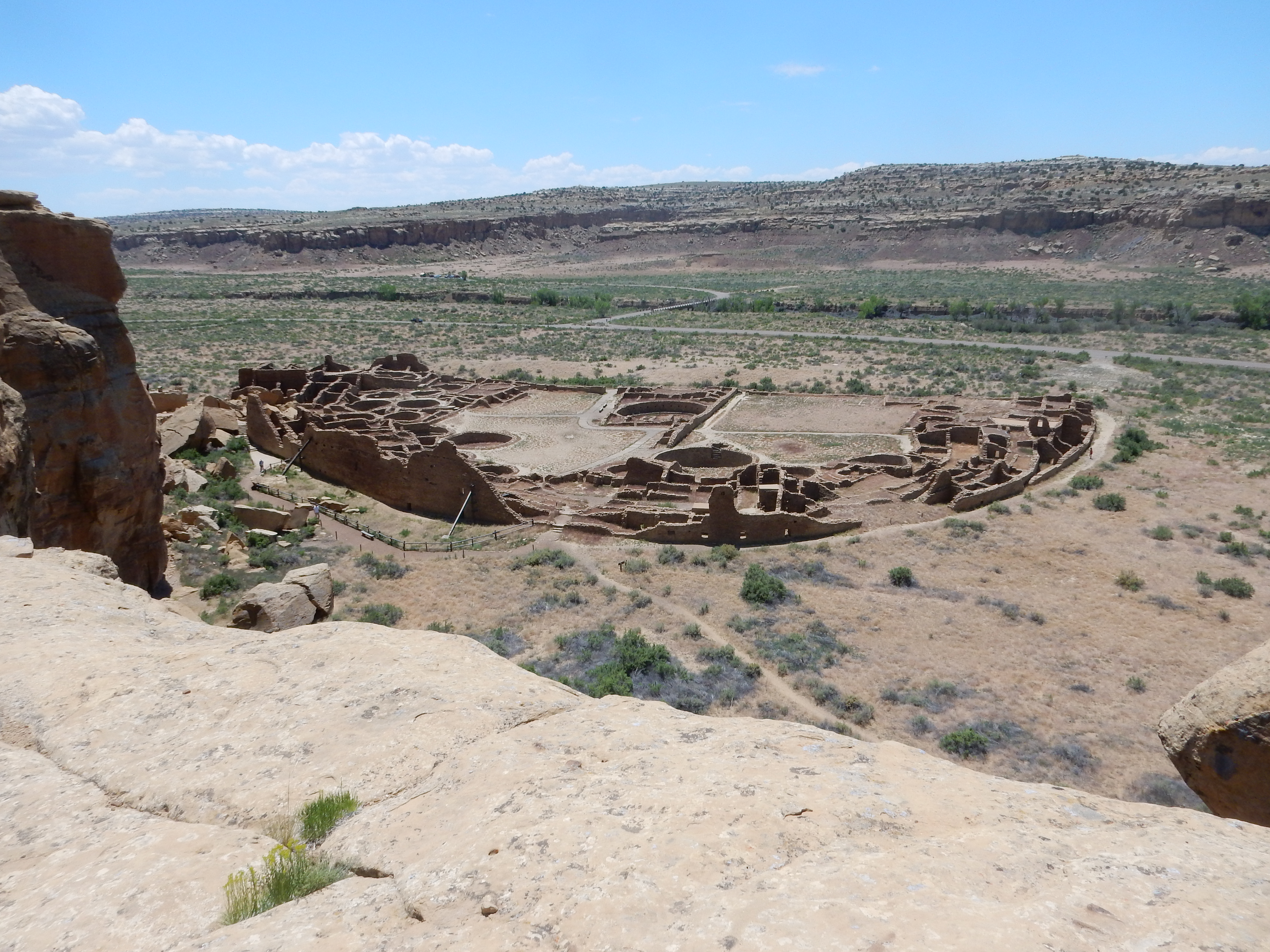
Pueblo Bonita, center of the Chaco civilization. 36
03.710N 107 57.764W
The migration of the survivors of the disaster to higher elevations also produced conflict, and may account for the tendency of pueblos in the Jemez to be located atop more easily defended mesas than in the more fertile valleys. This period, from about 1130 AD to 1325 AD, is known as the Coalition period and is characterized by the appearance of new patterns of pottery. The Chacoans may have been the principal ancestors of the Tewa or Tano peoples, who today live in the Rio Grande Valley north of Santa Fe at the pueblos of Nambé, Pojoaque, San Ildefonso, Ohkay Owingeh, Santa Clara, and Tesuque.
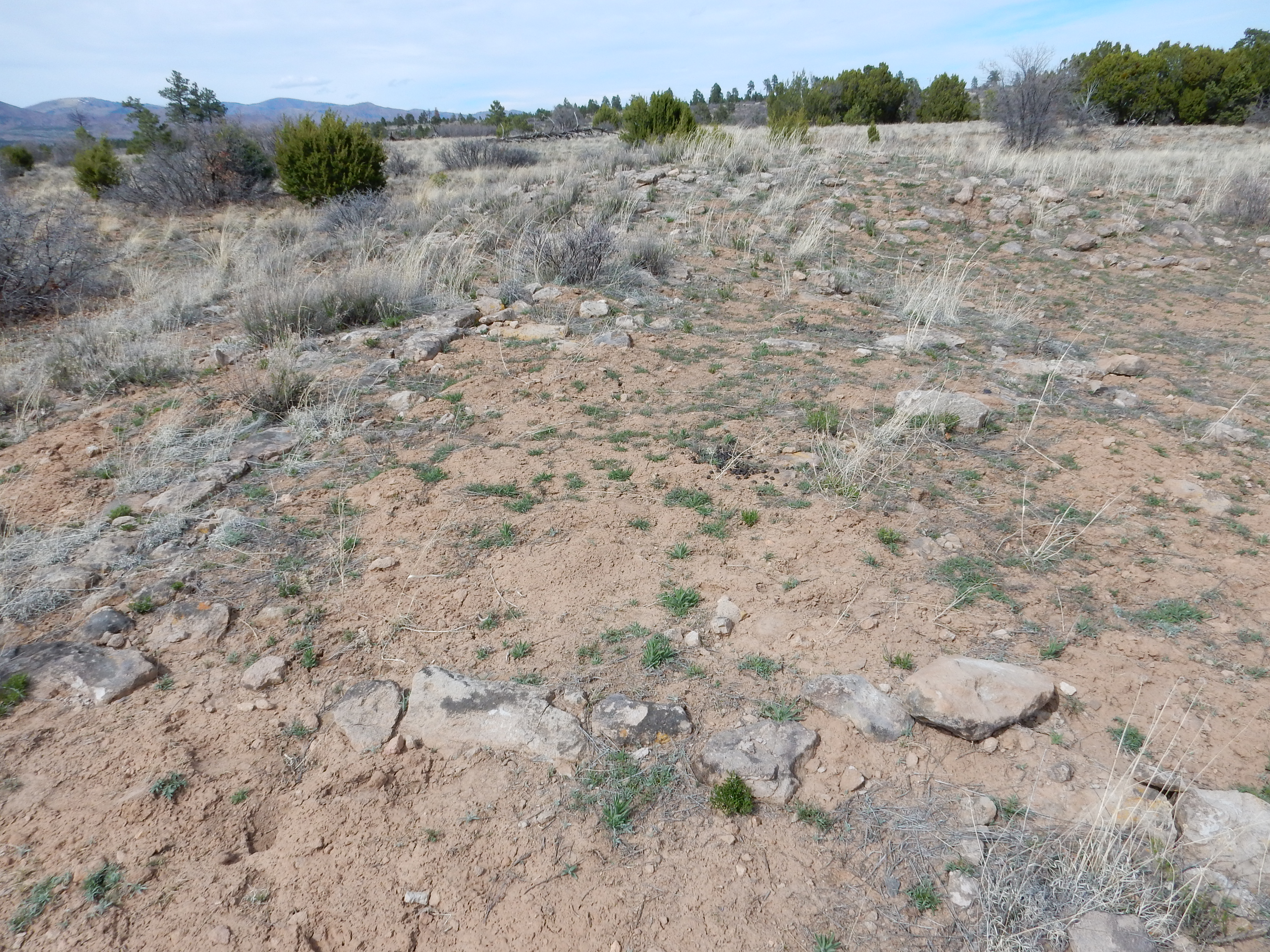
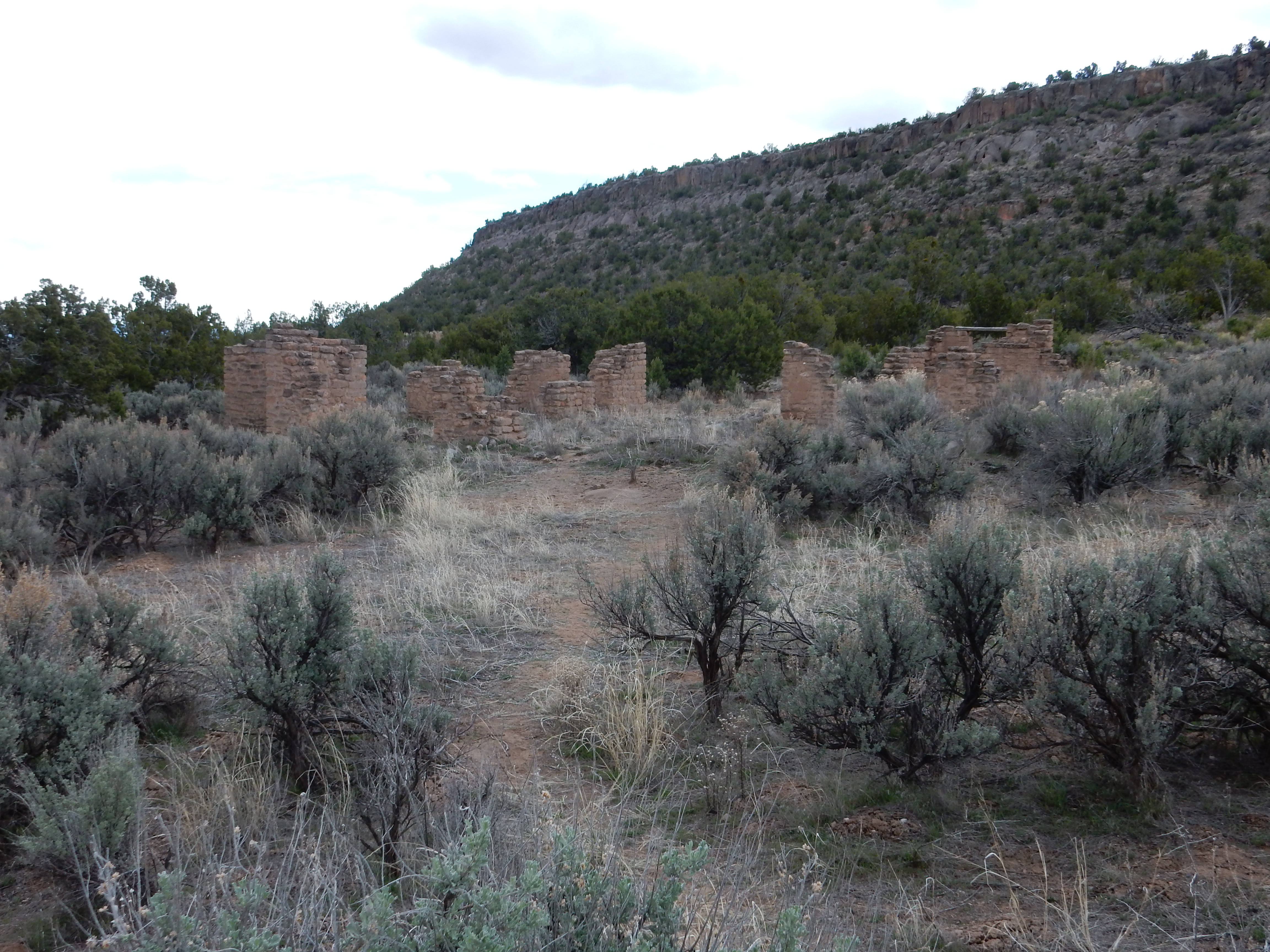
Ruins of field house on Burnt
Mesa. 35
49.046N 106 19.261W
The oldest settlements on the Pajarito Plateau date back to about the 13th century and were relatively small and located mostly at altitudes below 6800' (2000m). Each settlement had ten to twelve rooms arranged in two rows, usually laid out north to south. Only two or three rooms had fire pits, and the others may have been for storage. Perhaps two or three families occupied each settlement. The construction was tuff blocks at the bottom of the walls, often giving way to packed adobe towards the top,
Scores of such ruins are found on the larger mesas, but archaeologists believe only a few were occupied at any given time.
Archaeologists refer to the period from about 1325 AD to 1600 AD
as the Classical Period. The population began gathering into
larger settlements in the 15th century, and by the end of that
century there were a number of much larger population centers. One
of these is Kiatsukwa Pueblo ruins, located near 35
44.000N 106 36.971W. This is easily accessible from Forest
Road 10, but if you choose to visit, be respectful of the area,
disturb nothing, and take no samples (even of natural rocks.) The
ruins are strictly protected under the Antiquities Act.
Note the many large branches laid deliberately along the road to
the ruins. This was likely done by the Forest Service to control
erosion along the road and allow vegetation to grow back, but the
branches also discourage casual visitors to the ruins.
Old road to Kiatsukwa Ruins
Large boulders have also been placed at the junction with Forest
Road 10 to block vehicular movement. I repeat: If you visit, take
only photographs, and do not disturb the ruins in any way.
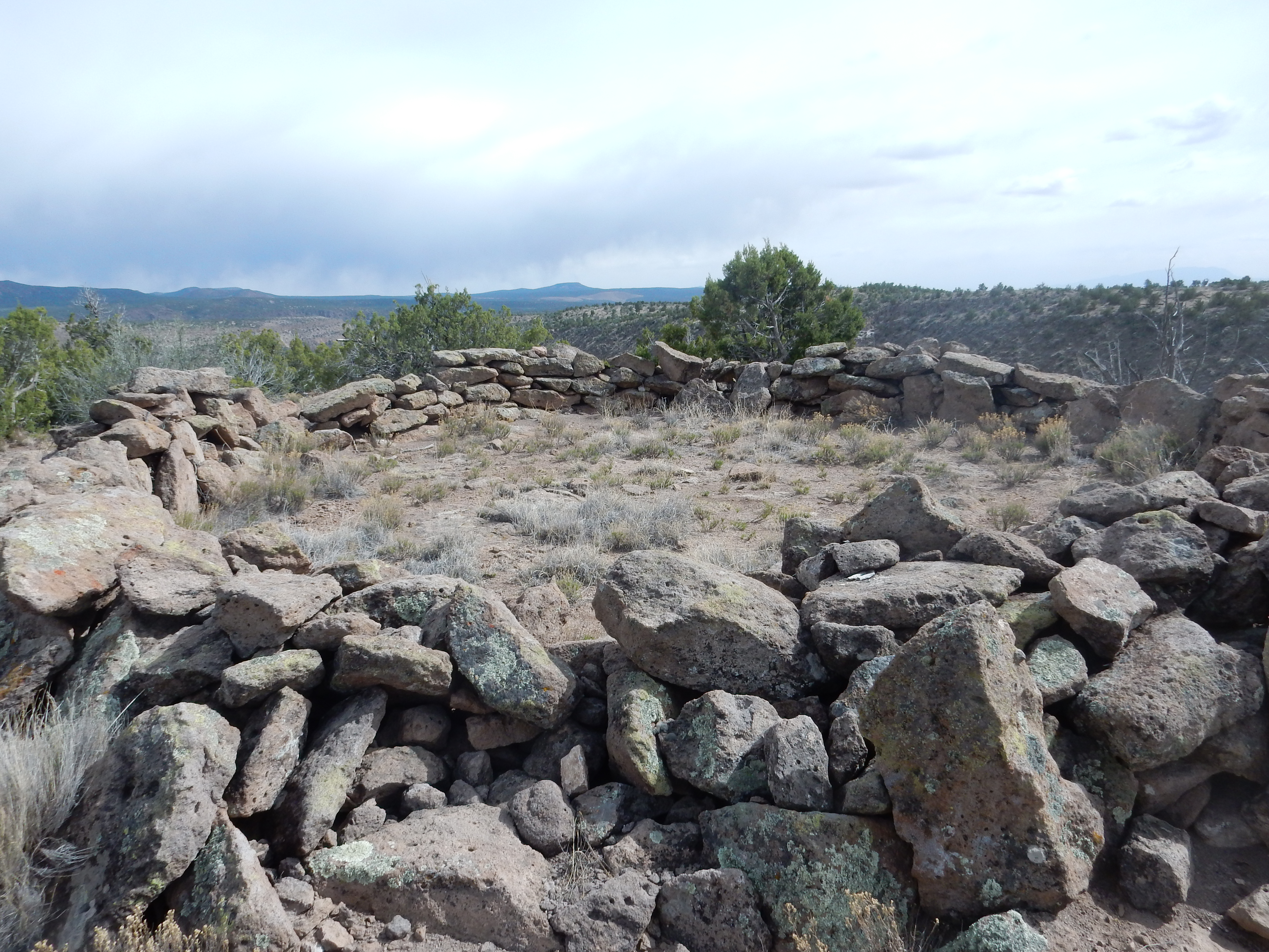
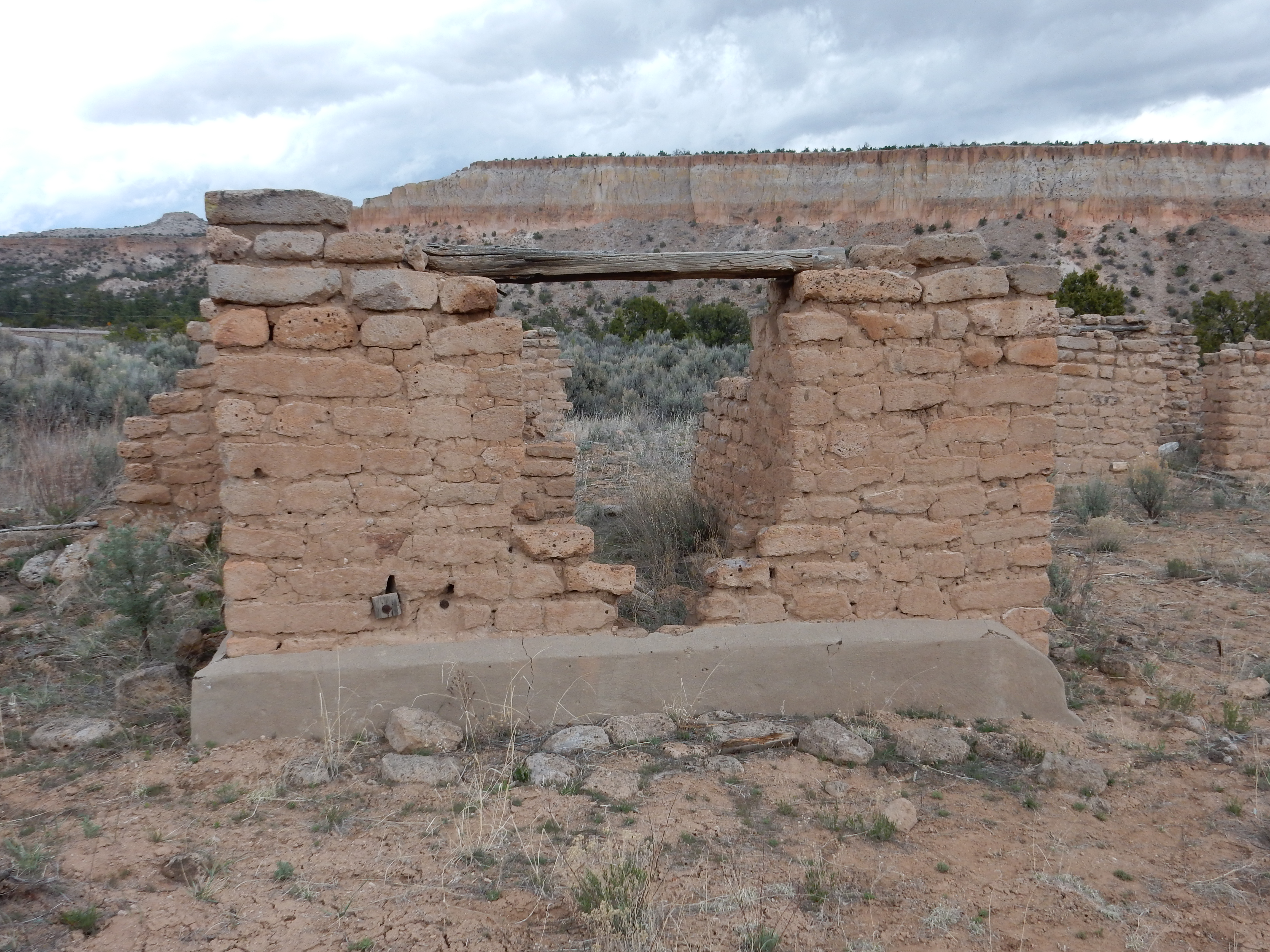
The ruins are largely unexcavated and consist of mounds of roughly shaped blocks of Bandelier Tuff. The site was occupied between 1400 and 1500 A.D. and briefly reoccupied in the early 1600s.

The pueblo numbered about 400 persons at its peak, with some buildings having three levels. The valley here is underlain by El Cajete Pumice, which seems to have been favored by the Ancestral Puebloans for its fertility and capacity to hold water. The pumice is evident in the soil along the road.
Kiatsukwa Ruins
Archaeologists at Bandelier National Monument have made attempts to reproduce ancestral Puebloan agricultural practices.
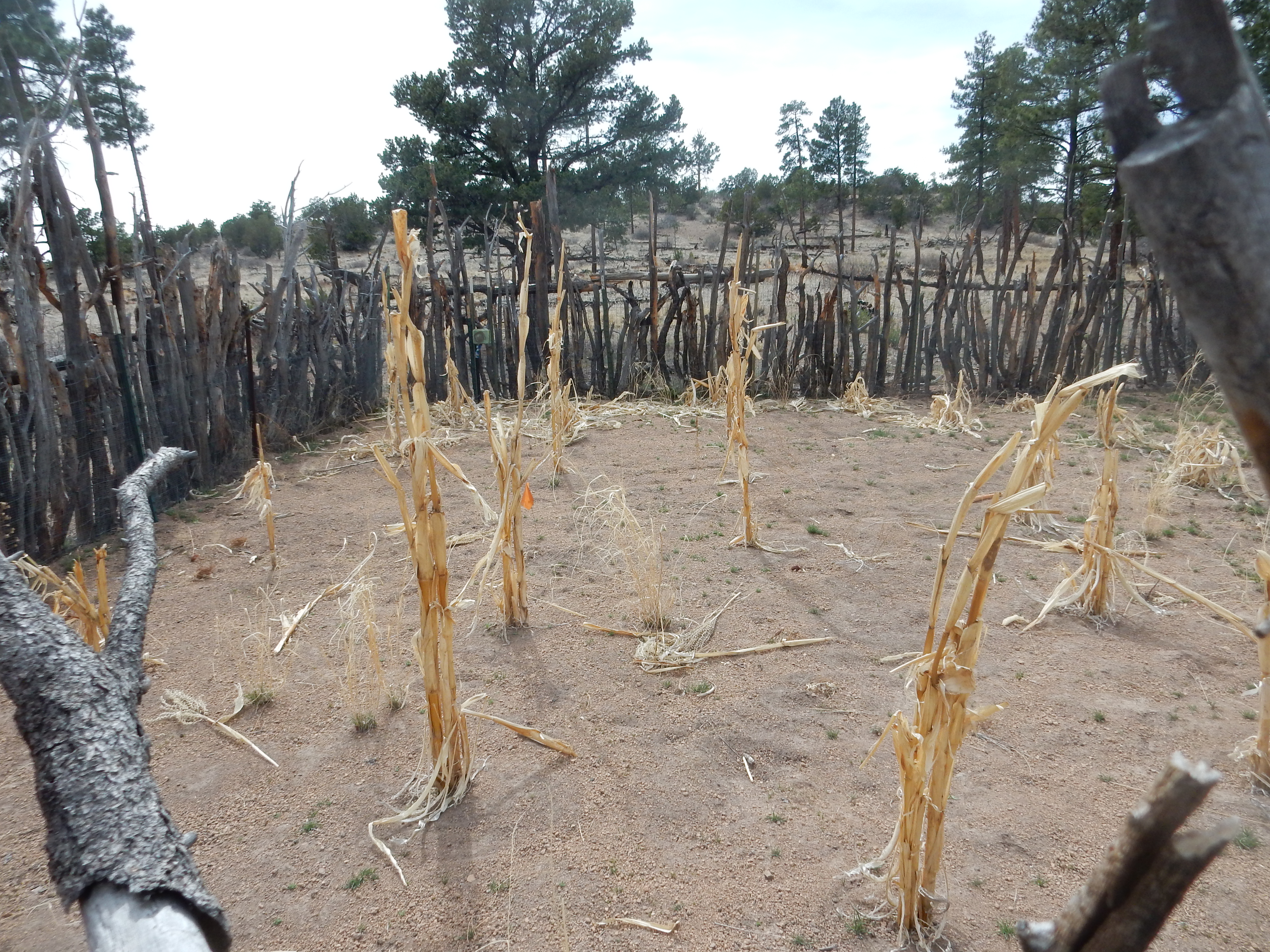
Experimental garden. 35
47.721N,106 17.002W
The corn here is of a variety resembling those used by Ancestral
Puebloans, and relies solely on rainwater and snow melt. The soil
here, atop Burnt Mesa northeast of Frijoles Canyon, is rich in El
Cajete Pumice.
Another important ruin is Otowi, located in Pueblo Canyon east of Los Alamos. The site is easily seen from the Clinton P. Anderson Overlook, being located directly to the north on a ridge on the canyon floor.
Otowi Ruins. Looking north from 35
52.386N 106 14.006W
This ruin is completely unexcavated and likely to remain so, since it is on tribal lands of the descendants of the people who lived here. However, the ground has a characteristic appearance in the satellite photograph that is partially discernible at ground level.
Tsankawi is the site of another large unexcavated ruin.
Eastern edge of Tsankawi ruins. 35
51.705W 106 12.895W
There are a number of archaeological sites around the world that have been left deliberately unexcavated like this. In some cases, it is out of respect for the feelings of identifiable descendants of the peoples of the ruins who are leery of having their ancestors’ ancient homes poked around. But in other cases, it is because the ruins are typical of a culture that has already been much studied, and are being left unexcavated against the day when better methods of excavation are invented. In the case of Tsanwaki, I suspect both reasons apply.
I also noticed that the visible edge of the ruins on the ground are well within the area that looks visibly disturbed on satellite. I have no ready explanation.
Within the ancient walls are at least two pits that are likely unexcavated kivas.
Kivas at Tsankawi. 35
51.727W 106 12.930W
Kivas were the underground ceremonial spaces of the Ancestral Puebloans. The classical kiva is a round room, roofed over, with a small pit on the north side (a sipapu) which likely represented the doorway from which the first humans emerged from the underworld. Kivas are interpreted by some archeologists as models of the Universe, where heaven, earth and the underworld meet — as with temples in many ancient cultures.
Possibly related are so-called circle shrines.
I have been warned that archaeologists have a tendency to
interpret anything whose practical purpose is not obvious as a
religious artifact. However, members of some native American
tribes still make use of stone shrines for activities that are
clearly religious in character, and stone circles have been
associated with native American communities from the Chaco
civilization to the early Spanish era at Petroglyphs National
Monument in Albuquerque.
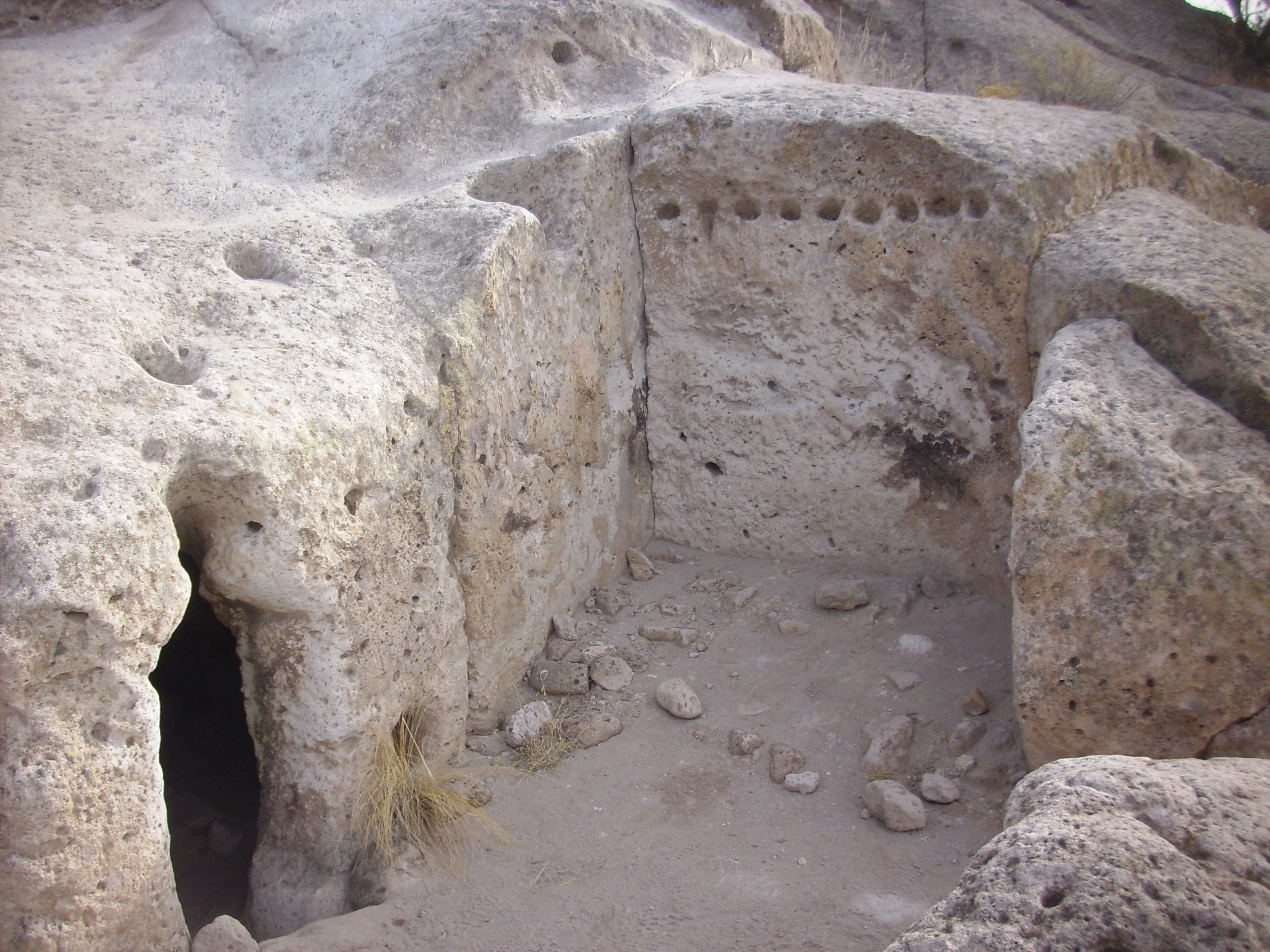
In addition to walled villages and individual field houses, the Ancestral Puebloans excavated caveate rooms in cliffs of the relatively soft tuff of the Bandelier Formation.
Here is a caveate room with a kind of atrium excavated along the trail to the top of Tsankawi Mesa.
Caveate room with atrium at Tsankawi. 35
51.673N 106 13.134W
The shape of the atrium appears to have been largely determined by natural jointing in the rock, but the faces were probably smoothed off and the row of holes then excavated to seat timbers supporting a light roof. The opening to the left is into a caveate room, which likely started as a natural cavity in the rock that was further excavated by the Ancestral Puebloans. These people came to the area in the 15th century and were speakers of the Tewa language, rather than the Keres language of the settlements in the main section of Bandelier National Monument to the southwest.
The south side of Los Alamos Mesa, north of Tsankawi, shows numerous caveate rooms.
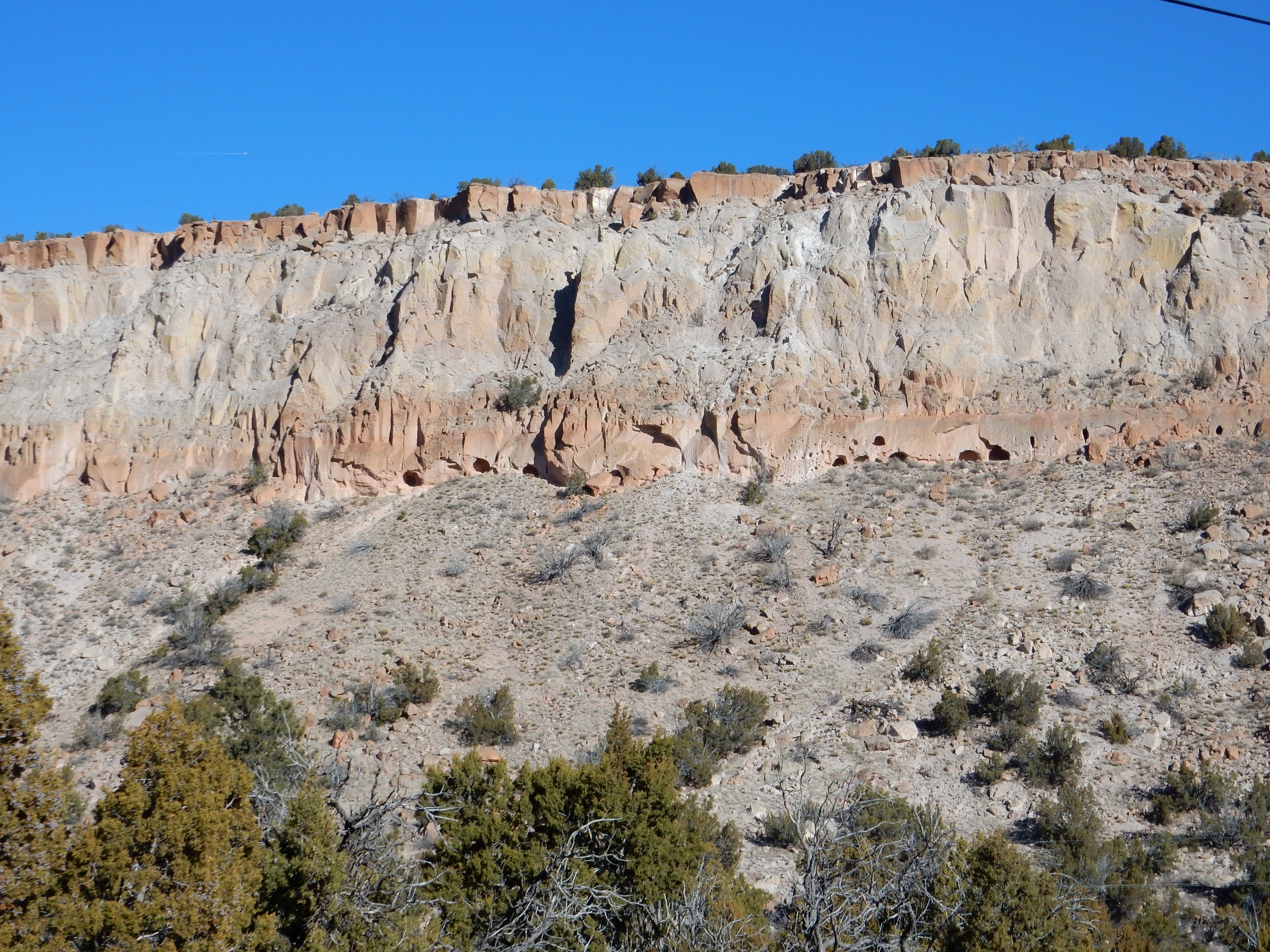
The caveate rooms are located right at the top of the talus slope below the vertical cliffs. They probably started as small natural cavities in the rock, but were greatly enlarged by the Ancestral Puebloans. There are also what appear to be rows of pits suitable for inserting beams to support a light roof.
The area was probably wetter in the 15th century. There is
abundant archeological evidence that the Ancestral Puebloans
abandoned many settlements in what are now quite dry areas of the
Southwest at about this time and moved to the valleys of the Rio
Grande and its major tributaries, where their descendants live
today.
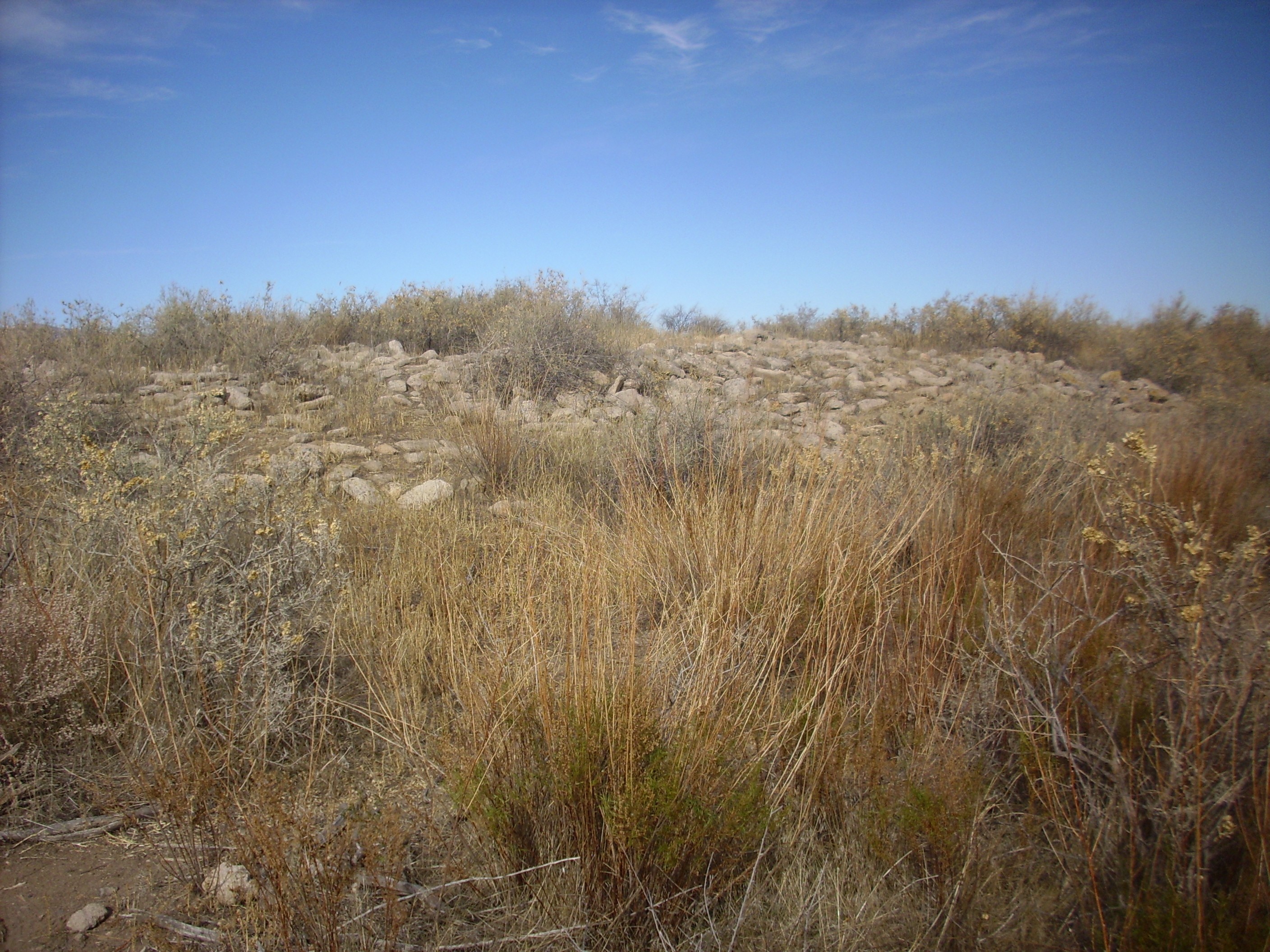
The ruins at P'oshu'owingeh ("village above the muddy river") may represent an early stage in this migration to the river valleys.
These ruins are largely unexcavated, but the bare ridges mark where the walls once stood. It is estimated that this pueblo once stood 3 or 4 stories tall and had 700 rooms.
The ruins here are on a river terrace overlooking the Chama River. The same terrace level is visible just across the valley. More distant, at the foot of Sierra Negra at the center of the panorama, is another remarkably level erosional surface at a higher level. This was formed in a side channel of the Rio Chama earlier than the the lower terraces. It’s hard to get good estimates of ages of these surfaces, but the higher, older surface is probably about half a million years old. Sierra Negra behind it is capped by a basalt flow that has been dated at 4.5 million years old, showing the age of the surface on which the flow erupted, clear at the top of the mesa. (The rest of the surface has long eroded away.) There has a lot of erosion here in the last five million years.
The establishment of relatively large settlements did not end the
use of field houses. Over one hundred field houses have been found
in the Frijoles quadrangle alone, which takes in most of
Banderlier National Monument and the LANL test ranges to the
north.
Other traces of early humans in the Jemez include trails or steps cut into the relatively soft tuff of the Bandelier Formation. There are a pair of likely prehistoric steps in the tuff above the Clinton P. Anderson Overlook.
Prehistoric steps. Near 35.872N
106.234W
This area saw some modern traffic in the 1940s, when the old road
to Los Alamos made switchbacks up the nearby mesa face. However,
the new road is further away, and it it unlikely these are modern
traces.
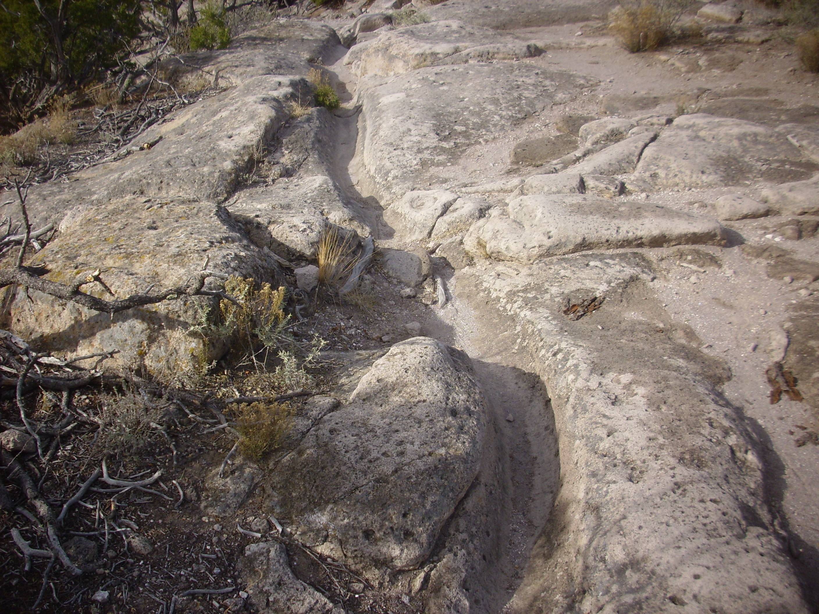
There are prehistoric trails carved deeply into the Bandelier
Tuff in several locations.
Prehistoric trail on Potrillo Mesa. Near 35.795N
106.221W
This is located on Potrillo Mesa south of White Rock and is now used by the occasional modern hiker. Similar trails are prominent in the Tsankawi section of Bandelier National Monument.
Prehistoric trail at Tsankawi. 35
51.732N 106 13.044W
The desert varnish visible in the trail shows its antiquity. The fact that the desert varnish has not been worn away shows that most modern tourists walk on the higher ground around the trail rather that in the trail. This seems most natural.
So why, then, did the Native Puebloans even create this trail?
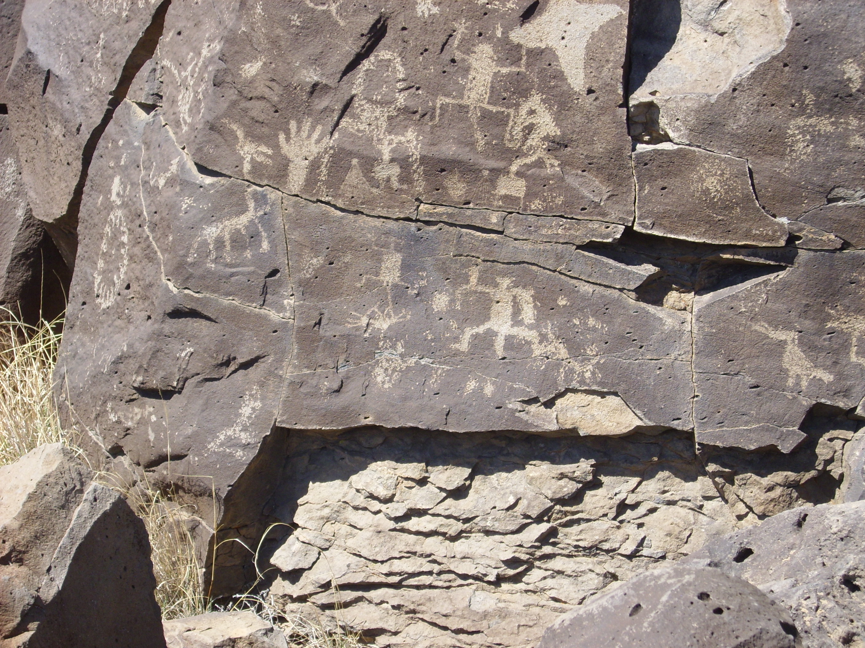
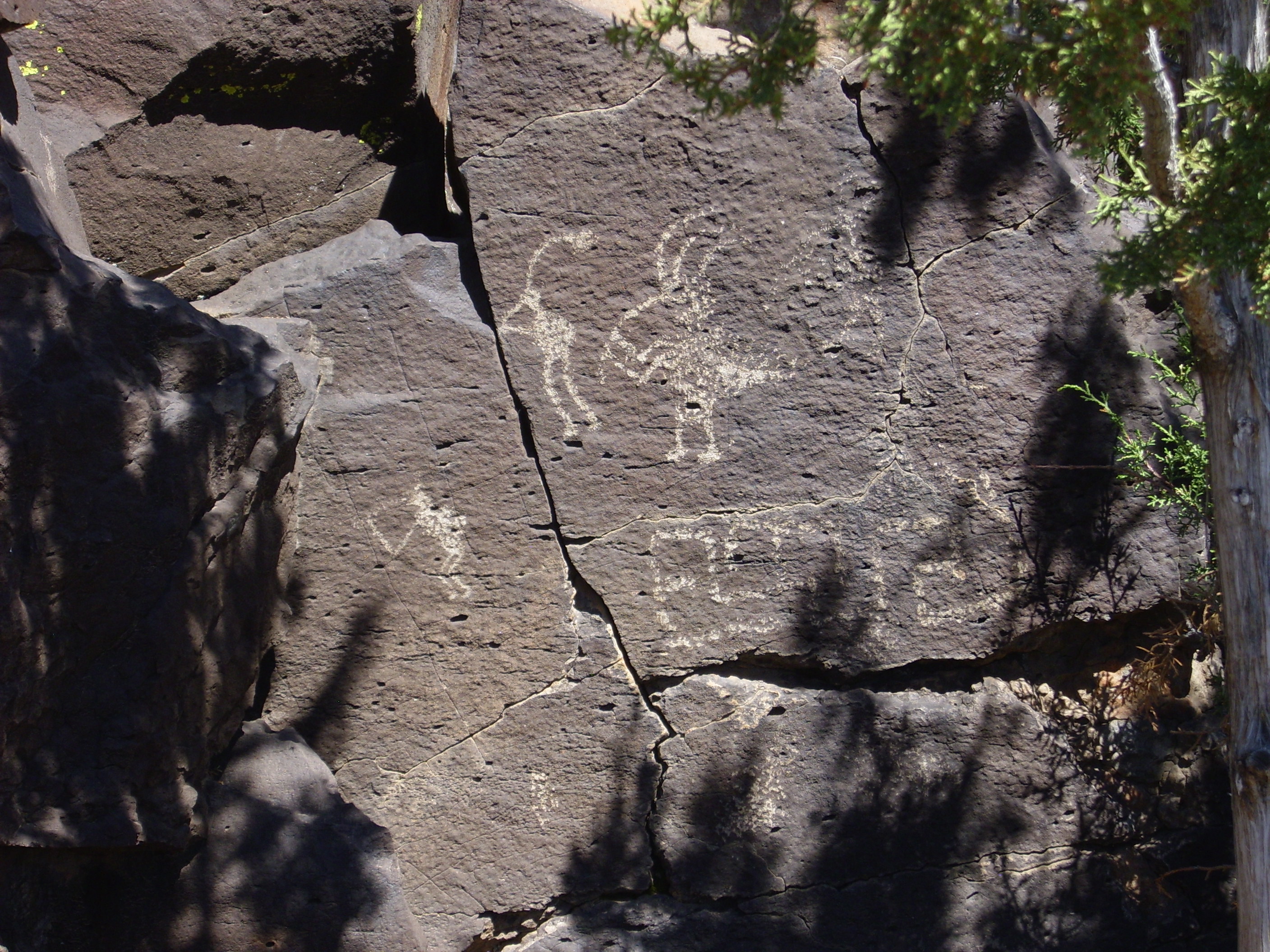
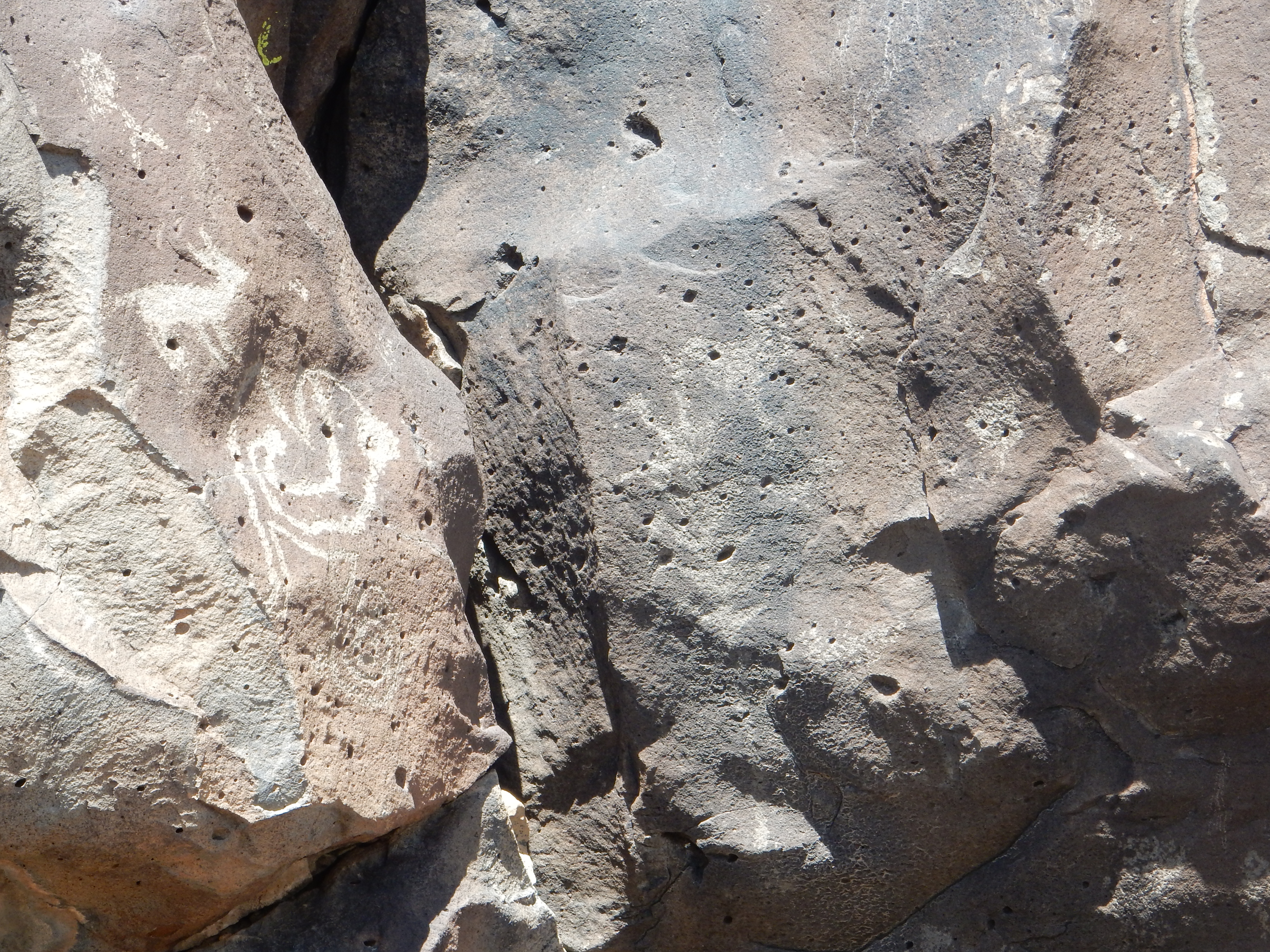
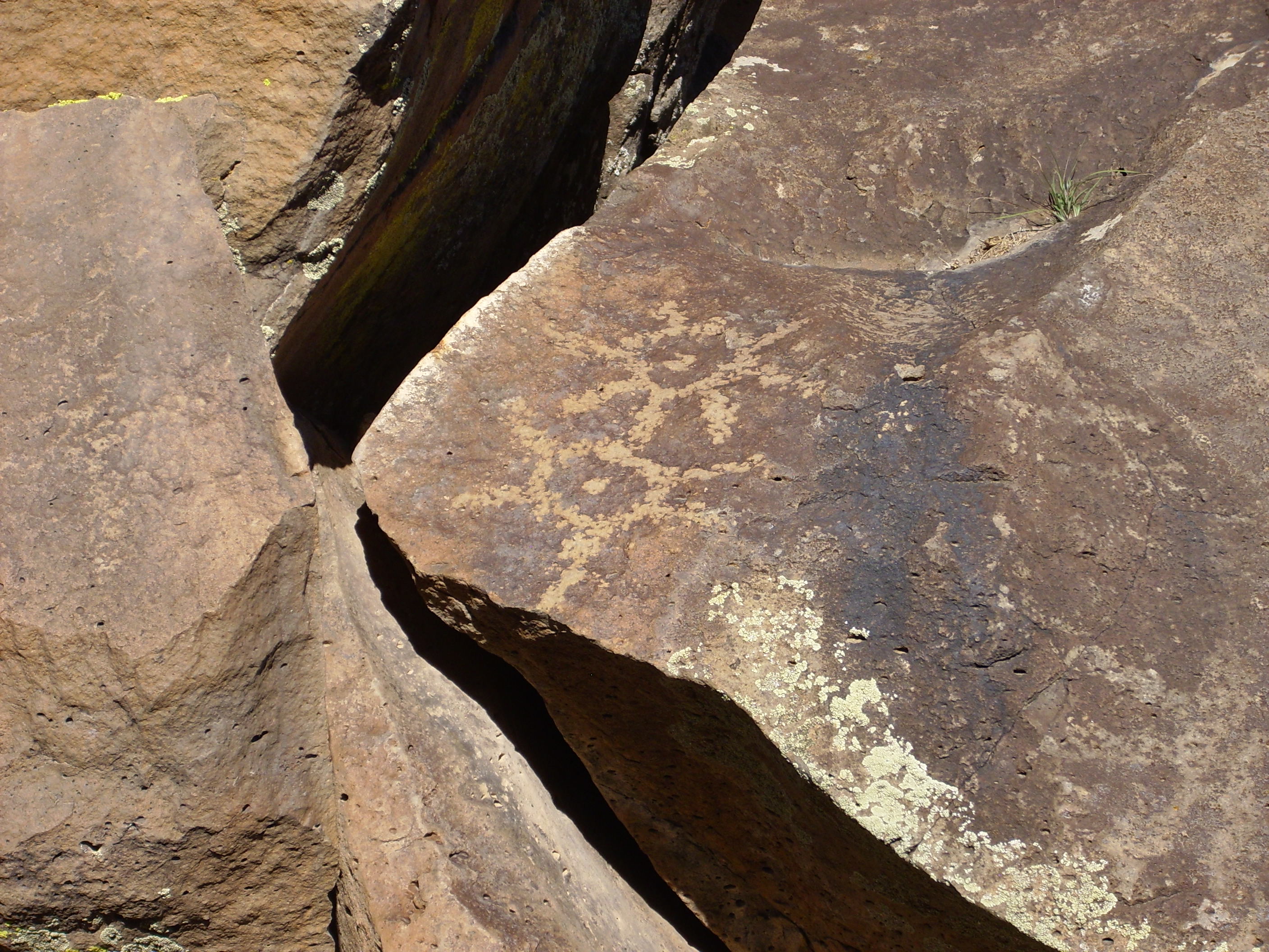
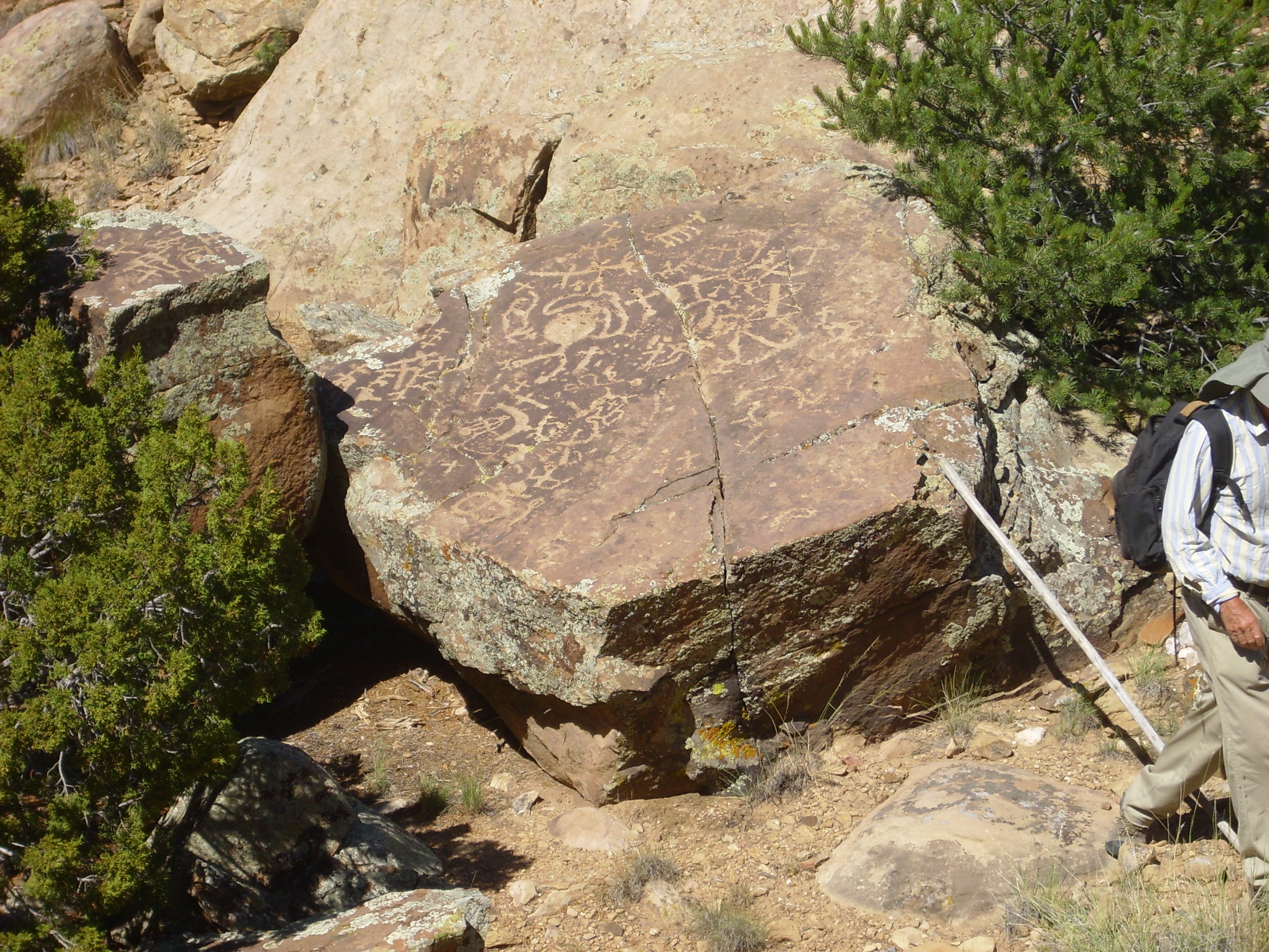
Among the traces left by the Ancestral Puebloans are petroglyphs. These are markings etched into stone, found scattered throughout the southwestern United States. A large number of petroglyphs are found on the eastern escarpment of the Cerros del Rio near the village of La Cieneguilla.
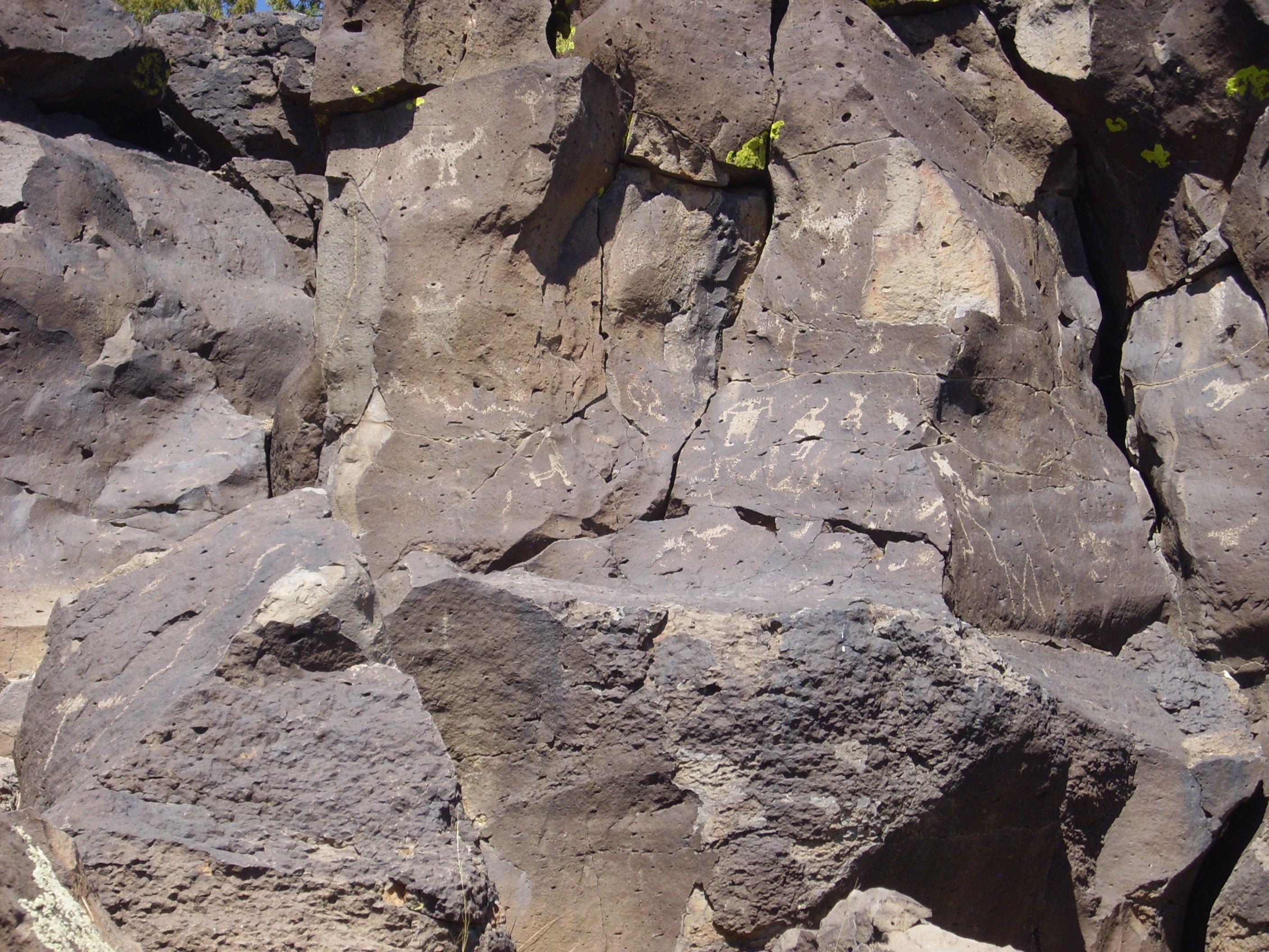

La Cieneguilla petroglyphs. 35.605N
106.126W
The petroglyphs in this area are on hawaiite that has a thick weathering film, known as desert varnish. When the surface is pounded with a heavy tool, the desert varnish is removed and the lighter rock beneath is exposed. Such petroglyphs can be roughly dated from the extent to which fresh desert varnish has begun to form over the petroglyphs, and this establishes that the petroglyphs were etched by Ancestral Puebloans.
I know little about petroglyph iconography. But then, neither do
archaeologists, who have a number of conflicting notions about
their significance. For example, the spiral pattern seen in the
last photograph is often interpreted as a representation of the
sun, but it has also been interpreted as a representation of water
or of migration. Some other figures have fairly clear meanings.
The figure at center with the head appendages (probably
representing feathers) is Kokopelli, a fertility deity shared
across several native American cultures. Kokopelli may have
originally represented a kind of wandering priest whose flute was
a symbol that he came in peace. Kokopelli has been thoroughly
commercialized in the modern American Southwest, which I find
vaguely regrettable.
The bird-like figure right of center is the thunderbird, a powerful supernatural being in many Native American traditions. To the left are deer or possibly sheep; if the latter, they must postdate the arrival of the Spanish in New Mexico.
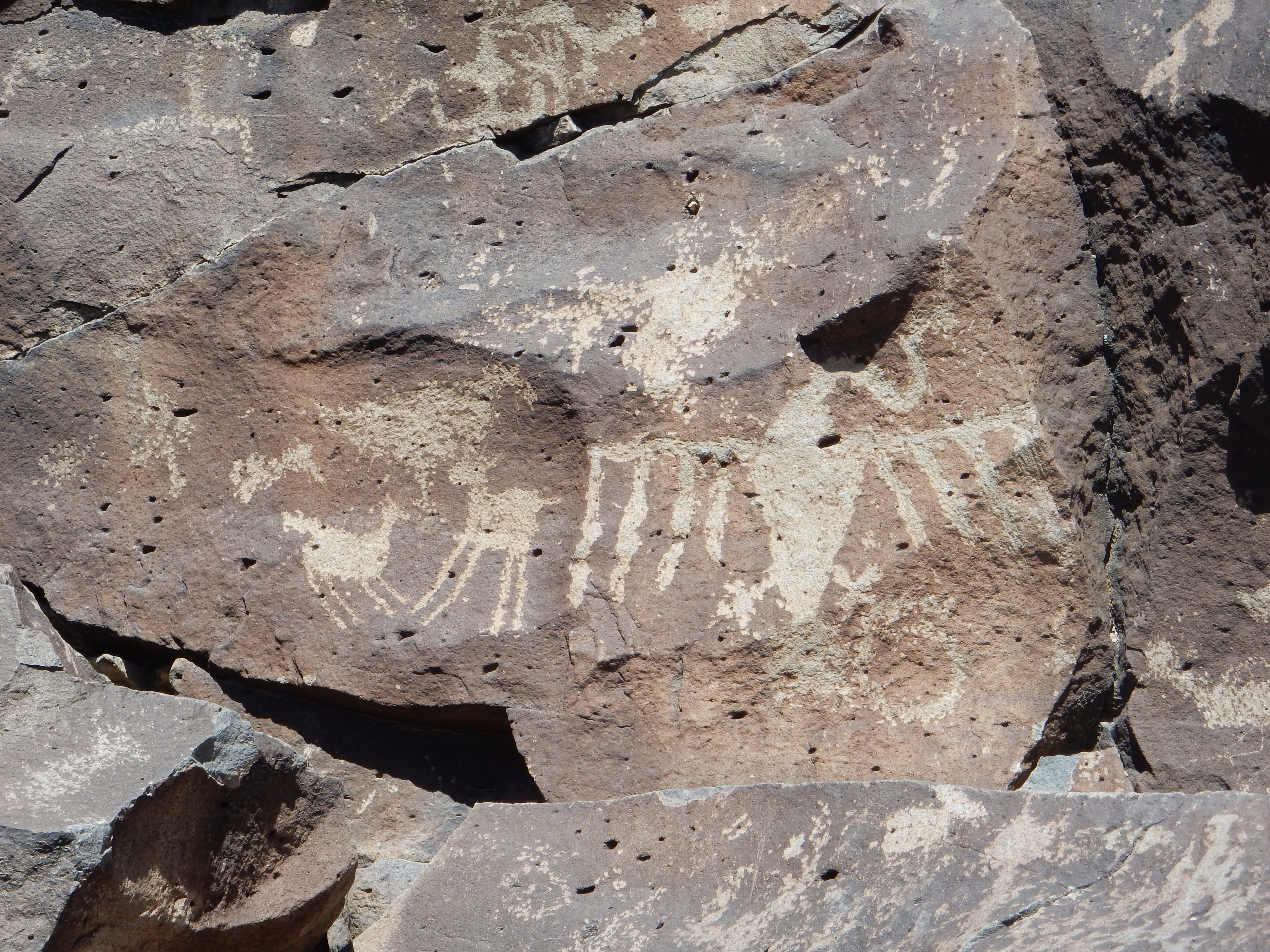
This photograph is centered on a somewhat faded maize petroglyph.
Maize or Indian corn was the staple of the Ancestral Puebloans and
is a common element in their petroglyphs.
I have seen petroglyphs throughout the Jemez area, including petroglyphs carved on Bandelier Tuff and in Mesozoic sedimentary rock. Basalt seems favored but not decisively so. Some petroglyphs are found close to ancient settlements, but I’ve also seen petroglyphs in areas far from any known settlement, including White Rock Canyon and the Hagan Basin.
Petroglyphs are found at several locations along the west rim of White Rock Canyon. Some are likely ancient Native American rock art:
and some are not.

The petroglyph in the first photograph not only shows an
authentic ancient pattern, but it also shows a thin layer of
desert varnish reflecting its antiquity. This is not present
on the modern petroglyph, which also reflects 1960s iconography.
The nearest known ancient ruins to these petroglyphs are at Tshirege and Navawi. Neither ruin has been excavated or is accessible to casual visitors.
Petroglyphs of a subtly different character are found northwest of Abiquiu.
Petroglyphs at Red Wash Canyon northwest of Abiquiu. 36 14.518N 106 22.877W
This is a boulder of Shinarump Formation located at the top of a
saddle, a natural focal point for travelers between the Chama
River valley to the south and the Arroyo del Cobre to the north.
The Jemez was an important center for the ancient obsidian trade,
with the obsidian being used to fashion spear heads and other
tools. Obsidian from the Jemez was traded throughout the
Southwest, and may have been transported as far as Ohio and
Mesoamerica. Important ancient obsidian quarries have been
identified at Cerro del Medio, El Rechuelos, the Rabbit Mountain
debris flows, Bear Springs, and possibly Paliza Canyon.
While hiking around Cerro la Jara close to the Valles Preserve
vistors' center, I came across what is likely an ancient tool
fashioning site.

This is a location on the north side of the dome, showing a scattering of obsidian chips on the ground. As we've seen, obsidian and rhyolite form from the same kind of of lava and are often interbedded, but these are isolated chips; the bedrock here is all rhyolite, not obsidian; and these chips are freshly broken, not rounded clasts one would expect if they had eroded out of the local rock. That makes it a fair guess that is this is a tool making site. It is common for prehistoric quarries and tool manufacturing sites to be at separate locations. I was careful not to disturb it, beyond placing a quarter on the spot to provide scale for my photograph and then removing it.
The first Spanish arrived in the New Mexico area around 1540,
ending the three centuries of the Classical Period, but for
decades the area remained largely unknown to Europeans. In 1598,
King Phillip II of Spain authorized Juan de Oñate to organize a
new Spanish province in what is now New Mexico. Oñate crossed the
Rio Grande at El Paso and established his headquarters near the
confluence of the Rio Chama and Rio Grande south of Black Mesa, at
the pueblo of Ohkay Oweenge. Oñate named his new capital San Juan
de los Caballeros. At this time, there were about 81 major pueblos
and a population of about 100,000 Puebloan people in New Mexico.
Sixty years later, there were 31 pueblos with a population of
15,000. The catastrophic decline in population has been attributed
to epidemic diseases unwittingly introduced by the Spanish,
mistreatment of the Puebloans, raids by migratory tribes who had
acquired horses, and drought.
The Spanish reintroduced irrigation, forgotten since the time of the Chacoans, and the acequia or community irrigation canal became the hallmark of Spanish settlements along the Rio Grande and its tributaries. The carrying capacity of the land was not large, even with irrigation, and the Hispanics of northern New Mexico developed a culture of small communities at favorable locations that shared water rights and grazing lands for their cattle. One such community is Canones.
The northern tip of Polvadera Mesa gives a magnificent view of the Canones Creek valley.
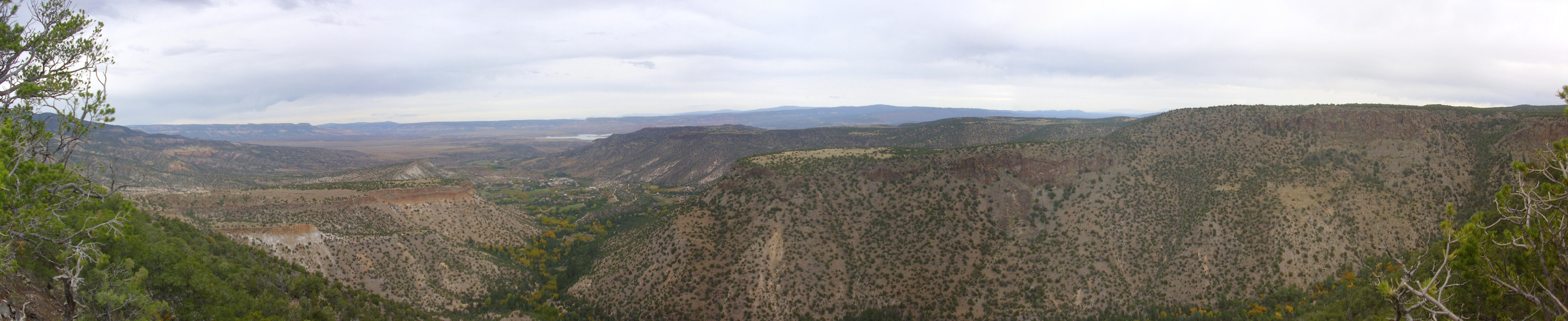
Canones area from northern Polvadera
Mesa. 36
09.723N 106 25.816W
At left in the middle distance is Pueblo Mesa. Beyond is the sloping ground north of Cerro Pedernal, with the cliffs of Mesa Alta on the skyline. The village of Cañones lies in the valley left of center, with a glimmer of Abiquiu Reservoir in the distance. Behind and to the right of Cañones is Cañones Mesa, which merges with the El Alto Plateau at right. The canyon at the bottom right of the panorama is Polvadera Canyon.
Pueblo Mesa has the Ancestral Puebloan ruins of Tsi’pinouinge atop it. This appears on the panorama as a tan patch of clear ground. I’m afraid my camera can’t do it justice. Through my binoculars, I could make out piles of stone blocks covering this area, and a low cliff running through the area that appeared to have doors and post holes excavated in it. There is also some ruined walls further south (left), where a trail comes up to the mesa top. I could not make out the shapes of buildings and kivas from this angle that are visible on satellite.
The satellite photo appears to show a
single kiva far from the village. There is evidence that
kivas were of more than one type. Archaeologists distinguish
between Great Kivas and Chaco-style kivas, with the Great Kivas
being larger, more elaborate, and kept further from ordinary
dwellings than Chaco-style kivas. Perhaps this outlying kiva was a
form of Great Kiva. A similar pattern is seen at Tyuonyi at
Bandelier National Monument, where there is a
single large outlying kiva (Big Kiva) and three smaller
kivas within Tyuonyi ruins itself (only one of which has been
fully excavated.)
The name, Tsi’pinouinge, means "village of the flaking stone",
referring to the many quarries in the Pedernal Chert nearby. Cerro
Pedernal is itself known as Tsi'pin ("flaking stone") or possibly
Tzi'iping ("pointed mountain'). This pueblo was the largest and
northernmost of all the pueblos of the Classical Period, occupied
from 1200 to 1325 AD. It had up to 400 rooms, 16 kivas, and a
central plaza. After it was abandoned, the area was occupied only
by nomadic Utes until the arrival of the Spanish.
Cañones is a Hispanic
village of about 113 persons. Its origins trace back to
1766, when Juan Pablo Martín Serrano was awarded the Polvadera
Grant. Serrano was a a wealthy military veteran with a large
family, and established a seasonal rancho in the canyon,
raising livestock, farming the canyon bottom, and trading with the
Utes. Permanent settlement seems to have begun with Juan Bautista
Valdez, who bought a grant at the present location of Cañones in
1807.
Cañones is typical of the small Hispanic villages of northern New Mexico, which were traditionally sustained by cattle and sheep ranching and farming. Anthropologists Paul Kutsche and John R. Van Ness have contrasted the Hispanic culture south of the Jemez, which they name the Rio Abajo ("lower river"), from the Hispanic culture north of the Jermez, which they name the Rio Arriba ("upper river"). The Rio Abajo tradition was characterized by large individual land grants, social stratification (patrón and peón) and large-scale sheep herding, while the Rio Arriba tradition, of which Cañones is an example, was characterized by communal land grants, small economies, campanilismo (community spirit), and a fair degree of social equality. An important institution of communities like Cañones is the acequias, or irrigation ditch, which provides abundant irrigation to the canyon bottom: Cañones and Polvadera Creeks provides an ample 33 acre-feet per year of water.
The Spanish community grant or merced came with an
obligation to improve and defend the land, or it reverted to the
Crown. Land was divided between house plots; irrigable plots of a
few acres measured by frontage along the stream; and common land
for grazing and gathering food and firewood. The former two
categories could be privately owned and sold, but the common land
was shared by the community, whose members held a usufruct,
or use right, to the common land. This system worked reasonably
well for a community engaged in subsistence farming.
The surrounding land can support about one cow per 126 acres at
lower elevations, one cow to twelve acres in the best locations at
middle elevations, and one cow to 48 acres at higher elevations.
Sheet irrigation is used to increase the carrying capacity of
pasturage in the immediate area of the village. The frost-free
period runs only from around May 24 to September 26, making fruit
cultivation and gardening a hit or miss proposition.
The town gained temporary fame in 1966, when the state closed the
one-room school and ordered the children to attend school in
Coyote, which at the time meant busing the students several miles
over a very bad road. The parents refused en masse to send
their children to school in Coyote, and the subsequent legal
battle seems to have revolved around the issue of whether the
parents were acting on legitimate concerns for their children's
safety or were using the children to pressure the state into
building a better road into the community. The upshot is that the
parents were fined for truancy, but the village now has an
acceptable paved road.
The residents of Cañones value their privacy; geologists familiar with the area and culture recommend that, if you wish to visit Tsi’pinouinge (which requires a permit from the Coyote ranger station), you should approach the area via a trail from near the point where I took this photograph rather than through Cañones. Please note that I have not hiked this trail and cannot guarantee that I have correctly identified the trailhead.
The Spanish culture of northern New Mexico is steeped in
Catholicism, and local churches and sanctuaries are important
historical landmarks. One such is El Santuario de Chimayo, which
one New Mexico State Historian has described as "no doubt the most
important Catholic pilgrimage center in the United States." A
small chapel was built here in 1810 by Don Bernardo Abeyta, a
member of the Penitentes and probably a devotee of the Christ of
Esquipulas, a site in Guatemala where the clay is believed to have
healing powers. The present chapel was built by 1816 and has
become a pilgrimage site for Catholics during Holy Week.
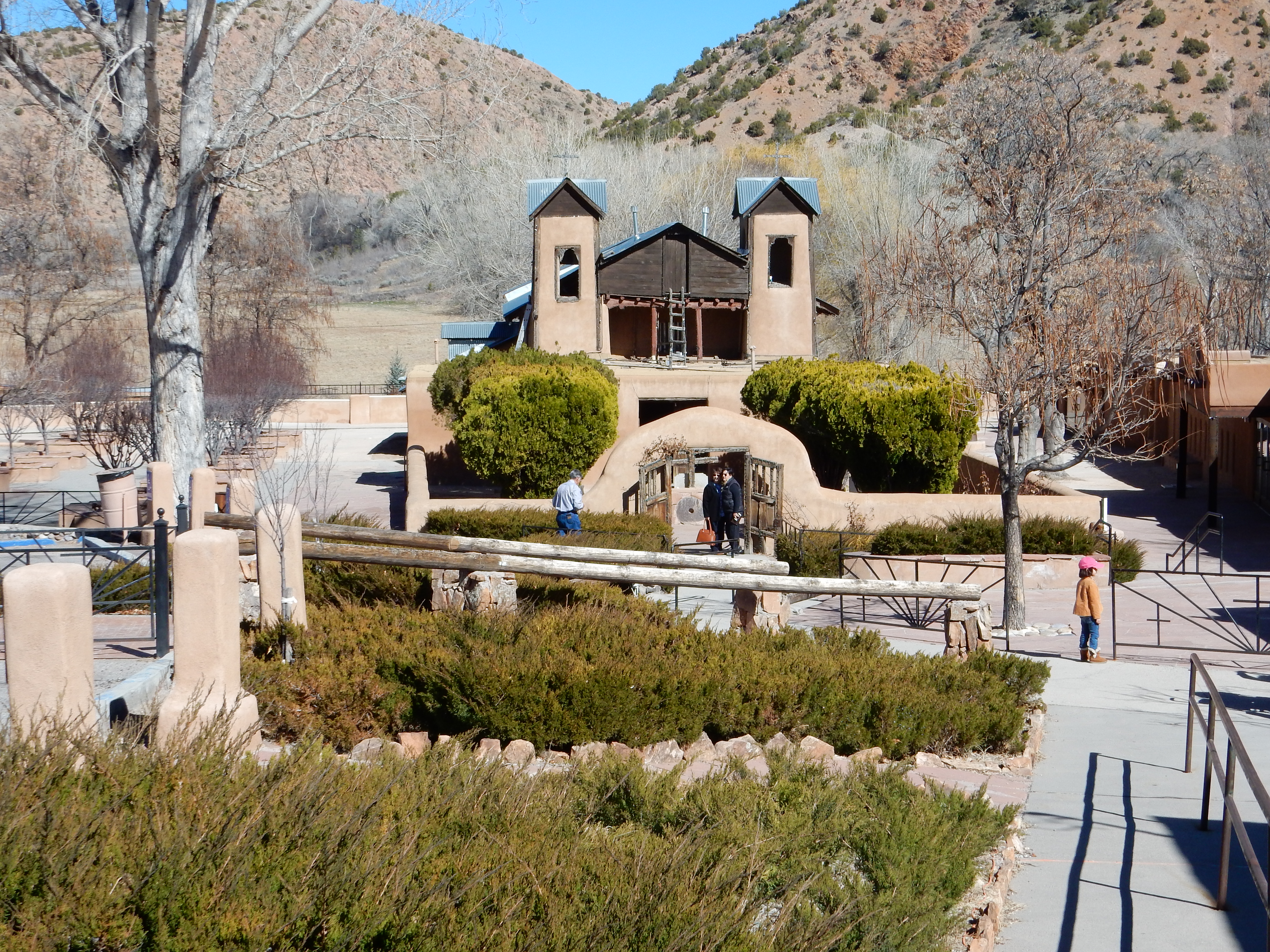
According to legend, the sanctuary marks the site where a buried crucifix was discovered sometime in the 18th century. Accounts vary as to who found the crucifix and under what circumstances. A small room within the sanctuary (el pocito) contains a round pit containing the sand in which the crucifix was found, which is thought to have curative powers. It is traditional for Catholics seeking blessings to walk long distances to the sanctuary and take a small amount of the tierra bendita, "blessed earth."
Ruins of older missions are historically significant, such as
Plaza de Santa Rosa de Lima.
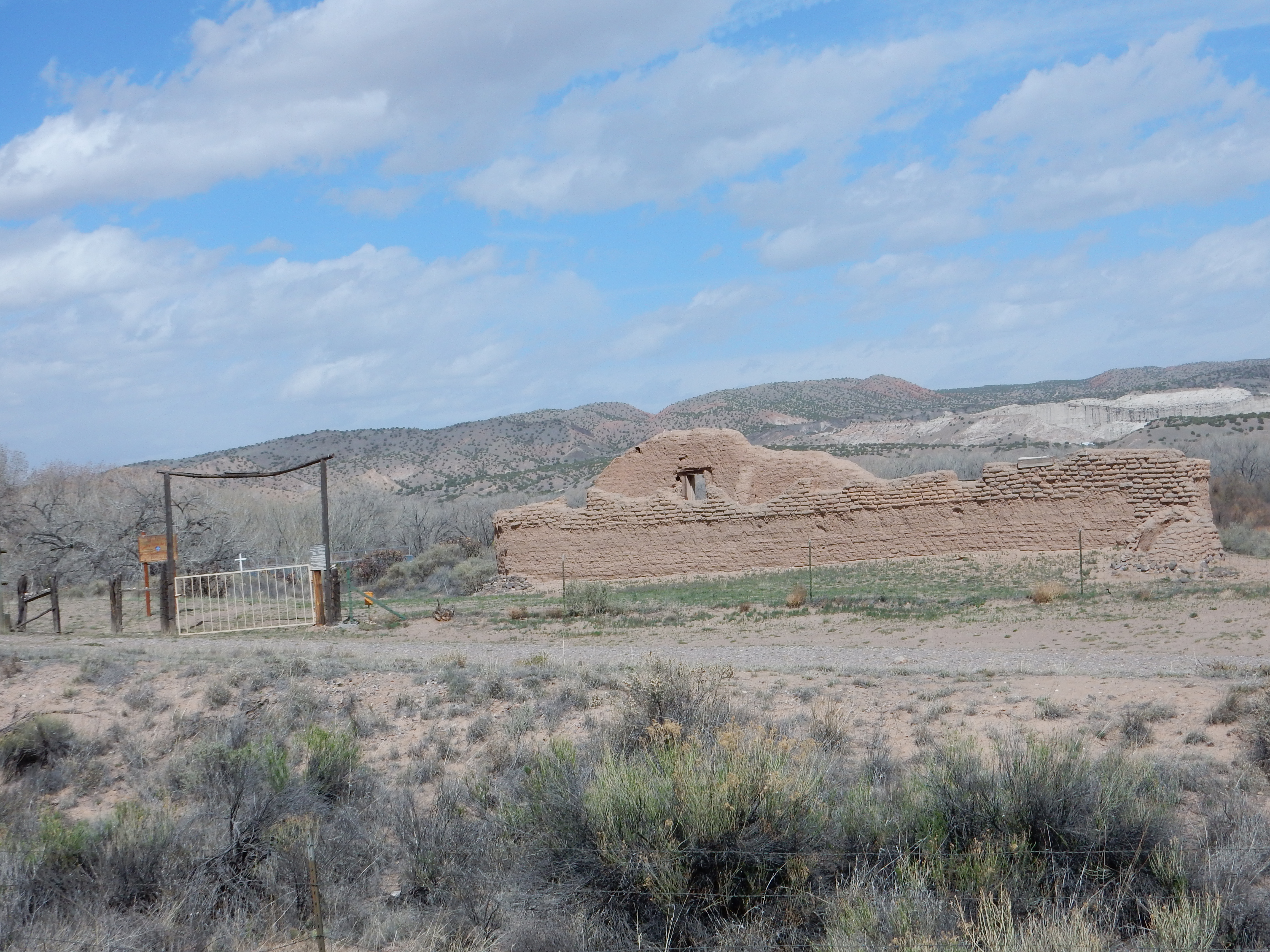
This is heart of the ghost town of Santa Rosa de Lima. The church
was apparently in use until the 1930s and is now on the National
Register of Historic Places. The nearby village of Abiquiu,
outside the original genízaro merced, has
become somewhat gentrified, and there is a bed and breakfast very
close by.
The Spanish regarded New Mexico as a backwater buffer province
between Mexico and the North American claims of the French, and,
later, the Americans. No foreigners were allowed in the territory,
trade to Santa Fe was monopolized by Chihuahua, and the province
remained deeply impoverished. Although Mexico established a modern
scientific mining school, no one knowledgeable about geology
visited New Mexico until the Mexican-American War of 1847.
One of the first Americans in the Jemez region was Josiah Gregg,
a trader on the Santa Fe Trail, who published the bestselling Commerce
of the Praires in 1844. Gregg was no geologist, but he did
notice the presence of large petrified logs in the Galisteo area,
which became the first report of fossils in New Mexico.
When war broke out between the United States and Mexico, the Army of the North invaded New Mexico across the Raton Pass and reached Santa Fe on 18 August 1847 unopposed. With the expedition was Lieutenant William H. Emory, who made the first scientific observations of the geology of the areas through which the Army marched.
The war of 1847 transferred sovereignty over New Mexico to the United States. The Treaty of Guadalupe Hidalgo granted U.S. citizenship to those New Mexicans who chose not to emigrate to Mexico and bound the United States to recognize the land grants made by the Spanish viceroy or his governors that had continued through the Mexican era. Existing water law was initially left intact, and the institution of the acequia has been little disturbed since 1847 and remains in place in many of the villages of northern New Mexico to the present day.
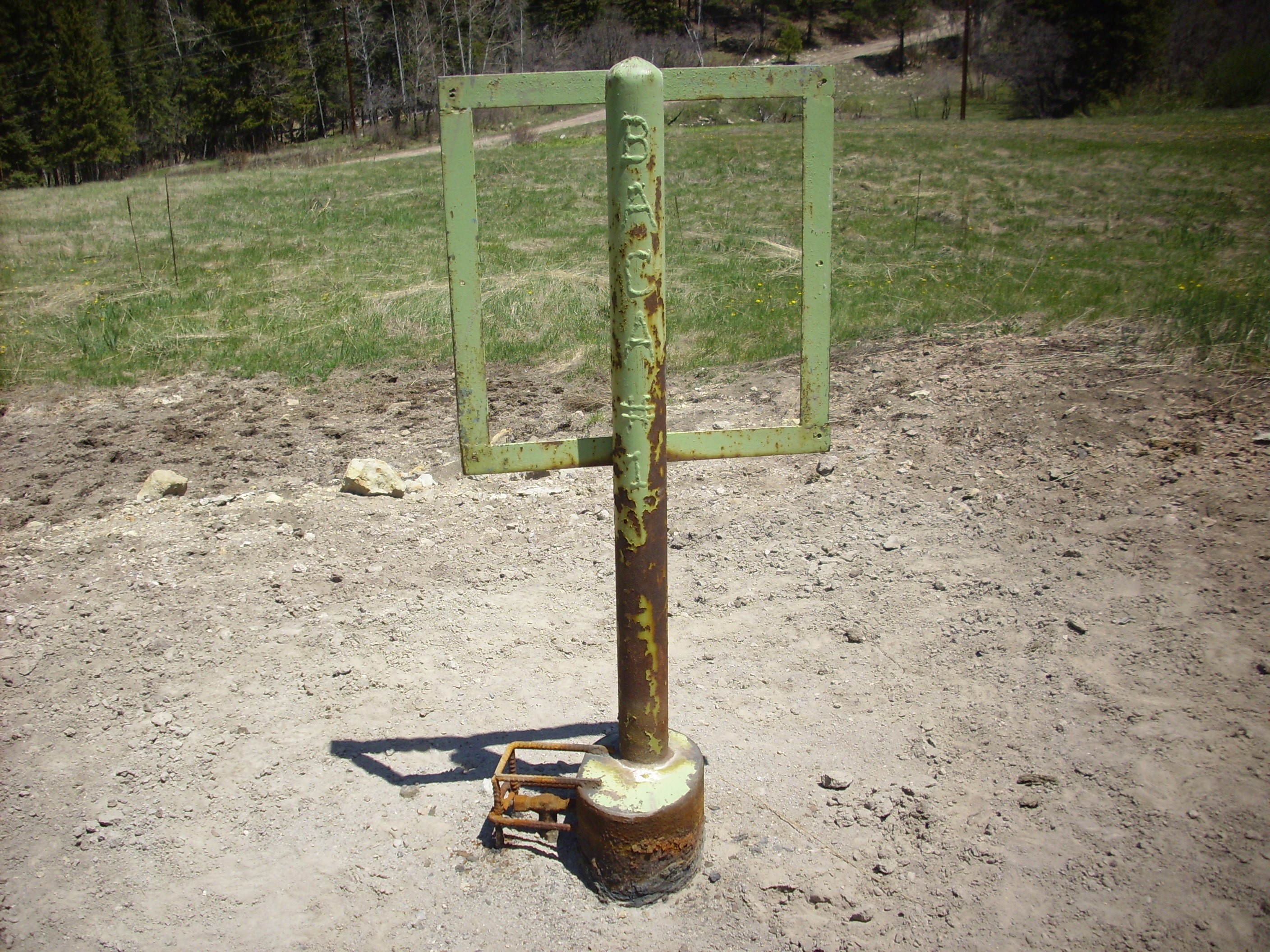
The recognition of existing land grants in 1847 still leaves its
mark on modern maps, which often show grant boundaries. Grant
boundaries are often also marked by highway signs. The Valles
Preserve is marked as Baca Location No. 1 on some older maps,
hearkening back to the time when the Baca family owned the land as
a former land grant.
My own home in White Rock is located on the former Ramon Vigil
Grant, which has an interesting and murky history. This grant was
originally awarded to Pedro Sanchez in 1742, who allegedly used
forged documents to petition for the grant. The White Rock area
was claimed by the San Ildefonso Pueblo as grazing commons, but
the pueblo could produce no documents to support their claim, and
it became part of the Pedro Sanchez grant. In 1765, the Spanish
governor of New Mexico declared the grant abandoned and ordered it
to revert to San Ildefonso. However, in 1851, Antonio Sanchez
appeared before the Alcalde (municipal magistrate) for San
Ildefonso, claimed to be a descendant of Pedro Sanchez, and sold
his claim to the land to Ramon Vigil. With the arrival of the U.S.
Surveyor-General at the end of 1854, Vigil petitioned for a "good
title" to the land, which was awarded in 1860 in spite of key
documents being missing or likely forged. The land was eventually
condemned for the Manhattan Project in 1943, then sold to private
developers in the postwar era for homes for Laboratory employees,
which included my father.
Some grants remain largely intact even to the present day. This is particularly true of land grants controlled by native American pueblos, but the Merced del Pueblo de Abiquiu grant, originally awarded around 1750, also remains intact. The grant takes in most of northern El Alto Mesa, and tourists driving in this area will find themselves restricted to roadways until they reach National Forest land further south.
The years just before the Civil War were marked by numerous
surveys of the western United States, generally by parties of the
well-trained Corps of Topographic Engineers accompanied by
civilian scientists. The rest of the country was hungry to learn
about the vast new western territories of the United States, and
the publication of hundreds of engravings and wood-cuts cost the
government better than $100,000, which was real money in the
1850s. It was the 19th century version of Big Science. This effort
was interrupted by the war, but resumed afterwards, with Hayden's
survey briefly penetrating New Mexico in 1869 and the Wheeler
Expedition conducting the first truly systematic and extensive
mapping in the 1870s.
The AT&SF Railroad was completed to Santa Fe by 9 February 1880. The "Chili" line became the closest railway to the Jemez, connecting Santa Fe with Denver on 8 January 1887. The line ran from Santa Fe to Buckman, turning north along the Rio Grande and crossing the river at Otowi.

From there the line ran to Espanola,
Embudo,
and points further north.
The arrival of the railroad accelerated contact between Anglos and Hispanics and native Americans, and also led to increased friction. Different legal traditions were a particular source of difficulty. Some disputes over land grant boundaries continue to the present day. But some of the thorniest disputes came over the issue of partition. With the arrival of the railroad, livestock raised in New Mexico could be shipped to distant and eager markets, and the grazing land held communally by small Hispanic villages suddenly jumped in value. Under the old customs, ownership of this land was nonpartible; that is, one could sell the right to share in the use of this land to a new owner, but the land itself could not be divided up and portions sold. American law had always viewed land as partible, and conflicts arose when Anglo purchasers thought they were purchasing exclusive use of a tract of ground and Hispanic sellers thought they were selling the right to share in the use of the land. American courts tended to side with the American purchasers, which produced lasting bitterness in the Hispanic community.
However, much of the Hispanic community was able to adjust to American legal and political traditions, and today Hispanics hold a substantial fraction of state and local political offices. Native Americans have not fared as well, in part because they now make up less than 10% of the population, and in part because of the greater cultural gap between native Americans and Anglos compared with the cultural gap between Hispanics and Anglos.
The area north and west of the Ramon Vigil Grant and the San Ildefonso Reservation was opened up for homesteading after being surveyed by the Surveyor-General. Both Hispanic and Anglo settlers established homesteads on the Pajarito Plateau.
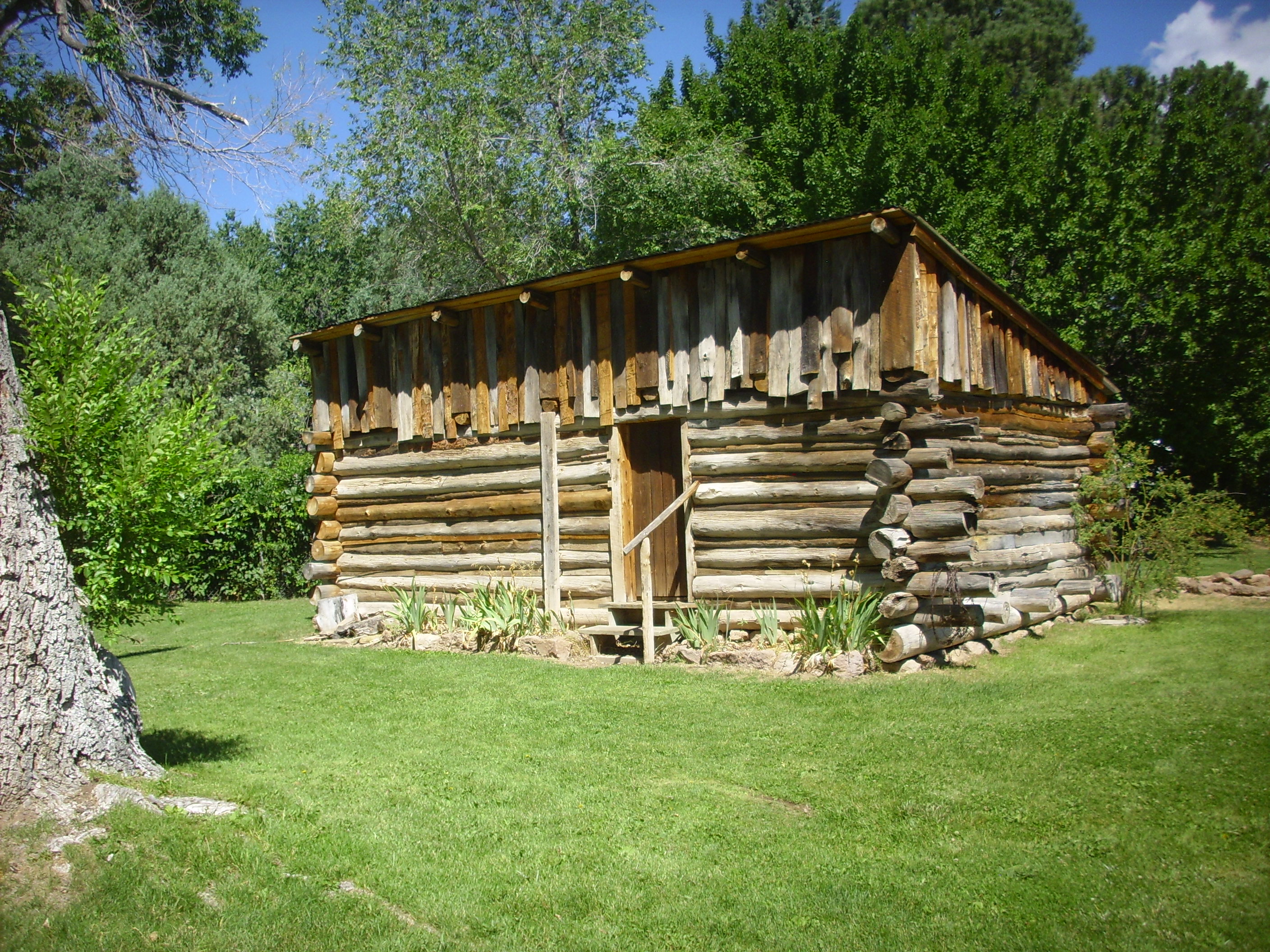
The Romero cabin dates to the late 19th century and was relocated
to the historical district from its original location on what is
now a LANL restricted area.
Cattle ranching plays a significant role in the history of the Jemez area, and cattle grazing on National Forest lands remain a part of the Jemez experience today. The Valles preserve is still a working cattle ranch, and historical buildings from the ranch days continue in use by Preserve staff.
Old ranch headquarters. 35 51.877N 106 31.022W
The Octagon
The building in the second photograph has an octagonal floor plan and was apparently used as a guest lodge.
Cattle grazing on most National Forest lands is by permit based on carrying capacity. The hiker may encounter cattle in most of the more fertile parts of the National Forest areas of the Jemez.
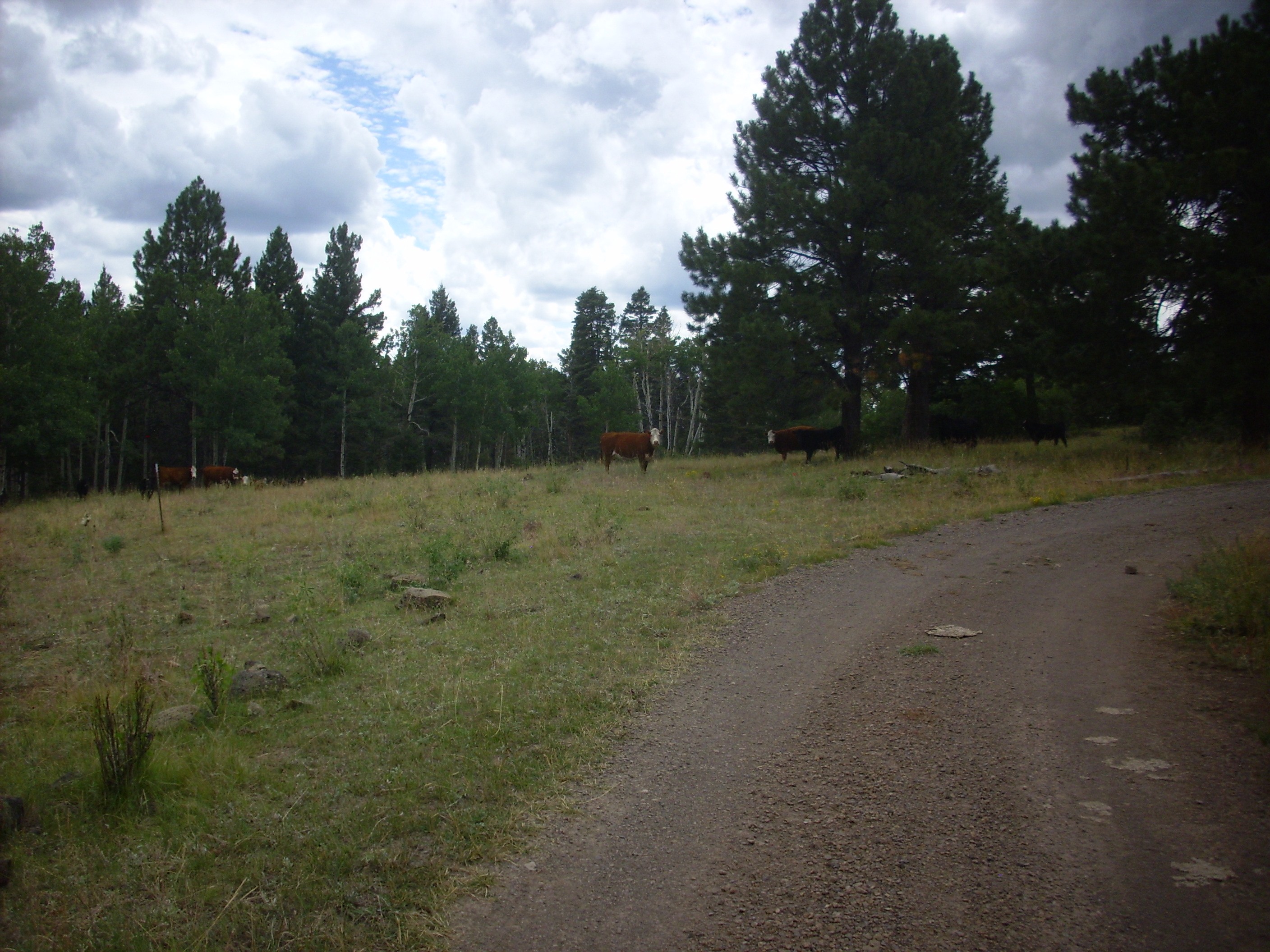
A mooving sight.
In my experience, most such small herds are mixed steers and cows
(with calves at the right time of year.) It is well to remember
that even cows can be aggressive if provoked severely enough, and
that these animals represent considerable wealth to their owners.
Treat them with due respect.
During the early part of the 20th century, much of the Jemez was opened to logging, which continues on a reduced scale to the present day. Logging was particularly extensive in the Valles caldera in the 1960s, including in the area around Redondito.

Logging roads east of Redondito. Looking
southeast from 35
54.294N 106 33.224W
The angle of the sun highlights the rows of logging roads on the peak. Most of the old roads in the caldera are now overgrown, but they make an effective network of trails for hikers and mountain bicyclists. However, the roads shown in this photograph are off-limits, as they are in the cultural exclusion zone around Redondito and Redondo Peak, established out of respect for native American beliefs.
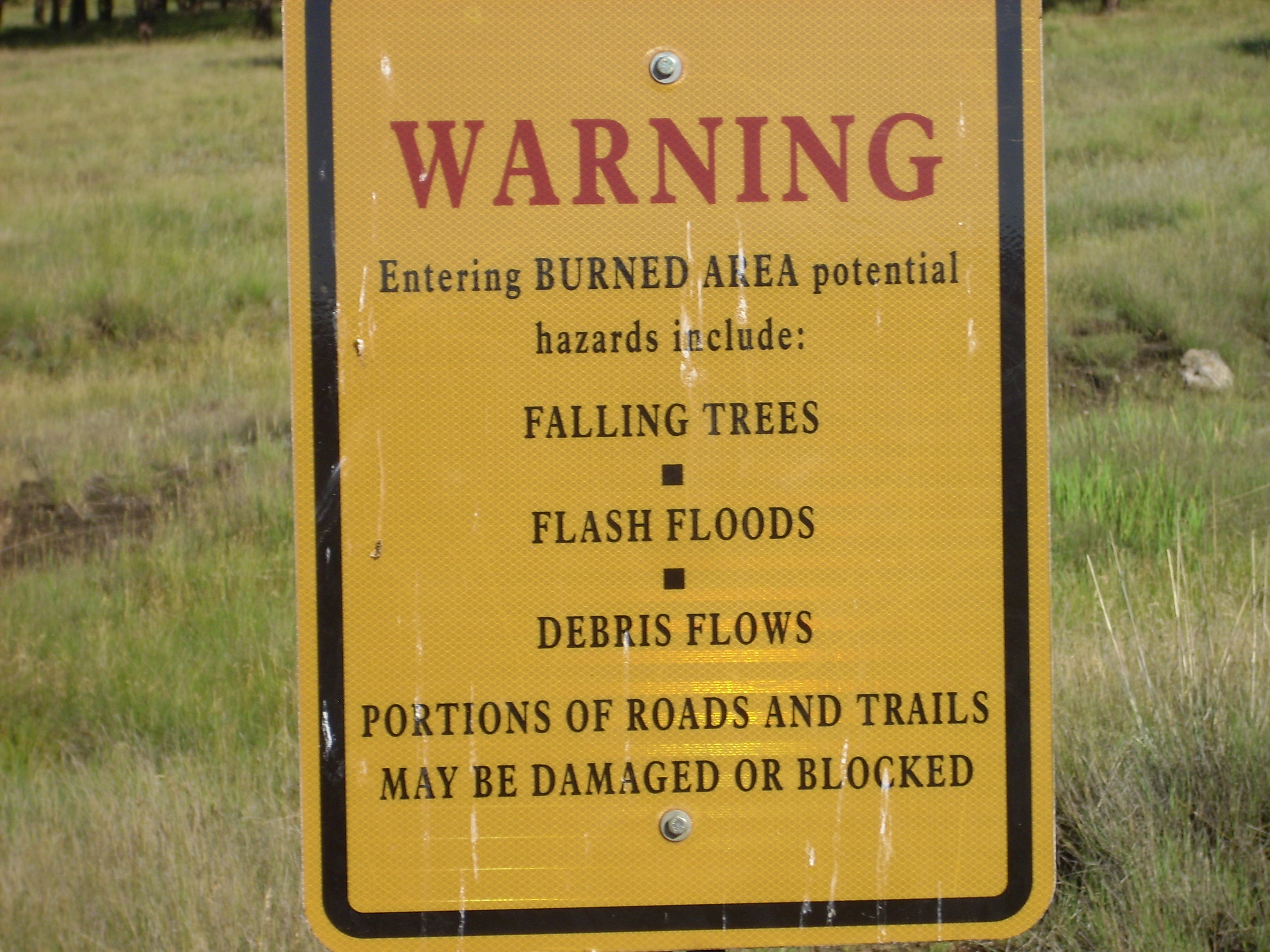
Logging brought with it an emphasis on fighting forest fires. It took decades to recognize that this could be counterproductive, by allowing undergrowth and forest litter to build up to the point where fire potential became explosive. Fires in such forests tend to be hot fires that reach the crowns of the trees, with devastating effect. We now have a better understanding of how fire can renew wild lands, burning out excess undergrowth and thinning tree seedlings.
Here’s what a healthy ponderosa forest is supposed to look like.
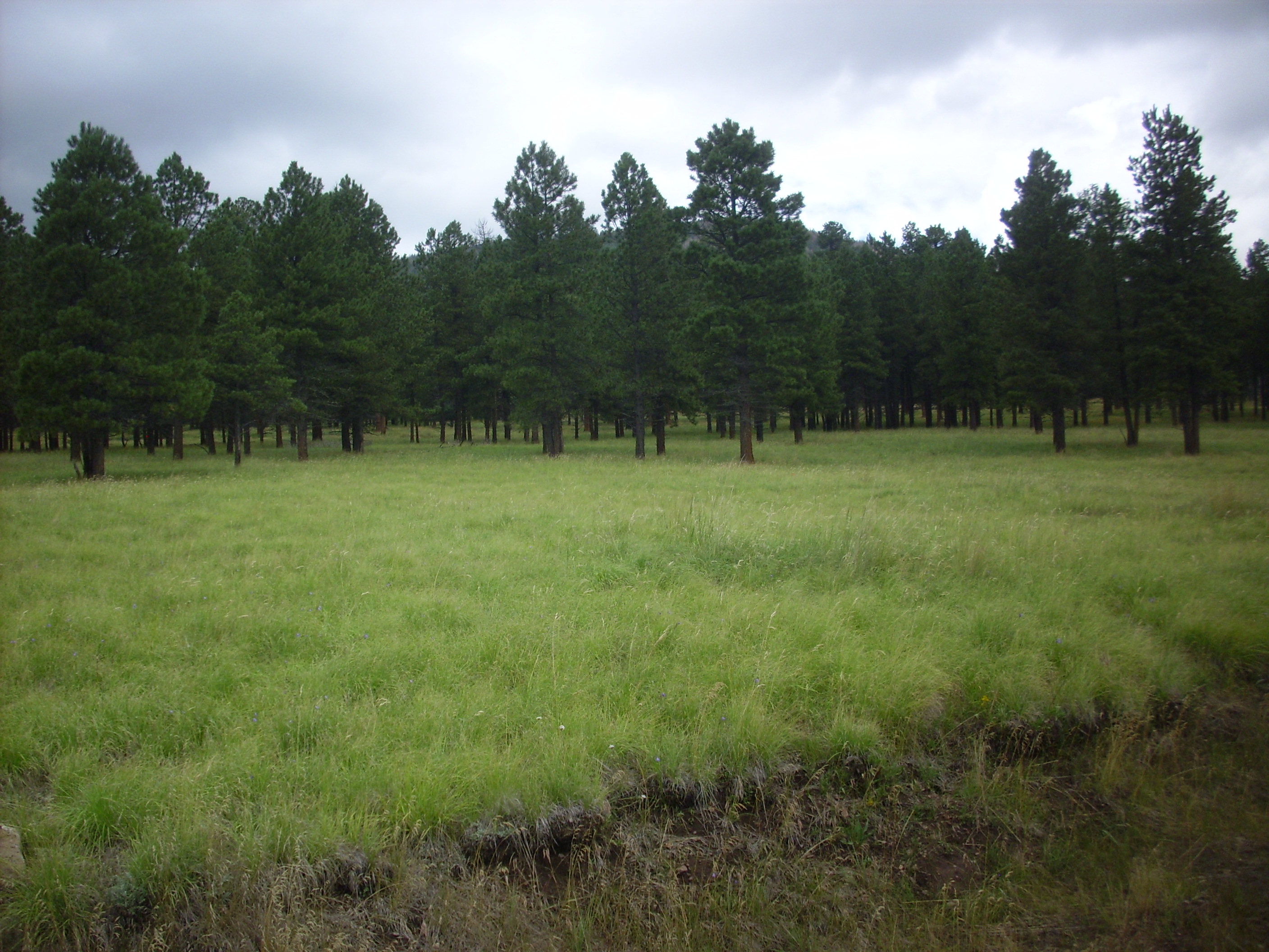
The trees are widely spaced and surrounded by grassland. This is
what you get if there are frequent “cool” ground fires to cut down
the number of ponderosa saplings and promote the growth of grass.
Curiously, this area is likely not a result of allowing grass
fires to run their course, but of livestock grazing simulating
some of the effects of fire.
With improved understanding of the role of fire, the Forest
Service regularly carries out prescribed burns of selected areas
of national forest. One such burn went out of control in May 2000,
becoming the devastating Cerro Grande fire which destroyed 48,000
acres (19,400 hectares) of forest and over 400 homes in Los
Alamos. The decision to carry out the prescribed burn was
controversial, since spring is the windy season in the Jemez and
the area was bone-dry. However, the Forest Service was concerned
that the Cerro Grande area was a tinderbox that could catch fire
from lightning strikes at any time as an uncontrolled burn, and
took the gamble of risking a preemptive controlled burn -- a
gamble that was lost. The devastating Las Conchas fire in 2011,
which burned a record 156,293 acres, was a result of wind blowing
down power lines in an area that had not experienced fire for
decades.
Visitors to the Jemez may encounter signs advising that a
controlled burn is in progress or read about plans for controlled
burns in local papers. Should you see a smoke plume in the Jemez
without any advisory signs or recent notices in the paper, then by
all means report it by cell phone. A wildfire is an emergency for
which the good faith use of the 911 code is justified.
Mining has played an important role in the history of the Jemez. We have already learned about gold mining in connection with the Bland Monzonite. But mining of copper took place even earlier, and mining of pumice continues to the present day.
The mining industry distinguished between mines, quarries, and
borrow pits. A borrow pit is an open pit where gravel and other
unconsolidated material is removed for use in road construction or
other civil engineering, while a quarry is an open pit where solid
rock (rather than any ore it contains) is mined for use as
dimension stone. Any excavation for extracting specific ores or
other minerals is a mine.
Copper mining likely dates back to the time of the Spanish conquistadores,
and copper ores were worked in the Shinarump Formation near Cuba
and in Canyon
del Cobre ("Copper Canyon") or in the Abo and Yeso
Formations in Canon
de San Diego. Of these, only the Nacimiento mine has been
worked in modern times.
The mine has been worked since at least the 19th century,
originally by adits (horizontal tunnels) in the copper-bearing
beds. These were shut down during the First World War, due to the
wartime labor shortage, and never reopened. Open-pit mining began
in the 1960s and continued to 1975, when rich new copper deposits
in South America began to be mined. These drove the worldwide
price of copper so low that the Nacimiento mine could not longer
be profitably worked. A local earthquake at about this time
destabilized part of the slope above the open pit, and the costs
of stabilizing the slope and continuing to pump water out of the
open pit were prohibitive.
In 1984, an attempt was made to extract the ore by in situ leaching using a solution of sulfuric acid. However, the method proved uneconomical. By then some 25,000 gallons of sulfuric acid had been pumped underground. This posed a serious environmental hazard, and in 2007 the Forest Service began remediation, flushing fresh water through the ore body to remove the acid waste and processing it in a series of treatment ponds on the site. The water returned to the watershed is apparently so cleaned up that it meets drinking water standards.
The treatment ponds begin with an anaerobic pond, filled with boulders, in which alcohol is added to feed anaerobic bacteria. The bacteria metabolize the alcohol using oxygen extracted from the sulfuric acid in the leach water, converting the sulfuric acid to hydrogen sulfide. This form of metabolism is called dissimilatory sulfate reduction. The hydrogen sulfide precipitates most of the metal contaminants out of the waste water but gives a distinct stench to the area.
Most copper mines consist of copper sulfides deposited by hydrothermal activity, with a rich cap of copper carbonate minerals (green malachite and blue azurite) formed by oxidation of the upper part of the ore body. The copper mines of the Jemez area are unusual in that the copper minerals were deposited by replacement of organic matter. The copper was leached from overlying formations by groundwater, which then percolated through the underlying sandstone. The copper replaced the organic matter in the sandstone as chalcocite, Cu2S, along with minor amounts of copper carbonates.
This is a large fragment of petrified wood exposed on the east face of the Nacimiento Mine.
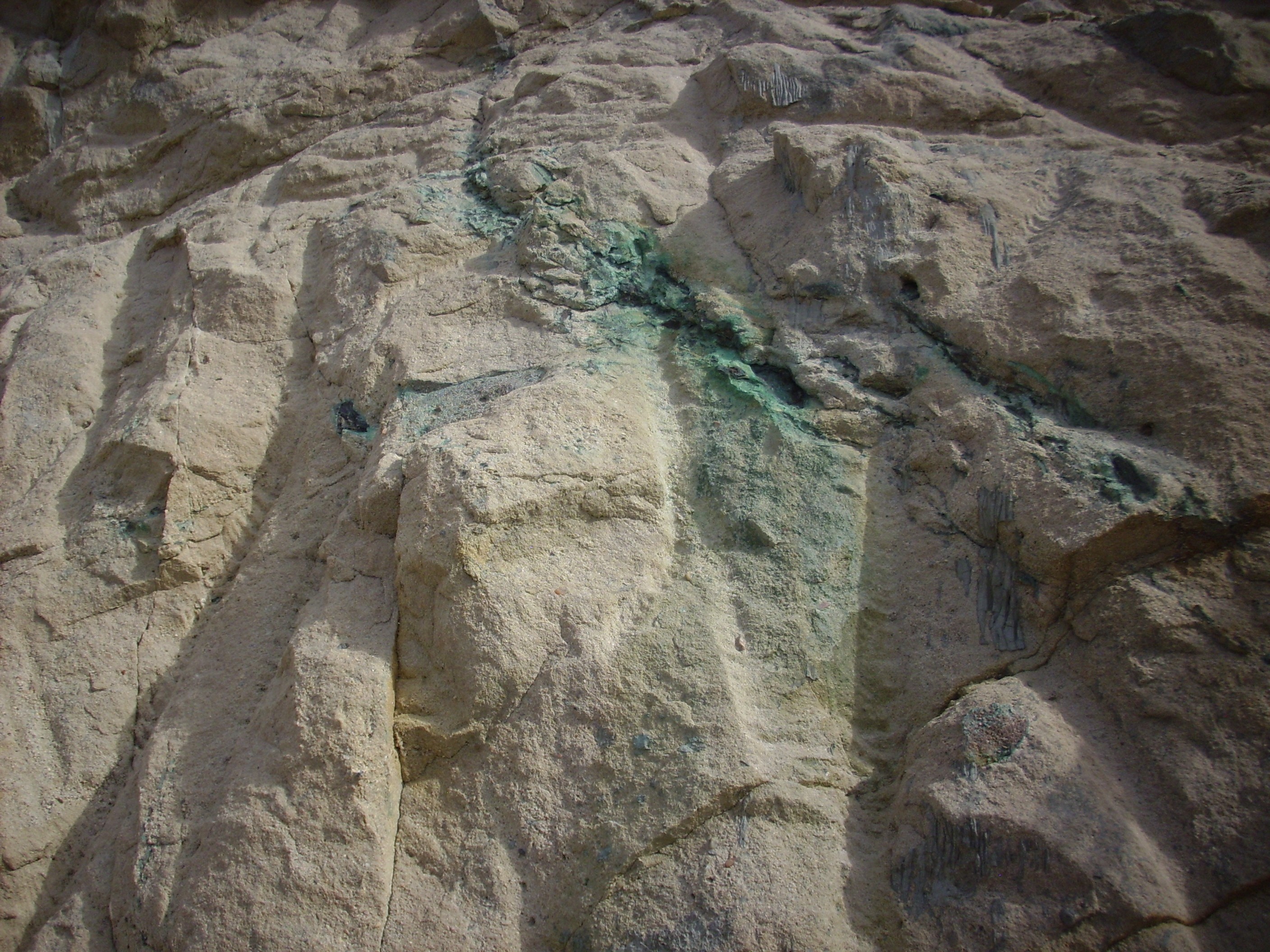
Copper mineralization at Nacimiento
Mine. 35
59.583N 106 53.815W
The main ore body must have been spectacular. The green color is
from malachite, while the petrified wood contains a variable
amount of black chalcocite. Unfortunately, this can be hard to
distinguish from the carbon of the original wood.
Another example:

Here is a bit of petrified wood from the tailings dump showing copper mineralization.
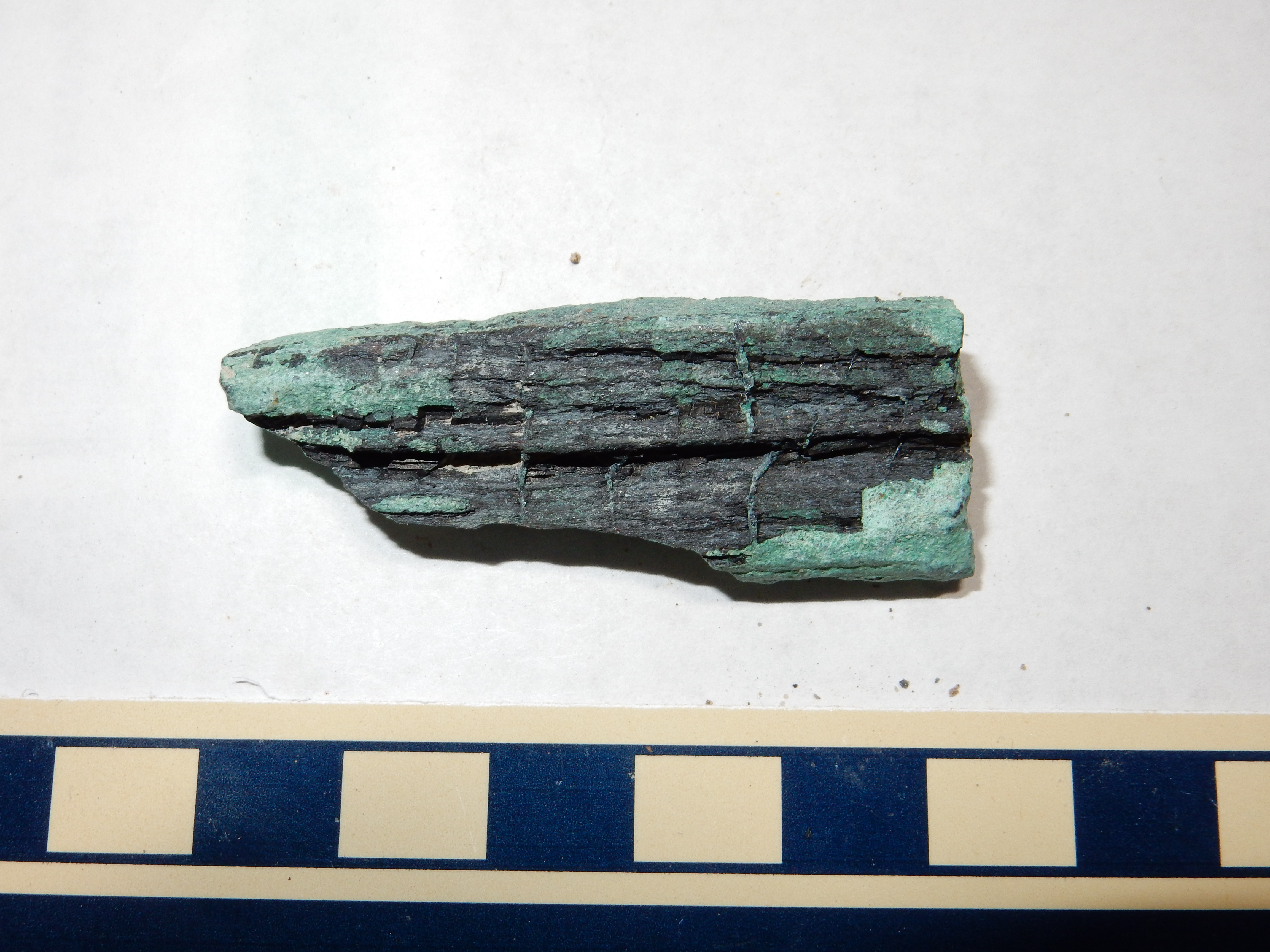
It’s not a large fragment, but in addition to having beautifully preserved grain, you can see that there is some kind of membrane or layer cutting across the grain at intervals of a few millimeters. I am not paleobotanist enough to tell you the significance of this, alas. The fragment is also heavy, suggesting that there is considerable replacement of carbon by chalcocite.
The Nacimiento Mine has been worked long enough for Nature to
have done some reworking of her own.
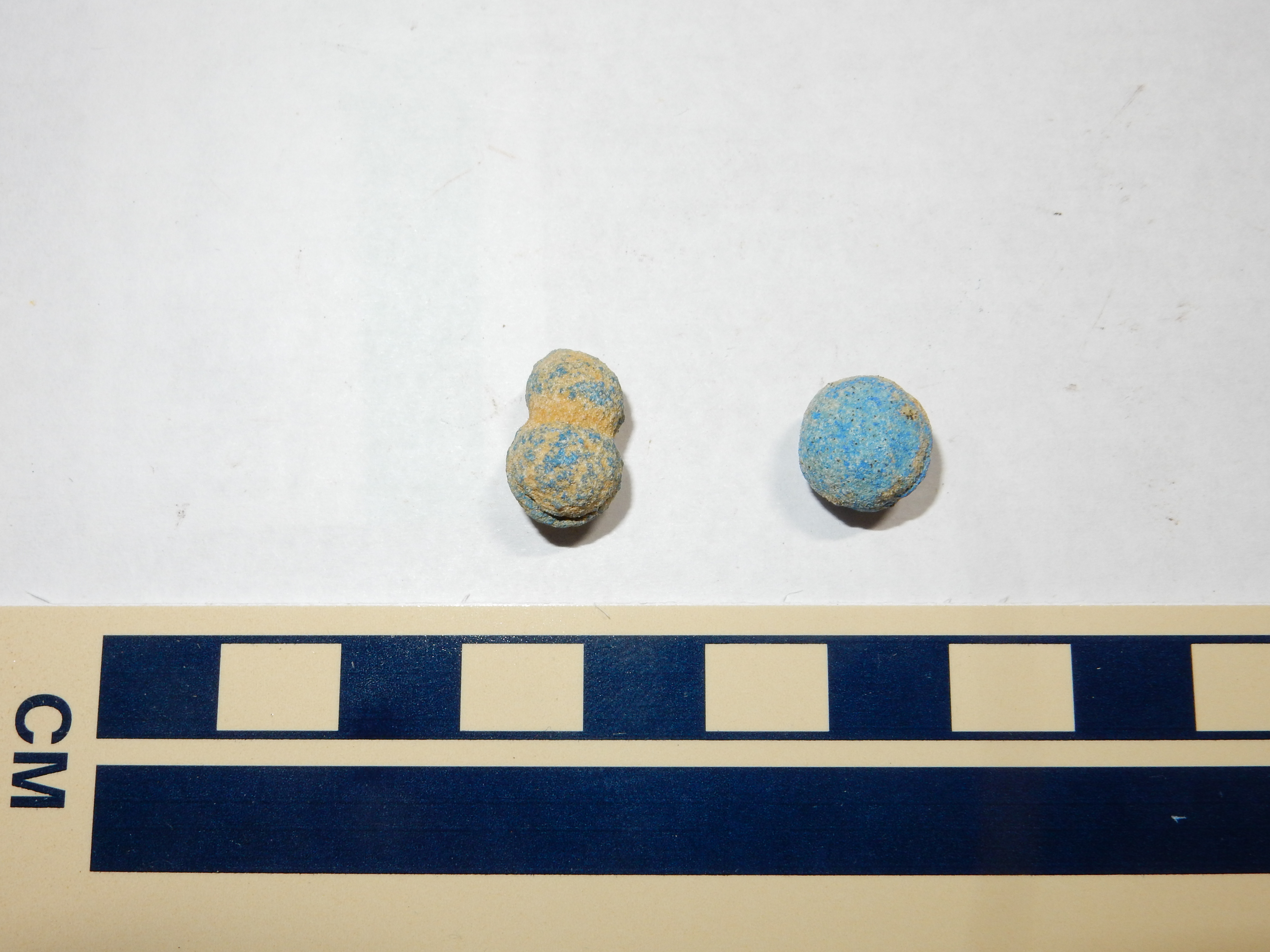
These are copper "blueberries" found in some of the tailings and
worked areas of the mine. They do not seem to be present in the
undisturbed beds, which suggests they have formed in a matter of
decades in copper-rich debris exposed to the elements by the
mining operations. Whether these should be classified as a natural
feature is a matter of semantics; in this case, they formed as a
consequence of anthropological disturbance, but they could in
principle form in natural landslides as well. Regardless, they are
a curiosity of sufficient value to collectors that the best
location for collecting them has been duly staked and claimed by a
local rock hound.
Even the main ore body at the Nacimiento Mine was mostly quartz sandstone. Rock from the ore body was milled to a fine powder, then the gangue (waste rock) was separated from the ore to produce copper concentrate suitable to be shipped out for refining. This was done by flotation, in which the finely ground mixture of ore and gangue is placed in a tank of water through which air is bubbled. Chalcocite grains readily cling to the bubbles and are floated to the top of the tank, where they are skimmed off and dried as copper ore concentrate. Because much of the ore at the Nacimiento Mine occurs as copper carbonates, special surfactants were developed that, when added to the water in the tank, caused carbonate mineral grains to cling to the bubbles as well, allowing both ore minerals to be separated from the gangue in one operation.
Pumice mining continues in the Jemez area to the present day. The most active mine is the Copar Mine northwest of Espanola.
Copar Mine. Looking east from 36.035674N 106.24034W
The mine here consists of Guaje Pumice (perhaps the most northerly exposure east of the Jemez) under an overburden of Otowi Member, Bandelier Formation. The overburden is stripped and the pumice beneath sorted into trucks for shipment to purchasers. A consequence is that 31 Mile Road is very well maintained to this point, so that the 18-wheelers can safely traverse it in good weather. Beyond the mine, the road abruptly drops in quality, though it is still a good gravel road by the usual National Forest standards.
A limited amount of quarrying has also taken place in the Jemez. An old limestone quarry, exploiting the Madera Formation, is located not far off State Highway 126.

Abandoned limestone quarry. 36.000275N 106.739989W
Nearby workings yielded stone used in the Seven Springs area for road embankments. The pond here was once a depression occupied either by a gravel crusher or a Portland cement kiln. The former is more likely.
Cinder is mined at the Cerrito
Pelado Mine in the Cerros del Rio.
The native Americans were not the only inhabitants to leave ruined settlements in the Jemez area. Ghost towns, most often dating from around the start of the 20th century, are found scattered throughout the region.
The Tsankawi section of Bandelier National Monument includes an
early 20th-century ruin known as the Duchess Castle.
Duichess Castle. 35 51.945N 106 12.880W
The Duchess Castle was constructed for Vera von Blumenthal and her friend Rose Dougan in 1918. (Vera was actually a baroness, not a duchess, but the name has stuck.) The “castle” was actually living quarters and a school, built to educate the local Pueblo peoples in how to refine their pottery techniques to increase their commercial value and help lift the pueblos out of poverty.
It’s a reminder of the high idealism of European culture that was devastated, along with much of Europe, in the First World War.
Duichess Castle. 35 51.945N 106 12.880W
The construction is shaped tuff blocks with mud mortar and some wood beams. The concrete at the base of the walls looks new and was almost certainly added for better preservation by the Park Service.
Traces of the smaller ghost towns may be nothing more than a cluster of old deciduous trees and some old foundation stones, as at the ghost town of Waldo in the Hagan Basin south of the Jemez.
Waldo. 35 26.865N 106 08.553W
Waldo is a bit unusual in that a salvage company purchased the
land for the express purpose of recycling the building materials.
Other ghost towns are better preserved.
And now you have the answer to the question that has been puzzled over by millions: Where’s Waldo?
The largest city in the Jemez region came into existence quite
abruptly in 1943, on the site of a former boys' school on the
Pajarito Plateau. Ashley Pond had purchased the old Ramon Vigil
Grant and the Los Alamos Ranch and started the school in 1916,
turning management over to A.J. Connell after 1918. The school
emphasized rigorous academic preparation for college, physical
activity (including wearing shorts and sleeping in screened
porches year-round) and strict discipline.
Fuller Lodge was part of the school complex and is now the oldest building in Los Alamos still in use.
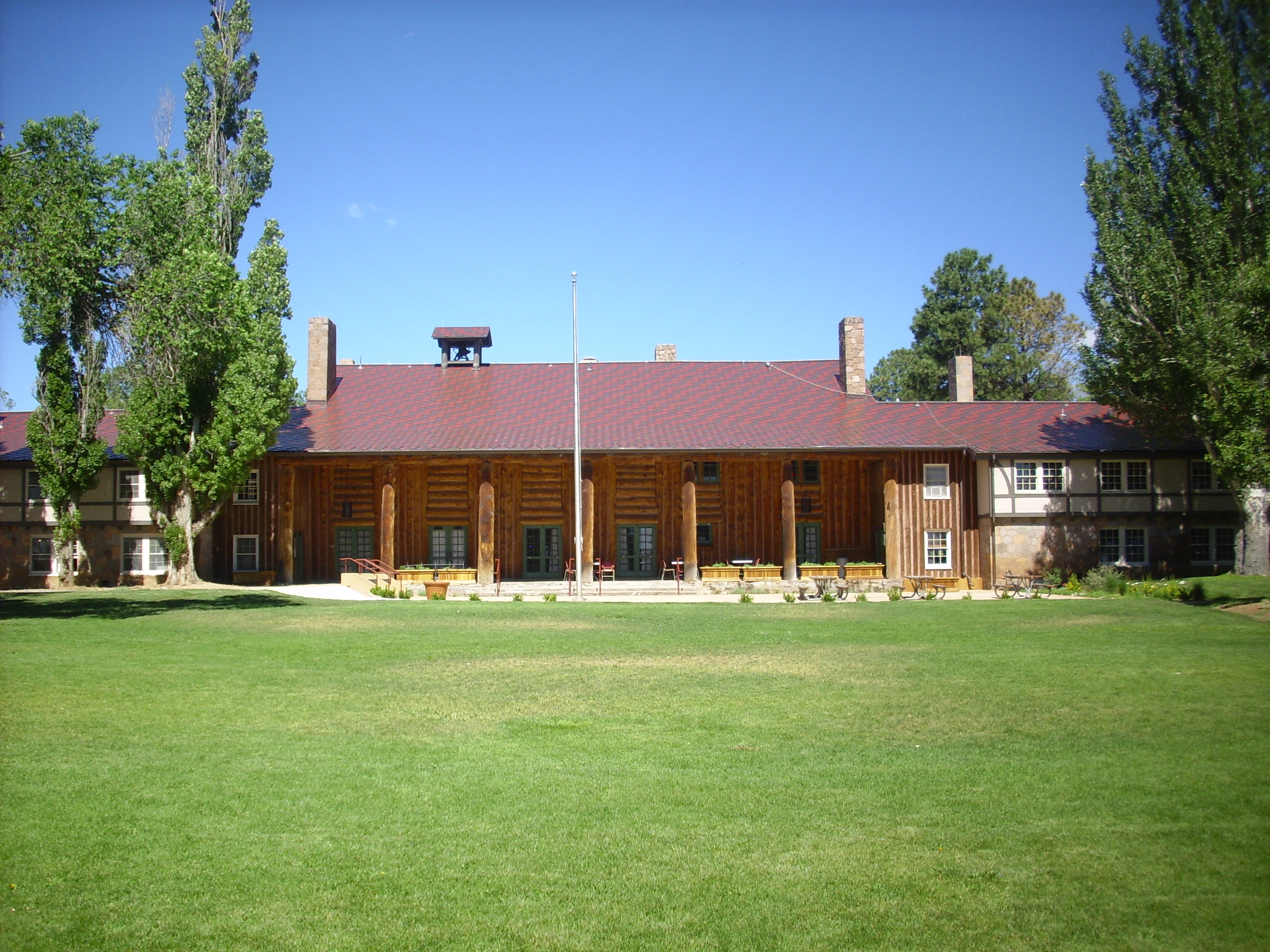
Fuller Lodge. 35 52.921N 106 18.161W
Near Fuller Lodge is Ashley Pond, a small pond named after the
boys' school founder, that has since been enlarged and developed
into the centerpiece of a large park. The pond has its own
population of somewhat aggressive ducks and geese.
The school was closed during the Second World War to make way for a secret laboratory for developing the atomic bomb. The homesteaders on the Pajarito Plateau also found their land condemned by the government, and while all were entitled to compensation, several found their entire compensation seized to pay back taxes.
Access to the new laboratory was via a highway bridge at Otowi.
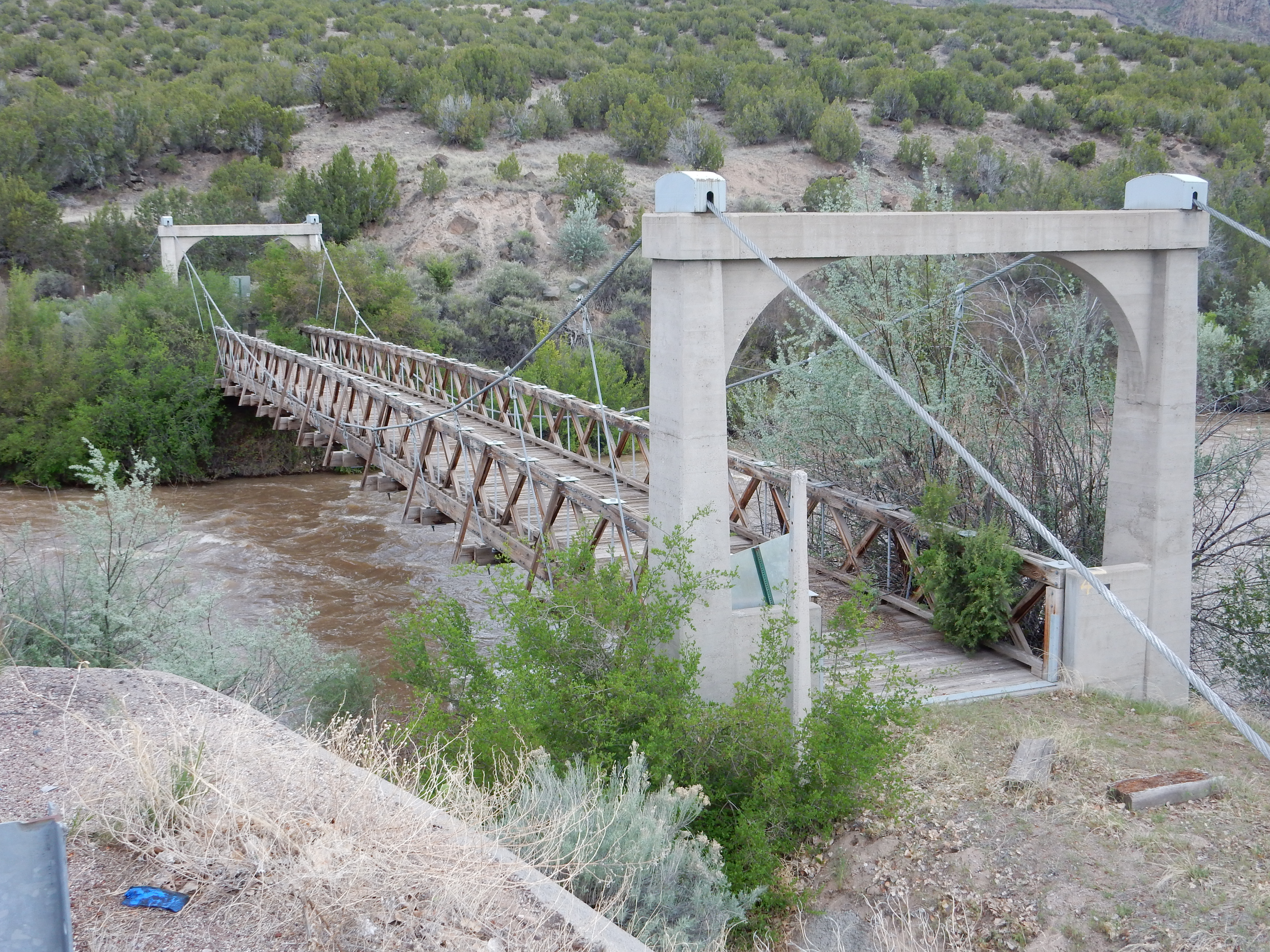
Old Otowi Bridge. 35 52.485N 106 08.616W
The bridge was built in 1924 and remained in use until 1948, when a steel bridge was built at the location of the modern crossing. Nearby is the Edith Warner home, "The House at Otowi Bridge":
The House at Otowi Bridge. 35 52.485N 106 08.616W
Edith Warner befriended the San Ildefonso Tribe, and vice versa, and also became acquainted with the scientists who designed the first atomic bombs at Los Alamos. Otowi was the transfer point for a lot of the more ordinary deliveries to the laboratory, which Warner was paid a small salary to manage.
After the use of atomic bombs on Hiroshima and Nagasaki
contributed to ending the war, the laboratory continued research
in nuclear energy, eventually becoming a permanent establishment
and a major employer in the region, with Los Alamos being
effectively a large company town. It remains so today.
Because there is obviously hot rock not far below the surface
here, exploratory geothermal drilling was done in the Jemez during
the 1980s. The Baca #1 well was drilled near the road north of
Sulfur Springs.
Baca #1 well pad. 35.909N
106.612W
The geothermal potential turned out not to be great enough for profitable exploitation. However, the drilling at this and several other well sites contributed significantly to our understanding of the geology of the Valles caldera.
The Jemez area has become a favorite location for filming Western
movies and television shows. Several have been filmed on the
Valles preserve, and there are also sets in the area north of
Cerillos.
This is a relatively new set; it was not yet present on Google
Maps at the time I took this photograph. You are seeing a set of
facades from the rear.
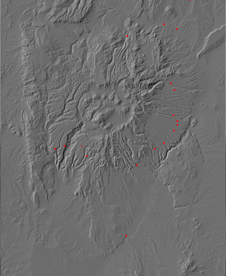
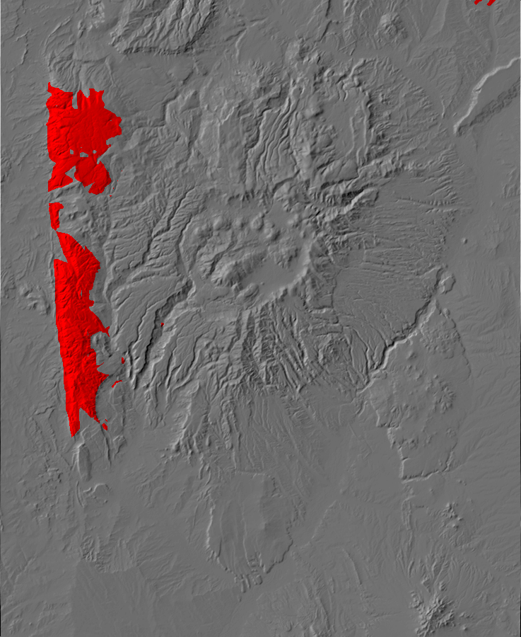
Digital relief map of the Jemez area. Red and yellow are
paved roads; orange are gravel roads. ©2015 Kent G. Budge
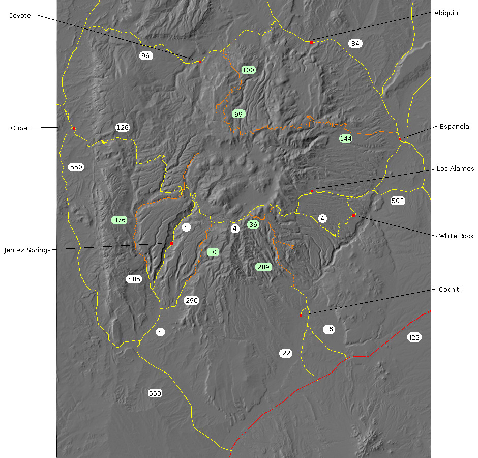
The Jemez Mountains are still largely undeveloped, and likely to remain so for the foreseeable future. However, there is a paved highway (NM 4) through the heart of the Jemez and a loop of paved highways around the periphery of the Jemez. The mountains also have a good network of forest roads. While these are gravel roads, the most important are well-maintained and suitable for passenger vehicles in good weather.
The entire Jemez area has been carefully mapped by geologists, and most of the geologic maps are available online from the New Mexico Bureau of Mining and Mineral Resources. Geologic maps are generally based on a topographic map of the mapped area, but show locations of rock formations, faults, and other geological features. These maps can be invaluable for the serious geology enthusiast visiting an area.
Perhaps the most useful resource for the geology tourist is the
extensive sets of road logs for the Jemez area. A road log
is a prescribed route with odometer mileages describing geological
features along the route. These are best (and most safely!) used
by a driver and co-driver. The vehicle's trip odometer is reset at
the start of the route, and the driver follows the prescribed
route while the co-driver watches the trip odometer and follows
the road log to identify interesting geologic features. Extensive
road logs have been published for the Jemez area by the New Mexico
Geological Society, and some are available online.
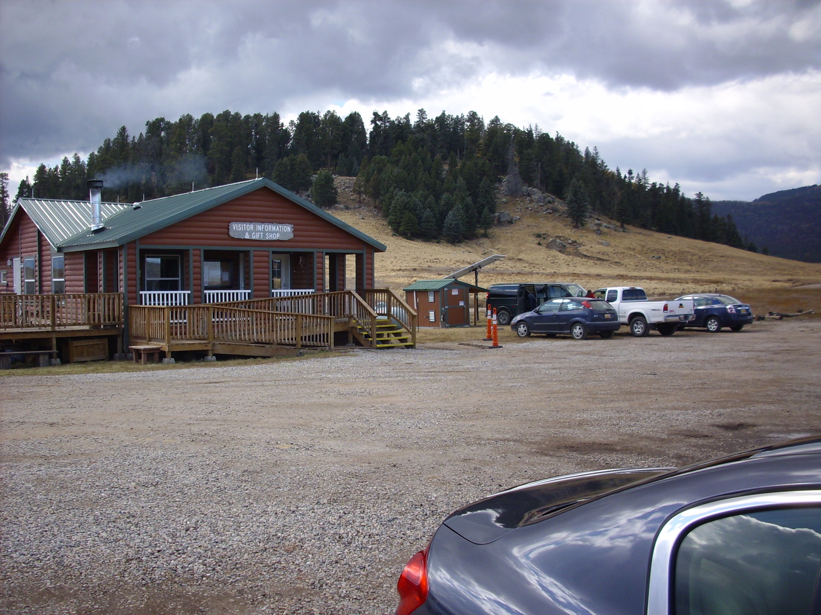
Valles Preserve visitors' center. Looking southwest from
35
51.412N 106 29.459W
The heart of the Jemez, the Valles Caldera, is almost entirely contained within the Valles Caldera National Preserve. A day pass costs you $15, and to drive in the back areas of the caldera, you will also need a back country vehicle permit. This is free with the $15 day pass but only a limited number are issued each day. The gravel roads to the north moat and along the length of the moat are kept in good condition and are suitable for passenger vehicles in good weather.
The trip to the north moat will give you a good view of the
topography of the caldera, caldera rim, ring domes, and resurgent
dome.
The southeast portion of the Jemez is contained within Bandelier National
Monument. Access is exclusively by shuttle bus from the transfer
station at White Rock, except during the winter months or if
you have a handicapped parking permit, or if you intend to camp on
site. The transfer station has extensive parking and a modest
number of inexpensive overnight trailer stations, and it ties into
the main bus system of Los Alamos County, which does not charge
fares. A 7-day individual pass to Bandelier is $6.
The main attractions at Bandelier are the extensive archaeological sites, but there is also some splendid geology, especially in the back country. For a short visit, I recommend the hike to Upper Falls. If you have more time, the hike from Ponderosa Campground the length of Frijoles Canyon to Upper Falls is a nice tour of many of the formations of the Pajarito Plateau.
The tent rocks of Kashe-Katuwe National Monument and the Veterans Memorial Overlook into the Bearhead Peak area are not to be missed. Hours are somewhat variable; I recommend arriving early in the day. Admittance is $5 per vehicle. Be aware that there is no lodging nearer than Santa Fe.
The road to the tent rocks is a paved all-weather road, but the
road from there to the overlook is a gravel road which, while
suitable for passenger vehicles in good weather, is closed during
inclement weather or conditions of limited visibility.
No rock collecting is permitted within the boundaries of the
Preserve or the National Monuments. Pets, other than service
animals, may also be restricted to certain areas.
If you are planning to visit a number of the national parks,
preserves, and monuments in the western United States during your
trip, you may find it worthwhile to get an interagency annual
pass. This is $85 per individual but gets you practically
unlimited access to national parks, preserves, and monuments for a
full year. Note that you will still need a back country permit in
the Valles preserve (though there will be no fee.)
Much of the Jemez surrounding the Valles preserve is under the
jurisdiction of the Santa Fe National Forest. Unless there are
local regulations to the contrary (as in the immediate area of
Soda Dam) you may collect reasonable quantities of hand specimens
for personal study.
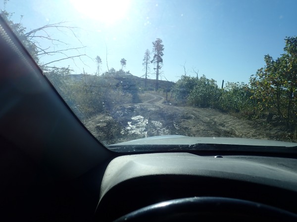
Most roads are gravel roads and these vary greatly in quality. The best are suitable for all passenger vehicles in good weather; the worst are barely suitable for an off-road vehicle with high ground clearance and a roll bar. Take care on sharp turns on steep grades; even the roll bar won't save you if you go off a vertical cliff 50 meters high, of which there are many in the area.
Note that many of the forest roads are closed to most traffic from January 1 through April 15.
I offer descriptions of the more passable roads based on
conditions during my most recent visits. Road conditions can
change from year to year and even from month to month. Travel at
your own risk.
This is the main road into the southeast Jemez and San Miguel
Mountains. It branches off State
Road Four, throws out a spur
to St. Peter's Dome, and continues to the Cochiti
area. The section from State Road Four to the Dome spur is a
first-rate gravel road suitable for passenger vehicles in good
weather. From there the road gets rougher, but is still acceptable
for passenger vehicles driven with care, until you reach Cerro
Balitas. Here the quality of the road becomes quite poor, so that
I cannot recommend it except as a jeep trail. The road is
presently (2021) closed at the boundary of Cochiti Pueblo, and in
any case has been completely washed out by flash floods at the
former Dixon apple orchard.
The spur to St. Peter's Dome is quite rocky but acceptable for
passenger vehicles driven with care. Take particular care on the
final ascent, and beware of an enormous pothole halfway along the
road that can be crossed in dry weather but turns into a mud pool
in wet weather.
El Pothole Grande. 35.771483N
106.4066607W
This road also branches off State Road Four, with a branch that connects to Forest Road 289 and another branch that enters a lightly built up area near a volunteer fire station. There are several branches from here, all leading to private property. However, the road is another well-maintained gravel road suitable for passenger vehicles in good weather, and the area is scenic.
This is the main road through the southern Jemez, branching off State Road Four and passing though the village of Ponderosa before rejoining State Road Four. The southern portion (SR 290) is a paved all-weather road, while the northern portion (FR 10) is a well maintained gravel road and quite suitable for passenger vehicles in good weather. This is a particularly scenic drive through a heavily forested area that has not experienced recent fires.
This road branches
off Forest Road 10 onto Borrego Mesa and takes you to the Bear
Springs area. It is not as good a road as Forest Road 10,
but is negotiable in a passenger vehicle with reasonable ground
clearance (such as an XUV) in good weather. The chief hazard is
taking a branch of the road by mistake and ending up in a rock
garden. Familiarizing yourself with the route and employing a GPS
to navigate is recommended.
This is the main road in the southwest Jemez, paved from its junction with State Road Four to the Guadalupe Box and an excellent gravel road from there to its junction with State Road 126. The road is suitable for almost any vehicle in good weather, including campers, and goes through some of the most scenic country in the Jemez. If you have time for only one back country drive during your visit, this is the one I'd recommend.
Note that Forest Road 376 continues north of State Road 126. This
portion of the road is rocky in places and badly washed out in
others, but I have driven it in my Hyundai Santa Fe.
This is the main road of the western Jemez. Though marked on maps
as a highway, this road is only partially paved, being
well-maintained gravel over its middle third.
This is the main road in the northern Jemez. It branches off
State Road 96 at Youngsville
and continues high into the Jemez, where it eventually joins
up with Thirtyone Mile Road (Forest Road 144) via Forest
Road 99. There is a spur
to Encino
Point and its magnificent overlooks. The road is another
well-maintained gravel road, passable to campers at least to the
La Grulla Plateau. The Encino Point turnoff could be awkward for
large vehicles, and the road is gated a significant distance from
the old fire tower. The best lookout point is directly west of the
gate at the end of the long meadow.
This road departs from Espanola and runs into the northwest Jemez
to join State Road 126. The road is well-maintained gravel at
least as far as the foot of Gallina
Mesa. From there the road becomes quite rocky as it climbs
towards the rim of the Valles Caldera, but it is negotiable for
passenger vehicles in good weather with careful driving. There are
logging roads up onto the rim itself -- a magnificent view -- but
these are in quite poor shape and are best driven (if at all; the
hike is not far) in a four-wheel drive vehicle with good ground
clearance.
There are no unusual hazards in the Jemez area. Nevertheless, you
can certainly get yourself killed here if you work at it a little.
The Jemez experiences a summer monsoon from early July to late September that can cause torrential if brief rain from local thunderstorms, mostly in the afternoon. Lightning danger is very high. If you hear thunder, get off high ground as quickly as you safely can. If you are caught in the open, stay away from isolated trees or other natural lightning rods, and crouch low on your feet. Rubber soles provide modest protection by acting as an insulator. Don't head for stream beds, as there is danger from ...
The Jemez are crossed by numerous deep and narrow canyons and arroyos (dry stream beds). A sudden cloudburst can fill these with roaring water with amazing speed. Do not hike in arroyo bottoms if there is another route; do not hike in arroyo bottoms if there is any sign of rain; and if you do insist on hiking in an arroyo bottom, be ever mindful of the fastest route to higher ground in case the need arises.
The Jemez covers three climate zones, from the high desert of the
Upper Sonoran Zone below 2100 meters (7000') through the
Transitional Zone between 2100 meters and 2700 meters (9000') to
the Canadian above 2700 meters. The Upper Sonoran is characterized
by piñon and juniper scrub forest and arid grassland; the
Transition Zone by ponderosa forest; and the Canadian Zone by
mixed forest of spruce, fir, and aspen.
Taking adequate water when hiking is a must. You require a full gallon of water a day when hiking in the lower terrain in mid-summer. The altitude also makes for wicked sunburns; you are well advised to slather on sunscreen rated SPF-30 or better regardless of how well tanned you already are. Insect life is locally abundant, so bring the DEET as well.
You are well advised to bring warm clothing even in summer if you
are planning to hike in the higher elevations. If you are soaked
by a sudden thunderstorm while on the trail, there is risk of
hypothermia.
Cell phone coverage is limited away from the main settlements and
paved roads. In an emergency, you may have a better chance of
getting a connection if you are on higher ground, though there is
no guarantee. You can pretty much count on no wireless service in
the wild canyons of the north, west, and south Jemez. If you plan
to hike in the back country, you may wish to bring a satellite GPS
messenger.
Beware this critter.
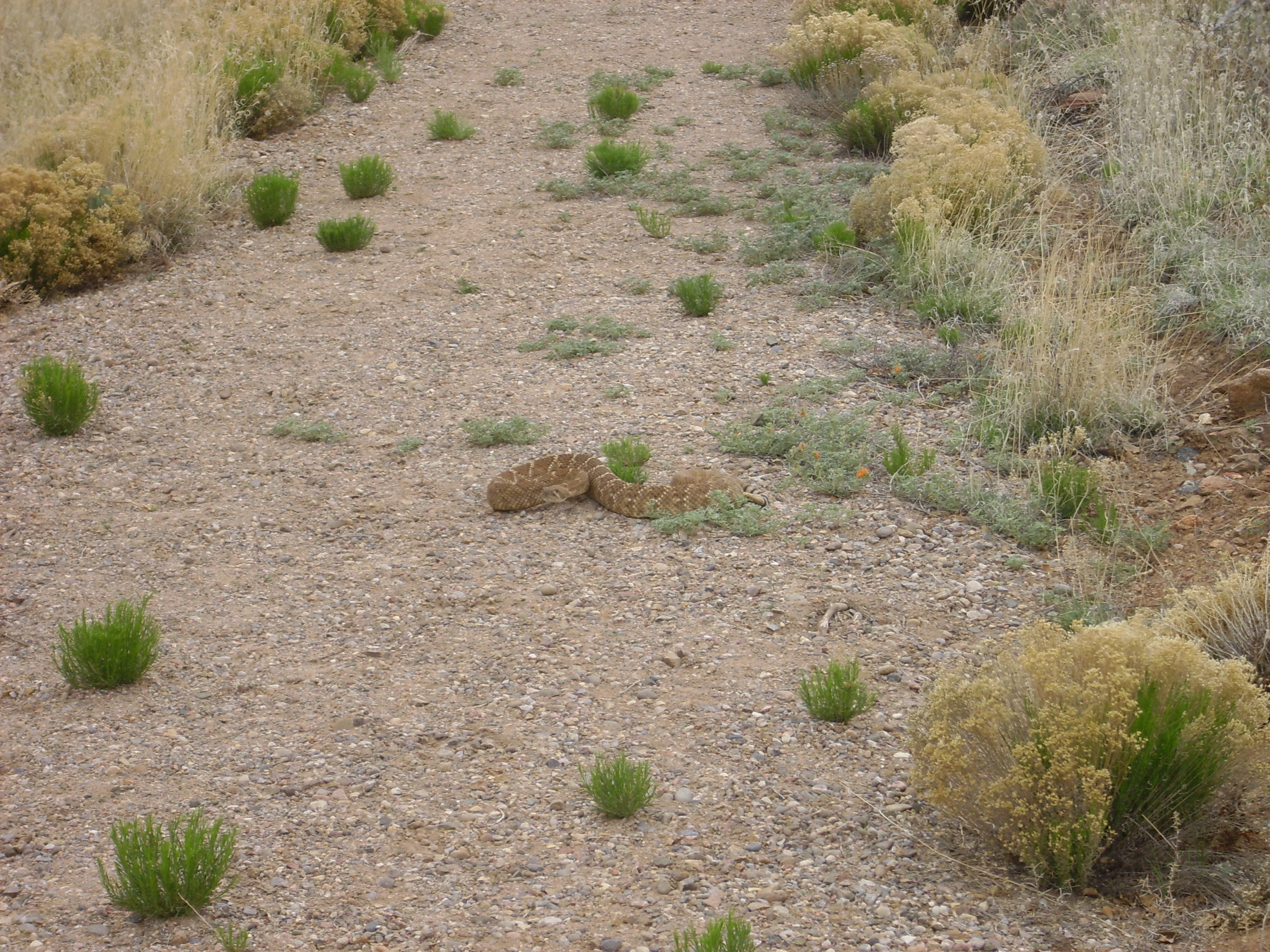
Crotalus atrox near the Veteran's
Memorial Scenic Overlook. 35
40.138N 106 26.984W
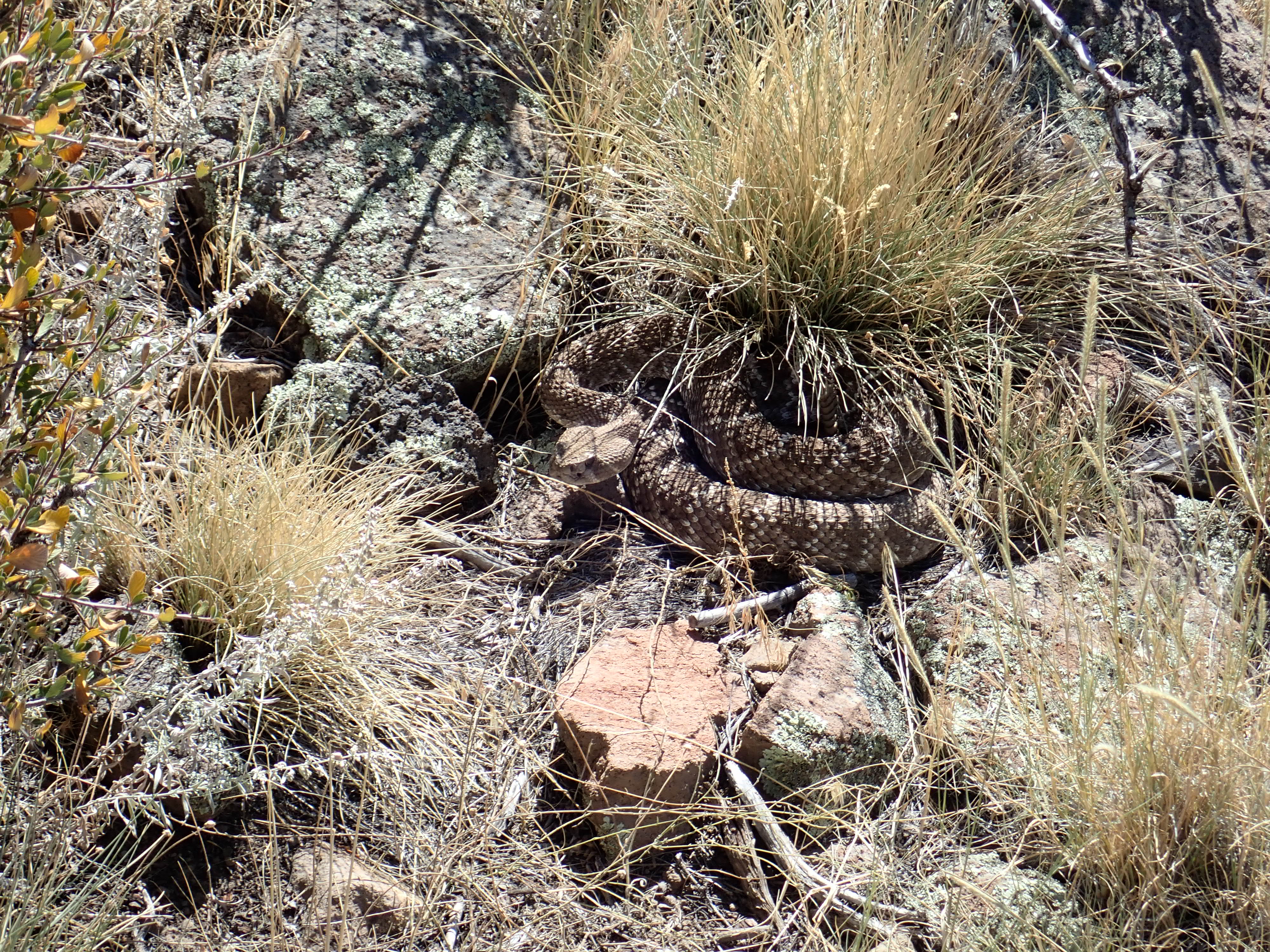
Crotalus atrox in the
Dome Wilderness. Near 35.7596596N
106.3471191W
This is the Western diamond rattlesnake, which, along with the
prairie rattlesnake (Crotalus viridis), is the chief
poisonous serpent of the Jemez area. Rattlesnakes are not uncommon
and their bite is dangerous. I encountered the one in the first
photograph at the overlook at Kashe-Katuwe Tent Rocks National
Monument. I came within about a half second of stepping on the
second while bushwacking in the Dome Wilderness east of the San
Miguel Mountains. I've also encountered a rattlesnake next to the
main loop trail at Bandelier National Monument.
Fortunately, rattlesnakes are not aggressive. They rattle
because they would rather not tangle with you, and they are not
looking for reasons to bite. Back away and you will be fine. The
greatest danger is of stepping on an unnoticed rattlesnake while
hiking rugged country, or of placing your hand on an unseen
rattlesnake while scrambling over steep ground. Hikers in
rattlesnake country must keep alert and always watch where they
are stepping. Sturdy high-top hiking boots and loose-fitting long
pants offer significant protection and should be considered
standard hiking gear in the high desert.
Provoke an attack, and you had better hope someone in your group
has the presence of mind to bundle you in a car and get you to a
hospital for antivenom treatment as quickly as possible. Don't
bother mucking around with trying to suck the venom from the wound
or applying a constriction band; both are dangerous wastes of time
when the right course of action is to keep the victim quiet, keep
the bitten limb as low and as motionless as possible, and get the
victim to a hospital as quickly as possible. If you can
get a wireless connection, dial 911 for rescue, or use the SOS
button on your satellite messenger.
The bull snake is a smaller animal that superficially resembles the Western diamond rattlesnake.

It can be distinguished by the lack of a rattler and the narrower
shape of the head. The bull snake is harmless, but it never hurts
to be on your best manners when encountering wild animals.
The only other poisonous critters of any significance in the
Jemez are insects, spiders, and scorpions. None have dangerous
bites or stings, but they can be very painful.
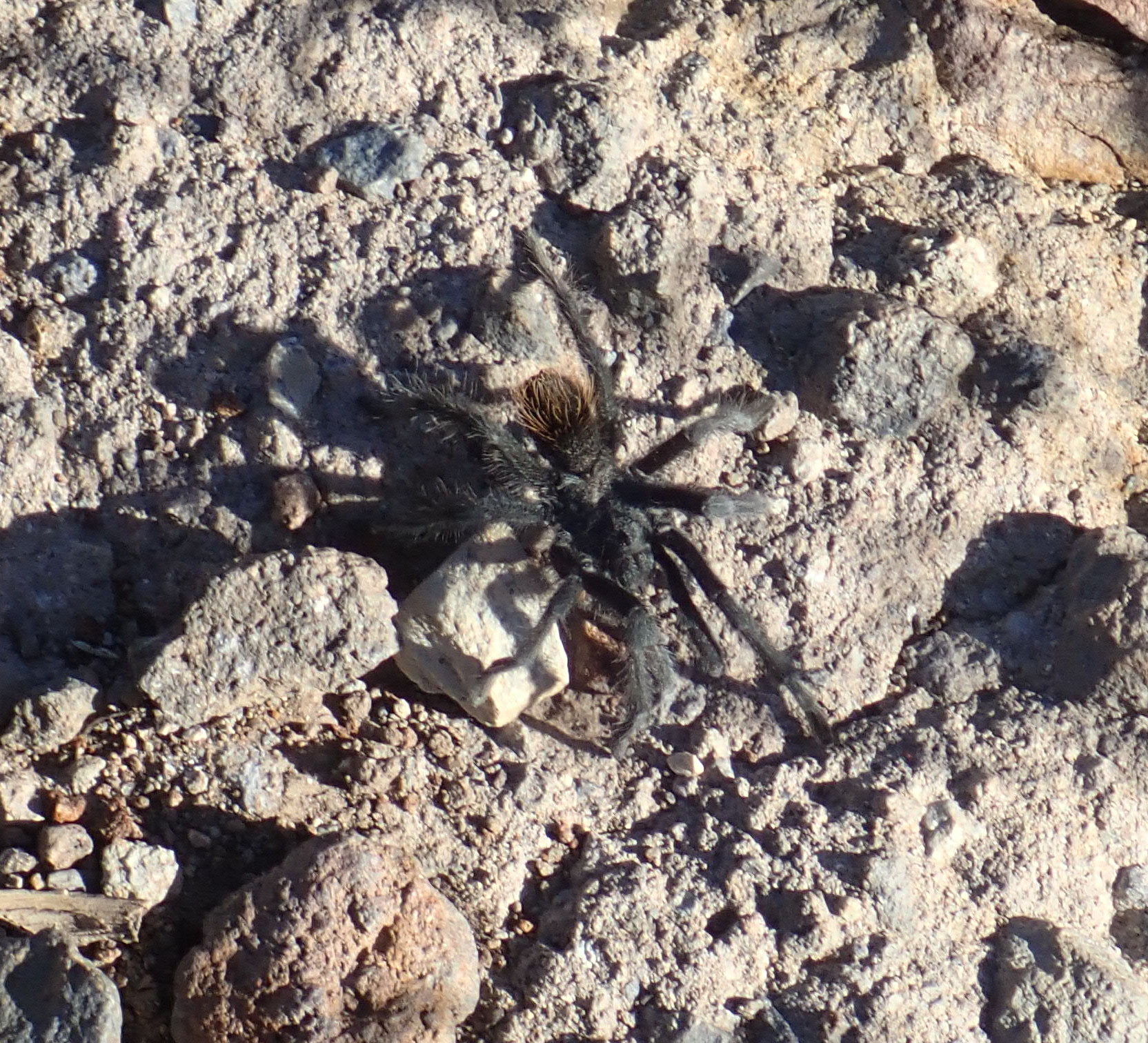
Tarantulas are not especially common most of the year, but during
the months of August through October the males actively search for
mates, often in large numbers. The spiders do not move quickly and
are largely oblivious to the presence of humans.
The chief large predators are coyotes, bears, and cougars.
Coyotes (smaller relatives of wolves) are not particularly
dangerous unless infected with rabies. If a coyote acts oddly (and
unprovoked aggression by a coyote is definitely odd) avoid the
animal. If you get bit, you're in for a series of painful rabies
vaccinations, with the added delight of a slight risk of the
vaccinations failing, which means a most unpleasant death.
Bears are usually shy, rarely have rabies, and will normally attack only if cornered or if you come between them and their cubs. Do not offer food to bears under any circumstances. Do not leave food around your camp where it is accessible to bears. I once had the bad fortune to encounter a bear in the foothills of the Sierra de los Valles just as a four-wheel vehicle was approaching from the other direction; had the bear felt trapped between us, the situation could have got very ugly. Fortunately the bear had nearby brush to escape into. In the summer of 2015, another hiker was less lucky; he found himself between a bear and her cub and was badly mauled. A cross-country runner was mauled in the summer of 2016 when she inadvertently got between a mother bear and her cubs.
While bears account for a greater number of recent maulings than any other (nondomestic) species in the Jemez, cougars (mountain lions) are individually the more dangerous predator.
Fortunately, cougars are uncommon and wary of adult humans. I encountered one at a very uncomfortably close range in the outskirts of White Rock once at twilight. I kept my flashlight facing the cougar's glowing eyes while I slowly backed away about a hundred yards, then turned and ran like hell. It seemed to work. I am careful to keep a light on when walking in twilight now, so that any large predator will have warning that I am coming, and will likely quietly slip away. If you do encounter a cougar, look big, act noisy, and do not run until you are a good distance away; if you run at once, the cougar may decide you are prey and run you down.
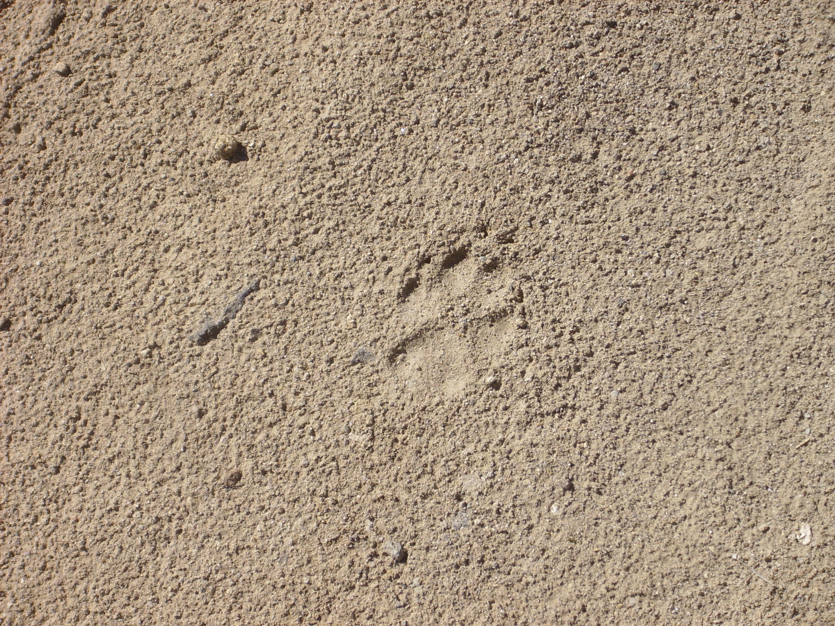
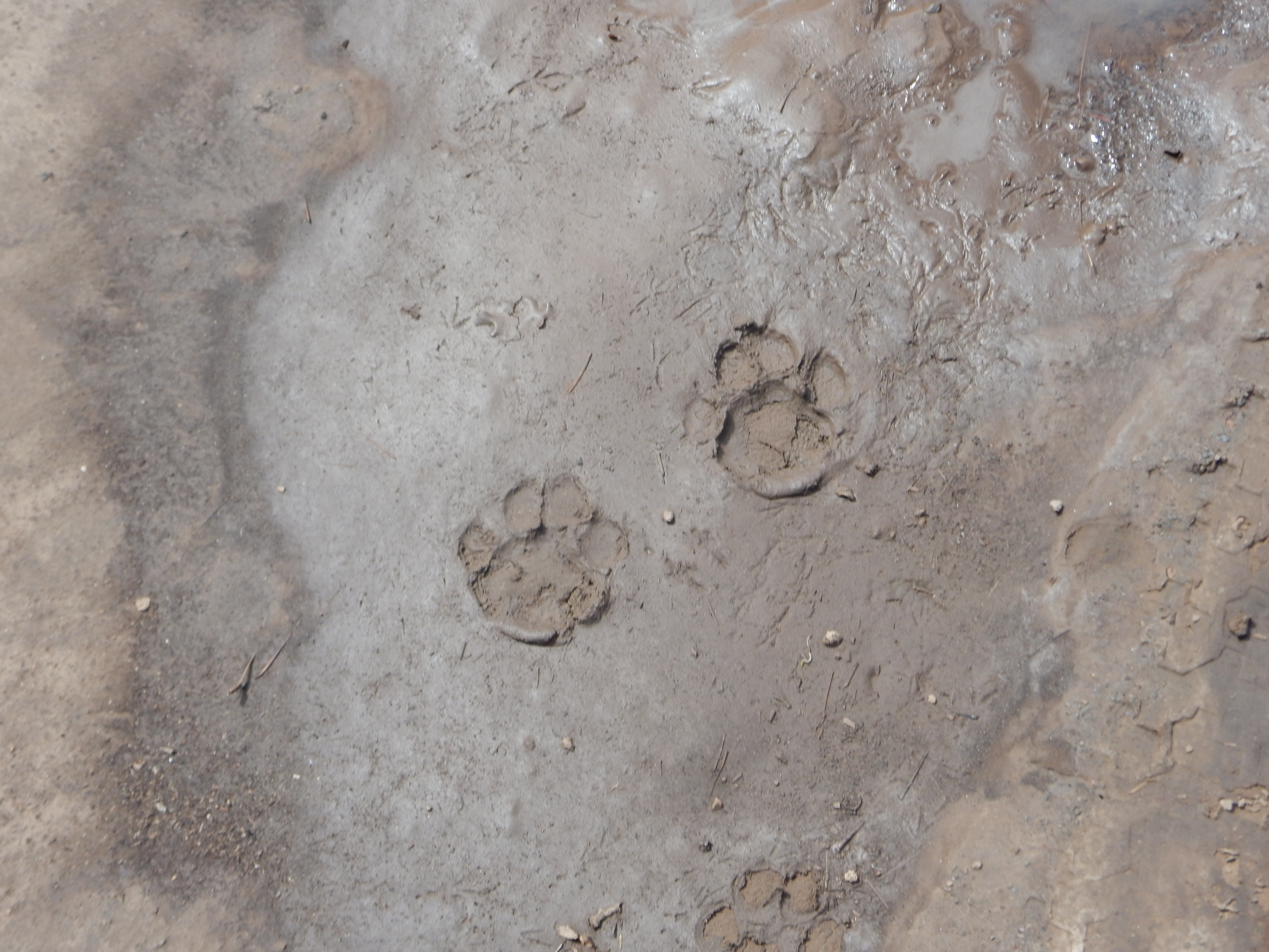
Bobcats are also found in the Jemez area.
While they occasionally take down a deer, attacks by non-rabid bobcats on humans are quite rare. Bobcats are most active in twilight. The photograph here shows prints which, based on their size and the lack of any visible claw marks, are likely from a bobcat.
Some wild animals are very comfortable indeed around humans.
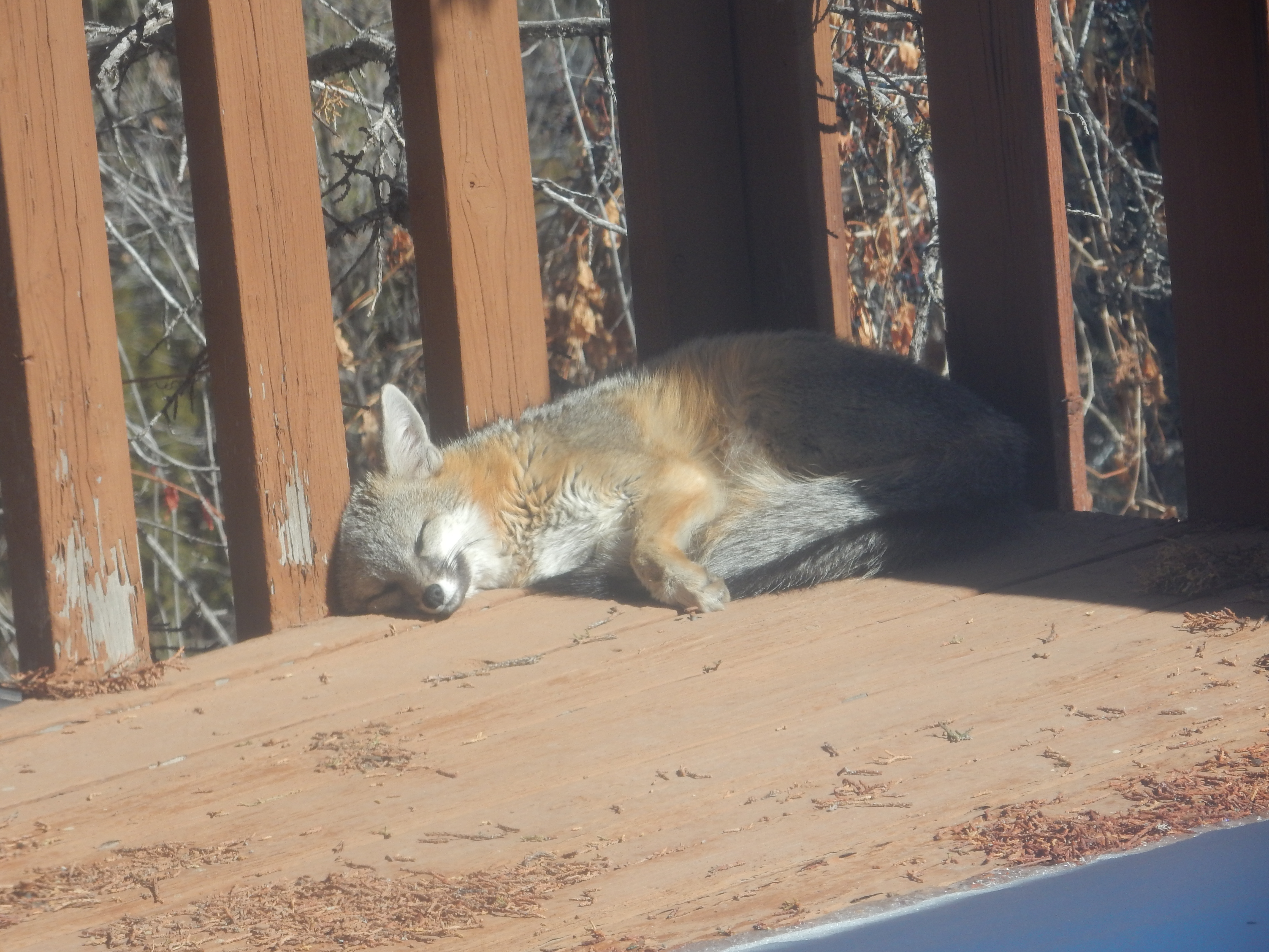
This is a gray fox,
Urocyon
cinereoargenteus. This particular animal has wintered two
years now on our back deck. We leave it completely alone, but find
its choice of our deck for its winter naps rather flattering. The
species is known to favor human-inhabited areas because we
frighten off its main predators. Supposedly, the species is able
to climb trees; the wooden deck, painted just the right color,
must be very inviting.
Raccoons are occasionally encountered in the Jemez region, and are notorious garden pests in settled areas.
I once had a tent torn open by a hungry raccoon looking for treats in northeastern New Mexico. The raccoon discovered a plastic baggie full of Benadryl, which it mistook for candy. I don't think the Benadryl agreed with the poor creature. The lesson is that even items you do not normally think of as food may attract wild animals.
Elk are the largest herbivore commonly found in the Jemez.
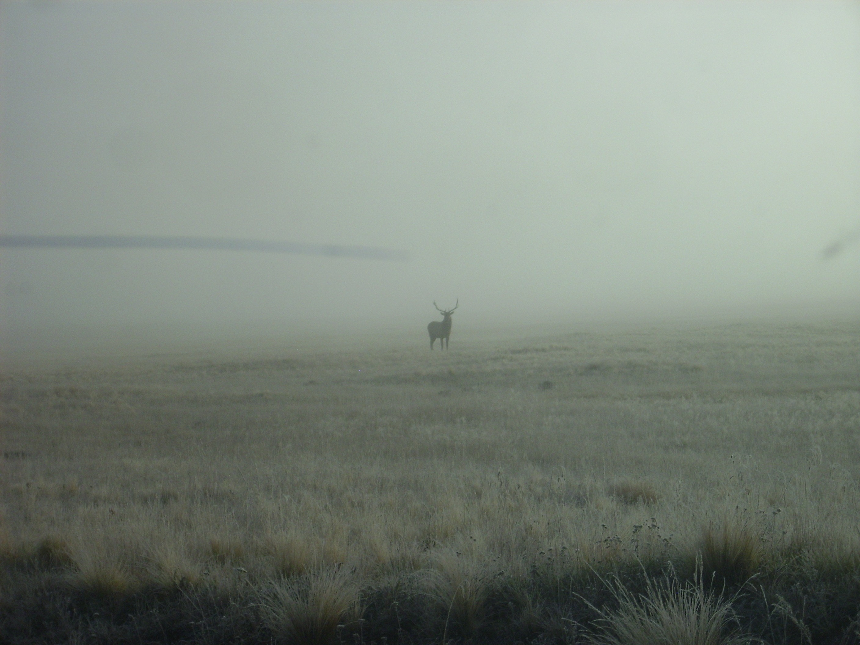
They are normally shy, but if you provoke a stag elk like the one
in this photograph, he's going to get mean. While there
have been no recent gorings by elk in the Jemez, it is wise to
give these animals some space. You can often hear nearby elk
bugling, particularly during the autumn mating season.
The most common large herbivore in the Jemez is the mule deer.
They are routinely spotted near highways throughout the region.
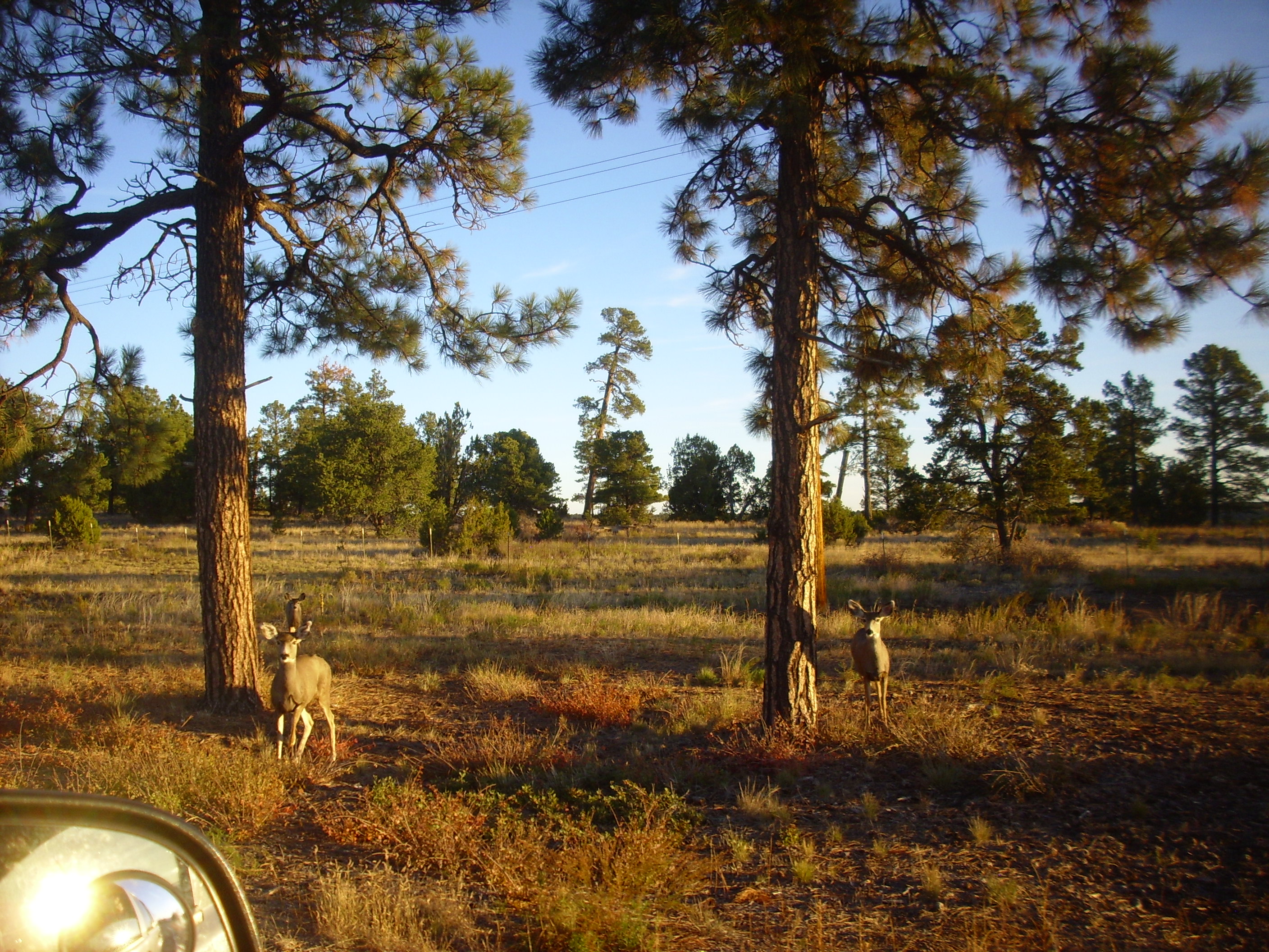
Most of those encountered are somewhat acclimatized to humans but, like all wild animals, should be respected.
Prairie dogs are numerous around the Valles Preserve headquarters. Their only danger to humans is as carriers of of flea-borne diseases. I mention them only because they are so darned cute.
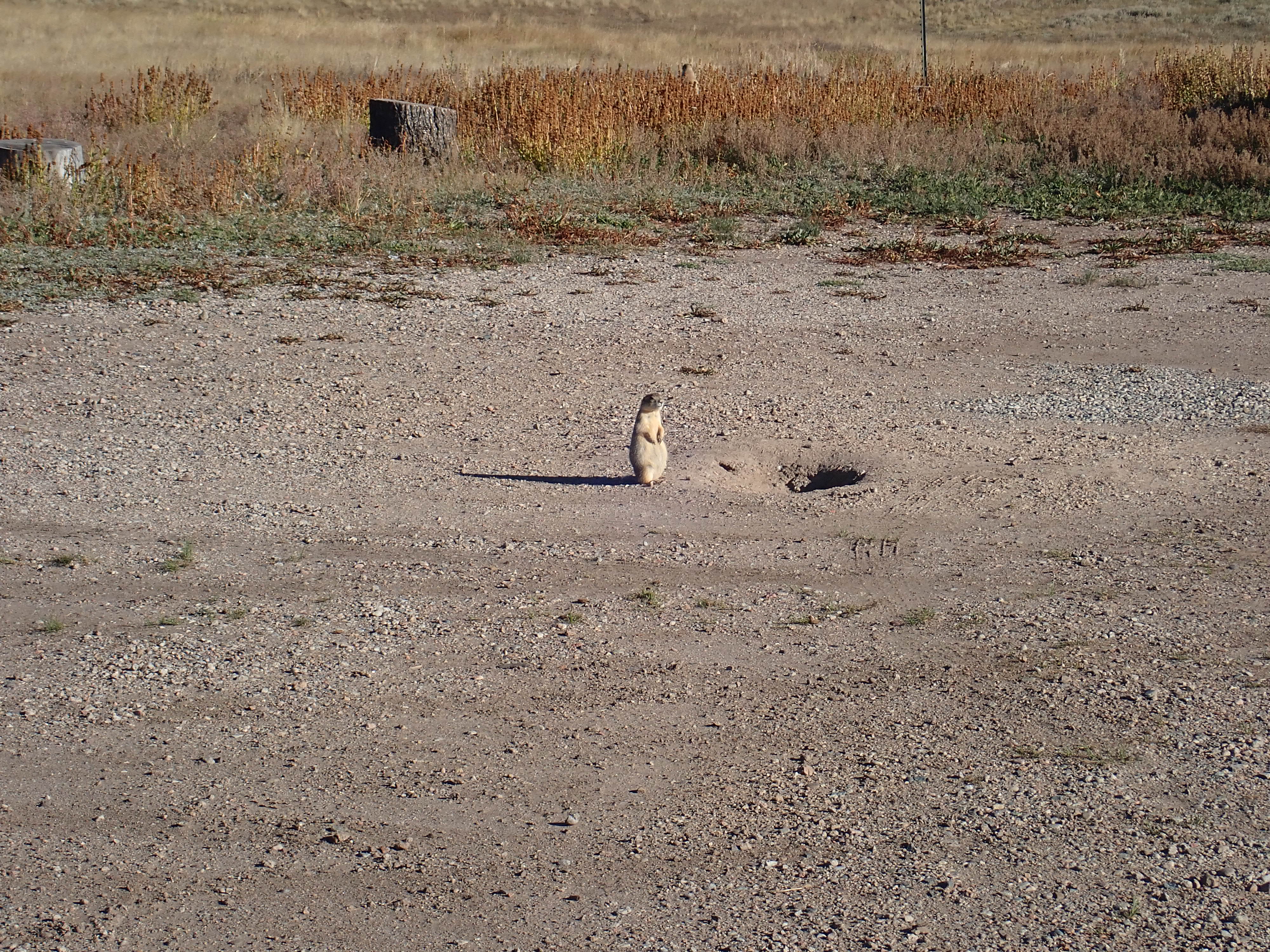
Notwithstanding the common name, prairie dogs are rodents of the
squirrel family rather than canids. The one seen here is likely
the Gunnison prairie dog,
Cynomys gunnisoni. Though
rarely of direct concern to humans, prairie dog dens are a hazard
to cattle, which can break a leg if it is caught in a den opening.
Since many of their predators are driven out of farm country, the
populations can become quite large. The colony around the Valles
headquarters is enormous, likely because predators are wary of the
high human traffic in the area. The prairie dogs here seem so
sleek and fat they can barely waddle.
I suppose this one has to be included, if only to reassure the
nervous reader.
Hydrothermal activity suggests that the Jemez volcanic field is
still capable of activity. There is little seismic activity in the
caldera, suggesting that the rocks beneath are hot enough that the
brittle to ductile transition takes place at a relatively shallow
depth. Seismic waves passing beneath the caldera from earthquakes
nearby are attenuated in a way that shows the presence of molten
rock. Careful analysis of seismic data suggests that there is a
lens-shaped zone centered beneath the caldera that is 17 km (10.5
miles) across, centered at a depth of about 11 km (7 miles), and
at least 8 km (5 miles) thick, composed of a sludge of partially
crystallized magma. Careful measurements of the Earth's electric
and magnetic field around the caldera (magnetotelluric
measurements) also suggest a magma body at depth.
However, there has not been any volcanic activity in the Jemez for 74,000 years; and, while it is quite likely there will be further eruptions someday, the odds are heavily against one in our lifetime.
There would be warning signs of such an eruption. One of most reliable indications of rising magma is an increase of sulfur emissions from hot springs and fumaroles, which can begin years before the actual eruption. The caldera is regularly monitored by synthetic aperture radar (SAR) satellites that would likely detect the ground surface rising due to injection of magma into the magma chamber. As magma begins moving towards the surface, it fractures the rock along its path and produces a characteristic kind of earthquake called harmonic tremor. Since the Jemez is monitored by the Los Alamos Seismic Network, established in 1973, harmonic tremor would likely be detected almost at once. Finally, almost every violent volcanic eruption on record has been preceded by at least a few hours of ash eruptions that typically pose little immediate danger. Were such warning signs to appear, the sparsely-populated Jemez could be evacuated within a very short time.
The previous chapters have discussed the story of the Jemez, from the birth of Northern New Mexico 1.8 billion years ago to the deposition of alluvium in the modern stream drainages. The following animations depict this history.
The first animation shows the exposure maps you've seen throughout the preceding chapters as an animation.
The next animation is similar, but is cumulative in time, adding successively younger exposures.

Direct comments about this book to kgb@kgbudge.com.
Clownie the Wonder Car
Copyright © 2015-2020 Kent G. Budge. All rights reserved.