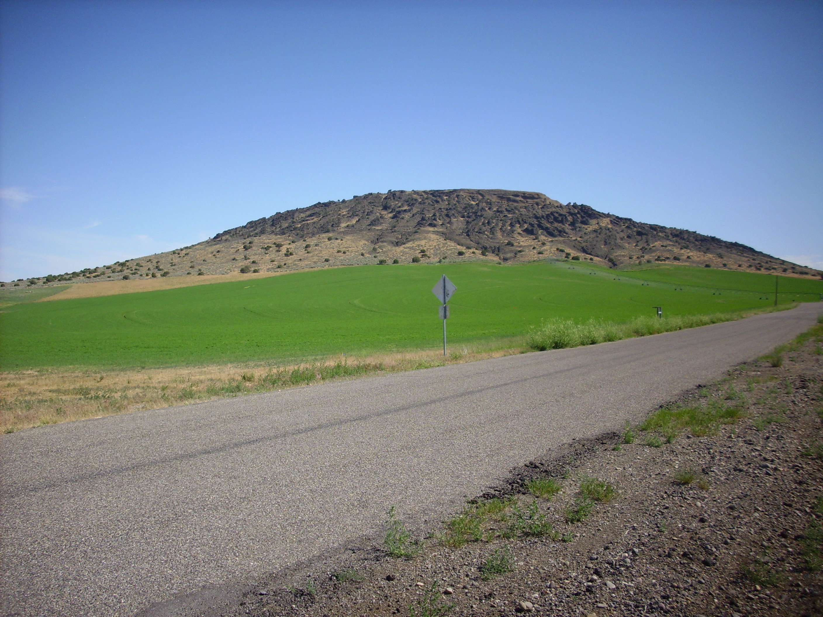
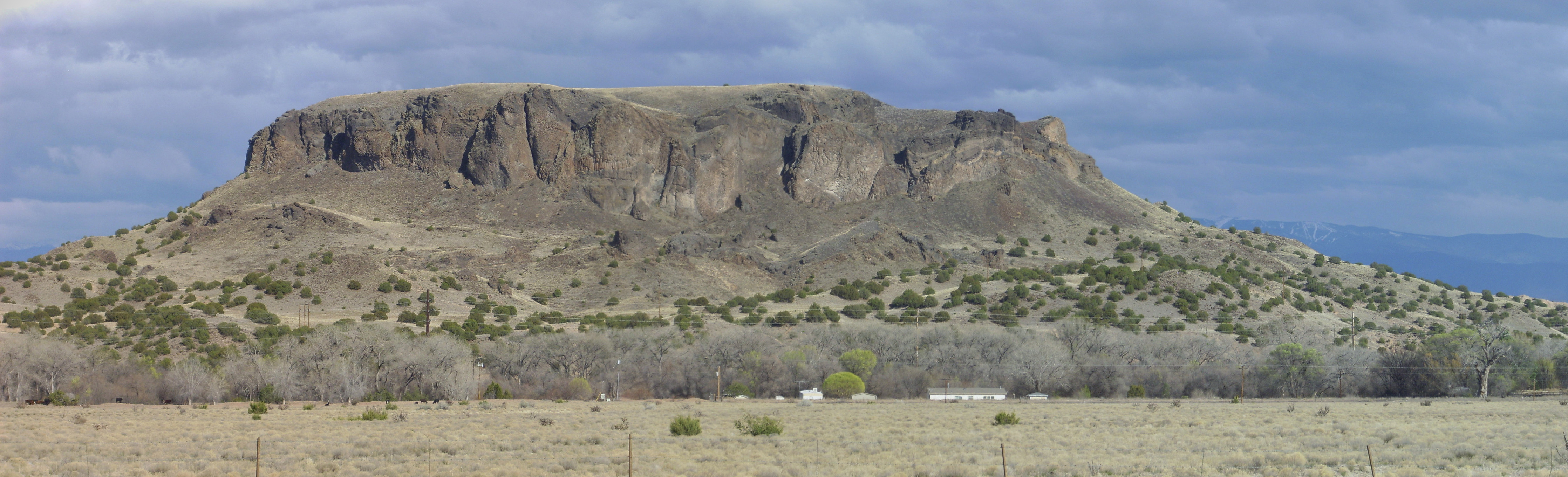
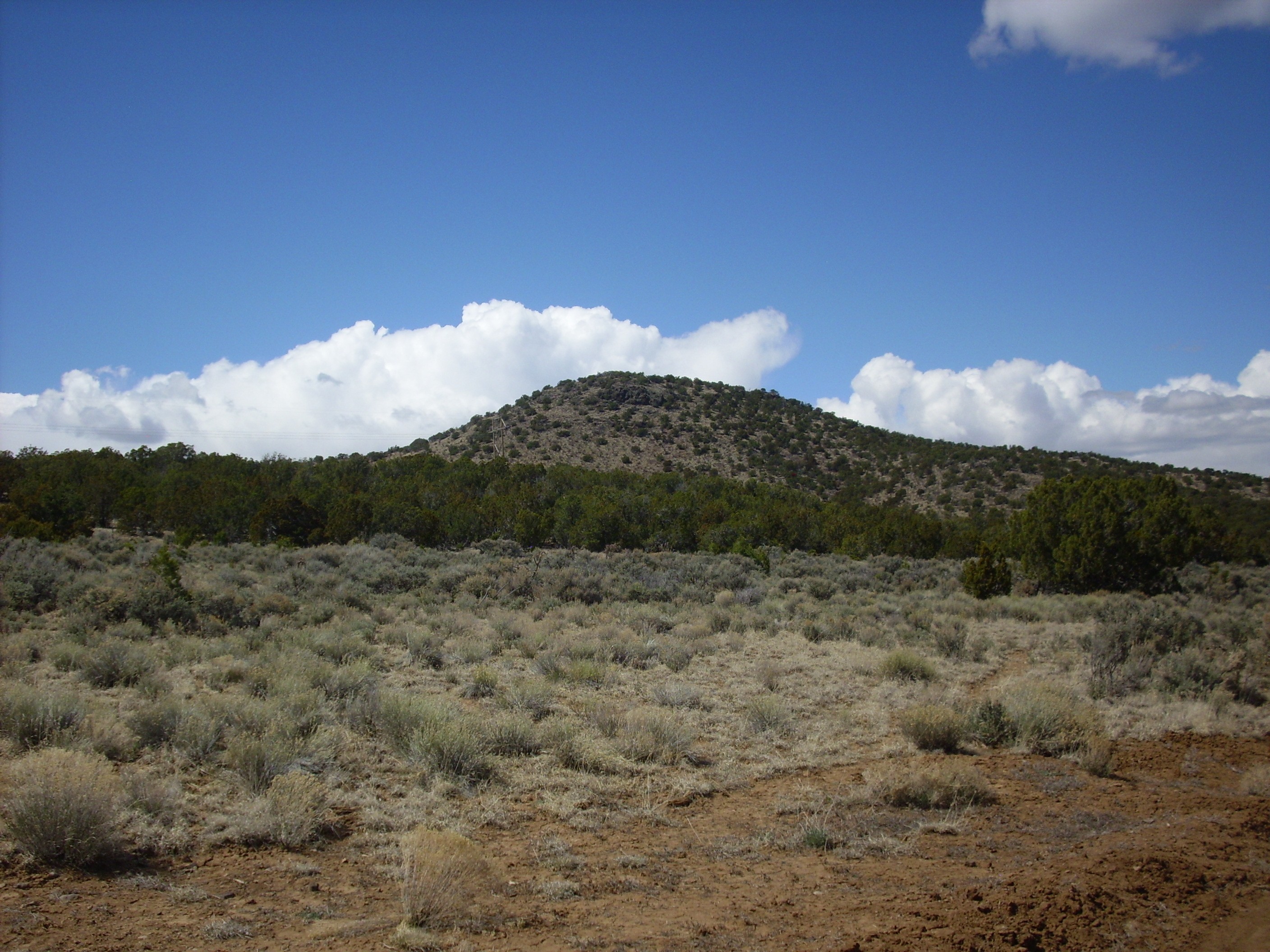
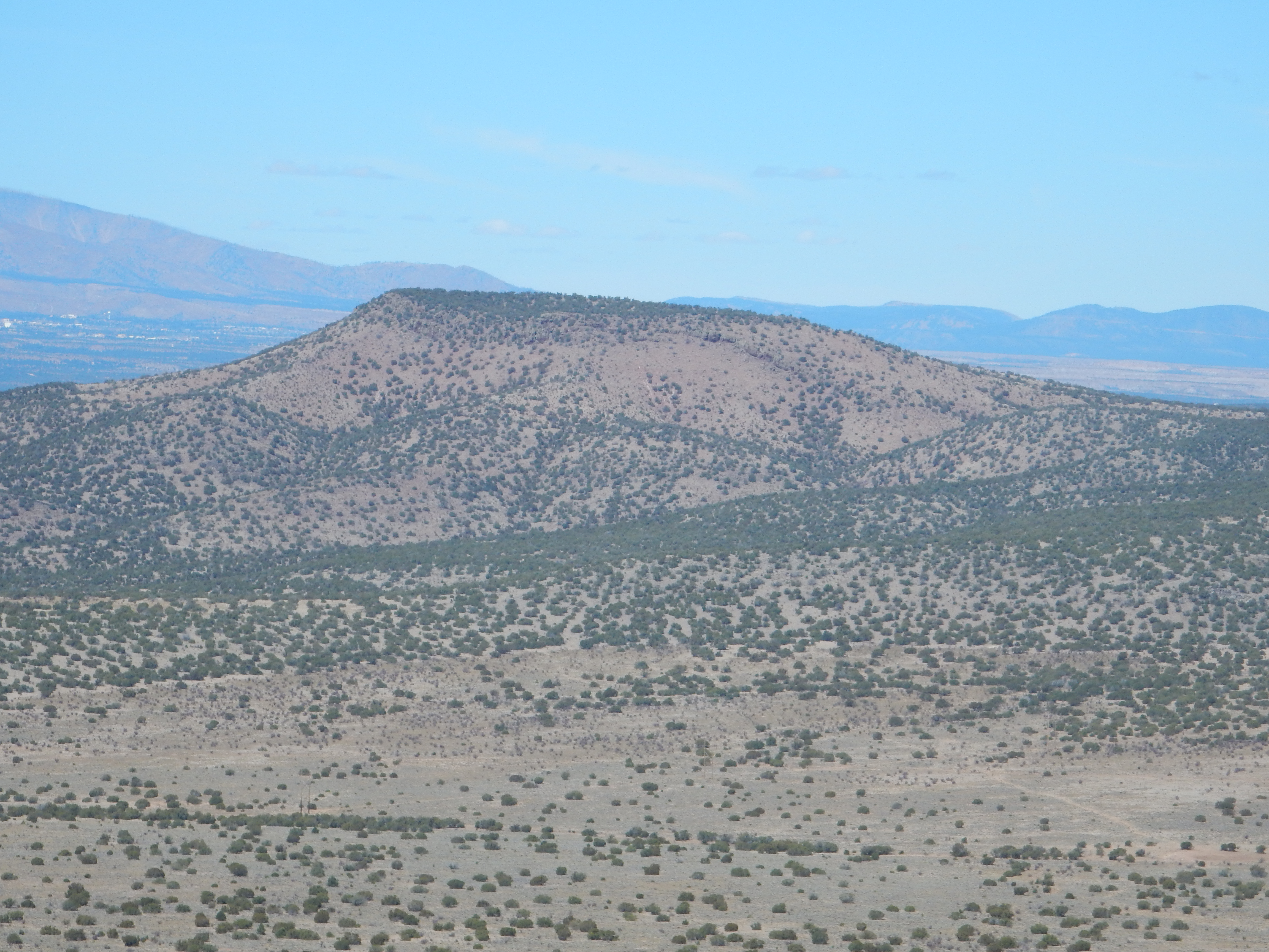
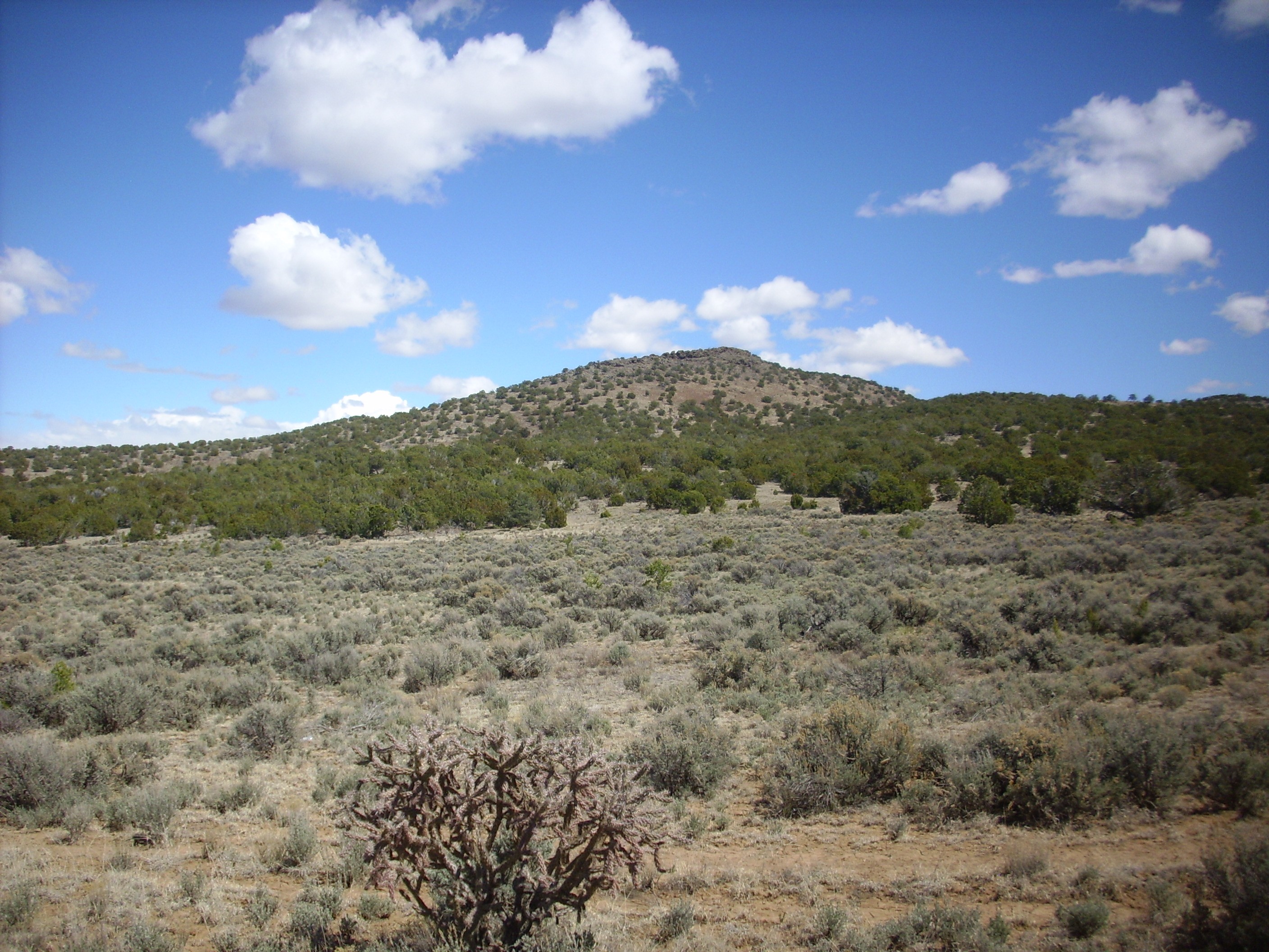
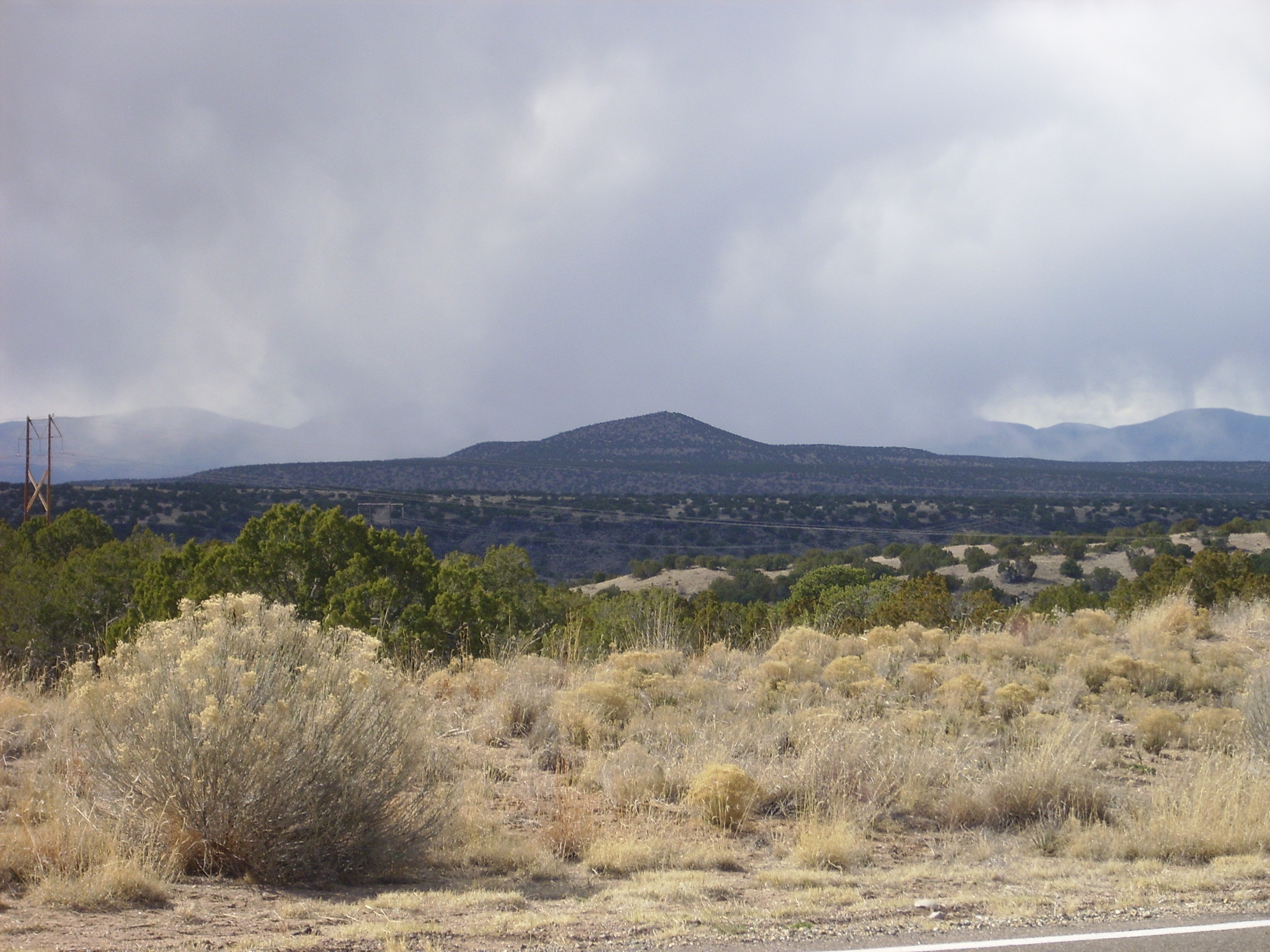
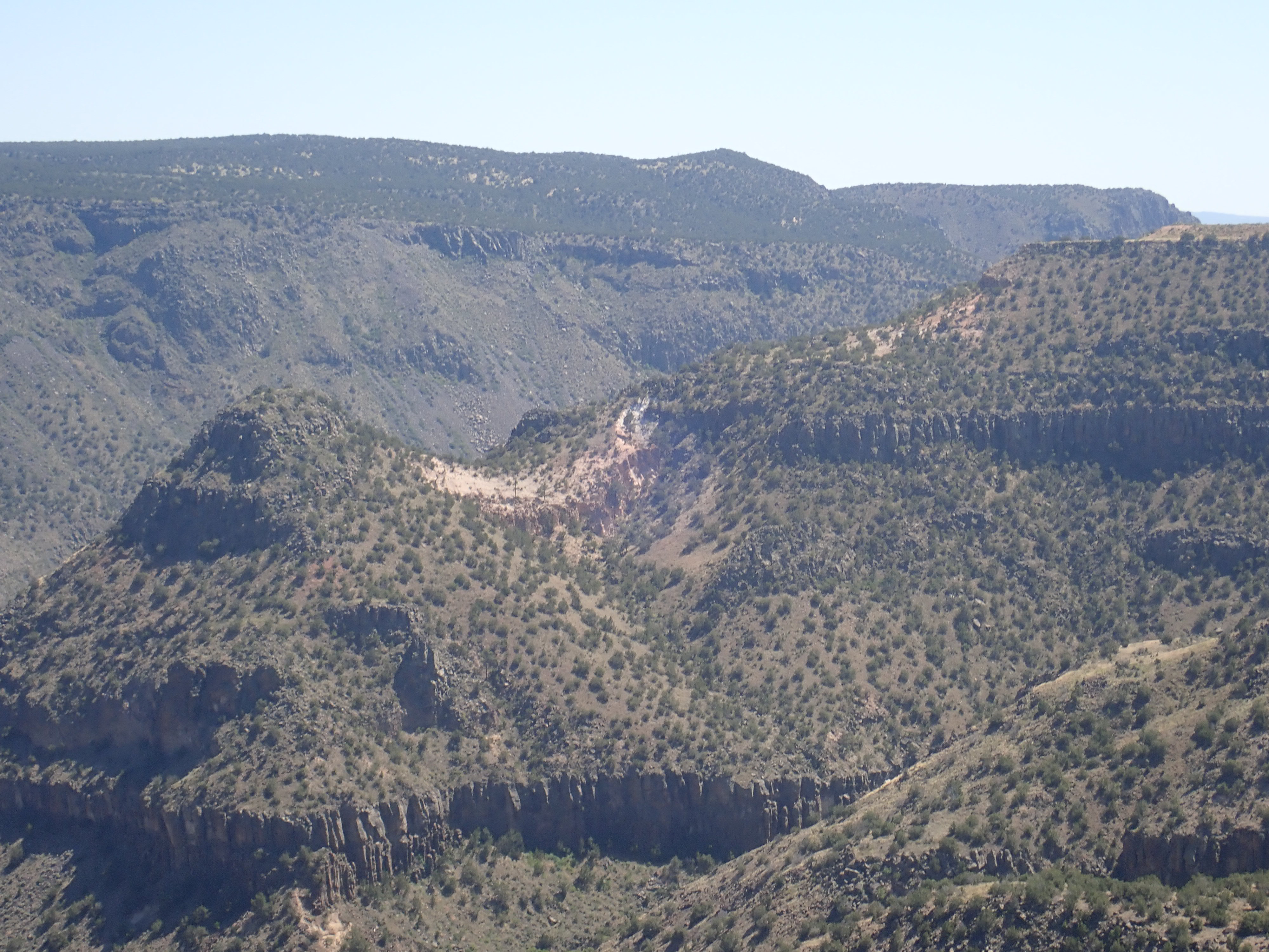
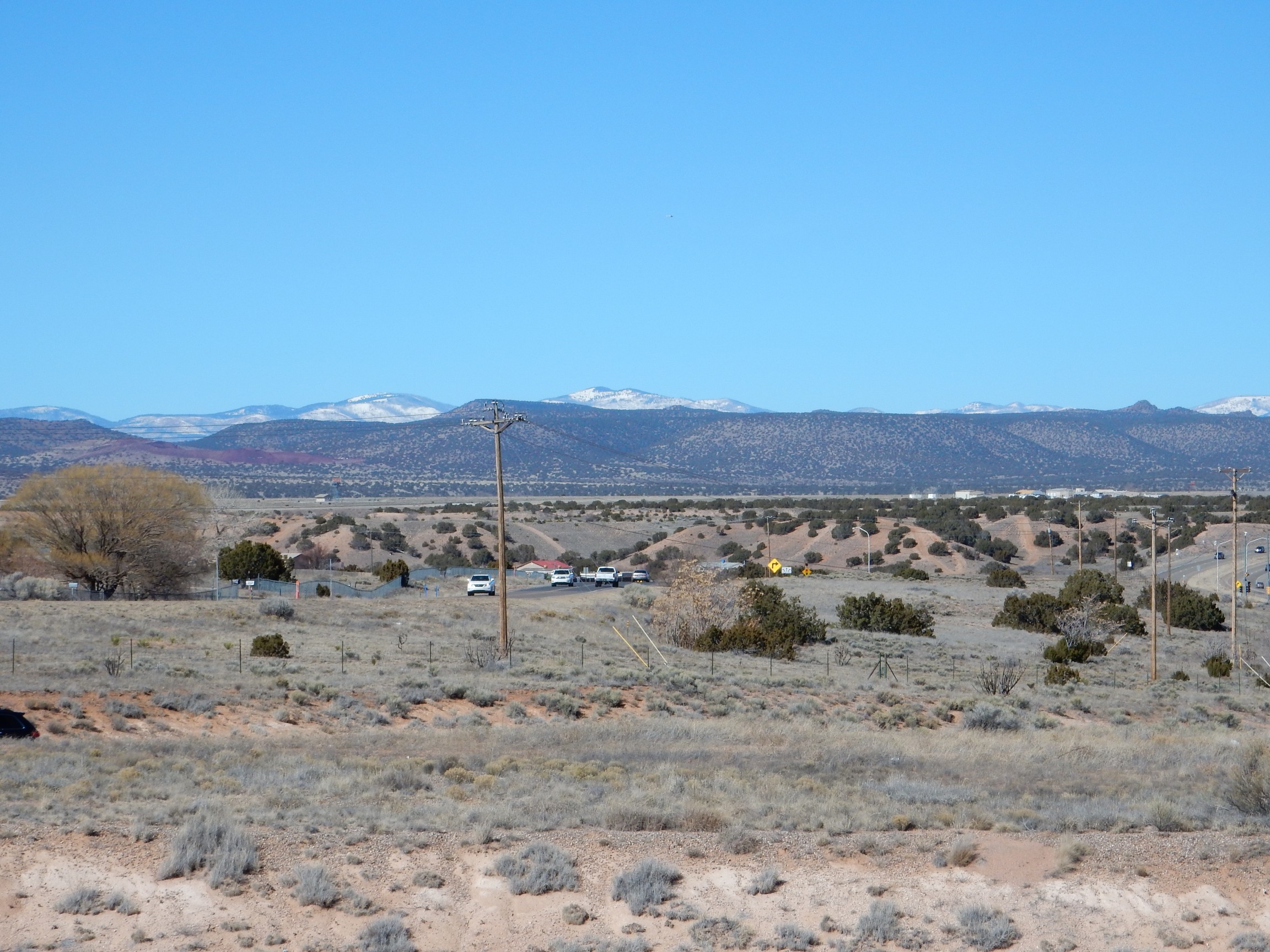
Cerros del Rio from atop Tetilla Peak. Looking northeast from 35 36.4i89N 10612.598W
The table of contents may be found here.
Cerros del Rio from atop Tetilla Peak.
Looking northeast from 35
36.4i89N 10612.598W
Three million years ago, the final pulse of Tschicoma volcanism
was approaching its climax in the Sierra de los Valles and on the
alluvial fans of the Puye Formation at its foot. Far to the
northeast, ice sheets were beginning to spread across Greenland as
global cooling began to set in. The Jemez area was becoming cooler
and drier, both from the global cooling and from continuing
regional uplift. The subtropical forests that characterized the
area during the Miocene had given way to temperate forests. These
were inhabited by large mammals such as saber-tooth cats,
ancestral bears, horses, and camels.
Australopithecines, human ancestors with a true upright posture,
had emerged in the Old World, and there is some evidence these
creatures were able to use simple tools. They are not thought to
have mastered either language or fire. The first true humans, Homo
erectus, had not yet appeared, and none of these human
ancestors were yet present in the New World. Man would not arrive
in the Jemez for nearly three million more years.
Continued rifting along the Rio Grande Rift was opening new
pathways for magma to rise from the mantle. To the northeast of
the Jemez, the Taos Plateau was already covered by thick flows of
the Servilleta Basalt, and one flow had followed a river valley
nearly to what is now Espanola. Maar eruptions had begun southeast
of the Jemez, harbingers of a new round of mafic volcanism around
the periphery of the
Jemez volcanic field where it overlaps the Rio Grande Rift.
In this chapter, we will examine these basalt fields and their origins.
The Hayden expedition of 1869 was followed by an ambitious and
systematic effort by the U.S. Army to map the entire United States
west of the 100th meridian. The expeditions of 1873 through 1875
covered the Jemez area, and while the maps were crude by modern
standards, they were good enough to show recognizable topographic
features. The Valles caldera is recognizable, as are El Alto and
the La Grulla Plateau. Guadelupe and San Diego Canyons are clearly
marked. The Santa Clara and Guaje Canyons are present but rather
poorly mapped.
Wheeler Survey map of Jemez
region
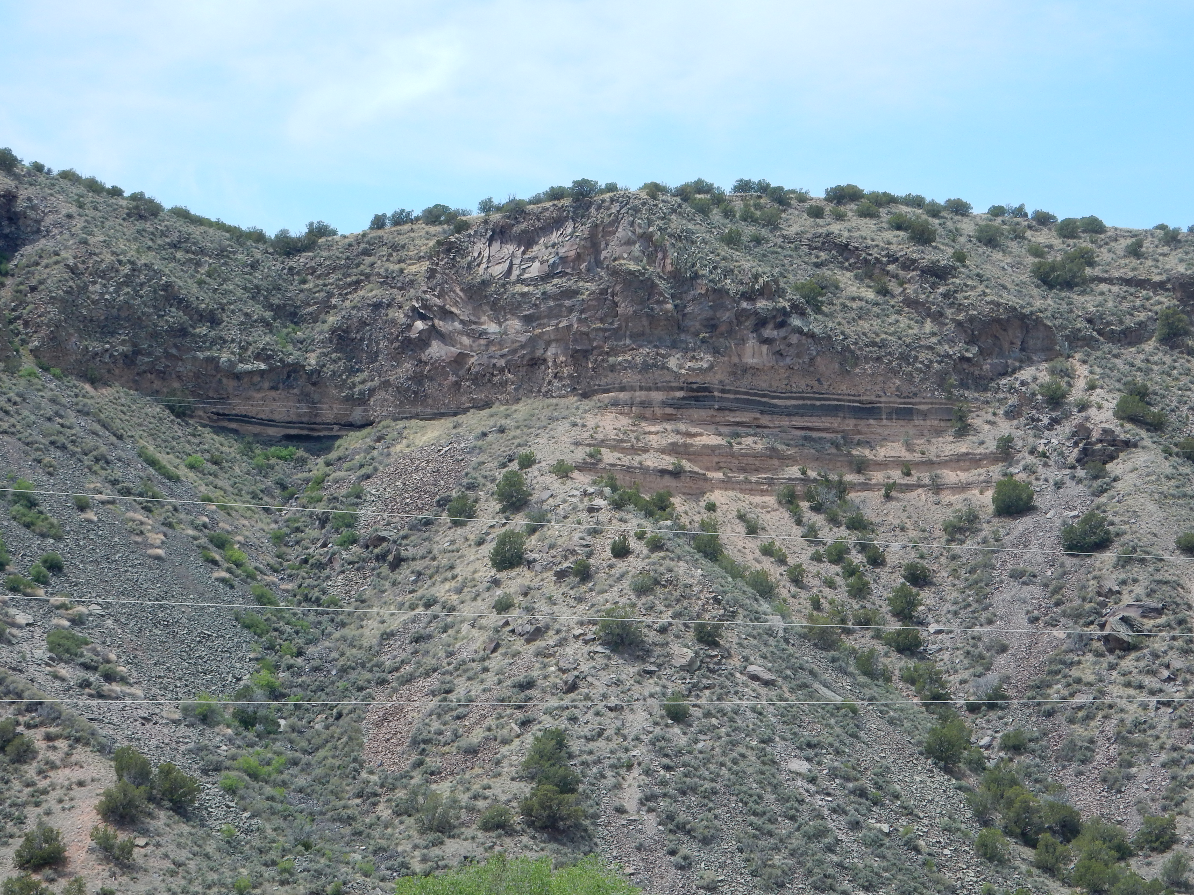
Among the features mapped most accurately were White Rock Canyon
and the adjacent Cerros del Rio. Both the Montoso Maar and Buckman
Mesa are mapped reasonably well; all are features that now come
into our geologic history.
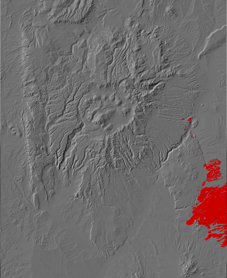
Relief map of the Jemez with El Alto (north), Servilleta
Basalt (northeast), Cerros del Rio (southeast), and Santa Ana
Mesa (south) outcroppings highlighted in red
We've had some encounters with basalt already. It is the main rock type of the Lobato Mesa Formation, and it is also makes up many of the older flows of the Paliza Canyon Formation. However, some of the best exposures of basalt are more recent and are located around the periphery of the Jemez volcanic field. The most voluminous of these is the Cerros del Rio field, but there are similar basalt flows at Santa Ana Mesa and at El Alto.
Basaltic lava is low in viscosity and can easily flow for miles from its source vent. As a result, it tends to form flat plateaus rather than volcanic cones. These plateaus are often quite distinctive in aerial photographs, as the previous Google Map links showed. The basalt flows we will be examining in this chapter all erupted at about the time the higher-silica Tschicoma eruptions of the Sierra de los Valles were beginning to wind down. The Cerros del Rio dates from about 4.6 to 1.6 million years ago, peaking at around 3.2-2.4 million years ago; Santa Ana Mesa is about 2.5 million years old; and the El Alto flows are around 2.8 million years old.
The pattern of basaltic volcanism around the periphery of an existing felsic volcanic field is seen in other parts of the world, such as the Yellowstone caldera. One explanation for this pattern is that fresh basaltic lava rising from depth is blocked by the great mass of viscous magma in the magma chamber at the heart of the volcanic field. Because this high-silica magma has a relatively low density, the higher-density basaltic lava stagnates underneath it. However, the basaltic magma can reach the surface further out, where the magma chamber has not yet developed, the rock is colder and denser, and the magma can find clear paths to the surface through faults.
The Servilleta Basalt erupted in the Taos area from 4.8 to 3.7
million years ago, about the same time as the oldest Cerros del
Rio basalts. Though it did not originate in the Jemez volcanic
field, this voluminous formation includes the massive flows
underlying Black
Mesa, north of Espanola, and so intrudes upon the Jemez
region.
Black Mesa north of Espanola
A major system of faults runs along the visible south face of this mesa, which offsets the Rio Grande Rift to the east north of Espanola. Southeast of these faults is the Velarde Graben, the deepest portion of the Rio Grande Rift in the Espanola Basin. This graben is not obvious at the surface, but seismic reflection and gravimetric data reveal its existence.
The flow itself is one of the younger Servilleta flows, with an
age around 3.6 million years. There is a layer of gravel beneath
the lowermost flow that suggests the flow followed the valley of
the ancestral Rio Grande from an eruptive vent somewhere to the
northeast.
The most voluminous of the basaltic formations erupted during this time period is the Cerros del Rio Formation. This is exposed as a large plateau east of the Rio Grande and southeast of White Rock, but there are also exposures west of the Rio Grande. These suggest that the Cerros del Rio Formation extends for some distance northwest beneath the younger Bandelier Formation. Drilling on the Pajarito Plateau has brought up basalt resembling Cerros del Rio basalt in a well more than halfway from White Rock to the Sierra de los Valles. It is thought the formation may extend almost to the Pajarito Fault east of the San Miguel Mountains. However, the Bandelier Formation rests directly on Paliza Canyon andesite and Tschicoma dacite in upper Los Alamos Canyon, and drilling in the Diamond Drive Graben shows that the Cerros del Rio Formation does not reach this far.
Because the Cerros del Rio is the largest of the peripheral basalt fields, and because it is the only one that is located mostly on public lands, I will describe it in some detail.
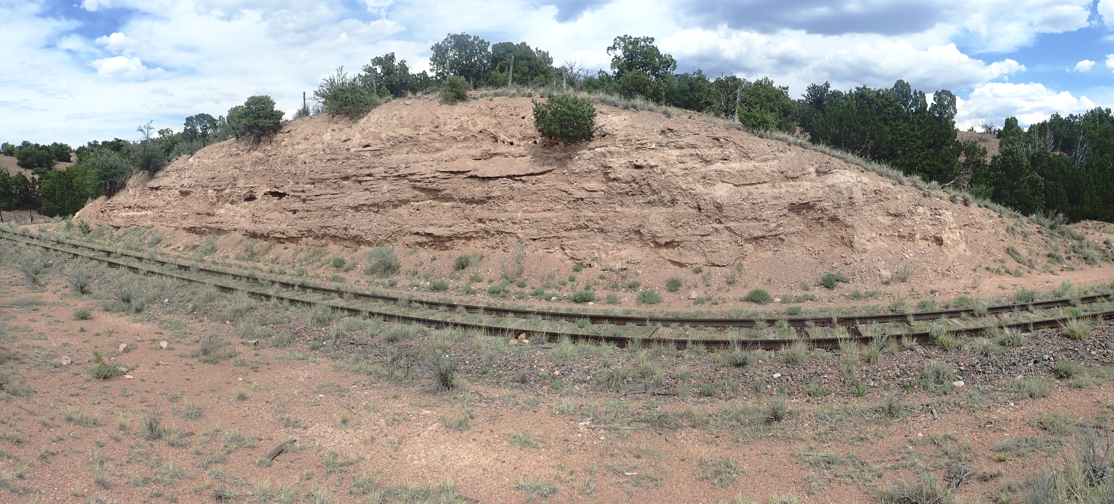
The earliest eruptions in the Cerros del Rio field likely took the form of maars. Maars are formed when magma rising from below comes into contact with an aquifer saturated with water. The water flashes into steam, blowing the country rock and magma into small fragments that settle around the vent to form a distinctive very shallow crater. Unfortunately, none of the maars in the Jemez area are young enough to be well-preserved as surface features. However, the early maars of the Cerros del Rio probably looked something like Menan Buttes in southeastern Idaho.
North Menan Butte, an example of
a young maar. 43
47.100N 111 58.607W
Beds of shattered rock and volcanic cinder produced by the interaction of groundwater with magma are described as phreatomagmatic, from the Greek phrear, "spring" or "well". Here are some of the phreatomagmatic beds around North Menan Butte.
Cinder beds at North Menan Butte, an
example of a young maar. Near 43
47.100N 111 58.607W
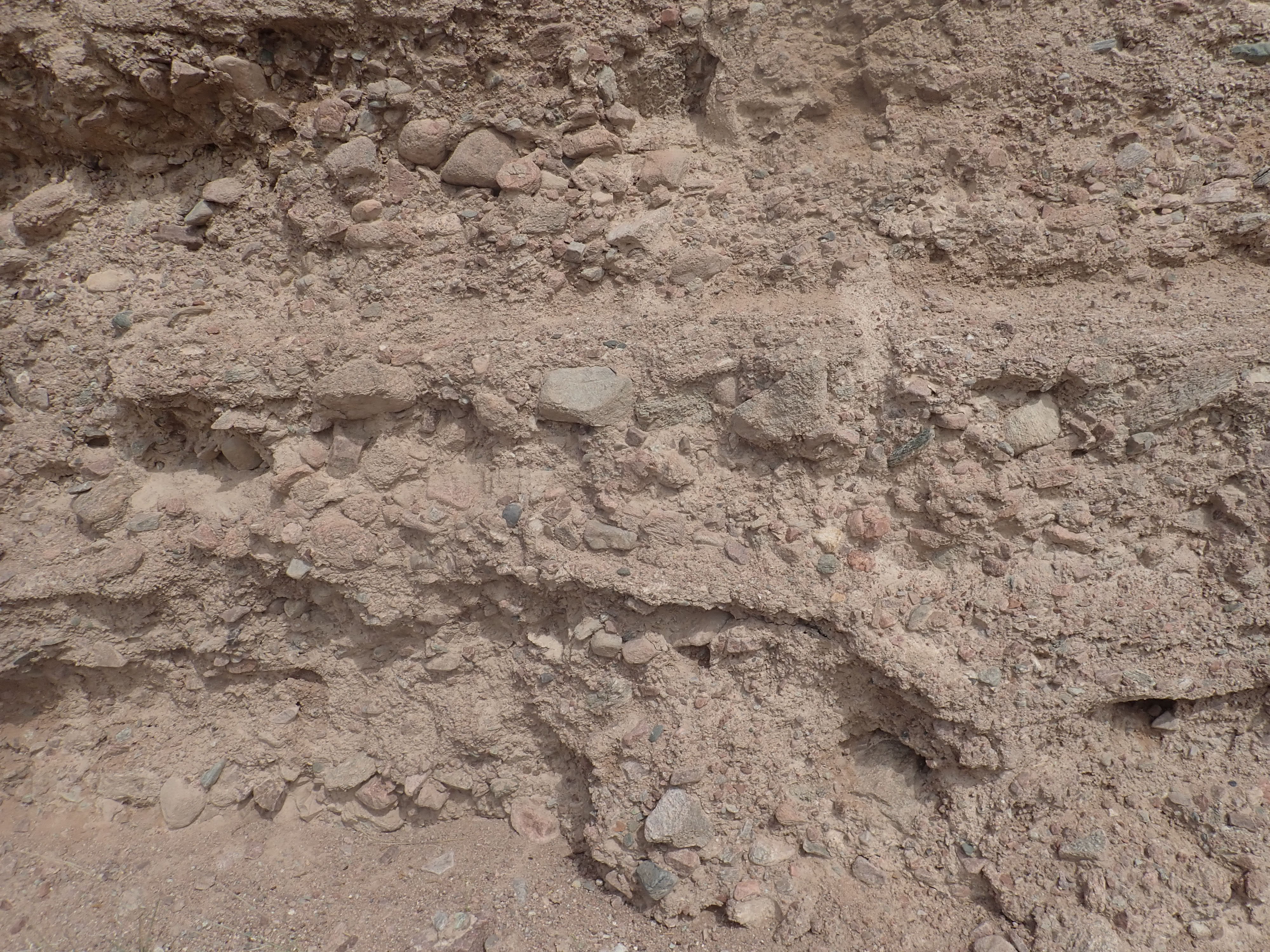
Here's a sample of the phreatomagmatic beds.
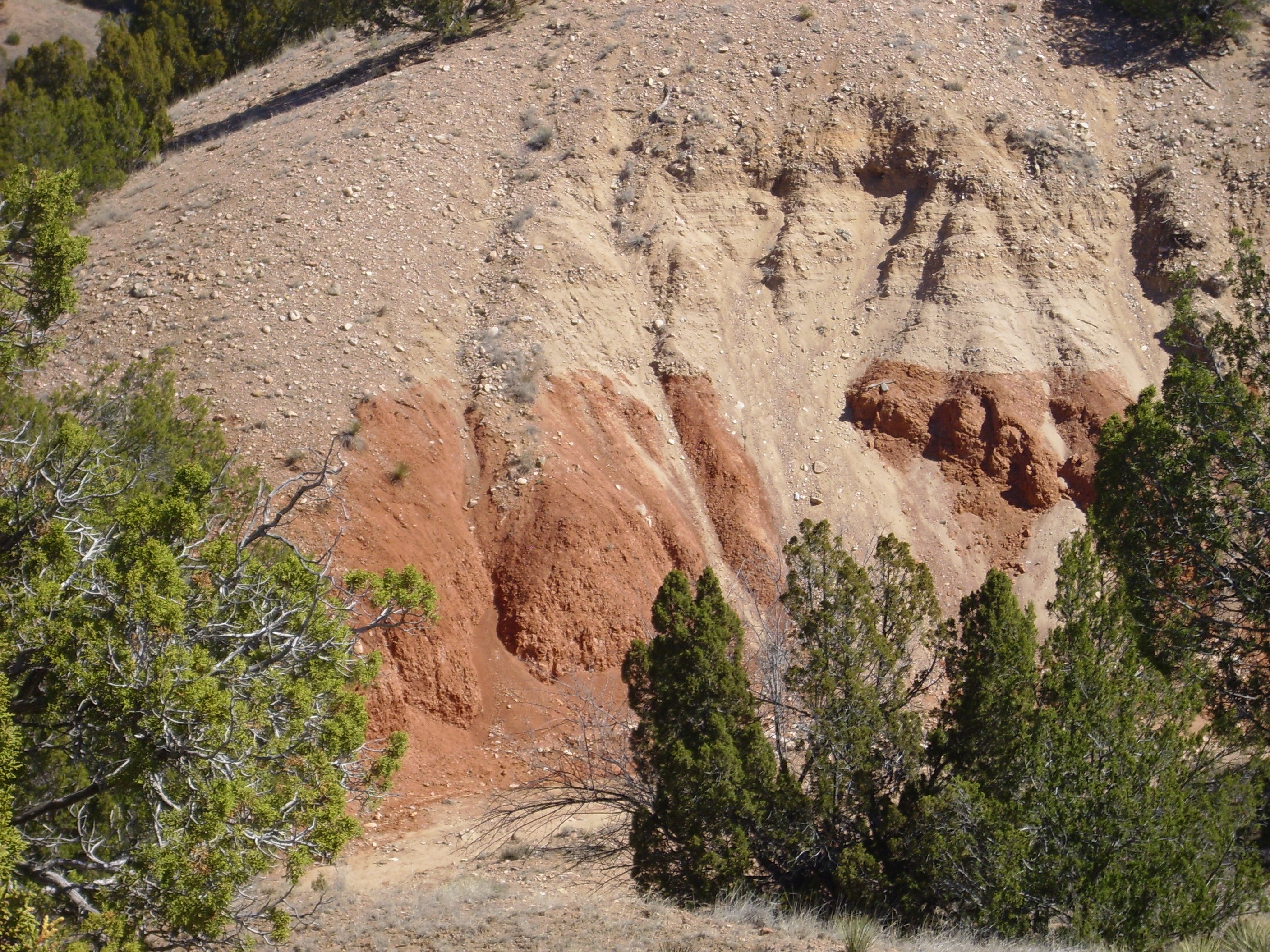
The presence of several eroded maars in the Cerros del Rio
suggests that this area was close to the ancestral Rio Grande
three to four million years ago, so that the country rock was well
saturated with groundwater. The associated phreatomagmatic beds
usually lie directly on Santa Fe Group sedimentary beds and are
usually buried under later Cerros del Rio lava flows.
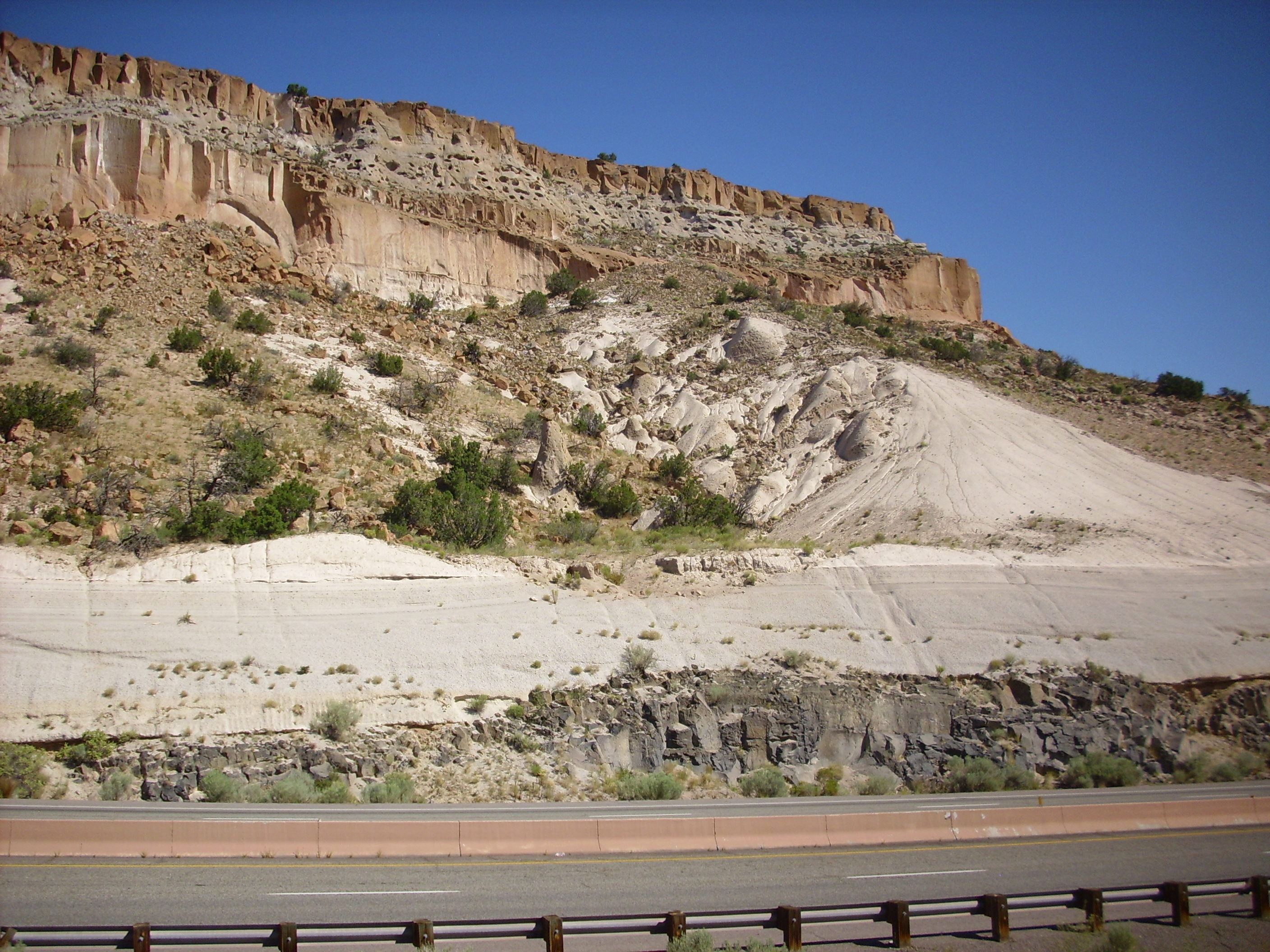
The most accessible of these beds for the casual explorer are on the west slopes of Buckman Mesa, which is prominent as seen from State Road 502 at the northern entrance to White Rock Canyon.
Buckman Mesa at the northern end of
White Rock Canyon. Looking south from 35.876N
106.144W
The mesa is capped with thick beds of andesite and basaltic andesite. Peeking out under these are beds mapped as phreatomagmatic deposits. Presumably the vent was Otowi Peak, which sits on top of the mesa to the right, and where the phreatomagmatic beds reach their greatest thickness.
If one wishes to view a maar deposit close up, there is no better
place in the Jemez region than lower Frijoles Canyon in Bandelier
National Monument. The Upper Falls Trail provides a fairly easy
hike from the visitors' center to some impressive maar beds.

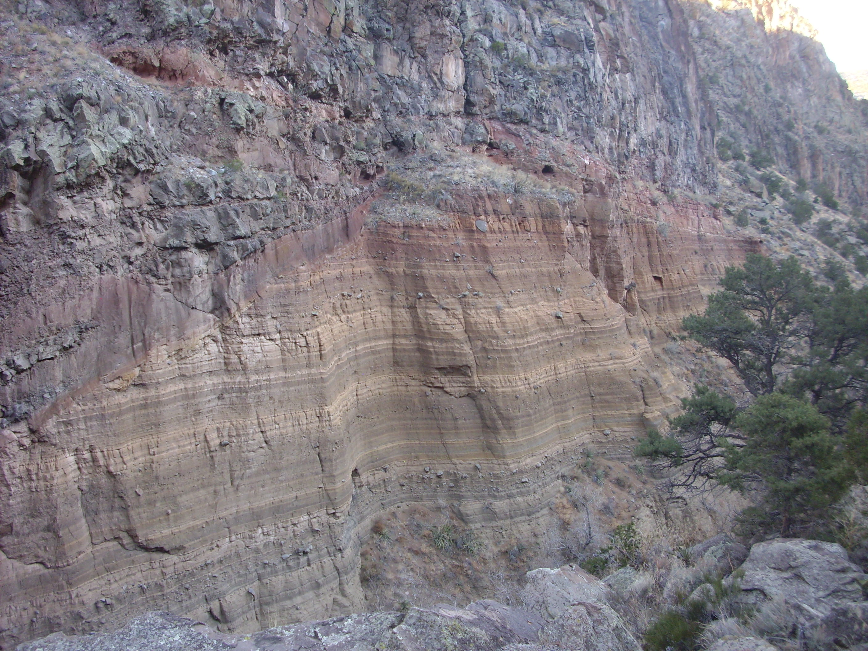
The maar deposits are overlain by thick flows of benmoreite,
which is sodium-rich trachyandesite. Trachyandesite, like
trachybasalt, is unusually rich in sodium and potassium, and like
andesite, it is slightly richer in silica than basalt.
Potassium-rich trachyandesite is known as latite, and we saw
examples from the Espinaso Formation earlier in the book.The
benmoreite at Upper Falls has a radiometric age of about 2.75
million years.
Of course, we can't leave Upper Falls without looking at the falls!
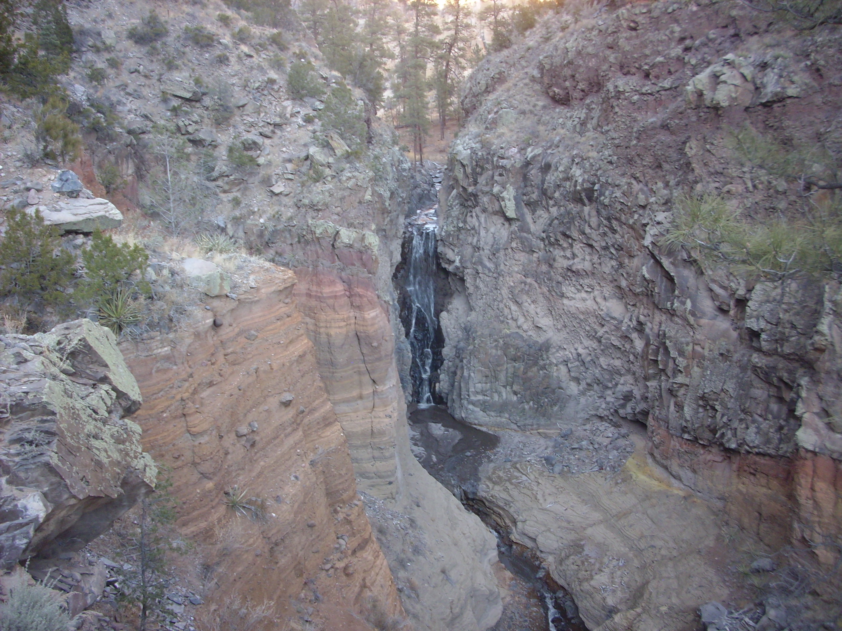
So if there is an Upper Falls, is there a Lower Falls? Yes, here. Alas, recent forest fires in the Jemez have resulted in violent flash floods in Frijoles Canyon, and these have completely erased the trail below Upper Falls.
You may have noticed the rusty color of much of the maar deposit and the overlying basalt. This is particularly pronounced at one point on the trail just above the falls.
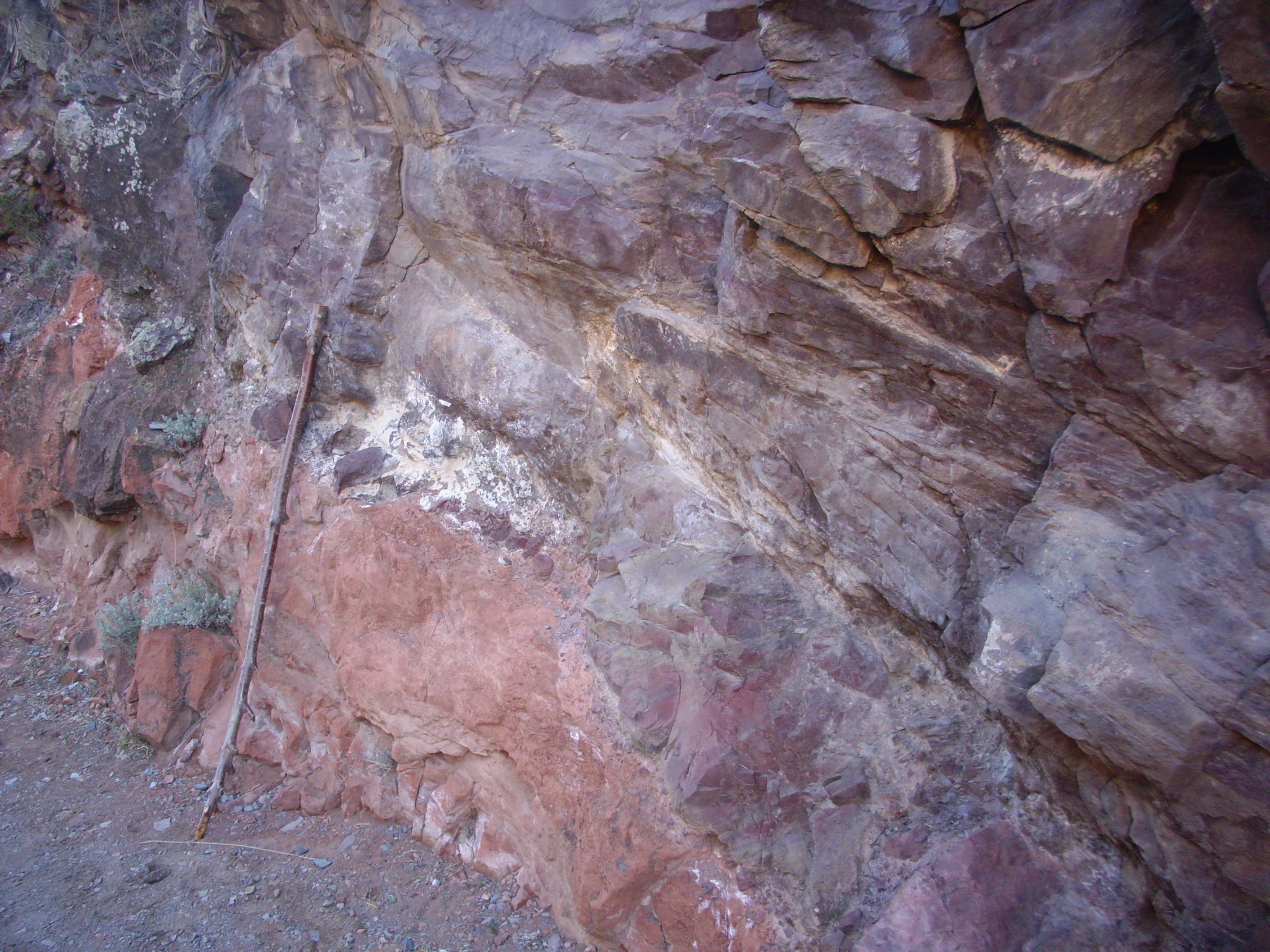
The red color comes from hydrothermal alteration of the benmoreite. The hot rock in the vent near here continued producing steam from the aquifer for some time after the initial eruption, which reacted with the iron minerals in the benmoreite to produce red hematite.
Another maar deposit is found at Cochiti Dam, right next to the
main outlet channel.

Tuff ring deposit at Cochiti Dam. 35.617N
106.322W
The grayish beds to the right in the photograph are a remnant of a tuff ring, which is the deposit immediately around a maar crater. The tuff contains numerous quartzite clasts probably derived from river gravels deposited here by the ancestral Rio Grande.
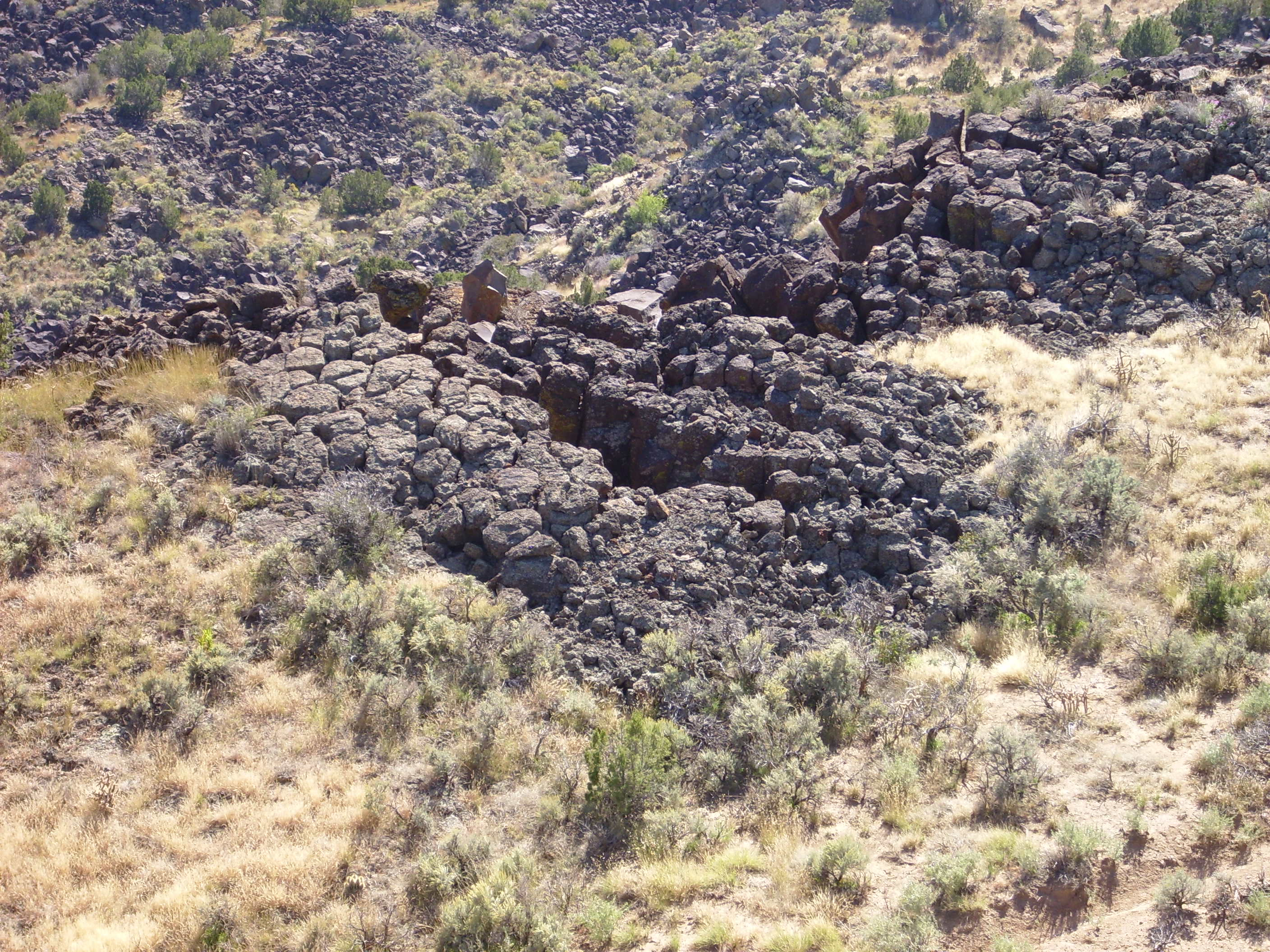
A particularly large maar is located at the foot of Montoso Peak
on the east rim of White Rock Canyon.
View from north rim of Montoso Maar. 35.765N
106.211W
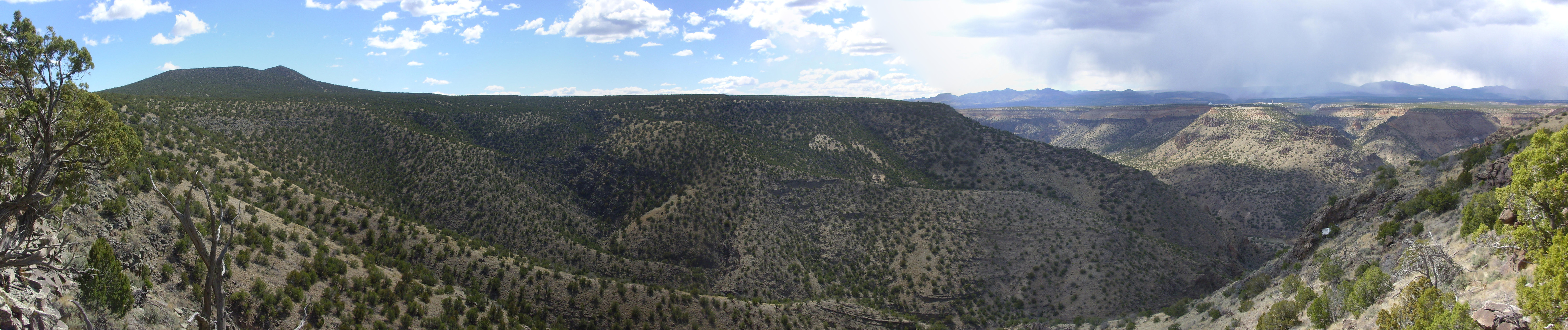
Montoso Maar is likely one of the oldest parts of the Cerros del Rio. The thick maar beds here were subsequently buried by later sediments and by thick basalt flows from Montoso Peak. When the Rio Grande cut the canyon to the west, the maar was exposed, and the relatively soft maar beds have since been deeply eroded.
Montoso Peak itself is on the skyline to the left, and its flows extend across the center of the panorama. To the right, we see the west rim of White Rock Canyon, with Bandelier Tuff sitting on top of Cerros del Rio Basalt sitting on top of Santa Fe Group sediments. The mouths of several tributary canyons to White Rock Canyon are visible. Beyond are the San Miguel Mountains and the Sierra de los Valles west of Los Alamos. You can see one of the technical areas of Los Alamos National Laboratory on top of the mesa, with a large VLBA dish radio telescope discernible in the full resolution image. The tributary canyon to the right of the mesa is Ancho Canyon.
North of Ancho Canyon is a deep paleovalley filled with Bandelier
Tuff. This is the course of the ancestral Rio Grande, prior to the
Valles eruption.
Note the junked appliance in the foreground at right. Geologists sometimes refer to such deposits, with tongue in cheek, as “locally-derived anthrogenic colluvium”, or, when it consists of automobile parts, simply as “Detroitus.”
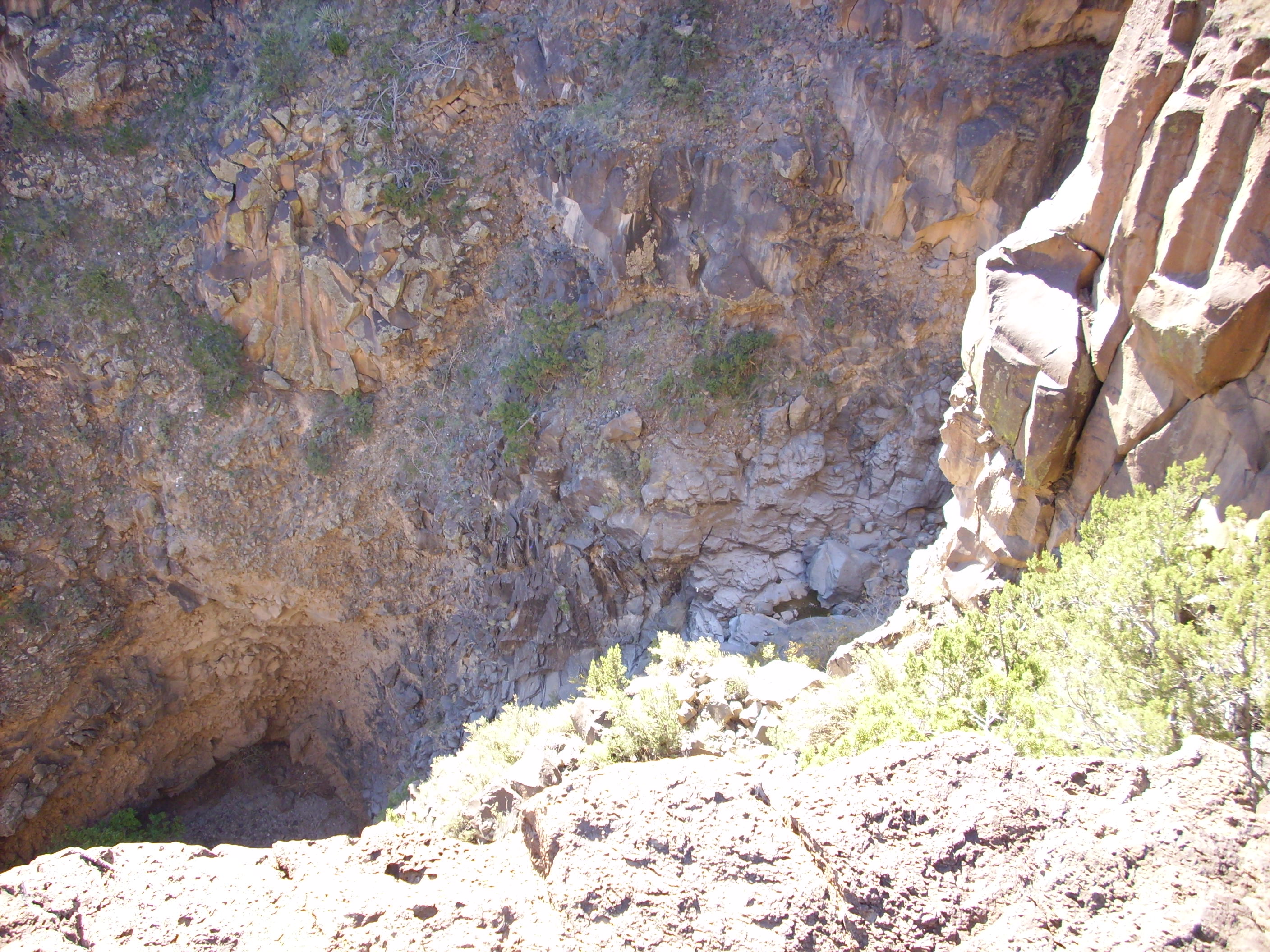
Here’s a closer look at the maar beds.
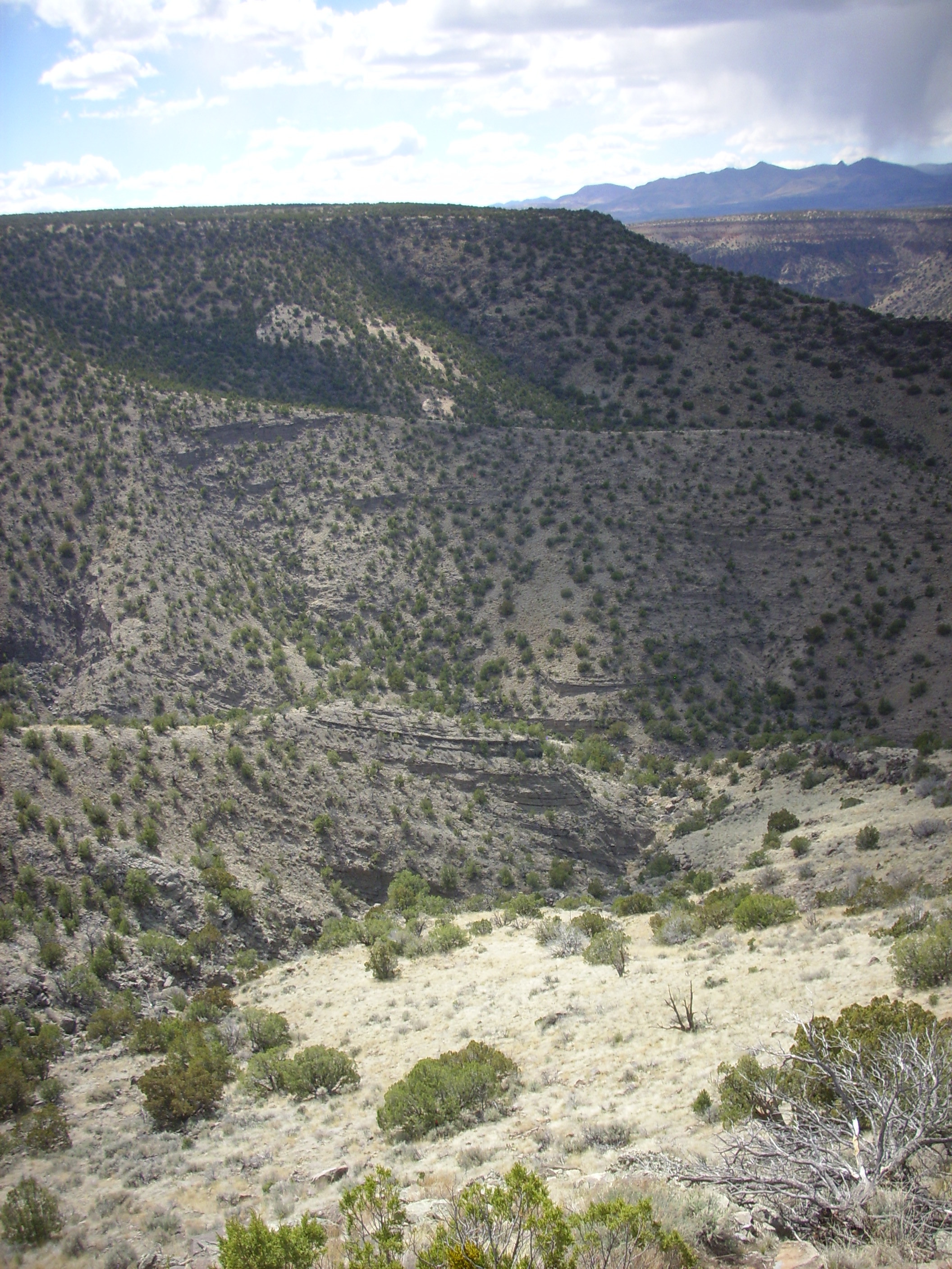
View from north rim of Montoso Maar. 35.765N
106.211W
Notice the great thickness of the beds, over a hundred meters in this area. This must have been a truly enormous maar, though not as large as the enormous Seward Peninsula maars in Alaska, which are over three hundred meters thick.
Here is the view of the maar from the west side of the canyon.

Eventually the maar eruptions transitioned to cinder code
eruptions, as the supply of ground water was depleted (either
through the aquifer being sealed off or the ancestral Rio Grande
shifting away from the maars.) Otowi Peak, which we saw earlier,
seems to have started as a maar and transitioned to a cinder cone.
This is not uncommon. Cinder cones built within maars are found
near Belen, New Mexico, and in the Potrillo volcanic field in
southern New Mexico. Another cinder cone remnant is visible
in the east wall of White Rock Canyon directly across from the
village of White Rock, where it has been cut in half by erosion.
Eroded cinder cone viewed from 35.810N
106.201W
You can see that some of the beds here are a bit lighter than
the usual dark basalt beds of White Rock Canyon. The cinder cone
appears as a low area in the canyon rim, probably because later
flows ponded around the cinder cone, which was subsequently mostly
eroded away to leave a depression. This is unmistakable in the
overhead satellite
view.
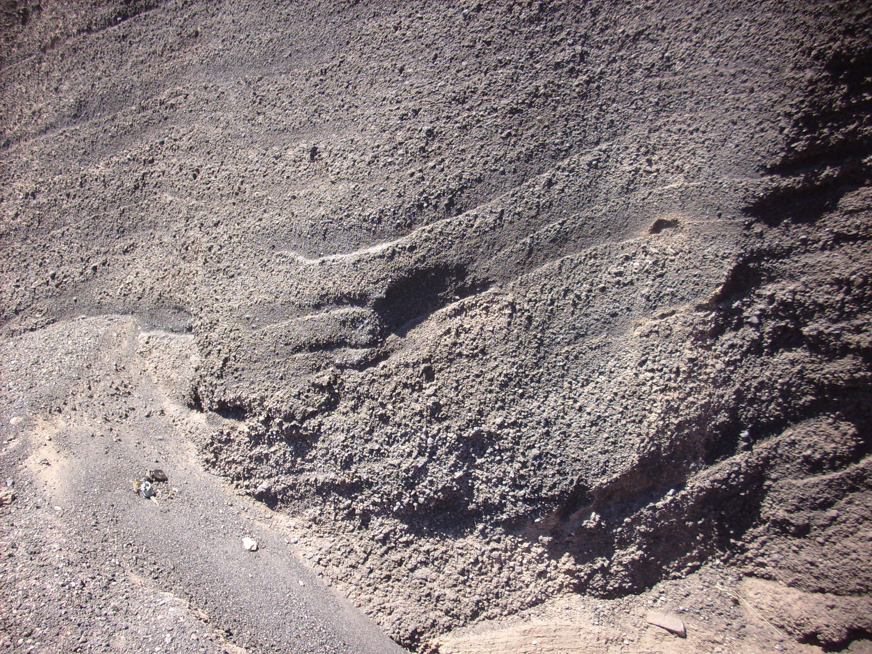
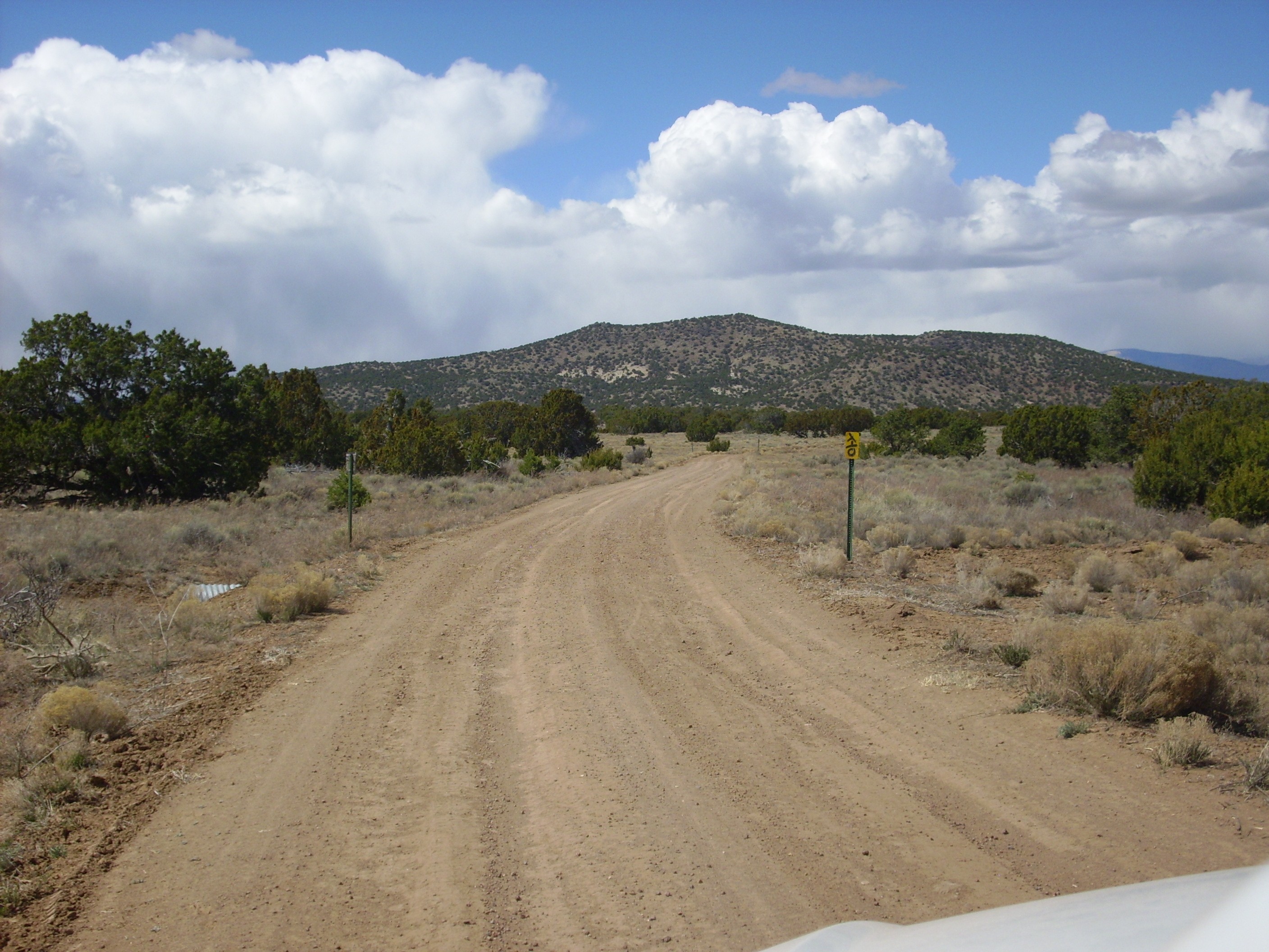
The cinder cone most accessible for close examination is located
along Forest Road 56, where it ascends onto the Cerros del Rio
Plateau from the east. Here the road cuts through this small
cinder cone.

Cinder cone in road cut. 35.617N
106.126W
The dip on the beds strongly suggests that the area just left of the car is a breach in the cinder cone wall. The breach is now filled with sediments and blocks of an overlying thin lava flow.
Here are the beds close up.
Cinder cone in road cut. Car keys at
lower left for scale. 35.617N
106.126W
These are very typical cinder beds, thrown up around a vent where blobs of basaltic lava were blasted into the air as gas escaped from the lava, with the blobs cooling in the air before landing around the vent. Such vents often also have a flow of degassed lava emerging from the base of the cinder cone, but here the flow likely would have been to the northwest, and is now buried under later flows.
The cinder has some commercial value. The geologic map indicates that the breach here was excavated for cinder and is not a natural feature. Further up the road, there are two larger cinder quarries, one of which is still active. The inactive quarry has a locked gate, but can be viewed from a nearby hill.

Inactive cinder quarry. 35.620N
106.141W
The cinder is here oxidized to a deep red. The color makes coarse cinder valuable as decorative stone, and finer cinder is used on highways to improve traction during winter storms.
Following the maar phase of the Cerros del Rio field, basalt magma continued to rise from the depths. The magma would have shot out of the vent with considerable velocity, driven by the formation of gas bubbles in the magma as it approached the surface. Some of the bits of lava cooled while still in the air, falling to the surface as solid cinder that built up a cinder cone around the vent. However, most of the magma, still liquid but now free of gas, pooled around the vent and began flowing away from the cinder cone, often for miles. Repeated eruptions of this nature from multiple vents built up the plateau of the Cerros del Rio.
The flows show a fairly consistent chemical stratification,
particularly around White Rock Canyon and to the west. The
lowermost flows tend to be composed of alkali-enriched rocks such
as benmoreite, hawaiite, and mugearite, which correspond in silica
content to basalt, basaltic andesite, and andesite, but are
enriched in sodium. The upper flows tend to be tholeiitic basalt,
rich in aluminum and poorer in alkali metals. This pattern is seen
in at least two separate pulses of activity, at 2.8 Ma and at 2.3
to 2.6 Ma.
The layers of basalt flows making up most of the Cerros del Rio
Formation are best examined around the perimeter of the plateau.
Because the basalt is far more durable than the underlying soft
sediments of the Santa Fe Group, erosion has created an escarpment
around nearly the entire perimeter of the Cerros del Rio. Only
along a short stretch of the eastern perimeter is the escarpment
low enough for easy access by vehicle.
We'll begin our tour of the perimeter of the Cerros del Rio at
Overlook Park on the west rim of White Rock Canyon.
White Rock Canyon is part of the valley of the Rio Grande River, which has cut through the Cerros del Rio Formation into the softer sediments of the Tesuque and Chamita Formations underneath. This produces spectacular cliffs and large landslides where parts of the basalt plateau have broken loose and slid down into the canyon.
At far left are mesas of light-colored Bandelier Tuff sitting on
a plateau of much darker basaltic andesite of the Cerros del Rio.
Round Mountain is visible to their right, in the far distance. It
is likely a far northern outlier of the Cerros del Rio field. To
its right in the middle distance is Otowi Peak sitting atop the
basaltic andesite of Buckman Mesa, which we saw from a different
angle earlier in this chapter.
Next comes the mouth of Canada Ancha, with exposures of Chamita and Tesuque Formation beds of the Santa Fe Group. This area is the location of the ghost town of Buckman.
The rest of the panorama show upper White Rock Canyon, with its
rim of basalt and basaltic andesite overlying Santa Fe Group
sediments. This includes the cinder code we saw earlier, which is
towards the right in this panorama. The skyline above the cinder
cone is underlain by thick flows of andesite erupted from the
Ortiz Mountain center, whose peak is hidden to the south. This is
one of the younger flows of the Cerros del Rio, with a radiometric
age of 2.32 million years.
At far right is Montoso Peak, which is underlain by basalt with a radiometric age of about 2.59 million years.
While the eastern rim of White Rock Canyon forms the western
escarpment of the Cerros del Rio Plateau, lava flows of the Cerros
del Rio Formation are also present along the entire western rim of
White Rock Canyon. The western boundary of the Cerros del Rio
Formation is buried under younger tuffs of the Bandelier Formation
west of White Rock, as we noted earlier.
There are two trails into White Rock Canyon from the village of
White Rock, the Blue Dot Trail and the Red Dot Trail. They are so
named because the trails are marked with paint spots of their
respective colors. The Blue Dot Trail is a fairly steep trail from
the
canyon rim just south of Overlook Park down to the level of
the Rio Grande. It is also well maintained, with such features as
rock
steps.
After the initial descent down the basalt cliffs, the trail comes out on a slump block. The landslides in the area unfortunately conceal the contact between the Cerros del Rio Basalt and the underlying Santa Fe Group, but the presence of large amounts of tan sediments in the landslides shows that this slump block is already below the level of the contact.
The terrain here is level enough to set up camp, and I have actually camped overnight with my son's Boy Scout troop here, at roughly the spot shown in the center of the photograph. Note the considerable quantity of well-rounded clasts along the trail. These match a similar gravel bank on top of the rim adjacent to this point, deposited as a gravel bar from one of the lakes formed when eruptions in the Cerros del Rio dammed the ancestral Rio Grande River.
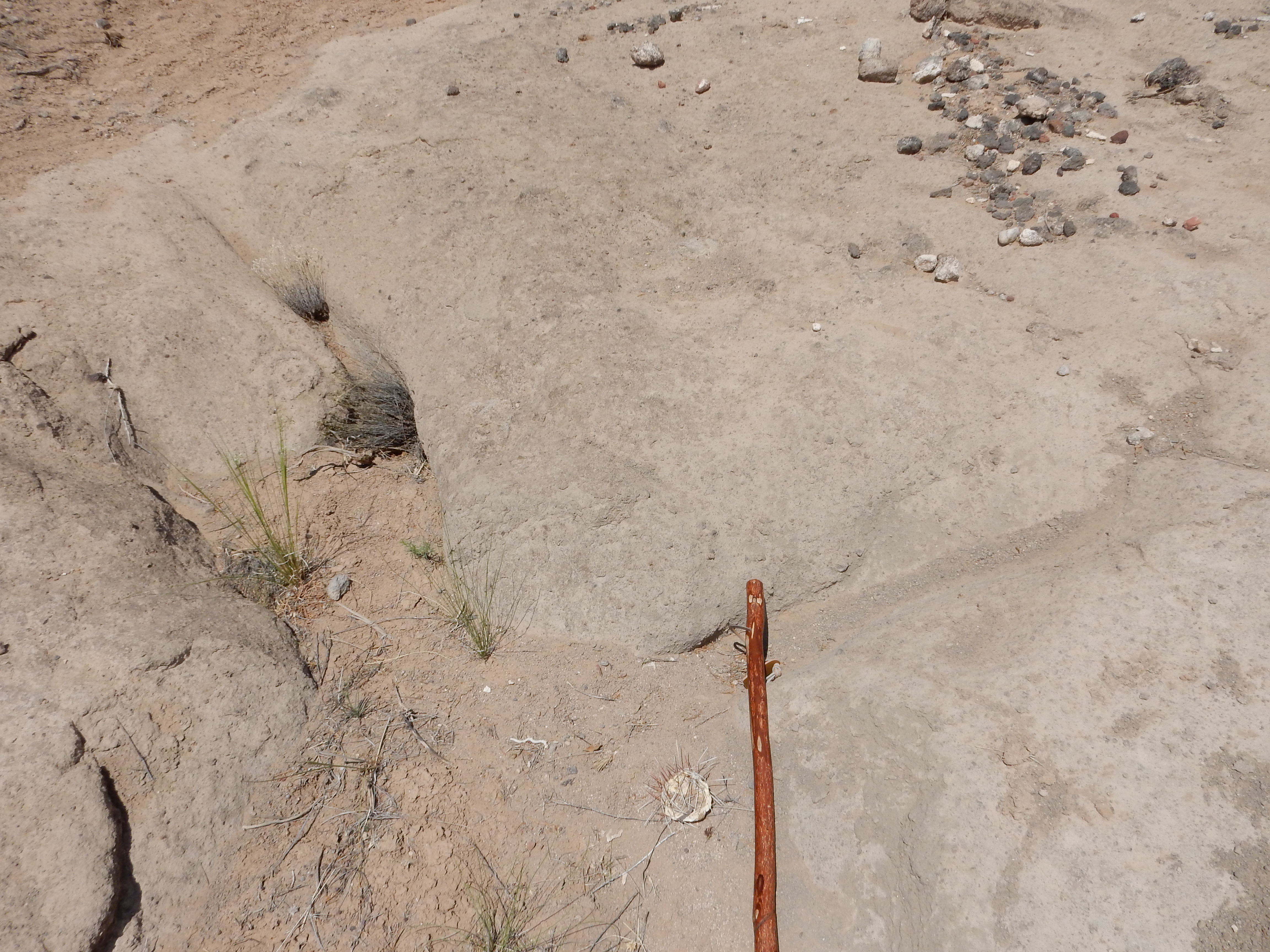
If one detours well off the trail, continuing south along the slump block, one sees what looks very much like an eruptive center. This cannot be spotted from above, but is only visible from the slump block well off the trail.
Why do I think this is an eruptive center? Well, for one thing, the rock here is much lighter than the surrounding rock, and close examination suggests that this is because it is more coarsely grained than the surrounding basalt -- almost like a diabase.
For another, the rock is foliated in a way that looks like a subsurface dome. I'm not sure these photographs do it justice.
It's a bit of a subtle thing, but the texture of the rock is
different here from anything I've seen anywhere else in the
canyon. However, it resembles the benmoreite outcroppings around
Upper Falls in lower Frijoles Canyon. The relatively high
viscosity of this magma could explain why the rock here formed a
plug rather than flowing easily from the vent.
The sheer cliffs forming the rim of White Rock Canyon are
ideal for rappelling, and one finds rope anchors at scattered
points along the rim, which are readily accessible from the Rim
Trail.
The rock into which this anchor has been sunk is described in the most recent paper on the Cerros del Rio as hawaiite. This is a sodic trachybasalt found throughout the Cerros del Rio. A trachybasalt is a basalt that is high in sodium and potassium, and a sodic trachybasalt has significantly more sodium than potassium.
Most of the rocks of the Cerros del Rio are somewhat alkaline, so that some of the basalt is actually trachybasalt and some of the andesite is actually trachyandesite. This is typical of mafic rocks produced by continental rifting like that along the Rio Grande Rift. It reflects a low degree of partial melting of undepleted mantle.
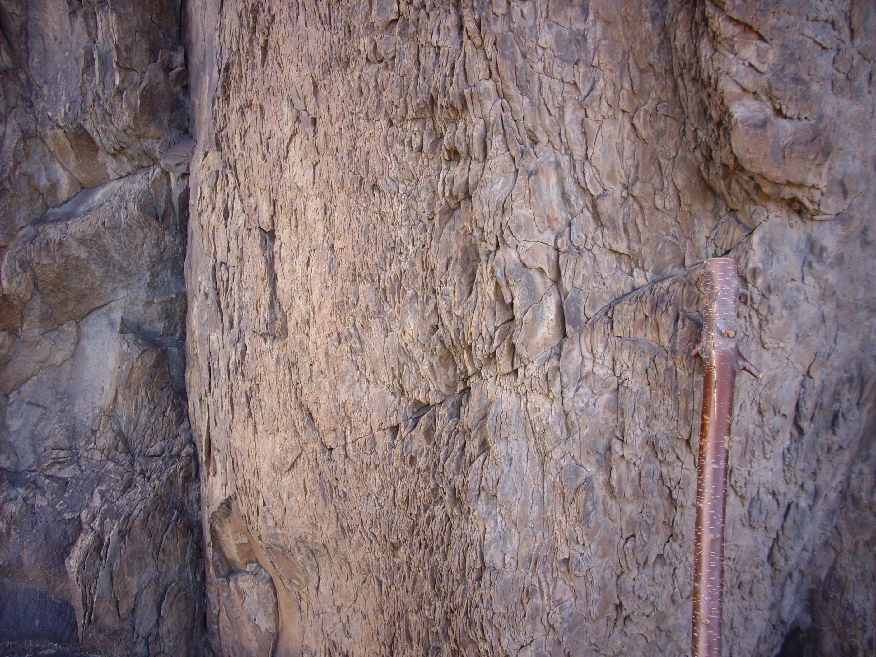
It is very common for a thick basalt flow, as it cools and
contracts, to fracture into roughly hexagonal columns. You
can see the tops of such columns in this photograph, which looks
down on a portion of the basalt flow that has slumped into the
canyon.
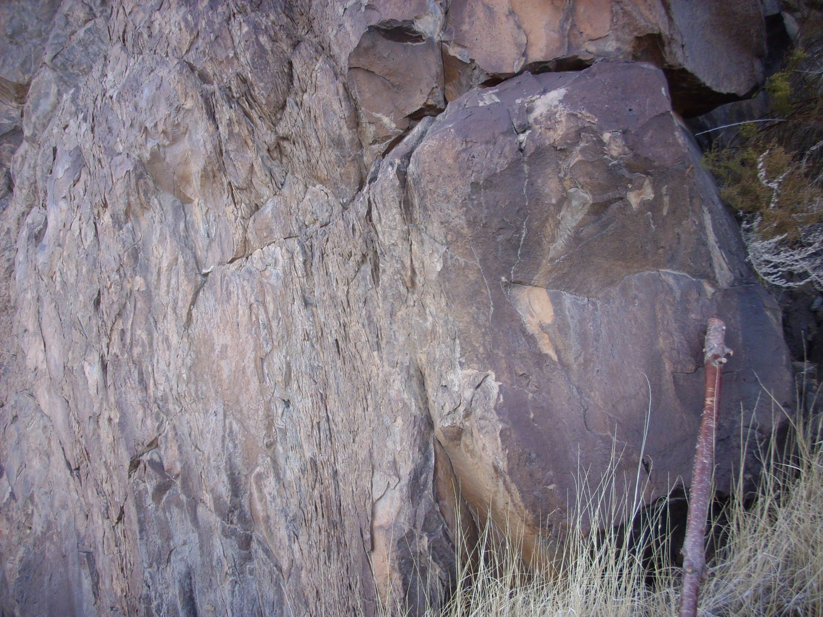
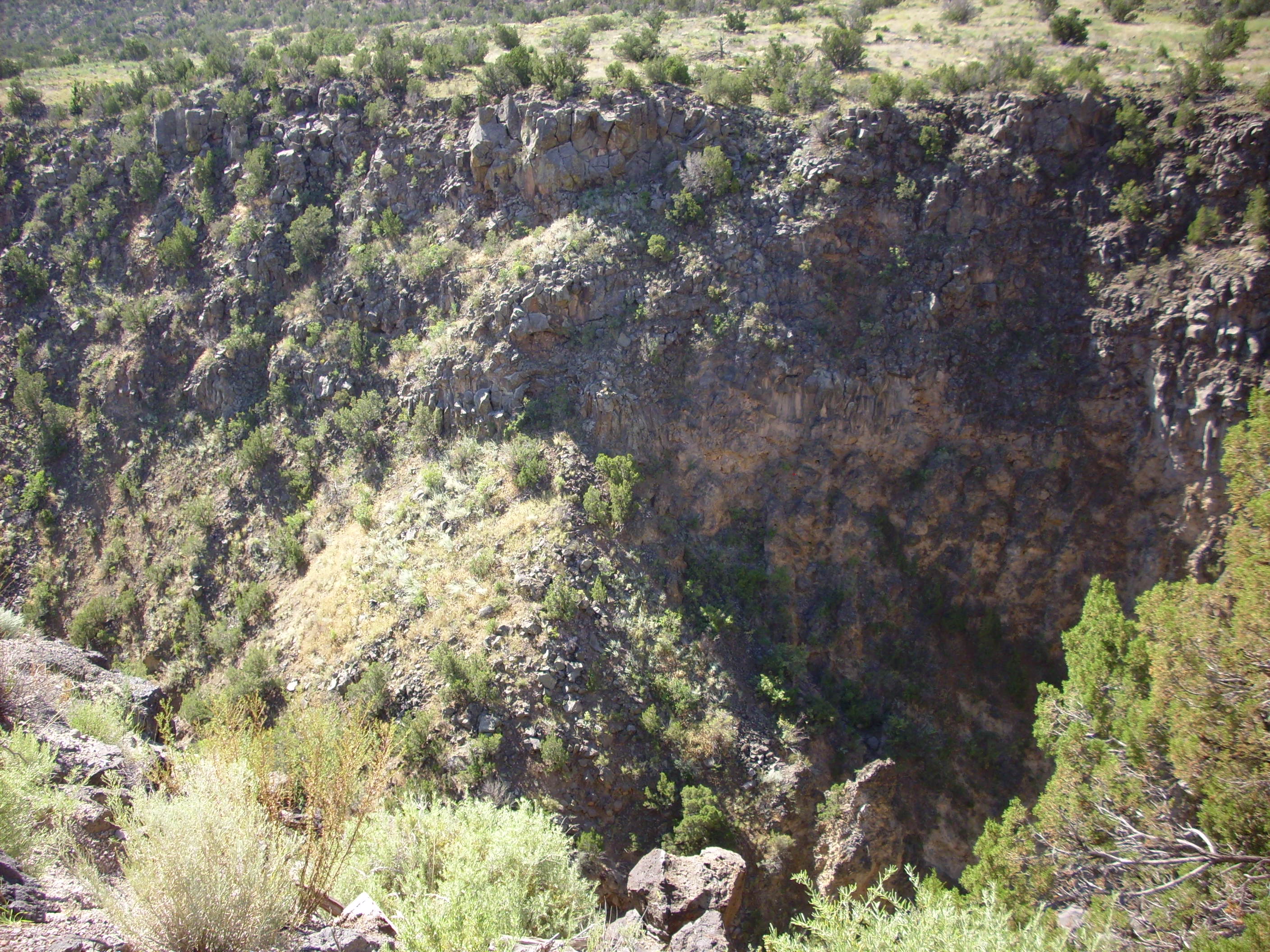
Further south along the Rim Trail a branch of the rim trail affords a view into the confluence of Pajarito Canyon and White Rock Canyon. Here an intermittent stream has carved a very deep canyon into the thick basalt flows.
The basalt is several hundred feet thick at this location, much thicker than in most of the canyon. Here's a view from below, from along the Red Dot Trail.
Confluence of Pajarito Canyon and White Rock Canyon.
Looking north from near 35.808N
106.198W
Most likely, the basalt here fills a paleocanyon coincident with the present-day Pajarito Canyon. This closer view shows that there are at least four distinct flow units in the basalt.
Thick basalt flows at confluence. Looking north from
near 35
48.550N 106 11.919W
At the base of this thick section of basalt is a bed of cinder.

Cinder bed at confluence of Pajarito Canyon and White Rock Canyon. Looking northeast from near 35.810N 106.199W
The reddish color represents oxidation, either at the time the
cinders were deposited or when the overlying basalt was deposited.
The darker color near the top of the bed suggests baking by the
overlying basalt flow, but such baked zones are usually quite
thin. Perhaps both processes were at work here.
There is a very distinct ledge in this area, formed by the boundary between two successive basalt flows. The boundary is visible in this photograph as a horizontal joint near the top of the cliff to the right of center.

The ledge is formed when the top flow is eroded away to expose the flow underneath, which is apparently slightly more resistant. One can see ropy patterns on the top of the lower flow, typical of pahoehoe flows.
This kind of preservation of an original flow surface is rare in White Rock Canyon, occurring only where relatively recent erosion has exposed a lower flow that was previously protected from the elements by an overlying flow. Here is a close up of the boundary between the upper and lower flows.
This area also has a number of petroglyphs, which we'll discuss later in the book.
Here's a view from further south in White Rock Canyon, at the trailhead of the Red Dot Trail.
White Rock Canyon viewed from 35.810N
106.201W
The cinder cone in the canyon wall now appears at left in the
panorama. Towards the right is a cliff of light-colored Bandelier
Tuff laid down in a paleocanyon in the Cerros del Rio. This may be
the cliff from which the canyon gets its name. At far right is
Montoso Peak in the distance.
Here's a closer look at Montoso Peak and the canyon to its north.

White Rock Canyon looking south from 35.810N
106.201W
In the middle distance, a large shoulder of basalt is visible on th east side of the canyon (left in the photograph). The peak behind and to the left of Montoso Peak is Cerro Micho, which is underlain by andesite 2.76 million years in age. The cone at the extreme left in the photograph is an outlier of Cerro Micho underlain by basaltic andesite that is slightly younger, at 2.73 million years in age.
The Red Dot Trail is another well maintained from the canyon rim in the Pajarito Acres subdivision to the river. The basalt cliffs are particularly impressive here.
Cliffs above Red Dot Trail. Near 35
48.508N 106 12.097N

Cliffs crossed by Red Dot Trail. Looking west from near
35
48.548N 106 12.019W
The furthest point south in White Rock Canyon that is easily
accessible from White Rock is near the mouth of Potrillo Canyon.

The light pink outcrops on the left side of the panorama are the
cliffs of Bandelier Tuff seen in the last panorama. The
pyroclastic flows that produced these cliffs likely flowed down
the ancestral Water Canyon and filled an eastward meander of the
ancestral White Rock Canyon to form the beds here. These beds mark
the limit of the Bandelier Tuff to the southeast.
There is a kind of natural amphitheater right of center, formed
by landslides. This exposes a great thickness of Cerros del Rio
lava flows lying atop beds of phreatomagmatic cinder. The basalt
shoulder from the previous photograph is now visible to the left
of this natural amphitheater. It is identified on the geologic map
as a hypabyssal plug, which cooled at some depth below ground.
To the right, some distance down the canyon, is a conical hill of basaltic andesite at the mouth of Ancho Canyon. This is likely an erosional remnant of a natural dam that once blocked the canyon at this point, where it is particularly narrow. This dam produced a large lake, which geologists have named Lake Culebra, filling the entire Espanola Valley to the north. Lake bed deposits are scattered across the mesas to the west of the Rio Grande, north of Pueblo Canyon and the main highway to Los Alamos. We'll have more to say about Lake Culebra later in this chapter.
The eroded valley at the foot of Montoso Peak is Montoso Maar, which we saw earlier.
The furthest point south before one reaches Department of Energy land off limits to the public is the eastern terminus of the Powerline Trail.
This gives a little better view into the Montoso maar and of the remnants of the natural dam. Directly east are cinder beds under a thick section of basalt.
South of its confluence with Ancho Canyon, White Rock Canyon is largely inaccessible except by boat along the Rio Grande. It was once possible to reach the canyon via a fairly easy hike down Frijoles Canyon from the Bandelier National Monument headquarters, but the trail is now washed out. The east rim of the canyon is equally difficult terrain. However, the road into Frijoles Canyon gives one a glimpse of a large cinder cone that was nearly buried under the Tsherige Member.
Cinder cone in TA-33 nearly buried under Bandelier Tuff.
Looking northeast from 35
46.617N 106 15.892W
The dark patch of ground is part of the southern summit of the
cinder cone. Note how the lowermost beds of the Tshirege Member
conform to the slope of the cinder cone. This area is on
restricted DoE land and is not accessible to casual visitors, but
LANL geologists have dated a dike running through the cone as
about 2.55 million years old.
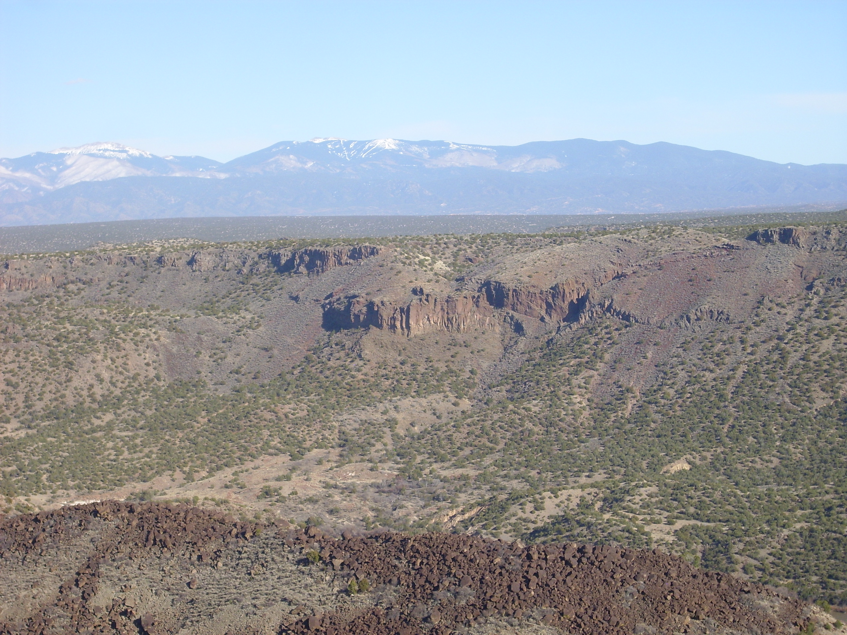
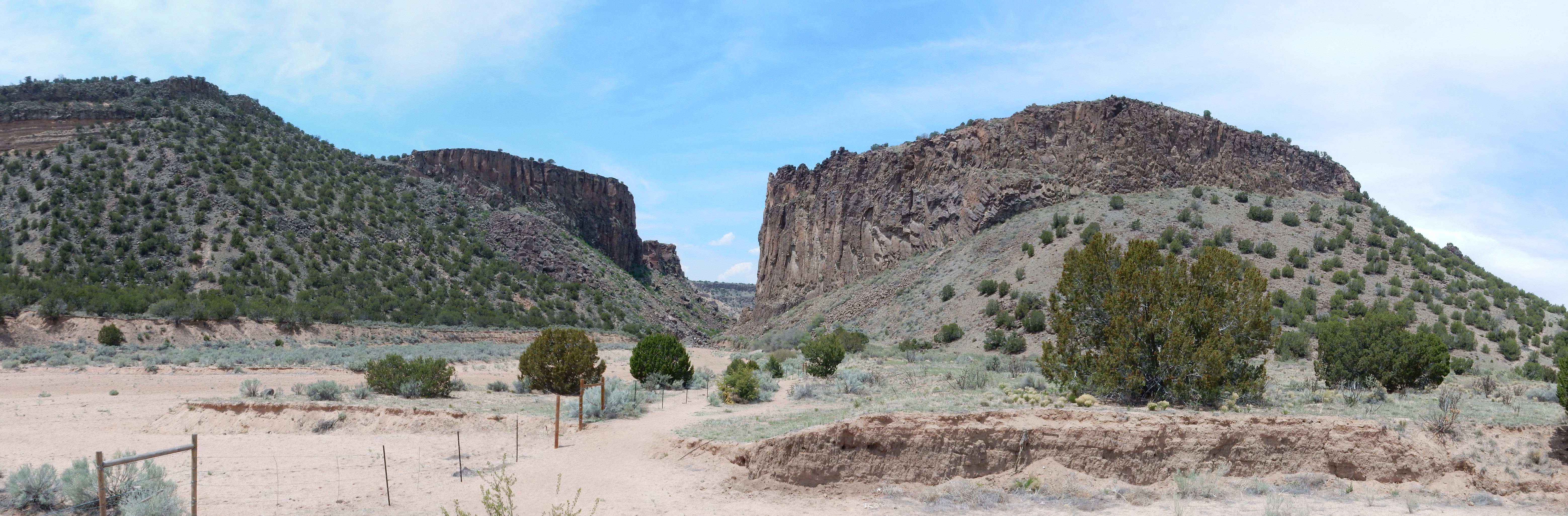
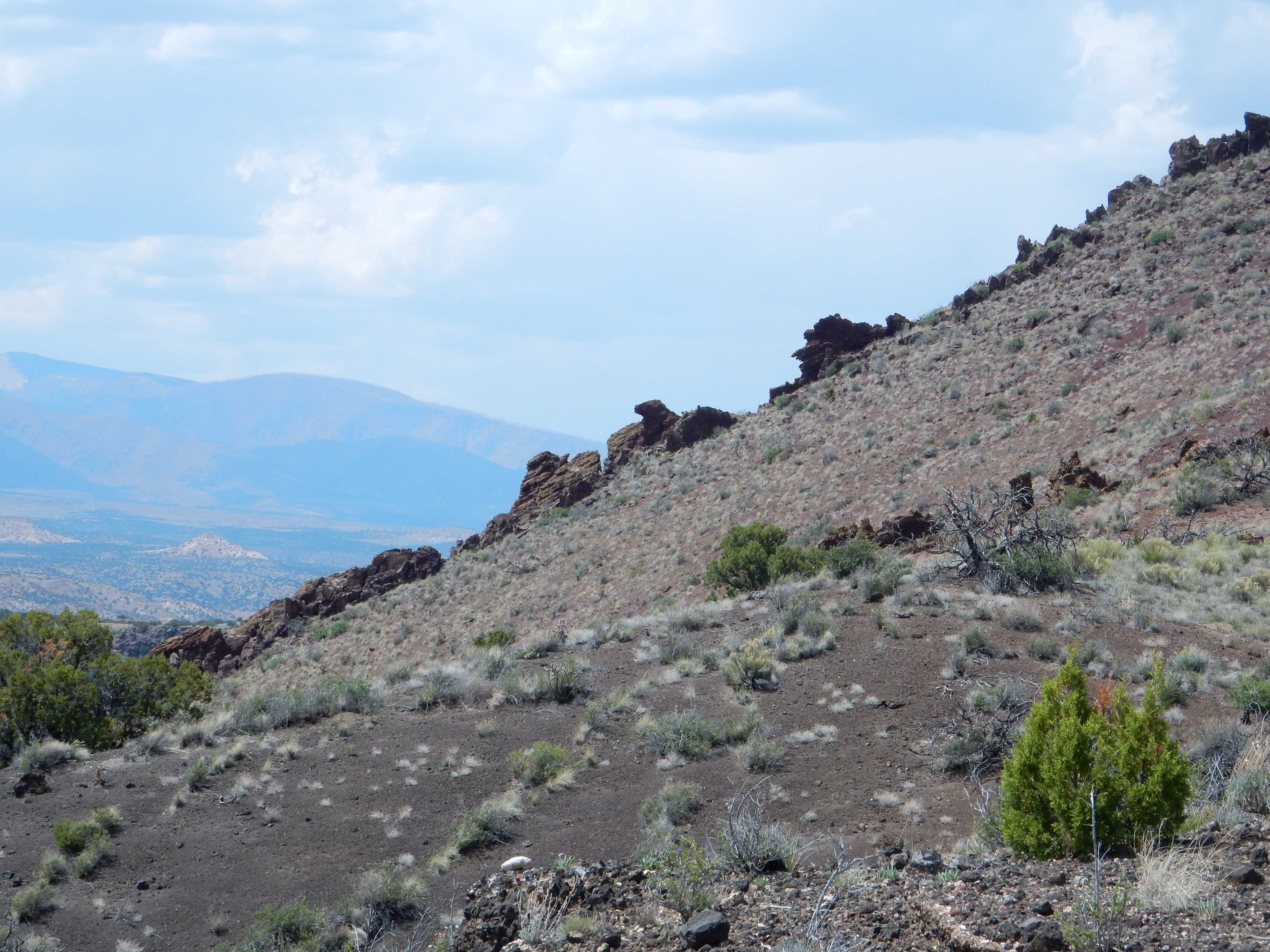
The next point that is easily accessible is the area of Cochiti. Here the escarpment bounding the Cerros del Rio becomes particularly spectacular, in part because it coincides with a major fault. Both escarpment and fault bear the name, La Bajada.
The pan begins towards the northeast, looking up the valley of
the Rio Grande. At extreme left are the San
Miguel Mountains, with mesas of Tsherige Member, Bandelier
Tuff, at their feet. La Bajada stretches across the left side of
the panorama with Tetilla
Peak just poking over the skyline near center. Sandia Crest
is on the distant skyline to the right, and Cochiti
Dam crosses the right end of the panorama.
The portion of La Bajada directly to the east is a bit unusual. Close study of the lava flows here shows that one of the flows was erupted recently enough (around 1.14 million years ago by radiometric dating) that La Bajada already existed, and the flow cascaded down the face of the escarpment and pooled on the low ground below.
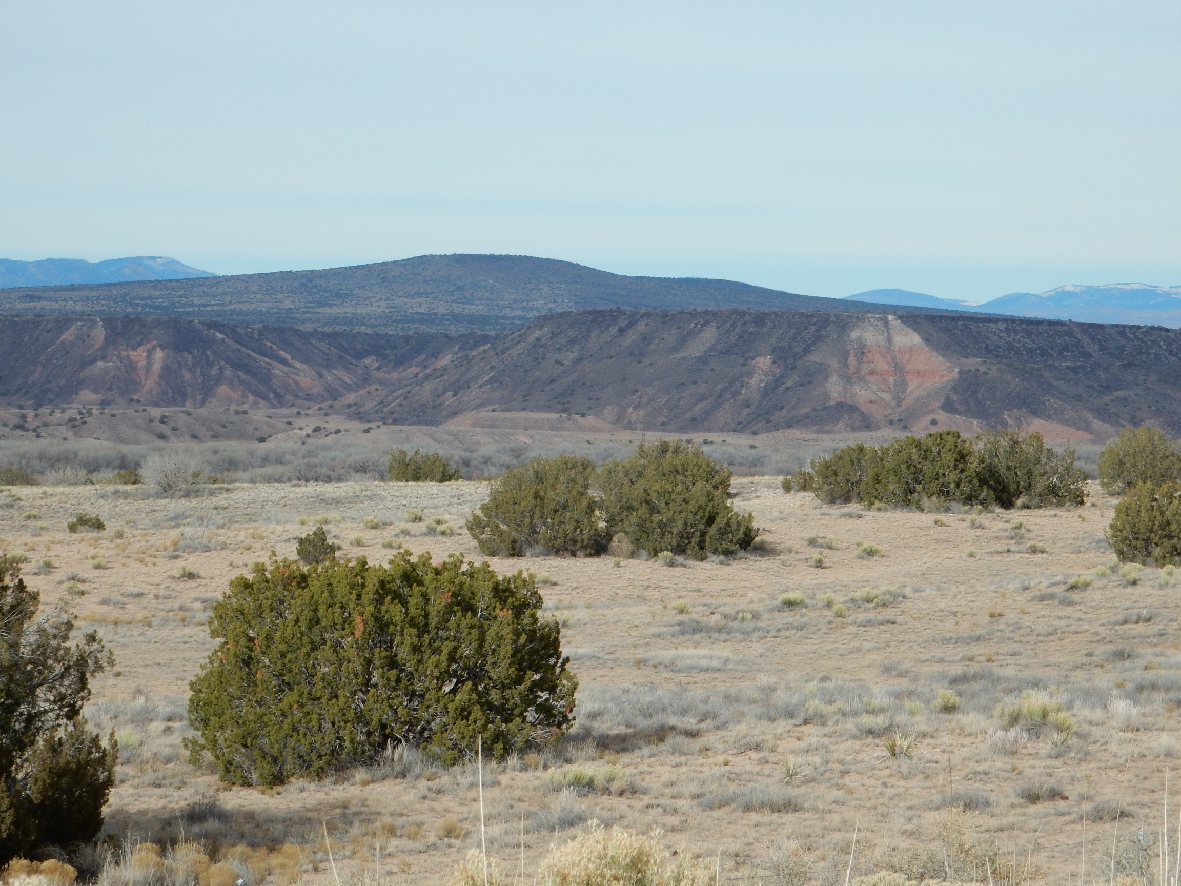
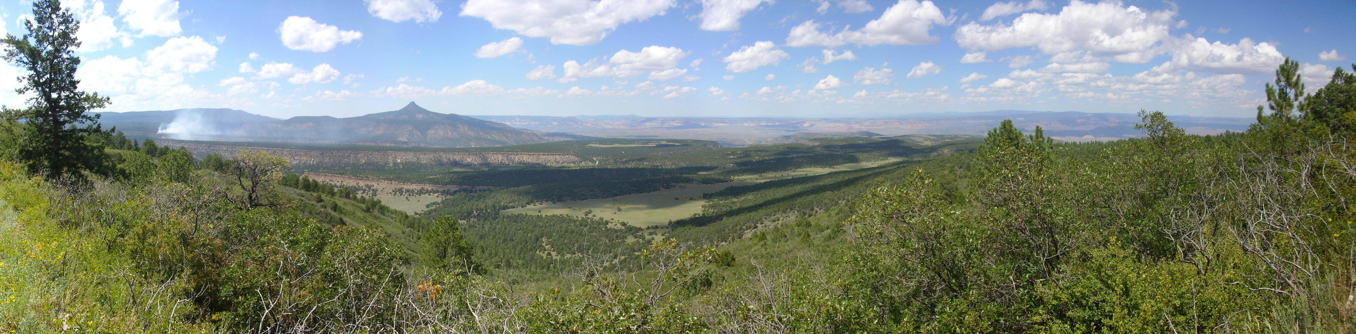
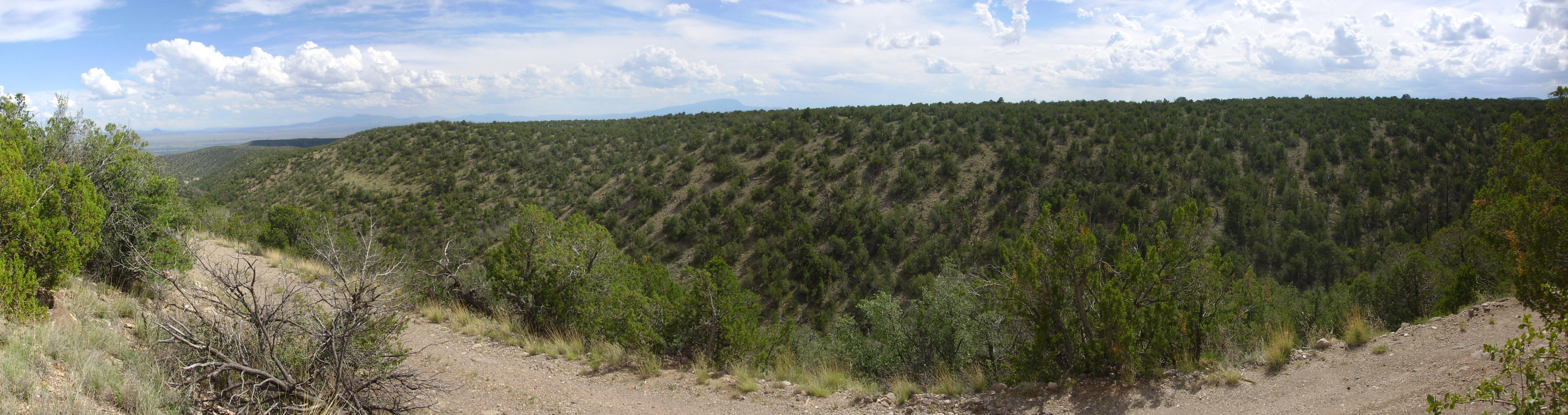
La Bajada continues south to the canyon of the Santa Fe River, which bounds the southern end of the plateau. This area can be seen from atop Cerro Seguro near La Cienega. (We visited this area in Chapter Five.) This is southeast of the Cerros del Rio and provides a nice panorama of much of the plateau.
Panorama from atop Cerro Seco. 35
34.228N 106 08.263W
The panorama begins with a view to the southwest, towards Sandia
Crest (washed out but just visible in the distance.) The hills in
front are not named on my map, but lie just north of a bend in
Interstate 25 and mark the southern limit of the Cerros del Rio.
The canyon crossing much of the panorama and disappearing into the
horizon at left is the canyon of the Santa Fe River. The hills to
its right are underlain by Ortiz monzonite, which rises like
islands (kipukas) out of the much younger Cerros del Rio Basalt on
the other side of the Santa Fe River. The peak to the right of the
hills is Tetilla
Peak, which dominates the western escarpment of the Cerros
del Rio along the La Bajada Fault.
The flat mesa extending north (right) from the Santa Fe River canyon is Tsinat Mesa, underlain by Cerros del Rio basalt flows.
South of the Santa Fe River canyon is Mesa de Juanita. Though geographically detached from the Cerros del Rio, it is underlain by Cerros del Rio basalt. It is bounded by escarpments to the west and south, but to the east the basalt is buried under alluvial fans of the Cerillos Hills.
The escarpment on the east side of the Cerros del Rio is less dramatic than that on the west side, since the small rivers and intermittent streams here are not as effective as agents of erosion as the Rio Grande. The escarpment is easily scaled and there are numerous petroglyphs in the area.
East escarpment of Cerros del Rio near
La Cieneguilla. 35
36.526N 106 07.398W
This escarpment forms the northeastern boundary of Tsinat Mesa. The rock here is a trachybasalt dated at 2.68 million years old. My geologic map is not so specific, but this is probably hawaiite. The sediments beneath the lava cap are rich in red granite fragments, and are shown on my map as Ancha Formation. The granite came from the Sangre de Cristo Mountains to the east and was probably transported to this area by the ancestral Santa Fe River.
The escarpment is buried under sheetwash further to the north, where the two gravel road access points are located.
Here is a panorama of the northern Cerros del Rio from the northeast.
Cerros del Rio from the northeast. Looking southwest from 35 44.253N 106 04.461W
We’re looking across low hills of the Tesuque Formation at the Cerros del Rio on the skyline. The little knob on the skyline at left is part of the Twin Peaks center. The knob just right of center is Ortiz Mountain, an andesite vent whose flows cover the northern part of the Cerros del Rio.
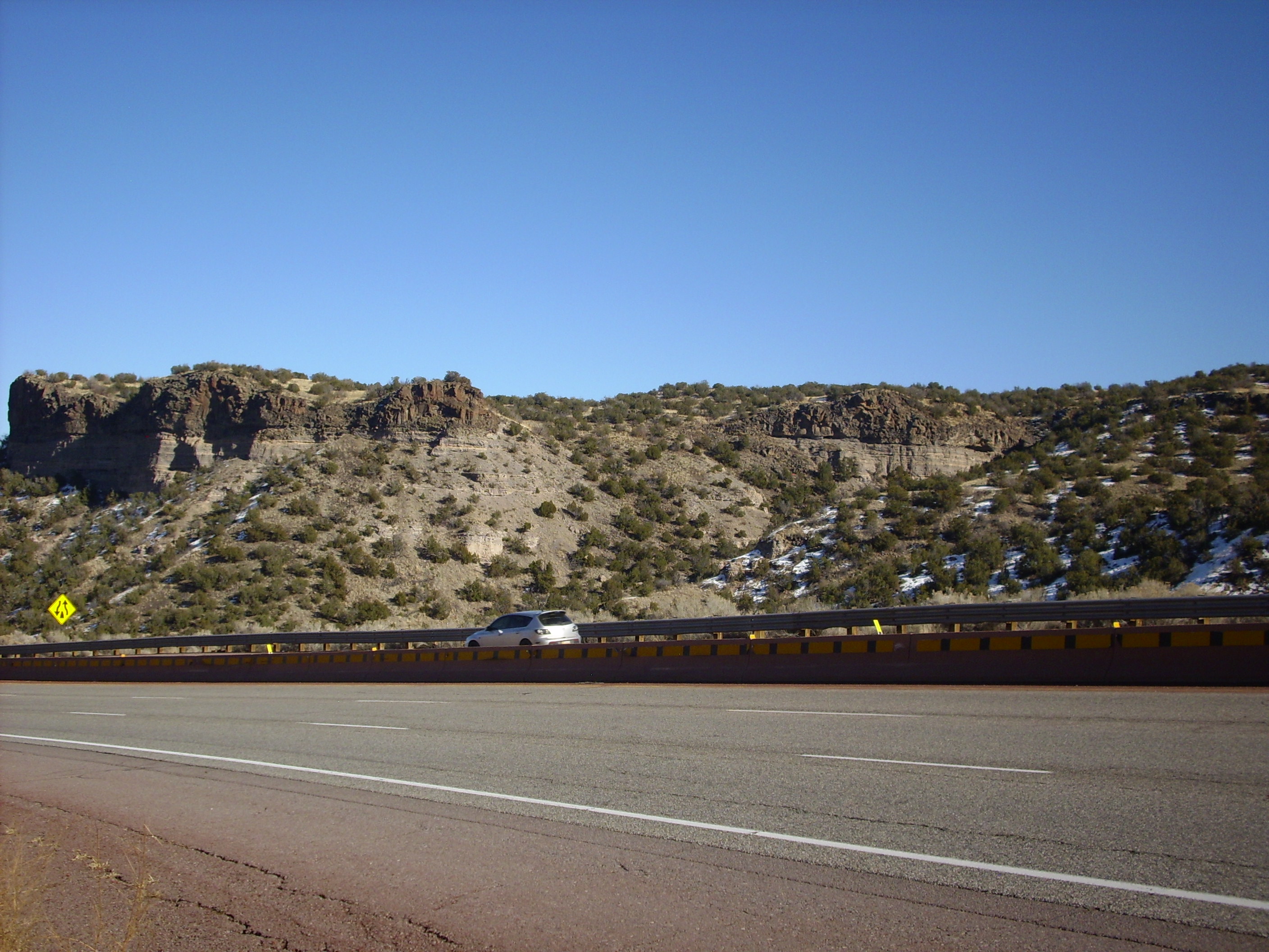
The escarpment becomes substantial again further north, where Alamo Creek, an ephemeral stream, parallels the eastern escarpment of the Cerros del Rio.
The mesa is capped with Cerros del Rio olivine basalt about 2.5 million years in age. Underneath are thin beds of volcanic cinders and other sediments. These rest on the Ancha and Tesuque Formations of the Santa Fe Group.
Further north, andesite flows from Ortiz Peak reached the edge of
the escarpment.
The lower slopes are the Cuarteles Member of the Tesuque
Formation, with possibly a thin layer of Ancha Formation at top;
closer examination would be required to be sure. Then come
alternating beds of sediments and very dark volcanic debris. On
top are very thick flows of andesite, with a a layer of shattered
andesite (breccia) at the bottom of the flow.
Notice how very flat the beds are, including the base of the andesite flow. The Rio Grande Valley was very flat when the Cerros del Rio began erupting 2.5 million years ago. Since then, regional uplift and changes in the flow of the Rio Grande downstream have caused the river to cut downwards, and sediments not protected by lava flows have eroded away to the new lower level of the river. This process is still taking place, producing the spectacular badlands of this area.
A favorite destination for the adventurous in this area is Diablo Canyon, at the north end of the Cerros del Rio. This area is accessible via Buckman Road from Santa Fe.
Notice the very thick section of basalt to the right, with pronounced columns. This area is described on the latest geological map as a former lava lake. The road in is suitable for passenger vehicles in good weather, and there is an excellent parking area with descriptive signage and a trail, but be warned that the canyon itself is notorious for a large population of rattlesnakes. Keep a sharp eye if you choose to hike the area.
There is some particularly striking columnar basalt just right of center. A closer look:

Columns like this form as the basalt cools, and the joints
(formed as the cooling basalt cracks under the thermal stress) are
usually perpendicular to the surface of the basalt. This shows
that the basalt here was pooled against a fairly steep hill, now
partially eroded away. So while most of the area was remarkable
flat, there were areas of local higher relief.
Buckman Mesa is separated from the Cerros del Rio by Canada Ancha, a wide valley leading to the Rio Grande.
The mesa is named after an Oregon lumberman who loaded his lumber, cut from the Jemez, onto the Chili Line railroad at this location. The area is now a well field supplying drinking water to the city of Santa Fe.
Geologically, the mesa is part of the Cerros del Rio, being
capped with basalt and basaltic andesite similar in age to the
other Cerros del Rio flows. There is a large cone, Otowi Peak,
atop the mesa, which is not visible from this perspective. Both
can be reached via a hiking trail from the parking area near the
Rio Grande, though this is poorly marked and difficult to find
without detailed instructions. The trail affords an excellent
close up view of the beds immediately under the lava cap.

The light tan Chamita Formation beds appear to be full of coarse boulders, but that may be the angle of the sun. There is a very distinct sequence of light gray beds, probably of mixed volcanic debris and sediment, then another distinct sequence of very dark beds that must be mostly volcanic debris, then the brecciated base of the basalt lava flow.
Notice also the lighter beds at right that appear to be truncated
by the brecciated flow. Although the surface on which these flows
erupted was quite level, there were some irregularities in the
surface.
The trail then comes onto the top of the mesa, with Otowi Peak ahead.

With the high escarpments on all sides and the flat mesa top, Buckman Mesa has some of the feel of an island in the sky. However, the proximity of the Cerros del Rio and the Pajarito Plateau and the presence of paths to the top keep it from being a true island in the sky.
The mesa top is covered with geologically young deposits of sheetwash and eolium. Sheetwash is what you get when water laden with sediments overtops the local stream channels and floods across a flat surface. Eolium is what the wind deposits. This is deeply gullied in some locations.
This particular gully exposes a bed of tuff.
This is a fairly well cemented tuff composed mostly of bits of dark igneous rock in a light tan matrix. It’s what I imagine the stuff just under the basalt flows looks like close up, but this is on top of the flows. The basalt fragments rule out either member of the Bandelier Tuff, and they’re unlikely to be found this far east anyway. This tuff is the result of Otowi Peak erupting through the basalt capping Buckman Mesa and producing small volumes of phreatomagmatic deposits.
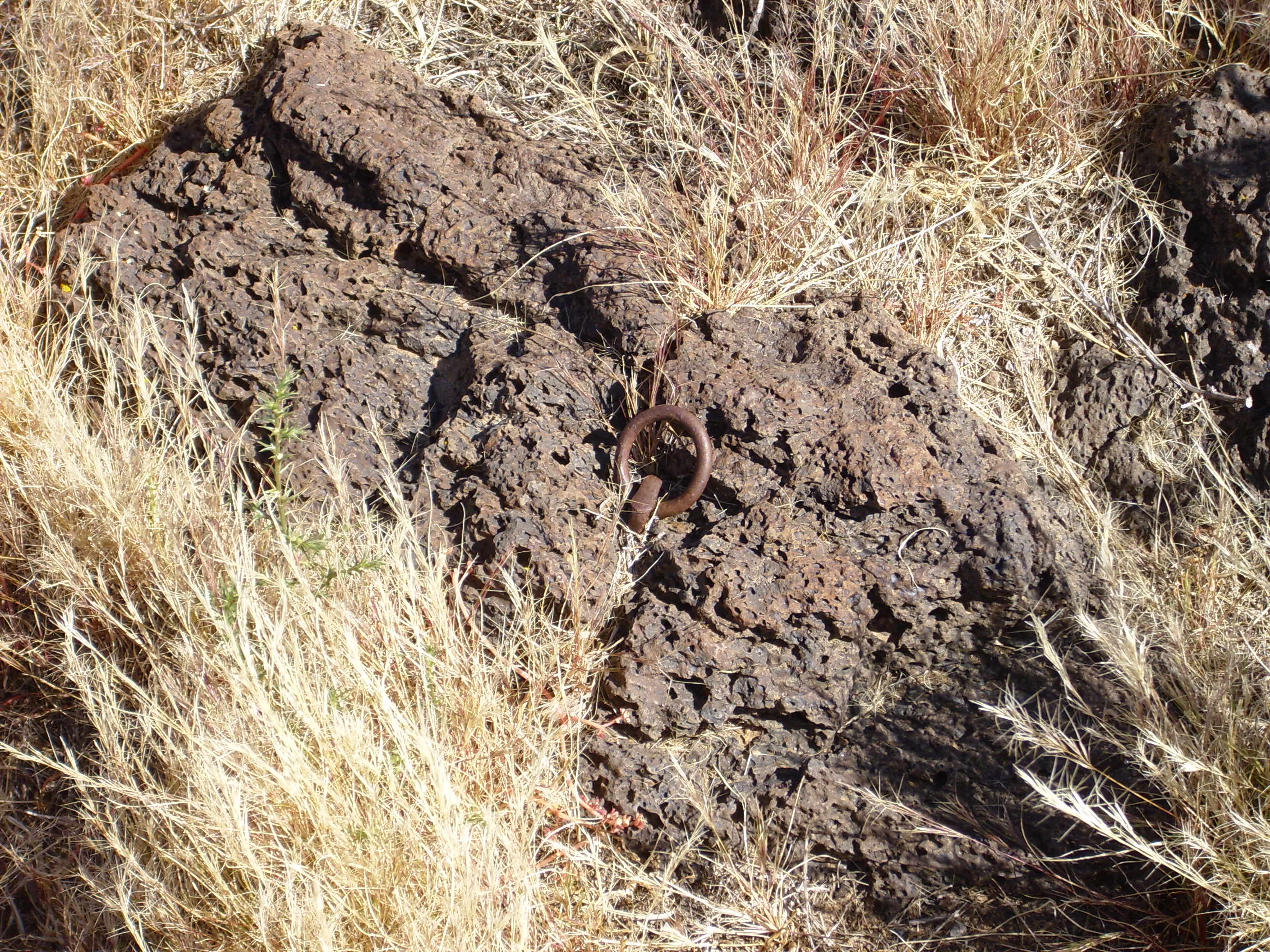
Closer to Otowi Peak, the ground is covered with reddish volcanic cinder.
Otowi Peak itself is mostly cinder, with some blocky lava.

North of White Rock Canyon, there is an isolated mesa known variously as Black Mesa or Round Mountain by Anglos, as Tunyo Piñ ("Spotted Mountain") by the San Ildefonso people, and as Mesa Huerfana ("Orphan Mesa") by the Spanish. This is not to be confused with the much larger Black Mesa north of Espanola.

Round Mountain. Looking southeast from near 35.932N
106.120W
Round Mountain is located on tribal lands and has religious
significance to the San Ildefonso Tribe, and so it is off limits
to casual visitors. This is a volcanic neck formed in an eruptive
vent, probably about 2.73 million years ago. The southwest
side of the mesa has visible beds of cinders.
Round Mountain seen from the west. 35.924N
106.124W
You can see the curved beds of cinders on the right side of the mesa. There are also columns of cooled lava at the base of the cliffs just left of center (click to enlarge). With a radiometric age of 2.73 ± 0.27 M, the mesa is almost certainly a northern outlier of the Cerros del Rio field.
West of the Rio Grande, the Cerros del Rio Formation is mostly overlain by younger tuffs of the Bandelier Formation, but there are occasional exposures. Some of these are fairly extensive, as at White Rock and in Pueblo Canyon along the main road into Los Alamos from the east.
Bandelier Formation sitting on top of
Cerros del Rio Formation on State Road 502 west of Totavi. 35
52.099N 106 11.913W
This particular road cut is iconic. You will see it in almost
every decent book on Jemez geology. At the bottom is a layer of
dark basalt of the Cerros del Rio Formation, which apparently
erupted from a center somewhere to the west (left in this
photograph). On top of the basalt is a very thin layer of lake
silt from Culebra Lake, which formed about 2.46 million years ago
when Cerros del Rio flows dammed the Rio Grande in White Rock
Canyon. There have been a number of lakes north of the canyon as a
result of such damming, which we'll discuss in greater depth later
in the book.
Opposite this road cut is a deep canyon in the Cerros del Rio. At this point, the flows are very thick.

It's rare to see this great a thickness of Cerros del Rio Basalt, and in fact we see a sloping contact further down the canyon with Santa Fe Formation sediments that bring the Cerros del Rio to a more typical thickness.
It's likely that we are seeing where the lava pooled in a deep
paleocanyon.
Further east, the road takes a short turn north, and from that point the Cerros del Rio is present only on the south side of the canyon. Here it is the topmost unit.

Cerros del Rio Formation in lower Pueblo Canyon. 35
52.090N 106 10.986W
Cerros del Rio Formation in lower
Pueblo Canyon
Cerros del Rio Formation in lower
Pueblo Canyon
The Cerros del Rio rests here on lacustrine beds (lake bottom deposits) of the upper Puye Formation. In some places, the lava shows signs of having cooled rapidly on contact with water. In this exposure, the beds seem to dip slightly to the southwest. This assumes I held the camera straight! But if we can trust my inner ear, this suggests that the Diamond Drive Graben extends this far east, and continued subsidence to the west has tilted the beds.
The last photograph shows prominent columnar fractures from the bottom of the flow up, and a more irregular pattern of fractures from the top down. This is a very common pattern in thick basalt flows, and arises from the way the flow cools rapidly from the top and much more slowly from the bottom. The lower columnar part of the flow is called the colonnade, and the irregular top part is called the entablature, by analogy with Greek temple architecture.
The Cerros del Rio continues down the west side of White Rock
Canyon for its entire length. Here's the northern section of the
western rim of White Rock Canyon, seen from Buckman Mesa across
the canyon.
The village of White Rock is visible atop the mesa to the left. The dark Cerros del Rio beds contrast with the light pinkish mesas of Bandelier Tuff resting on the Cerros del Rio.
Across the canyon are some impressive cooling columns.
The great thickness of lava here indicates that it filled a
paleocanyon in the Santa Fe Group, possibly the same one we just
saw in Pueblo Canyon, but further downstream.
In the next panorama, we look almost directly down the canyon as
it passes White Rock.
The village of White Rock is built on a plateau of Cerros del Rio basalt with a thin covering of sheetwash and eolium deposits. The basalt is best exposed in the La Vista subdivision, which forms a topographic high on the Cerros del Rio surface and may have been an eruptive center. This is close to my neighborhood; my house is built on Cerros del Rio basalt on the west side of Pajarito Canyon.
Cerros del Rio Formation in La Vista area. 35
49.359N 106 13.359W
Cerros del Rio Formation underlying Casa Budge.
Cerros del Rio basalts are also exposed in the confluence of
Water Canyon and Potrillo Canyon and the lower portions of other
canyons of the Pajarito Plateau south of White Rock.
Cerros
del Rio basalts in the confluence of Water Canyon and Potrillo
Canyon. 35
47.445N 106 12.712W
At far left and far right are the basalt cliffs that mark the sudden drop from the relatively shallow Potrillo Canyon into the much deeper Water Canyon. (I am standing on this cliff to make this photograph.) Water Canyon descends from the Pajarito Plateau at center right, and continues to its confluence with White Rock Canyon at left. Here part of the east rim of White Rock Canyon is visible, with Montoso Peak on the skyline.
The feature of greatest geological interest is probably the large outcropping of light pink Bandelier Tuff in the south wall of Water Canyon. It appears that this outcropping has not slumped down the canyon wall; it was this thick when deposited 1.21 million years ago. Since older Cerros del Rio basalt and underlying Santa Fe Group sediments form the rest of the canyon wall, this shows that the Bandelier Tuff filled a deep ancestral Water Canyon, or perhaps a meander of White Rock Canyon, when it was erupted, and erosion has since re-cut the canyon, leaving this remnant on the canyon walls.
The Cerros del Rio is exposed in lower Frijoles Canyon, where some interesting features of the formation can be examined. The basalt first appears in the canyon bottom about halfway from the visitors' center to Upper Falls.
The Frijoles River is soon cutting deep into the basalt, exposing basal breccia at the bottom of the top flow unit.
Further down, on the west side of the canyon, there is a spectacular contact between the benmoreite of the Cerros del Rio and the overlying Bandelier Formation.

Seen from the canyon rim above:
Contact between Cerros del Rio and Bandelier Formations
in lower Frijoles Canyon. Looking south from near 35
46.008N 106 15.484W
This illustrates how the Bandelier Tuff filled low-lying areas in the surface over which it was erupted. The Cerros del Rio was evidently already heavily eroded in this area 1.2 million years ago, and this particular paleocanyon has been interpreted as the previous course of the Rio Grande, prior to the Bandelier Tuff eruption.
Cerros del Rio basalts are common on the west side of the Rio Grande in the area north of Cochiti. These are relatively young flows. The area is on tribal lands and mostly inaccessible to casual visitors.
The basalt and basaltic andesite flows that define the Cerros del
Rio Plateau, and which we have now seen in cross section in
numerous locations, range in age from about 3 million to about 2.6
million years. Basalt lava is relatively low in silica, relatively
fluid, and flowed out freely to form the flat surface of the
Cerros del Rio. Later, more silica-rich, and therefore more
viscous, andesite lava was erupted to form the hills and peaks.
About 2.6 million years ago, there was a particularly voluminous
pulse of more silica-rich magma, mostly basaltic andesite and
andesite (or their alkaline equivalents), which formed most of the
high terrain on the Cerros del Rio. Additional high terrain was
produced by a second pulse at around 2.4 million years. We'll now
look at the plateau itself and its many hills and small mountains.
We'll begin at the southern end of the Cerros del Rio, atop Tsinat
Mesa.This is mostly underlain by level flows of olivine
basalt, forming a very flat surface, but the northern end of the
mesa is bounded by hills and mountains of more silicic rock.
Panorama from Tsinat Mesa. Looking west
to north from 35
35.052N 106 10.859W
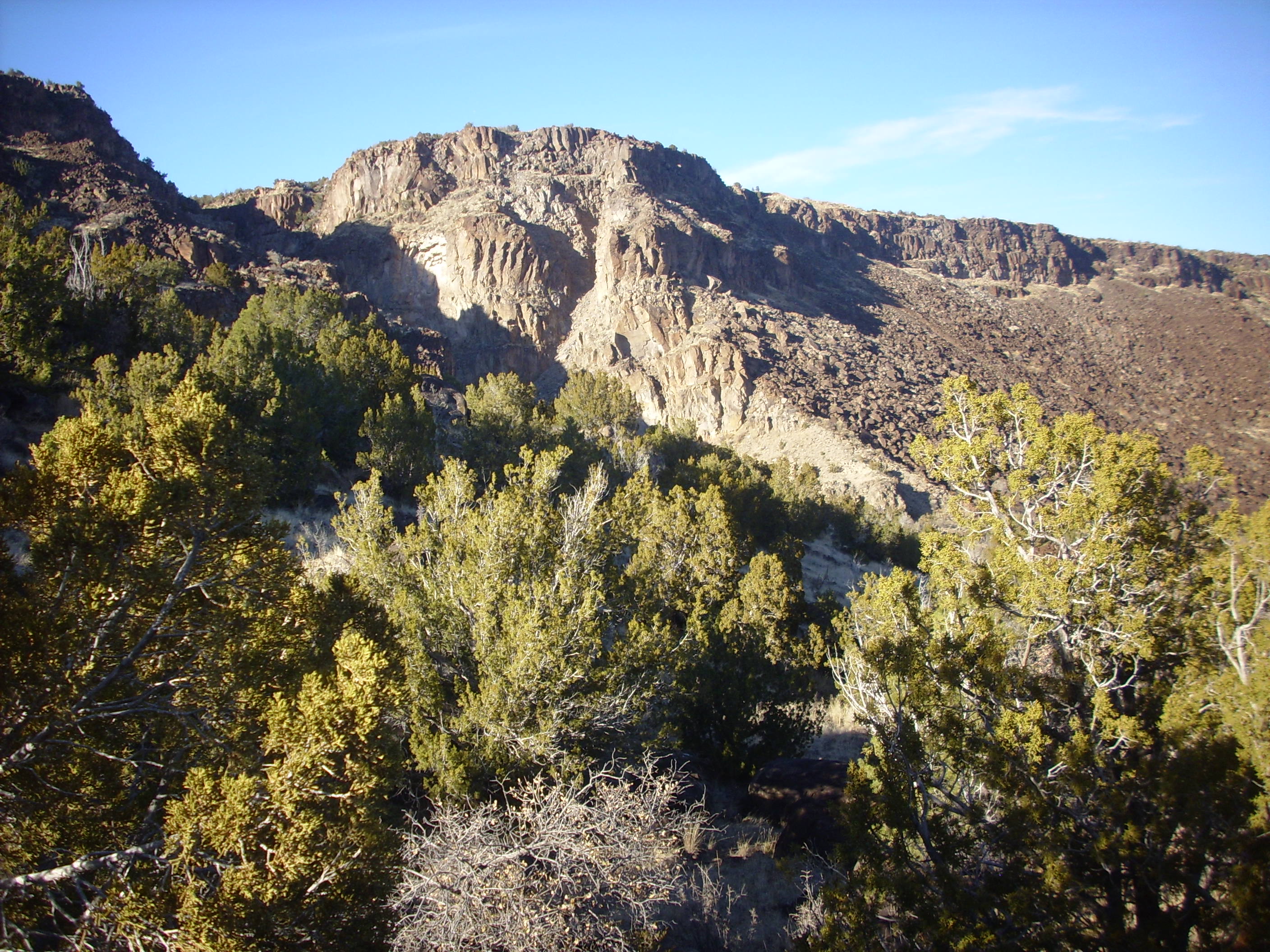
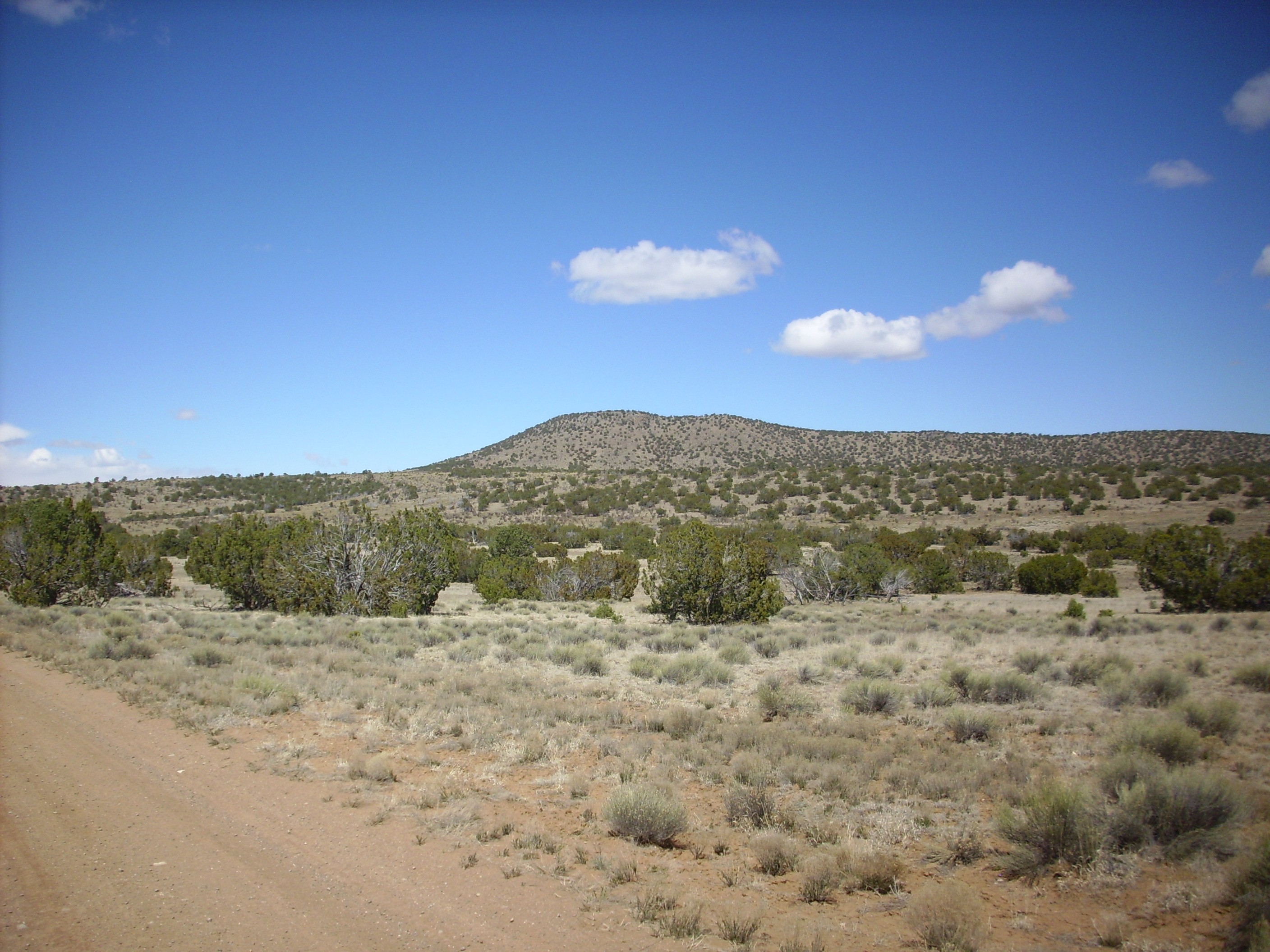
Tetilla Peak is the shapely mountain to the left, which is a distinctive landmark visible for great distances. Here's a view from the south.
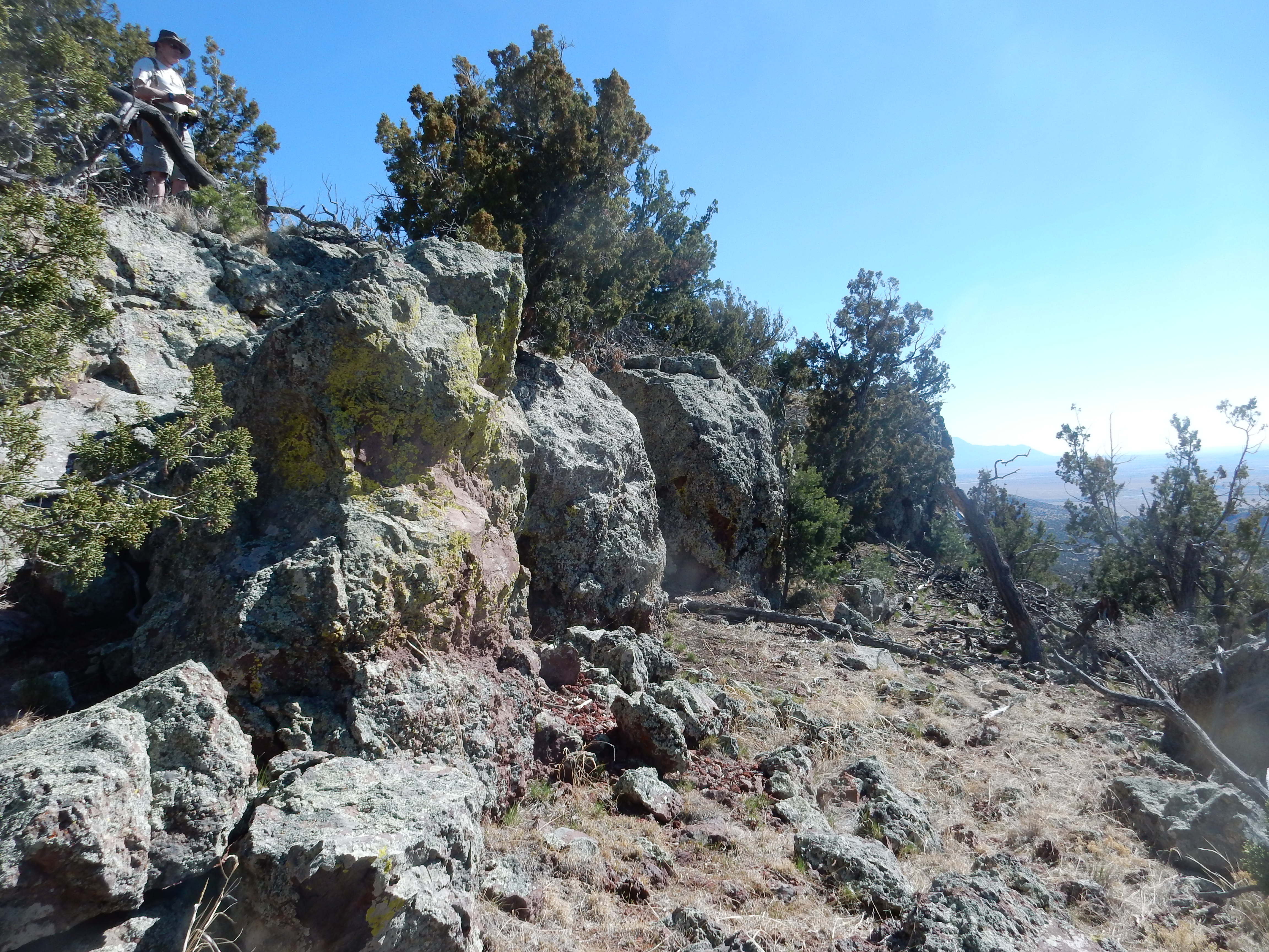
At 7206′, it is not actually the highest point in the Cerro del Rio, but it is the most prominent. It may also be one of the older features of the Cerros del Rio, erupted 3.04 million years ago, according to radioisotope dating. What makes this more surprising is that it has a cap of dacite that is the most evolved lava in the entire Cerros del Rio. But the radioisotope age may be off; magnetic data and field relations suggest the age is more like 2.7 million years.
Tetilla Peak is surrounded to the east by andesite flows. Because andesite lava is considerably more viscous than basalt lava, these andesite flows have steeper faces.
Face of andesite flow at foot of Tetilla
Peak.35.607N
106.198W
Compare the basalt flows surrounding the peak with the andesite
flows.

Arroyo at foot of Tetilla Peak. 35.607N
106.199W
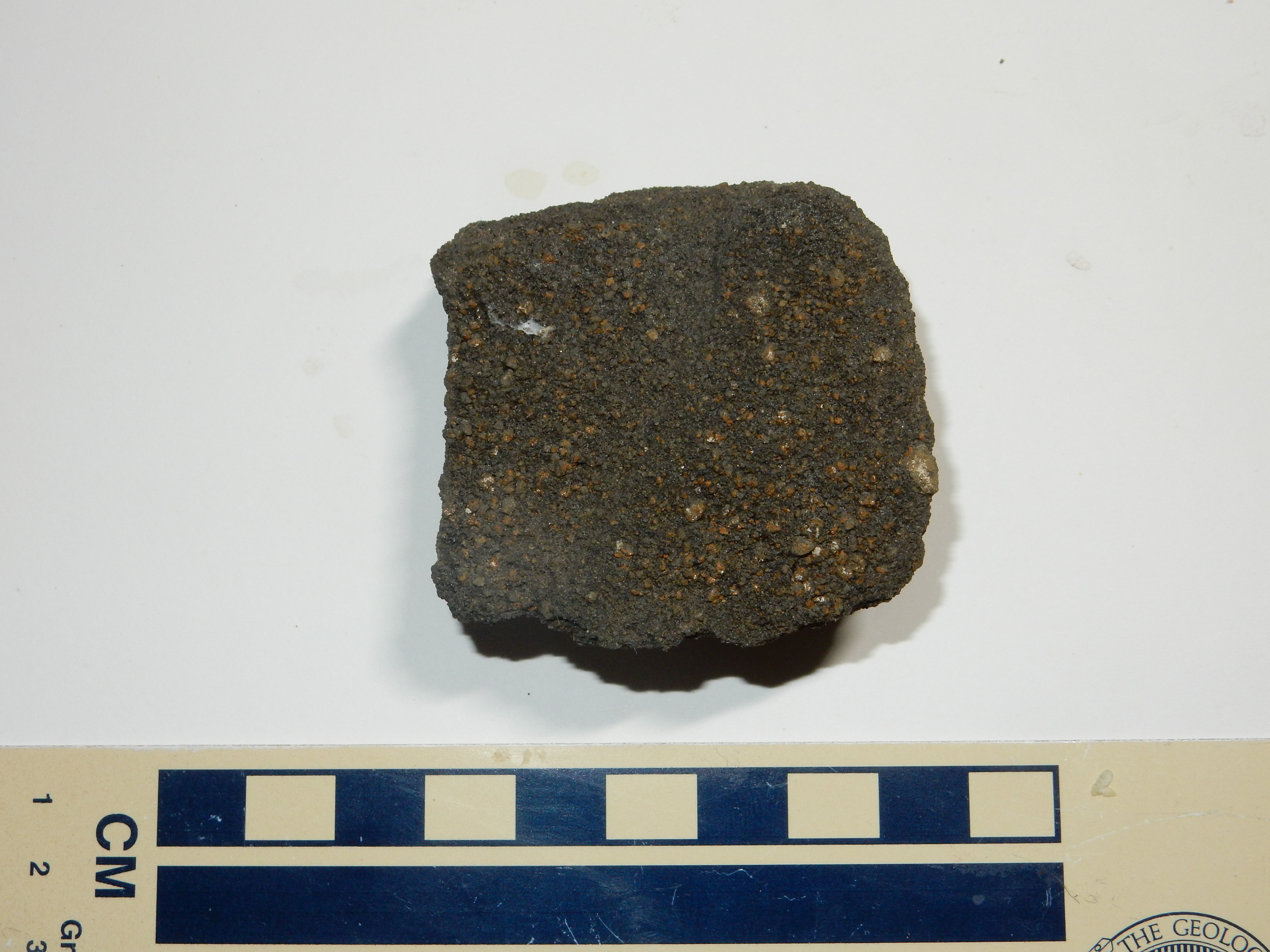
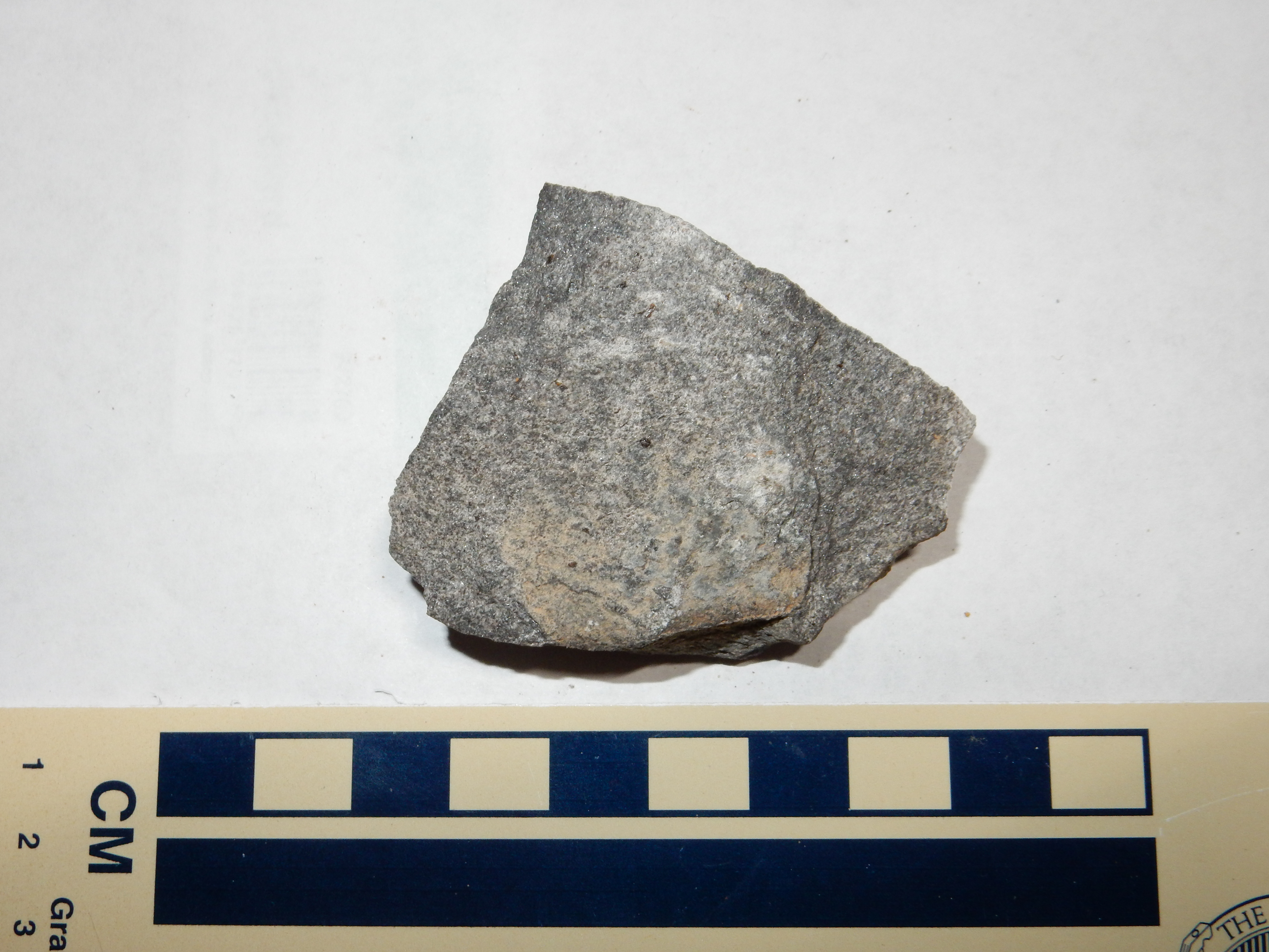
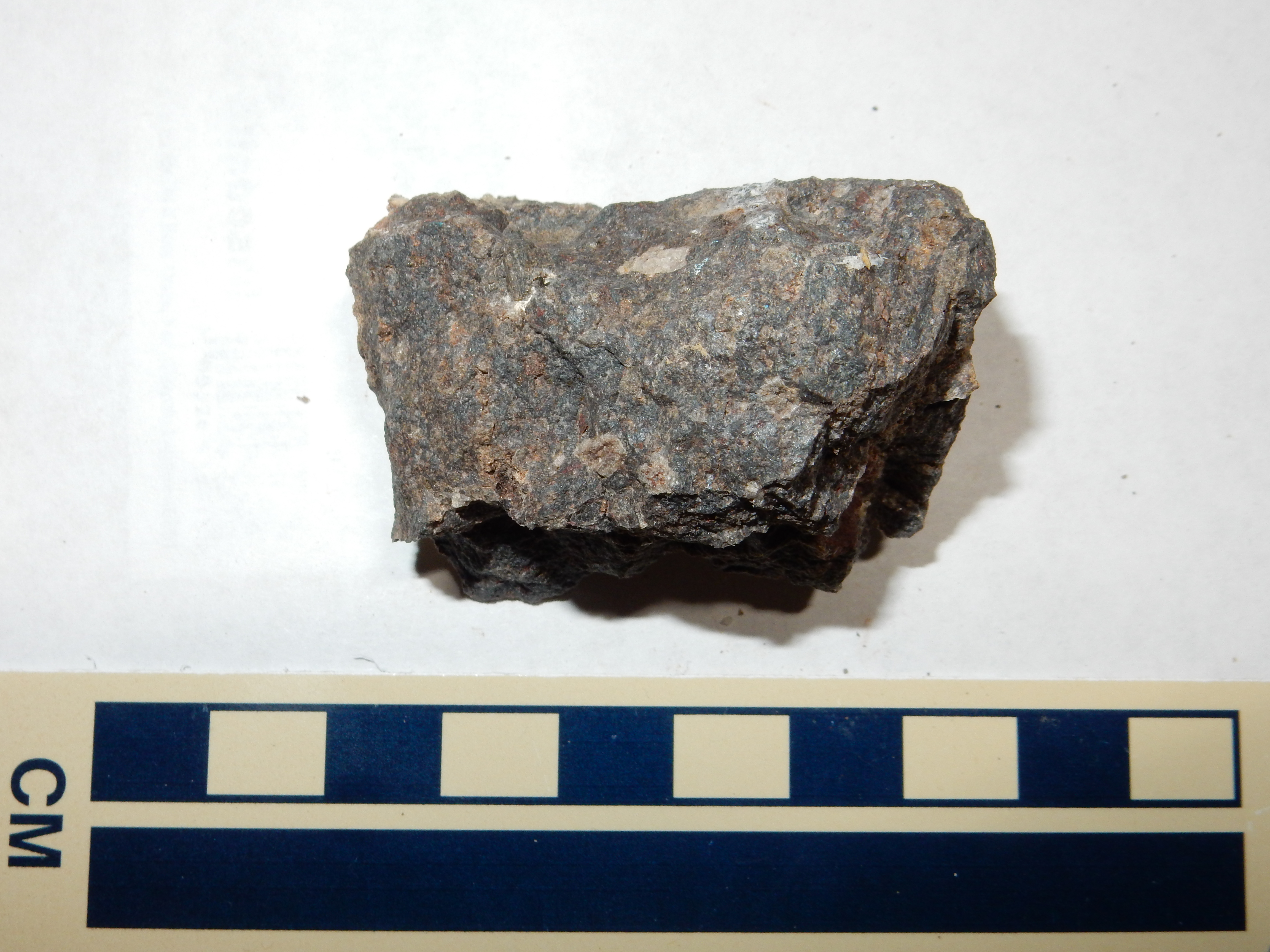
The basalt is probably younger, but has been eroded away where it made contact with the andesite flow to produce the cliffs. The andesite flow to the right is much thicker. Here is a sample taken from the right side of the arroyo.
Andesite of Tetilla Peak
The presence of plagioclase and hornblende phenocrysts (white patches and dark needles) is typical of andesite, but the rock also has green patches of what appers to be olivine. Olivine andesite is not unknown, but it’s uncommon and noteworthy, and the geologic map of the area mentions no olivine in the andesite of Tetilla Peak, only in the basalt around it. Or perhaps the green patches are an unusual sodium-rich pyroxene mineral, aegerine, which would be more consistent with a sodium-rich andesite.
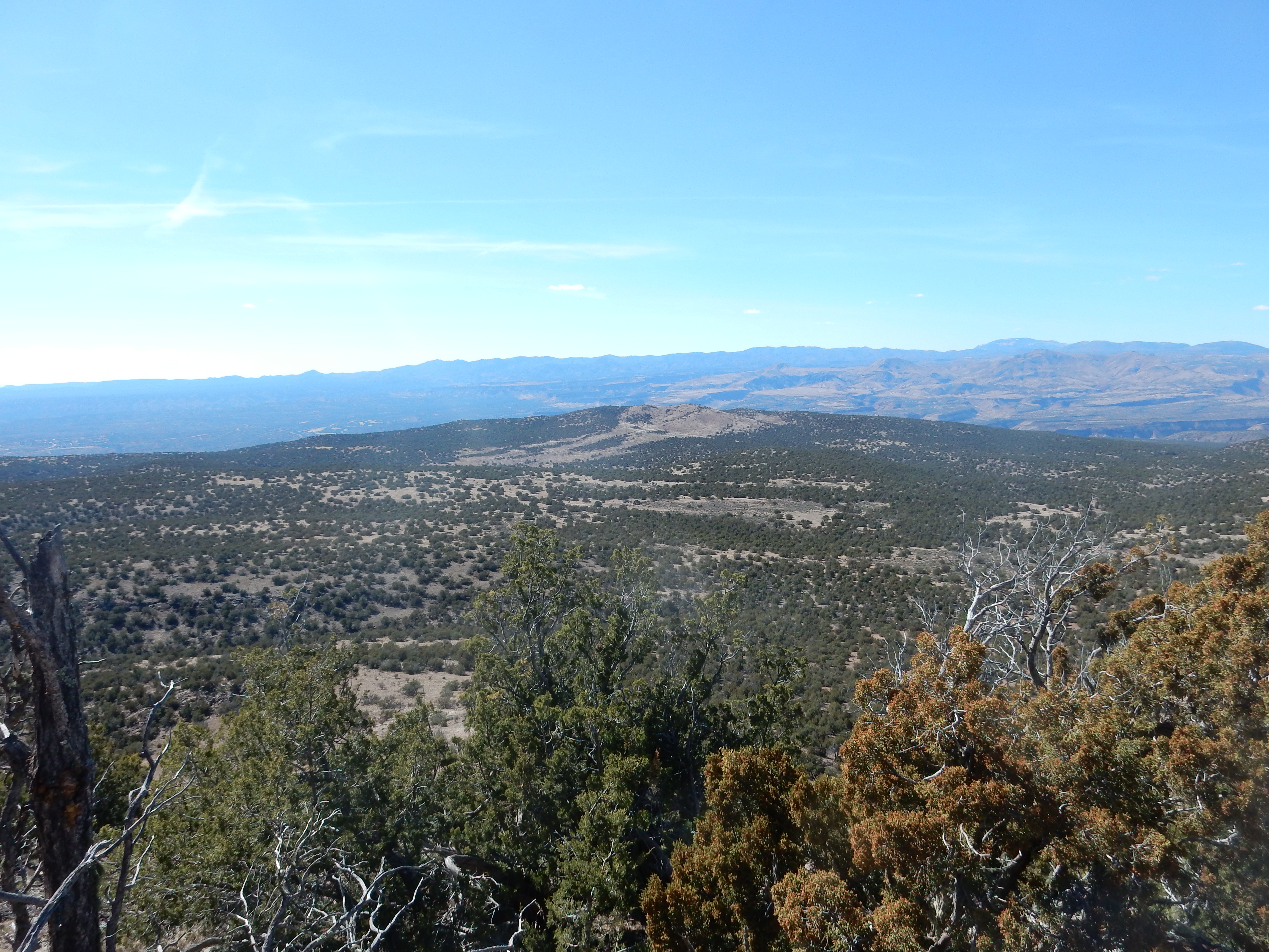
Tetilla Peak is easily climbed and the view from the peak is spectacular.
This is a full 360 degree panorama starting at the southwest, towards Sandia Crest. One can see virtually the entire southern and central Cerros del Rio Plateau from this point. The dacite cap is well exposed here.
This dacite has sparse but sizable plagioclase phenocrysts.
The pulse of activity around 2.6 million years began with Cerro
Micho, the highest point in the Cerros del Rio.
Cerro Micho. 35
42.552N 106 12.176W
Cerro Micho is underlain by andesite that is about 2.76 million years old. This was followed by the eruption of Cerro Ruiz.
Cerro Ruiz. 35
41.311N 106 11.215W
Cerro Ruiz is underlain by 2.61-million-year-old andesite.
To the north of Tetilla Peak and southwest of Cerro Ruiz is
Colorado Peak.
Colorado Peak. Looking northwest from 35.626N
106.204W
Colorado Peak is underlain by andesite about 2.6 million years
old. The flat top is surrounded by a ring of dikes intruding the
cinder making up most of the upper part of the mountain. This is
clearly visible from Tetilla Peak to the south.
Here is the ring dike on the west side of the peak.
The lower slopes are covered with cinder.
Montoso Peak is is very prominent on the skyline directly south
of my house, and we've seen it in most of the panoramas of White
Rock Canyon I showed earlier. This makes it the furthest northwest
peak in the Cerros del Rio.
Montoso Peak. 35
44.425N 106 13.143W
Montoso Peak is underlain by basalt that is 2.59 million years old. The low-viscosity basalt has produced a mountain with relatively gentle slopes: A shield volcano.
Near the center of the Cerros del Rio is Cerro Rito. This is the
western end of the Twin Hills massif.
Cerro Rito. 35
42.001N 106 11.010W
The Twin Hills themselves are found at the northern end of the
massif.
Twin Hills. 35
42.534N 106 10.243W
The Twin Hills massif is underlain by basaltic andesite a bit younger than the other features we’ve seen so far, at 2.53 million years old.
The rock under these peaks is composed of consolidated cinder, while the lower slopes are solid flows. This is quite typical of cinder cones, which include most of the high ground on the Cerros del Rio.The northernmost part of the Cerros del Rio Plateau is Sagebrush
Flats, which resembles Tsinat Mesa at the other end of the
plateau. South of Sagebrush Flats is a
wild maze of steep-sided andesite flows, quite striking on
the topographic map.
Ortiz andesite flows
The andesite here all erupted from around Ortiz Peak, located
north of Twin Hills.
Ortiz Peak. 35 44.918N 106 08.911W
Ortiz Peak seen from the east,
highlighted by distant rain shafts.
The Ortiz Andesite is one of the younger flows in the Cerros del Rio at 2.32 million years old. This seems to rule out the possibility that its rugged topography is the result of more extensive erosion that other parts of the Cerros del Rio. Looking at the topographic map for the Cerros del Rio, I get the sense that most of the andesite flows had a tendency towards this deeply lobed structure, but none were nearly as voluminous as the Ortiz flows and so did not fully develop it.
West of Cerro Colorado is Cochiti Volcano. This is not
particulary prominent, but it is underlain by some of the youngest
flows in the Cerros del Rio, composed of andesite 1.51 million
years old.
One of the flows associated with Cochiti Volcano actually
overlies a bed of Otowi Member, Bandelier Tuff. Another flow is
the one I mentioned earlier, which cascaded down La Bajada and
pooled at the base of the escarpment. This area is all tribal
lands and inaccessible to the general public.
This is the second most voluminous of the basalt eruptions around
the periphery of the Jemez from this time period. It is dominated
by San Felipe Volcano, a classical small shield volcano, whose
flows have a radiometric age of 2.5 million years.
San
Felipe Volcano, a typical small shield volcano, viewed
from the south from 35
15.168N 106 33.942W
Santa Ana Mesa is cut by several north-south faults that are clear to see on the topographic map and even in the satellite photo. San Felipe Volcano erupted along one of these faults. The displacements on these faults are as much as 110 meters (350'). As with the Cerros del Rio, the oldest beds include cinder beds likely from a maar eruption early in the field's history. There is also evidence of cinder cones that were subsequently buried by a fluid lava flow, like the cinder cone exposed in the east wall of White Rock Canyon.
Here's another view.
San Felipe Volcano. Looking north from 35
21.571N 106 29.732W
The exposed beds at right are interfingered river channel
sediments and piedmont sediments of the upper Santa Fe group, most
recently assigned to the Ceja Formation. The piedmont beds were
mostly brought in from the east, in the direction of the Hagen
Basin and La Bajada, whose Paleozoic and Mesozoic red beds account
for the red color.
The southernmost part of the Santa Ana field, and thus the
southernmost flow we can reasonably assign to the Jemez volcano
field, is Canjilon Hill. The most prominent feature here is
Octopus Plug.
Octopus Plug, near southern end of Santa Ana basalt
field. 35
21.676N 106 32.245W
Canjjilon Hill is a diatreme, a wide vent filled with
volcanic rubble that likely lay under a maar that has since been
eroded away. Octopus Plug is a remnant of a more solid intrusion
of basalt into this rubble.
Most of the mesa can be viewed from favored locations around the village of Placitas, in the northern foothills of Sandia Crest to the south.
Santa Ana Mesa viewed from near
Placitas. 35
18.883N 106 27.135W
This photograph shows that the mesa dips slightly to the east.
The beds were almost certainly level when first laid down, so this
indicates continuing tilting towards the east side of Santo
Domingo Basin in the last three million years.
Finally, here is a view of Santa Ana Mesa from the southwest.
View of Santa Ana basalt field. Looking northeast from
near 35.392N
106.639W
Santa Ana Mesa dominates the center of the panorama. At far left
is the Sierra Nacimiento, with Chamisa Mesa and Borrego Mesa just
to the right of the highway. Redondo Peak is the high point of the
skyline.
The entire mesa is on tribal lands and thus is not open to the
general public.
This was the least voluminous of the basalt eruptions from this
time period, consisting of just a few flows in the northeastern
Jemez. However, one of the flows is quite prominent from Abiquiu,
since it caps Abiquiu
Mesa.
Abiquiu Mesa. Looking southwest from 36
12.528N 106 17.662W
A flow of El Alto basalt forms an imposing wall south of Forest
Road 31 just where it turns to make the ascent to El Alto Mesa.
El Alto Basalt. Looking south from 36
09.988N 106 21.330W
Note that this is on private land and visitors should remain on the roadway.
The source of at least some of these flows is Cerro Pelon. This is remarkable in that the bulk of Cerro Pelon is Tschicoma dacite. The El Alto flow appears to come from a vent on the north side of the dome, possibly opened by a landslide (now buried by El Alto basalt.)
Panorama from northwest flank of Cerro
Pelon. 36
07.441N 106 24.207W
At left, we see smoke from a small wildfire, and, on the skyline,
the La Grulla Plateau. Bandelier Tuff extends across the left side
of the panorama, with the unmistakable profile of Cerro Pedernal
on the skyline. Mesozoic beds of the Colorado Plateau lie beneath
Cerro Pedernal and extend across the rest of the skyline, with
Abiquiu Reservoir visible right of center.
The foreground ridge to left is Tshicoma dacite forming the west flank of Cerro Pelon. The upper part of the ridge to right is also underlain by Tshicoma Dacite, but the lower part of the ridge and the ridge in the middle distance at center is underlain by El Alto Basalt erupted from Cerro Pelon. The grassy valley may also be underlain by El Alto Basalt under its surface layer of alluvium.
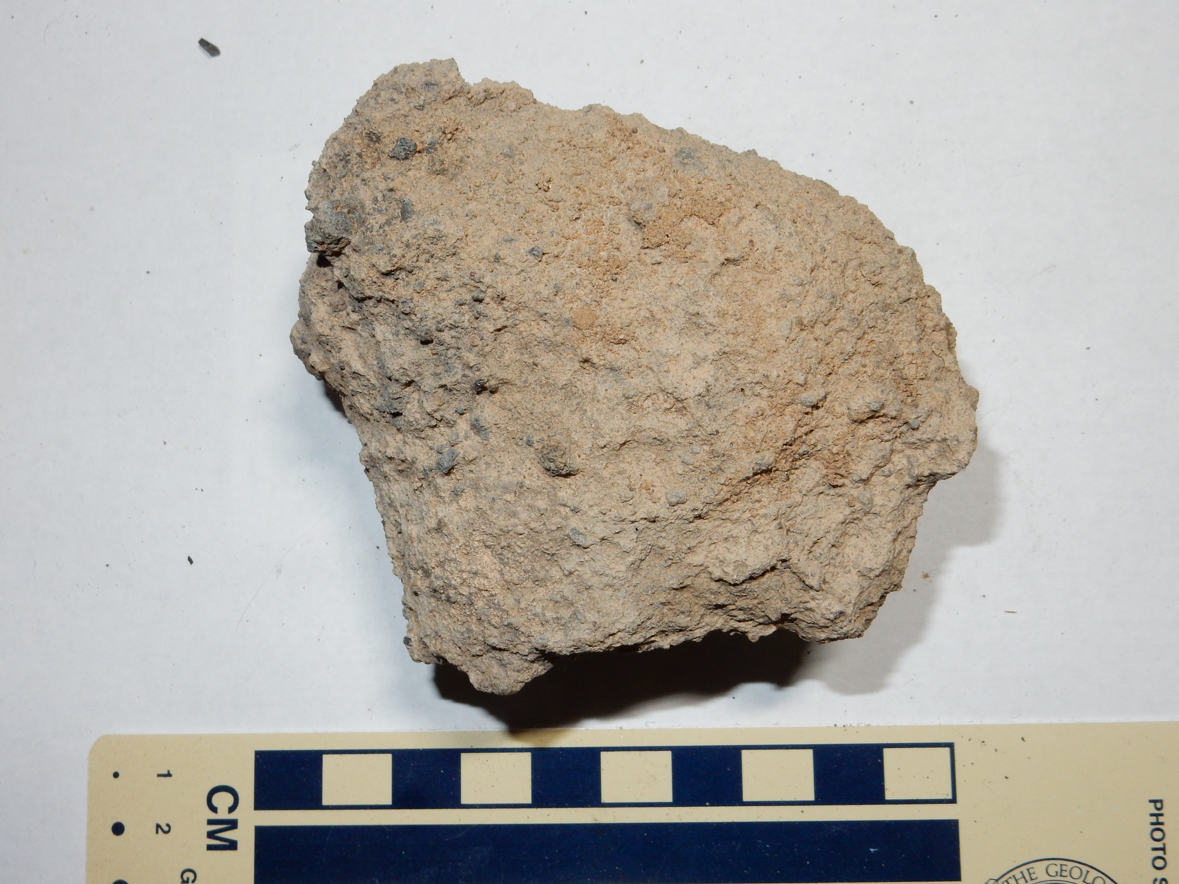
Here's a sample of the basalt from this area.
El Alto Basalt from Cerro Pelon. 36
07.458N 106 23.802W
This is a somewhat unusual basalt, with numerous coarse
phenocrysts.
From a vantage point well to the west, the level surface of the Abiquiu Mesa flow is striking.
El Alto surface looking southeast from 36
14.662N 106 22.095W
Note how the flat surface of Abiquiu Mesa (left of center on the skyline) lies below the level of El Alto (to the right on the skyline) and how it appears to emerge out of a canyon in the higher country. Erosion must have already produced a significant escarpment around El Alto, while the ground at the foot of this escarpment must have been fairly level at the time of eruption.
About 2.35 million years ago, an eruption in the Cerros del Rio
created a lava dam across the Rio Grande south
of the present location of White Rock, near Water Canyon.
This created Culebra Lake, which at its maximum was over 80 meters
(240') deep and covered an area greater than 1000 km2
(400 square miles) in what is now the Espanola Valley and Abiquiu
areas.
The remains of the dam are visible from the rim of White Rock Canyon south of hte village of White Rock.
The remains of the dam are at left, and a similar buttress is
seen across the canyon and just north of Montoso Maar. Also note
the notch filled with light beds of the Bandelier Tuff. This may
have been the actual "spillway" prior to eruption of the Bandelier
Tuff much later.
Culebra Lake deposited lacustrine sediments throughout its lake bed, but most of these have already eroded away. A few beds are preserved beneath Bandelier Tuff in the area east of Los Alamos. There was also for many years an outcropping of Cerros del Rio basalt next to the main highway to Los Alamos that showed ripple marks imprinted in the basalt when it flowed into the lake and made a cast of the lake floor. Regrettably, this was destroyed when the road cut was expanded some years ago. (However, the same road expansion produced the iconic road cut shown earlier in this chapter.)
Lacustrine sediment beds are still visible north of where this outcropping once existed.
Lacustrine sediment beds. 35
52.274N 106 11.757W
The lacustrine sediment beds are the yellowish-tan beds located
at the center of the phograph, below a hill of badly fractured
Bandelier Tuff. The beds are rich in clay and form a superb slip
surface for the overlying rocks to slump.
We will revisit Lake Culebra in a subsequent chapter.
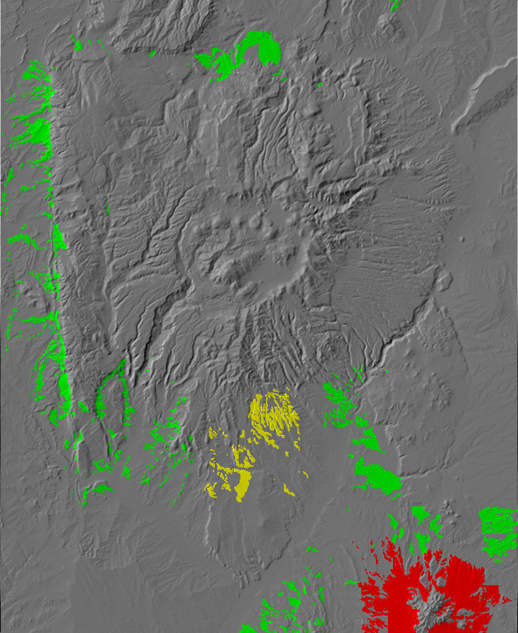
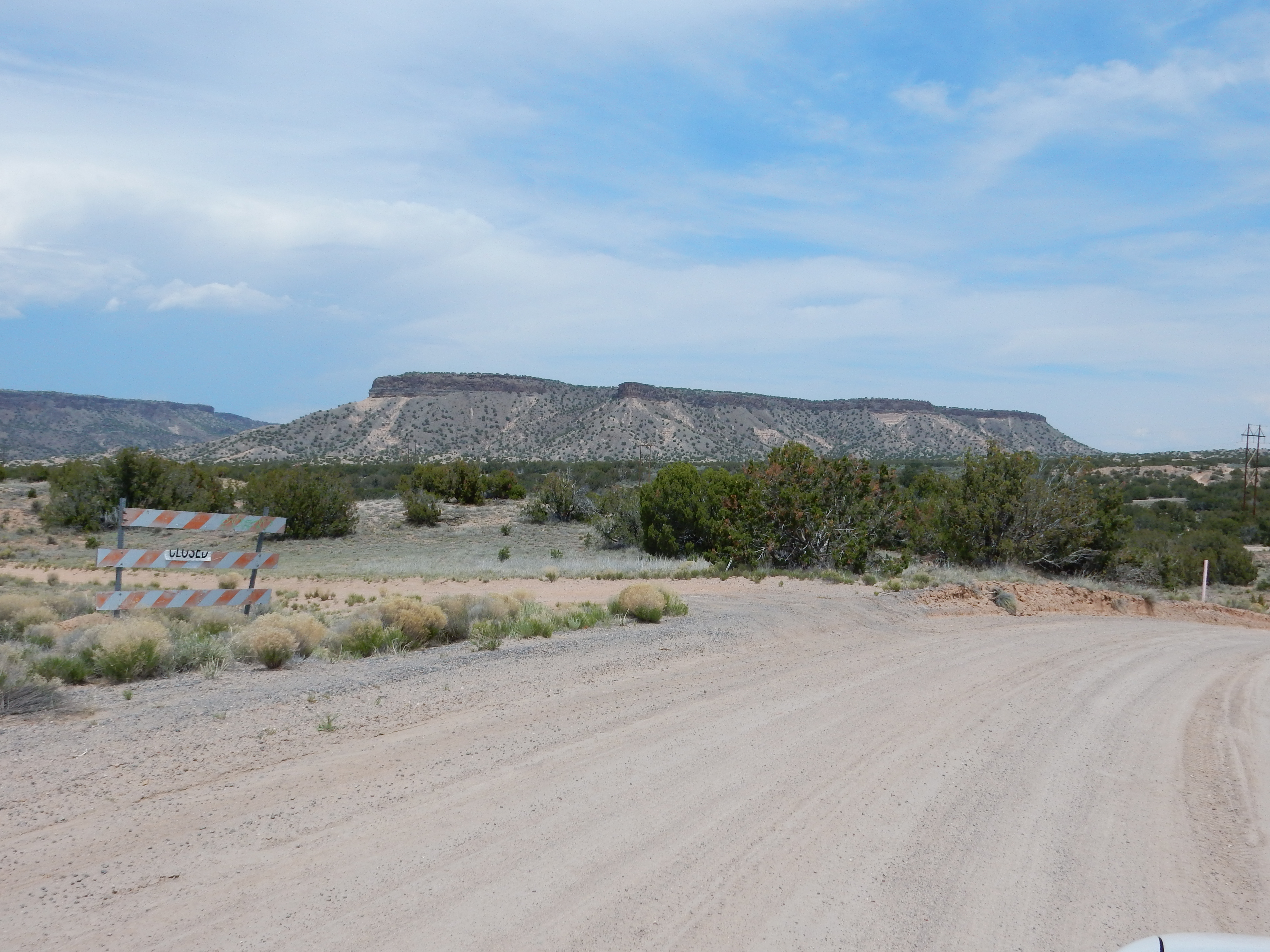
Relief map of the Jemez with exposures of the Tuerto
Gravel in red, the Gravel of Lookout Park in yellow, and other
pediments in green.
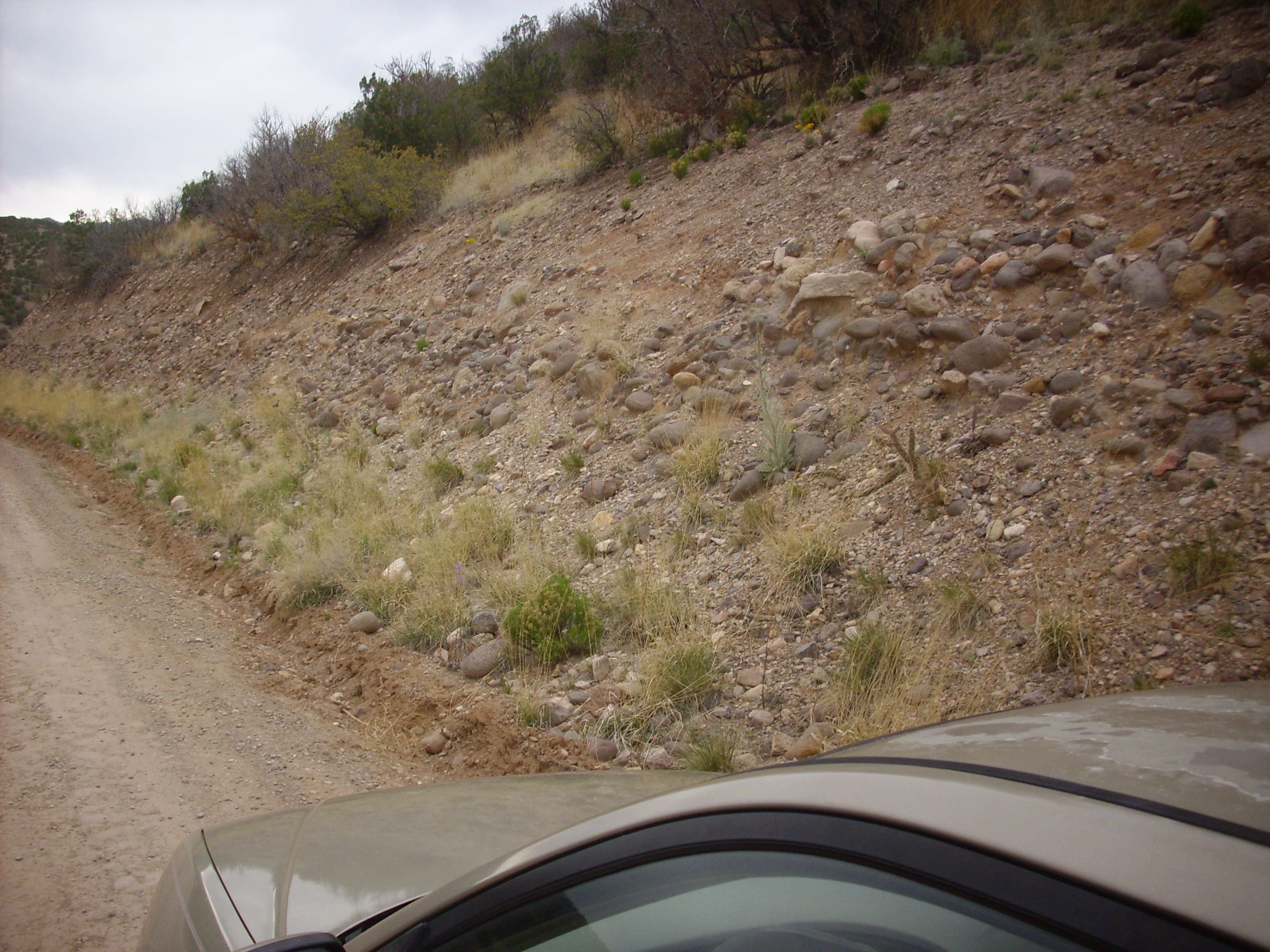
We have seen in many of the photographs of the Cerros del Rio that the basalt flows capping the plateau appear to have erupted across a fairly level surface. This is one of the older surviving examples in the Jemez area of a physiographic surface. Physiographic surfaces are typically formed on valley bottoms where the base level is set by some resistant feature downstream in the river system (a knickpoint), such as a resistant bed of rock over which the river flows to produce rapids or a waterfall. Such surfaces can be constructive, formed by accumulation of flat beds of sediment, or destructive, where erosion bevels the region flat. Some physiographic surfaces are formed by both processes.
The surface on which the Cerros del Rio formed is thought to be
part of the Divide surface, which was first recognized by
geologists in the area just north of Santa Fe. There are at least
three such surfaces in the Santa Fe area, each corresponding to a
different base level from a different time in the past. The older
surfaces are deeply gullied by erosion that is now leveling the
area to form a new physiographic surface corresponding to the
modern base level. However, the preservation of the older surfaces
is striking, and may be a result of extensive calichification of
the surfaces in the arid Southwest climate.
One of the oldest and most spectacular of the physiographic surfaces is the Ortiz surface, first recognized by geologist I.H.Ogilvie in 1905. The Ortiz surface was one of the first recognized examples of a pediment. A pediment is a nearly level surface cut in the bedrock at the foot of an eroding highlands. Pediments seems to be characteristic of arid regions with poor drainage, where calicification is rapid, suggesting that northern New Mexico was already an arid climate two to three million years ago.
Remnants of this surface extend for great distances around the Ortiz Mountains. The surface is well preserved south of Los Cerillos.

Ortiz Surface south of Los Cerillos. 35
23.764N 106 07.360W
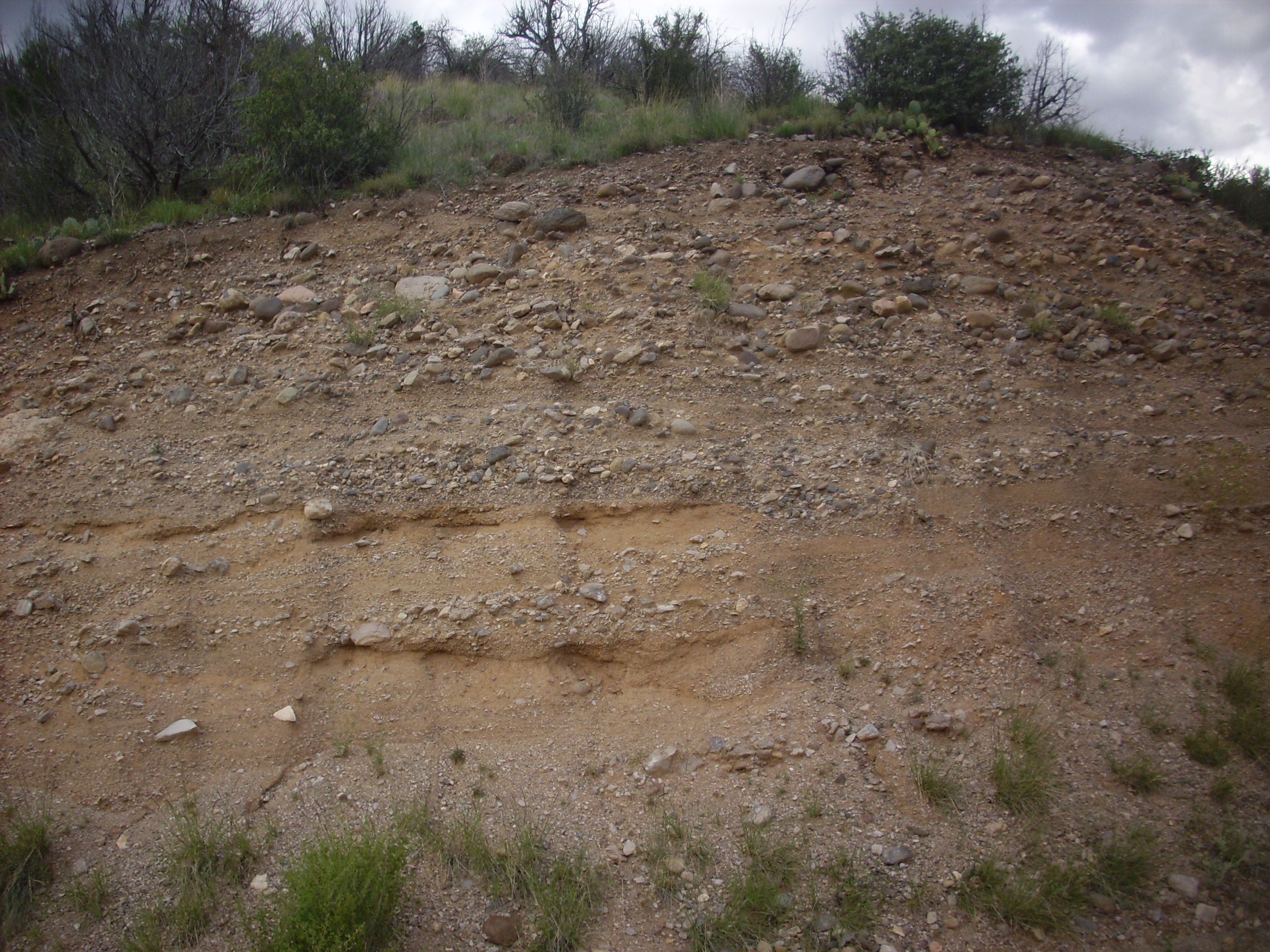
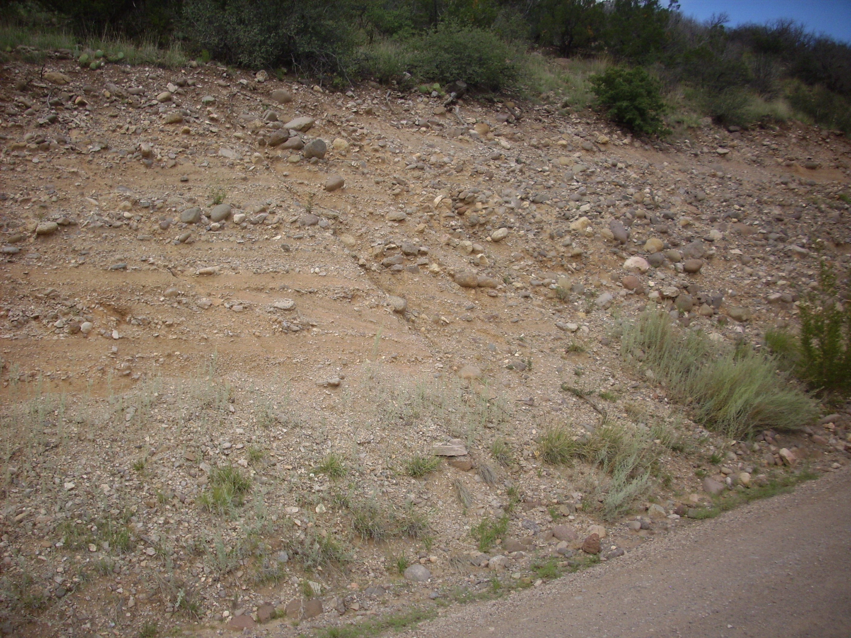
Pediment surfaces are often covered with sheet wash, which is a layer of gravel and boulders washed across the surface by infrequent but heavy runoff. The Ortiz surface is covered by such a sheet wash, which has been named the Tuerto Gravel. This is composed of very coarse gravel that is unusually resistant to erosion due to pervasive calicification. Unfortunately, it has proven very difficult to pin down the precise age of the Tuerto Gravel, but the best guess is that it is Pliocene, betwen 5.3 and 2.6 million years in age.
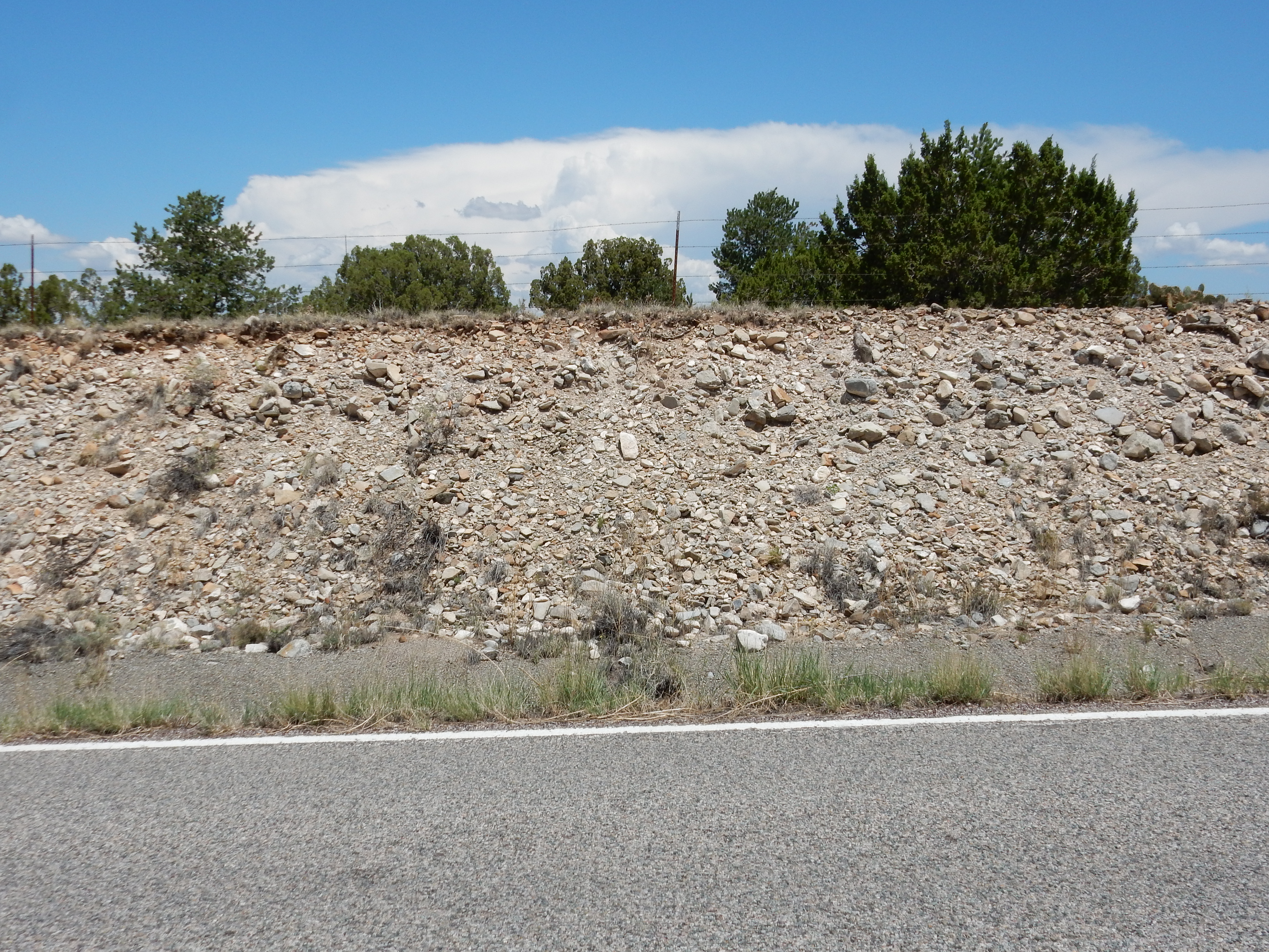
Tuerto Gravel south of Los Cerillos. 35.417N 106.128W
The Ortiz Surface is plainly visible from a vantage point in the Cerillos Hills.

Ortiz Surface south of Los Cerillos. Looking south from
35
27.434N 106 07.798W
The surface forms the skyline at center, and remnants of the surface can be seen extending back towards the camera.
Some geologists believe the Totavi Lentil of the Puye Formation was deposited on the Ortiz Surface and correlates with the Tuerto Gravel.
At about the same time the peripheral basalt eruptions peaked,
erosion of the Keres Group volcanoes in the southern Jemez began
to produce another pediment surface. Like the Ortiz surface, this
is covered with a sheetwash layer, the Gravel of Lookout Park.
This is well exposed where the road climbs up to the Veterans'
Memorial Overlook at Kashe-Katuwe National Monument. (This area
was formerly known as Lookout Park and gives the unit its name.)
Gravel of Overlook Park near Veterans'
Memorial Overlook. Near 35
39.994N 106 26.790W
The clasts are mostly Paliza Canyon Formation and Bearhead Rhyolite that was eroded off the mountains to the north.
The contact between the Gravel of Lookout Park and the Cochiti
Formation is exposed further down the road.
Contact between Cochiti Formation and
Gravel of Lookout Park. 35
40.040N 106 26.906W
The Cochiti Formation is the sandy beds at the bottom of the
photographs. The beds of gravel and cobbles above are the Gravel
of Lookout Park. In the second photograph, it looks like a
microfault has thrown down the beds of the Gravel of Lookout Park
to the right (east). The transition is not terribly dramatic,
though it stands out more when seen from a distance. It is
unsurprising that some recent geologic papers assign the Gravel of
Lookout Park to the Lookout Park Member of the Cochiti Formation.
The pediment surface forms the plateau on which the Veterans Memorial Overlook is located. This area has been thrown down a short distance by a fault just to the west of the Overlook. From a vantage point west of this fault, one can see the pediment surface beautifully displayed on the mesa to the south.
Notice how remarkably flat the top of the mesa is. The flat areas further away at the left end of the panorama are also part of this pediment surface, but have been thrown down by the fault I mentioned earlier. The pediment surface extends for miles to the west and south (albeit with numerous cross-cutting arroyos) and is everywhere surfaced with Gravel of Lookout Park. The Gravel of Lookout Park was deposited across this surface in a geologically short period of time, around 2.5 million years ago. Later, river drainage patterns shifted and erosion cut numerous arroyos into this pediment surface, but the surface is still discernible.
One wonders if the Gravel of Lookout Park correlates with the
Tuerto Gravel to the south. However, the ages seem to be wrong.
The Gravel of Lookout Park can be quite accurately dated from
underlying and overlying volcanic rock, and it appears to be
younger than the Tuerto Gravel. However, the latter is
sufficiently difficult to precisely date that the possibility
cannot be entirely ruled out. In any case, the source rock for the
Lookout Park gravel is from the Jemez, while that from the Tuerto
Gravel is primarily from the Ortiz porphry belt.
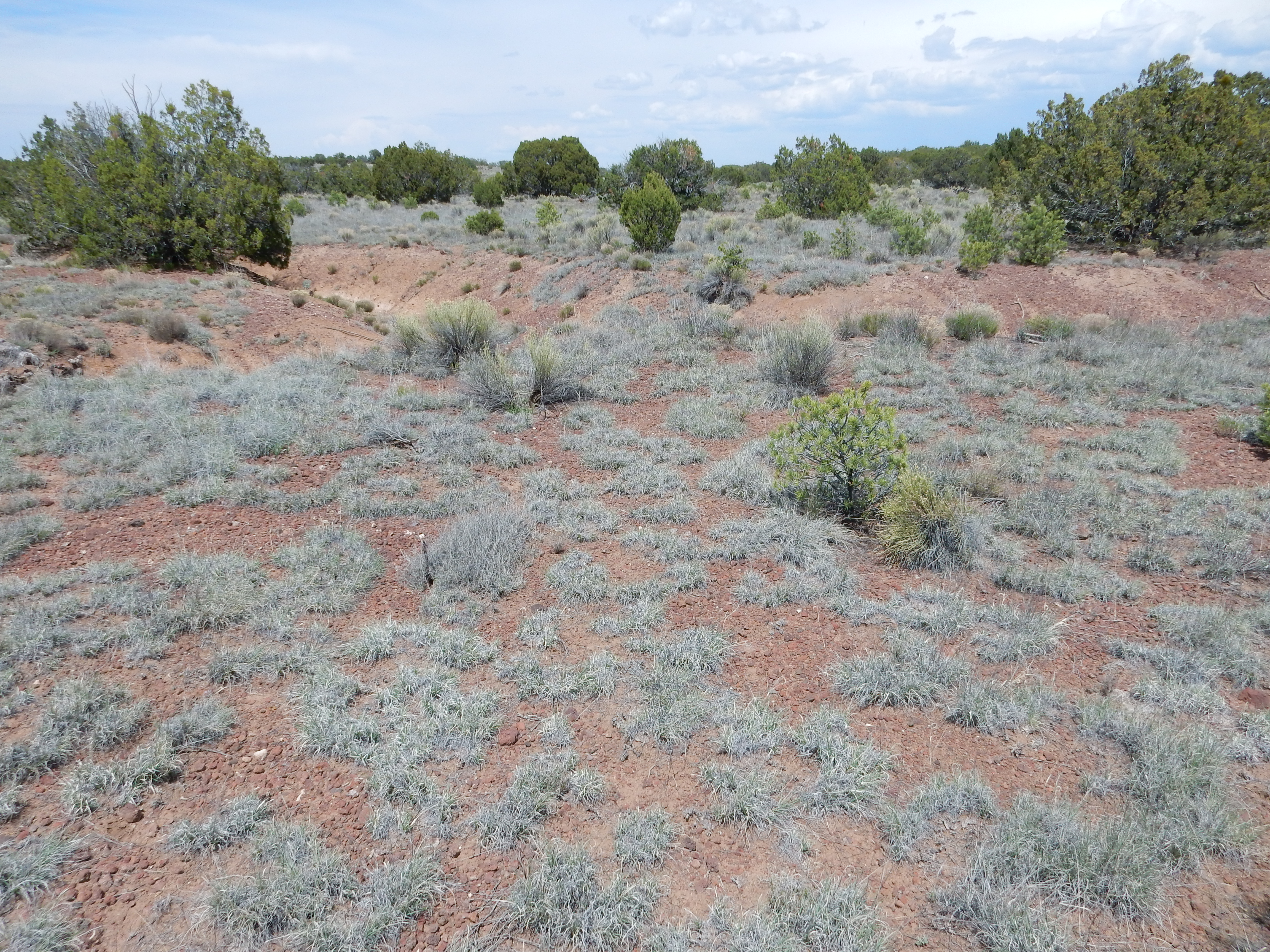
In many places, the Gravel of Lookout Park is overlain by a thin eolium, wind-deposited sediments.

These are very young deposits, so we are getting a bit ahead of
our story, but I mention them here to complete the story of the
Gravel of Lookout Park.
Once, while visiting the Veterans' Overlook Memorial, I hiked along the trail east of the overlook, more out of idle curiosity than anything else. (I had not brought my own map of the area.) The trail goes some distance east, then south across the entrance road, then gradually loops around to the southwest. Where I met one of the natives:
Crotalus atrox near the Veteran's
Memorial Scenic Overlook. 35
40.138N 106 26.984W
Click for the full resolution image, and you'll clearly see the rattle and the diamond pattern. Yep, this is a fine fat specimen of Crotalus atrox, the western diamondback rattlesnake. It was leisurely making its way across the trail when I happened along, and we both reared back and regarded each other with alarm. Oddly, I did not hear the snake rattle, nor did it coil in the usual rattlesnake manner. I might wonder if this was actually a bull snake (the two species look a lot alike) but the rattle is very obvious in the full-resolution photograph and the coloration is precisely correct. It was a cool day; the snake may have been torpid enough to behave oddly. Regardless, it made no move to leave the trail, and I was disinclined to try to go around. (Who knows what else was lurking off the trail?) I turned around.
La Majada is a very flat surface located just west of the La Bajada escarpment.
La Majada. 35
31.725N 106 14.483W
The extremely flat ground on which this road runs is La Majada (“Sheepfold”) Mesa. It is an almost perfect example of a geomorphic surface, formed by the combined action of the Santa Fe River, Galisteo Creek, and possibly the Rio Grande, which beveled off the high ground and filled the lower spots with sediments. The surface appears to be divided by Galisteo Creek, reappearing south of the creek along I-25.
La Majada surface south of I-25. 35
29.860N 106 15.298W
The area north and south of Galisteo Creek east of La Bajada is known locally as La Bolsa ("the bag"). This area is underlain by Mancos Shale, but many hills have flattened tops covered with pediment gravels.
Pediment deposits atop hills of Mancos Shale
south of I-25. 35
28.107N 106 09.661W
There are remnants of at least two pediment surfaces in this
area, all thought to be younger than the Ortiz surface.
The youngest surface in the Santa Fe area is the Airport surface, which is quite striking from certain vantage points.
Airport Surface. Looking northwest from 35
35.419N 106 04.805W
You can see the very level surface at the foot of the Cerros del
Rio lining up perfectly with the inter-arroyo divides in the
middle distance. Whatever knickpoint was responsible for setting
the base level of the Airport Surface has now been eroded away,
and the gullying here is now working to erode the area down to the
new base level.
Relief map of the Jemez with Ancha Formation
outcroppings highlighted in red.
The youngest rift fill formation in the Jemez area is the Ancha Formation, which is exposed mostly in the area west and south of Santa Fe. It is usually but not universally regarded as part of the upper Santa Fe Group. Radioisotope dates from zircon grains in pumice of the Ancha Formation give it an age of around 1-3 million years, roughly contemporaneous with the peripheral basalts, with which it appears to interfinger on the east side of the Cerros del Rio. The Ancha Formation also appears to overlie parts of the Tuerto Gravel, supporting the estimate that the Tuerto Gravel is at least 2.6 million years old.
Ancha Formation rests directly on much older Galisteo Formation
beds near the village of La Cienega.
Contact of Ancha and Galisteo
Formations. 35.559N
106.126W
The Galisteo Formation is the red beds at the bottom, while the
light tan beds on top are Ancha Formation. The contact here is a
discontinuity of at least 25 million years in the geologic record.
The Ancha Formation thins out and disappears to the north.
Northwest of Santa Fe, the Ancha forms the top of the higher hills
and ridges, whose lower slopes are Tesuque Formation. Here's the
contact visible in a road cut.
Contact between Ancha Formation and
Tesuque Formation.
35 42.239N 106 04.807W
The Tesuque Formation is the reddish beds at bottom, full of bits of red granitic rock. This has to be Lithosome A, though I can’t guess which member; the geological map for this area is not specific.The tan beds on top are Ancha Formation.
Further south, in the Los Cerillos-Gallisteo area, the Ancha Formation becomes quite prominent.
Here the Ancha Formation tends to lie directly on rocks of Eocene age or earlier. A particularly spectacular contact is found at Garden of the Gods.
Nearly horizontal beds of the Ancha Formation on the top of the
hill overlie beds of the Galisteo Formation that have been tilted
nearly vertical by the nearby Cerillos Hills intrusion.
The greatest thicknesses of Ancha Formation are found east of the Jemez area and south of I-25. Here is the formation close to the Sangre de Cristo Mountains.
We see that this formation is a coarse, poorly cemented, sandy
conglomerate. This makes in an important aquifer in the region
south of Santa Fe.
The pulse of basaltic magmatism peaking 3 million years ago had largely wound down by 2 million years ago. However, big things were now cooking in the heart of the Jemez Volcanic Field.
Next page: Things gets tuff in the Jemez
Copyright © 2015 Kent G. Budge. All rights reserved.