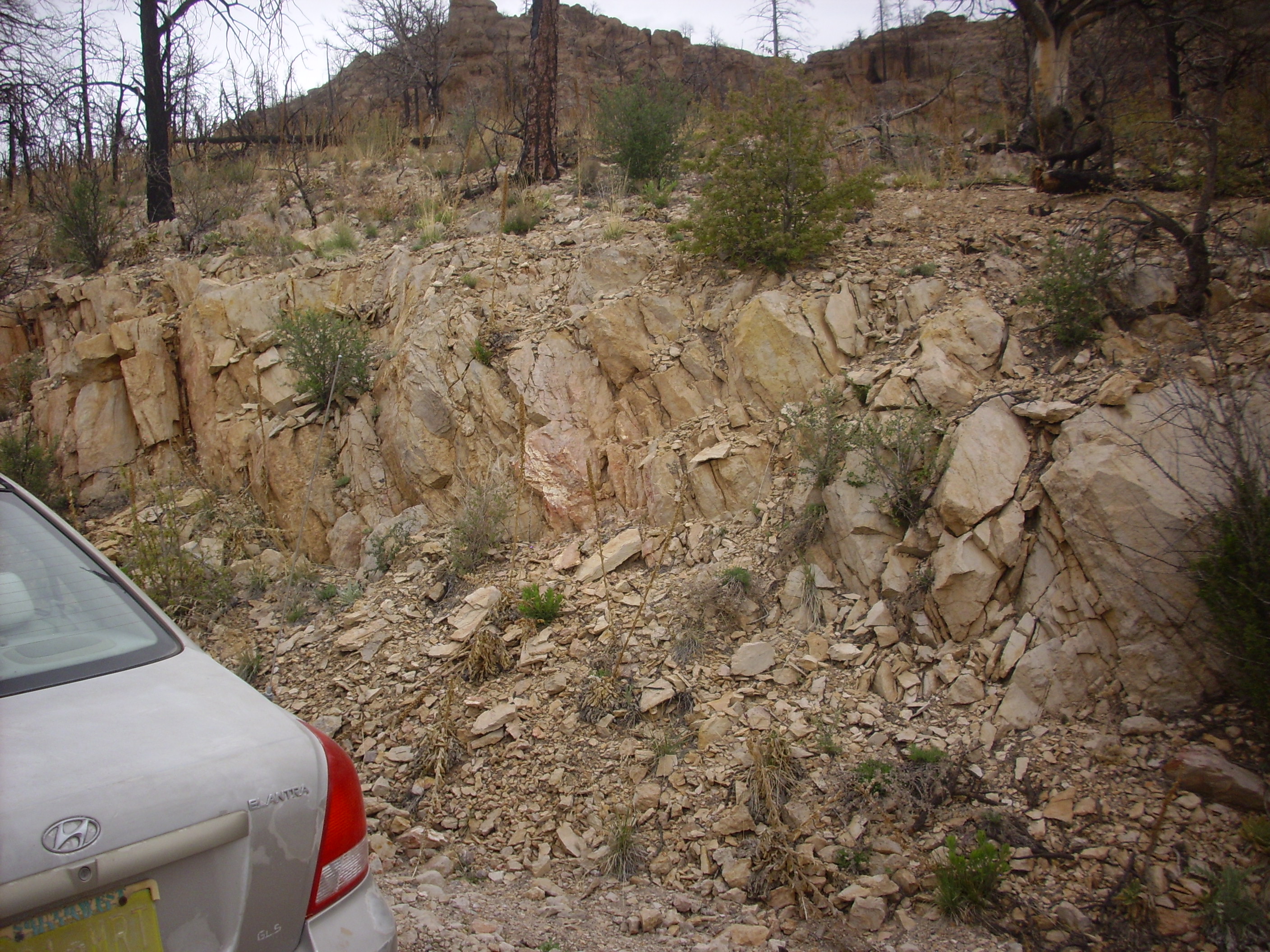
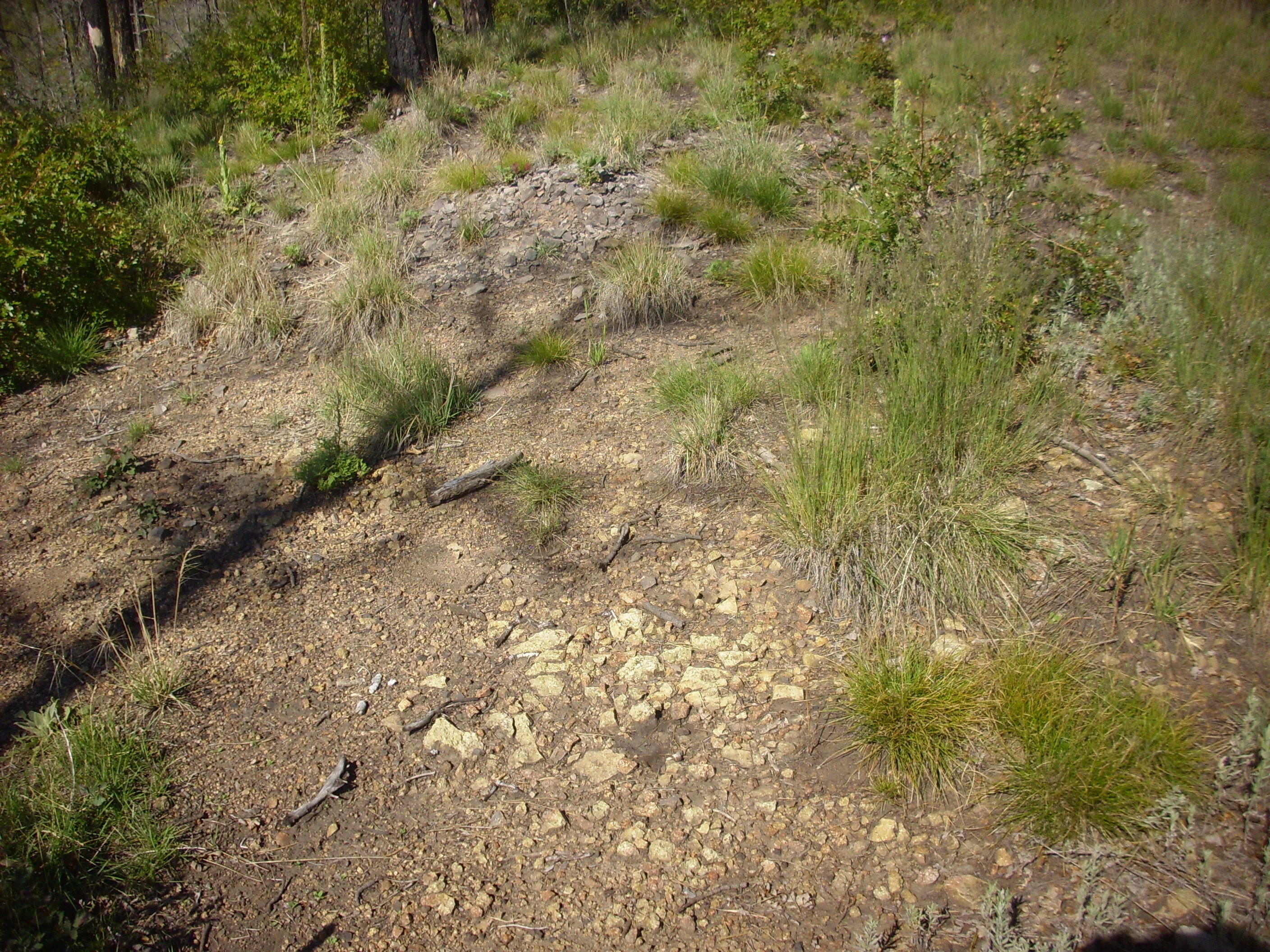
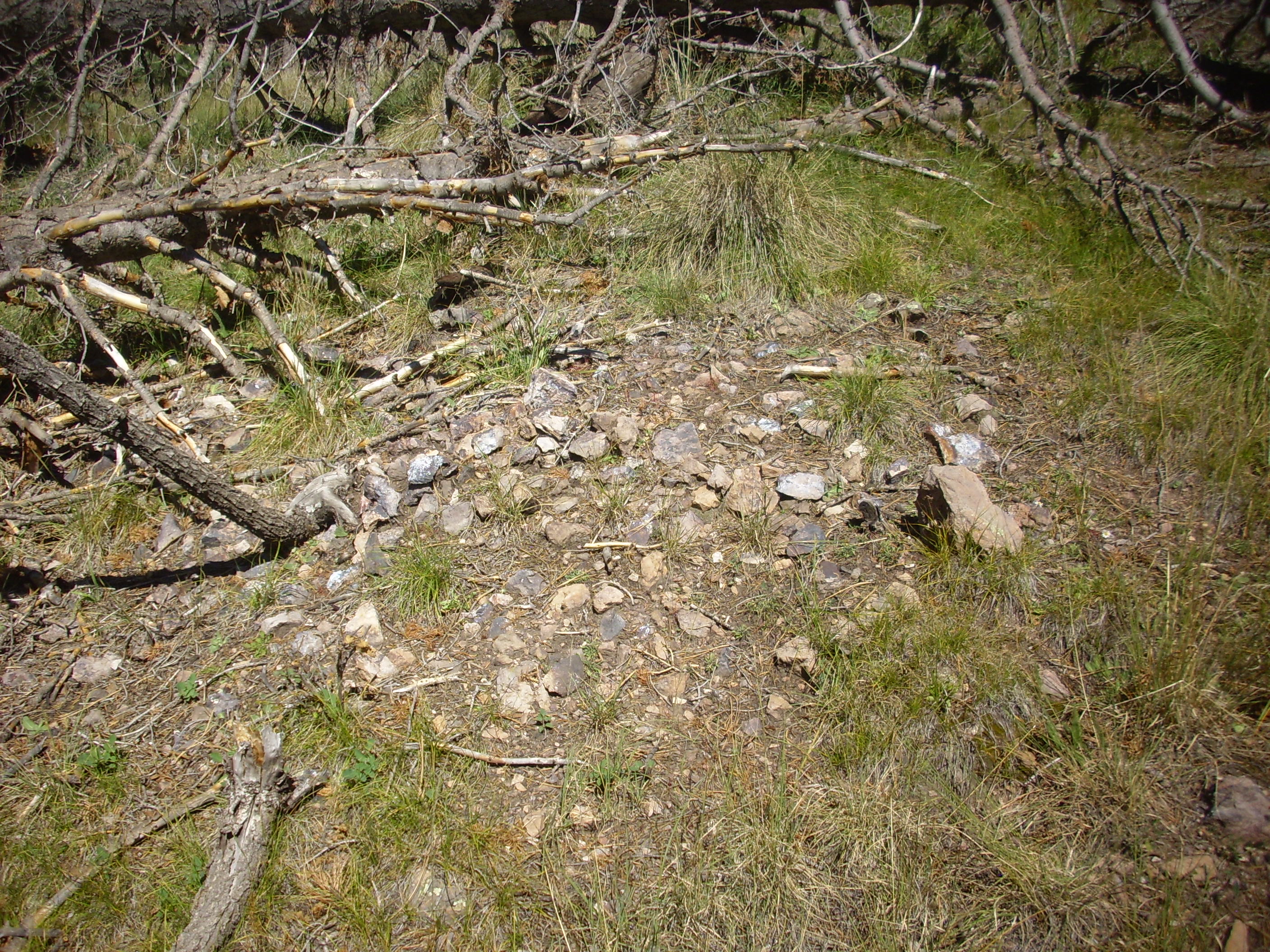
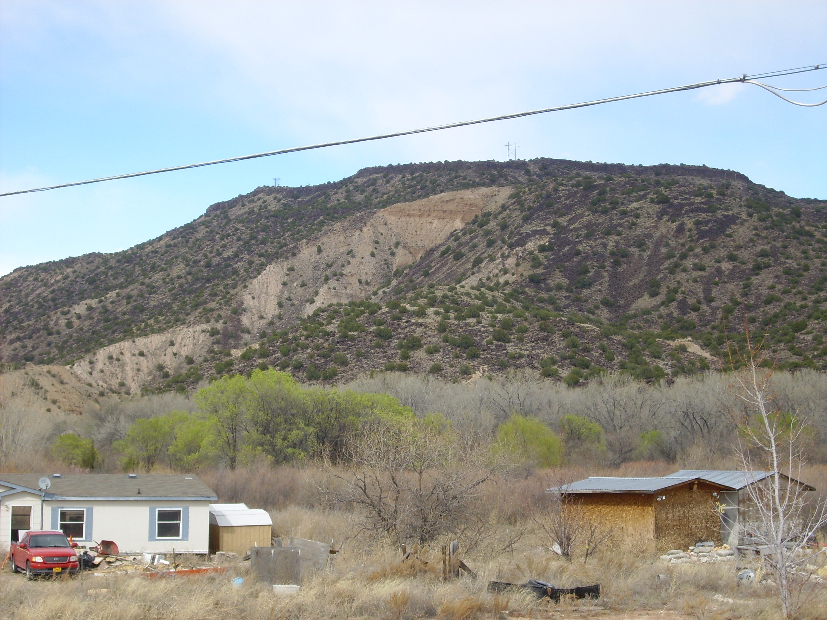
Paliza Canyon volcaniclastics. 35 45.620N 106 22.335W
The table of contents may be found here.
Paliza Canyon volcaniclastics. 35
45.620N 106 22.335W
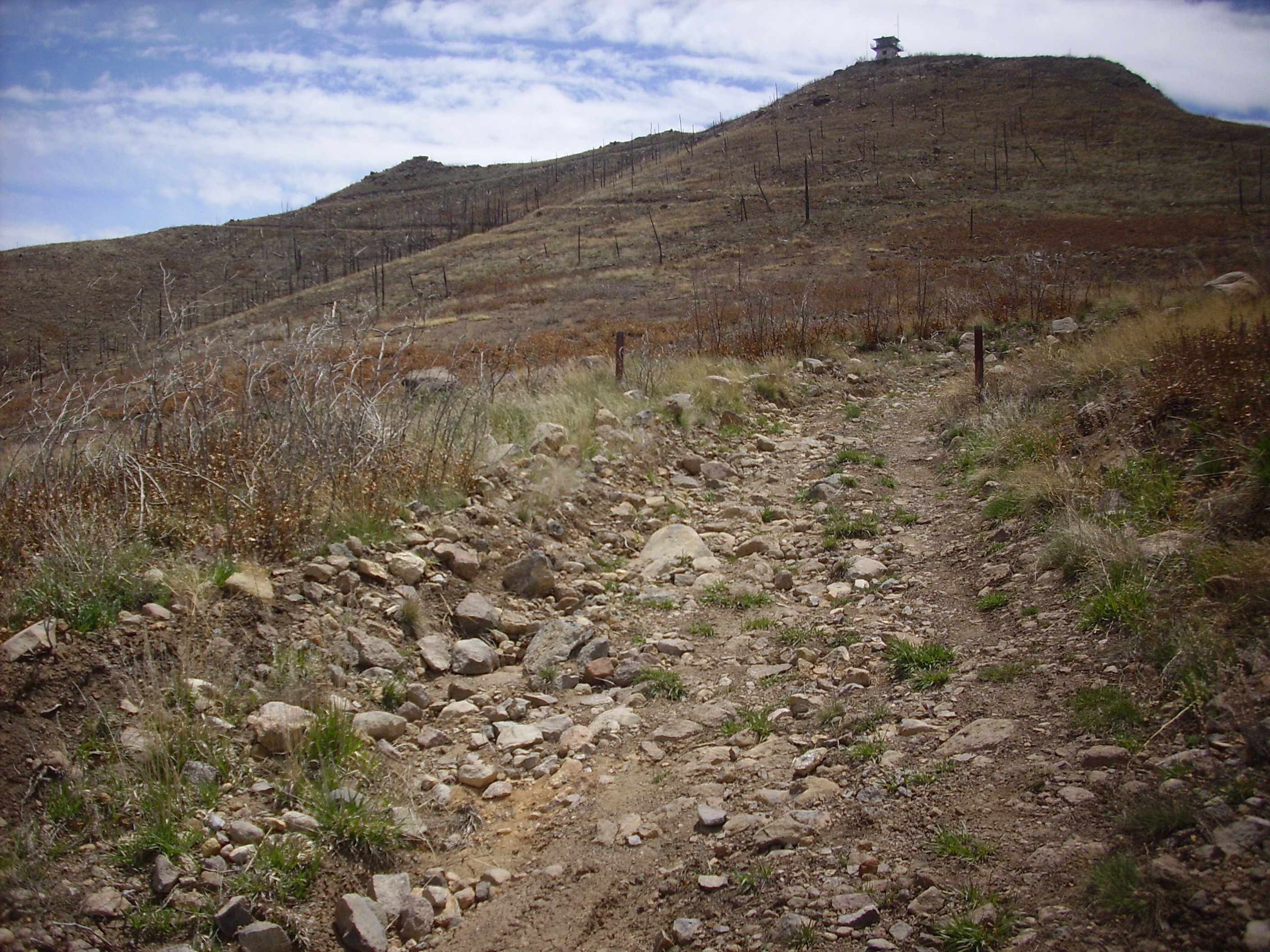
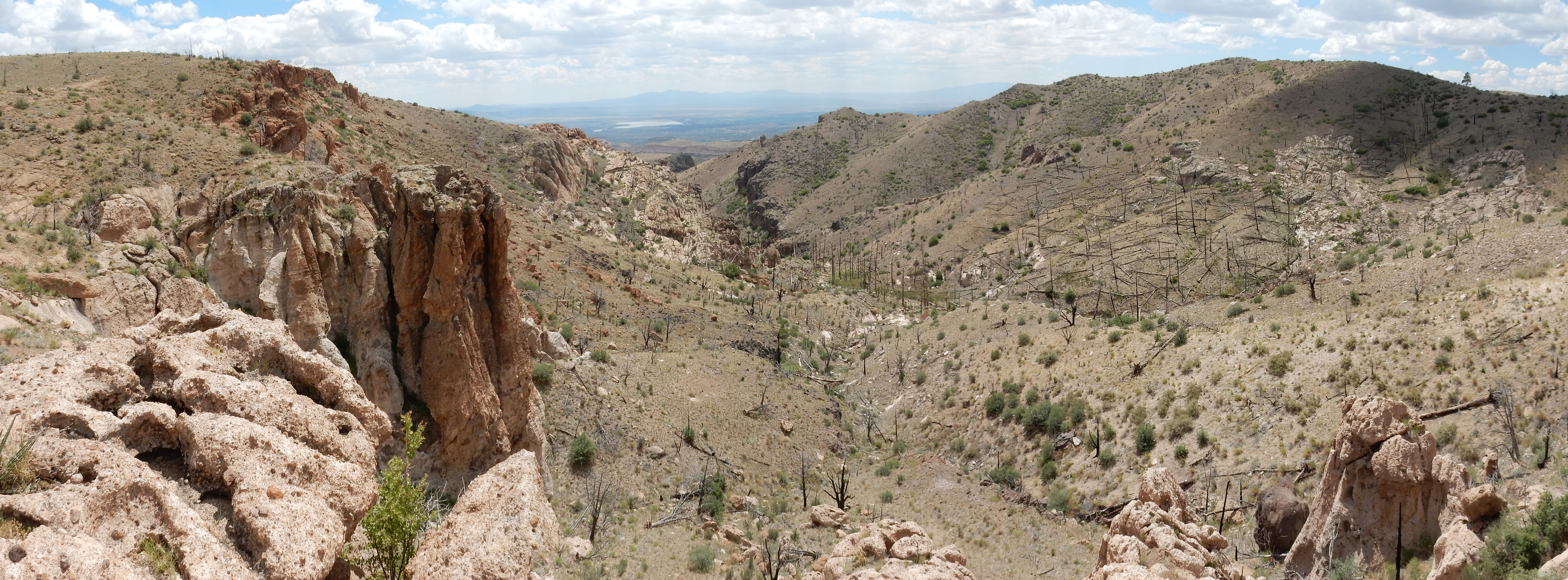
Seven million years ago, the western side of the broad river valley between the Sierra Nacimiento and the Sangre de Cristo Mountains had become a cluster of volcanic mountains. The great pulse of eruptions responsible for building the Jemez volcanic pile had peaked a few hundred thousand years earlier, but activity had not entirely ceased, and increasingly silica-rich magma still occasionally rose to the surface. Meanwhile, erosion had begun to wear down the volcanoes, creating an apron of debris extending all around the mountains but particularly to the south.
Mastodons, camels, primitive horses, and beavers were among the
animals living in the moister river bottoms or among the pine
forests of the higher elevations, but the ancestors of humans had
only just diverged from the chimpanzees and begun a bipedal
existence. Sahelanthropus tchadensis may represent the
first human ancestor not shared by the other great apes. With
North America distant from humanity's birthplace in Africa, and
connected to the Old World by a narrow, intermittent land bridge,
it would be nearly another seven million years before humans
arrived in North America.
Renewed extension of the Rio Grande Rift would shortly open new
fractures through part of the volcanic field, resulting in
voluminous high-silica eruptions that would produce distinctive
beds of tuff and add to the growing debris apron around the Jemez.
In this chapter, we will look at the formation of vast beds of volcanic sediments accompanying early volcanism in the Jemez volcanic field towards the end of the Tertiary Period.
Gravity is a relentless leveling force, and, over geological time spans, it can bring down the highest mountain. This is particularly true where the climate favors erosion and the rocks underlying the mountain are soft or otherwise easily decomposed. The eroded sediments can produce widespread and thick beds, as they do in places in the Jemez.
In addition, volcanoes tend to eject a lot of solid particles
into the air during eruptions. These, too, must come down
somewhere, and they form a variety of rock types described as pyroclastics.
As the products of volcanic activity, they seem like they would be
igneous rocks; but as rocks formed from deposits of broken rock
fragments, they seem like fair game to be claimed as sedimentary
rocks. Early geologists had some difficulty deciding how to
classify them, particularly since it was uncertain exactly how
various kinds of pyroclastic rocks formed. Those composed of
volcanic ash were lumped together as tuffs.
Geologists eventually settled on volcaniclastics as a
broad term for beds of shattered volcanic rock. This includes
fragments of volcanic rock formed by ordinary processes of erosion
as well as shattered rock produced directly by volcanic activity.
The term pyroclastic was reserved for beds composed of
rock fragments formed as a direct result of explosive volcanism.
Tuffs were defined as pyroclastic rocks formed from volcanic ash,
without distinction by mechanism of formation, which meant that
tuffs included both rock formed directly from hot ash and rock
formed from ash reworked by water. Either way, the original ash
particles were pyroclasts, originally formed by explosive
volcanism.
Most magma contains considerable dissolved gas, mainly water vapor and carbon dioxide. The gas remains dissolved in the magma so long as the magma remains deep underground and under pressure from the weight of the overlying country rock. However, when the magma approaches the surface and the pressure begins to drop, the gases begin bubbling out of the magma.
In a low-silica magma, gas molecules move easily through the magma to join existing gas bubbles, instead of forming new gas bubbles. As a result, the bubbles are few and large. When the magma reaches the surface, these large bubbles burst relatively gently. The lava may fountain to a considerable height, but the individual blobs of lava are fairly large and fall to the surface close to the vent. Now free of gas, the lava can pool to form flows. This is the kind of eruption that tourists in Hawaii view from fairly close up in reasonable safety.
In a high-silica magma, gas molecules have great difficulty
diffusing to existing bubbles and tend to form new bubbles
instead. The magma becomes a foam of microscopic bubbles. At the
same time, the magma is rapidly solidifying. The solidification is
so fast that crystals do not have time to form, and the magma
solidifies into volcanic glass instead. If the glass forming the
walls of the bubbles is not strong enough to withstand the
pressure of the gas within, the rock disintegrates into fine dust
as the bubbles shatter. The final product is a hot mixture of
volcanic gases in which is suspended countless tiny shards of
volcanic glass. These shards continue to emit residual gas for
some time, and this helps keep the shards suspended in the
mixture. Eruption of this mixture is characteristic of explosive
volcanism.
Clasts formed by explosive volcanism are collectively known as tephra,
regardless of size or whether the clasts formed from fresh magma
or from country rock shattered by explosive activity. The finest
clasts, under 2mm in diameter, are classified as ash.
Those between 2mm and 64 mm (2.5 inches) in diameter are known as
lapilli, while larger tephra are classified as either volcanic
bombs or volcanic blocks, depending on whether they
are still partially molten when they reach the surface (bombs) or
are already solidified (blocks).
The mixture of tephra and hot gases accelerates rapidly as it approaches the surface, sometimes reaching velocities of over 600 m/s (2000 feet per second) by the time it leaves the vent. This is roughly twice the speed of sound. This jet of material is known as an eruptive column. The column entrains some of the surrounding air, which expands and dilutes the column. What happens thereafter is determined by whether the eruptive column mixes with enough of the surrounding air to become less dense than the atmosphere.
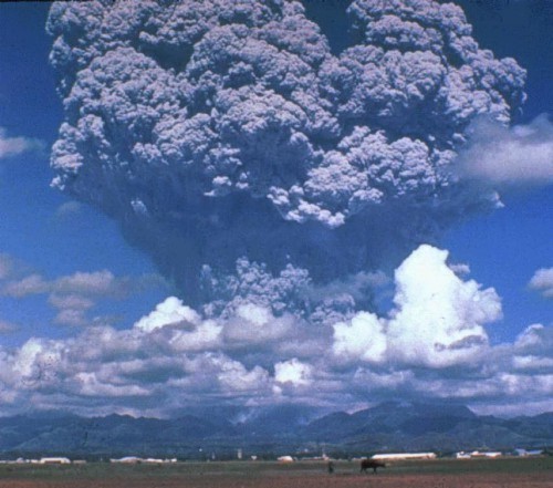
Eruption of Mt.
Pinatubo. USGS
If enough air is entrained to make the eruptive column less dense than the surrounding atmosphere, then buoyant forces will cause the eruptive column to continue rising, often to more than 30km (20 miles). This is well into the stratosphere. Such an eruptive column is called a convective eruptive column or a plume. Once the column reaches an altitude where its density is equal to the surrounding air, it slows rapidly and begins to spread out to form an umbrella or mushroom cloud.
As the eruption column expands and cools, the ash begins to fall back to the earth. The coarsest clasts will tend to fall out close to the vent, while finer ash may be deposited a considerable distance downwind. Ash from the Jemez area has been identified as far as 500 km (300 miles) downwind. The very finest ash particles that reach the stratosphere may remain there for years.
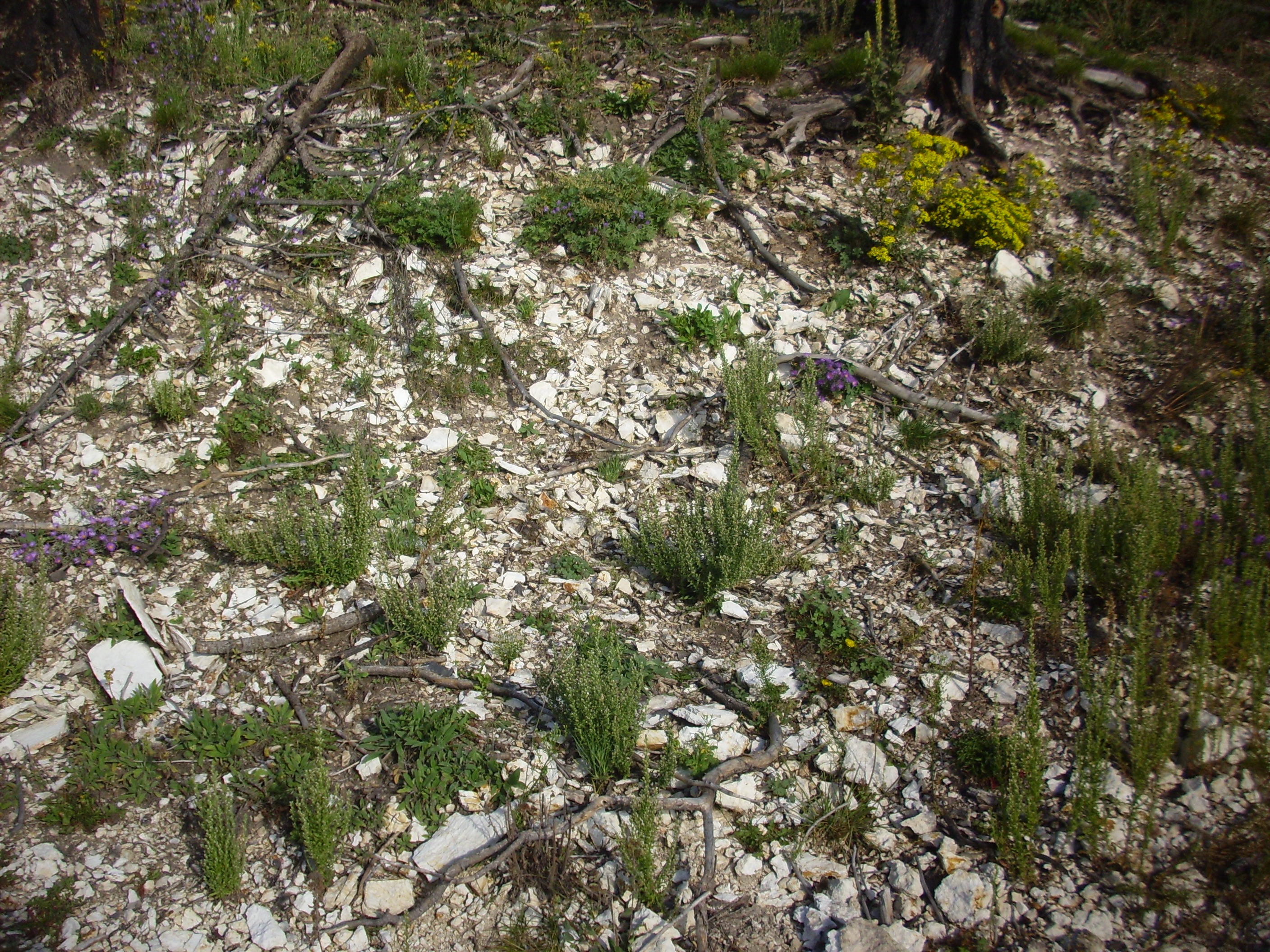
Ash fall beds have a number of distinctive characteristics. They tend to form an even blanket of uniform thickness over the existing terrain, and the clasts are typically well-sorted. The ash is typically white to grey in color, which often makes an ash bed stand out in a sequence of sedimentary beds. Because the ash is already quite cool when it is deposited, fresh ash beds are unconsolidated. However, because the ash is rich in colloidal silica, it will rapidly become cemented if it moistened by rain or groundwater, and so ash beds are often well preserved in the geological record.
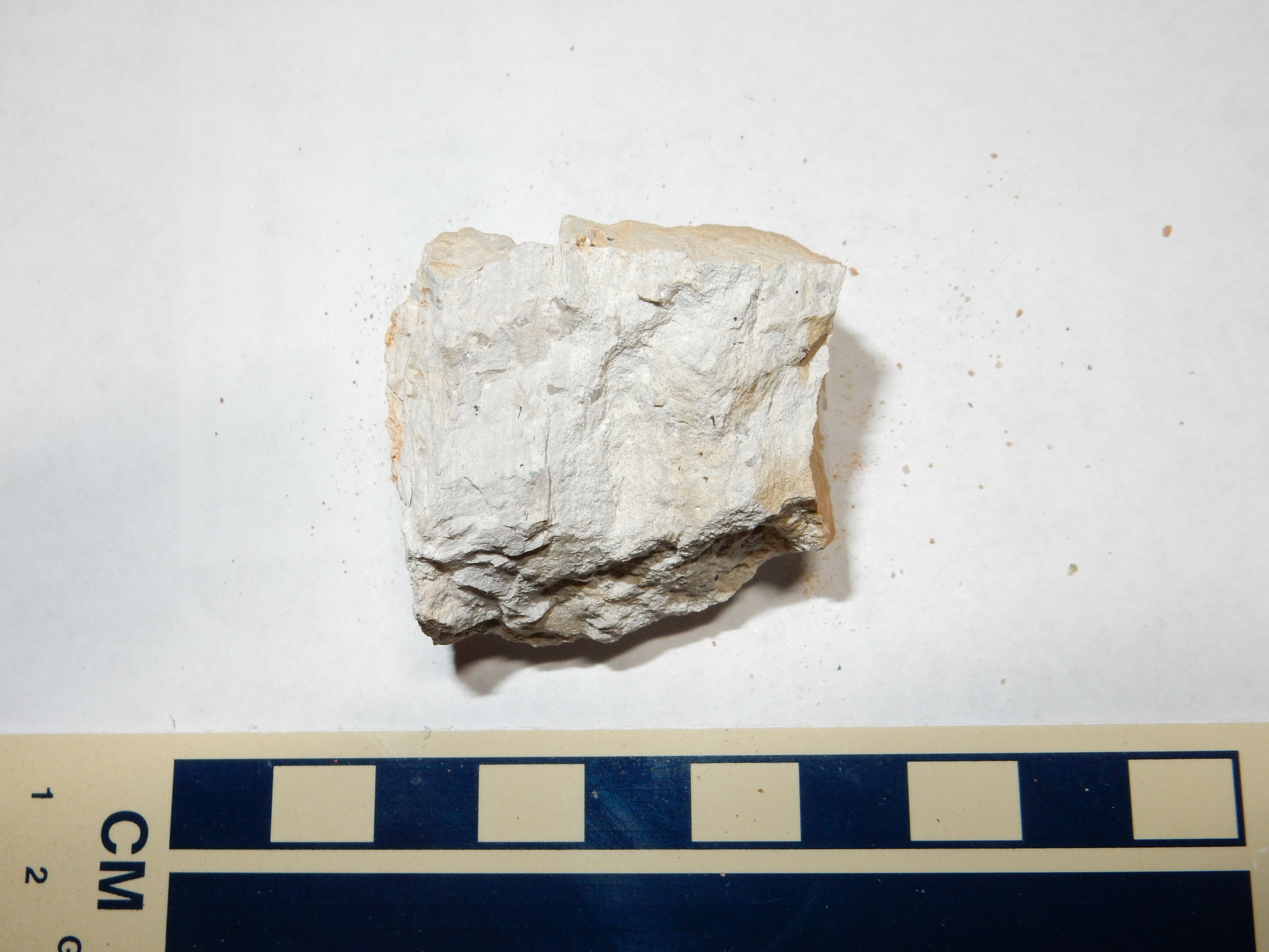
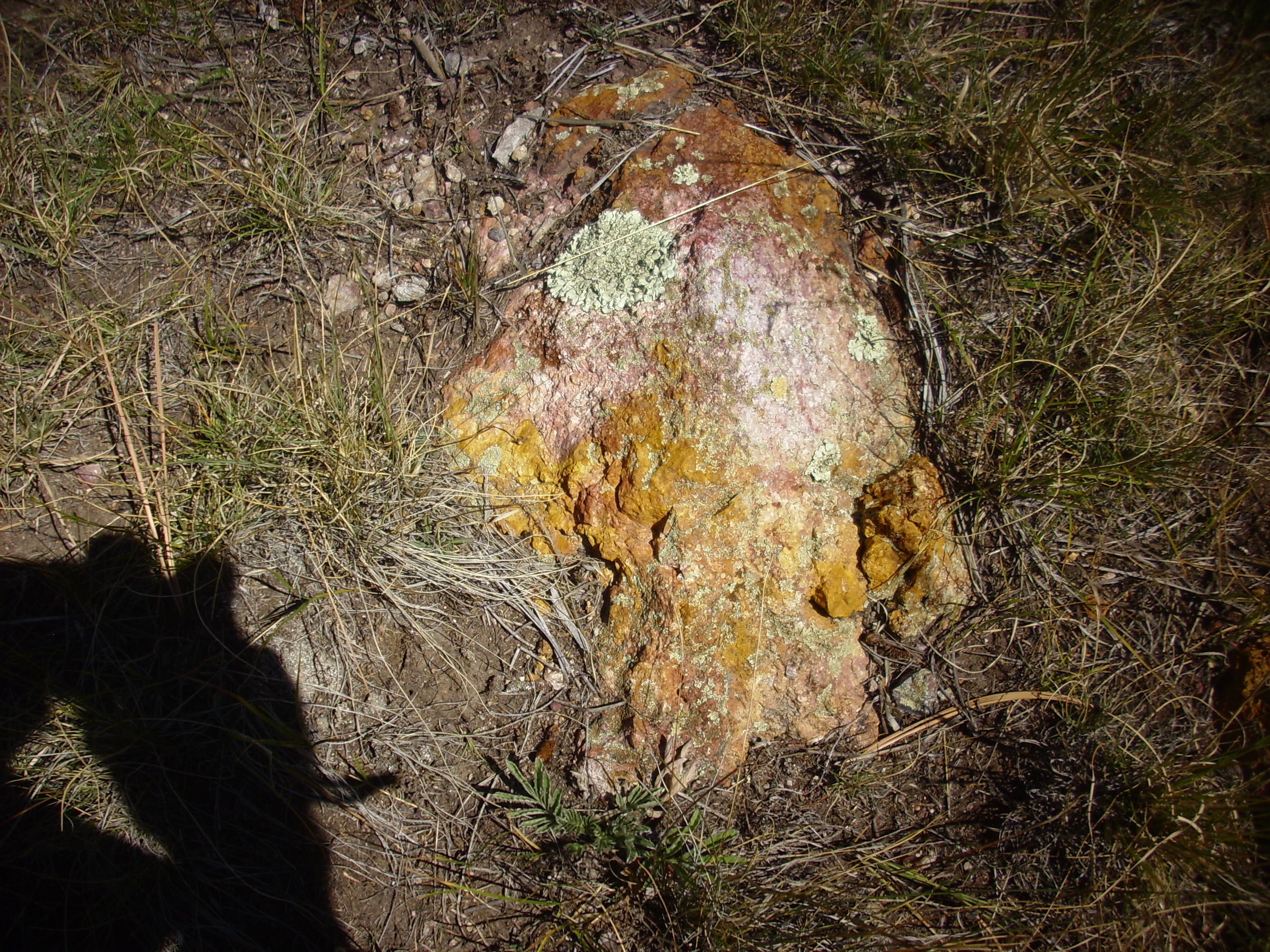
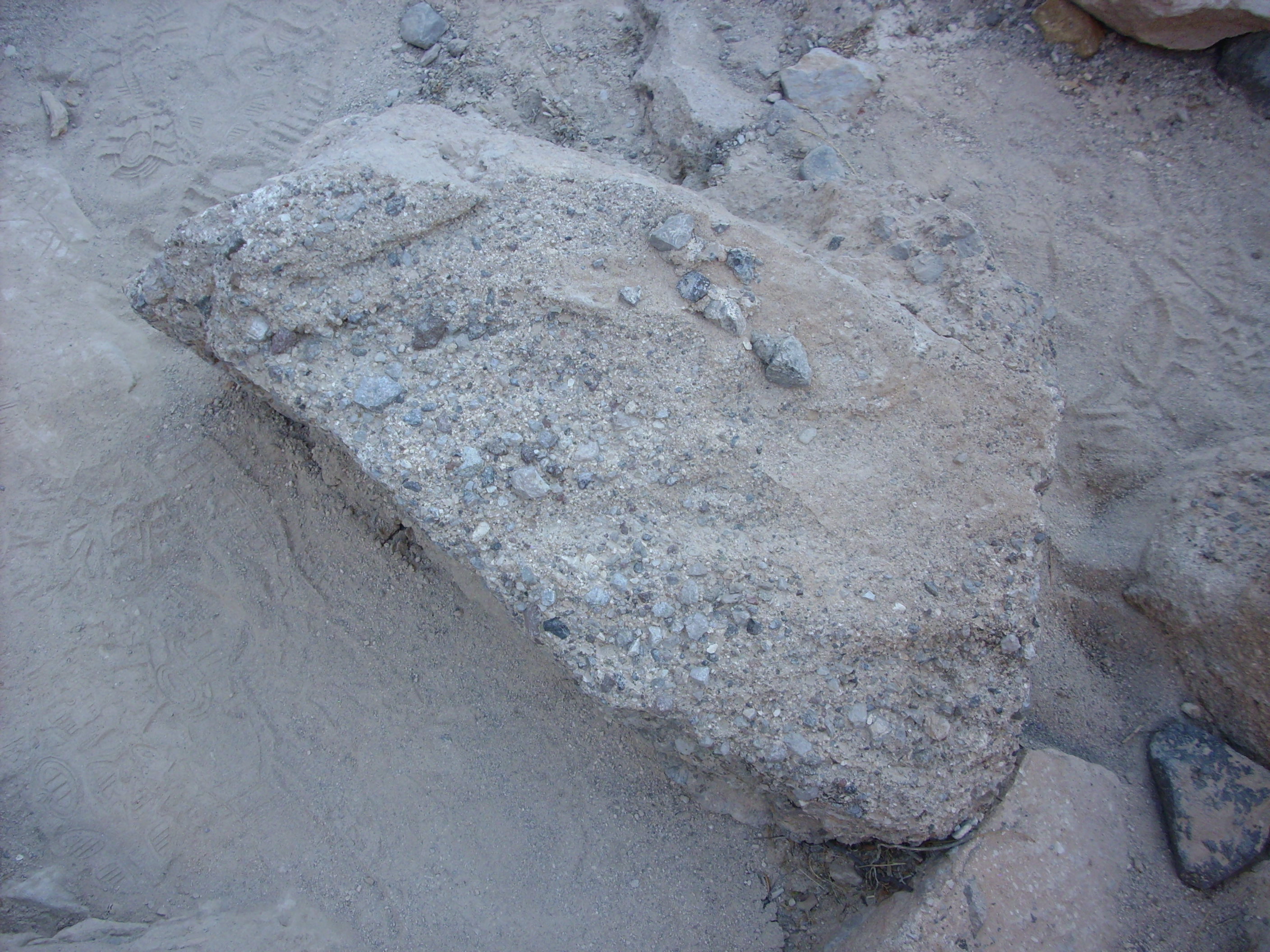
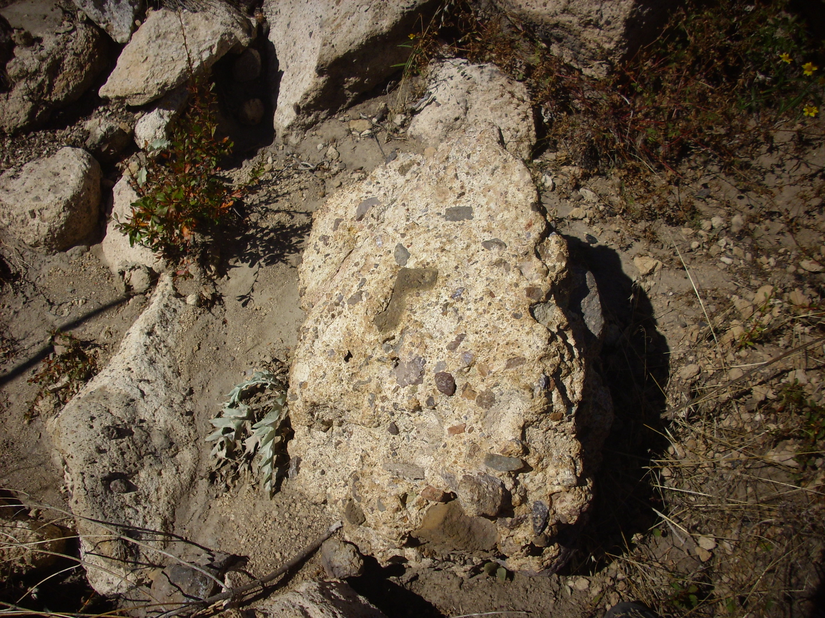
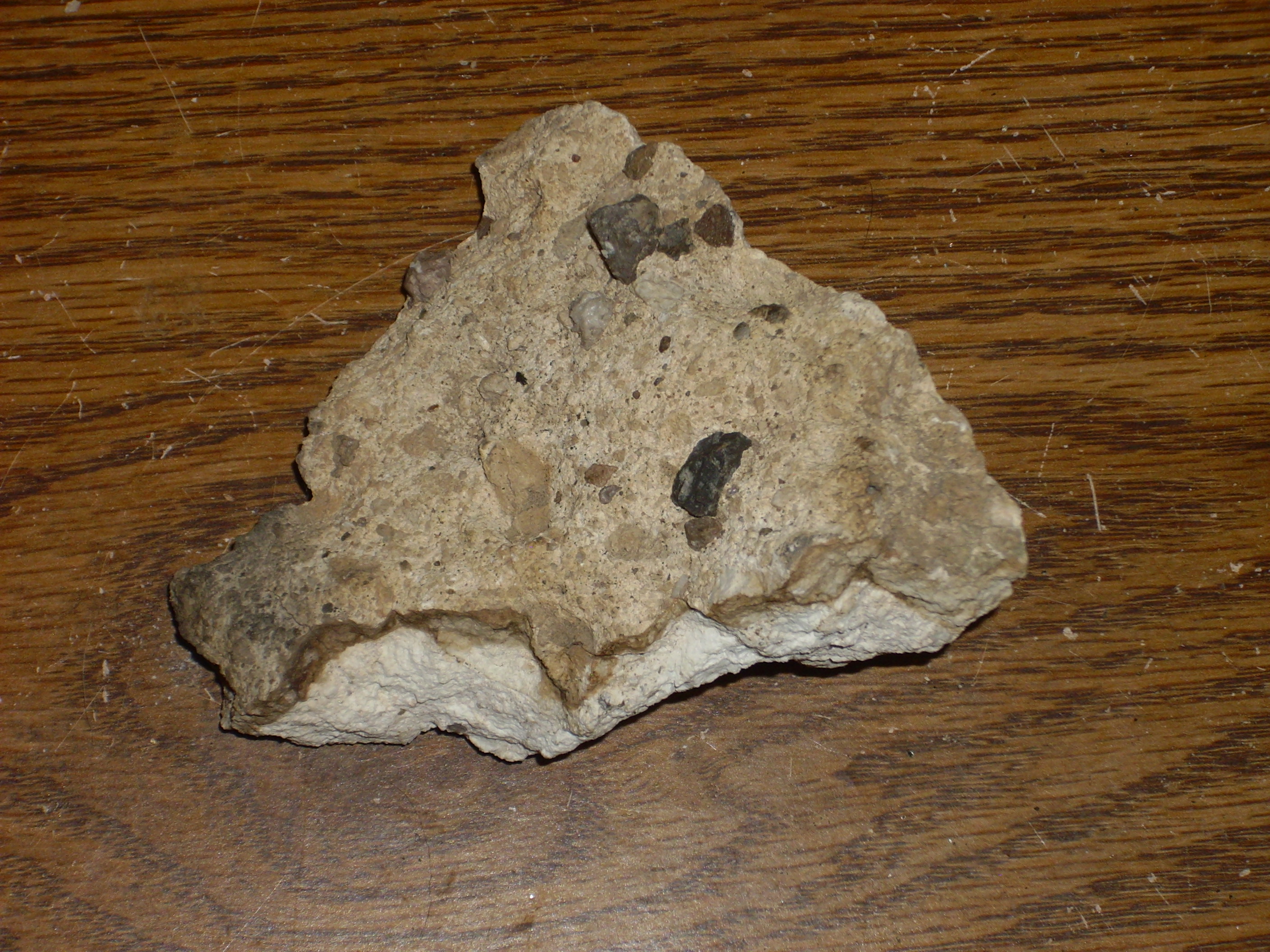
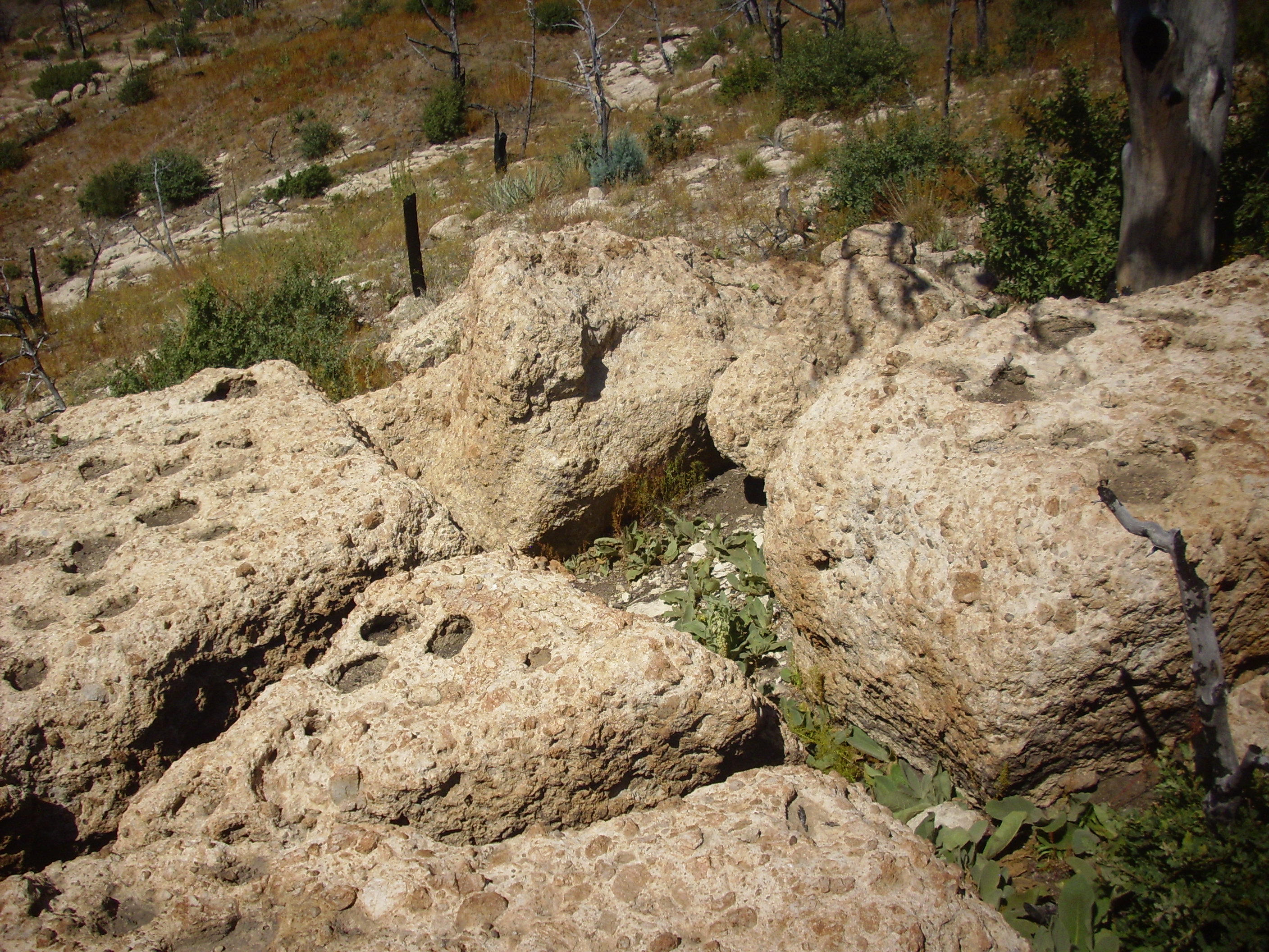
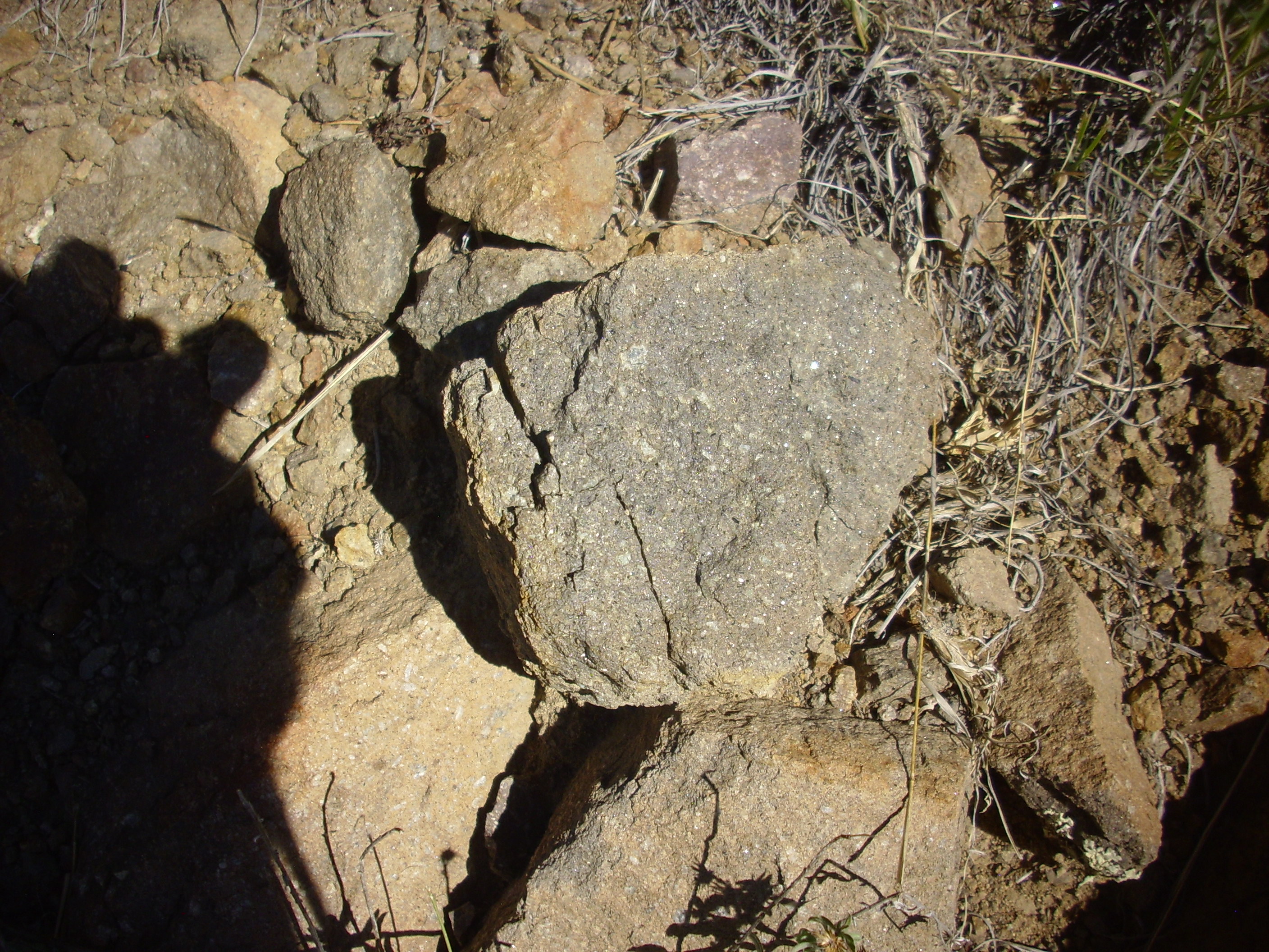
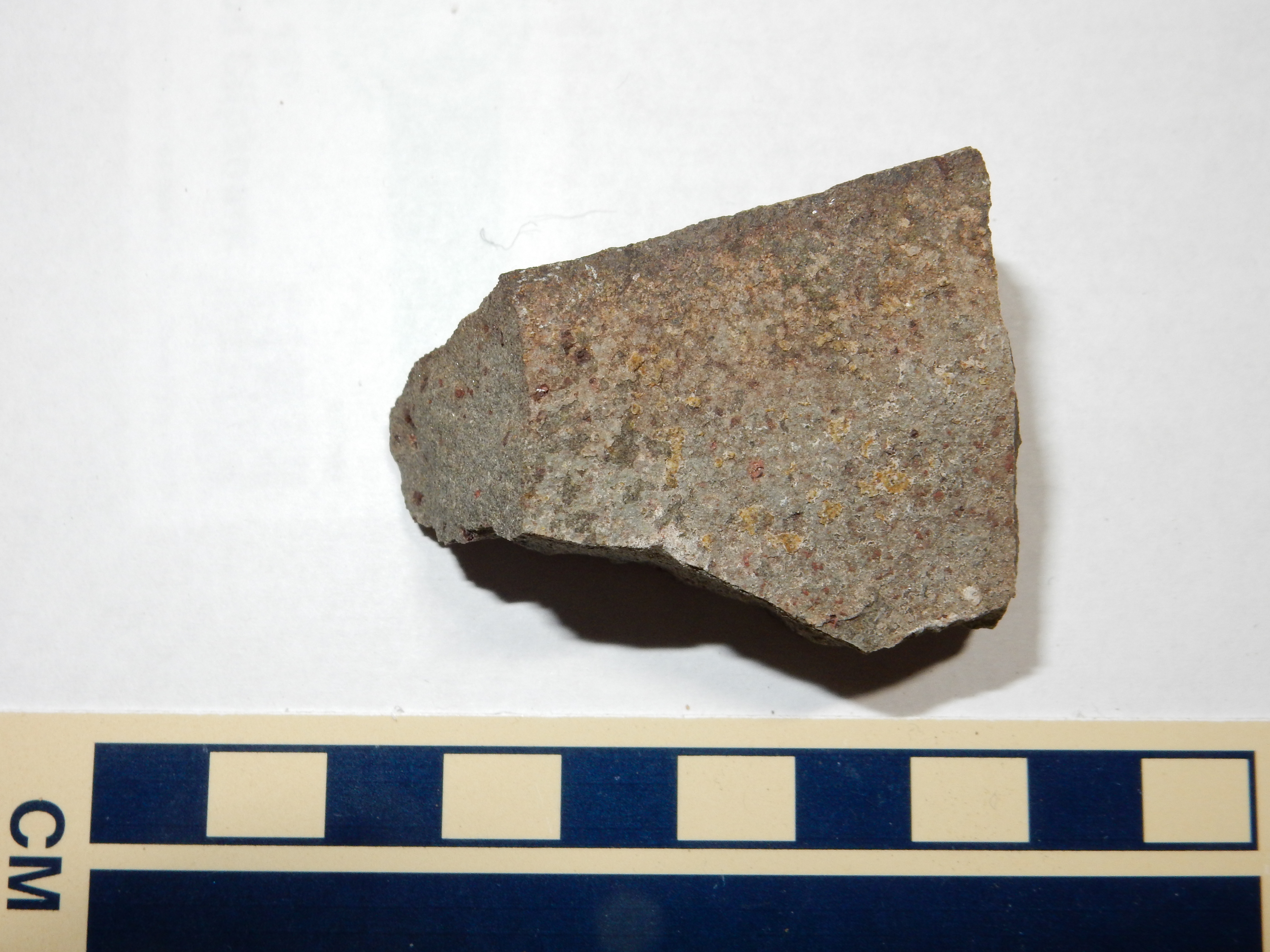
Pumice fall resembles ash fall in all but the size of the clasts. If a high-silica magma is a bit less viscous when it erupts, perhaps because it is unusually hot or rich in water vapor, it may resist disintegrating to ash under its internal pressure and can then solidify as a glassy foam of larger bubbles. Such rock is known as pumice, and it ranges in size from lapilli to small volcanic blocks. Pumice contains so much void space that it will usually float on water
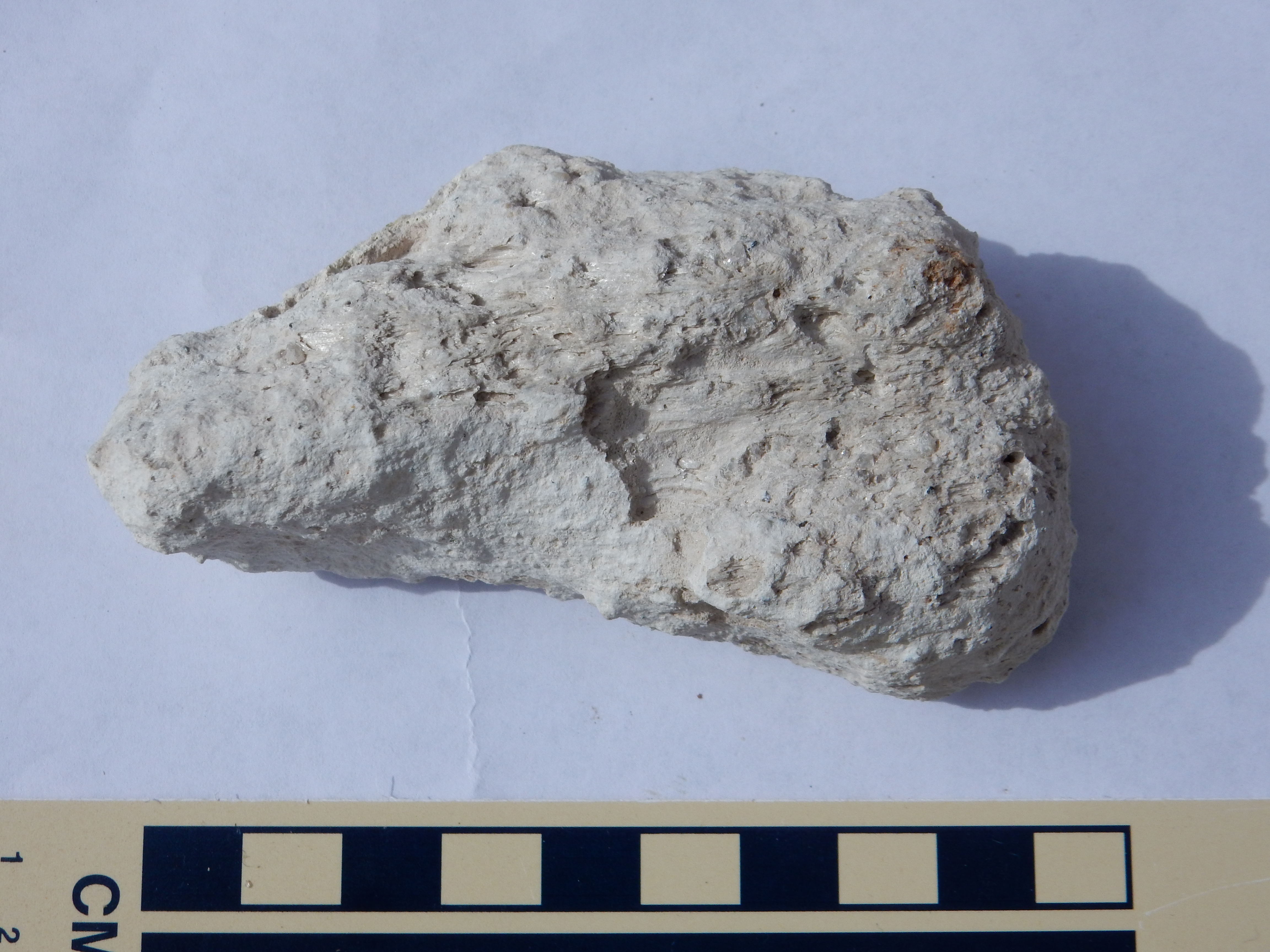
The sample is about 10 cm (4 inches) long and so is classified as
a volcanic block rather than a lapillus. Under close examination,
we find that many of the voids are elongated along the length of
the sample, suggesting the pumice was stretched while still
partially molten. This is quite common. Under the loupe, the
pumice shows a few phenocrysts of quartz and feldspar, some tiny
fragments of mafic rock, and even a few bits of older pumice
entrained in the younger rock.
Like ash fall beds, pumice fall beds are fairly uniform in
thickness and tend to be well-sorted, and they are unconsolidated
when fresh but can become well-consolidated after they absorb
water. Indurated ash fall beds are one of the rock types
that earlier geologists identified as tuff.
Ash flow tuffs (sometime called ignimbrites, though this
term is falling into disfavor) are formed from volcanic ash
deposited in a pyroclastic flow. These occur when an
eruption column does not entrain enough air to remain buoyant. The
result is column collapse. The hot mixture of gas and
particles falls back to the surface and flows along the
ground, often for distances of many kilometers. Because the
mixture is heavier than air, it tends to pool in low areas. The
clasts in the flow are kept suspended in part by their own
emissions of residual hot gas, but mostly from rising air
entrained and heated at the front of the flow. When the supply of
heat runs out, the particles settle onto the surface.
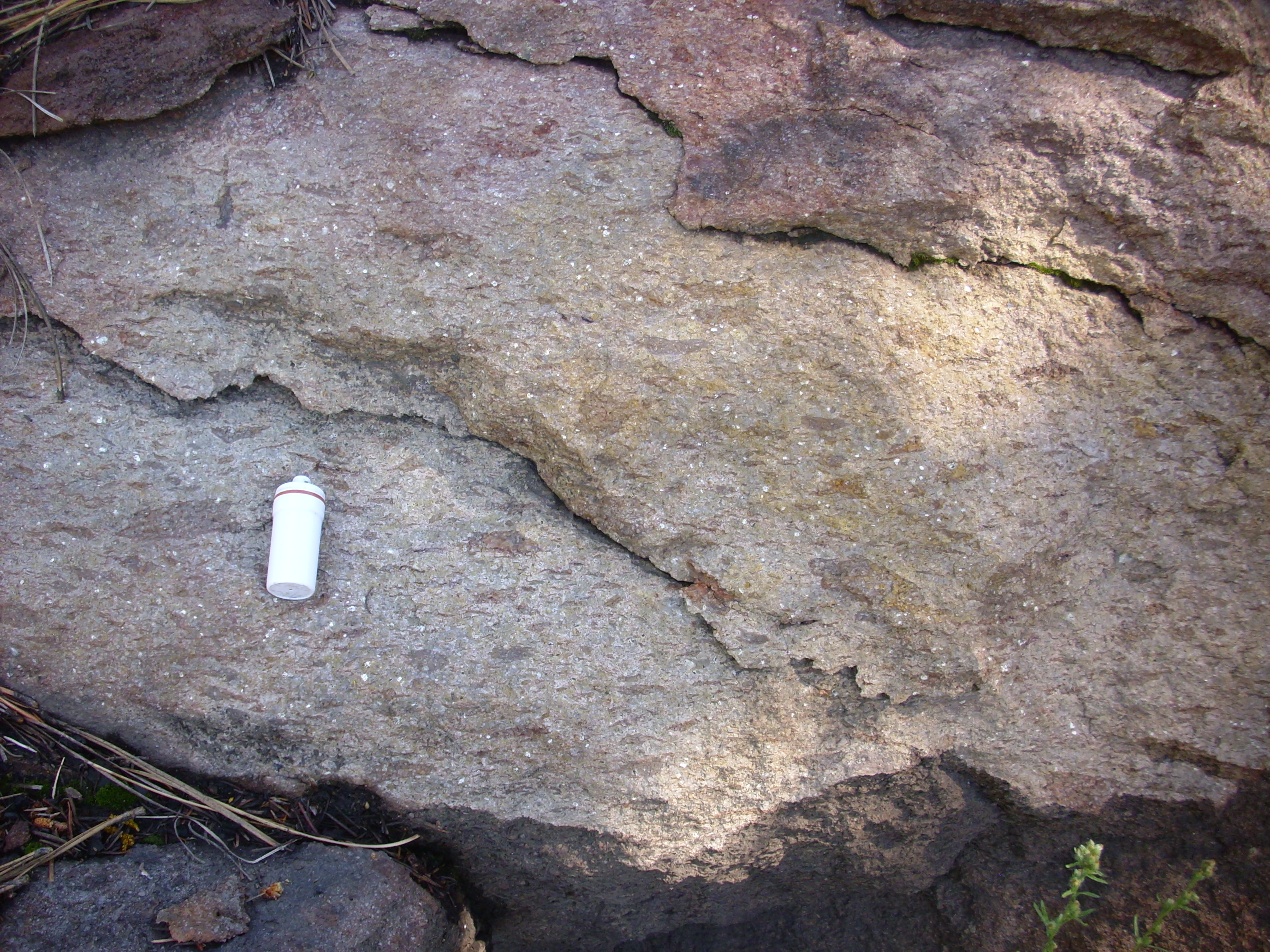
Welded tuff showing fiamme. 35.54.857N
106 30.554W
If the pyroclastic flow is hot enough, the clasts will still be
slightly molten when they settle on the surface. The clasts will
partially merge and there may be local flow, which will tend to
smear out the larger clasts in the flow (often fragments of
pumice) in a distinctive way (fiamme). Such an
ignimbrite is known as a welded tuff.
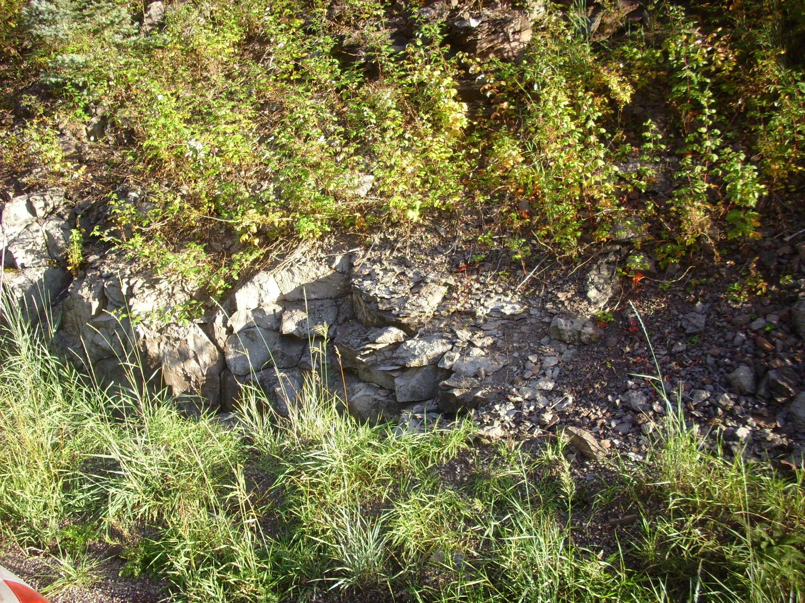
Unwelded tuff showing intact pumice and
lithic clasts. 35
52.233N 106 13.390W
If the flow is not as hot, so that the clasts are fully solidified when the settle on the surface, they will retain their individual identity to produce an unwelded tuff. However, the hot gases trapped in the flow will cement the clasts together as they cool, so that an unwelded tuff is typically still solid rock, albeit a rock that is usually softer than a welded tuff. Further deposition of cement by ground water can further indurate either kind of tuff, so that hardness is not a reliable guide to whether a tuff is welded or not. The surer field criterion is that there are fiamme present in a welded tuff.
Pyroclastic flows can reach speeds of over 300 km/h (200 miles per hour). Faster still are the hot pressure waves (blasts) that move ahead of them and to their sides, and which are one of the most serious hazards of volcanic eruptions. Behind the blasts are clouds of hot, turbulent gases with a relatively low ash content known as surges, which can produce characteristic surge deposits.
We will see examples of all these kinds of pyroclastic flows in
the pages that follow.
Lahars are volcanic mud flows. They are formed when heavy
rain mixes with fresh volcanic ash to form a dense mixture that
can flow for miles down existing slopes and river channels, then
harden like concrete when it comes to rest. I will have much more
to say about lahars in the next chapter.
Reworked tuffs are formed over longer periods of time when ash is exposed to wind and water. The Abiquiu Formation contains many beds of reworked tuff. These rocks are cemented through the same processes of diagenesis that are at work in other kinds of sedimentary rock, though the abundance of silica in the ash aids the process and can produce very thoroughly cemented rock.
A number of domes around the San Miguel Mountains are part of a
formation called the Bearhead Rhyolite, named for its type
location at Bearhead
Peak.
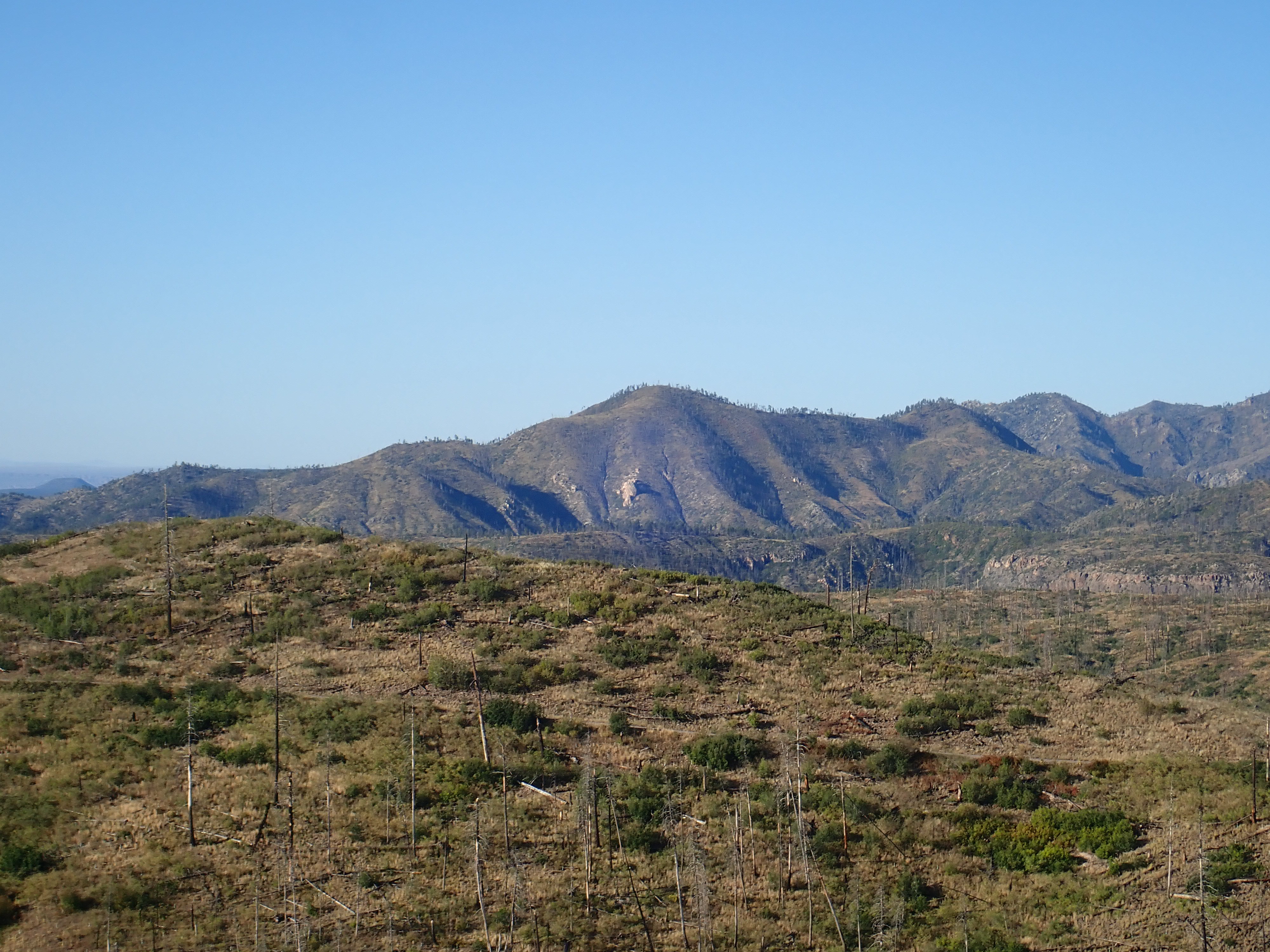
Bearhead Peak, Looking southwest from
35.779712N
106.4199207W
This formation is generally younger (6-7 million years old) and
considerably richer in silica than the bulk of the Paliza Canyon
Formation. The Bearhead Rhyolite is found in the same general area
as the Paliza Canyon Formation, with the Bearhead Rhyolite
typically lying on top of the Paliza Canyon rocks. In some places,
erosion has exposed intrusions of Bearhead Rhyolite within
the Paliza Canyon Formation.
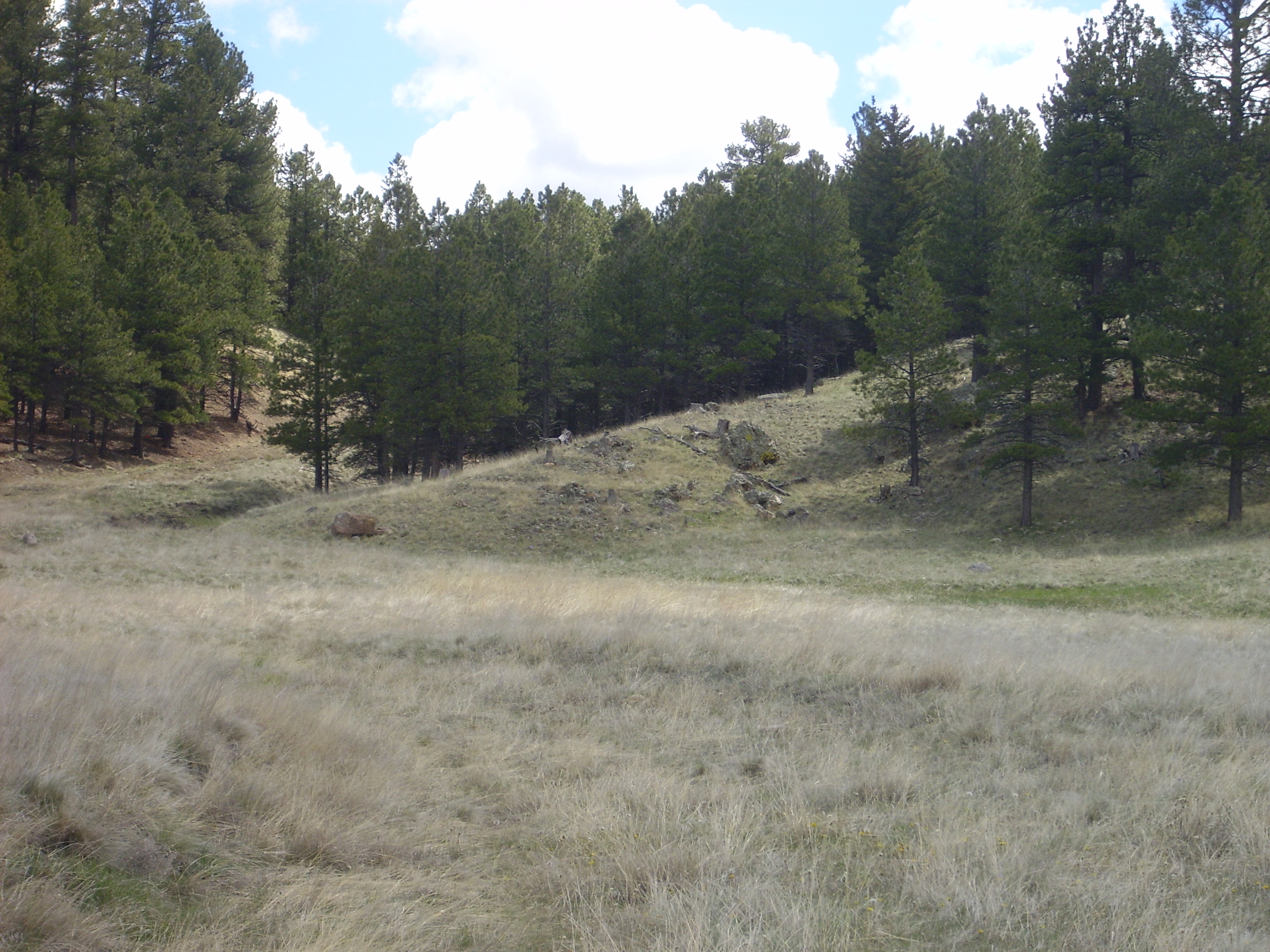
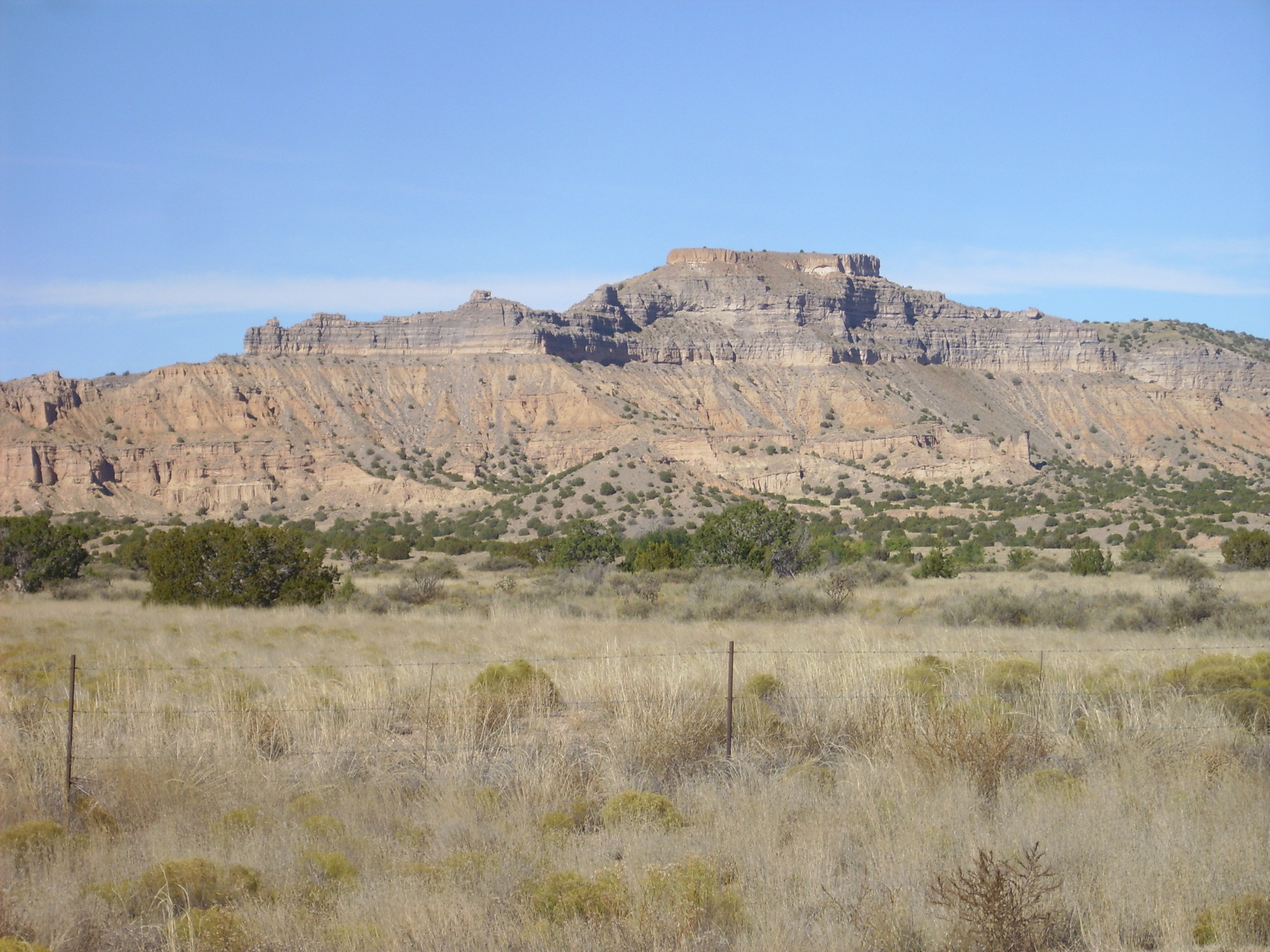
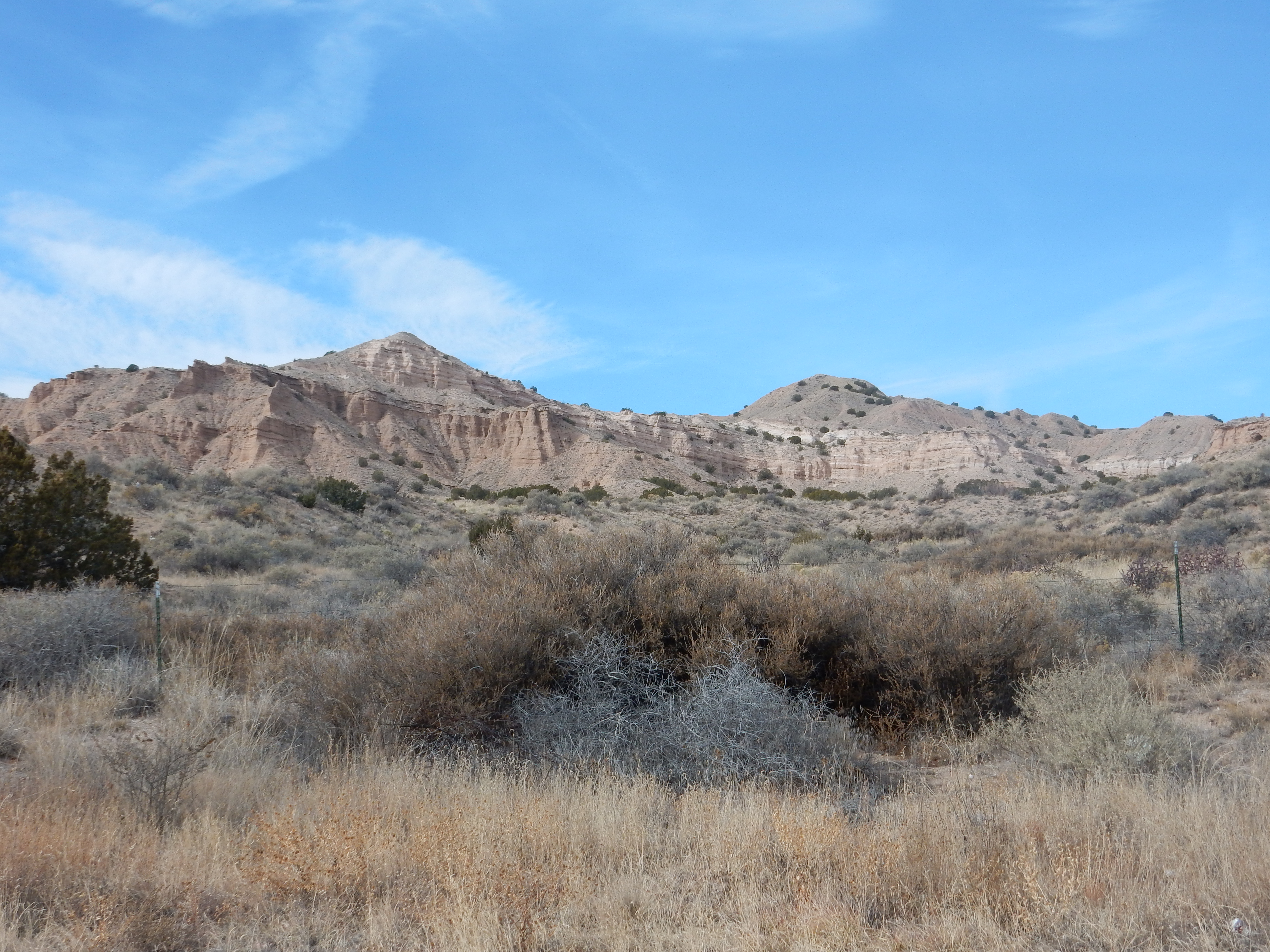
One of the more accessible outcroppings of Bearhead Rhyolite is along Forest Road 298, well south of the side road to St. Peter's Dome. The road passes west of Cerro Balitas, a plug of Bearhead Rhyolite and tuffs that we saw earlier in our panorama of the area.
Cerro Balitas looking north
from 35
43.311N 106 24.162W
The foreground ridge is underlain by Tshirege Member, Bandelier Tuff. The darker ridge behind it to the right is Paliza Canyon Formation andesite, while Cerro Balitas itself is Bearhead Rhyolite with a cap of Peralta Tuff. The road cuts through an outcropping of Bearhead Rhyolite as it passes west of Cerro Balitas.
Outcrop of Bearhead Rhyolite. 35
44.049N 106 24.555W
The geologic map for this area maps this as hypabyssal rhyolite, which cooled just below the surface.
Here is a photograph of a sample of Bearhead Rhyolite from the
outcropping shown above.
Bearhead Rhyolite. 35
44.049N 106 24.555W
There are signs of flow banding, which shows that the magma was still slowly flowing up to the time it solidified. Under the loupe, the sample shows sparse phenocrysts of feldspar, quartz, and biotite mica. The ground mass is very fine grained, looking almost like a siltstone.
A similar rhyolite plug, Cerro Picacho, is located to the northeast across Sanchez Canyon. This is accessible by hiking trail from St Peters Dome.
Cerro Picacho. Looking south from
35.757N 106.378W
The entire plug is composed of dense rhyolite.

Bearhead Rhyolite from Cerro Picacho. 35.744N 106.380W
Bearhead Rhyolite is most extensive in the southern Jemez, taking the form of domes, plugs, and thin dikes. A dike of Bearhead Rhyolite can be seen in the road bed of Forest Road 36 inside the south caldera rim:


Bearhead Rhyolite dike in road bed.
335
49.860N 106 28.862W
This is just within the Valles Preserve boundaries, so this
sample was photographed in place. Another dike occurs along Forest
Road 208 on Aspen Ridge.
Bearhead Rhyolite along Aspen Fault. 35
48.078N 106 30.199W
This exposure occurs along the Aspen Fault. The exposure can be traced a considerable distance north along the fault. Many exposures of Bearhead Rhyolite in the southern Jemez appear to lie along faults of the Cochiti Fault Zone, which was active at the time the Bearhead Rhyolite was erupted. These faults gave the rhyolite magma an easy path to the surface.
Here‘s an unusually well-exposed contact between a Bearhead
Rhyolite dike and the surrounding Paliza Canyon dacite, on a spur
of the eastern slope of Aspen Ridge.
Bearhead Rhyolite dike in Paliza Canyon
Formation. 35
47.642N 106 29.127W
The light-colored Bearhead Rhyolite is visible in the foreground, with an abrupt transition to dark Paliza Canyon dacite futher from the camera.
Bearhead Peak itself is one of the most inaccessible points in
the southern Jemez, being surrounded by deep canyons and rugged
terrain with no forest road nearby. However, one can get a distant
view of Bearhead Peak from the Veterans'
Memorial Overlook at Kashe-Katuwe National Monument. This is
located on the south rim of Canada Canyon and overlooks
spectacular scenery to the north, where several canyons converge
in an area underlain by Peralta Tuff.
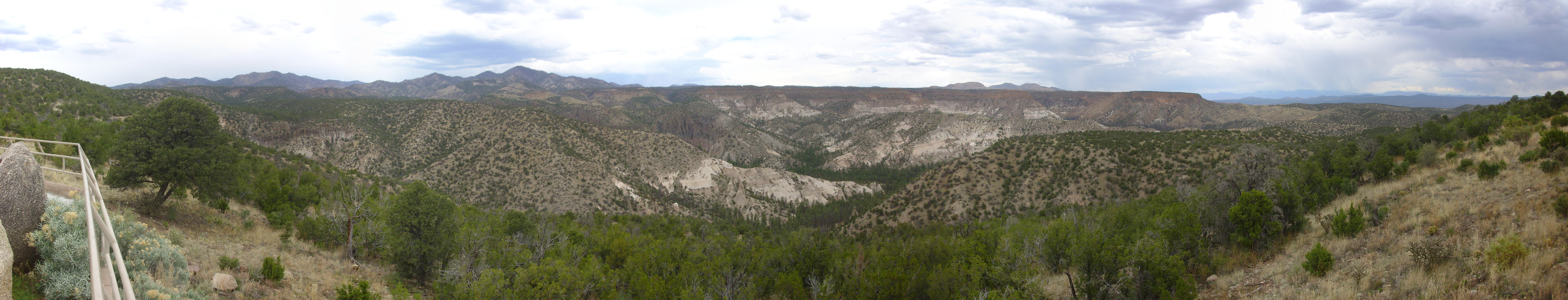
Panorama from Veteran's Memorial
Scenic Overlook. 35
40.398N 106 27.162W
The peak left of center is Bearhead Peak. Dark cliffs mapped as
Bearhead Rhyolite are visible across the foreground canyon to the
left and right. The rounded hill between is mapped as Cochiti
Formation. At center is Peralta Tuff in the lower slopes, with
numerous tent rocks, while the darker pink to orange cap forming
the mesa tops is relatively young Bandelier Tuff. The contacts
between the two members of the Bandelier Tuff, and between the
lower member of the Bandelier Tuff and the underlying Peralta
Tuff, are well displayed. (Click for a higher-resolution view.)
The map of the Bearhead Rhyolite shows a rather interesting distribution. There are isolated large domes and plugs scattered throughout the Keres highlands of the southern Jemez, but the thinner dikes seem highly concentrated in a band that lies mostly along the east slopes of Aspen Ridge and in a part of the north caldera wall that seems to line up with this band. This may well be a fault zone that underwent rapid crustal extension 6 to 7 million years ago, providing numerous conduits for the underlying magma to reach the surface. It may be significant that the portion of the caldera overlying this band is known to geologists to be the area where the caldera floor dropped the greatest distance in the Valles eruption 1.25 million years ago.
There are outcrops of Bearhead Rhyolite throughout the eastern
end of the northern moat area. Geologists interpret these dikes as
feeder conduits connecting overlying domes and flows (now mostly
eroded away) with a vast underground body of rhyolite, the
Bearhead Batholith. It's conjectural that it's actually down
there, but the conjecture is a good one.
Here is an outcrop of Bearhead Rhyolite in the northern moat:
Bearhead Rhyolite. 35
58.526N 106 31.282W
This outcrop marks the western margin of the zone of Bearhead
Rhyolite intrusion. Further west, the caldera rim is relatively
unaltered andesite and dacite, followed by older sedimentary beds
at the base of the northwest caldera rim. To the east of this
point, there is extensive faulting and numerous Bearhead Rhyolite
intrusions until you reach the Toledo Embayment, a kind of
semicircular divot cut out of the northeastern rim of the caldera.
The Embayment is thought to have formed sometime after the
Bearhead Rhyolite intrusions, and we'll look at it again later in
the book.
The intersection of the northeast caldera rim and the northwest rim of the Toledo Embayment form a reentrant in the caldera rim, a triangular point aimed into the caldera. At the tip of this reentrant is Cerro Trasquilar, a relatively young rhyolite dome unrelated to the Bearhead Rhyolite. The remainder of the reentrant is underlain by highly altered rock that geologists believe was originally Santa Fe Group rift fill sediments from before the birth of the Jemez volcanic field. The Santa Fe Group beds are capped by flows of Paliza Canyon Formation andesite, themselves hydrothermally altered, and intruded by Bearhead Rhyolite. The older Bearhead Rhyolite intrusions have also been hydrothermally altered, while the younger and larger intrusions are pristine rhyolite.
Here is a view of part of the reentrant from the northwest slopes of Cerro Trasquilar.
Fault zone. Looking northwest from 35.9721432N
106.5195776W
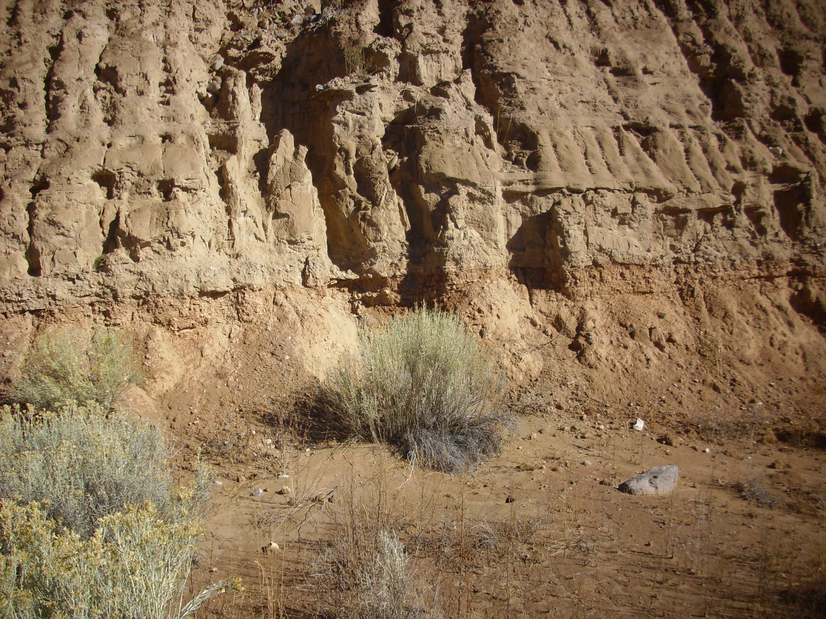
At center is La Garita, the high point of the north caldera rim, which is underlain by Paliza Canyon Formation and La Grulla Plateau dacites. To the right are two hills, one in the foreground and the other in the middle distance. Both are mapped as Santa Fe Group sediments, intruded by Bearhead Rhyolite and interbedded with andesite of the Paliza Canyon Formation. The white outcrops on the nearer hill are part of a Bearhead Rhyolite intrusion.
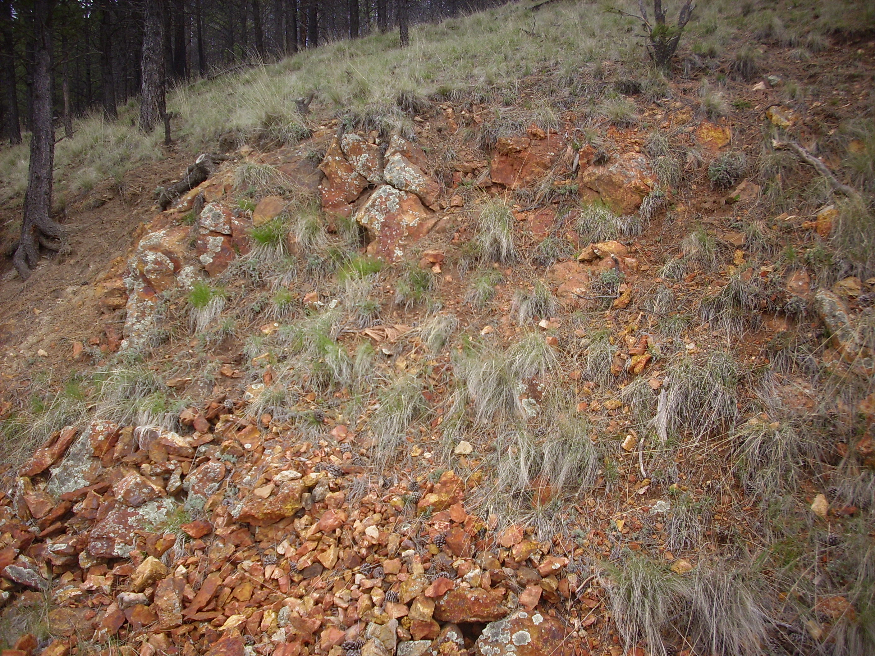
The Santa Fe Group typically consists of poorly-cemented dirty sediments. Throughout the reentrant, the sediments have been altered by the heat and acidic fluids given off by the Bearhead Rhyolite intrusions found throughout this area. The loose sediments have been cemented into hard rock, with the orange color likely coming from oxidized iron.
Altered Santa Fe Group sediments. 35.970121N 106.4892054W
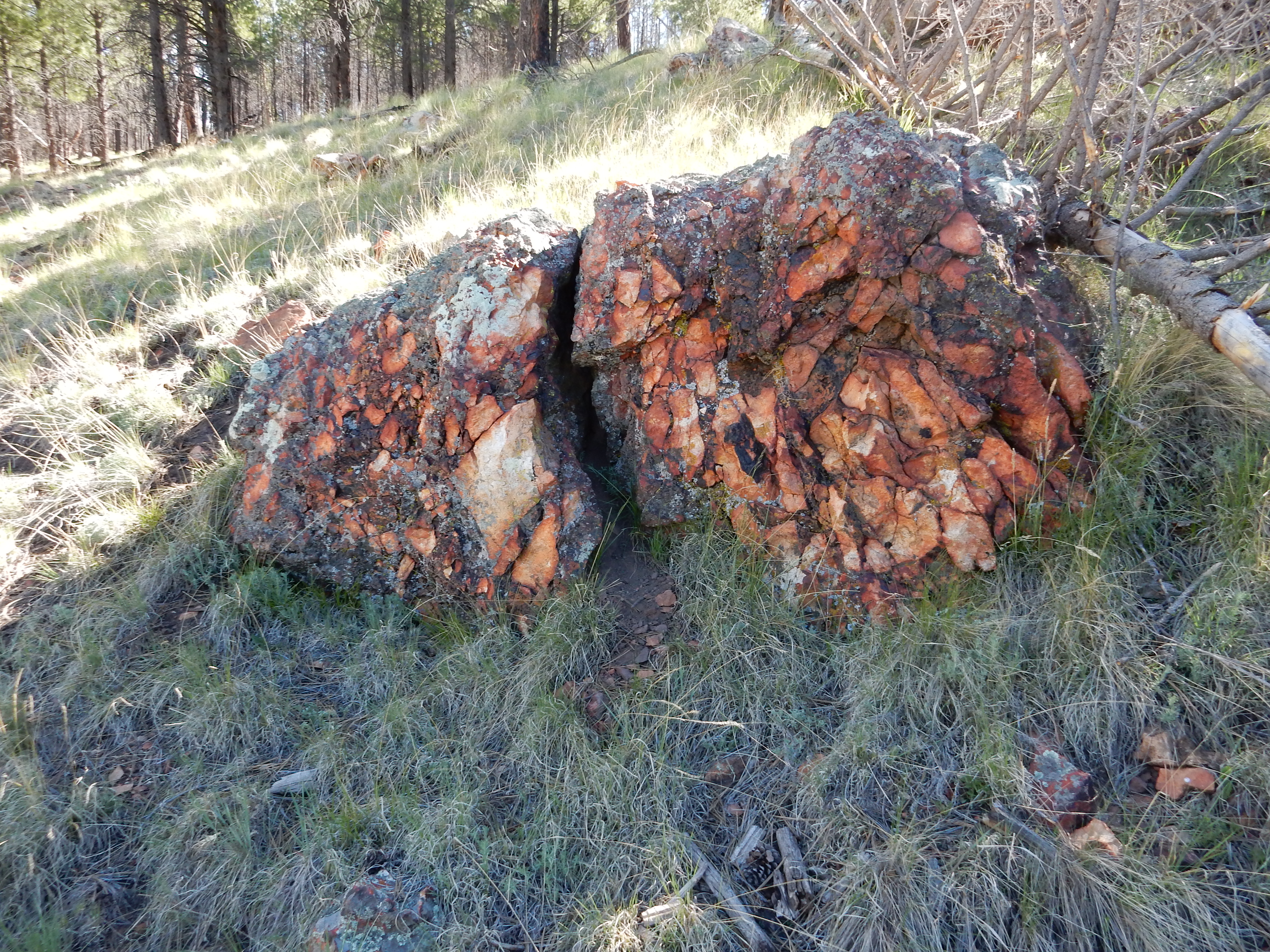
Other exposures more closely resemble well-cemented sedimentary
rock.
Altered Santa Fe Group sediments. 35.9719376N 106.4905054W
The cementing is quite thorough, so that this rock resembles a hornfels.
Up slope are Bearhead Rhyolite intrusions.

Some of the Bearhead Rhyolite in this area is itself heavily altered. This outcrop is nearly pristine, solid rock, with a hit of a glassy texture.
Further up slope are additional outcrops.
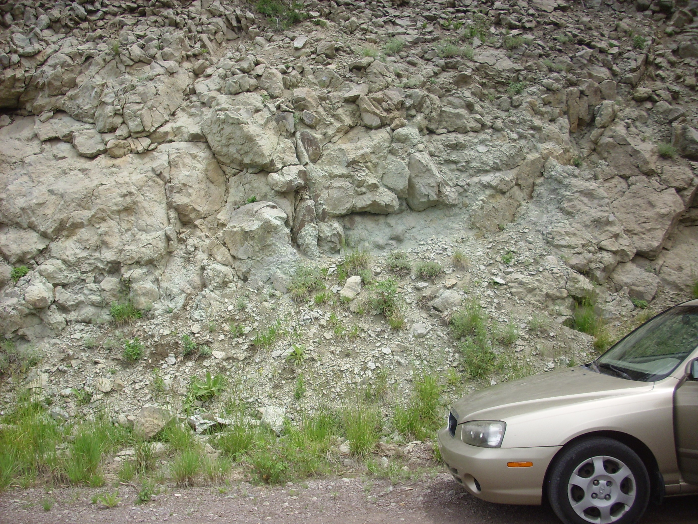
Above these intrusions, an andesite flow is
poorly exposed.
Andesite in reentrant. 35.9746793N
106.4974293W
Like the Santa Fe Group sediments, this is heavily altered by
heat and fluids from the nearby Bearhead Rhyolite, but it’s
clearly distinguishable from Santa Fe Group hornfels.
The overall picture geologists get is that mafic volcanism ceased in the Jemez around 7 million years ago, and did not resume again until about 4 million years ago. However, felsic volcanism continued for about another million years, and resumed earlier. While the magma that produced the Paliza Canyon Formation originated mostly in the mantle, the magma that produced the Bearhead Rhyolite was mostly melted crust. In an area like the Jemez, in which magma repeatedly rises from the depths, a considerable amount of high-silica magma can build up to form a giant magma chamber in the middle crust. We'll see the consequences later in this book.
The Bearhead Rhyolite is not significantly different in
composition from the Canovas Canyon Rhyolite that preceded it. It
is more widespread, is centered further to the east, and is
generally found overlying Paliza Canyon Formation flows. This may
seem like a somewhat arbitrary distinction. However, it is common
for otherwise similar formations to be separated by marker
beds of distinctive character. The marker bed that
distinguishes the older Canovas Canyon Rhyolite from the younger
Bearhead Rhyolite is the Peralta Tuff Member of the Bearhead
Rhyolite. This bed also marks a resumption of high-silica
volcanism in the southern Jemez after a hiatus at around 7.5
million years ago. During this hiatus, high-silica volcanism seems
to have shifted northwards, with some of the Bearhead Rhyolite
exposures in the north rim dating to this time.
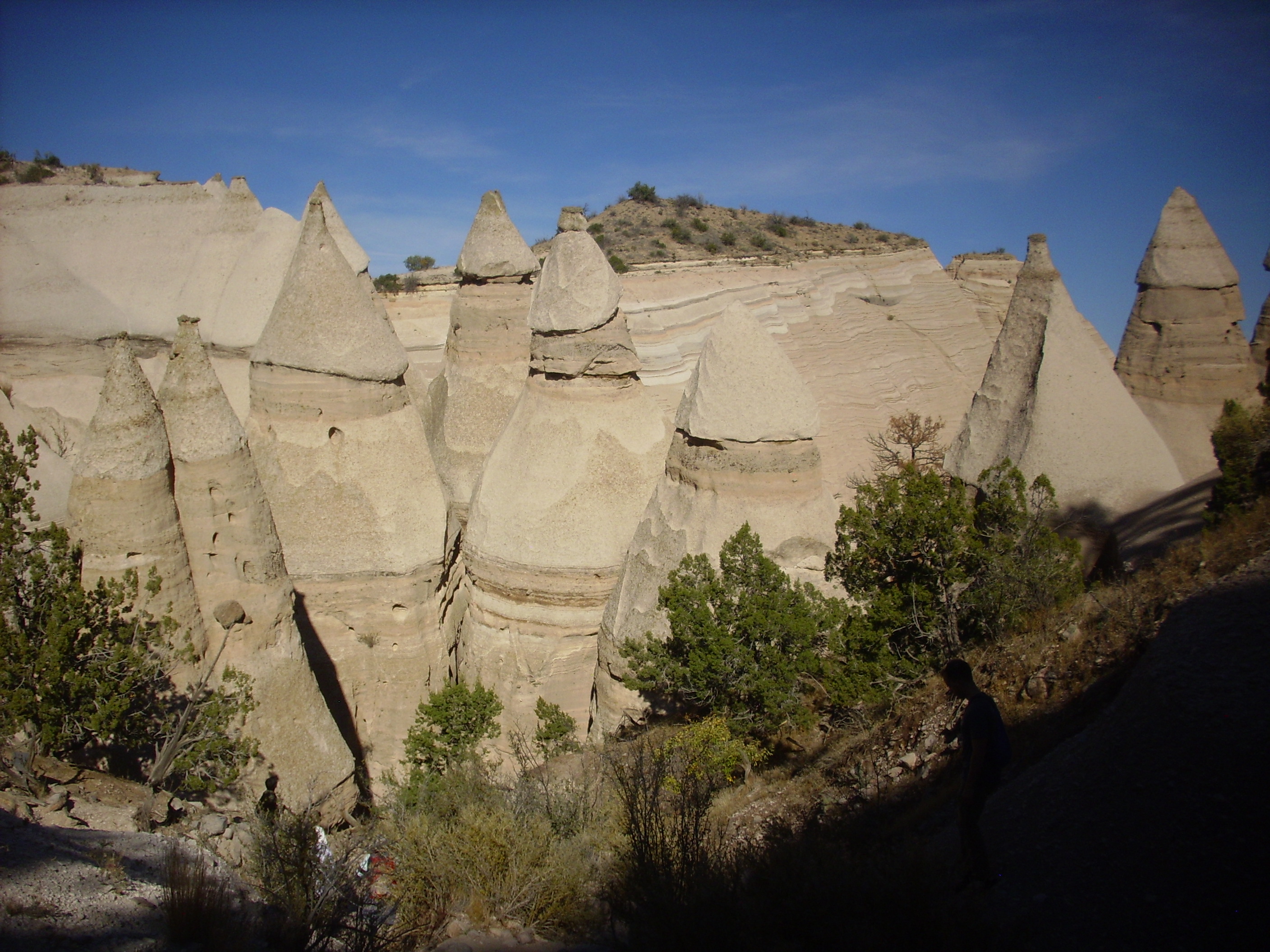
The Peralta Tuff has been dated radiometrically at 6.8 million years old. It forms thick beds in some parts of the southeast Jemez, particularly around Kasha-Katuwe Tent Rocks National Monument. This is a relatively new national monument, established as almost one of the last acts of President Clinton in office. It is located in the southwest Jemez north of Cochiti Pueblo, and one must drive through the pueblo to reach it.
High-silica volcanism, such as that which produced the Bearhead Rhyolite, is violent. The magma is extremely viscous and tends to be saturated with dissolved gas, and this makes for explosive volcanism. Such volcanism is responsible for the Valles caldera and the Bandelier Tuff that dominates the Los Alamos area. However, no caldera has been identified in the southern Jemez, and geologists speculate that the rapid widening of the Rio Grande Rift (which peaked in this area around 12 million years ago and was still quite active at 7 million years) tended to open fissures through which the magma was able to erupt before enough magma built up for a caldera eruption. The eruption was still violent enough to produce a great variety of pyroclastic rocks.
The area around Kasha-Katuwe Tent Rocks National Monument is underlain by two formations, the Peralta Tuff and the Cochiti Formation. The Peralta Tuff in this area records 35 separate explosive eruptions, of which 21 were ash and pumice falls from distant vents while 14 were close enough to deposit ash flow tuffs. Of these, at least seven originated from Bearhead Peak. The fall and flow deposits are interbedded with volcanic sediments reworked by floods and streams.
The distinctive feature of Kasha-Katuwe Tent Rocks is, unsurprisingly, the tent rocks. These form when relatively soft beds of ash are capped by somewhat harder beds that partially protect the beds underneath from erosion.
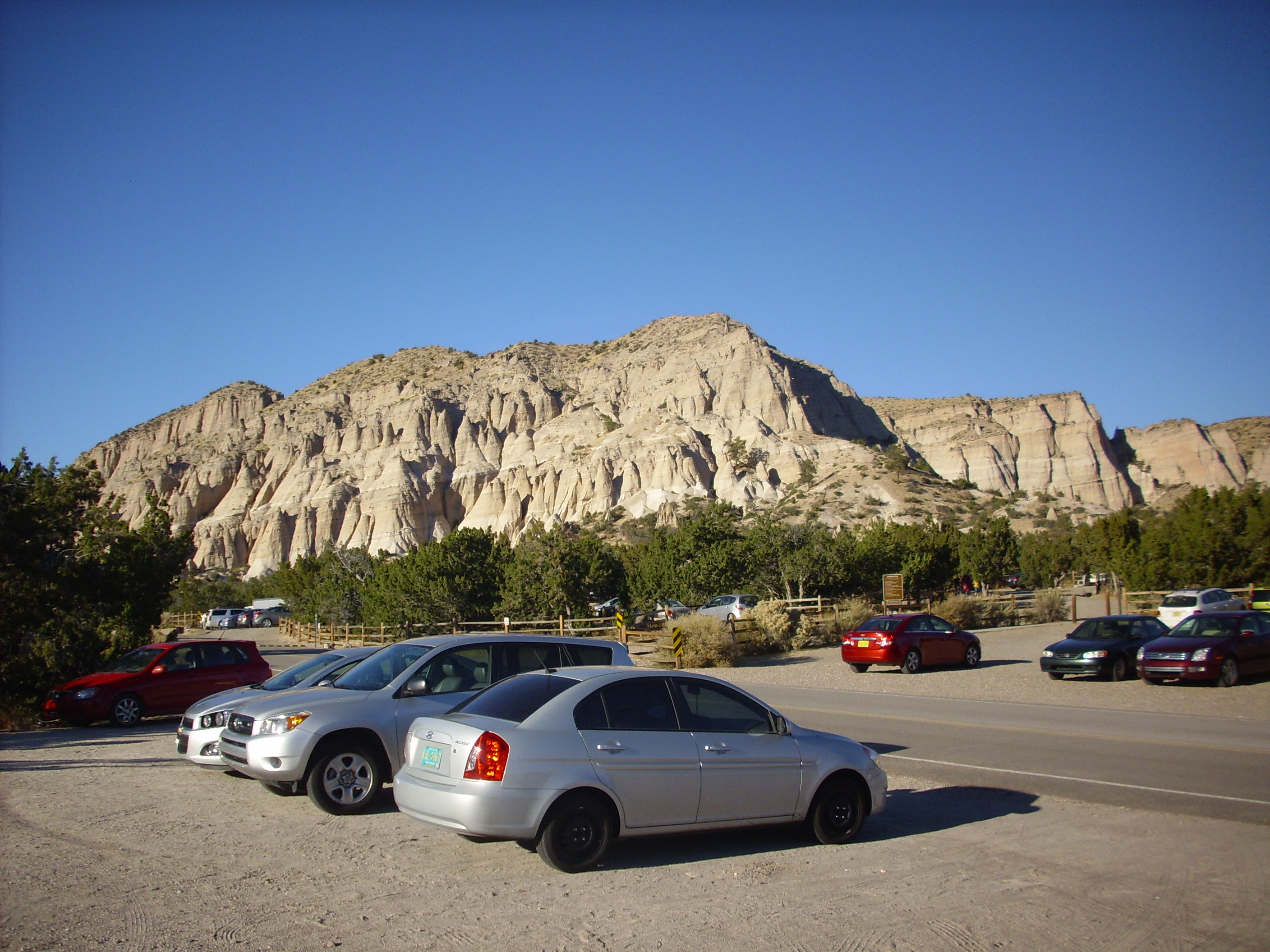
The tent rocks are eroded out of the Peralta Tuff. The Cochiti Formation forms the thin darker layer on top.
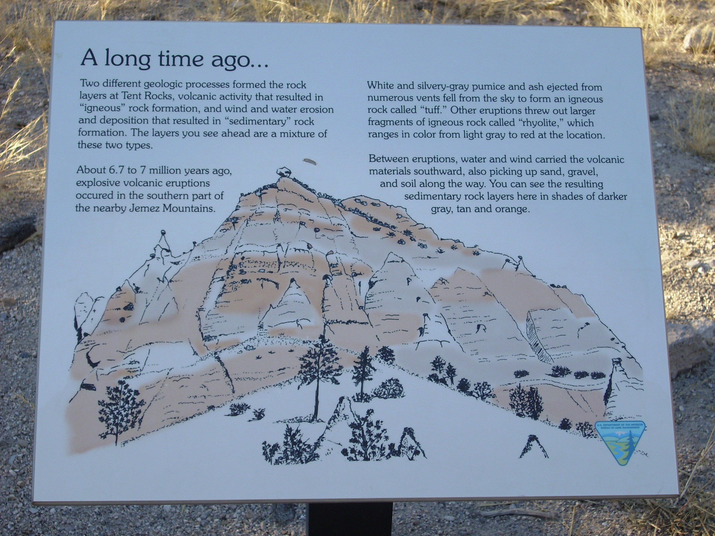
A local sign explains some of the geology. Click to enlarge.
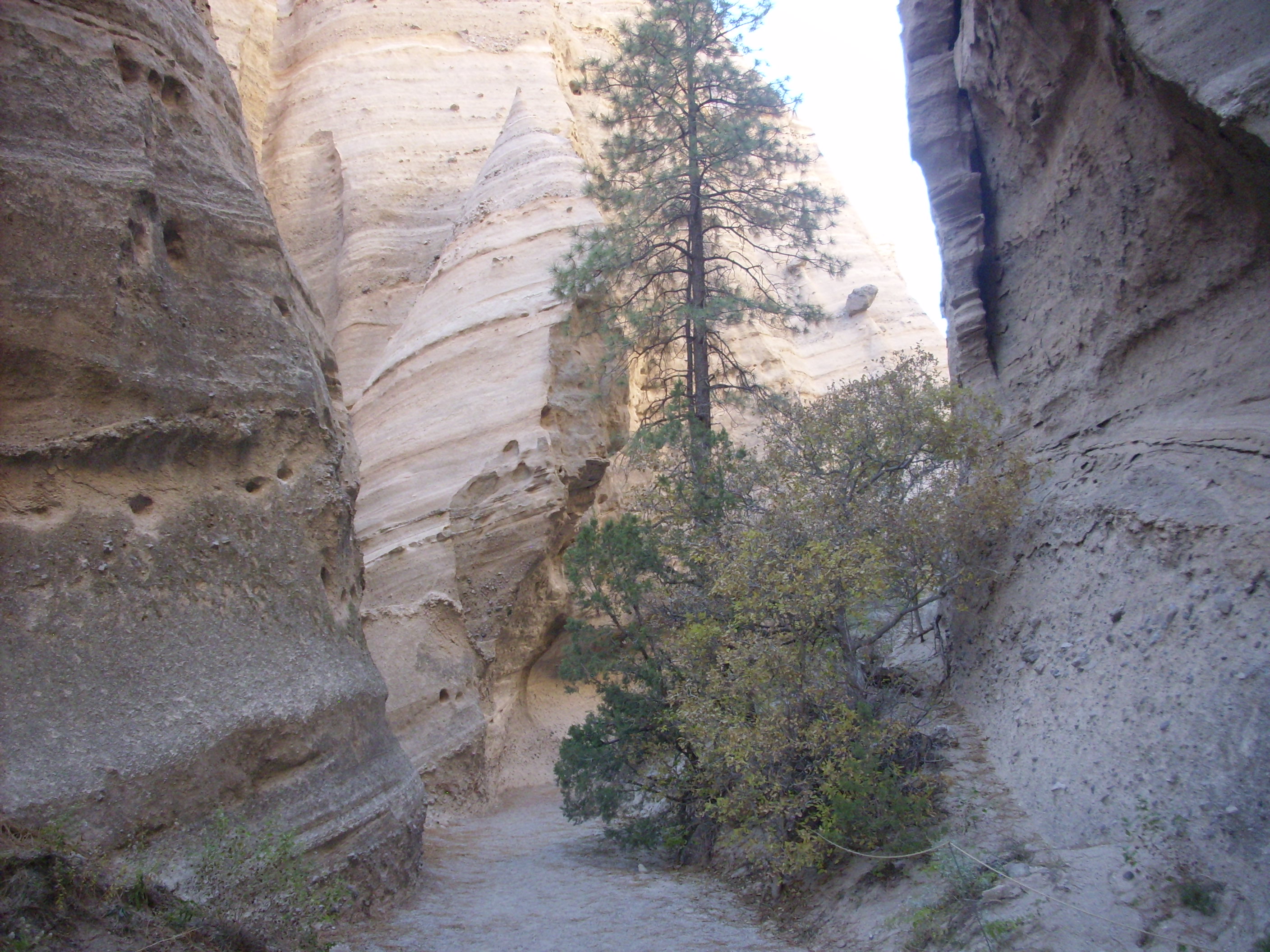
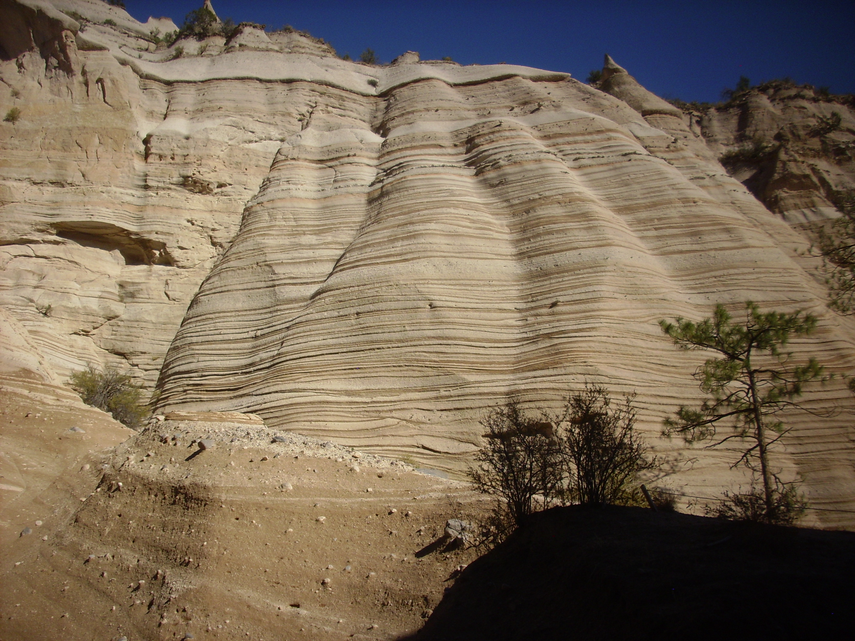
A spectacular feature of the monument is the slot canyon that has
been eroded into the Peralta Tuff. The trail to the slot canyon
first passes south of a magnificent exposure of the Peralta Tuff
in a cliff side.
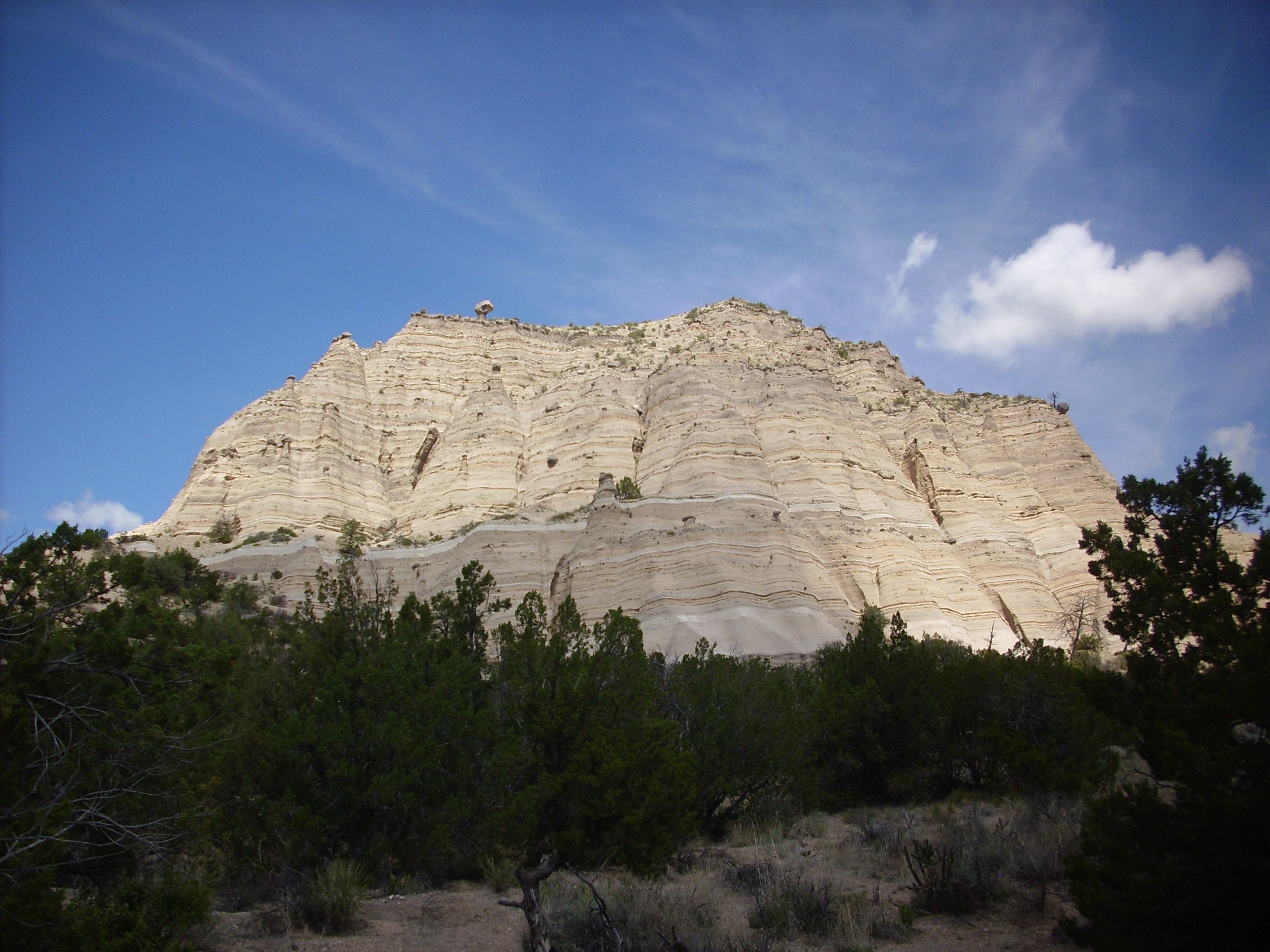
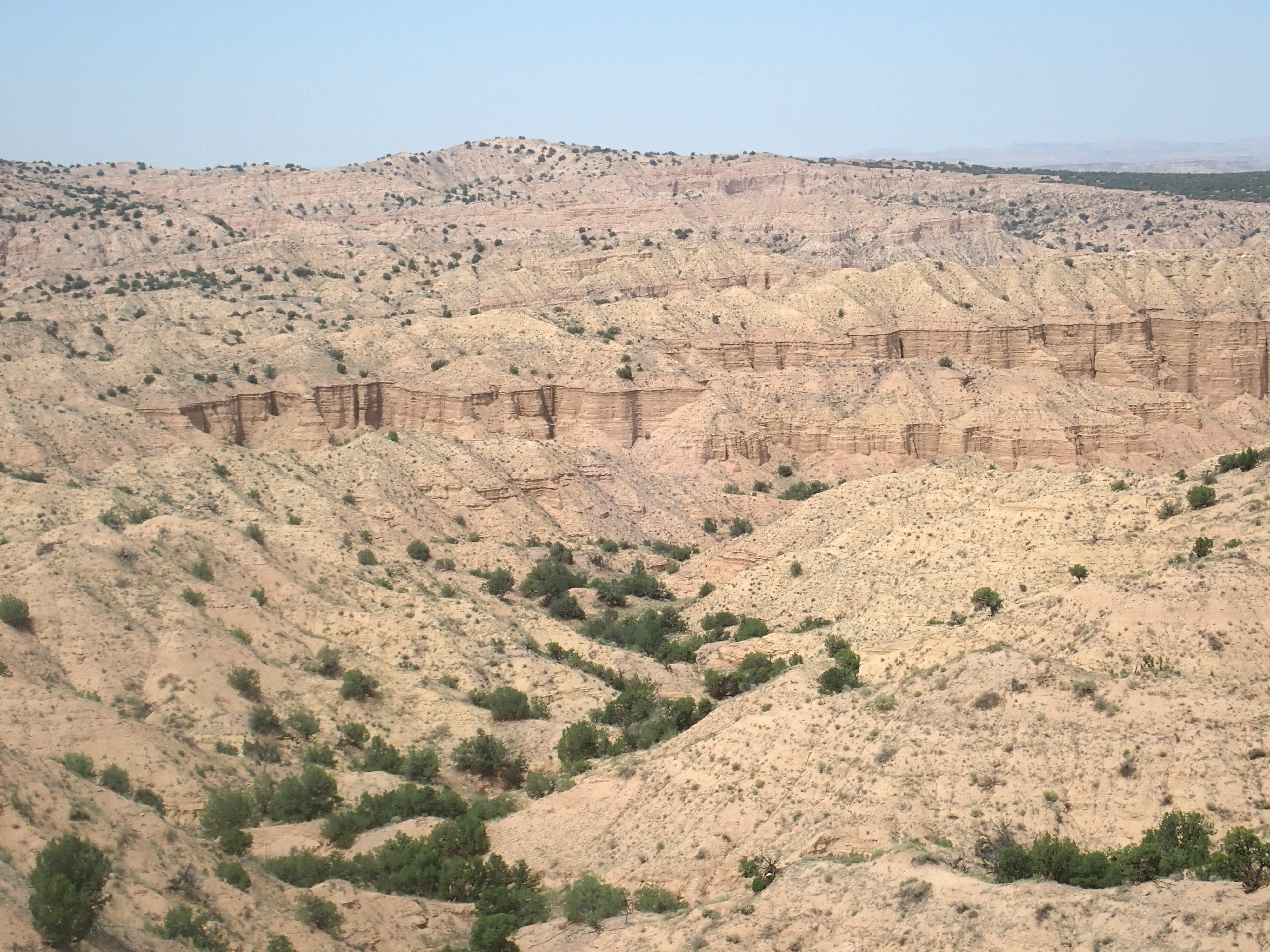
Peralta Tuff. Looking northwest from 35
39.607N 106 24.546W
Note the hoodoo atop the cliff, left of center, and the second hoodoo halfway down the cliff. (Click to enlarge.) These form when a boulder protects the softer beds immediately underneath from erosion. The darker bands are reworked beds with considerable soil mixed in, while the purer white bands are individual pyroclastic flows or ash fall beds.
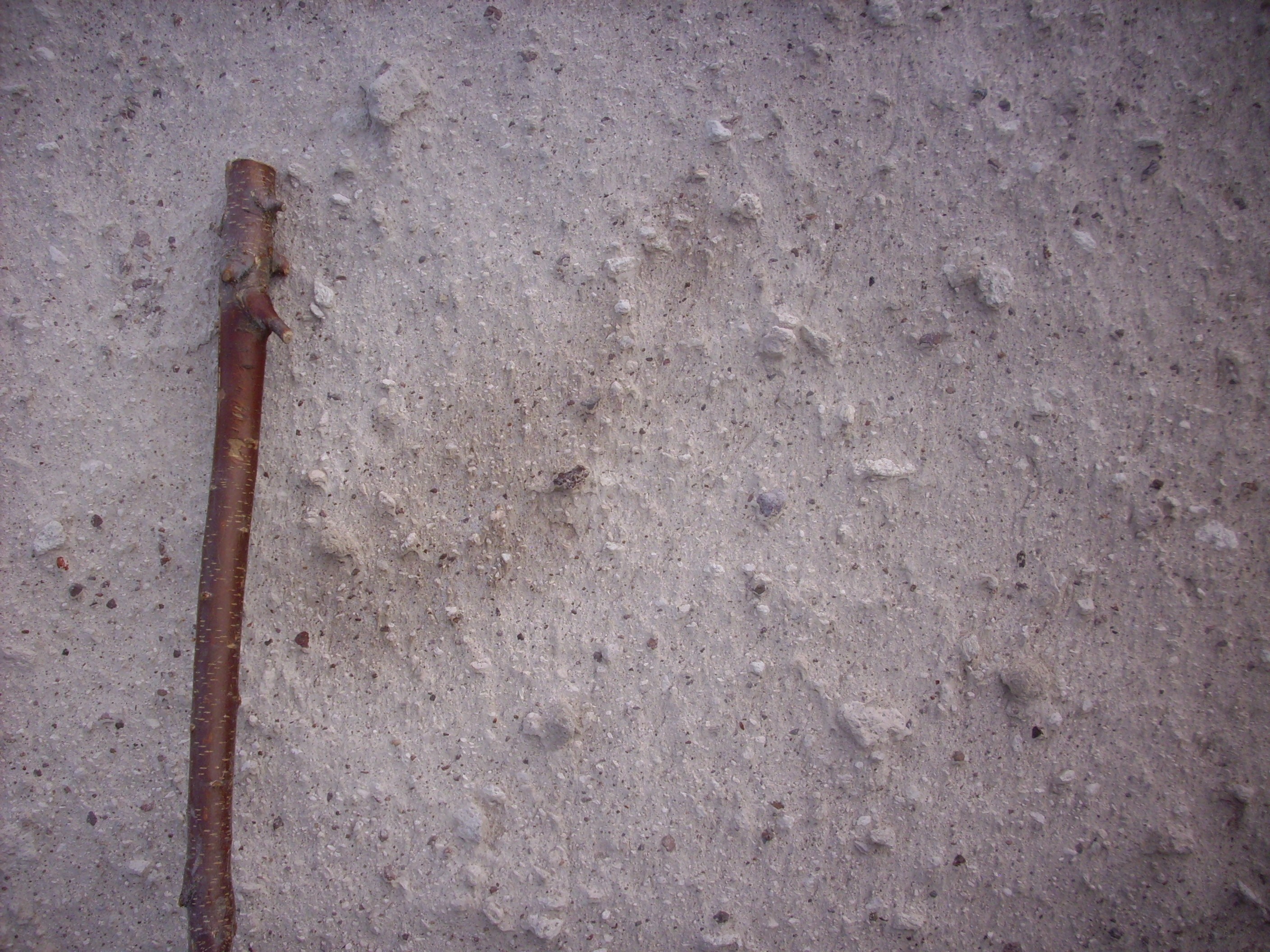
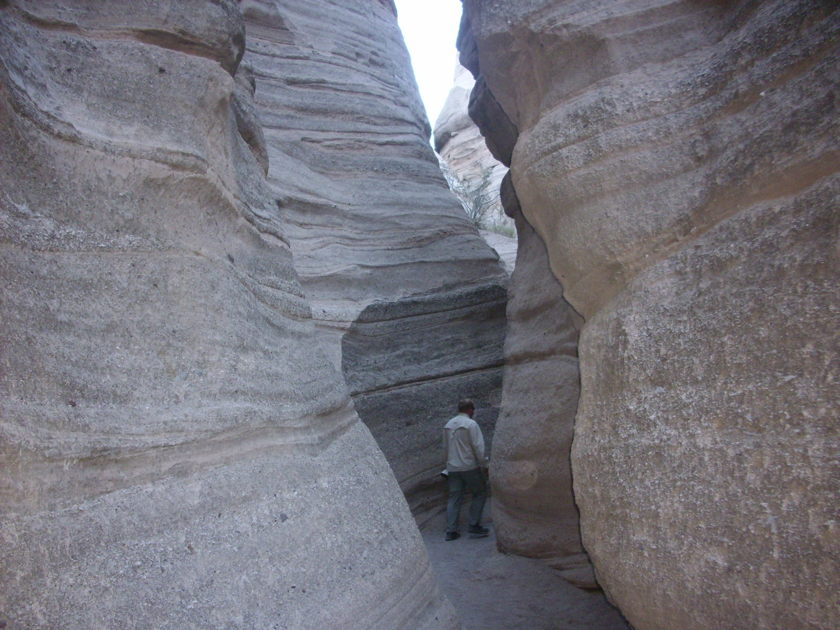
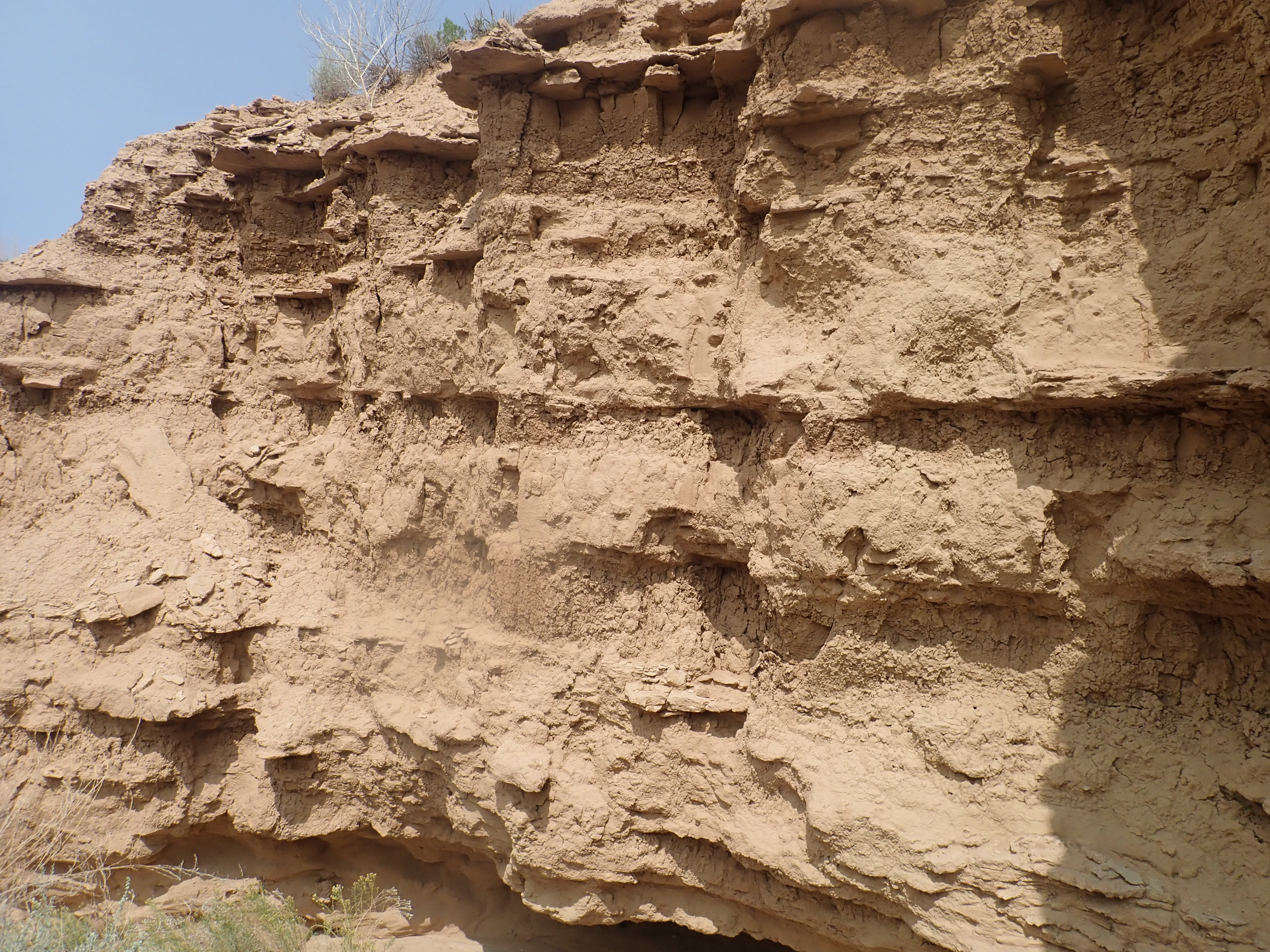
These beds are also exposed in the entrance to the slot canyon
and throughout its length.
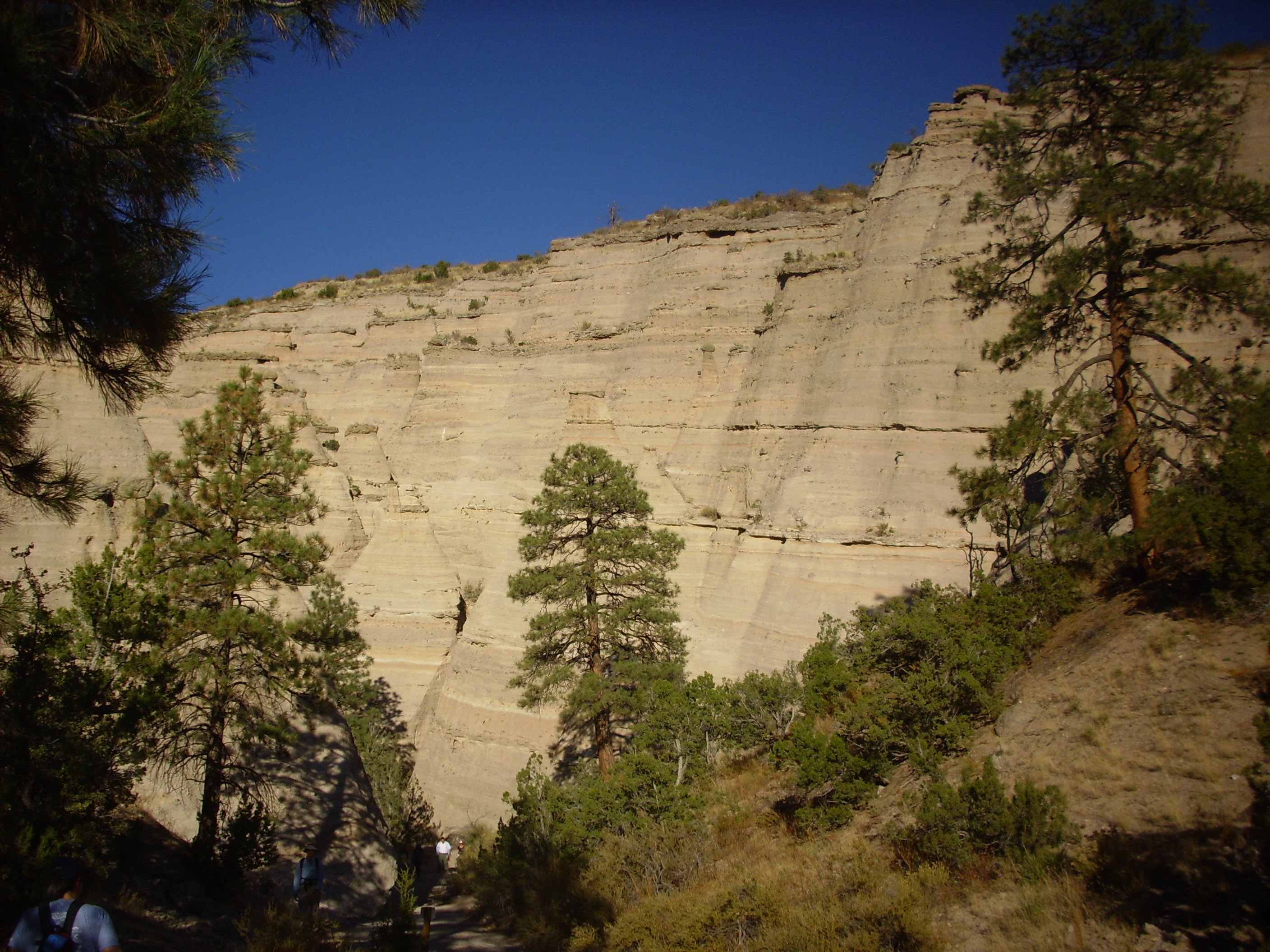
The individual beds vary in texture from very fine grained to
very coarse. The walking stick for scale is about five feet tall.
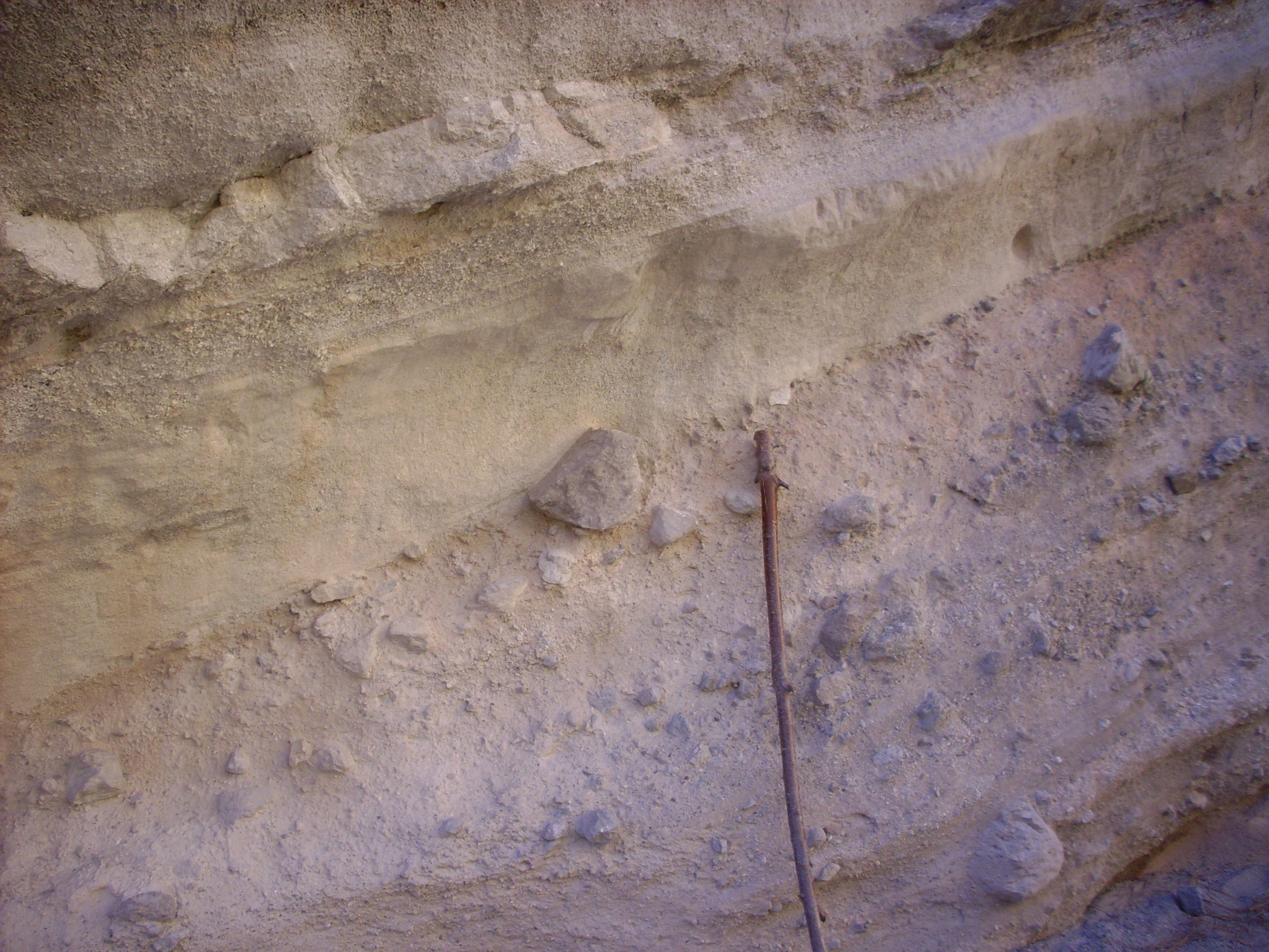
The bed towards the bottom with some very large bounders in it is
probably a lahar. Lahars tend to be very poorly sorted.
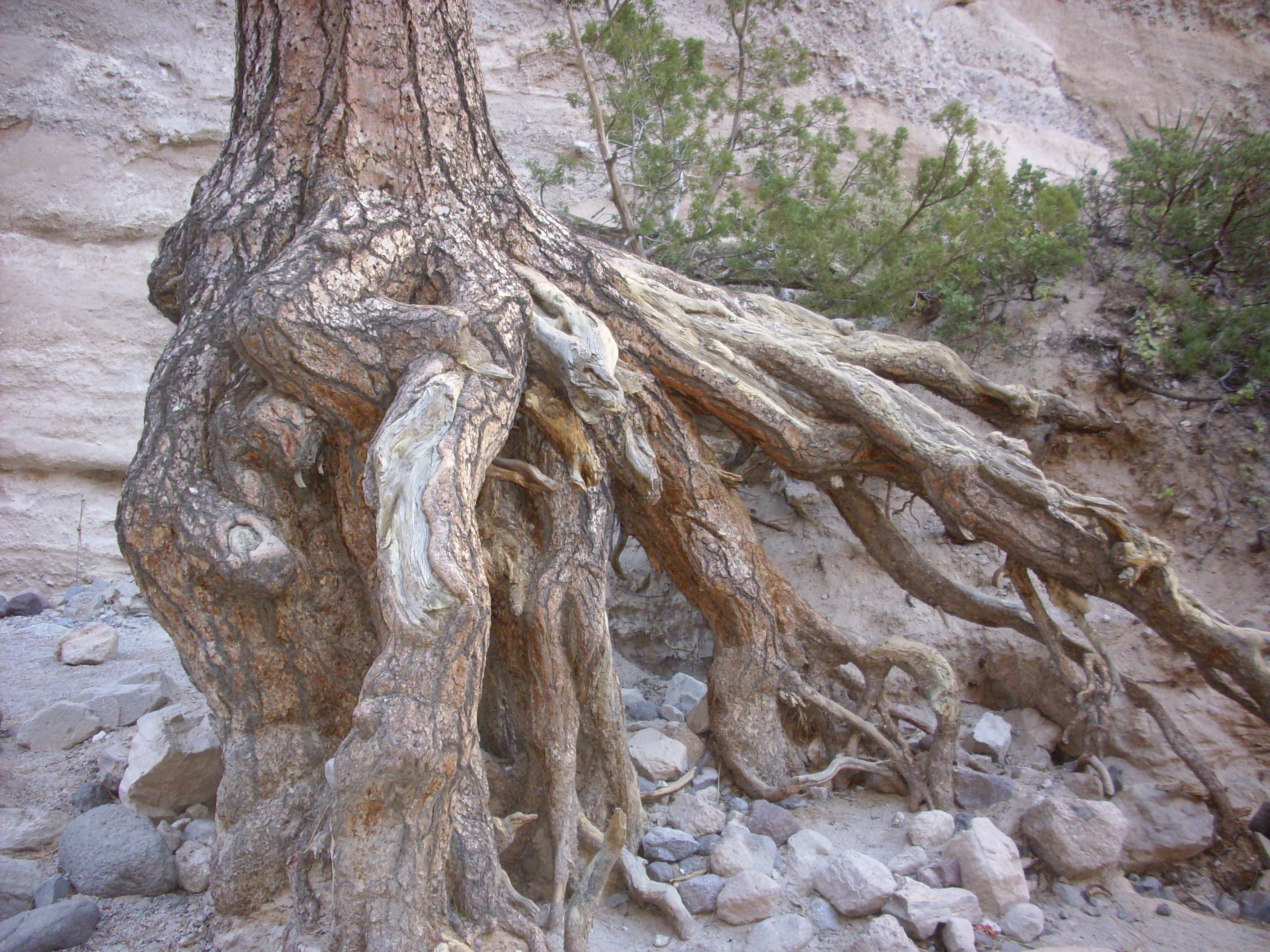
This large tree, known as "Eleanor" to the rangers assigned to
the park, looks very much as if flash floods have eroded away
several feet of soil from around the roots. A ponderosa pine can
live to be up to six hundred years old, and the tree was obviously
already large when flash flooding washed the soiil from its roots.
Erosion has therefore removed at least a foot every century. This
is, in geological terms, a tremendously high rate of erosion,
which cannot be sustained for long.
The slot canyon has a magnificent, eerie beauty.
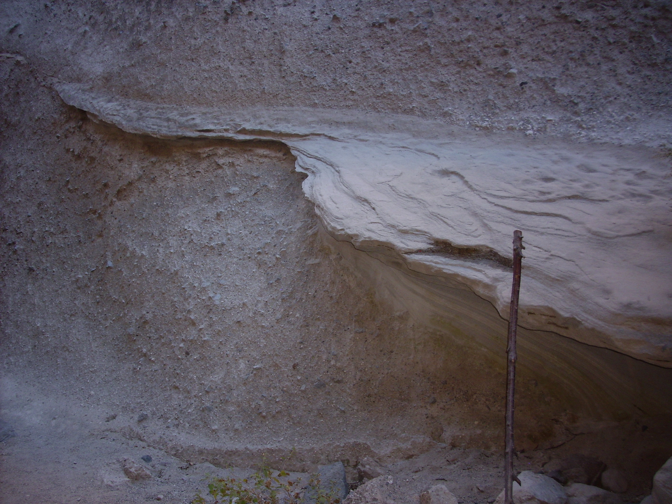
Here there is a resistant layer that has eroded out of the softer
beds above and below. This layer may be particularly rich in
volcanic ash, which provides a source of silica for cementing the
grains tightly together. Possibly this is a thin lahar flow
between pumice falls. Note again my walking stick for scale.
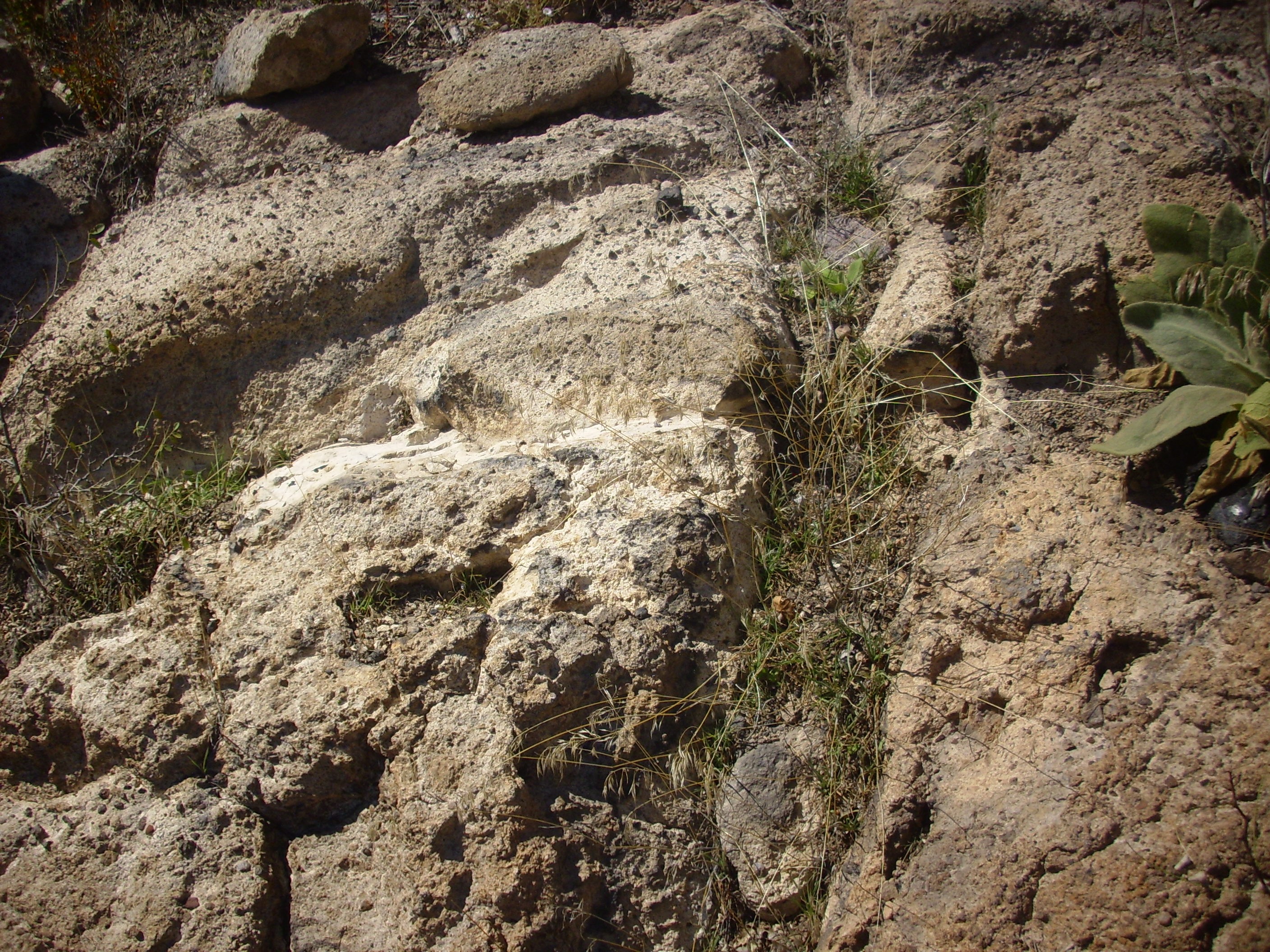
Here is a "mushroom" consisting of a resistant silica-rich bed above less resistant sediments. Much larger examples are found in the monument among the tent rocks, but this one can be examined up close.
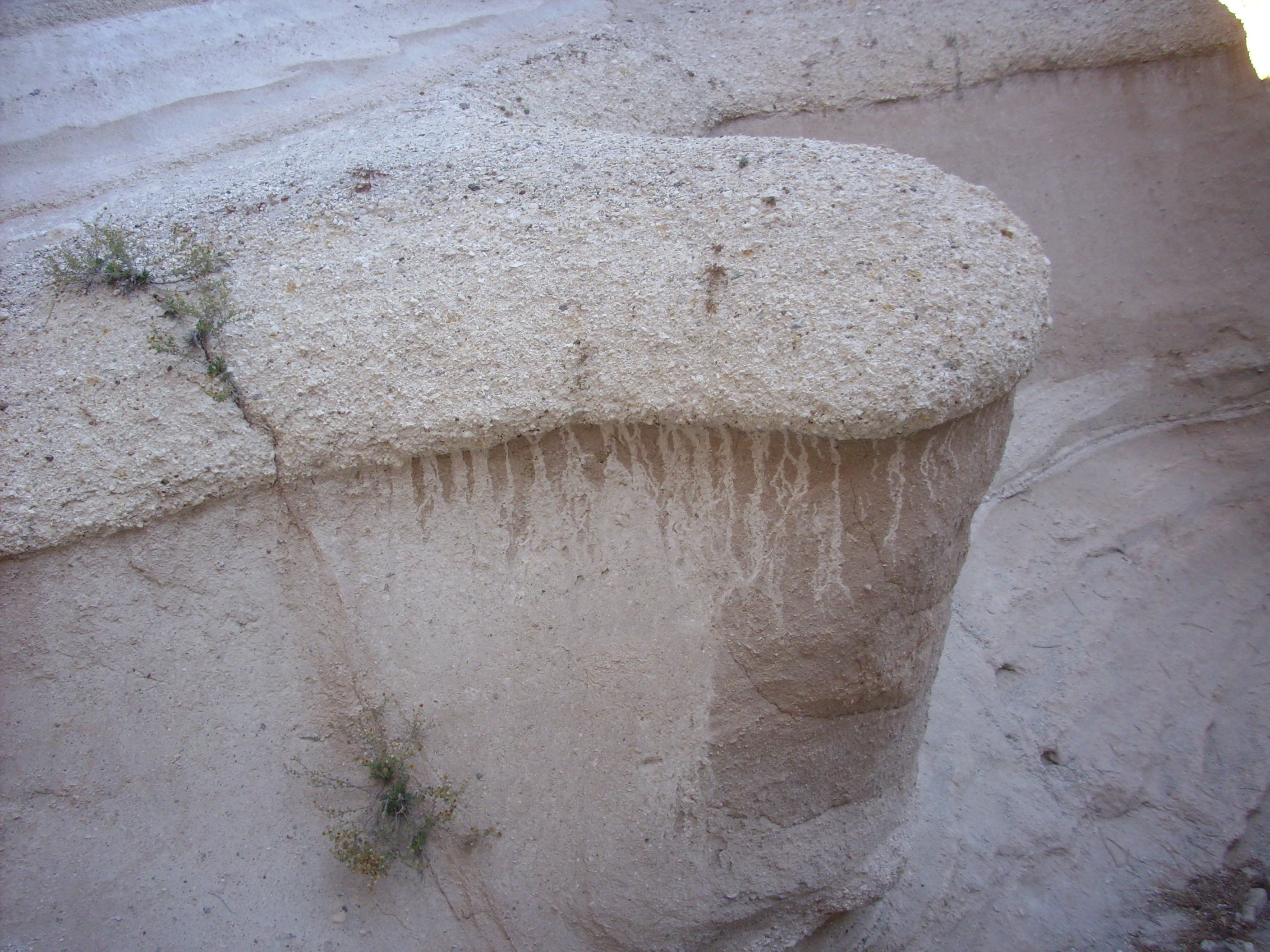
At first glance, the "mushroom" looks like a pumice bed, but on
close examination, one finds that the individual clasts are
actually bits of solid rhyolite.
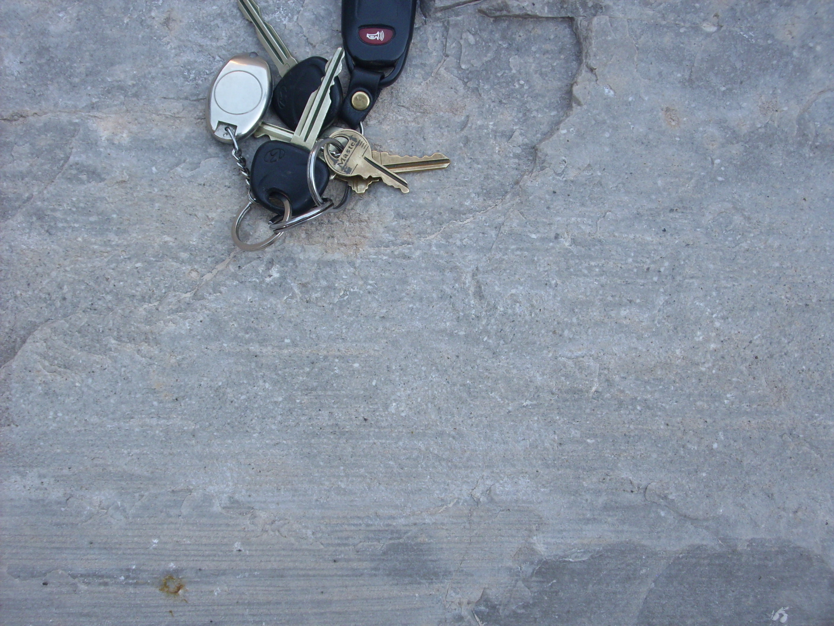
Some slabs of conglomerate on the canyon floor looked for all the
world like concrete. Concrete is, after all, artificial
conglomerate. I have sometimes mistaken heavily weathered concrete
for conglomerate in the field, and I doubt I'm the first
geologist, amateur or professional, to have done so.
Some slabs are so heavily opalized (cemented together with amorphous silica) that they are glossy in luster, and nearly as hard as quartzite.
It's even possible that this is actually a solid block of flow banded rhyolite of the Bearhead Rhyolite that has been carried into the slot canyon by a flash flood. However, the visible grains and layering suggest opalized sediment beds.
In the next photograph, recent heavy rainfall seems to have
accentuated the beds.
The beds at Kashe-Katuwe were not all laid down in a single
continuous sequence. This is demonstrated by the presence of an
angular unconformity.
Angular unconformity. Looking
north from 35.667121N
106.4100387W
Notice that the beds at the very top cut across the beds beneath along a flat surface. This angular unconformity suggests that something — perhaps an earthquake causing displacement along a nearby fault — tilted the lower beds, which were then eroded flat, and new beds were subsequently laid down at a slight angle.
The trail ascends the steep face of the canyon wall, giving a nice view back into a nest of tent rocks.
Notice the thin rim of Cochiti Formation on the far canyon wall. The distinction from the underlying Peralta Tuff is clear. We'll revisit this shortly.
The preservation of this much ash in this area is a consequence
not only of its proximity to the vents at Bearhead Peak, but of
its location between two major faults. North of Kashe-Katuwe, the
Pajarito Fault splits. One strand contnues west of Kashe-Katuwe as
a fault thrown down on the east side, like the Pajarito Fault to
the north. The other stand passes east of Kashe-Katuwe as the La
Bajada Fault, which is thrown down to the west. Kashe-Katuwe thus
lies in an area that has dropped between two faults, forming a
trap for ash and other sediments.
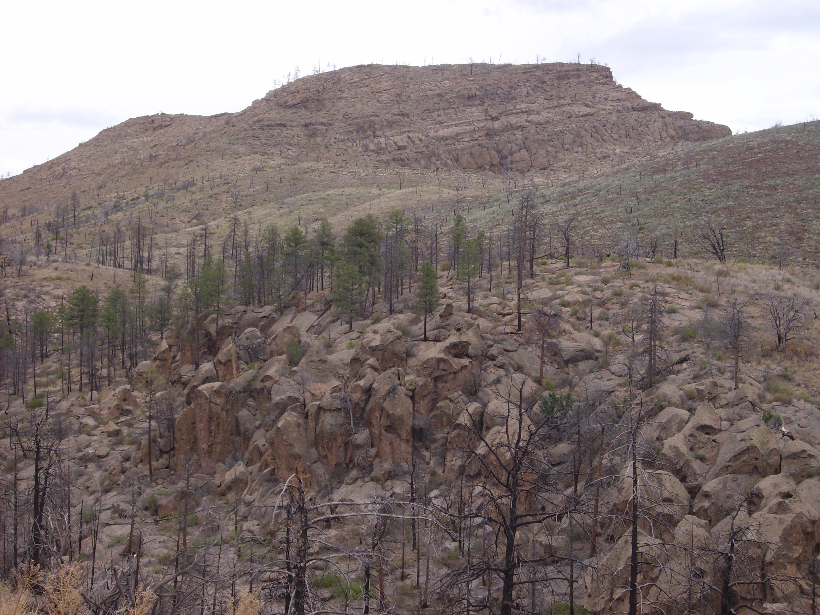
I introduced Cerro Balitas earlier, since there is hypabyssal Bearhead Rhyolite exposed on its northwest flank. The rest of the hill is underlain by Peralta Tuff showing a variety of facies.
The lower slopes of the hill on its northern flank are underlain
by younger tuff of the Tsherige Member, Bandelier Tuff.
Partway up the flank, the Peralta Tuff is exposed. It is rich in
lithic clasts, mostly of mafic rocks of the Paliza Canyon
Formation on which Cerro Balitas and its outlying flows sit.
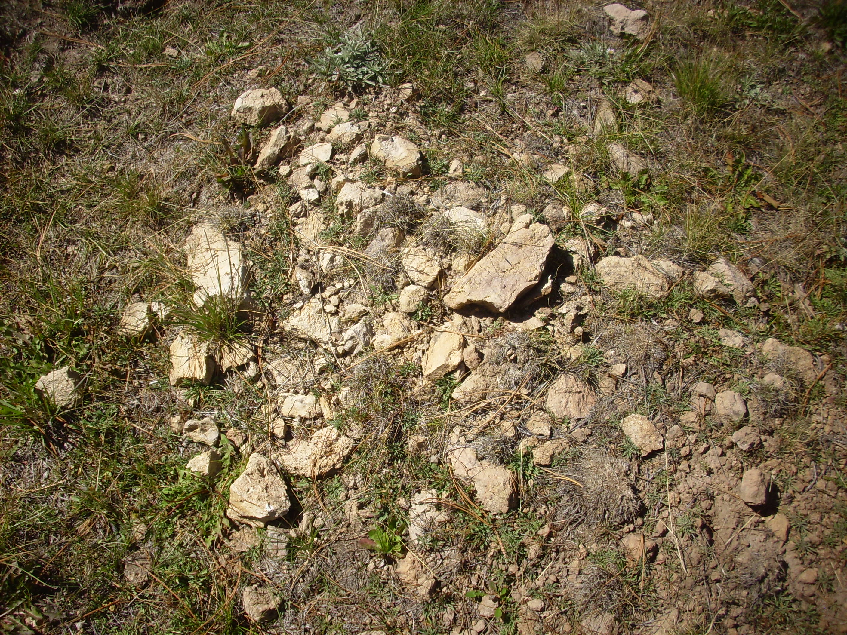
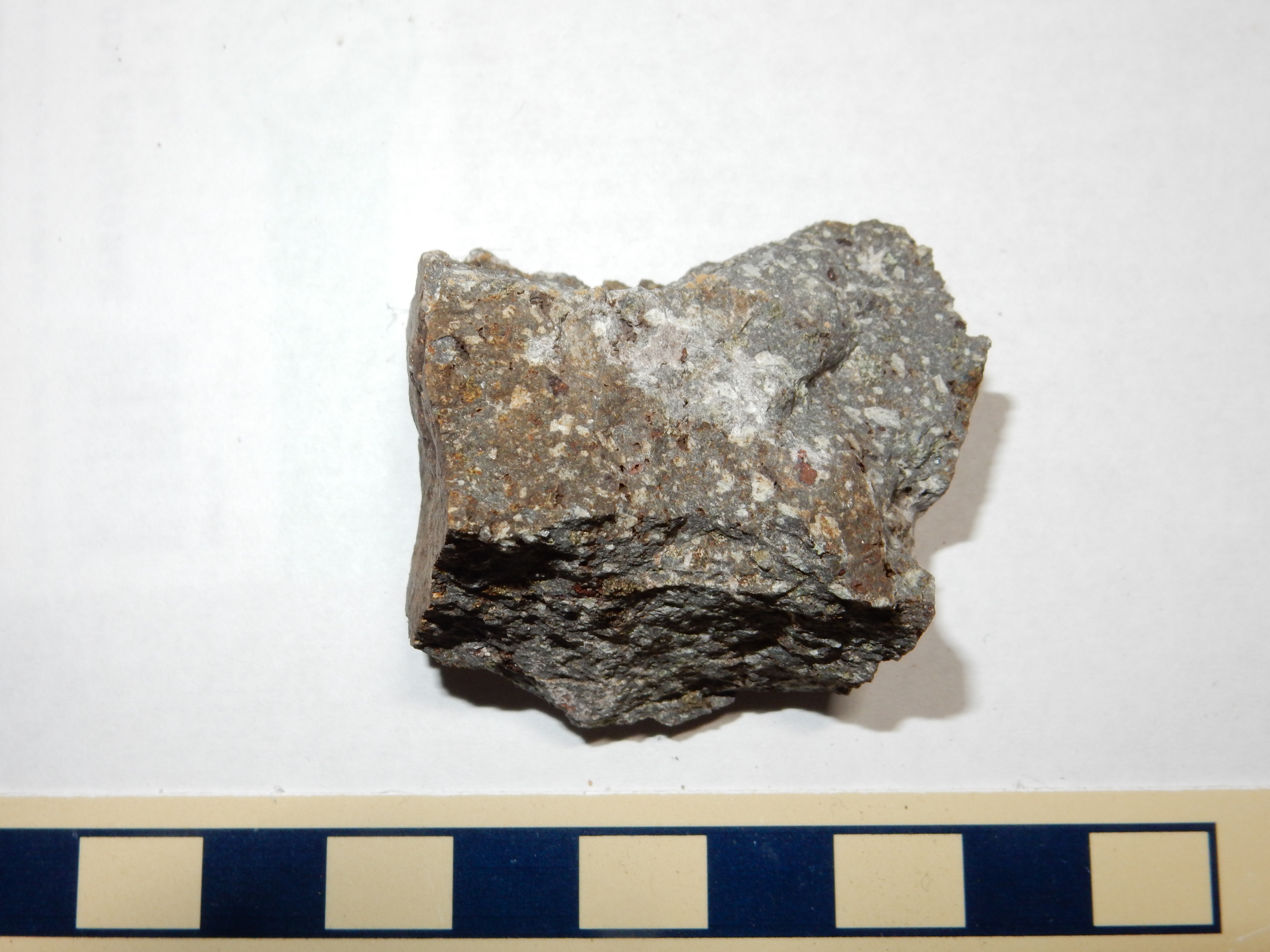
Peralta Tuff. 35
44.174N 106 24.392W
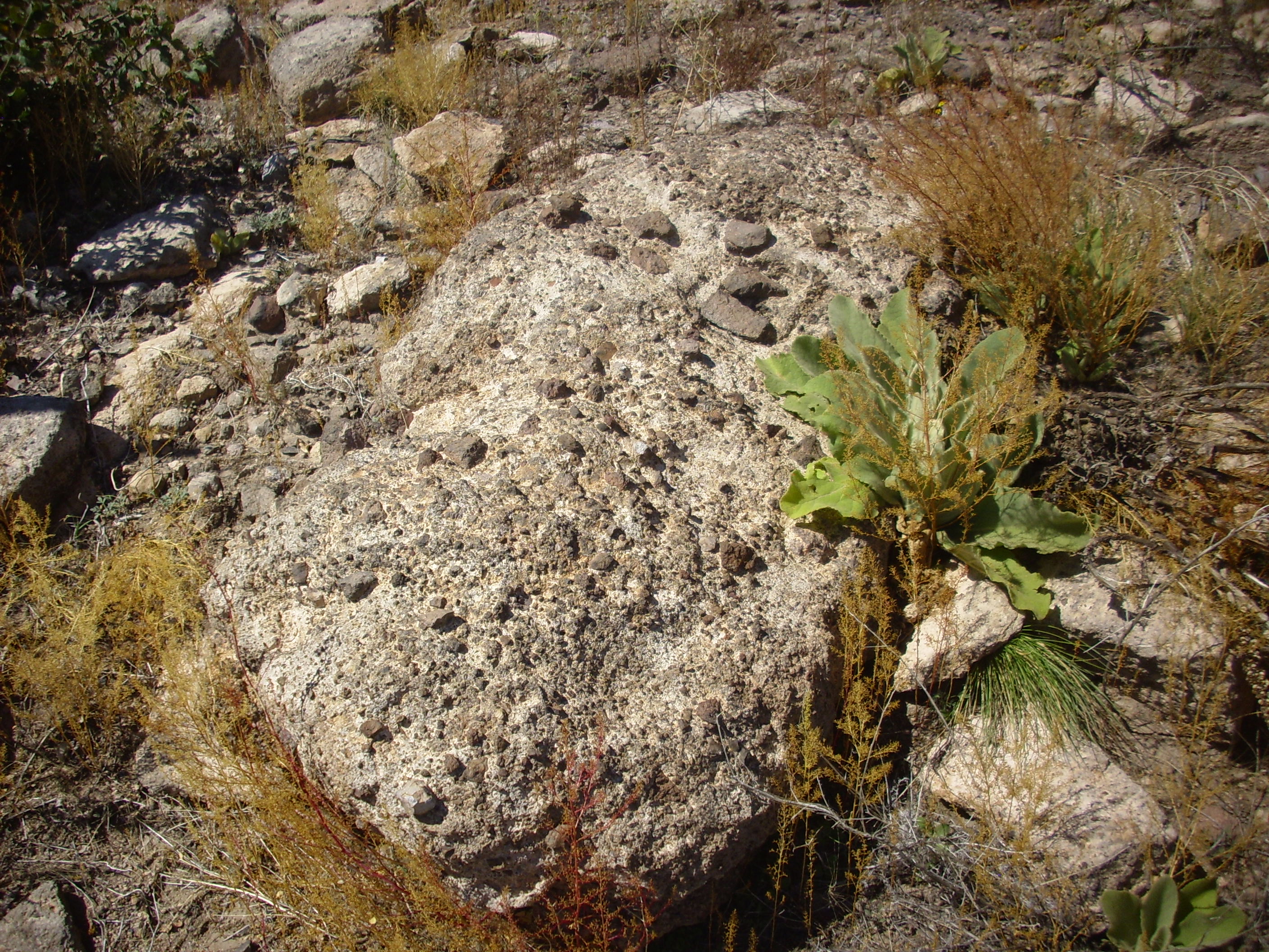
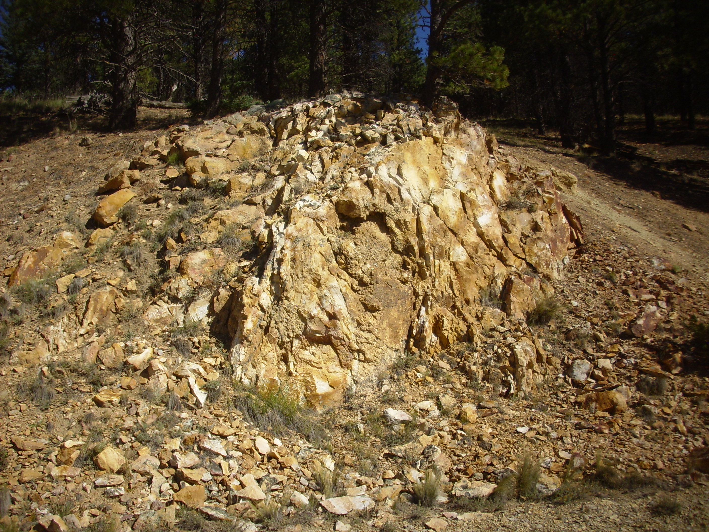
Northwest of Cerro Balitas one comes across a striking
outcropping of pyroclastic rock.

Peralta Tuff. Near 35
44.103N 106 24.007W
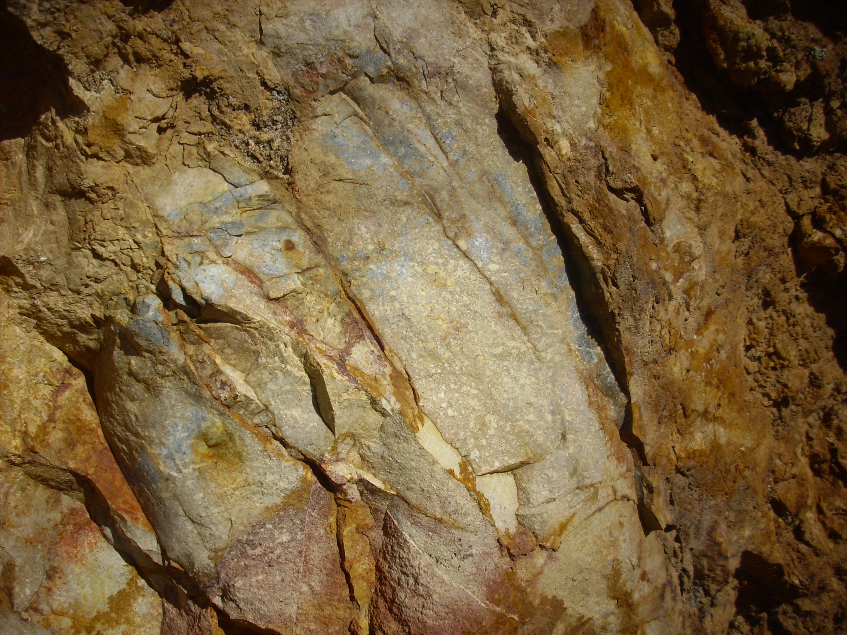
Peralta Tuff with high lithic content. Near Near 35
44.103N 106 24.007W
This is a superb example of a lapilli-tuff. A lapilli-tuff is a mixture of lapilli-sized fragments and volcanic ash. Some of the lithic clasts are football-sized:

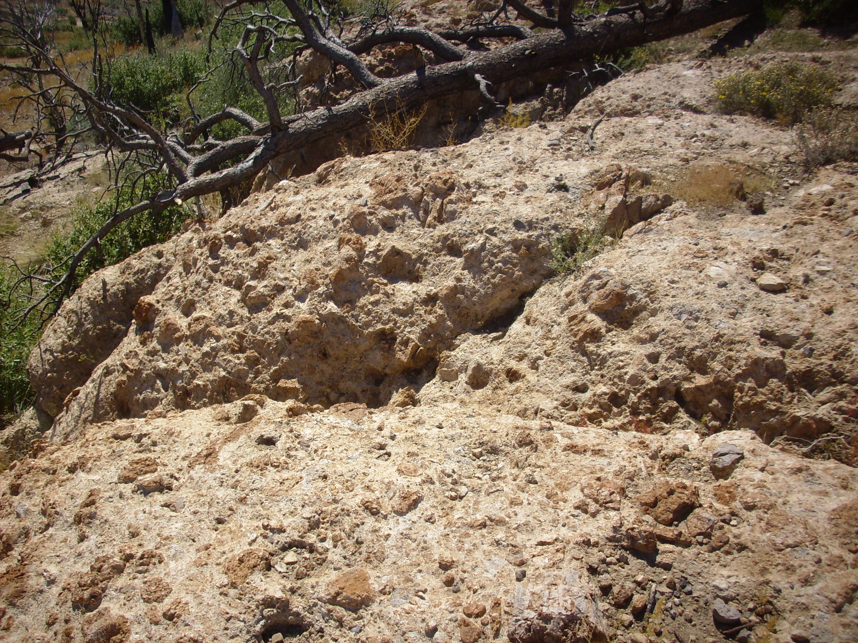
Peralta Tuff with very large lithic blocks. Near 35
44.103N 106 24.007W
The two dark rocks at lower right are actually partially embedded in the white tuff beneath them. It is an indication how energetic the eruption was that it could sweep up such large blocks and carry them along.
Peralta Tuff with coarse lithics. Near 35
44.103N 106 24.007W
This rock contains fragments almost large enough to qualify it as
a pyroclastic breccia. It resembles a conglomerate, but cemented
by red-hot ash rather than minerals brought in by ground water.
Peralta Tuff. Near 35
44.103N 106 24.007W
Lapiilistone. 35
43.967N 106 23.945W
This is so dominated by lapilli-sized fragments that it
qualifies as a lapillistone.
Further down the flow, the nature of the pyroclastic rock changes
in another way.
Block and ash flow. Near 35
43.967N 106 23.945W
This is also a lapilli-tuff, but the bits of rock appear to be composed of Bearhead Rhyolite, like the ash itself, rather than Paliza Canyon Formation, as in the earlier examples. This is very likely an example of a block and ash flow, typically of high-silica volcanism. Magma this viscous tends to dome up rather than flow away from the vent. Such domes can become hundreds of meters high. When the face of a dome becomes steep enough, the solid outer crust can collapse, exposing the gas-rich liquid magma within. This explodes into red-hot volcanic ash, which mingles with the fragments of the solid outer crust to produce a flow like the one here. The mechanism is a little like the famous eruption of Mt. St. Helens, but on a much smaller scale. Or you can think of the famous eruption of Mt. St. Helens as the Mother of All Block and Ash Flows. I'm easy.
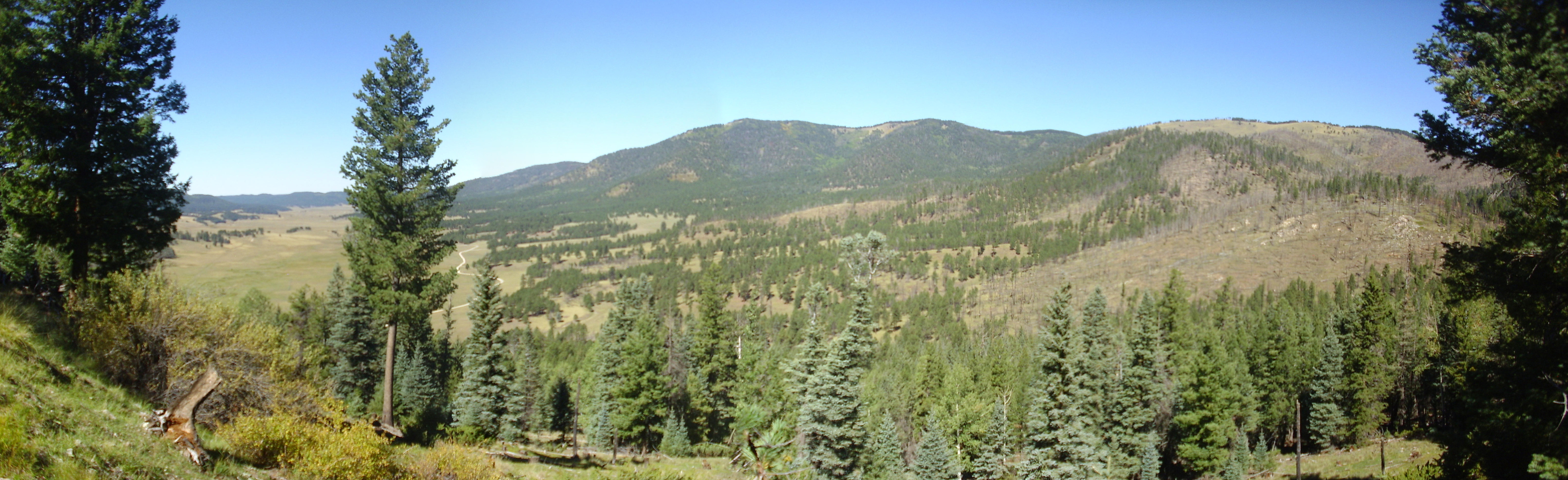
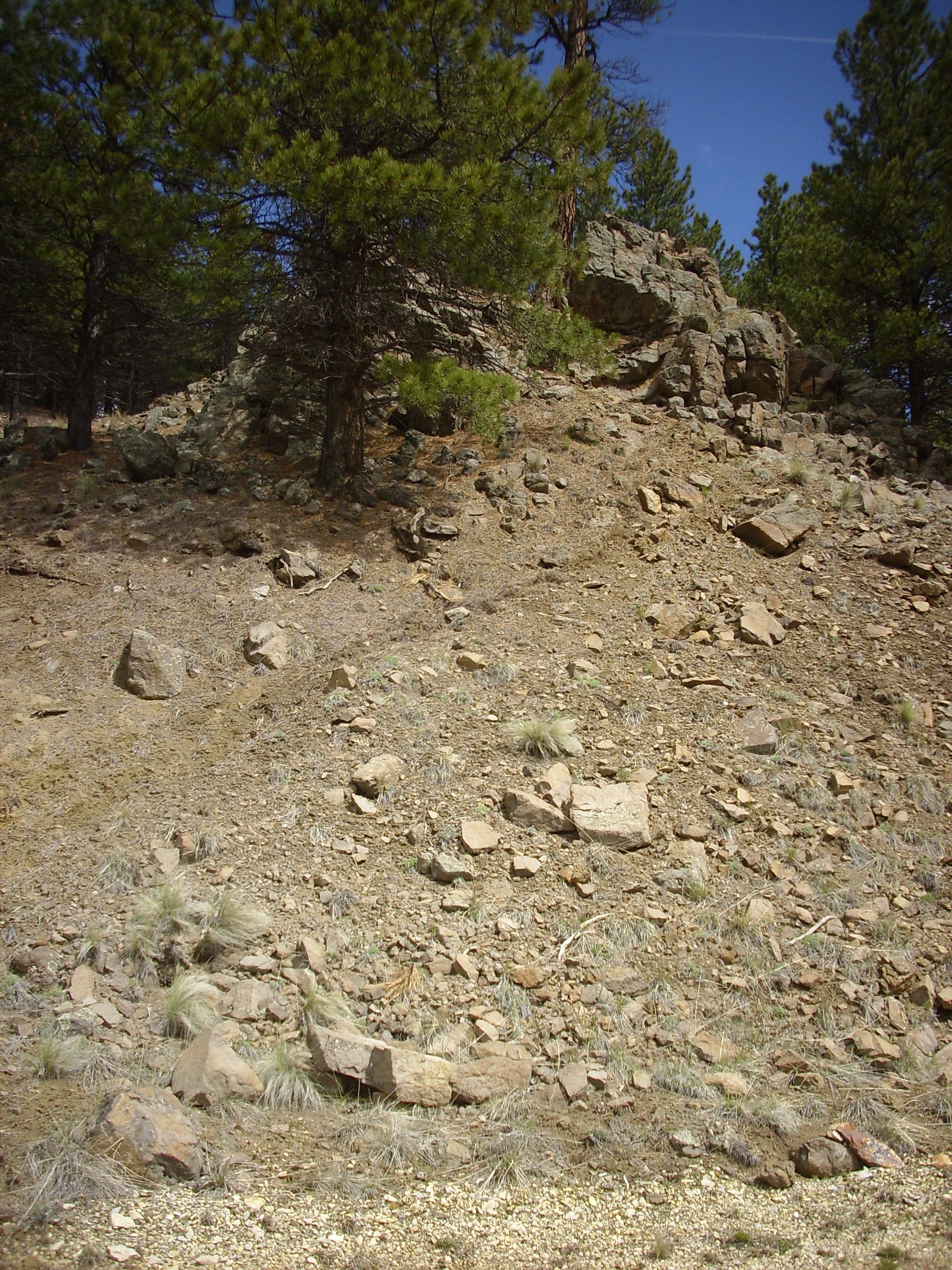
Here is a panorama of Cerro Balitas seen from the southeast.

Southeast flank of Cerro Balitas. 35
43.837N 106 23.706W
Notice that the thin tuff beds at the head of the small canyon dip fairly steeply to the southwest (left) but the beds beyond, on the far side of the canyon and in Cerro Balitas itself, are level. It's hard for me to imagine that there isn't a fault running down the canyon, but the only fault mapped in this area is just over the ridge on the far side of the canyon. Go figure.
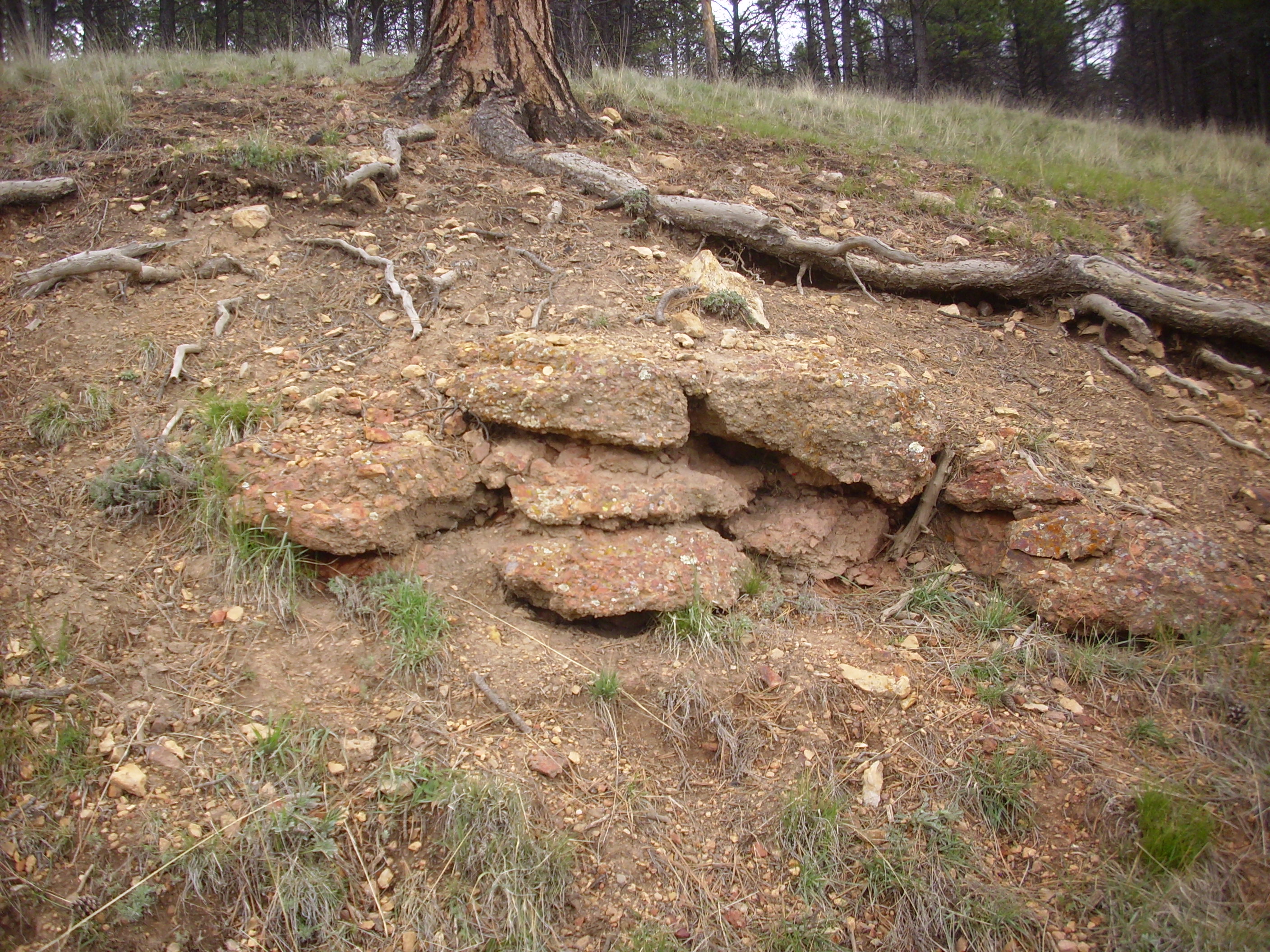
More block and ash flows.
Block and ash flow on southeast flank of Cerro Balitas.
35
43.837N 106 23.706W
Block and ash flow on southeast flank of Cerro Balitas.
35
43.754N 106 23.614W
The southeast face of the flow is fairly steep , resembling a
high-aspect flow. However, this steep face is most likely an
erosional feature.

Southeast end of Cerro Balitas tuff beds. Looking
northwest from near
35 43.501N 106 23.273W
The flow includes some surge beds.
Surge beds. 35
43.546N 106 23.394W
Surge deposits are common at the start or the end of a tuff
eruption. They differ from ordinary pyroclastic flows in that they
are thinly bedded and well sorted, and likely formed from a
mixture of gas and particles that was richer in gas than the main
body of the flow. The particles are kept suspended by the
turbulence in the flow more than by their own emission of gas.
Such flows are relatively low in density and are more likely to
cross topographic barriers than ordinary pyroclastic flows.
This deposit was located towards the top of the ridge, rather
than at its base. It is clear that the ridge was formed by
multiple flows, and not a single eruptive episode, with these beds
likely marking the base of an individual flow.
The upper slopes of Cerro Balitas are a difficult climb, but some
boulders detached from the upper slopes are more accessible. These
prove to be similar to the lapilli-tuff we've seen earlier.
Tuff boulder. 35
44.050N 106 24.097W
Cerro Balitas is thus a knob of pyroclastic rock surrounded by pyroclastic rock, except for the outcrop of solid hypabyssal rhyolite around the northwest flank. This may be the actual eruptive center, which has mostly eroded away, leaving Cerro Balitas as a remnant.
Cerro Picacho is similar to Cerro Balitas in being composed of Bearhead Rhyolite with ash flows extending to its south and east. However, the dome itself appears to be solid rhyolite rather than rhyolite tuff.
The area immediately south of Cerro Picacho has been eroded into a canyon.
Canyon south of Cerro Picacho. 35 736N 106 377W
The rim in the foreground and to the left is Peralta Tuff. The white exposures deeper in the canyon are underlying Canovas Canyon Formation. This has been dated as over 12 million years old, but the radiometric dating has been questioned, and the beds are likely somewhat younger.
The far canyon rim is Paliza Canyon Formation olivine andesite.
Over geologic time scales, it is almost inevitable that groundwater will react with the rocks through which it passes, altering the chemistry of both. Where the water is cool and relatively pure and the flow rate is modest, such reactions will be slow, but when the water is hot, acidic, and constantly flowing, the reactions will be relatively fast and dramatic. This results in hydrothermal alteration of the rock. Geologists recognize many forms of hydrothermal alteration, depending on the temperature and chemistry of the water.
In many places, the Paliza Canyon Formation shows hydrothermal
alteration that appears to be associated with the eruption of the
Bearhead Rhyolite. For example, here's an outcropping of Paliza
Canyon Formation andesite at the base of the Valles caldera north
rim, close to where we saw our first outcrop of Bearhead Rhyolite
in the northern caldera.

Hydrothermally altered andesite. 35
58.310N 106 31.102W
Just a short distance along the road to the east is a sizable
fault. The rocks immediately around the fault have been bleached
white by hydrothermal fluids circulating through the fault.

Fault zone. 35.9721432N
106.5195776W
The fault runs along the far side of the mass of whitish rock in the bend of the road at far left. This contrasts with the darker rock at right. The latter is a Paliza Canyon Formation biotite dacite:
Here is the mass of white rock just east of the fault.
At first glance, this looks like a rhyolite. A closer reveals the
ghostly remnants of feldspar crystals.
This is actually biotite dacite that has been bleached by hot, acidic fluids flowing along the nearby fault. The feldspar has been converted largely to clay minerals. On the west side of the fault:
The fault trace is visible to the right of the outcrop. The rock here is Paliza Canyon Formation andesite that has also been hydrothermally altered.
Unaltered versus hydrothermally altered andesite. 35
58.310N 106 31.102W
The dark rock at the top is unaltered andesite, while chunks of
altered andesite litter the slope under it.
It is no coincidence that hydrothermally altered rock is found in
the same part of the caldera north rim as intrusions of Bearhead
Rhyolite. This is an area where part of the Bearhead
Rhyolite Batholith is close to the surface. During crystallization
of a batholith, a great deal of volatiles (water vapor with many
different dissolved gases, including acid sulfur oxides) is
"sweated" by the solidifying magma. This can do weird and
wonderful things to the overlying rock.
In the case of the rocks found here, the hydrothermal fluids were both hot and highly acidic, and their effect was to leach sodium and potassium out of the rock, converting most of the feldspar to clay minerals. Ferrous iron was oxidized as well, producing the reddish staining.
A little further to the east is another example of hydrothermally
altered rocks.

Hydrothermally altered outcrop. 35
58.628N 106 30.334W
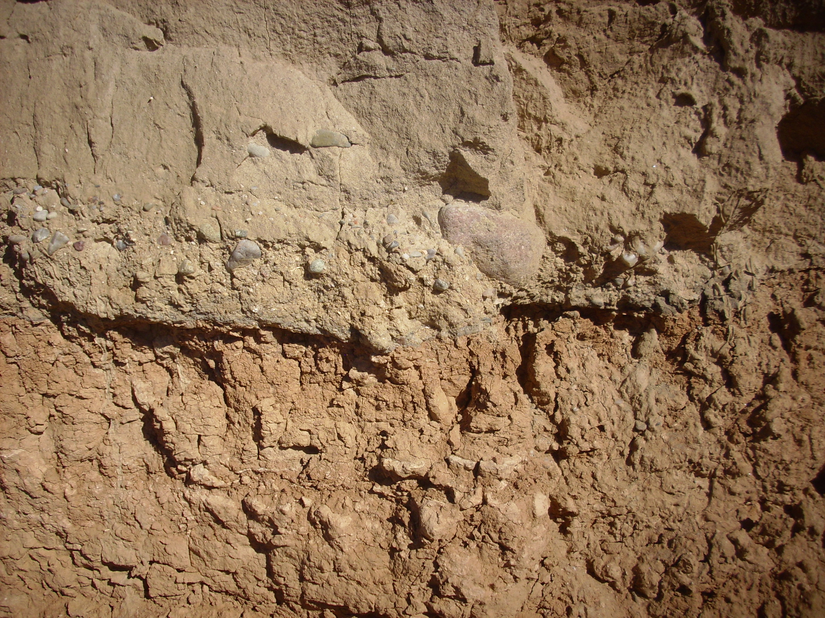
Close up of hydrothermally altered conglomerate. 35
58.628N 106 30.334W
Part of the outcropping is a coarse conglomerate containing
angular fragments that cannot have come far from their source.
These are embedded in a matrix of equally granular sand grains
that are cemented together with silica and hematite. (The hematite
is responsible for the orange color.) This marks the western
margin of the Santa Fe Group rift fill sediments of the Toledo
reentrant, which is pervasively altered.
Next to the conglomerate is a knob of volcanic rock so altered
that its original type is uncertain. It could be anything from
Paliza Canyon andesite to a local intrusion of the Bearhead
Rhyolite.
Close up of hydrothermally altered volcanic rock. 35
58.628N 106 30.334W
Another heavily altered outcrop is likely Bearhead Rhyolite.
Altered Bearhead Rhyolite. 35
58.517N 106 30.417W
Or, at least, I think this
is Bearhead Rhyolite. Even rocks with very different origins can
be difficult to distinguish in the field once they’ve been boiled
in acid for tens of thousands of years.
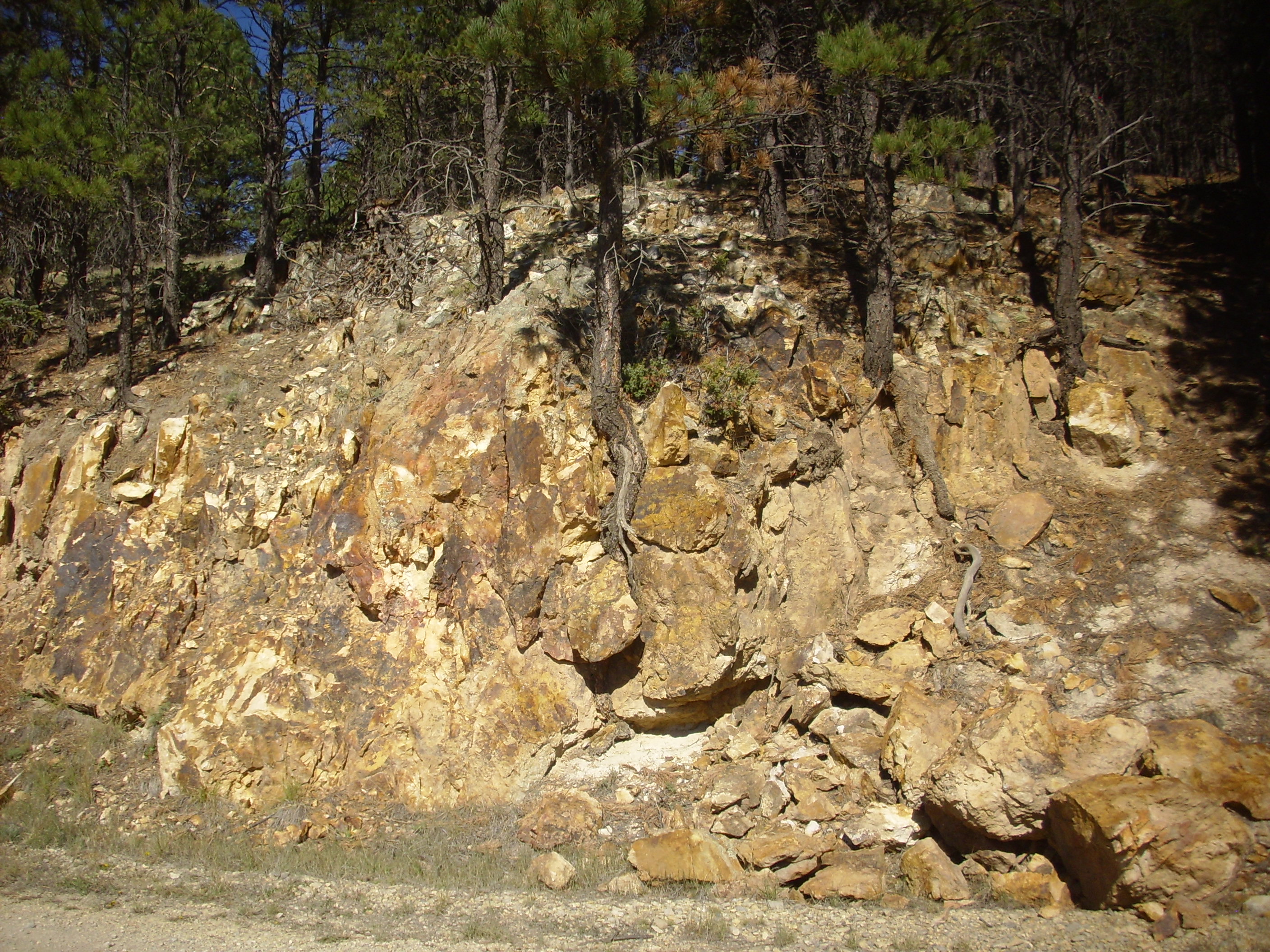
Hydrothermal alteration is pervasive in the Bland area south of the caldera, but extends north to the southern caldera wall. There are outcrops of altered dacite south of Rabbit Mountain along a southern spur of Forest Road 36.
Hydrothermally altered dacite. 35
49.299N 106 28.299W
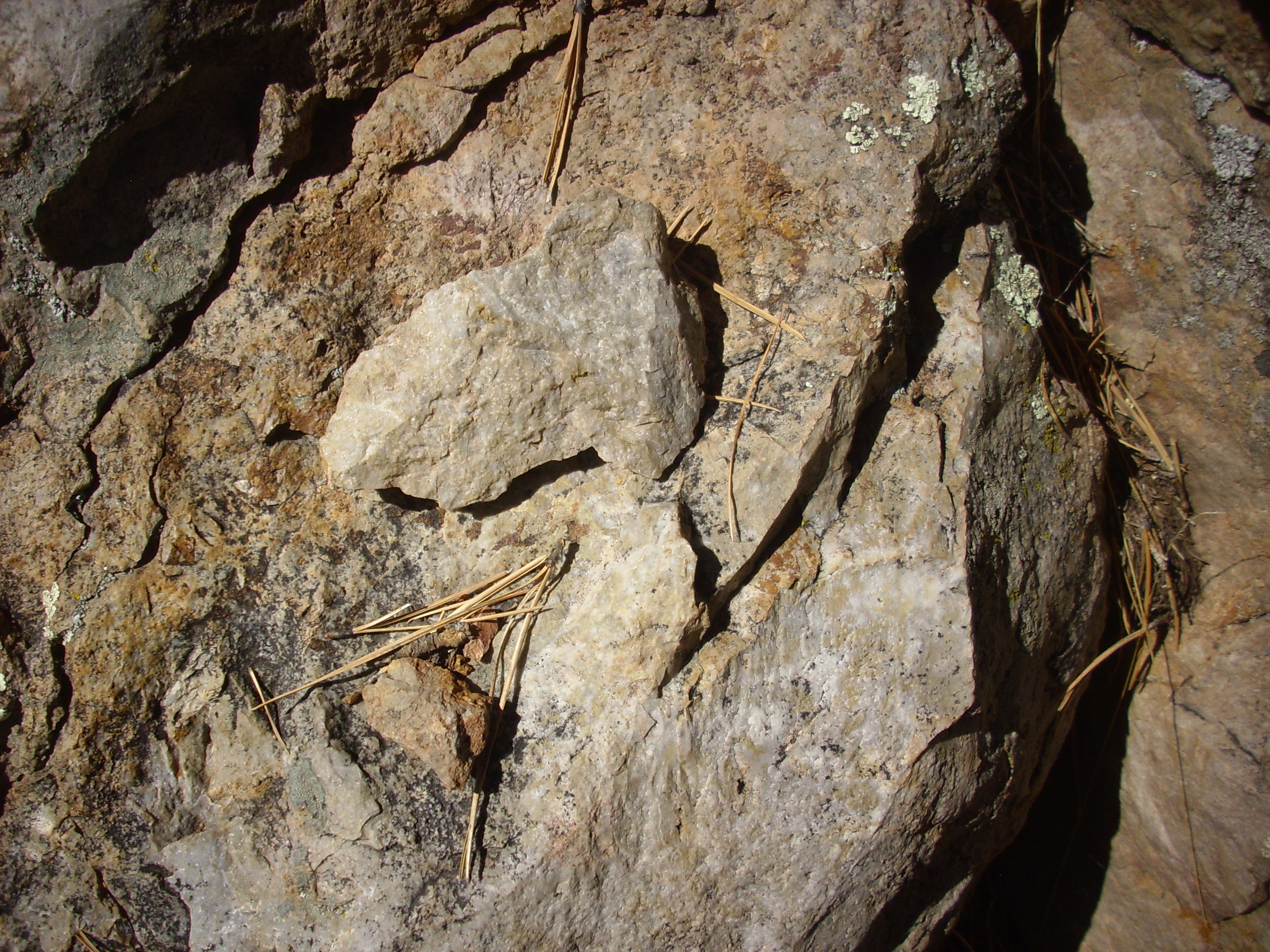
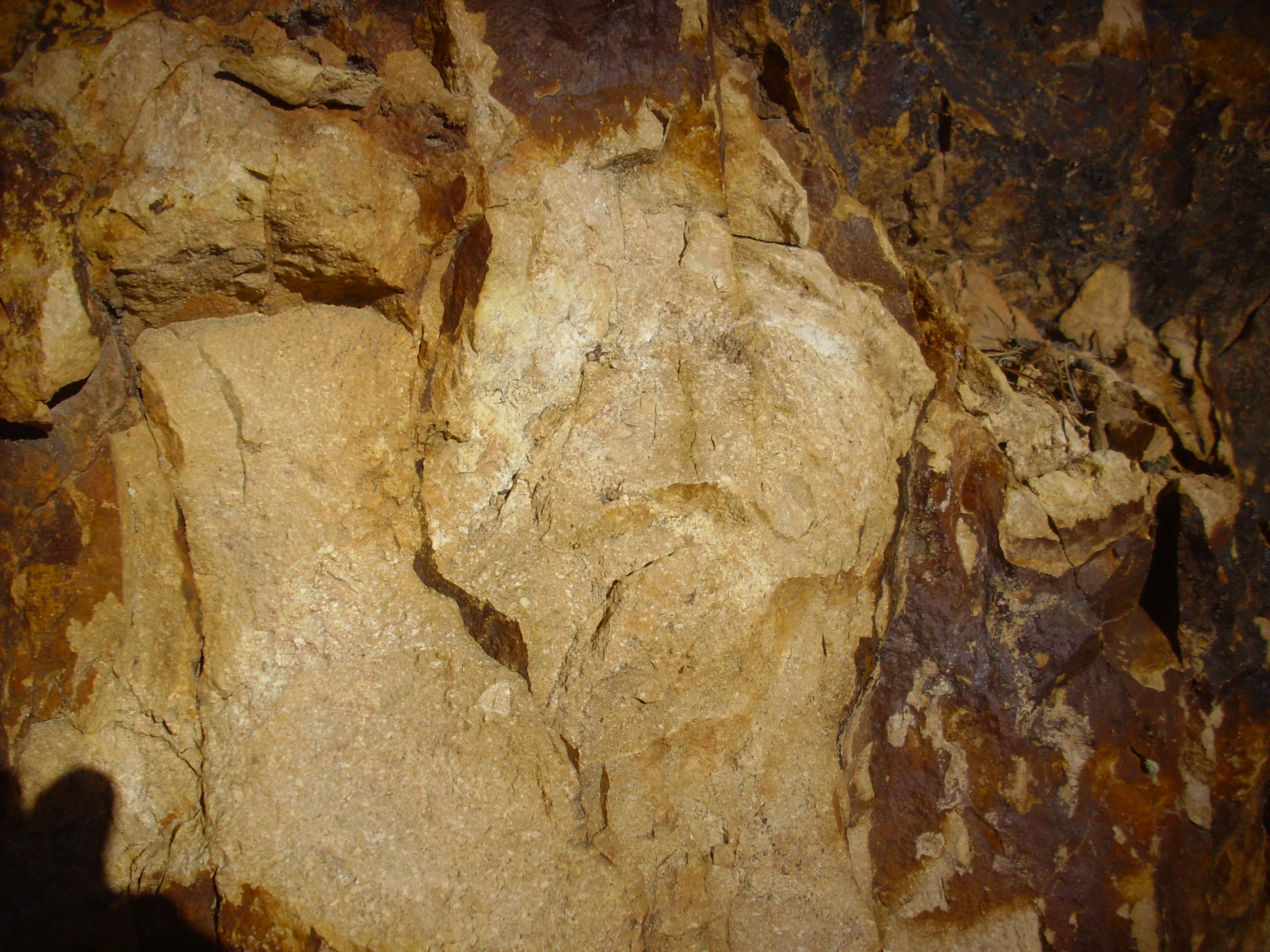
Here's a sample

Hydrothermally altered dacite. 35
49.299N 106 28.299W
The white veins are massive quartz deposited in fractures in the
rock. The rock itself shows signs of extensive oxidation of iron
minerals, and there are scattered pockets of greenish
epidote, which occasionally forms small tabular crystals. Epidote
is a common product of hydrothermal alteration.
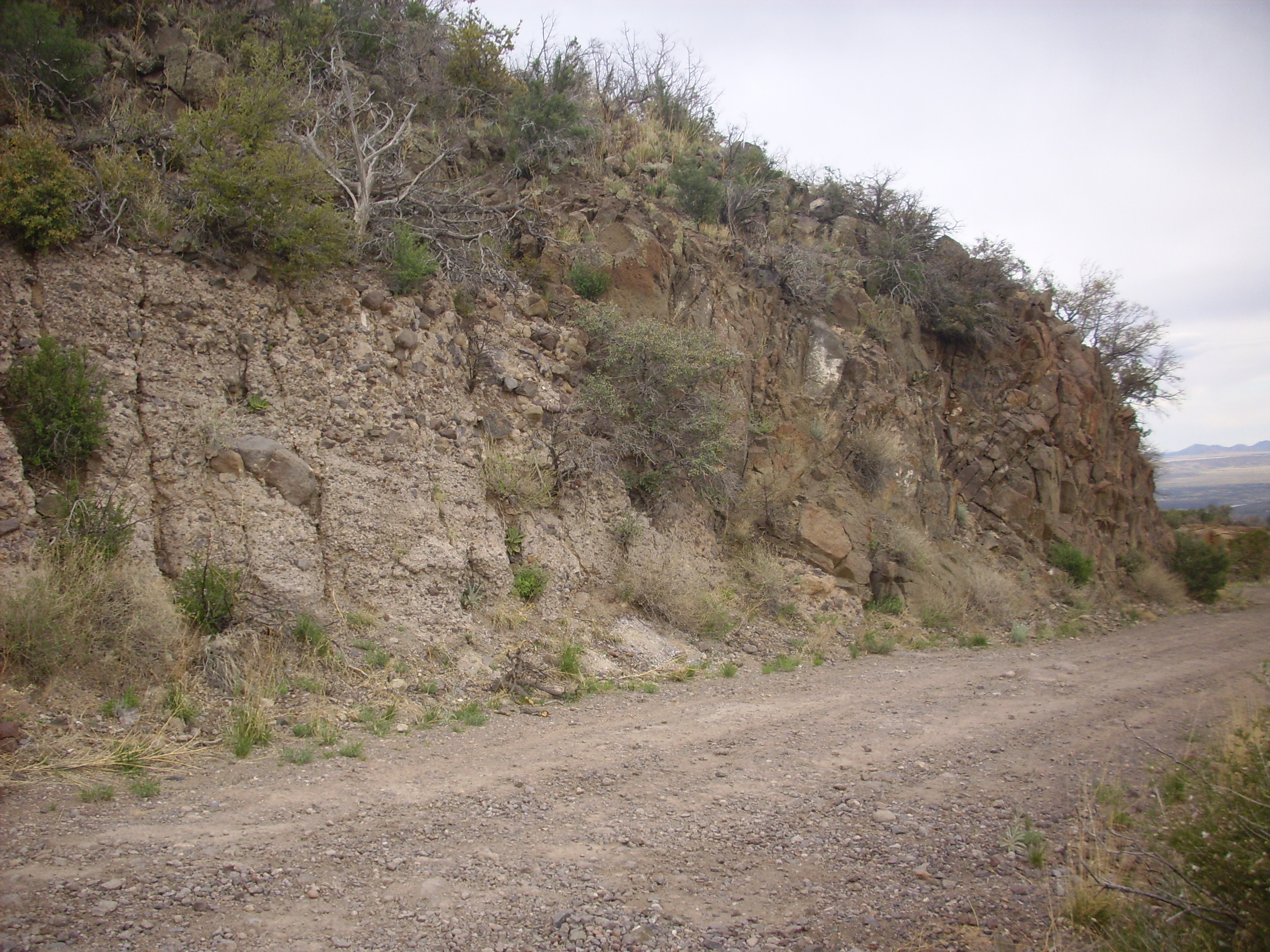
A variety of alteration minerals are present in the basalt at Las
Conchas, immediately south of State Road Four at the base of the
southern caldera rim. The unaltered basalt looks like this.
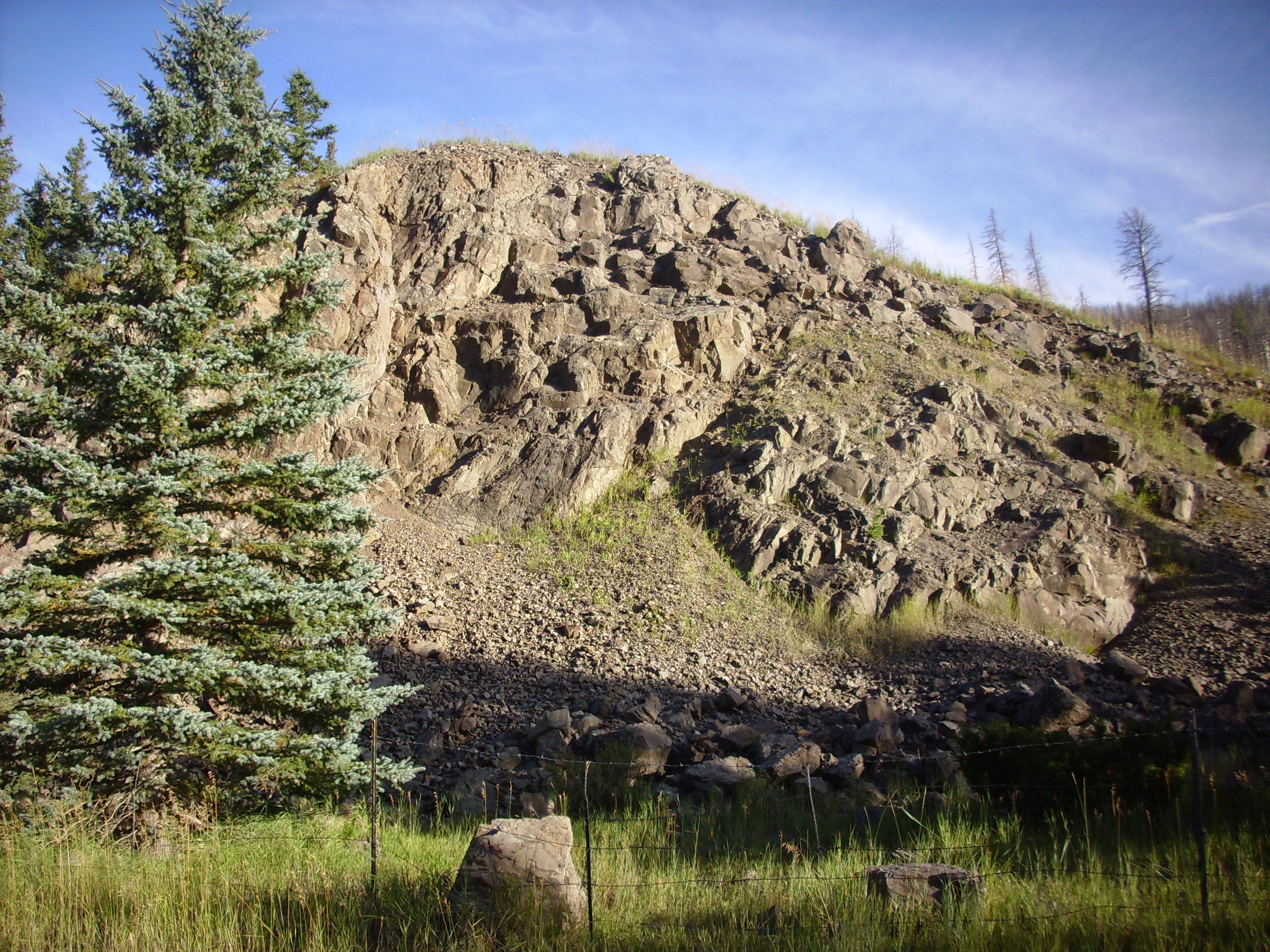
Paliza Formation basalt at Las Conchas. 35
48.838N 106 31.533W
This is basalt of the Paliza Canyon Formation, which has been dated to a hair over 8 million years in age. The outcrop in the photograph is not visibly altered, other than oxidization of scattered olivine crystals to rusty brown iddingsite.
Unaltered Paliza Formation basalt at Las Conchas. 35
48.838N 106 31.533W
A short distance east, the basalt shows minerals deposited in cavities in the rock.
Altered Paliza Formation basalt at Las Conchas. 35
48.856N 106 31.436W
This sample has had quartz deposited in it.
Quartz altered Paliza Formation basalt at Las Conchas. 35
48.856N 106 31.436W
Quartz alteration is not particular extreme. Somewhat more extreme is epidote alteration.
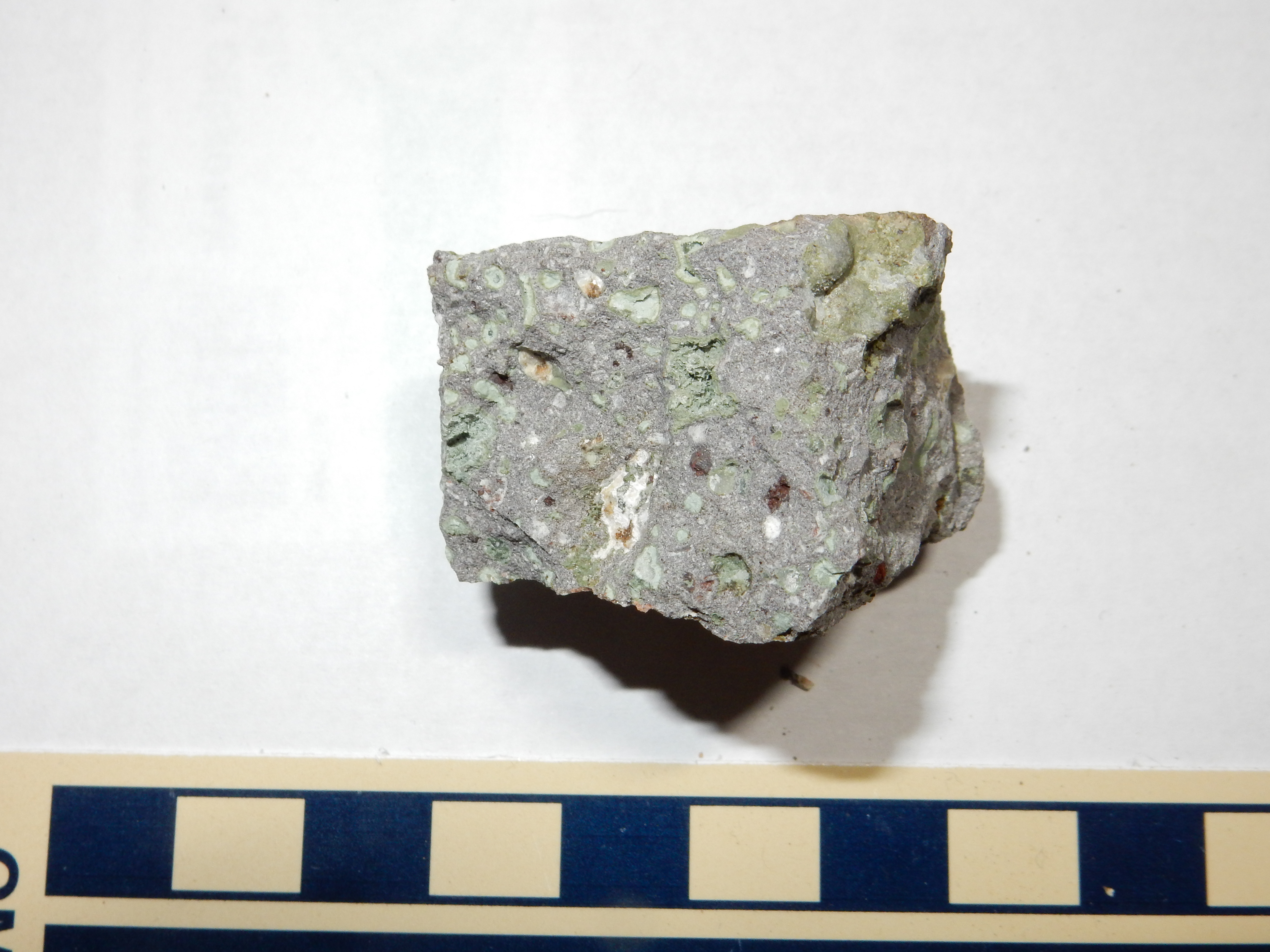
Epidote altered Paliza Formation basalt at Las Conchas.
35
48.856N 106 31.436W
The epidote is the green mineral appearing in patches and lining cavities in the basalt.
Epidote is a common product of hydrothermal alteration. It is
also common in metamorphic rocks formed at low pressure and
relatively low temperature. It is a sorosilicate mineral
with the composition Ca2Al2(Al, Fe)(SiO4)(Si2O7)O(OH).
Sorosilicate minerals are characterized by the presence of pairs
of silica tetraheda joined by a single shared oxygen ion. Each
pair thus has the formula Si2O7. In the case
of epidote, both isolated silica tetrahedra, SiO4, and
silica-silica pairs, Si2O7, are present.
Because there is relatively little linking of silica tetrahedra in
epidote, its rather complex structure is best visualized, not in
terms of its silica backbone, but as chains of aluminum octahedra
joined edge to edge. These chains are linked together by silicon
and calcium ions.

Epidote sample from Colorado.
Epidote typically has a green color, due to substitution of ferric iron for up to a third of the aluminum.
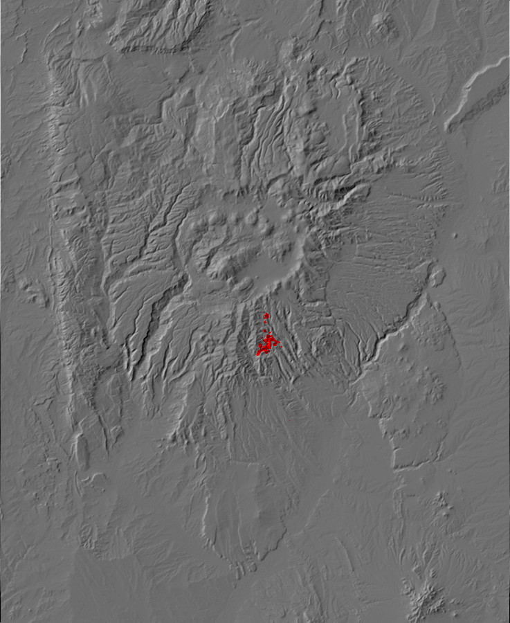
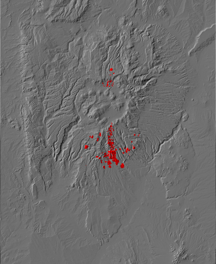
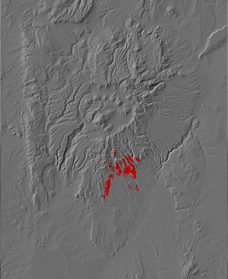
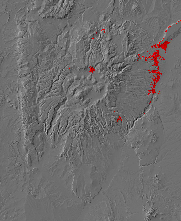
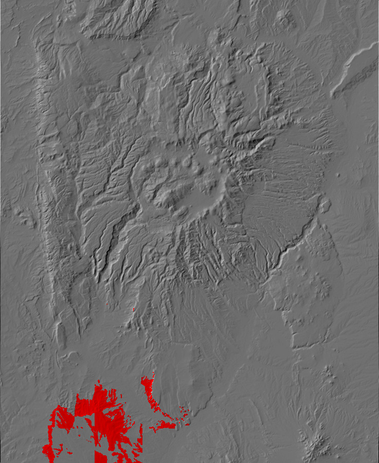
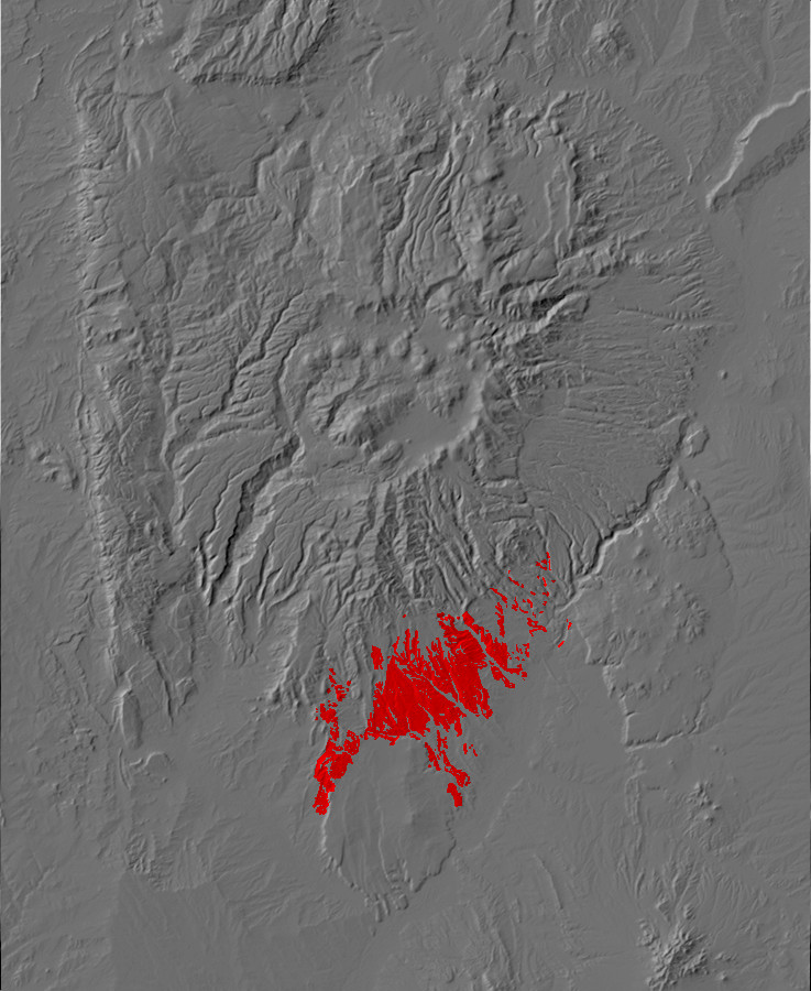
Relief map of the Jemez with Bland intrusion
outcroppings highlighted in red
In 1889, gold was discovered in the southeastern Jemez. Disputes with Spanish land grant holders who claimed portions of the district were appealed all the way to the Supreme Court of the United States, which ruled that the land grant boundaries lay south of the district and the claims were on public lands. This triggered a gold rush and the establishment of mining camps at Bland and Albemarle.
At its peak around the turn of the century, Bland was a mining town of 3,000 with a post office and over fifty other buildings. All this was crammed into narrow Bland Canyon. The ore was originally shipped to Pueblo, Colorado, for smelting, but by 1896 an amalgam mill (using mercury to extract the gold from the ore) was operating at the mouth of Bland Canyon. This was soon converted to the cyanide process.
The richest of the claims, at Albermarle in nearby Colle Canyon, was accessed from Bland via a road called the Teamster's Nightmare, which climbed the 300m (1000') wall of Bland Canyon at better than a 30% grade.The first all-steel building in New Mexico was constructed in Colle Canyon to hold an automated gravity flow mill, and power was supplied from a plant constructed at Madrid, 56 km (35 miles) away, and a route for the transmission lines blasted up Colle Canyon.
The ore took the form of quartz-pyrite veins associated with a monzonite intrusion that has become known as the Bland Stock. Monzonite is an intrusive volcanic rock consisting mostly of equal parts of alkaline feldspar and plagioclase. We saw examples earlier in the book, when we examined the large monzonite intrusions of the Cerrillos Hills southeast of the Jemez. The Cerrillos Hills has been an important mining district since prehistoric times, and geologists originally assumed that the Bland Stock was of about the same age (30 million years old) and origin. However, the whole area is crossed by faults (which in turn host most of the quartz-pyrite veins) and most of the rock has undergone extensive hydrothermal alteration. This hampers efforts either to accurately date the rocks or to deduce their original character.
The massive investment in the mines only recovered about 80% of its value. The confines of Colle Canyon trapped both dust from the mining operations and toxic cyanide fumes generated in the mill from the acidic ores. The cyanide problem was mitigated by neutralizing the acid with sodium carbonate, but the lack of a reliable water supply continued to hamper operations. Worse still, the best ore was found to be close to the surface, with the gold content dropping to half its surface value at a depth of 178m (585'). The ore was rapidly exhausted, and the Cochiti Gold Mining Company went bankrupt in 1902. The subsidiary Navajo Mining Company attempted to shift the focus of operations from Albemarle back to Bland, but itself went bankrupt within a year. The mining infrastructure, including the coal-fire power plant at Madrid, were sold at fire sale prices. Although low-level mining activity continued for many years, the post office finally closed in 1935, and the steel building housing the gravity mill in Colle Canyon was taken out for scrap during the steel shortage in World War II. The last remains of the ghost town were destroyed in the Las Conchas Fire in 2011.
The first radiometric dating of the Bland monzonite gave an age
of around 11.5 million years, about the same as the older flows of
the Paliza Canyon Formation. Geologists have since carefully
traced rock beds from Bland to the north, where the hydrothermal
alteration is much less extensive. The unaltered beds show
characteristics typical of early Paliza Canyon flows, and the
composition of the monzonite dikes intruding these beds is similar
to Paliza Canyon rocks. Additional radiometric dates on Bland
monzonites give ages around 6.6 million years, similar to the
Bearhead Rhyolite, but this may reflect hydrothermal activity
resetting the radiometric clocks. The current favored
interpretation is that the Bland Monzonite is part of a solidified
magma chamber that once erupted andesite and dacite of the Paliza
Canyon Formation. As it solidified, the cooling magma "sweated"
fluids rich in incompatible elements, including gold and silver.
The subsequent Bearhead intrusion completed the alteration process
and further concentrated incompatible elements to produced the
quartz-pyrite veins that host the gold.
Should the price of gold rise enough, the district could become
economically viable again. As a result, much of the old mining
district remains in private hands. The access roads are impassible
today because of flash floods that followed the 2011 fire.
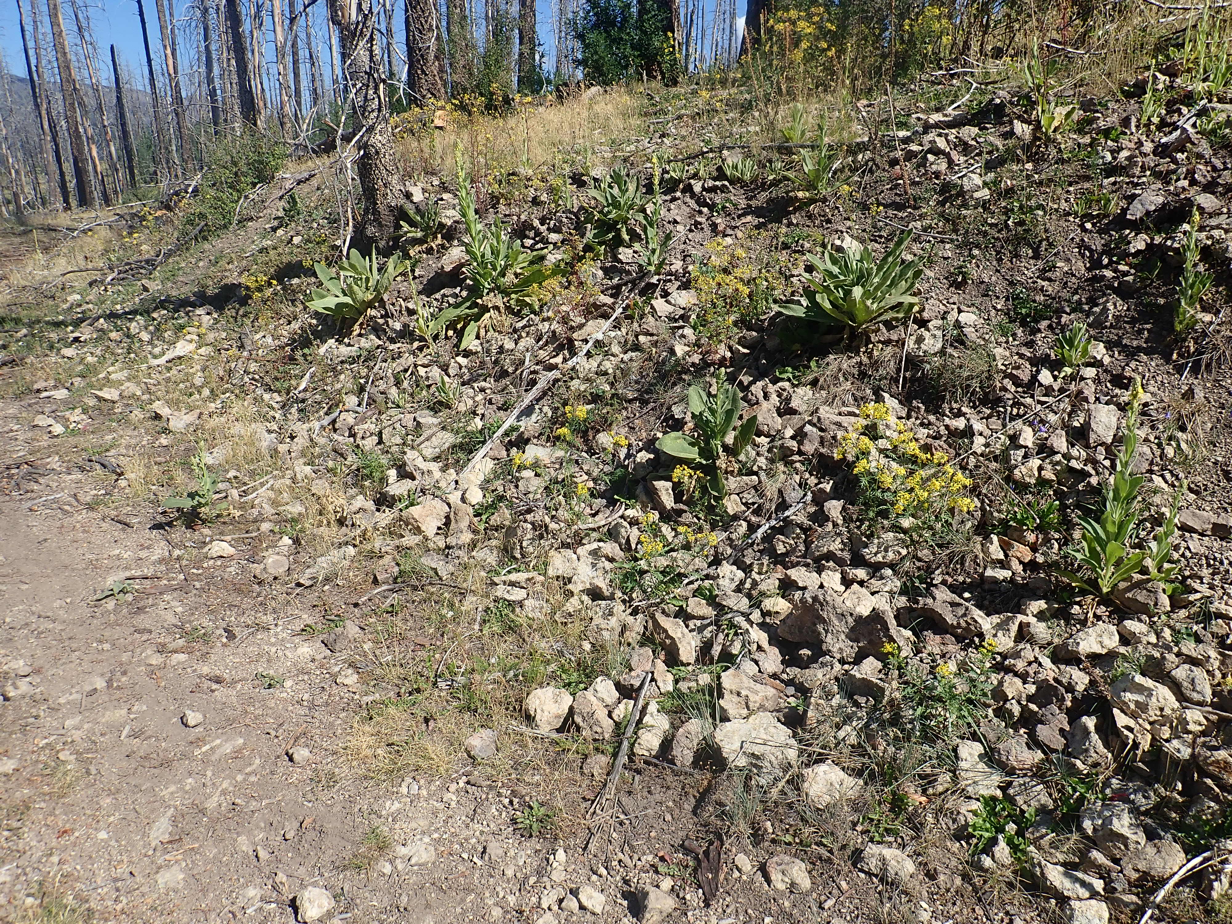
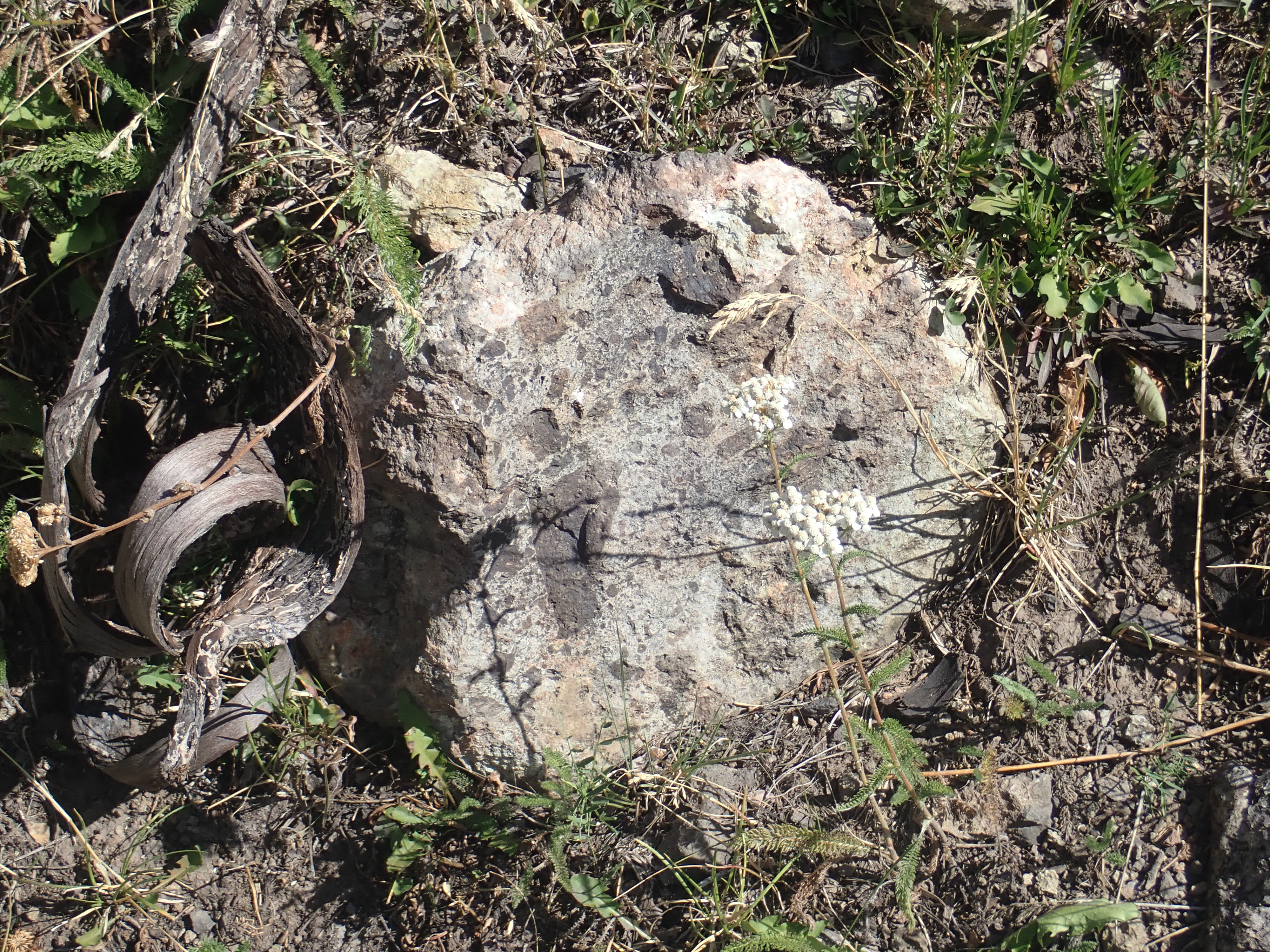
However, there are some poorly exposed monzonite dikes in a knoll east of Aspen Ridge that can be reached by bushwhacking about a mile from Forest Road 208 to the west. The best exposure is on the southwest flank of the knoll some distance below the top.

Monzonite dike west of Krager RIdge. 35 47.601N 106 28.863W
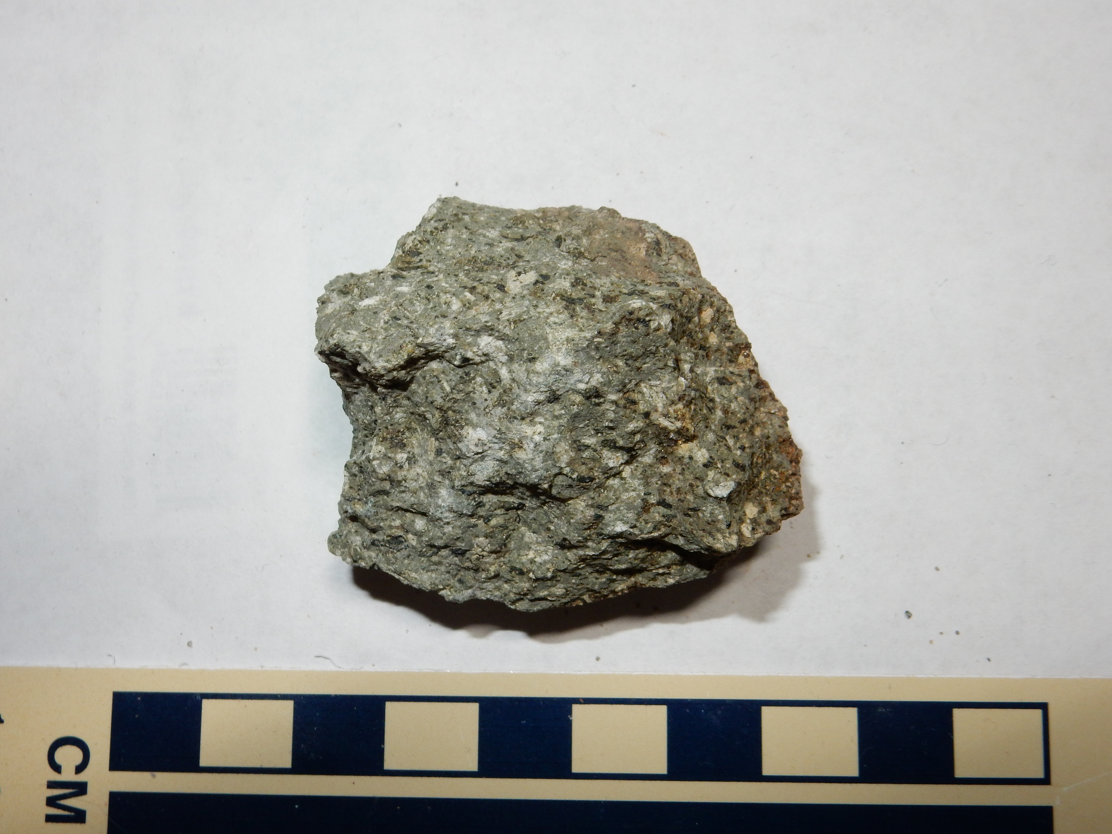
Bland monzonite
The greenish color is likely due to hydrothermal alteration to epidote. Additional monzonite dikes are found around the perimeter of the knoll, particularly on its east side and down into the adjoining canyon floor.
In a number of locations in the southern Jemez, north-south
trending faults are filled with hydrothermal breccia.
Hydrothermal breccia atop Aspen Ridge. 35.805792N 106.5050157W
The breccia forms lenses along the fault traces. It consists of shattered Paliza Canyon Formation andesite, typically altered, cemented in a white matrix. These lenses are difficult to date, with a possible age range from that of the Bearhead Rhyolite (around 8 million years) to post-Valles Event (1.25 million years.) The former age seems more likely, since the breccia is associated with the same system of faults as intrusions of the Bearhead Rhyolite.
As Paliza Canyon volcanism waned and Bearhead Rhyolite volcanism peaked, sediments continued to be deposited in the nearby Rio Grande Rift. These are mostly assigned to the upper Santa Fe Group, as there are indications by this time of an integrated river system draining the Espanola and Santo Domingo basins. However, the river ended in a playa in the area south of Albuquerque, where it deposited the Popotosa Formation. Integration further south did not take place until around 4.5 million years ago.
Relief map of the Jemez with Chamita Formation
outcroppings highlighted in red.
The Chamita Formation overlies the Tesuque Formation, mostly in
the area west of the Rio Grande. Based on its fossils and
radioactive dating of flows and ash beds in the formation, it is
between 10 and 5 million years old, and its makeup is sufficiently
different from the Tesuque Formation for it to be classified as a
separate formation. One of the prominent ash beds in the formation
has been accurately dated to 6.8 million years in age, and both
this age and its composition appear to be identical with those of
the Peralta Tuff. The formation is quite variable in thickness,
which geologists have attributed to widespread erosion.
The type section is located south of Black Mesa and north of the confluence of the Rio Chama and Rio Grande. This area was the location of New Mexico's first Spanish capital, San Juan de los Caballeros.
Type area of Chamita Formation south of Black Mesa. 36 03.345N 106 03.684W
There are excellent exposures along Route 291/582.
Chamita Formation. 36 03.987N 106 05.152W
The exposures here are of the Cejita Member, which is mostly
sediments eroded off the Sangre de Cristo and Picuris Mountains.
Further south is a contact with the Valito Member, which is
thought to be flood plain deposits of the ancestral Rio Grande.
Contact between Vallito Member and Cejita Member. 36 03.825N 106 05.202W
The contact is about halfway down the hillside, separating tan
Vallito Member beds at bottom from overlying pinkish Cejita Member
beds.
The contact between the Chamita Formation and the underlying Tesuque Formation is exposed in a landslide scar on the western tip of Black Mesa. (map).
Contact between Ojo Caliente Member,
Tesuque Formation; and Chamita Formation. 36.086N
106.140W
The lighter tan beds making up the lower two-thirds of the mesa
are Ojo Caliente Member, Tesuque Formation. The uppermost part of
the mesa is Chamita Formation, and is noticeably darker and
redder. The contact is quite distinct.
Note the separation in elevation between the base of the Chamita
Formation on the north side of Black Mesa and the Chamita
Formation to the south. There are major faults, part of the Embudo
fault zone, running along the south side of Black Mesa, and the
beds to the east are thrown down. The fault zone has a
considerable left slip component, and is regarded as a continental
transform fault, similar to the San Andreas Fault in
California but much shorter. This fault transfers displacement
along the west side of the Espanola Basin, where the western edge
of the Rio Grande RIft is active, to the Sangre de Cristo Fault on
the east side of the San Luis Basin, where the eastern side of the
Rio Grande Rift is active.
The Chamita Formation is divided into four members, the Hernandez, Cejita, Vallito, and Cuartales Members. The Vallito Member is sediments deposited by the ancestral Rio Grande, while the Hernandez Member was deposited by the ancestral Rio Chama and the Cejita Member by an unnamed tributary flowing from the Penasco area to the northeast. The Cejita Member is distinctive for its content of Paleozoic limestone, sandstone, and mudstone clasts, eroded from thick beds in the Sange de Cristo. The Cuertales Member is alluvial sediments from the Sangre de Cristo Mountains and is shared with the Tesuque Formation. (As if things were not already confusing enough.)
This sharing of a member is actually permitted by the
statigraphic codes that govern the formal designation of rock
units. The Chamita Formation was originally defined from locations
where it sits atop the Ojo Caliente Member of the Tesuque
Formation, with a very definite discontinuity separating the two.
Further east, the Ojo Caliente thins out and disappears, and the
Chamita Formation beds become indistinguishable from Tesuque
Formation beds. This led one team of geologists to recommend that
the Chamita Formation be abandoned, and its members assigned to
the Tesuque Formation. But the leader of that team later reversed
himself, after consulting the North American Stratigraphic Code,
and concluded that the Chamita Formation could be retained where
it is separated from the Tesuque by a clear unconformity. This is
mostly west of the Rio Grande River.
There are small exposures of the Chamita Formation in White Rock Canyon, and better exposures in lower Pueblo Canyon along the road from Pojoaque to Los Alamos. The Hernandez Member is exposed furthest west, near the Totavi gas station and store.
Hernandez Member. 35
52.810N 106 10.249W
This exposure includes some river bed sediments. Geologists have studied these closely enough to determine that the river flowed to the southeast, which makes sense if this was the ancestral Rio Chama flowing towards its confluence with the ancestral Rio Grande.
Hernandez Member. 35
52.810N 106 10.249W
This exposure shows a thick bed of river gravel sitting atop
floodplain silt beds. In addition, the rightmost part of the
exposure has been displaced downwards by a local
northwest-trending fault.
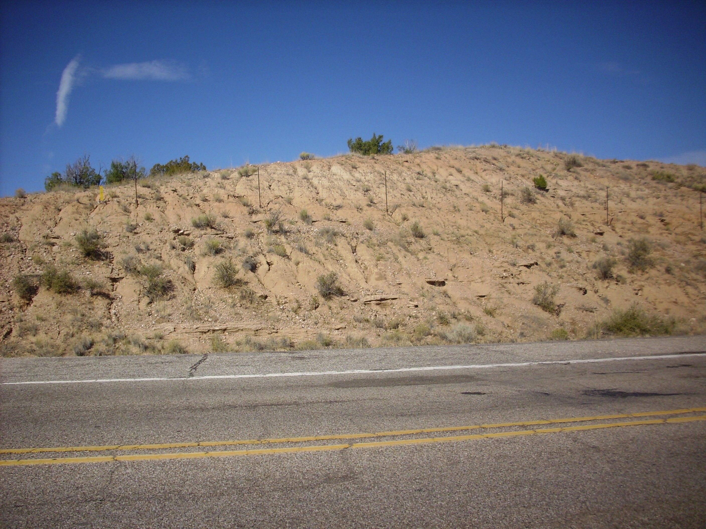
Further down the canyon, just before the turn to Espanola, we encounter Cejita Member on top of Cuartales Member in the road cut.
Cejita and Cuartales Members. 35
53.090N 106 09.596W
The Cuartales Member is just visible over the top of the barrier to the right in the photograph. Looking over the barrier:
Cejita and Cuartales Members. 35
53.090N 106 09.596W
The contact is very obvious now. Closer still:
Cejita and Cuartales Members. 35
53.090N 106 09.596W
You can see that the Cuartales Member is reddish muddy sandstone consistent with this being the furthest part of an alluvial fan from the Sangre de Cristo Range. The pink color reflects its origin while the fine grain reflects the considerable distance from the source. Over it is a thin layer of sandy conglomerate and then tan sandstone, consistent with a source further north. Between the two is a thin dark layer, also sandy, though probably with abundant lithic grains from a volcanic source. (I neglected to bring a loupe; I'm kind of guessing here.) A layer like this shouts that something happened here. My guess is that the course of the ancestral Rio Grande abruptly shifted to the east due to a large eruption in the Jemez area.
Or it may just be a placer deposit where the upper member filled
a scour channel in the lower member. Wish I'd remembered that
loupe.
There are extensive exposures of the Chamita Formation west of the road from Totavi to Espanola. Some of these are well exposed in road cuts just north of the turnoff at Totavi.
Cuartales Member. 35
53.351N 106 09.059W
A little further north is an exposure of Vallito Member.
Vallito Member. 35
53.492N 106 08.892W
You're looking here at a cross section of a river channel, full
of silt and gravel.
At Battleship
Mountain, west of the road from Otowi to Espanola, the
Chamita Formation forms the lower slopes.
The lower, pinkish part of the mesa is Chamita Formation, forming the zone below the prominent light ash-rich bed at the base of the Puye Formation, which forms most of the upper part of the mesa. There is a small cap of the Tshirege Member, Bandelier Tuff, at the very top of the mountain.
The beds at the base of the mountain have long been identified as
Ojo Caliente Member of the Tesuque Formation, but more recent work
suggests these are Vallito Member eolian beds that have been
thrown down by a fault at the base of the mountain.
North of this area, at Round
Mountain Quarry, paleontologists have discovered fossils of
short-faced, heavy-jawed ancestors of dogs, as well as horses,
pronghorn, and llamas.
The contact of the Chamita Formation with the overlying Puye
Formation is well exposed in a road cut along 30 Mile Road west of
Espanola.
Contact of Chamita and Puye Formations. 36
00.726N 106 08.383W
The fine pink sediments of the Chamita Formation contrast strongly with the coarse gray sediments of the overlying Puye Formation. This portion of the Puye Formation appears to be a lahar, or volcanic mud flow, which scoured clean the top part of the Chamita Formation to make this very sharp contact. We'll say much more about lahars in Chapter 8.
The Chamita Formation, like much of the Santa Fe Group to which it belongs, is often poorly cemented. However, some of the beds here are quite well cemented, and here's a sample.

Chamita Formation. 36
00.726N 106 08.383W
Under the loupe, the sandstone is revealed as medium-grained and
moderately sorted with well-rounded grains, mostly quartz but with
numerous lithic grains. The sandstone is clast-supported, though
with ample light matrix in the pores -- a lithic arenite. In other
words, a somewhat muddy and not especially mature sandstone, as
one would expect in rift fill sediments.
The Chamita Formation reaches its greatest thickness further north, where it is exposed beneath a cap of Lobato basalt southwest of Black Mesa.
Lobato Mesa Formation basalt flows atop a mesa of
Chamita Formation northwest of Hernandez. 36
05.111N 106 08.318W
Geologists who have examined the contact between the basalt and the underlying Chamita sediments have concluded that the surface of the Chamita beds was already significantly eroded when the basalt was erupted around 10 million years ago. Regional uplift must have already become significant enough by then that deposition of sediments along this part of the Rift had reversed and net erosion of sediments had set in.
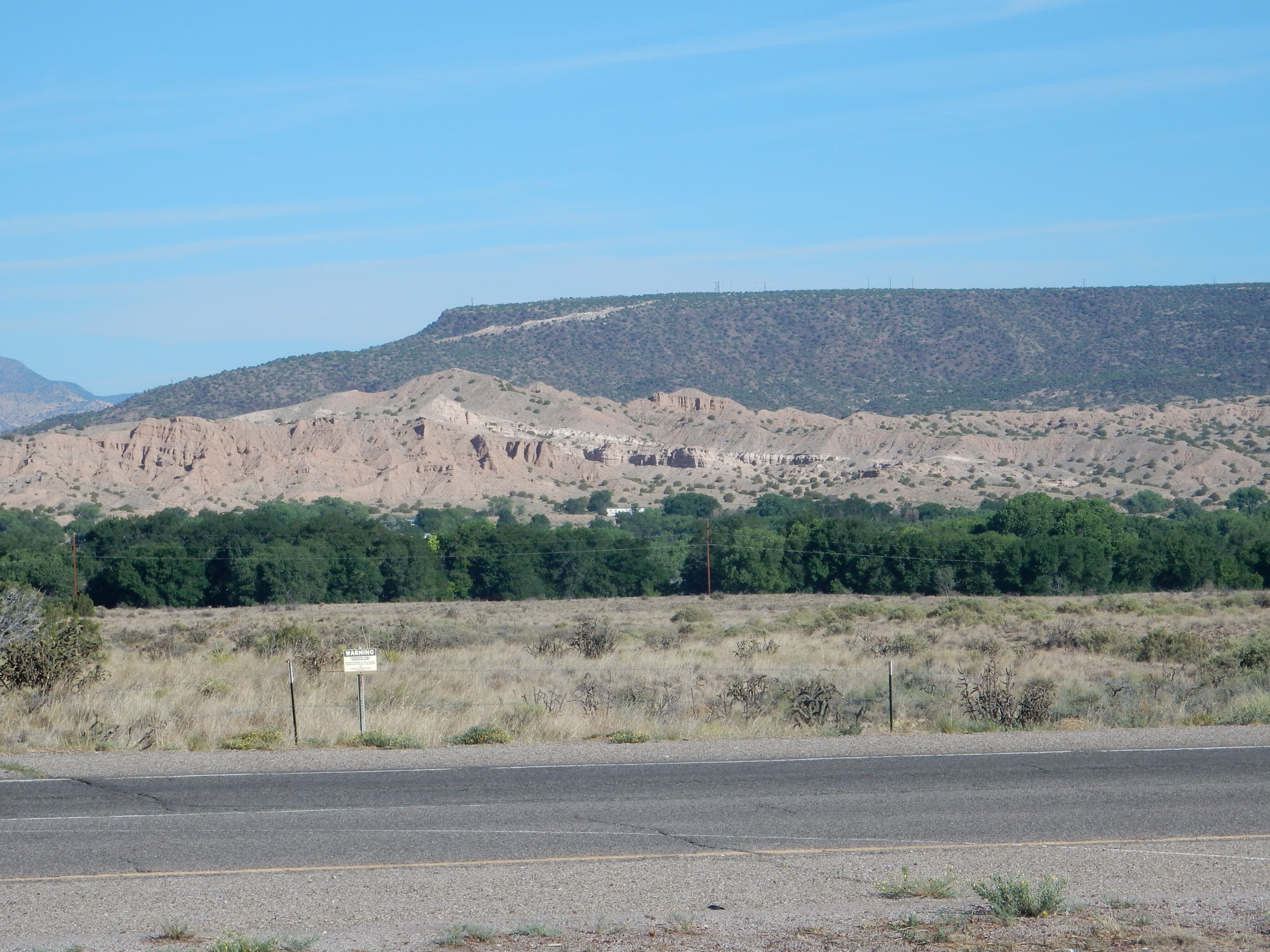
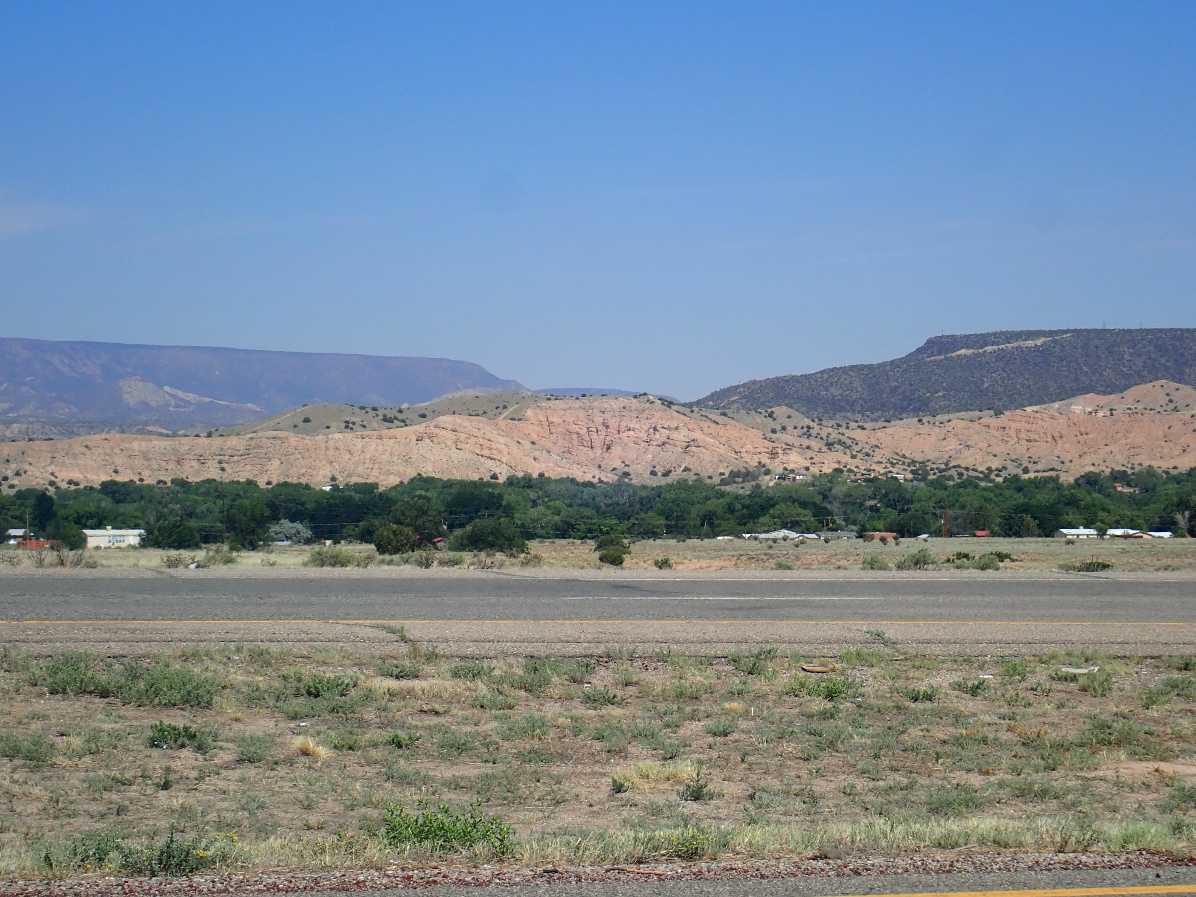
The southernmost exposures mapped as Chamita Formation are
located at the eastern foot of the San Miguel Mountains.


Chamita Formation east of San Miguel Mountains.
35.761945N
106.3459917W
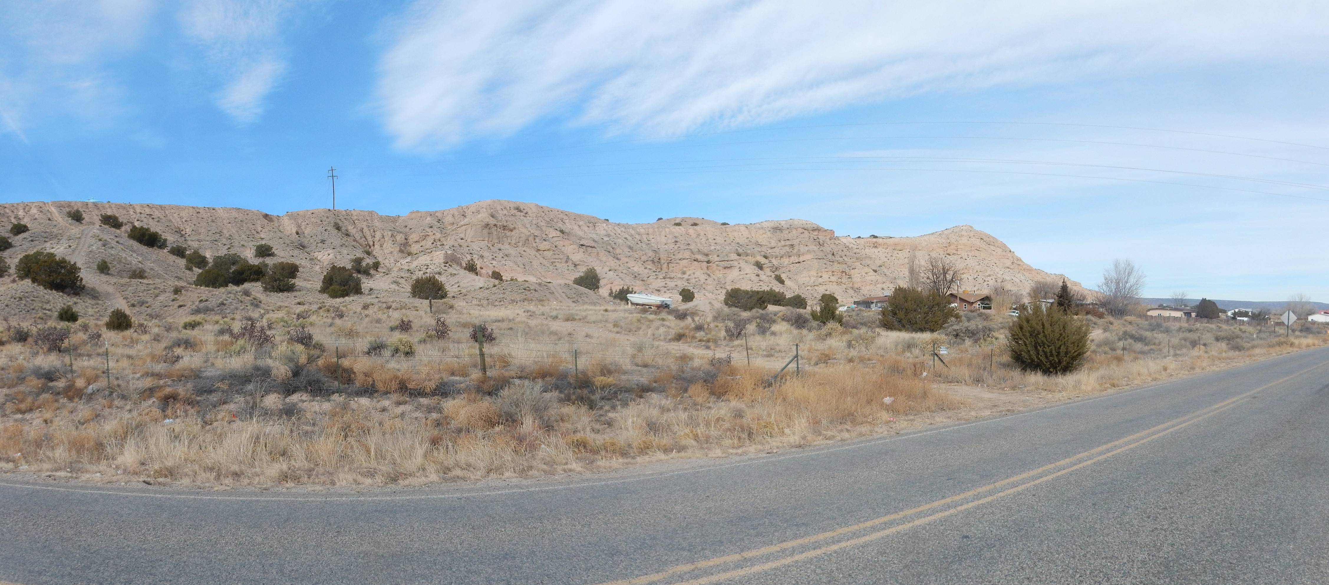
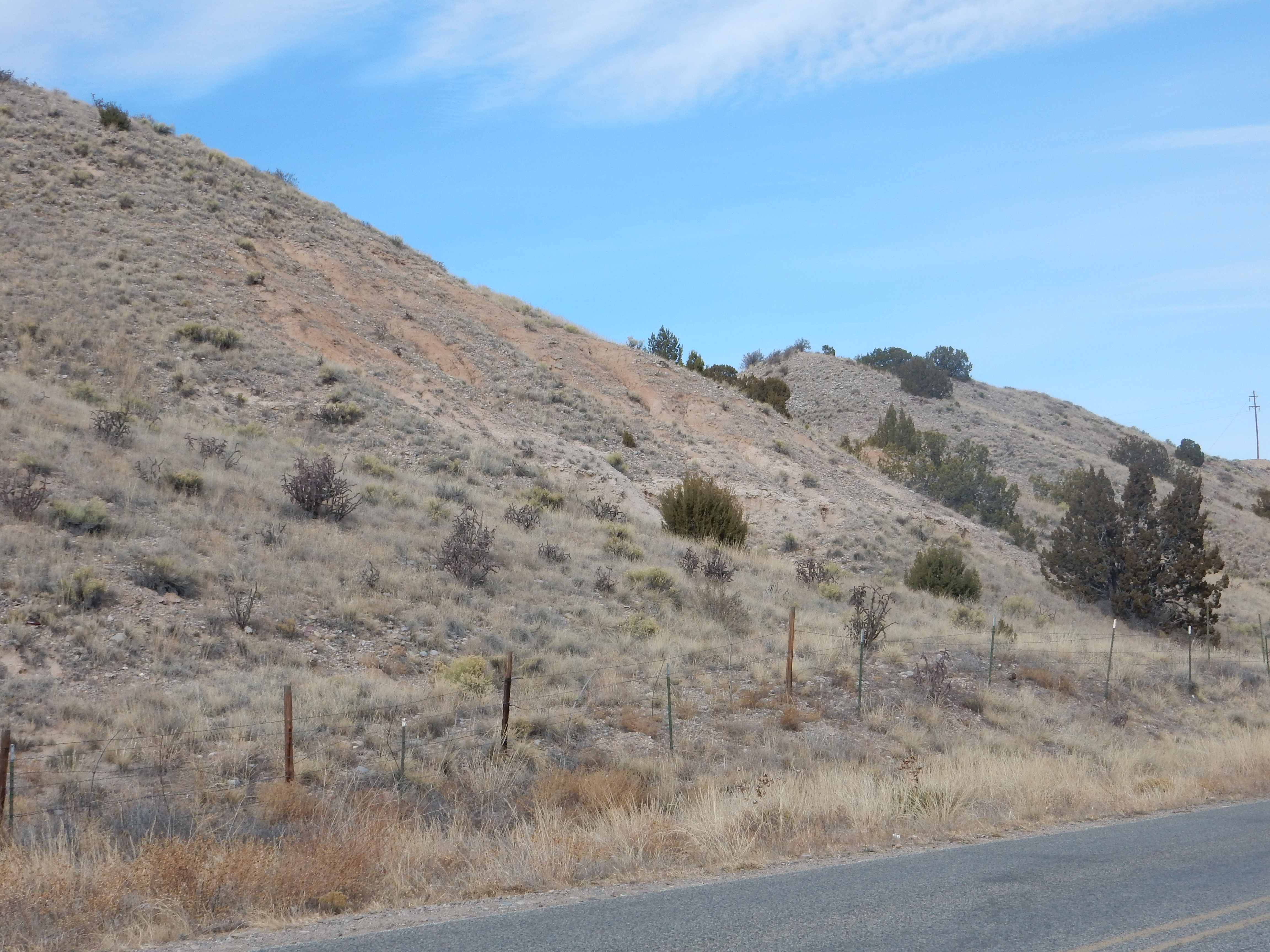
This is a well-cemented but immature sandstone, identified as lower Vallitos Member. The beds continue south along the east slopes of the San Miguel Mountains.

Chamita Formation east of San Miguel Mountains. 35.759915N
106.3489217W
The beds here dip gently to the west, but at a significantly
shallower angle than the Galisteo Formation beds beneath.
The Chamita Formation is the principal rift fill of a series of three grabens within the Rio Grande Rift. These are the Velarde graben, south of Black Mesa; the Santa Clara graben, north of Los Alamos; and the Pajarito graben, underlying much of the Pajarito Plateau. These remain the most active portions of the rift at these latitudes, and there is evidence for at least 5% extension across the Pajarito Plateau since the Valles event, 1.25 million years ago.
The Chamita Formation beds are visibly deformed where they begin to dip into the Velarde graben.
Chamita Formation dipping into Velarde graben. Looking
west from 36.0597713N
106.0602237W
There are three prominent zones of ash beds in the Chamita Formation. These can be quite accurately dated using radiometric methods. The Lower Coarse White Ash Zone towards the base of the formation is around 13 million years old. It may correspond to early high-silica eruptions in the Jemez whose vents have since been buried by later flows. Some of the oldest Canovas Canyon Formation beds are close to this age. The Lower Chamita Tuffaceous Zone is about 7.7 million years old. The Upper Chamita Tuffaceous Zone has been quite precisely dated at 6.8 million years old, identical with the Peralta Tuff, and has the same composition. This is almost certainly ash fall from the Peralta Tuff eruptions.
The UCTZ (geologists love acronyms, since they fit well on maps)
is well exposed along Route 582 north of Pueblito, south of Black
Mesa.
Upper Chamita Tuffaceous Zone. 36
04.583N 106 04.904W
The whitish beds, best exposed at the base of the knob at right, are the UCTZ beds. They are located some 28 km (17 miles) north-northeast of the Peralta Tuff vents but are one to two meters (several feet) thick.
Relief map of the Jemez with Arroyo Ojito Formation
outcroppings highlighted in red
A near-contemporary of the Chamita Formation is the Arroyo Ojito Formation, found in the western Santo Domingo Basin. This forms spectacular badlands northwest of Bernalillo.
Arroyo Ojito Formation badlands northwest of Bernalillo.
Looking northwest from 35.4008N
106.7852W
This formation was deposited by streams draining the area to the north and northwest, corresponding possibly to an ancestral Rio Puerco. Most of the formation is on tribal lands, but there is an area just below the escarpment here that is on public land. Here's a view of the formation in the side of an arroyo:
Arroyo Ojito Formation. 35.4058N
106.7873W
Here we see alternating layers of claystone and mudstone laid down by the river system. In some other locations, there are ash beds in the formation similar in age and composition to the Peralta Tuff.
Some of the beds of this formation contain volcanic debris of
about the same age as the Peralta Tuff.
Relief map of the Jemez with Cochiti Formation
outcroppings highlighted in red
As the high-silica eruptions of the Bearhead Rhyolite began to
die out, around 6 million years ago, erosion of the eruptive
centers produced a large quantity of sediment that was deposited
on top of the Peralta Tuff. This is the Cochiti Formation. It
underlies a large area of the southeast Jemez, grading northward
into the volcaniclastics of the Paliza Canyon Formation. The
distinction is that the volcaniclastics were formed at the same
time as the Paliza Canyon Formation flows and domes and are rich
in volcanic ash, while the Cochiti Formation formed by subsequent
erosion and is poor in ash.
However, the distinction is not a sharp one. This is reflected in
geological maps of the Jemez, where a formation mapped as Cochiti
Formation at the boundary of one quadrangle is sometimes mapped as
volcaniclastics of the Paliza Canyon Formation in the neighboring
quadrangle. In an attempt to make the distinction more rigorous,
one geologist wrote an entire paper dedicated to examining
different definitions of the Cochiti Formation. His precise
definition is that the Cochiti Formation is sediments composted
entirely of volcanic debris that overlie Keres Group beds and are
in turn overlain by relatively young alluvial gravels.
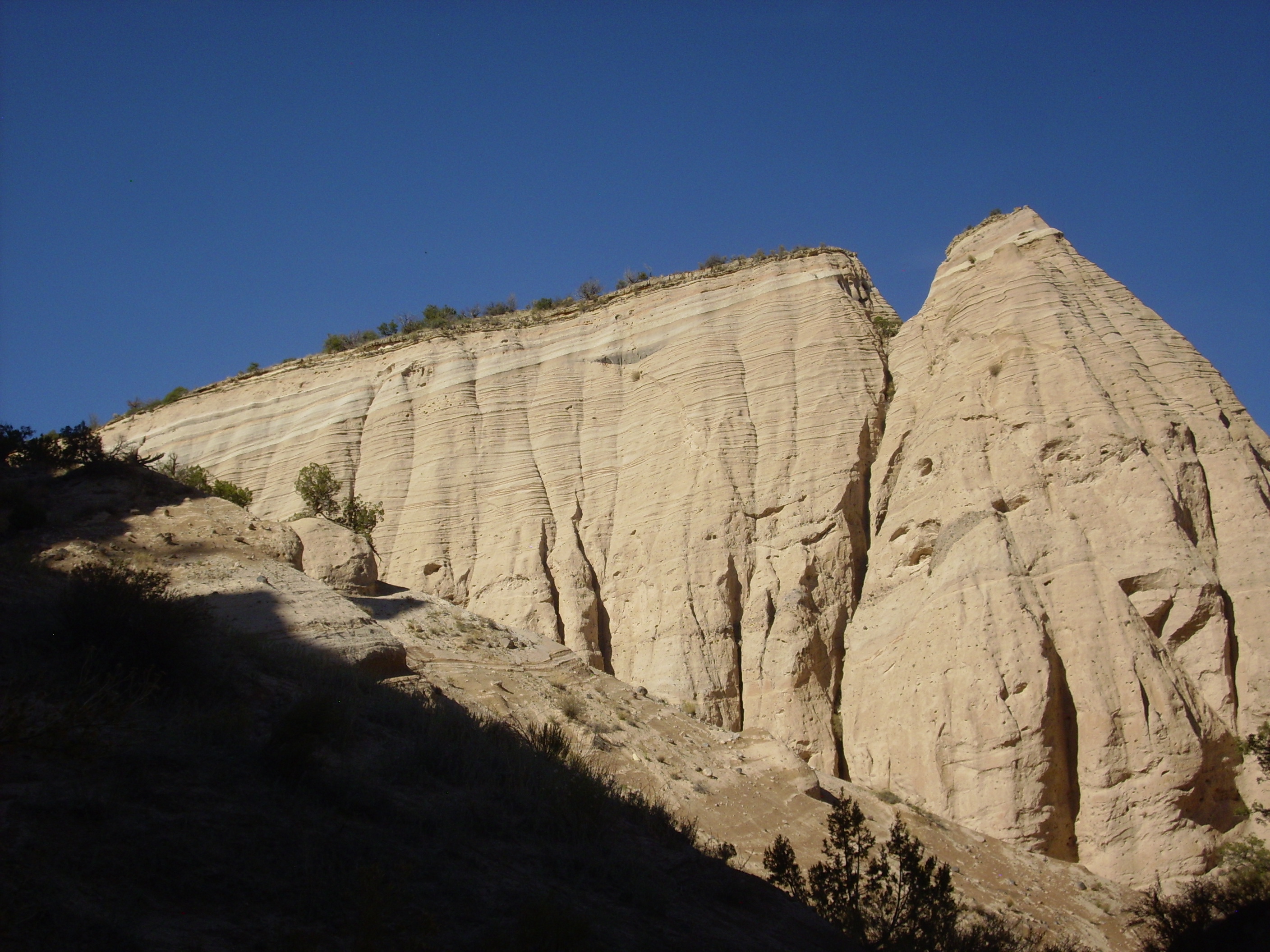
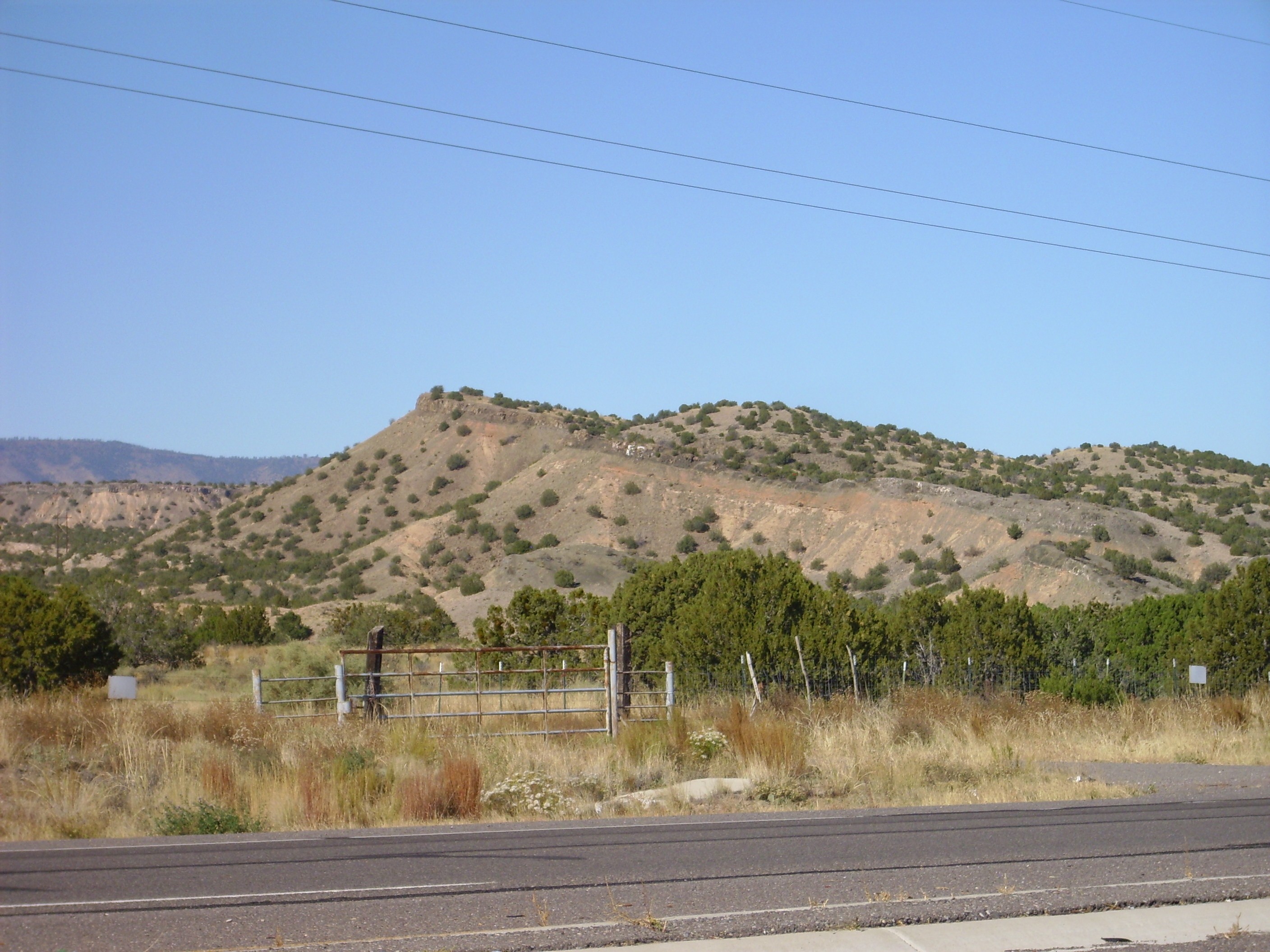
The Cochiti Formation caps the Peralta Tuff at Kasha-Katuwe Tent Rocks. The contact is particular clear just north of the main tent rocks as seen from the west.
Cochiti Formation overlying Peralta Tuff.
Looking east from 35
39.667N 106 25.656W
The contact between the Cochiti Formation and the underlying Peralta Tuff is obvious. The less easily eroded Peralta Tuff is here a cliff-forming formation, while more easily eroded Cochiti Formation is a slope-forming formation that supports considerably more vegetation.
Outcrops of the Cochiti Formation can be examined at close range
at numerous locations along the road from Cochiti
Pueblo to the Veterans'
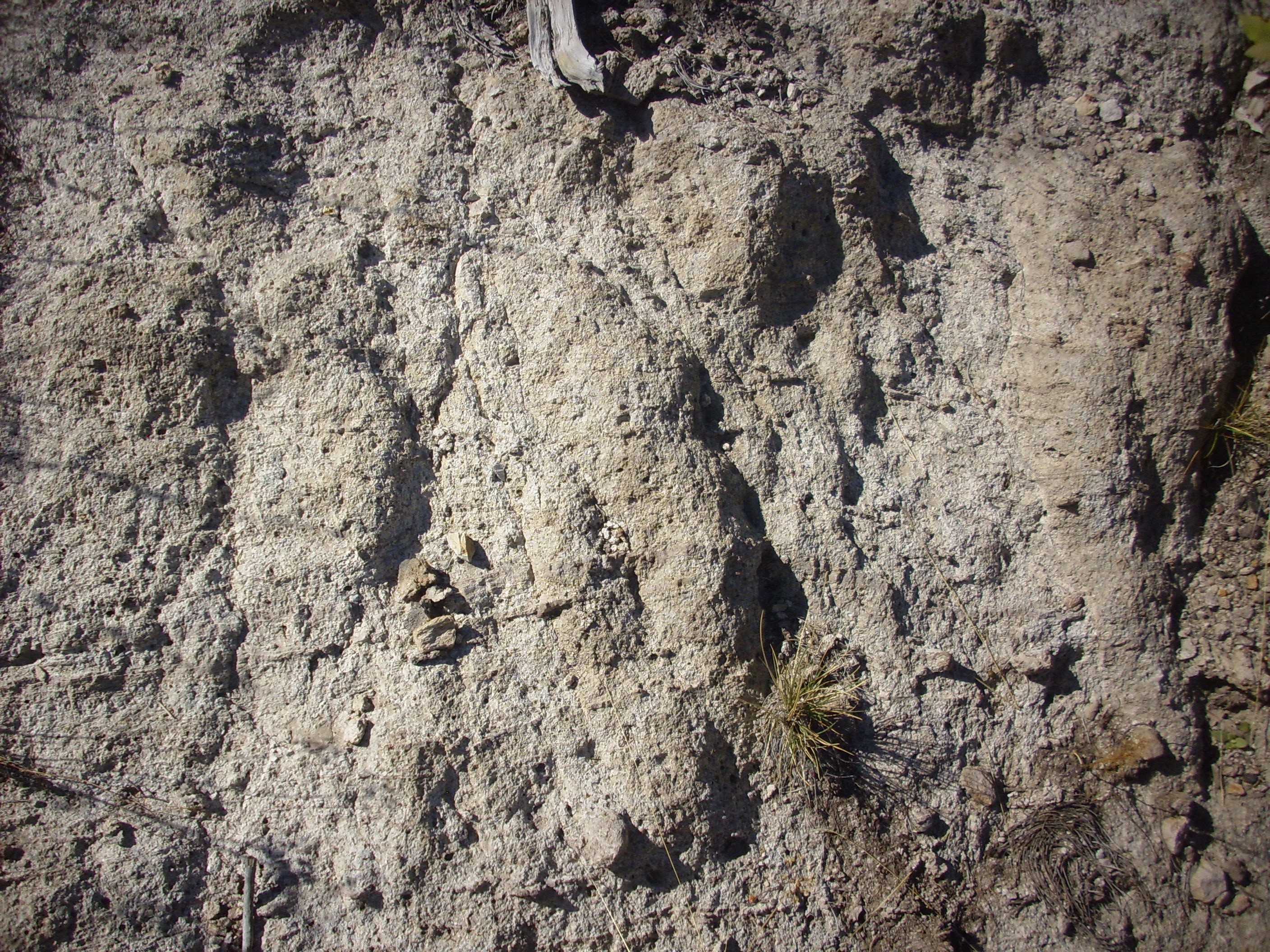
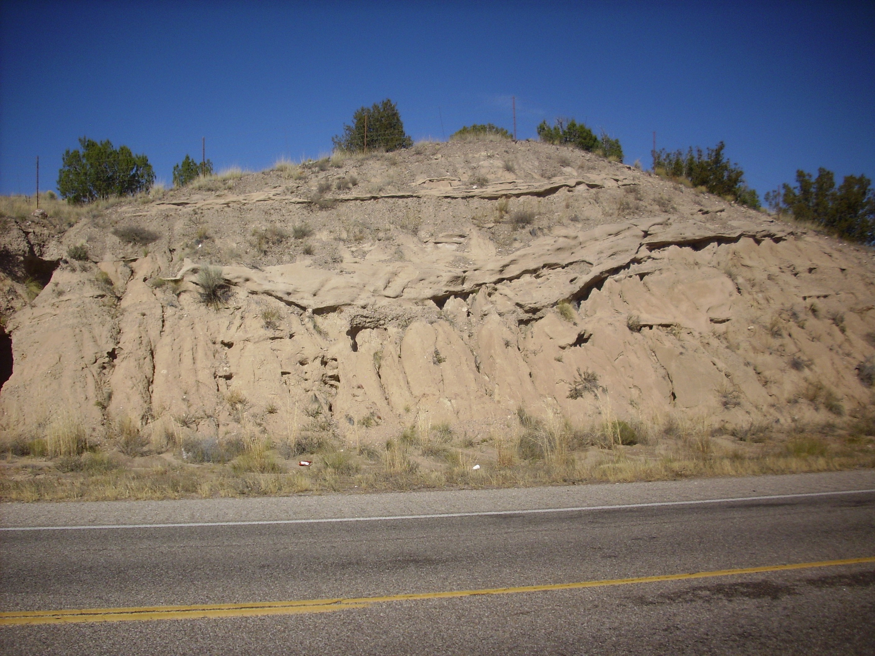
Memorial Overlook. Here is a particularly fine exposure.
Exposure of Cochiti Formation. South of
35
39.713N 106 26.545W
The lighting here makes the formation look almost handsome. The usual impression one gets in the field is of nondescript brown dirt. More formally, it is described as poorly-sorted silt, sand, and gravel of up to cobble size in a tan matrix.
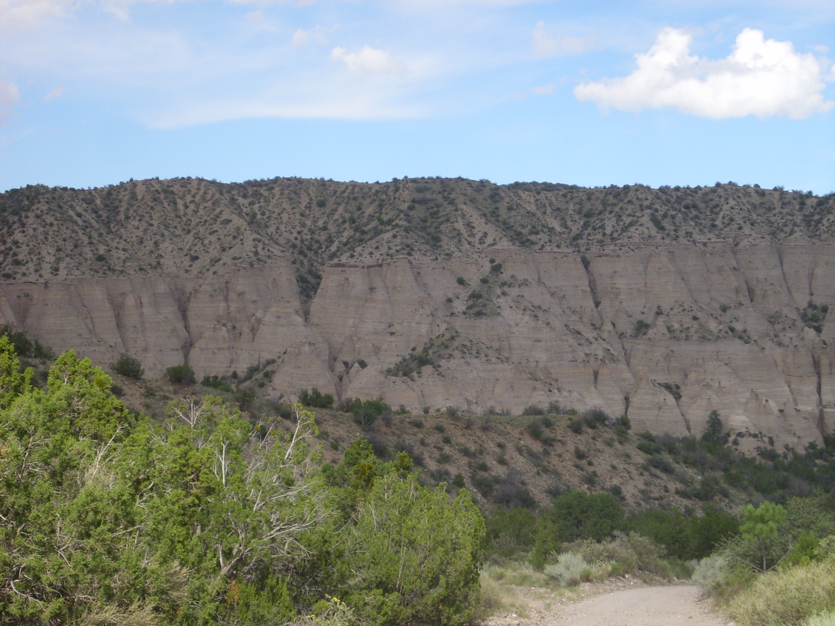
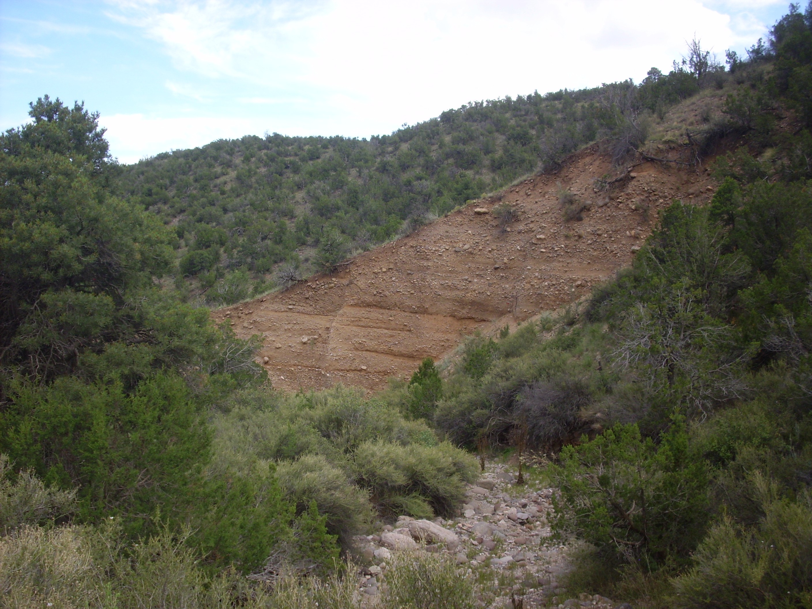
For comparison, here is a photograph of volcaniclastics of the
Paliza Canyon Formation exposed further north, along Dome Road.
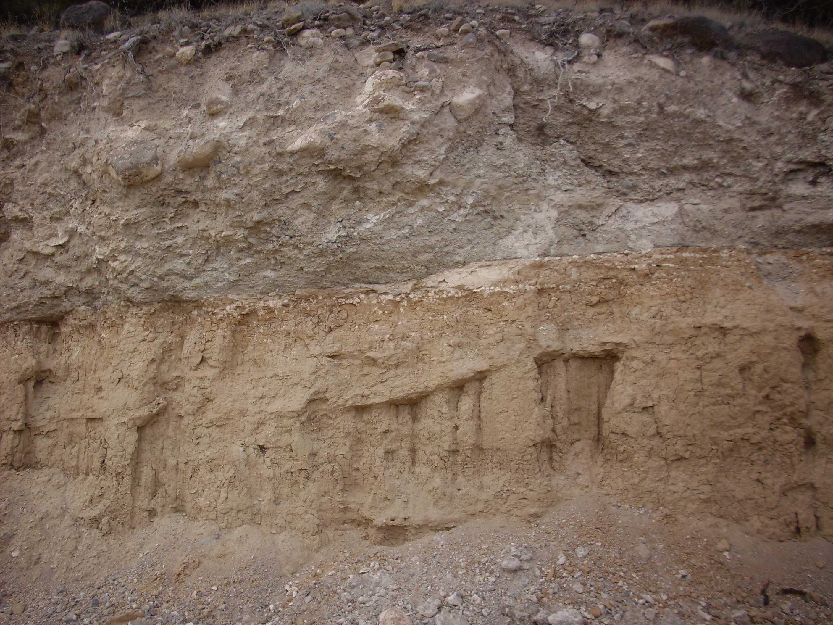
Contact in road cut. 35
42.800N 106 23.406W
The hill behind this road cut is the location of a source vent for the Paliza Canyon Formation. To the right in the road cut is solid porphyritic andesite. This has a radiometric age of 9.33 million years, making it one of older Paliza Canyon flows in this area.
To the left are the volcaniclastics, assigned by some geologists
to the Paliza Canyon Formation and by others to the Cochiti
Formation. These deposits appear to be from an ash-rich mud flow,
or lahar, formed shortly after the eruption of a Paliza
Canyon Formation volcano. According to the recent rigorous
redefinition of the Cochiti Formation, these would be assigned to
the Paliza Canyon Formation.
We'll revisit lahars again later in the book.
What is the oldest mountain range in the world? Giving an answer is a bit problematic. Some mountains ranges in continental shields are composed of Archean rock over three billion years old. But the age of the rock is not necessarily the age of the mountain range itself. In New Mexico, the Precambrian cores of the principal mountain ranges are up to 1.8 billion years old, but these mountains are believed to have been thrown up during the Laramide orogeny, which began just 60 million years ago. Erosion quickly attacks the mass of rocks thrown up by mountain building, and the Laramide mountains of New Mexico are in places deeply eroded, exposing rock which, based on the kinds of minerals it contains, must once have been many kilometers below the surface. Several kilometers of erosion in tens of millions of years is not at all unusual.
Of course, the mountains themselves are not much more than a couple of kilometers higher than the surrounding terrain, and likely never were. As the tops of the mountains eroded, their deep, buoyant roots pushed the mountains back up to maintain isostatic balance. Because the difference in density between continental crust (2.7 g/cm3) and the underlying mantle (3.4 g/cm3) is not much more than 20%, it takes at least four kilometers of mountain roots to balance a kilometer of mountain. This means that for a mountain two kilometers high to be permanently eroded flat, some eight kilometers of rock must be eroded away.
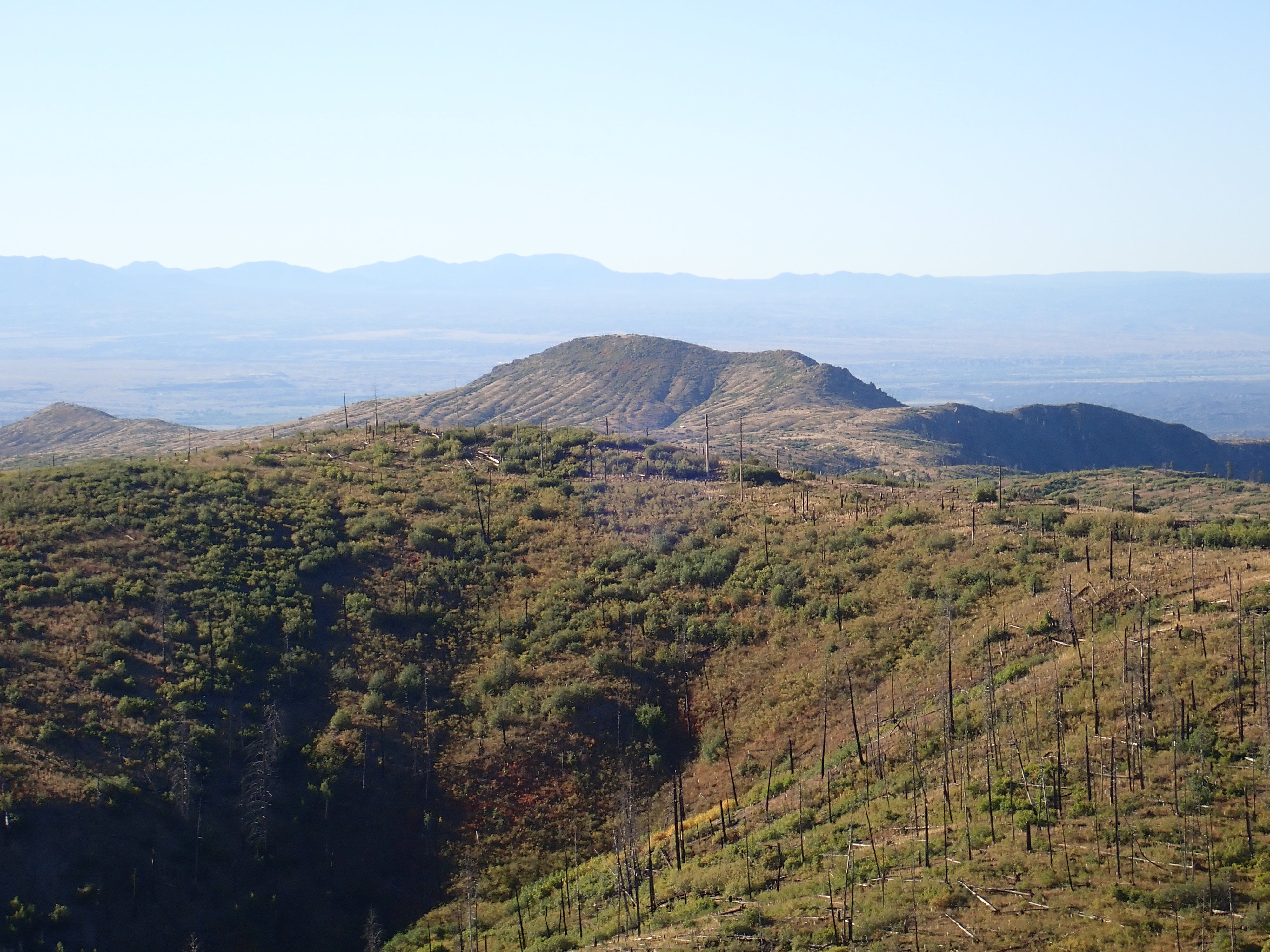
The granite cores of the Sierra Nacimiento at the western edge of the Jemez likely follow this pattern. There is some evidence this area has been thrown up repeatedly since the Mississippian, but the most recent period of uplift goes back at least thirty million years. This is enough time that the Sierra Nacimiento have been deeply eroded, as is clear when they are viewed from the west.

Southern Sierra Nacimiento. Looking west
from near 35
42.697N 106 57.303W
Erosion has stripped the upper layers of this block of crust to
expose Precambrian basement rocks that were once far below the
surface. The high point in the southern part of the range, visible
here, is Pajarito Peak, which is mostly underlain with gneiss with
a quartz monzonite cap. These beds are around 1.6 billion years
old. The range north of Pajarito Peak is underlain by the Joaquin
Granite, with a radiometric age of 1.4 billion years.
The volcanic rocks of the Jemez are particularly susceptible to
erosion, since they include loosely consolidated volcaniclastic
and ash beds as well as lava flows whose minerals are not entirely
stable at the surface. When these flows were first erupted, they
likely had the smooth surfaces that are still apparent on some of
the younger domes of the volcanic field, which we will see more of
in succeeding chapters. The older formations of the Polvadera and
Keres Groups have been deeply eroded in the millions of years
since they were erupted, preferentially along faults associated
with the Rio Grande Rift. The fault zones break up the rock,
making it more susceptible to erosion. A particular clear example
is upper San Juan Canyon.
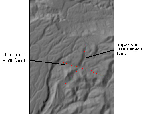
Map of upper San Juan Canyon and associated faults
The deep canyon in the lower left part of this relief map is
lower San Juan Canyon. The upper part of the canyon turns sharply
east to follow an unnamed east-west fault, then turns sharply
north again to follow the Upper San Juan Canyon Fault. To the
east, upper Paliza Canyon and upper Peralta Canyon also follow
major north-south faults.
The rugged terrain of the southern Jemez suggest that erosion has
been extensive, so that little of the original surface is left.
Nevertheless, most geologists do not believe that the original
terrain could have been much higher than the remaining ridge
crests and peaks. Local domes that obviously correspond to
eruption centers, such as Cerro del Pino southeast of San Juan
Canyon, are still discernible as high points of the terrain,
though they have likely been stripped of their outer mantles. As
we shall see in the next chapter, it seems to take about four
million years for a fresh eruptive center to show obvious signs of
erosion.
Next page: Dacite and dacite, what is
dacite?
Copyright ©2015 Kent G. Budge. All rights reserved.