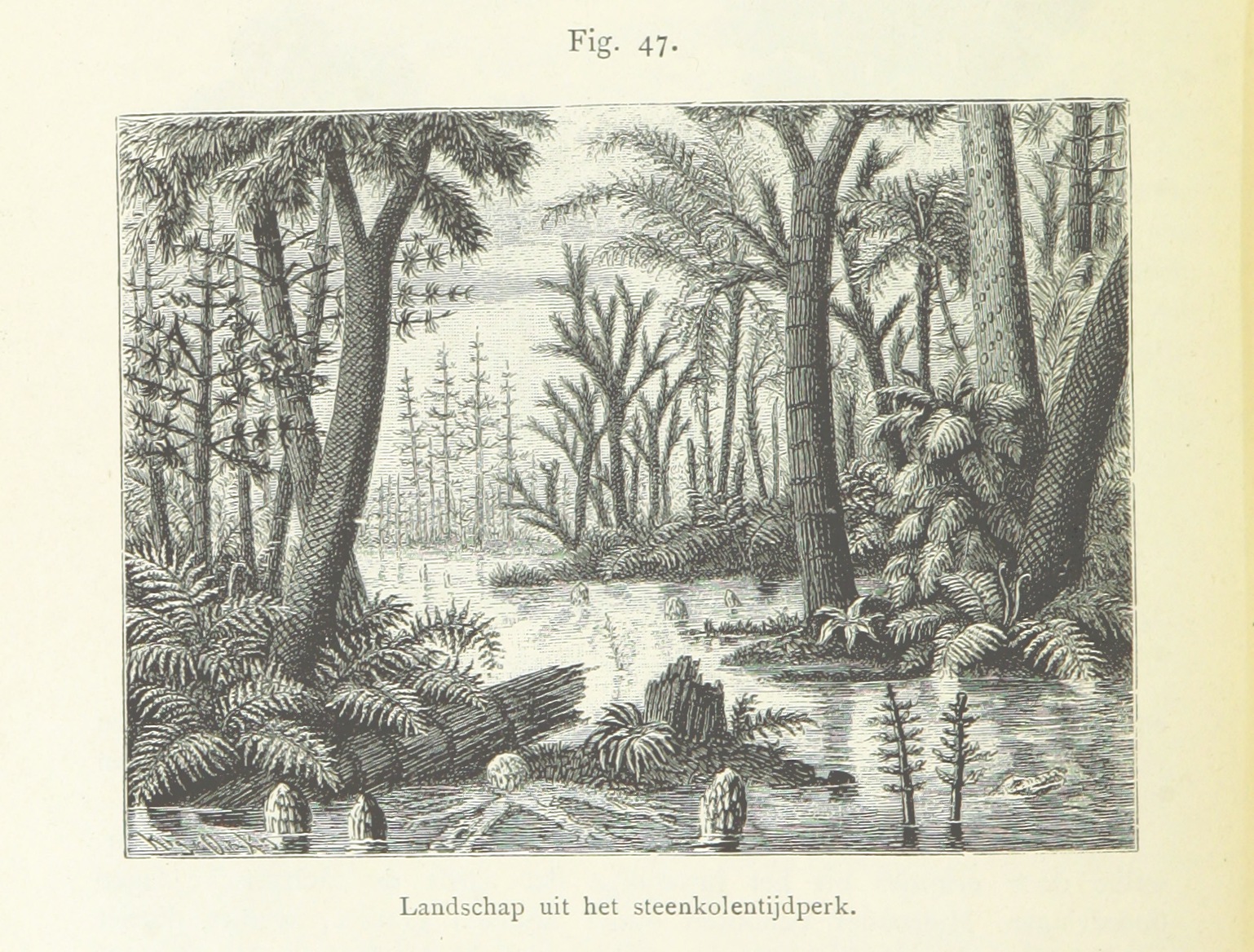
Artist's conception of Paleozoic swamp. Wikimedia Commons
The Table of Contents may be found here.
Artist's conception of Paleozoic swamp. Wikimedia
Commons
In this chapter, we will look at the earliest fossil-bearing
formations of the
Jemez area.
Across most of North America, the boundary beneath the oldest fossil-bearing beds is not a mere transition to older rock beds. The boundary is unconformable, meaning that the beds above it do not appear to be a continuation of the beds below it. This indicates that the rocks of Cambrian age or later were laid down on a surface eroded into the older rocks. This also means that there is a considerable length of geological time, sometimes over a billion years, between the sedimentary beds and the Precambrian rocks beneath them. This missing period of time was first recognized in New Mexico by the brilliant geologist, John Newberry, during the Ives expedition of 1857-1858, a full twelve years before it was recognized by John Westley Powell in the Grand Canyon. It is so distinctive and so widespread across North America that it has been dubbed the Great Unconformity.
The Great Unconformity is beautifully visible at Cody,
Wyoming, where the gap in the geological time record is over
2 billion years.

Beds of the 515 million-year-old Flatstone Sandstone sit unconformably on 2.7 billion-year-old Archean rocks. The sandstone is a tan color while the Archean rocks are mostly fine-grained gray granite intruded by ribbons of coarser pink granite. The Archean rocks date back to a time when the Wyoming-Montana area was not yet a part of North America, but instead was either part of a different continent or a small continent in itself.
Though widespread, the Great Unconformity is not identical
everywhere. For example, outcroppings of Cambrian to Devonian
rocks are present only in the southern part of New Mexico, or are
buried in the subsurface in the extreme northwest corner of the
state. Throughout most of the rest of the state, including the
Jemez area, rocks of Mississippian age or later sit directly on
Precambrian rocks.
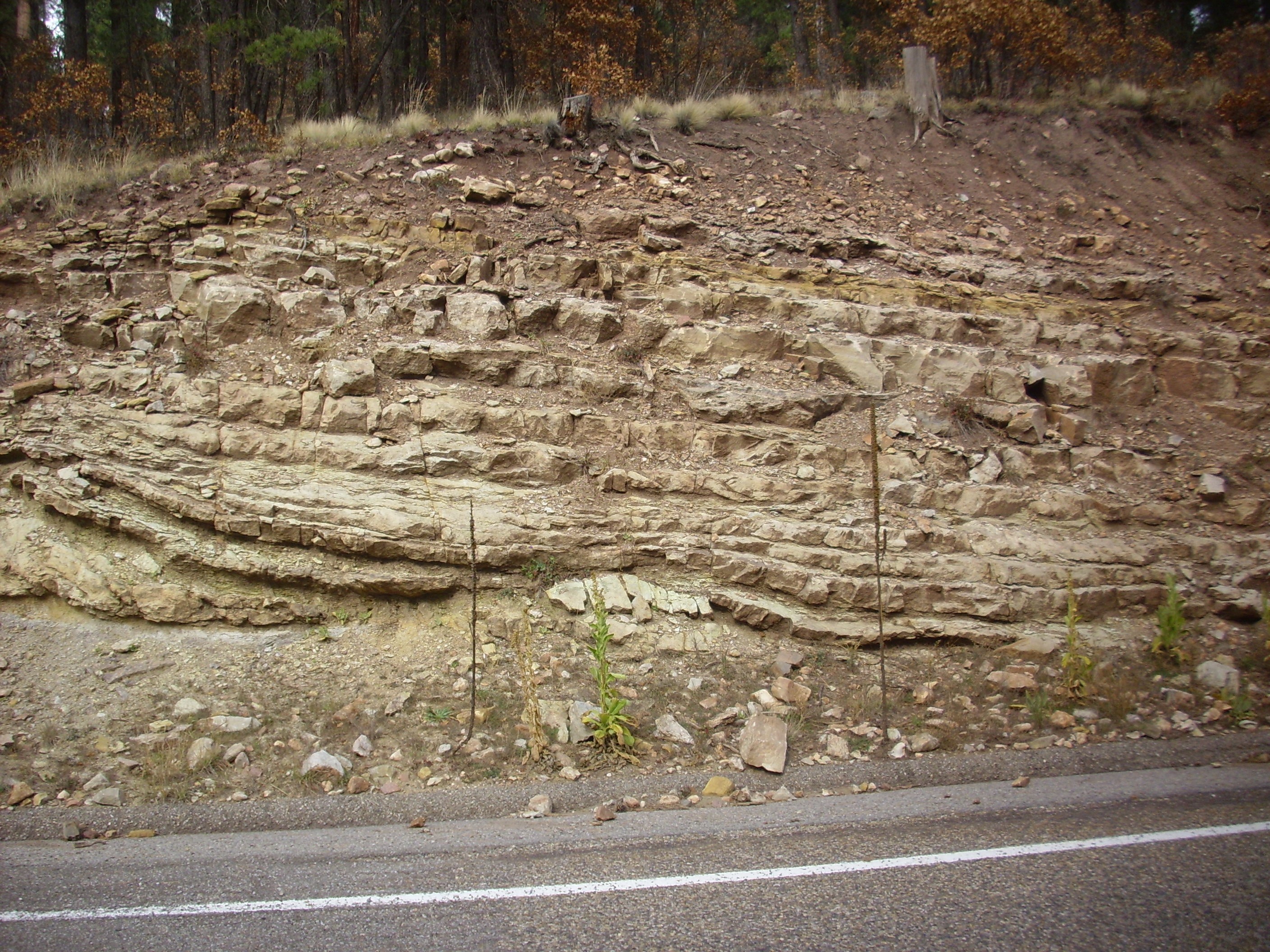
A prominent exposure of the Great Unconformity is seen at the top of Sandia Crest, east of Albuquerque. Here Pennsylvanian sandstone of the Sandia Formation sits atop 1.43-billion-year-old Sandia Granite.

This can be admired more closely on the road to the crest. This is one of the best exposures of the Great Unconformity I’ve seen.

Great Unconformity in the Sandia
Mountains. 35
11.466N 106 24.003W
The Sandia Granite is overlain by 310-million-year-old Sandia Formation. The contact represents some 1.1 billion years of missing geologic history, eroded away prior to 310 million years ago.
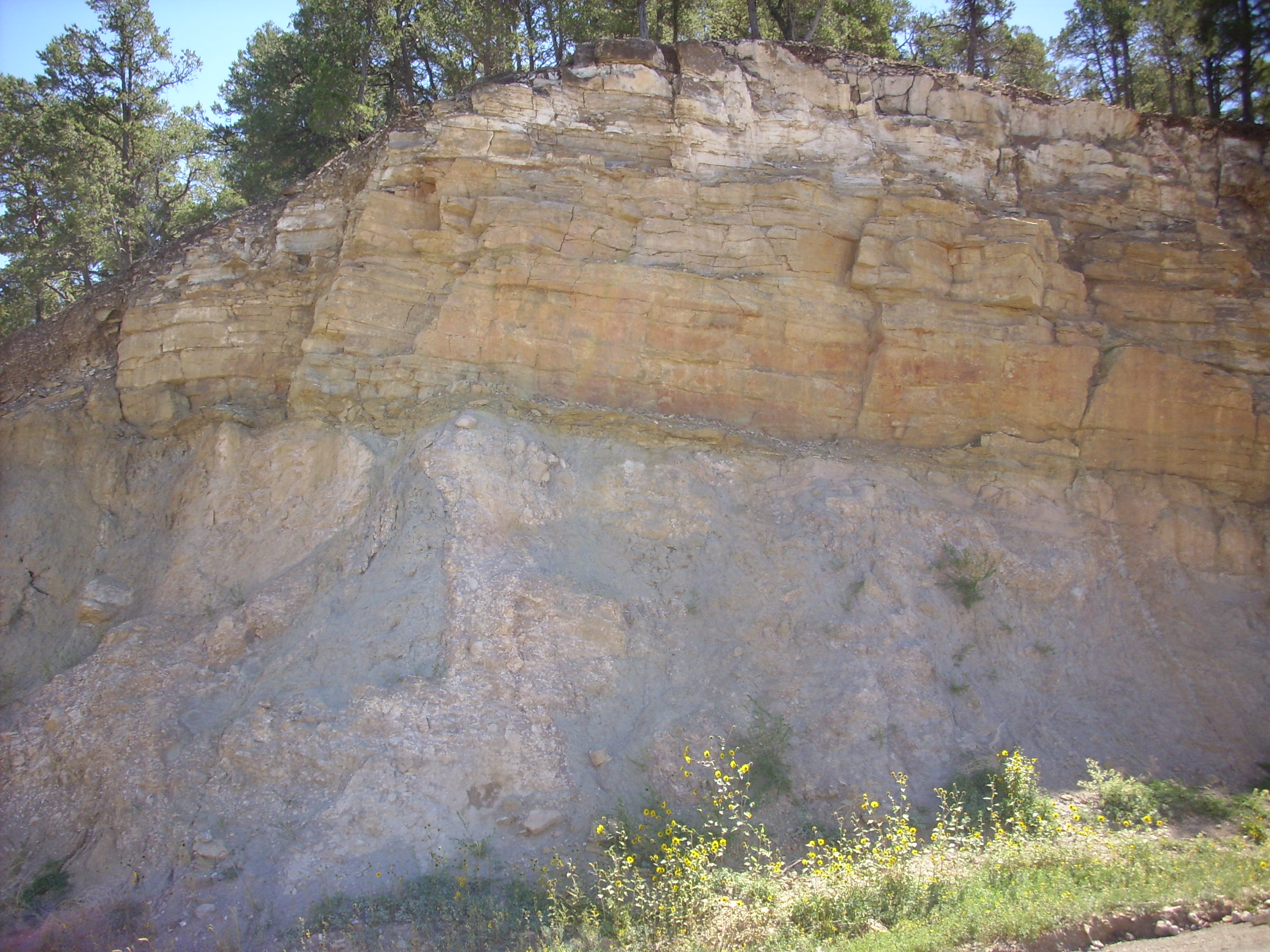
Since the only Precambrian outcropping in the Jemez proper is at Soda Dam, this is also the only place in the Jemez where one can see the Great Unconformity. We visited the Soda Dam area in the previous chapter, but it's time to visit the area again.
To the east of Soda Dam, the rocks sitting on top of the Precambrian gneiss are red beds of the Mississippian Log Springs Formation.
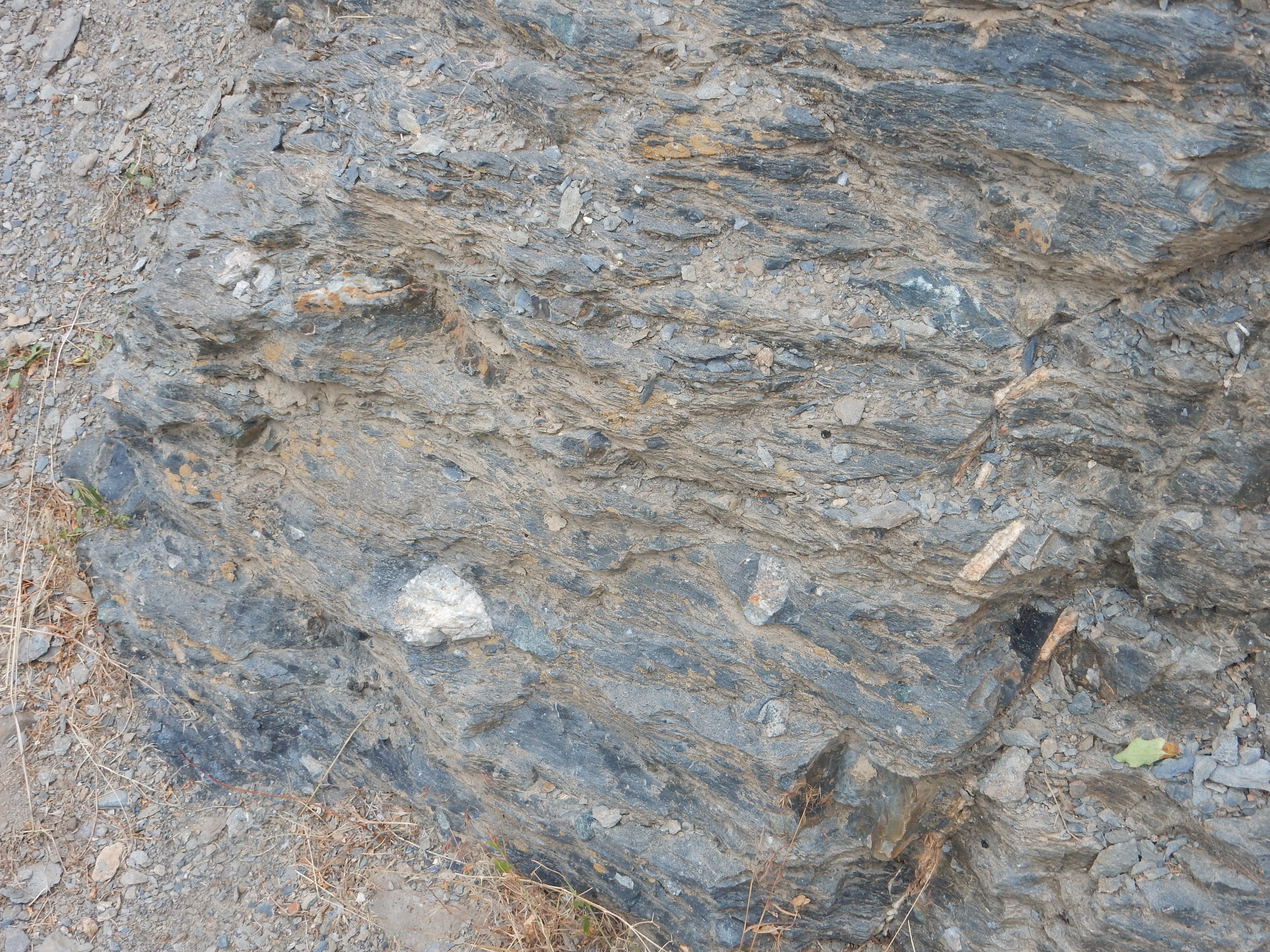
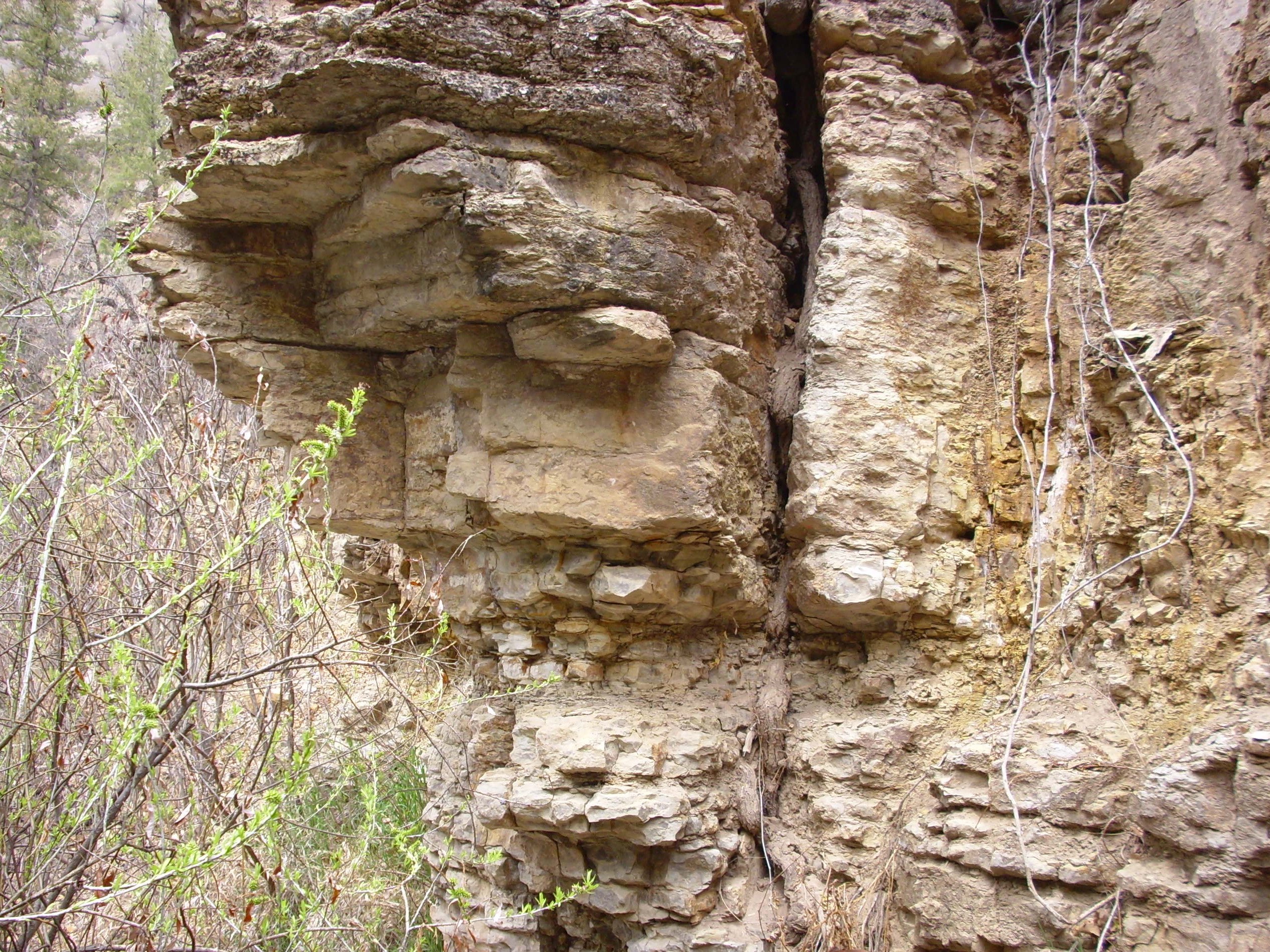
To the west of the dam, just across the highway, the geology is confused by the presence of a strand of the Jemez Fault and by extensive deposits of relatively young travertine. The fault itself is well exposed part of the way up the canyon wall.

The fault is the yellowish, steeply tilted zone just above the
center of the photograph. We will have much to say about faults
later in this book, but for now it suffices to say that a fault is
a fracture in the earth's crust across which the rock beds are
displaced vertically, horizontally, or both. The Jemez Fault
displaces the rocks mostly in the vertical direction and mostly
with the downthrown side (the side where the rock beds are
displaced downwards) to the east. However, this strand or
branch of the fault is displaced downwards to the west.
To the left is Precambrian gneiss and to the right is relatively young travertine deposits of Soda Dam. The travertine sits on top of Pennsylvanian Sandia Formation, but the two are quite difficult to distinguish since they are both limestone. To the left of the fault, however, there are intact Mississippian limestone beds sitting atop the gneiss, representing another exposure of the Great Unconformity.
The Mississippian beds are visible at center left, forming thin
beds tilted to the left. These are probably part of the Arroyo
Peñasco Group. To the right is Jemez Cave, and the jumbled
formations above the cave are geologically young travertine
deposits.
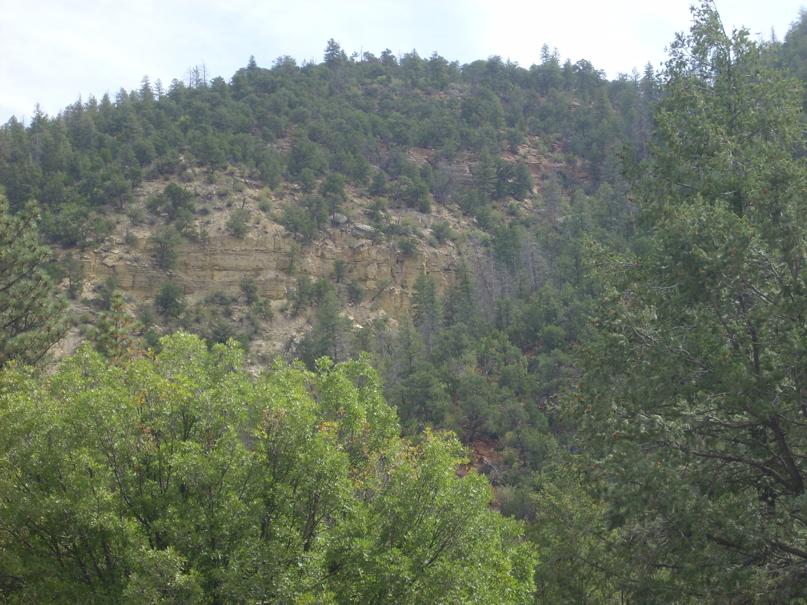
North of the Guadalupe Box, there is another exposure of the Great Unconformity.
The lower part of the photographic is Precambrian monzonitic
gneiss. Laid down on top of it are beds of Mississippian Arroyo
Peñasco Group.
The youngest Proterozoic formation of the Jemez is the Joaquin Granite at 1.424 billion years. The Trampas Group in the Picurus Mountains dates to the the Picuris Orogeny, but that is the last geological event clearly recorded in the rocks of northern New Mexico for the next billion years.The Arroyo Penasco Formation is about 330 million years in age. Thus some 1.09 billion years is missing from the geologic record in the Jemez region. We must look elsewhere for clues to what was taking place in the Southwest during this "Boring Billion."
The period from 1.1 to 0.6 billion years ago is particularly
poorly recorded throughout the American Southwest. The nearest
whole rock beds that record this long interval of the Earth's
history belong to the Grand Canyon Supergroup found in some
locations in the lower portions of the Grand Canyon of Arizona.
These date back from 1.25 billion to around 700 million years.
These are almost the only rocks in the American Southwest that
record the Boring Billion.
The supercontinent of Columbia began to break up around 1.35 billion years ago, about the same time as the Picuris Orogeny. It's tempting to see a connection, but there may not be one. The rifting away of Australia and Antarctica from what is now the western margin of Laurentia seems to have been a separate process from the continuing accretion of island arcs to what is now the southern margin of Laurentia.
A new supercontinent, Rodinia, began assembling around 1.1 billion years ago, and mountain building associated with continental collisions took place in west Texas. This event is known as the Grenville Orogeny, and it brought an end to the long period of accretion along the south margin of Laurentia. The assembly of Rodinia increased weathering of continental crust enough that the oceanic ratio of 87Sr to 86Sr spiked about this time. 87Sr is produced by decay of 87Rb, which is highly concentrated in continental crust, while 86Sr is not produced by any decay process. Thus continental crust shows an increase in 87Sr/86Sr over time spans of billions of years that is not seen in oceanic crust. When there is rapid weathering of continental crust, the ratio of 87Sr to 86Sr in seawater increases significantly, and this is recorded in marine carbonate rocks formed at the time, where strontium easily substitutes for calcium.
There are a couple of proposed reconstructions of the geography of Rodinia. Both place Australia and East Antarctica along the west coast of Laurentia, but one model has Australia far to the north and East Antarctica directly west of the Jemez while the other has Australia directly west of the Jemez and Antarctica to the south. Most place Africa to the southeast and attribute the mountain building in west Texas to the collision of Africa with North America. Either way, Laurentia drifted close to the equator while remaining rotated 90 degrees clockwise compared with its modern orientation.The only record of these events in northern New Mexico is provided by zircons in sedimentary rock beds.
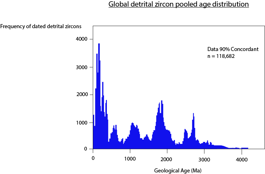
Earlier I explained how zircons help establish the age of the Earth. The oldest known zircons are actually older than the rock beds in which they are found, because zircons eroded out of the igneous rock in which they originally crystallized are extremely durable. The same is true of zircons that have crystallized throughout the history of the Earth. When we take a sample of a young sedimentary bed, and extract and date a large number of zircons from it, we typically find that the zircons range in age from slightly older than the bed itself back billions of years. However, the distribution in age is not uniform. Young zircons are most common, but we also find peaks at various times in the distant past. These are times when a particularly large volume of magma crystallized that was subsequently exposed by erosion.
The detrital zircon distribution in northern New Mexico is similar to that of other parts of the world. There is a peak at about 3.16 billion years, the age of the older rocks of the Canadian Shield. Another peak at 2.7 billion years may point to the formation or breakup of late Archean supercontinents. There is another peak at 2.05 billion years, about the time that the core of Laurentia assembled. Thereafter there are numerous peaks from about 1.88 billion years to about 1.02 billion years, likely recording the long history of accretion of island arcs to the southern Laurentian margin, including the Yavapai, Mazatzal, Picuris, and Grenville orogenies. The period from 1.02 billion years to 620 million years is as boring as the Boring Billion of which it is part, with only a small peak around 760 million years that may mark the breakup of Rodinia.
The timing of the breakup of Rodinia can also be estimated from paleomagnetism. When magma solidifies, any magnetic minerals in the rock will be aligned with the Earth's magnetic field. Unless the rock is subsequently heated above a certain temperature, its Curie temperature, this remanent magnetization remains unchanged for up to hundreds of millions of years. Geologists can measure the remanent magnetization of a rock sample and estimate the strength and orientation of the Earth's magnetic field at the time of its formation. Such paleomagnetic measurements show where the rock was relative to the Earth's magnetic poles.
Paleomagnetic measurements in Australia and North America are
consistent with the continents lying side by side up to about 770
million years ago. At this time, the locations of the continents
begin to diverge, suggesting that Australia had broken away from
North America to produce the paleo-Pacific, or Panthalassic,
Ocean. This is fair agreement with the small zircon peak at 760
million years.
The reassembly of the continents into the supercontinent of
Pannotia between 600 and 550 million years ago likely accounts for
a detrital zircon peak from 624 to 595 million years ago.
This interval of time includes the Varangian glaciation, the
worst ice age the Earth has known. This was actually three
distinct cold periods: The Sturtian, from 717 to 680 million years
ago; the Marinoan, from 650 to 635 milion years ago; and the
Gaskiers, a very brief glaciation occurring about 580 million
years ago. Photosynthesis had drawn down the amount of warming
carbon dioxide in the atmosphere, and the location of Rodinia,
astride the equator, meant that the Earth's dry land was
positioned to reflect the maximum amount of solar energy. The
breakup of Rodinia exposed great new masses of rock to weathering,
which drew down carbon dioxide further. This triggered a climate
runaway, as glaciers spread across the globe, reflecting more
solar energy into space and cooling the Earth further. Eventually
most of the Earth was covered with great ice sheets. Evidence of
glaciation has been found on every continent for this time period,
including areas that seem to have been close to sea level near the
Earth's equator. Glacial till, a characteristic
sedimentary deposit produced by glaciers, is preserved in parts of
Utah from this time period. This was deposited offshore in the
newly opened Panthalassic Ocean.
Above the tillite, in many locations, geologists have found a
"cap rock" of carbonate minerals that is interpreted as
precipitation of these minerals as the ice melted and released
trapped carbon dioxide.
The "snowball Earth" scenario remains controversial. There are
alternate explanations for some of the evidence, and an unsolved
mystery: How did life on Earth ever recover from so extensive a
glaciation? That there was extensive glaciation seems clear, but
the "slushball Earth" theory suggests that glaciation, while
severe, did not cover the entire land area or much of the oceans.
This glaciation may have helped scour off younger sedimentary beds across the Southwest. But whether due to glaciation or more conventional erosion, a vast area of western North America was beveled nearly flat, forming a peneplain. Geologists mapping the remnants of this peneplain find less than 10 meters (30') of relief, with only very low ridges of slightly more resistant quartzite breaking the perfectly level surface.
Though the geologic record of this period in the Southwest is
fragmentary, one geologic event during this time period did leave
its mark on the Jemez area.
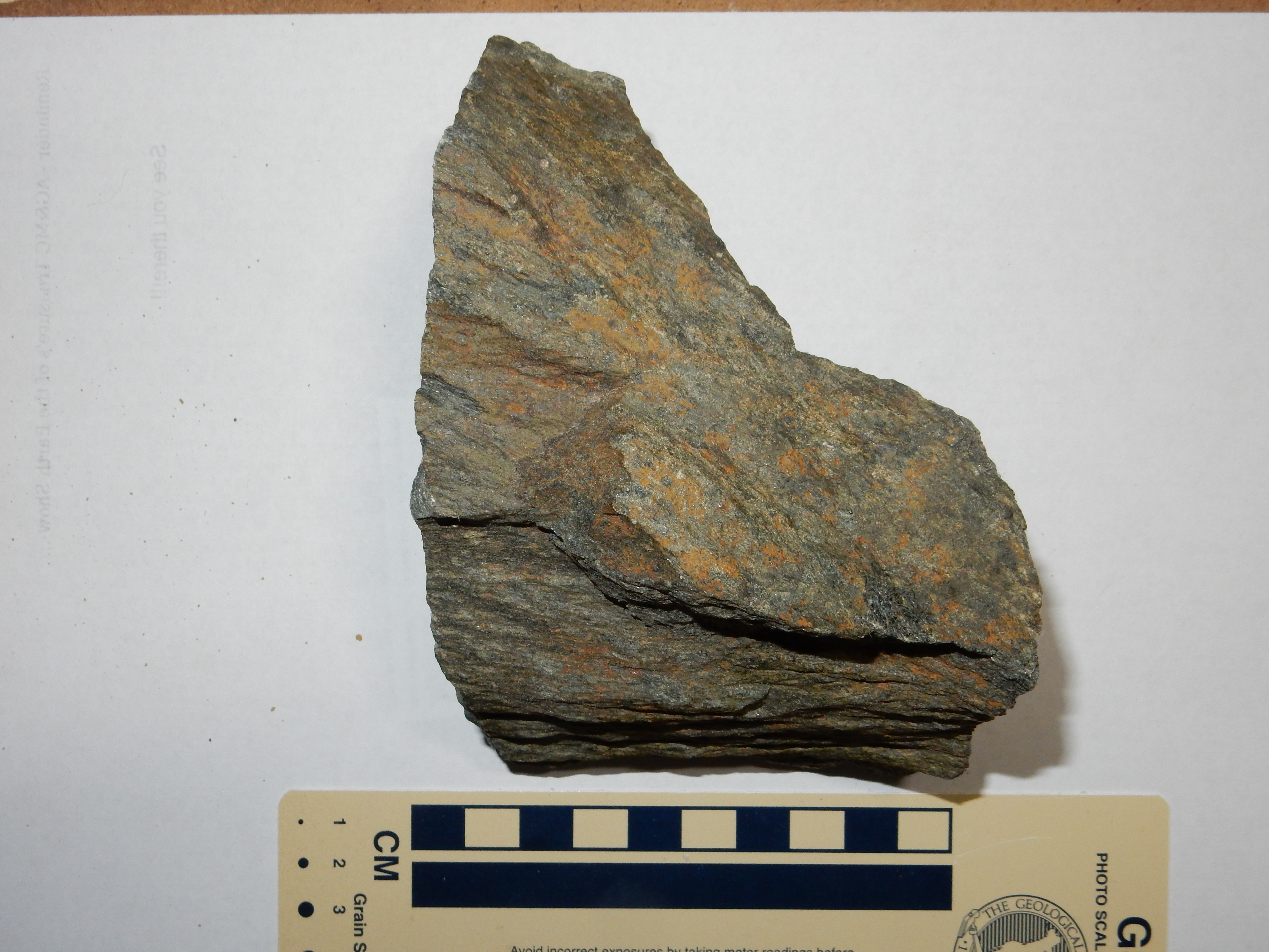
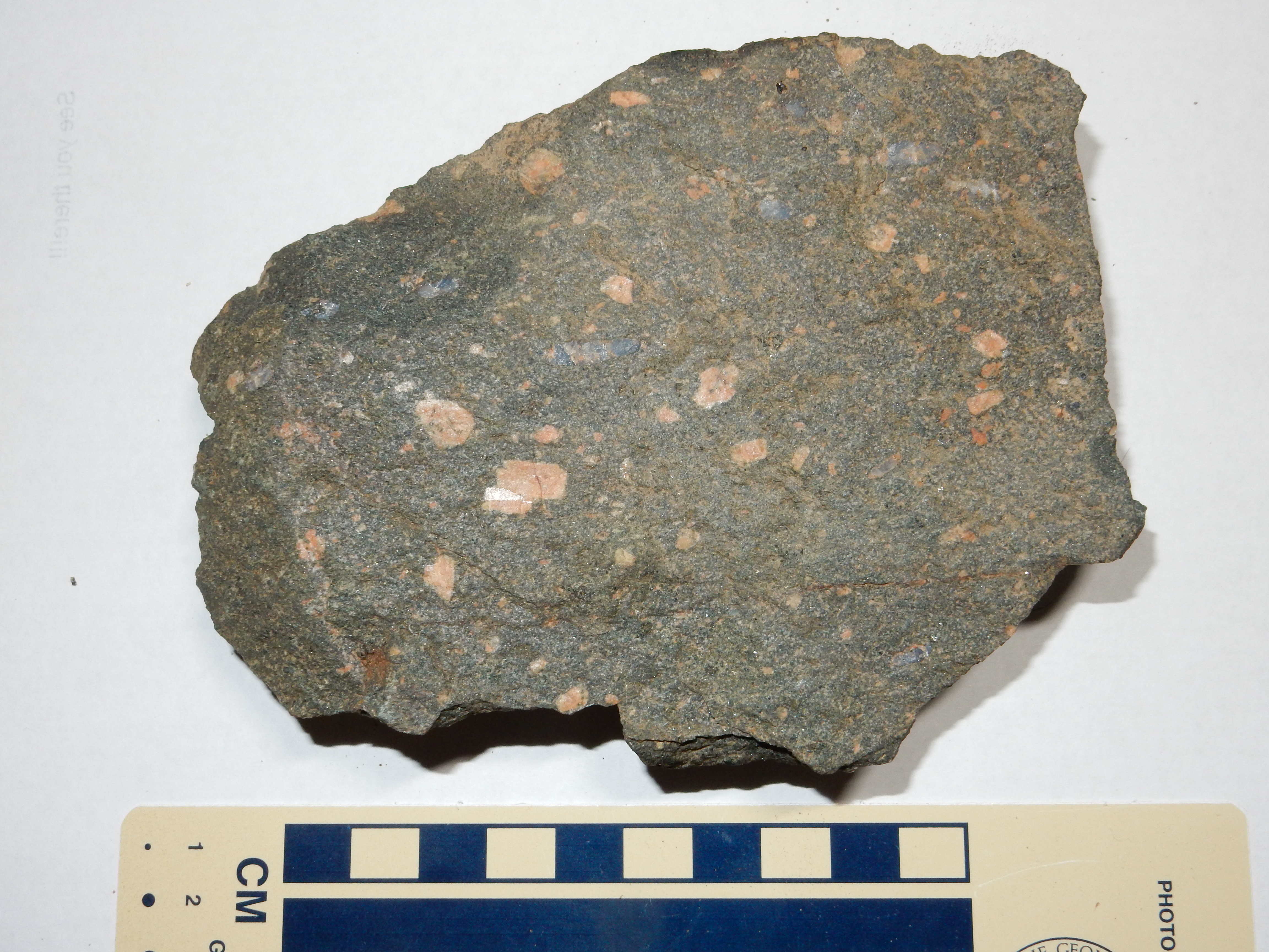
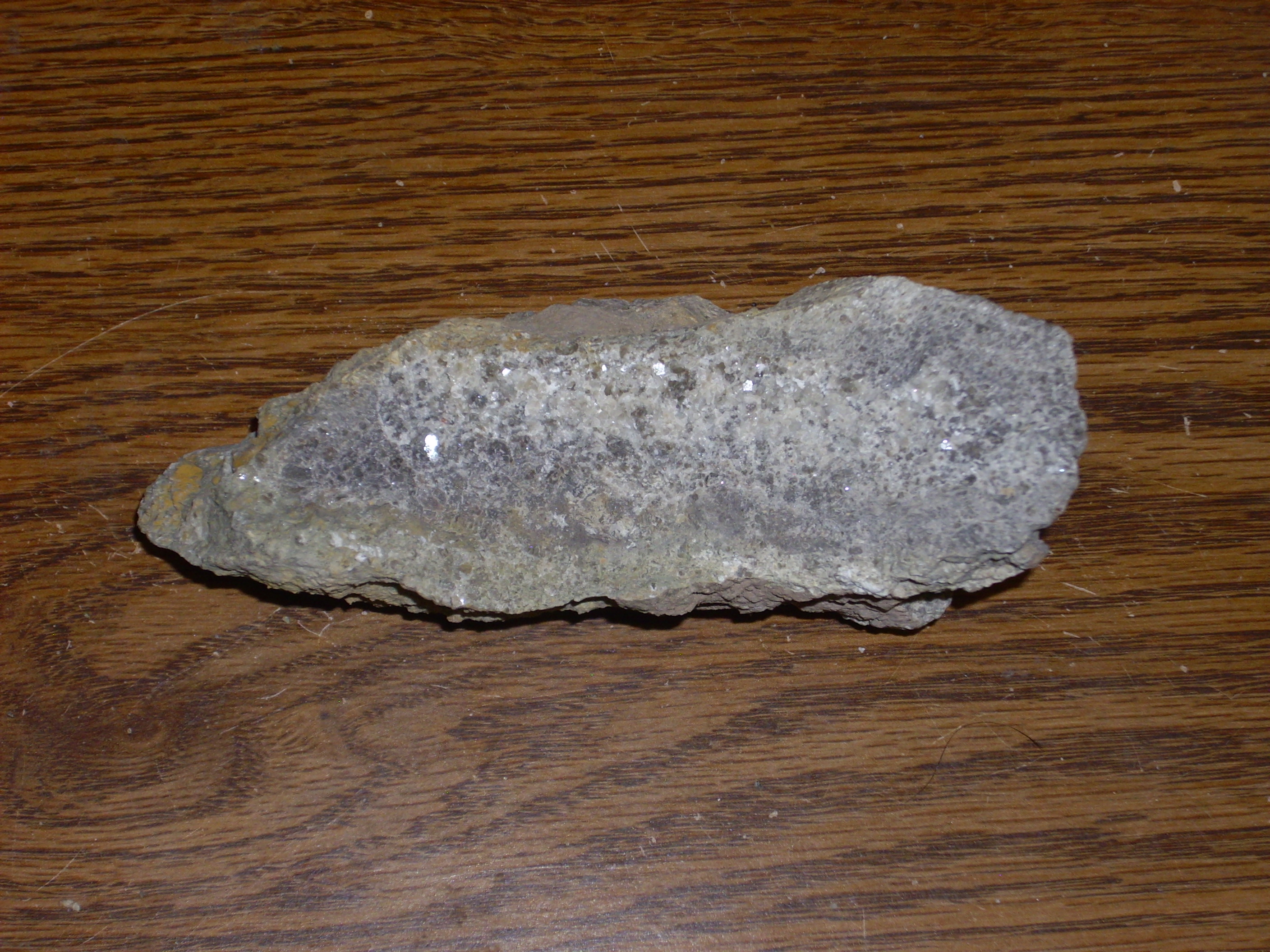
Here are a couple of pieces of Precambrian basement rock collected from a spot northeast of Santa Fe, along the Hyde Park Road.
 |
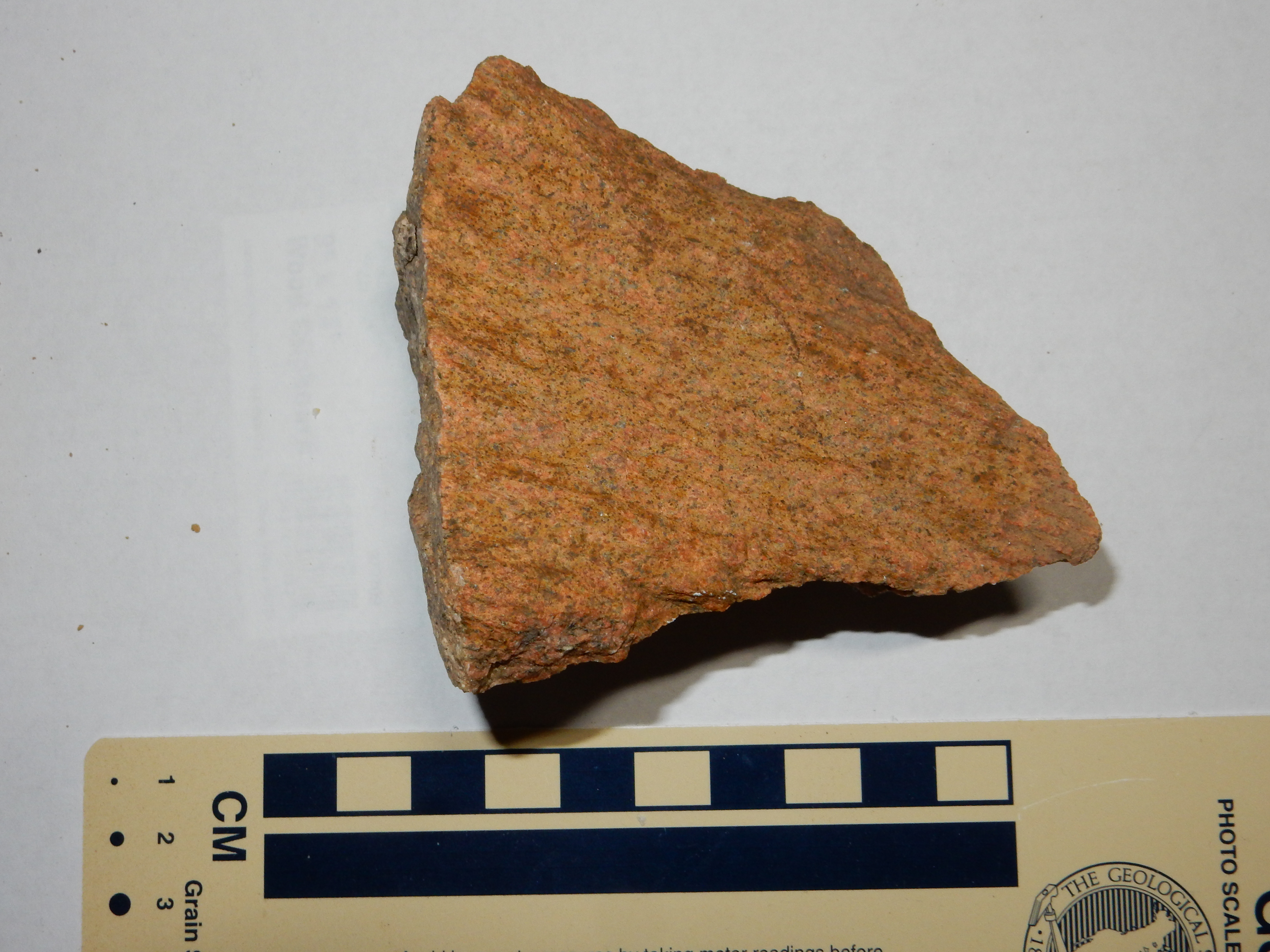 |
The rock on the right is the predominant rock in the road cut. It
is a fairly unremarkable granite gneiss, though attractive enough
that it's used for decorative gravel throughout the region. It
resembles the gneiss from Soda Dam. The rock on the left is from
the biotite schist that was intruded by the granite gneiss.
There's more to these rocks than meets the eye. The fractured surfaces, which my photos cannot do justice to, are actually quite ancient. These distinctive fractures, which are even more striking in the original outcropping, are called shatter cones, and they are an indication that the rocks were very close to a meteorite impact event. This is confirmed by findings of shocked quartz in the area. This Santa Fe impact structure is of moderate size, not more than a few kilometers in diameter, and took place long enough ago that the crater has long since been eroded away, leaving only the deep rocks that were under the center of the crater.
It is possible that some of the shattered rock produced by the
impact was preserved. About three kilometers (two miles) to the
west, at Nun's
Corner, layers of dolomite of the Mississippian Arroyo
Peñasco Group sit on top of Precambrian granite. The granite is
highly fractured, almost rotten in texture, suggesting it is breccia
(shattered rock) produced by the impact.
How long ago did this impact occur? The Precambrian granite here
is between 1.6 and 1.7 billion years old. Geologists have found no
trace of shatter cones or shocked quartz in the overlying younger
rocks, which are about 350 million years old. Since metamorphism
would likely have erased the cones, we can further constrain the
impact to after 1.4 billion years ago. So the impact occurred
sometime between 1.4 billion and 350 million years ago. In other
words, we can't constrain it very well, though the preservation of
possible shatter breccia under the Arroyo Penasco Group hints that
the impact came late in this time interval rather than early.
During the missing billion years of geologic history in the Jemez, the oxygen levels in the atmosphere continued to rise. With the end of the Varangian glaciation, and with oxygen levels now above 10%, life on Earth took on a new exuberance. DNA sequencing suggests that the common ancestor of all animals was a choanoflagellate, a single-celled organism having one large flagellum, the whip-like organelle found in many single-celled eukaryotes. The flagellum is surrounded by a kind of collar composed of strands of protoplasm covered with cilia. This gives the choanoflagellates their common name of collar protozoa. The choanoflagellate feeds by using its flagellum to draw water through the collar, which filters out food particles. The flagellum can also be used for movement.
Sketch of small colony of choanoflagellates. Wikimedia
Commons.
Modern choanoflagellates sometimes form small colonies of cells,
though the individual cells remain capable of surviving
independently if the colony is broken up. Choanoflagellates have
all the essential structural and biochemical features of animal
cells, and closely resemble collar cells found in sponges and
primitive worms. They first emerged perhaps 950 million years ago,
based on the "molecular clock." This is a figurative name for the
technique of estimating the time since two biological lines
diverged based on accumulated mutations distinguishing the two
lines. The molecular clock is the biological equivalent of
radiometric dating, though unfortunately far more poorly
calibrated. Choanoflagellates evolved the ability, unique among
those forms of life that live off other organisms, to organize
themselves into communities.
The first true animals, which were likely sponges, appeared
perhaps 760 million years ago. Fossils of possible early sponges
of this age have been found in Namibia,
and have been given the species name Otavia antiqua.
Corals first appeared around 680 million years ago, when
their lineage diverged from animals having a bilateral body plan
such as our own. Corals and their relatives (the cnidarians)
show radial symmetry in their body plans instead.
Our last common bilaterian ancestor with insects, molluscs, and
their kin likely lived around 650 million years ago, and the
chordates (vertebrates and their close kin) split away from
echinoderms (starfish and their kin) roughly at the start of the
Cambrian, 541 million years ago.
The Cambrian is the earliest geological period in which there
were abundant hard-shelled animals to leave fossilized remains.
This was likely a consequence of oxygen levels rising to a
critical threshold of about 17%, enough to allow some organisms to
abandon anaerobic respiration entirely. Anaerobic respiration
produces acid byproducts that etch away calcium carbonate shells.
Precambrian fossils exist, but it was some time before their
nature and antiquity was recognized.
With the breakup of Pannotia, much of the Earth's crust became
covered with shallow oceans in which the rocks of the Cambrian and
succeeding periods were deposited. Much of the western U.S. is
underlain by Cambrian sedimentary beds, including the Tonto Group
in the Grand Canyon, the Wheeler Formation with its spectacular
trilobite beds in western Utah, and the Tintic Quartzite
throughout Utah. This area seems to have remained a slowly
subsiding passive margin clear into the Pennsylvanian.
Northern New Mexico remained an area of higher elevation, part of a structure geologists have dubbed the Transcontinental Arch. This extended to Wisconsin and beyond, and is sometimes regarded as a southwestern extension of the Canadian Shield. It was characterized by deep faulting trending to the northeast, parallel to the Jemez Lineament and possibly related. The Transcontinental Arch did not become submerged until later, and the Jemez area remained above water until the Mississippian.
The region from central Colorado to southwestern New Mexico
contains numerous small intrusions of alkali or cabonatite
magma of Cambrian to Ordovician age. Carbonatite magmas are magmas
that are so rich in carbon dioxide that they solidify into
carbonate minerals, and they are rare in the geologic record. But
they are believed to be closely associated with highly alkaline
magmas. The only known carbonatite volcano in the modern world
is Ol
Doinyo Lengai volcano in Tanzania, which erupts molten
sodium carbonate.
Alkali dikes are reported in the southern Nacimiento Mountains. A
different, but related, kind of mafic dike intrudes an outcrop of
the San Pedro Quartz Monzonite along State Road 126 in the
northern Sierra Nacimiento Mountains.

Possible lamprophyre dike in San Pedro
Quartz Monzonite. 35
59.672N 106 49.325W
This dike is prominent enough to be shown on the geologic map for
this area. A close examination shows a feature not often seen in
mafic dikes.
There are rather large crystals of orthoclase in the otherwise fine-grained dike rock. These somewhat resemble the distinctive orthoclase crystals of the nearby rapakivi quartz monzonite. A sample:
Furthermore, while washing the sample to prepare it for its portrait, I realized that there are bluish quartz grains in the rock that are elongated in one direction. (You can see one just above and to the left of the center of the sample.) These features suggest this may be a kind of lamprophyre called vogesite. The geologic map for this area indicates that lamprophyre dikes are present in the quartz monzonite. So there it is.
Lamprophyres are very low-silica, high-potassium rocks formed in small volumes by very slight melting of the earth’s upper mantle. They are characterized by porphyritic texture, including xenocrysts of feldspar and quartz. Xenocrysts are individual mineral grains that are in some way foreign to the rock, such as grains melted out of the surrounding country rock. Lamprophyres are classified according to the dominant minerals in the ground mass, and a vogesite is a lamprophyre whose ground mass is made up mostly of amphiboles and microcline. That appears to be the case here.
Lamprophyres are considered a kind of alkali intrusion. This one has not been dated, and there are some hints it has undergone metamorphosis, but it is possible this is a Cambrian-Ordovician alkaline dike.
The significance of the Cambrian-Ordovician dikes is slightly uncertain, but the best current theory is that, during the breakup of Pannotia, the crust under New Mexico and Colorada was stretched enough to disturb the mantle and bring alkali magma to the surface. This was likely one arm of a triple junction, where stretched crust begins to rift along three directions from a central spreading center. It is common for two of the rifts to develop into full-fledged ocean basins while the third does not quite tear apart. The failed rift is called an aulacogen. The best modern example is the Afar Depression of Ethopia, where the Gulf of Aden and the Red Sea form the other two arms of the triple junction.
There are some difficulties with this theory. There are no structural hints of the boundaries of the aulacogen, other than evidence of uplift in the Florida Mountains in southern New Mexico about this time. Nor are there any sedimentary formations that can clearly be associated with the infilling of the rift. However, it's the best explanation we have for the burst of alkaline magmatism in a narrow window of time.
Following the failed aulacogen, the Jemez area was quiescent for roughly one hundred million years, through the Silurian and Devonian Periods. There is no geologic record in the area again, other than a broad detrital zircon peak centered around 420 million years ago (corresponding to the Silurian-Devonian boundary), until the early Mississippian.
During this interval, the first vascular plants, arthropods, fish, and amphibians appeared in the fossil record. Though possible mollusc tracks are found on land as early as the Cambrian, it was with the evolution of liverworts from filamentous green algae sometime in the Middle Ordovician (470 million years ago) that the dry land of the continents was finally populated with macroscopic life. This was restricted at first to moist environments, since liverworts have no roots, vascular tissue, or stomata. Stomata are openings in the surface of a plant surrounded by a pair of guard cells that allow the plant to balance water loss against access to atmospheric carbon dioxide. Mosses evolved stomata about 453 million years ago. Vascular plants, having true water-conducting tissue, evolved in the early Silurian (about 430 million years ago) and plants with true leaves evolved in the middle Silurian (429 million years ago). The first plants with true seeds appeared late Devonian, 370 million years ago, allowing plants to spread into drier regions and cover the continents.
Following the Mexican-American War of 1847, the United States took control of a vast stretch of territory from the Rio Grande to the Pacific Coast, including the future states of California, Nevada and Utah and much of Arizona, New Mexico, and Colorado. This included the Jemez region.
The U.S. government was eager to build a transcontinental
railroad across the new territory. Congress funded surveying
expeditions to explore possible routes for railroads, including a
route roughly along the 35th parallel. Attached to this survey was
a French geologist, Jules Marcou. Marcou had been trained by the
pioneering geologist, Jules Thurmann, and assisted in mapping the
Jura Mountains of France. He was later introduced to Louis
Agassiz, and joined Agassiz in the U.S. in 1847. Marcou studied
the geology of the Michigan copper mines, the states of New
Jersey, Virginia, and Pennsylvania, and Mammoth Caves in Kentucky.
He had also traversed Canada and published an early geologic map
of North America. Though parts of New Mexico had previously been
studied by officers of the Corps of Topographic Engineers, who
often had an excellent background in the natural sciences and made
perceptive observations, Marcou was the first trained geologist in
the territory.
The Marcou Survey of 1853 passed through Santa Fe, Cerrillos, and Algodones on its way to Albuquerque, where the expedition paused to refit. Marcou took advantage of the delay to explore the Sandia Mountains, and his attention was drawn to the thick beds of limestone capping Sandia Crest. Geologists of his day were particularly interested in fossils, and Marcou immediately recognized characteristic fossils of the Carboniferous in the limestone. He also discovered several new fossil species.
The expedition then headed southwest from Albuquerque, and Marcou
seems not to have personally explored the Jemez. The geologic map
produced from his notes is understandably most accurate
immediately along his route. It correctly identifies Santa Ana
Mesa and the Cerros del Rio as geologically young volcanic
formations, but the Jemez is mapped as a simple north-south range
with a granite core surrounded by Carboniferous rocks and red
sandstone on all sides. This was nonetheless the first report from
a trained geologist passing near the Jemez region, and Marcou was
certainly correct in identifying some of the beds in the Jemez as
carboniferous, even if he was mistaken on their extent. It seems a
shame he did not explore Canyon de Guadelupe and Canyon de San
Diego personally, and thus missed discovering some of the richest
beds of brachiopod fossils in North America.

345 million years ago, during the Mississippian Subperiod,
northern New Mexico was a shallow subtropical sea. To the east lay
most of the Earth's continental crust, which was assembling into a
new supercontinent, Pangaea. The narrow Rheic Ocean separated
North America from South America and Africa, which had already
fused with Australia, Antarctica, and India to form a large
continent which geologists have named Gondwana. Europe, Siberia,
and central Asia had fused with North America to the east and
northeast to form Laurasia, and only China remained isolated,
separated from Laurasia and Gondwana by the Paleo-Tethys Ocean.
This was the beginning of the Visean Age, the second age of the
Mississippian Subperiod. The first age of the of the Mississippian
Subperiod is known as the Tournasian Age, and it was characterized
by Romer's Gap, a period of some 10 million years in which our
tetrapod ancestors simply disappeared from the fossil
record. They survived the late Devonian mass extinction by only
the narrowest of margins, likely as small populations clinging to
life in particularly favored environments. Only by the start of
the Visean Age did tetrapods begin to proliferate again. The mass
extinction was not restricted to animals; whereas Archaeopteris
trees grew to 30 m (100 ') prior to the Tournasian Gap, the
largest trees during the gap grew to not more than two meters (7')
in height. These, too, recovered in the Visean, where seed ferns
like Pitus primaeva grew to 40 m (130').
This was a time of low relief and very high sea levels. Like New Mexico, most of Laurasia was flooded with shallow seas. Only in eastern Canada, New England, and Scandinavia were large areas of dry land exposed,. While much of central Gondwana was dry land, the margins of the southern continent were also flooded by shallow seas. The transgression that drowned the Jemez area during the Mississippian is known as the Kaskaskian transgression.
In Europe, the Mississippian and Pennsylvanian subperiods are jointly called the Carboniferous Period, because there were vast and long-lived swamps in which a great deal of peat was laid down that eventually became coal. During the Carboniferous, 90% of all known coal deposits were laid down in just 2% of the Earth's geologic history. The vegetation of the swamps was dominated by licophytes (giant relatives of club mosses) such as Lepidodendron and early seed plants such as Glossopteris. The lycophyte rain forests reached their maximum extent about 308 millions years ago, when they covered an area of almost 2.5 million square kilometers (almost a million square miles). New Mexico was not one of these areas; most of the state was under salt water, in a shallow marine environment, and most of the rock laid down during this period was limestone and shale.
The lycophyte forests of the Carboniferous would seem like a very
alien world to us. The lycophyte trees grew to 50 m (160') in
height, but would have looked like green poles covered with small
leaflets rather than the familiar tree canopies of today. In fact,
they would have vaguely resembled the cell phone towers badly
disguised as trees that you see in some locations. Unlike modern
trees, they had unifacial cambium. Their cambium (growth
layer) produced new conducting tissue on one side only, so they
lacked the phloem that transports sugar from the leafy tops of
modern trees to their roots. This meant that the roots had to
retain their own leaflets to produce sugar locally. The lycophytes
were also determinate, building their trunks to their
maximum height in just a few years, branching out to produce the
spores by which they reproduced, then dying almost immediately.
Horsetail trees were also present in the Carboniferous swamps.
They resembled lycophyte trees in having unifacial cambium
and determinate growth, but had true woody tissue, albeit not
arranged like that in modern trees.
The great evolutionary innovations of the Carboniferous were seed
plants and amniotic eggs. Both are adaptions to drier
conditions. The high oxygen levels may have made evolution
of eggs possible by allowing early eggs to have a lower surface to
volume ratio, reducing loss of water while supporting adequate
oxygen uptake. Trees as we would recognize them today, with
features resembling those of modern conifers, appeared in the
Pennsylvanian. Cordaites was a conifer standing about 5
meters (16') high. The coal swamps were populated by amphibians,
of which the largest (such as Eryops) exceeded two meters
(six feet) in length. Large insects and other arthropods first
appeared in great numbers during the Mississippian, thriving in
the humidity and in oxygen levels 60% higher than today.
These included Pulmonoscorpius, a scorpion ancestor
the size of a German shepherd, and Athropleura, a
millipede 2.5 m (8 feet) long. There were dragonfly ancestors (Meganeuropsis)
with wingspans of 60 cm (two feet). Gigantism extended to
marine organisms, such as Gigantoproductus, a
brachiopod with a shell 30 cm (a foot) across.
We infer the high oxygen levels indirectly, from estimates of
carbon sedimentation and because it seems improbable that such
large arthropods, with their relatively inefficient respiratory
systems, could have survived at lower oxygen levels. The earliest
coal beds contain almost no charcoal, suggesting that oxygen
levels remained below 13%, until about 363 million years ago. At
that concentration, wildfires are very difficult to sustain.
Charcoal became increasingly common thereafter as oxygen levels
continued to increase. Oxygen levels may have risen as high as 35%
by 290 million years ago, explaining the giant arthropods and
amphibians of the Carboniferous and the presence of large amounts
of charcoal in the later coal beds. The character of the charcoal
suggests it formed in fires of extraordinary intensity, reaching
temperatures as high as 600C (1100 F). The Carboniferous
atmosphere was likely a perpetual brown haze of smoke from
numerous intense wildfires burning around the globe.
How did so much coal get deposited in so short a time? The
intense wildfires produced a large quantity of indigestible
charcoal, but this is only 15% of the coal beds. Another factor is
that organisms that could decompose lignified cellulose were slow
to evolve. The first wood consumers, wood roaches, did not appear
until the late Pennsylvanian. Fungus grew only slowly in the acid
waters of the coal swamps. The lycophytes and horsetail trees grew
extremely rapidly, perhaps 60 meters (160 ') in just ten years,
then died, rather than keeping their carbon tied up as heartwood
as in modern trees. Such rapid growth was possible because
of carbon dioxide levels 50% higher even than in our
postindustrial world.
Our perception of the Carboniferous is highly colored by the
extensive coal swamps, which suggest a very warm Carboniferous
Earth. But, in fact, the Earth had been locked in an ice age since
the late Devonian, 360 million years ago. The middle Devonian (387
million years ago) saw the appearance of the first forests on
earth, including the Gilboa fossil forest, composed of tree ferns
such as Wattieza. These were followed by Archaeopteris,
the first tree with true woody tissue. These forests drew down
atmospheric carbon dioxide levels enough to trigger the late
Devonian ice age. The coal swamps of the Carboniferous thus were
concentrated along a band close to the equator, while much of
Gondwana was covered with ice sheets. This ice age lasted a full
67 million years, ending only with an even greater catastrophe
that marked the end of the Paleozoic world. We'll come to that
presently.
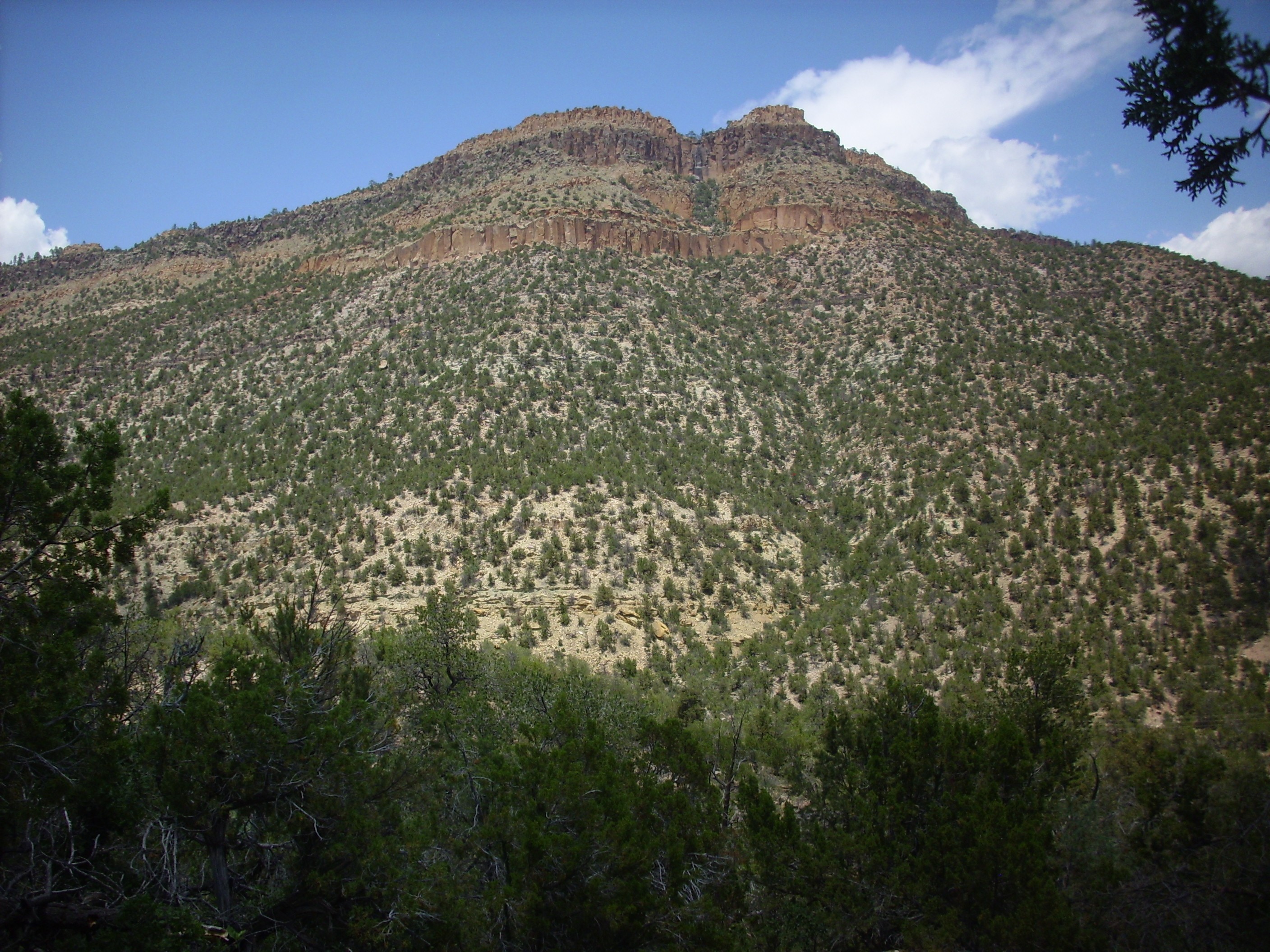
The Carboniferous formations of the southwest Jemez are nowhere
better seen than from atop the western rim of Guadalupe Box, which
can be reached by a short if strenuous hike along a fire road.
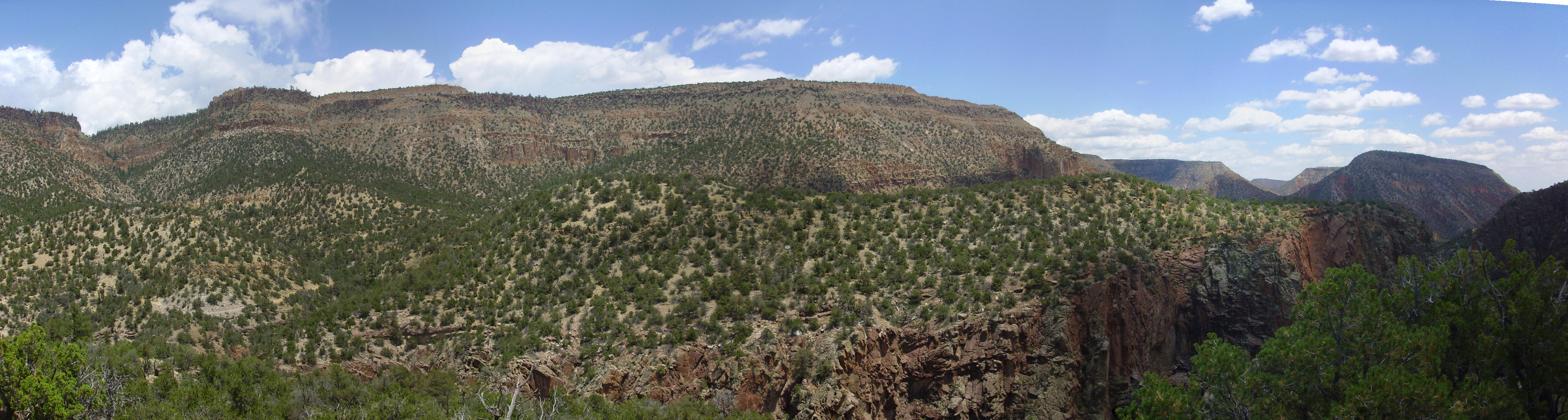
The Carboniferous at Guadalupe Box.. Looking east from 35
44.162N 106 45.954W
To the right is the mouth of Guadalupe Box, with Mesa
Garcia in the distance. Tall cliffs of Proterozoic gneiss
form the Box. Atop the gneiss are Mississippian beds of the Arroyo
Peñasco Group, forming a thin layer that dips with the gneiss to
the north (left in photograph) before pinching out. Atop this is a
spotty layer of red sediment of the Log Springs Formation, then a
a thick layer of Osha Canyon Formation. On top of the Osha Canyon
Formation is the Sandia Formation, whose lowermost hard sandstone
beds form the knob in the center of the panorama.
At far left is an unnamed canyon descending from the north end of
Guadalupita
Mesa into the valley of the Rio Guadalupe. The Osha Canyon
Formation is visible in the wall of this canyon, overlain by
Sandia Formation. Sandia Formation also underlies the lower part
of Guadalupita Mesa on the skyline. Above the Sandia Formation on
the northern (left) slopes of Guadalupita Mesa, and below the cap
of Bandelier Tuff, are white slopes of the Madera Formation.
The red beds on the southern (right) slopes of Guadalupita Mesa
are Permian formations that we will examine more closely later.
In 1944, an oil and gas survey led by C.B. Read noted that the
lowermost Paleozoic beds in northern New Mexico consisted of
marine limestone, which they mapped as the lower limestone member
of the Sandia Formation. In 1955, A.K.Armstrong proposed that
these beds be promoted to formation rank as the Arroyo Peñasco
Formation. By 1967, Armstrong had realized that the Arroyo Peñasco
Formation was equivalent to the Espiritu Santo and Terrero
Formations in the Sangre de Cristo Mountains, and the Arroyo
Peñasco was promoted to group rank.
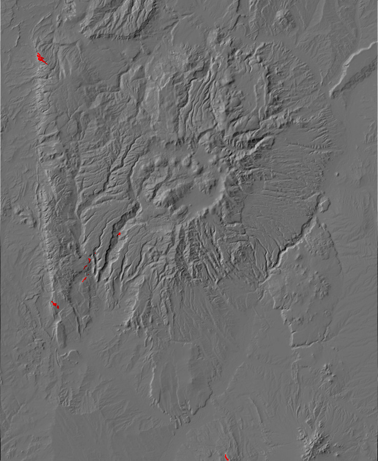
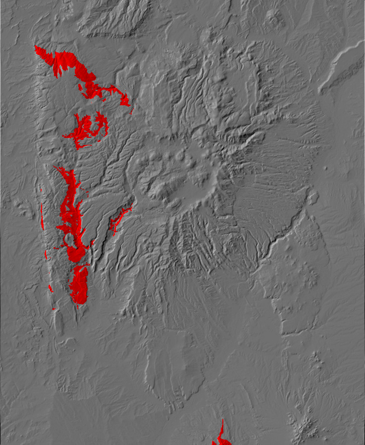
Relief map of the Jemez with Arroyo Peñasco
Group outcroppings highlighted in red.
The Mississippian Arroyo Peñasco Group is the oldest Phanerozoic sedimentary unit in northern New Mexico. It is not found everywhere in the region, and it shows evidence of having itself been weathered and eroded in many places before being buried under Pennsylvanian sediments.
When geologists propose a new formation name for a set of rock
beds, they normally designate a type section, an
outcropping where the entire proposed formation is visible. The
beds can then be traced from the type section to the surrounding
area or matched across intervening ground where the formation is
not exposed or has eroded away. The geologists proposing the new
formation are expected to describe it as thoroughly as possible,
with particular emphasis on describing the physical properties of
the formation (its lithology) and giving a precise
description of where the formation begins and where it ends. The
description must be sufficient for another geologist to trace and
map the formation in the field.
The type section of the Arroyo Peñasco Group is located east
of Warm Springs in the southern Sierra Nacimiento. This
location is unfortunately on tribal land not generally accessible
to the public. The formation invariably rests on Precambian
granite, with its lowermost beds composed of fairly clean
sandstone. Then come massive limestone containing characteristic
Mississippian marine fossils. The top of the Arroyo Peñasco is
placed where limestone gives way to either red mudstone devoid of
fossils (the Log Springs Formation) or sandstone and shale
containing Pennsylvanian fossils (the Sandia Formation.)
The Arroyo Peñasco Group was deposited on the Precambrian
peneplain beginning around 350 million years ago, when the
Transcontinental Arch began to subside and southern and central
New Mexico was covered by a shallow sea whose shoreline moved back
and forth across the Jemez area. There is little conglomerate in
the lower beds of the Arroyo Peñasco Group, which tend instead to
be fairly clean sandstone of the Del Padre Sandstone Member of the
Espiritu Santo Formation. This indicates an absence of any high
ground to shed coarse sediments into the advancing ocean. Further
west, this sea deposited the Redwall Limestone of the Grand Canyon
area.
The bulk of the Espiritu Santo Formation is also limestone,
deposited in a shallow marine environment. The upper formation of
the Arroyo Peñasco Group, the Tererro Formation, begins with a bed
of limestone rubble, indicating a period of erosion separating the
two formations. The lowest beds of the Tererro Formation, like
those of the Espiritu Santo Formation, are richer in clastic
sediments and the remaining beds are again a massive limestone.
This indicates a hiatus, a pause in deposition of
sediments due to the temporary retreat of the sea from the area.
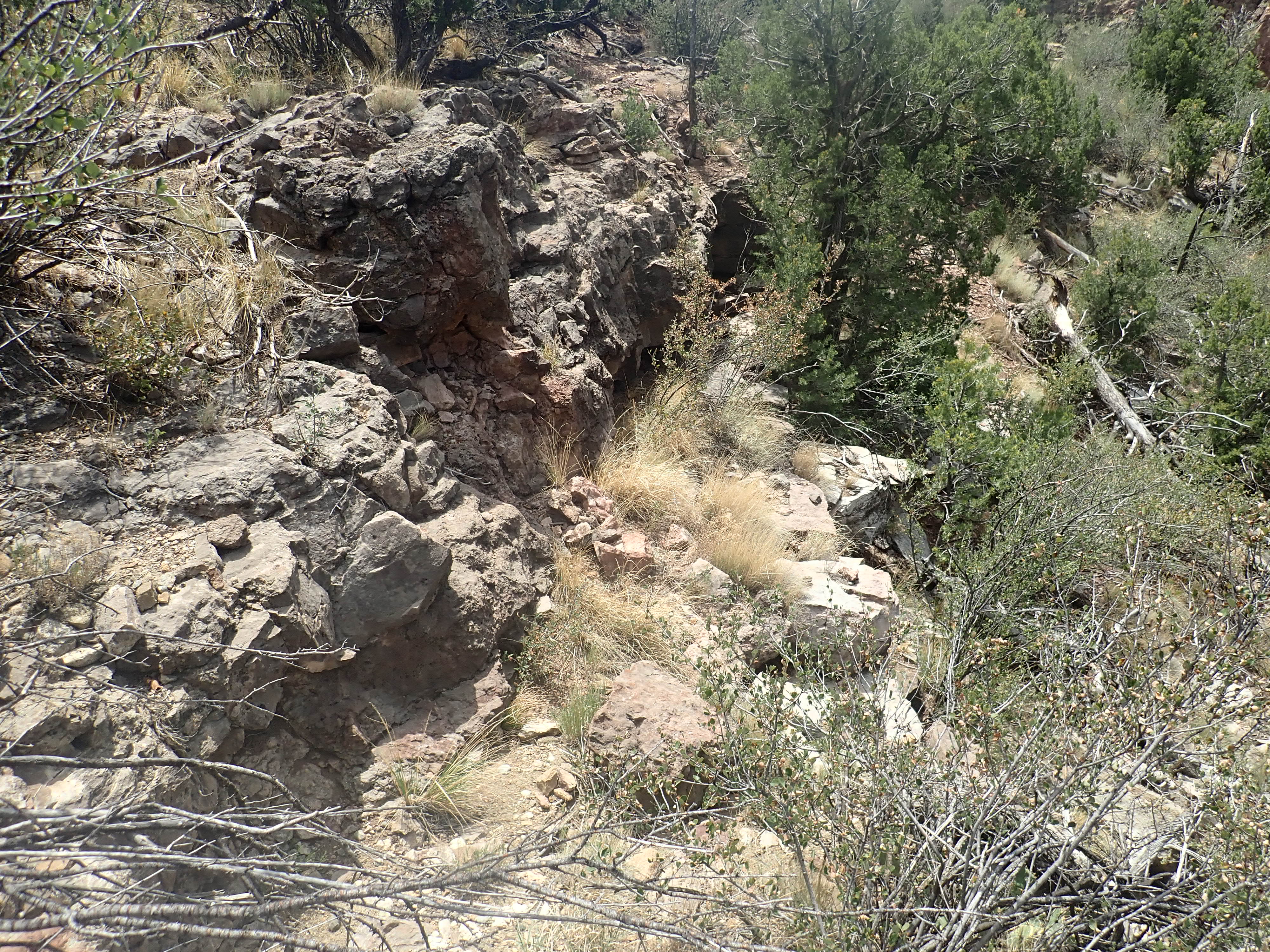
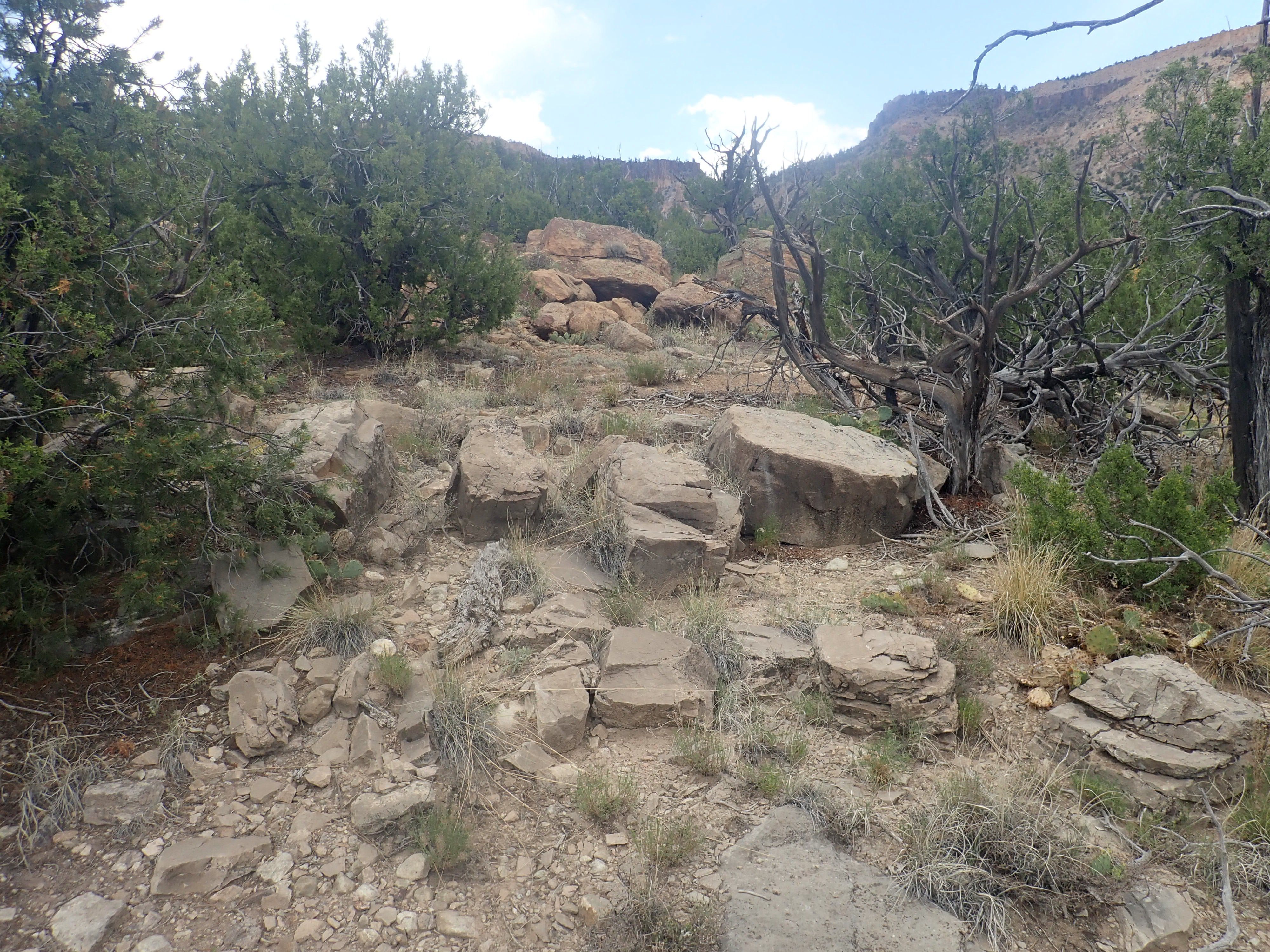
We've seen thin beds of the group atop the brecciated granite near the Santa Fe impact structure and the gneiss at Soda Dam and Guadalupe Box. One can more closely examine the Arroyo Peñasco Group at Guadalupe Box by crossing the Rio Guadalupe and hiking a fire road east of the river to the top of the east rim of Guadalupe Box. Adventurous readers are advised that the Rio Guadelupe has no bridges or easy fords in this area and can be swift and deep; it should be crossed with caution.
This photograph shows a thick bed of limestone of the Arroyo Peñasco Group overlain by a thin layer of Log Springs Formation.
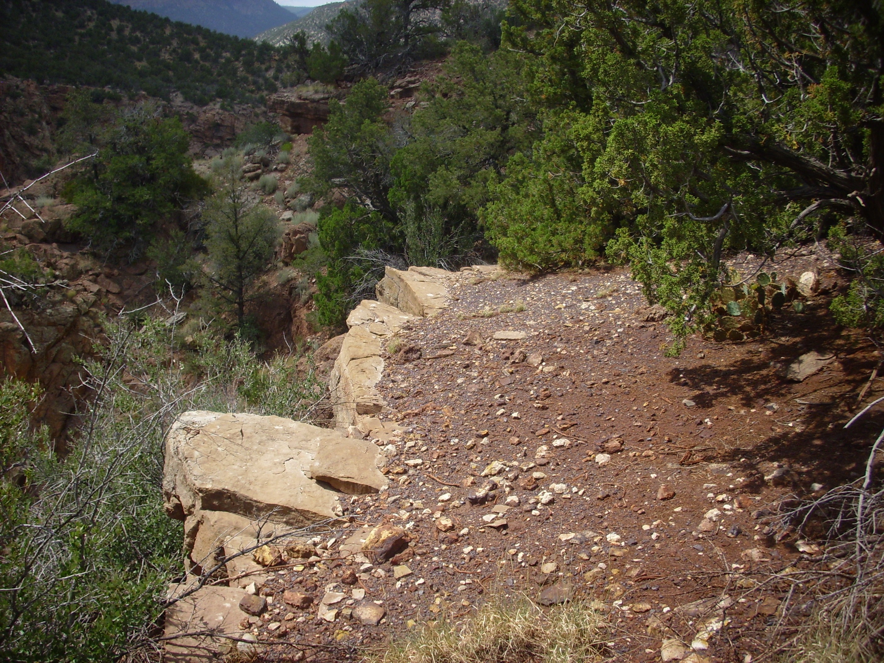
Log Springs Formation and Arroyo Peñasco
Group on east rim of Guadalupe Box. 35
43.988N 106 45.793W

Massive limestone of the Arroyo Peñasco
Group on east rim of Guadalupe Box.
35.7355093N
106.7661187W
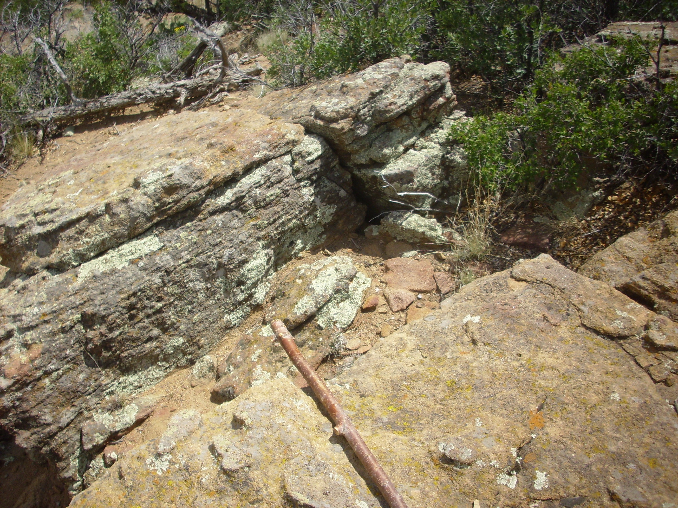
These beds lie directly on top of Precambrian gneiss, showing
that the Del Padre Sandstone Member is thin and spotty here.
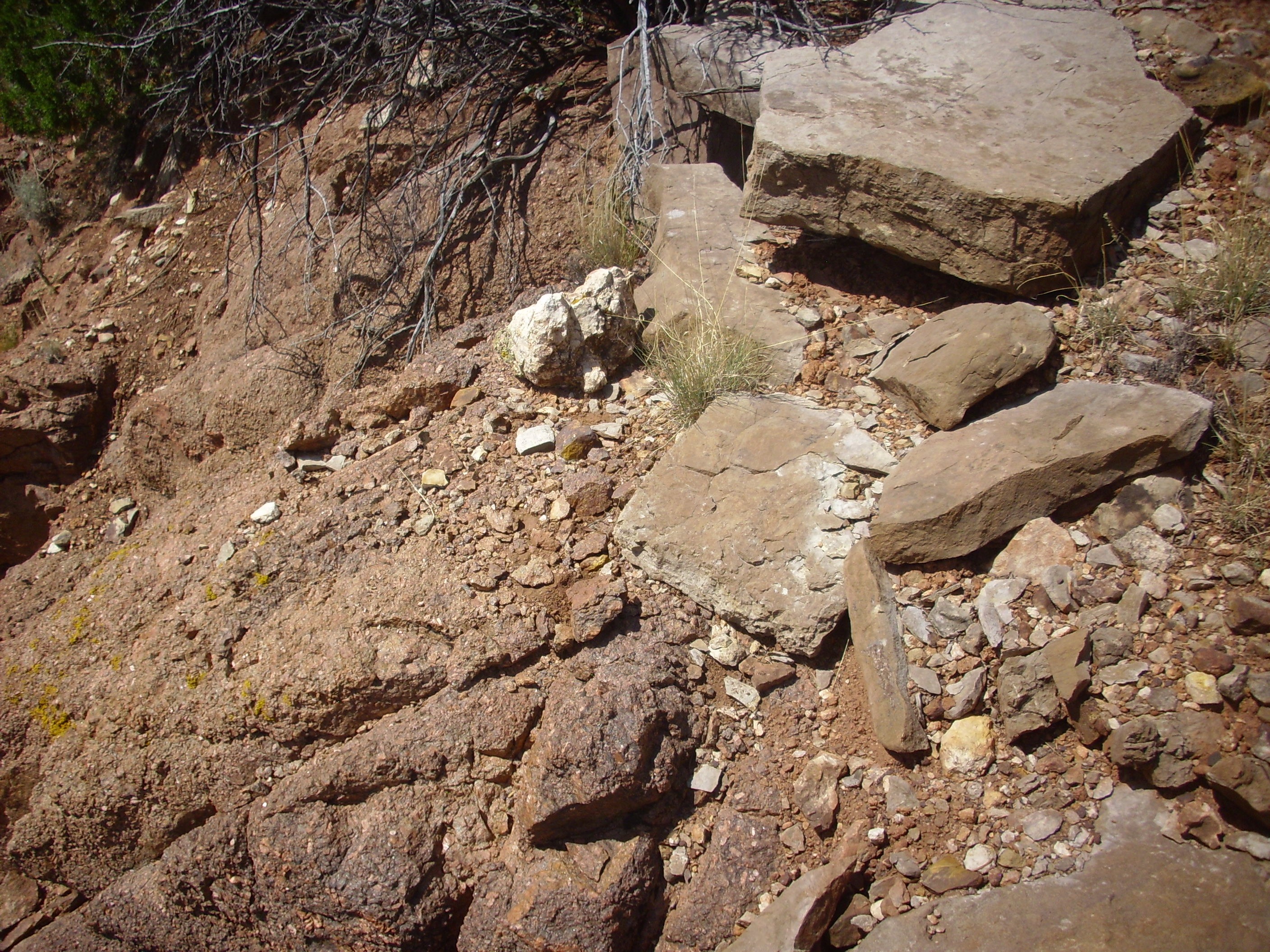
The Great Unconformity, up close and personal.. 35
43.988N 106 45.793W
Only the Espiritu Santo Formation is reported at Guadelupe Box. However, this looks like a collapse breccia:
Collapse breccia.. 35
43.988N 106 45.793W
and there are massive limestone beds below. This suggests to me
that this is the base of the Tererro Formation.
The erosion that produced the collapse breccia also produced a
crust of karst on the limestone.
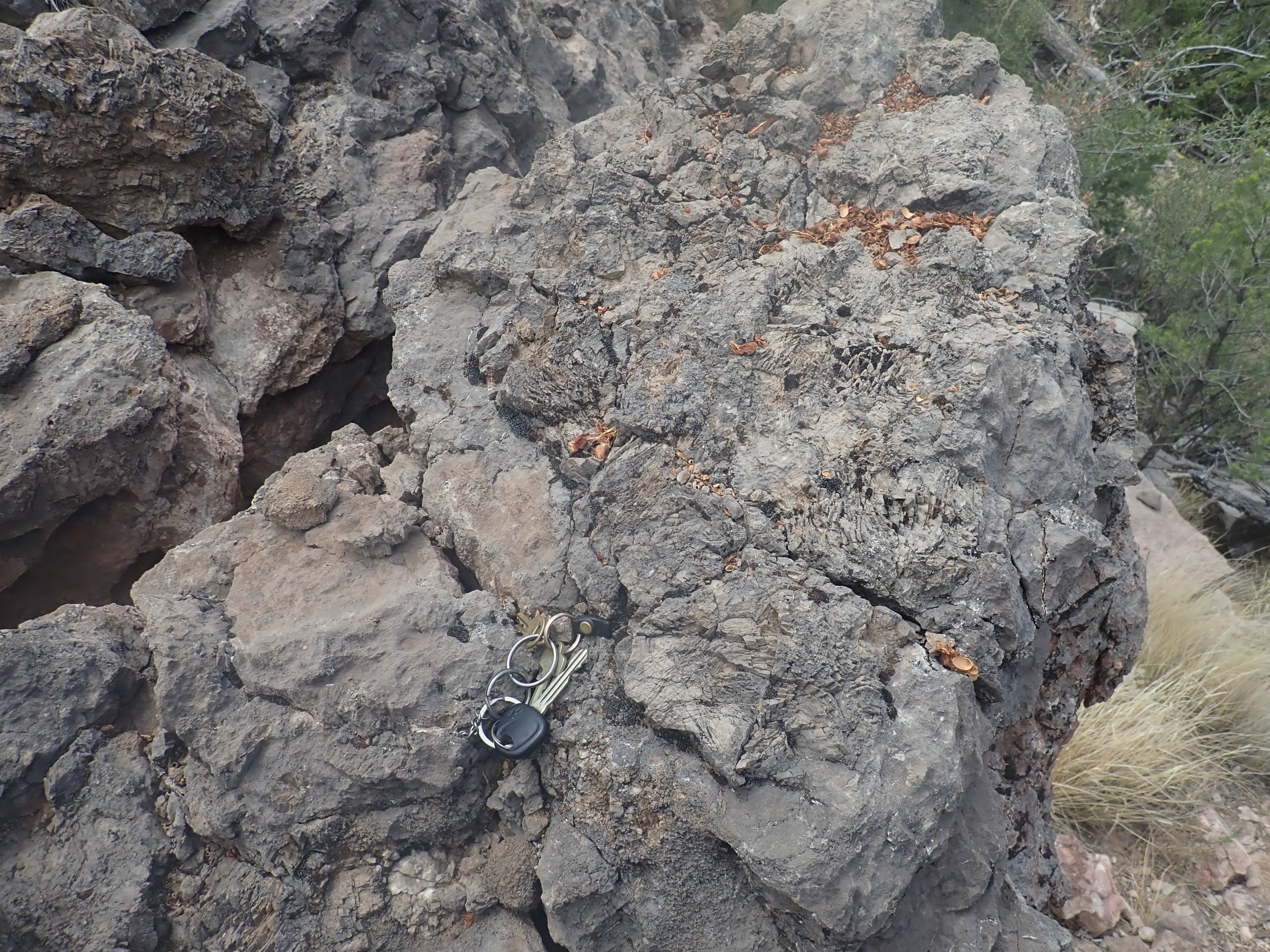
Karst.. 35
43.988N 106 45.793W
Karst, in this sense, refers to the razor-sharp wedges of rock
crusting the surface here.
A thin section of Tererro Formation is found in other locations in the Sierra Nacimiento, and it is much more prominent in the Sangre de Cristo Mountains to the east.
Here is a photograph of the base of the Espiritu Santo Formation in the mountains west of Montezuma, New Mexico.

The Great Unconformity west of Montezuma. 35.651777N
105.3177057W Public domain
A massive bed of Del Padre Sandstone overlies Precambrian beds,
likely metamorphosed sandstone and mudstone, that were tilted
nearly vertically before being beveled flat as part of the
Precambrian peneplain.
During the Mississippian, momentous events were taking place far to the west of the Jemez. At that time, the western coast of North America was located in what is now central Nevada. The continental margin here had been passive since Australia split away from North America during the breakup of Rodinia, about 770 million years ago. Although the geological record is incomplete, the weight of evidence is that the oceanic crust beyond the edge of the continent began subducting under an island arc or small continent further out in what is now the Pacific, and in the early Mississippian the North American continent itself drifted into the subduction zone. This began a pattern of tectonic activity along the western edge of North America whose effects have continued to the present day.
Because continental crust is too buoyant to subduct, the arrival of North America at the subduction zone "jammed" the subduction zone. This had two effects. First, the island arc or microcontinent under which ocean crust has previously subducted to the west became fused to the western edge of North America. Second, the subduction reversed itself; oceanic crust from further west began subducting to the east under North America, whose western margin became a destructive margin. The collision threw up a substantial range of mountains, an event called an orogeny. In this case, geologists have dubbed it the Antler Orogeny, after Antler Peak, Nevada, a modern mountain whose underlying rocks included thick Mississippian conglomerate beds. These could only have been shed from a high mountain range, and they provided the first clues to the event. They also place the passive margin prior to the Mississippian in central Nevada. Everything to the west has been fused to North American during the last 300 million years.
Limestone of the Arroyo Peñasco
Group. 35
43.988N 106 45.793W
Limestone is a sedimentary rock composed mostly of the mineral
calcite, CaCO3. Most limestone consists of tiny
fragments of the shells of marine organisms, mixed with variable
quantities of sand, silt, and clay. It forms primarily in shallow
marine environments, where tiny shelled organisms such as
foraminifera (shelled plankton related to the amoeba) multiply in
great numbers. The Arroyo Peñasco Group is rich in fossil
foraminifera and microscopic algae. Calcium carbonate is soluble
in deep, cold water, so it is not possible for limestone to form
in waters deeper than 3000 meters (10,000 feet), and while
limestone sometimes forms in fresh water, this is uncommon.
Furthermore, the best shallow marine environments for limestone
formation are ones in which other sediments, such as silt and
clay, are scarce. This is most likely to be the case in an arid
climate, where there are few rivers to carry sediments into the
ocean. Extensive limestone beds suggest that the underlying
tectonic plate was situated at around 30 degrees north or south
latitude when the limestone formed. These are the so-called "horse
latitudes", where most modern deserts are located. New Mexico is
thought to have been about 10 to 15 degrees south of the equator
during the Mississippian, on the edge of this latitude zone.
Dolostone is a close relative of limestone and likely forms from
limestone exposed to magnesium-rich fluids under the right
conditions of temperature, pressure, and oxygen abundance. The
magnesium replaces part of the calcium to produce dolomite, a
mineral with the composition CaMg(CO3)2. The
details of this process are still not entirely understood, but
dolostone seems to form more readily during times of high sea
level, and it is rare to find a "partial" dolostone: Carbonate
rocks tend to be either almost entirely calcite or almost entirely
dolomite; rocks combining both minerals are very uncommon.
Curiously, the process of dolomitization sometimes leaves fossils
nearly unchanged.
Limestone is easy to identify in the field. Though it is a tough rock, it is not particularly hard, so that it is easily scratched with a penknife. It sometimes displays visible calcite crystals. The surest test of all, however, is to drip some acid (such as diluted hydrochloric acid) on the rock. Limestone will foam vigorously. Dolostone resembles limestone in appearance, but is harder and bubbles only feebly when exposed to acid. Rocks composed of silicate minerals generally show no reaction to acid.
Thick marine carbonate beds are almost as characteristic of the
Carboniferous as coal beds. This is the consequences of at least
two things: First, sea levels were optimum for reef growth on
extensive shallow marine environments. Second, the drop in carbon
dioxide levels in the atmosphere favored carbonate deposition. It
may seem odd that reduced carbon dioxide should produce increased
carbonate deposition, but the chemistry of carbon dioxide in water
makes it so. Carbon dioxide dissolved in water exists mostly in
three forms: carbon dioxide, CO2; bicarbonate ion, HCO3-;
and carbonate ion, CO3-2. The negative
charge on the bicarbonate and carbonate ions must match the
positive charge on cations, mostly sodium, calcium, and magnesium.
So if carbon dioxide is extracted from the water, the balance must
shift from bicarbonate with its single negative charge to
carbonate with its double negative charge. More carbonate means
that calcium and magnesium carbonate are more easily precipitated
from the water. The reaction is effectively that soluble calcium
bicarbonate is converted to insoluble calcium carbonate by
extraction of carbon dioxide:
Ca+2 + 2HCO3-
-> CaCO3 (s) + CO2 (g) + H2O
(l)
Calcite, CaCO3, is one of the most common non-silicate
minerals. Its crystal structure is fairly straightforward,
consisting of of alternating layers of calcium ions and carbonate
ions.
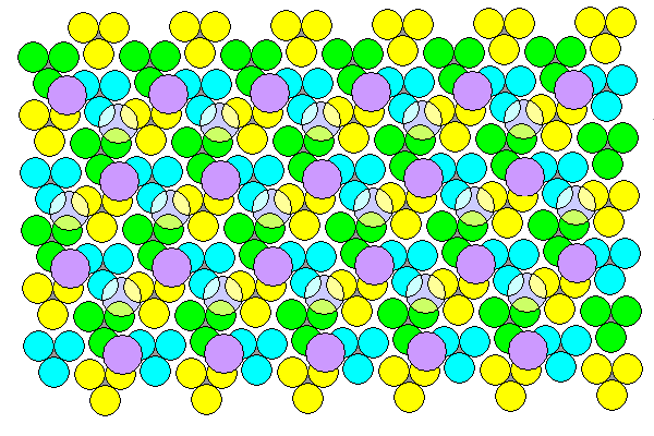
Structure of calcite. Courtesy of Steven
Dutch.
In this diagram, we are looking directly down on the alternating
layers of the crystal. Calcium ions are shown in purple and
carbonate ions as a set of three oxygen atoms, drawn in green,
blue, or yellow, surrounding a small gray carbon atom.
Well-crystallized calcite is quite common, and is popularly known
as dogtooth spar.
Calcite samples. As with most images here, you may click
to enlarge
Calcite crystals tend to form elongated pyramids, as in the
sample at top. However, calcite has perfect cleavage in three
directions, and so large calcite crystals break into cleavage
fragments, like the one sitting on the ruled paper, that are boxy
in shape. Calcite has the optical property of birefringence,
or double refraction, in which images seen through clear calcite
appear doubled. You can see in this photograph that the lines on
the paper are doubled as seen through the crystal.
Dogtooth spar is an example of a crystal habit. All
calcite crystals have the same internal arrangement of atoms, and
this is reflected in their shape. However, the shape is also
affected by the chemical behavior of crystal surfaces, which is in
addition to the chemistry of the internal structure. As a result,
the shape is affected by the conditions under which the crystal
formed. For example, the crystal shape may be affected by other
substances in the solution from which it crystallizes, even if
they do not enter its internal structure, because of their
interactions with the crystal surface. Knowing the various habits
of a mineral is important for identifying the mineral in the
field. Dogtooth spar is the most common calcite habit, but calcite
also occasionally forms very transparent crystals with a boxier
shape known as Iceland spar. The cleavage fragment
came from an outcrop of Iceland spar. Another habit is angel wing
calcite, which is calcite that forms in thin layers that do indeed
have a feathery texture vaguely reminiscent of a bird's wing.
Calcite is also relatively soft. It is not quite soft enough to
scratch with a copper penny, but it is easily scratched with a
knife. Its softness, distinctive cleavage, optical properties, and
reaction with mild acids to produce bubbles are distinctive enough
that calcite is easily identified in the field. In addition,
calcite very typically fluoresces when exposed to
shortwave ultraviolet light, glowing white, orange, or red.
However, the glow is produced by common impurities and so is not a
completely reliable key to identification. In particular, it is
often absent from Iceland spar.
Calcite is very slightly soluble in cool, acidic water. When limestone beds are exposed at the surface, rainwater (which is slightly acid from dissolved carbon dioxide, even in the absence of industrial pollution) can cut deep sinkholes and caverns in the limestone. This produces what geologists call a karst topography. Northern New Mexico is presently too arid for areas underlain by limestone to develop much karst topography, but this was not true in the distant past.
Dolomite resembles calcite, but every other layer of calcium ions
is replaced by magnesium ions. Dolomite also favors
different crystal habits than calcite, tending to form tabular
crystals with curved faces.
Geologists studying sedimentary formations will often attempt to construct the paleotopography of a region at various times in the past. This starts with the obvious: Wherever there is a rock bed of the particular age we are interested in, we know that the conditions that produced that kind of rock were at work at that location at that time. So wherever we see exposures of the Arroyo Peñasco Group limestone, we know that that area was covered with a shallow sea 345 million years ago.
There is no other significant Mississippian formation in northern New Mexico. Can we conclude that areas lacking Arroyo Peñasco Group were high ground 345 million years ago? Unfortunately, there are three other possibilities. One that has probably occurred to you already is that most of this area is covered with beds that are younger than Mississippian age and conceal any older rocks. Unless we have reliable drilling data for these areas, we do not know whether any Mississippian rocks are located there. In principle, further drilling might someday give us that information.
But there are areas where we see bare Precambrian rocks exposed,
and other areas where we see rocks younger than the Arroyo Peñasco
Group sitting directly on Precambrian rocks. Here we are still
left with two possibilities. One is that this was high ground
during the Mississippian, so that no sedimentary beds were laid
down at that time. But there is also the possibility that beds
were laid down but subsequently eroded away. And this could have
taken place any time between the Mississippian and the age of the
younger beds.
The next widespread formation in northern New Mexico is the
Pennsylvanian Sandia Formation, which we'll get to shortly. There
are a couple of local formations intermediate in age between the
two, but they are not widespread enough to much affect our
reconstruction of the paleotopography, and they are usually found
above beds of the Arroyo Peñasco Group rather than directly on
Precambrian granite. if we know that areas with Arroyo Peñasco
Group exposures were shallow seas during the Mississippian, and
assume that areas where Sandia Formation sits directly on
Precambrian rocks were high ground during the Mississippian, we
get this map:
Paleotopographic map of Arroyo Penasco Group
The red areas are known to be shallow marine
environments during the Mississippian. The green areas must have
been above water during or shortly after the Mississippian.
Everywhere else is unknown. This gives us a rather patchy picture
of what took place. We'll see better examples with other
formations later in the book. But we see indications that there
was some high ground in the southern Sierra Nacimiento during the
Mississippian.
We do have another clue that most exposures of the Arroyo Peñasco
Group were briefly above water towards the end of the
Mississippian.
Around 320 million years ago, North America collided with Africa
as part of the assembly of the supercontinent of Pangaea. This
produced the Allegheny Origen, which threw up mountains from
Newfoundland to west Texas. The collision is also recorded by the
87Sr/86Sr of marine carbonate rocks, which
began to rise about this time. During this collision, a
large area coinciding with parts of today's Rocky Mountains was
also uplifted to form what geologist Willis T. Lee, writing in
1918, called the Ancestral Rocky Mountains. Mountain building
began first in the late Mississippian in eastern Oklahoma and
Arkansas. Uplift then spread west in the earliest Pennsylvanian,
slowly at first, but quickening in pace in the mid-Pennsylvanian.
Sediments eroded from the Ancestral Rocky Mountains would dominate
the geologic record of the Jemez area for the next 150 million
years.
The coincidence in timing pointed to the Allegheny Origen as the
reason for the rise of the Ancestral Rocky Mountains. However, the
Ancestral Rocky Mountains seem oriented the wrong way to be a
result of compression inland of the collision to the southeast.
This odd orientation has been explained as a consequence of
preexisting zones of weakness, but we have seen that shear zones
from the Yavapai and Mazazatl Origens are oriented southwest to
northeast, not southeast to northwest. The Ancestral Rocky
Mountains ranges are also known to have been raised along large thrust
faults, where the crust was compressed so strongly that
older beds were thrust over younger beds. I'll say more about such
faults later in the book. Finally, new geologic findings of
Pennsylvanian and Permian beds in northeast Mexico suggest that
there was rapid subduction offshore of Mexico. All these clues
point to compression by subduction from the southwest as the force
behind the rise of the Ancestral Rocky Mountains. The coincidence
in timing with the Allegheny Origen may be just that, a
coincidence.
The Ancestral Rocky Mountains included a highlands called
Uncompahgria, stretching in a great arc from western Colorado (the
Uncompahgre Uplift) down to the area just east of Santa Fe (the
San Luis Uplift). A small outlier range, the Penasco Uplift, was
located in the current location of the Sierra Nacimiento. A
deep basin, the Paradox Basin, formed to the southwest of
Uncompahgria, with its deepest point somewhere close to the
current location of Arches National Monument. Both Uncompahgria
and the Penasco Uplift were bounded by great thrust faults along
their southwest flanks. These are visible at the surface in the
Sierra Nacimiento, and have been mapped from drilling and seismic
profiling at locations like Gateway, Colorado, along the southwest
flank of Uncompahgria. In the Gateway area, the rock beds were
displaced at least six miles horizontally and 7000m (20,000')
vertically, a huge displacement.
The continental collision, and a return of extensive glaciation
to Gondwanaland, also produced a brief lowering of sea levels that
separates the Mississippian from the Pennsylvanian in North
America. During this time, northern New Mexico was again heavily
eroded. The Arroyo Peñasco Group survived only in areas where it
had filled shallow valleys or where tectonic disturbance dropped
blocks of crust to a lower level. These remaining exposed beds of
the Arroyo Peñasco Group developed a karst topography.
Deposition in the Jemez area would continue to be dominated by the slow leveling of the Ancestral Rocky Mountains and infilling of the Paradox Basin through the rest of the Paleozoic.
Modern karst topography often is mantled in a deep red iron-rich soil called terra rossa, which fills in the sinkholes and crevices in the underlying beds. This is particularly the case in tropical areas, and the Jemez area was located almost on the equator at this time. The Log Springs Formation is likely a preserved terra rossa formed on the karst topography of the Arroyo Peñasco Group, augmented with sediments eroded off the nearby highlands. Similar thin beds of red sediments (usually assigned to the Molas Formation) are found at the Mississippian-Pennsylvanian boundary throughout the western United States. Their uniformity suggests that the Ancenstral Rocky Mountains did not really get going until the early Pennsylvanian. The intense oxidation of the terra rossa was likely enhanced by oxygen levels nearing their highest in the geologic record.
In a few locations, the iron-rich lower beds of the Log Springs Formation are overlain by a thicker sequence of mudstones, sandstones, and conglomerates, with the uppermost bends tending to have more coarse material. This suggests that increasing quantities of coarse sediments were being eroded off nearby highlands pushed up as part of the Ancestral Rockies.
I haven't bothered with a map of the Log Springs Formation, because it is nearly identical with the map for the Arroyo Peñasco Group. The Log Springs Formation is thin and spotty at Guadalupe Box, but it is much thicker to the west, in the southern Sierra Nacimiento Mountains. This is a further indication that there was high ground in southern Sierra Nacimiento at the end of the Mississippian. The exposure of the formation at Guadalupe Box is rich in hematite, which forms a thick coating on limestone clasts derived from the underlying Arroyo Peñasco Group.

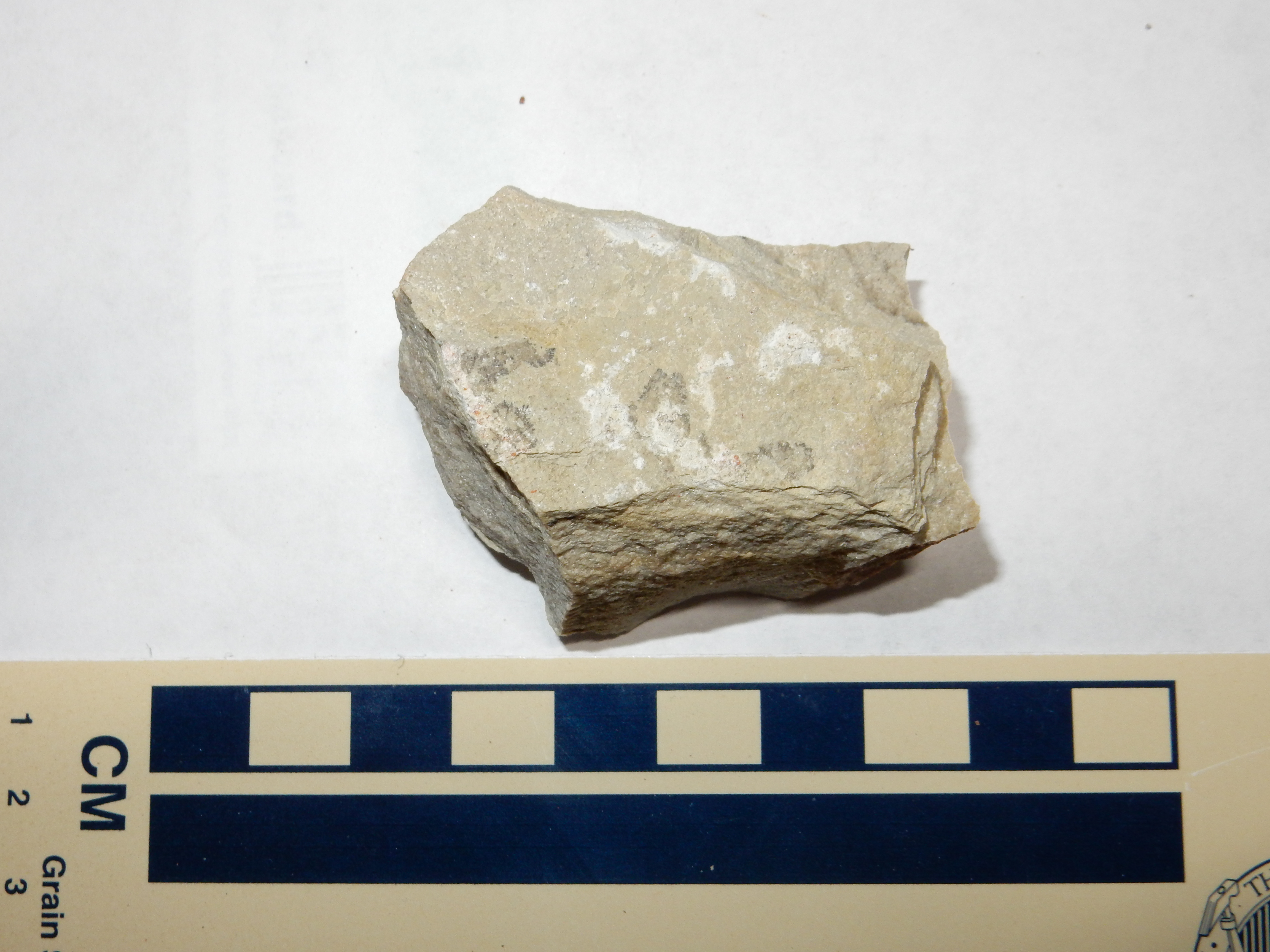
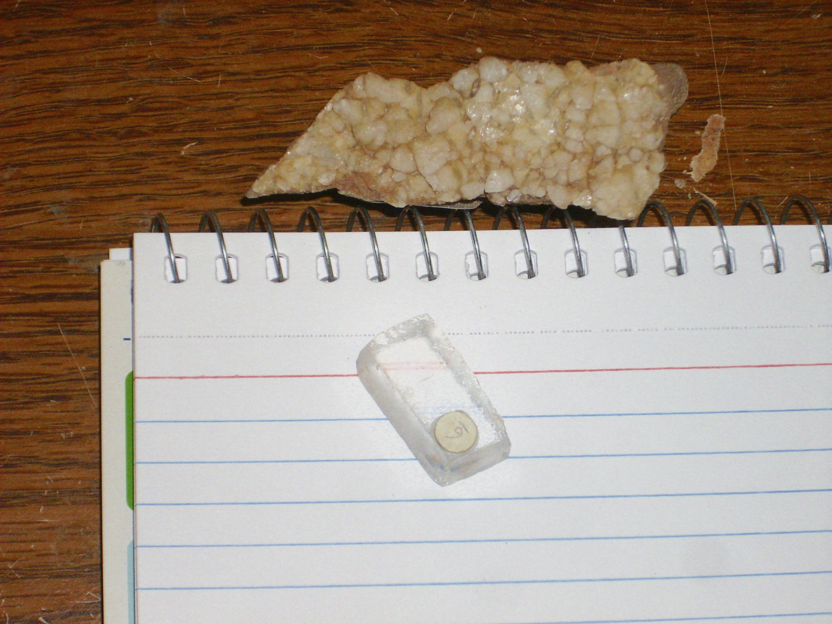
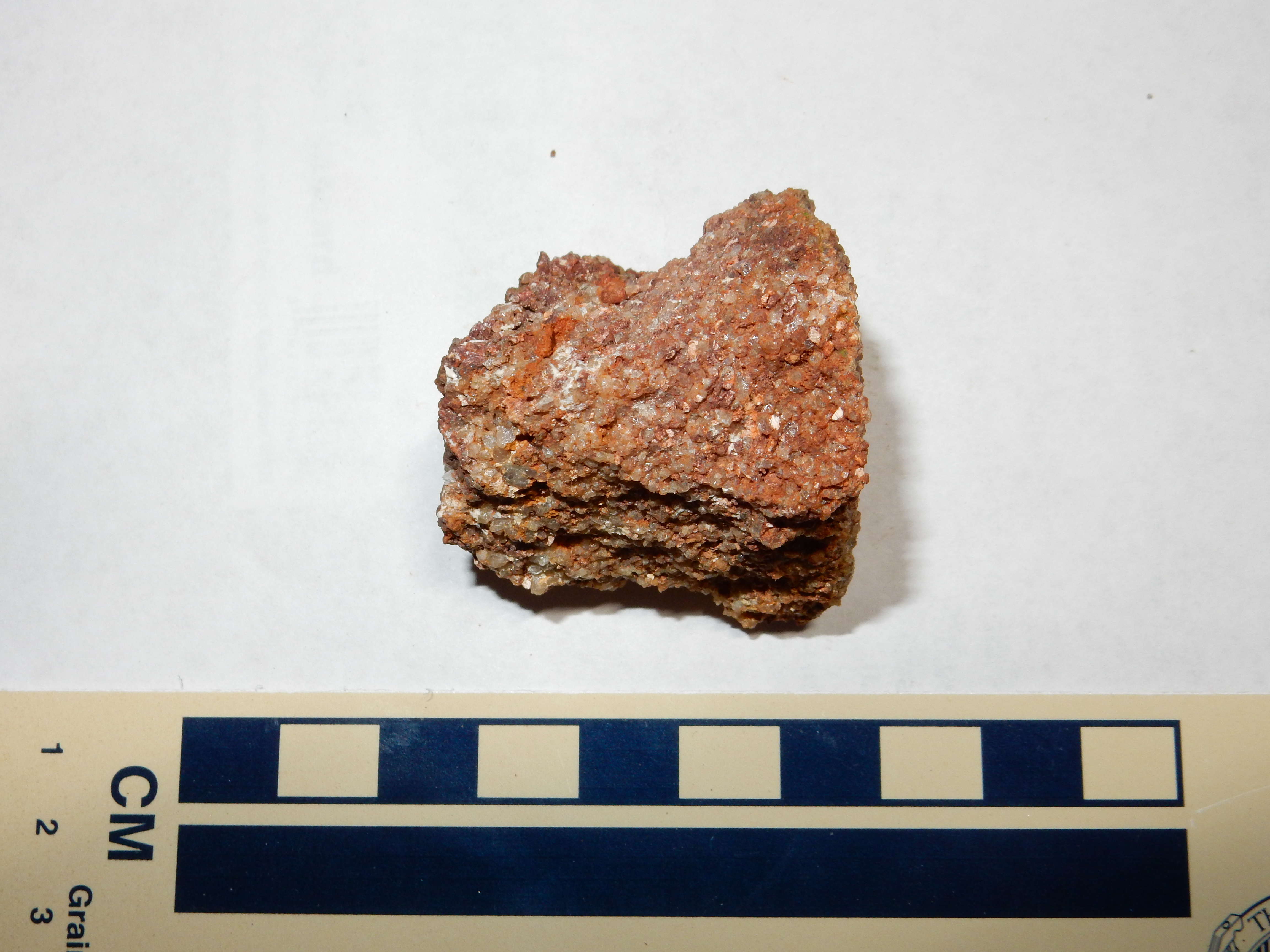
Hematite-coated nodule from Log Springs Formation.
35
43.988N 106 45.793W
This sample shows the bright red color of hematite on the left, and somewhat darker color on the right where the nodule was partially buried. The sample has a high density, which I measured at around 4.45 g/cm3, whereas normal limestone has a maximum density of around 2.8 g/cm3. Solid hematite has a specific gravity of 5.26 g/cm3. This suggests that there is more hematite coating than limestone nodule. Hematite makes an excellent iron ore, but the beds here are neither rich enough nor extensive enough for economical exploitation.
Hematite, Fe2O3, is a common minor component of sedimentary rocks. It is also common in weathered igneous and metamorphic rocks, but is rather uncommon in fresh igneous and metamorphic rocks. Under conditions typical of the earth's interior, where metamorphic rock is formed and magma is generated, there is very little oxygen and iron tends to remain in the ferrous state. Thus, fresh igneous and metamorphic rocks contain most of their iron as ferrous minerals. Such ferric iron as is present is bound up with ferrous iron in magnetite. However, the high oxygen levels at the earth's surface ensure that ferrous iron is eventually oxidized to ferric iron, and most of this ferric iron exists as hematite or its hydrated counterpart, goethite, FeO(OH).
Powdered hematite has a blood-red color, which gives it its name (Greek haima = "blood"). As the percentage of the hematite that has been hydrated to goethite increases, the color shifts to a yellowish brown. Massive hematite is dark red to black in color. Large deposits are mined as iron ore on every continent except Antarctica. However, well-crystallized hematite, which is jet black in color, is quite uncommon. Massive hematite can be identified both by its blood-red streak (produced by rubbing a sample against an unglazed porcelain plate) and by its high density. Unlike magnetite, hematite is not attracted by a magnet.
Paleotopographic map of Osha Canyon Formation
By 310 million years ago, New Mexico was again a shallow tropical sea studded with mountainous islands (the ancestral Rocky Mountains.) This return of the sea to the area is known as the Absaroka transgression. Marine sediments were deposited over much of the region. The lowest Pennsylvanian formation in the Jemez is the Osha Canyon Formation, first identified at Guadalupe Box. Its base is placed at the first thin limestone beds above the red shale of the Log Springs Formation.
Osha Canyon Formation atop Log Springs Formation.
35.7332193N
106.7653107W
Here we see Osha Canyon Formation forming the south rim of an unnamed canyon, with overlying Sandia Formation forming the hill in the background.
Osha Canyon Formation. Looking south from 35
44.285N 106 45.830W
The bulk of the Osha Canyon Formation is marly shale, composed of a mixture of mud and fine calcite grains. The thin limestone beds stand out, since they are much more resistant to erosion. The lower beds contain more limestone and are typical of a shallow marine environment, but deep enough that wave motion has little influence. The upper beds are more typical of an environment disturbed by wave motion and shore currents (a high-energy environment.) The uppermost bed at Guadelupe Box is a feldspar-rich sandstone cemented with calcite.
The formation was originally identified and described on the east rim of Guadalupe Box (the type section.)
Osha Canyon Formation on the east rim of Guadelupe Box.
35 44.034N 106 45.793W
A sample:

Notice the circular structure at lower right in the sample. This some kind of shelled fossil, though it is not possible to know what kind of organism it was from this single cross section.
The Osha Canyon Formation is not nearly as widespread as the
other Carboniferous formations of the Jemez, being found only in a
limited area of the southwestern Jemez and southern Sierra
Nacimiento. Perhaps this was a particularly low area into which
the sea returned first. However, the Osha Canyon Formation is
noted for the presence of fossil tabulate corals and for rare
examples of a primitive giant echinoderm, Giganticlavus.
Echinoderms share the bilateral body plan of vertebrates, though this gives way to a five-sided symmetry in many adult echinoderms (starfish being a particularly familiar example). Other modern echinoderms include sea urchins, sea cucumbers, crinoids (sea lilies), and sand dollars. Giganticlavus was a member of the edrioasteroid family, which, like the tabulate corals, became extinct at the end of the Permian. Close relatives of the crinoids, the edrioasteroids were cushion-like animals that attached themselves permanently to a surface.
Tabulate corals are found in fossil beds from the latest Cambrian to the end of the Permian and are distinguished from modern corals by the presence of horizontal partitions (tabulae) in the reefs they form. The tabulate corals are among the families that were extinguished by the Permian-Triassic extinction event, of which we'll say more in the next chapter.
Map of Sandia Formation exposures in the Jemez
area
The Osha Canyon Formation is overlain by the sandstone and thin
limestone beds of the Sandia Formation, which formed from sediment
eroded off the rising San Luis Uplift. This is the first really
widespread formation of the Phanerozoic Eon in northern New
Mexico, with outcrops in the southwest Jemez, atop Sandia Crest,
and in the Sangre de Cristo Mountains. It was first named by C.L.
Herrick in 1900. Where it rests on Precambrian rock, the contact
is easily identified. Where the Sandia Formation rests on Osha
Canyon Formation or Arroyo Peñasco Group, it is distinguished by
the transition from massive limestone or limy sandstone to coarse
sandstone, mudstone, and conglomerate, with only a few thin beds
of limestone. These rocks are usually less resistant to erosion
than massive limestone, so the Sandia Formation tends to be found
underlying a slope between more vertical cliffs of Precambrian
rock or Mississippian limestone below and later Pennsylvanian
limestone above. Such a formation is sometimes described as a slope-forming
formation.
We saw beds of the Sandia Formation atop Sandia Crest in the last chapter, and we've already seen several photographs in this chapter showing Sandia Formation atop Osha Canyon Formation.
Sandia Formation atop Osha Canyon Formation.
35.7336313N
106.7649067W
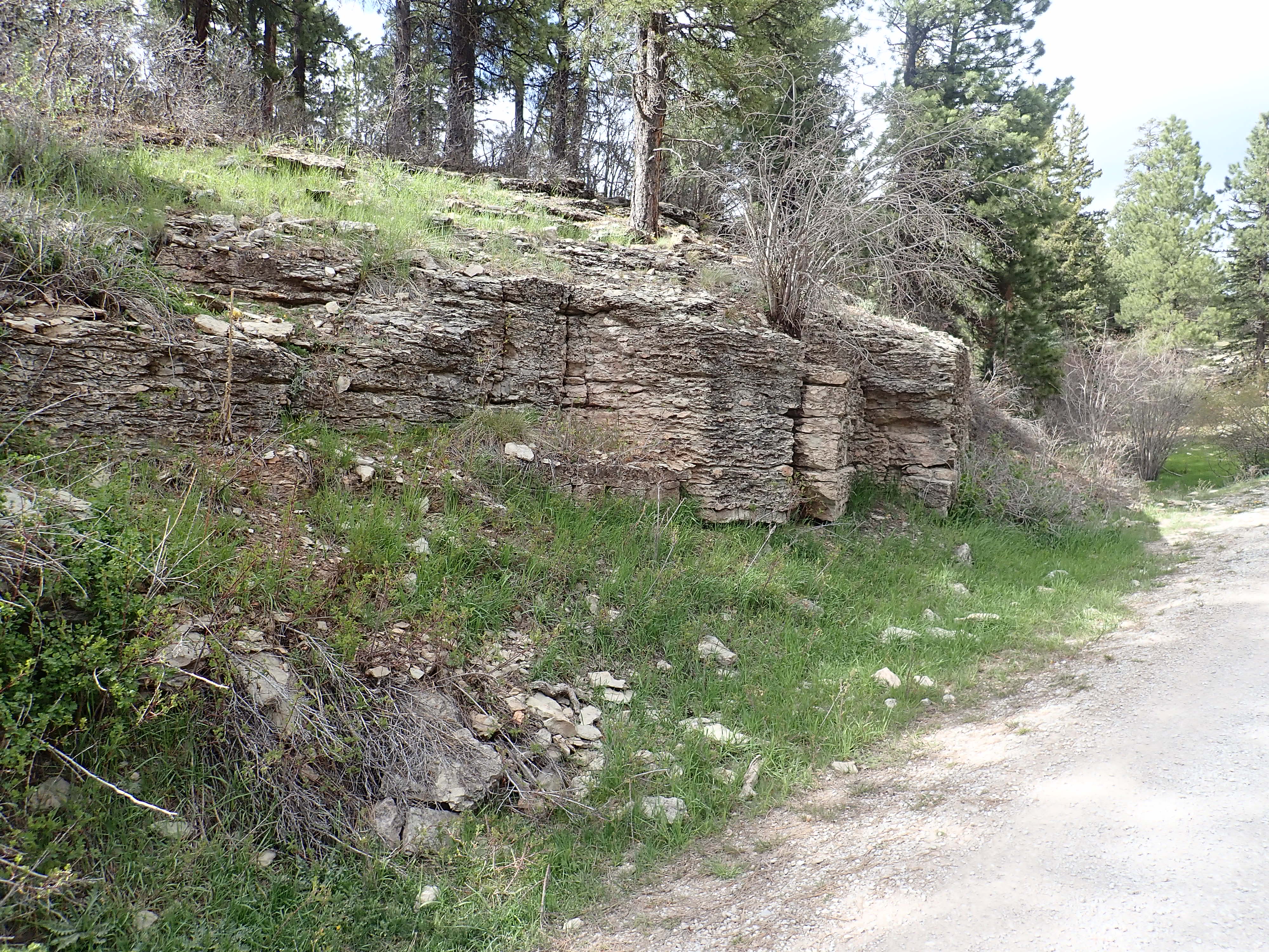
Here is a closer look at some of the prominent sandstone beds found near the base of the Sandia Formation.
Sandia Formation. 35
44.068N 106 45.776W
The multicolored patches on the rock are lichens, which are
communities of fungi and algae. Lichens were among the first and
most resilient forms of life to emerge from the oceans. There is
an excellent chance that their lineage is older than the rocks
they are encrusting here: The oldest unambiguous lichen fossils
are around 400 million years old, and fossil fragments that may be
lichens reach clear back to the Paleoproterozoic.
Sandia Formation sandstone. 35
44.068N 106 45.776W
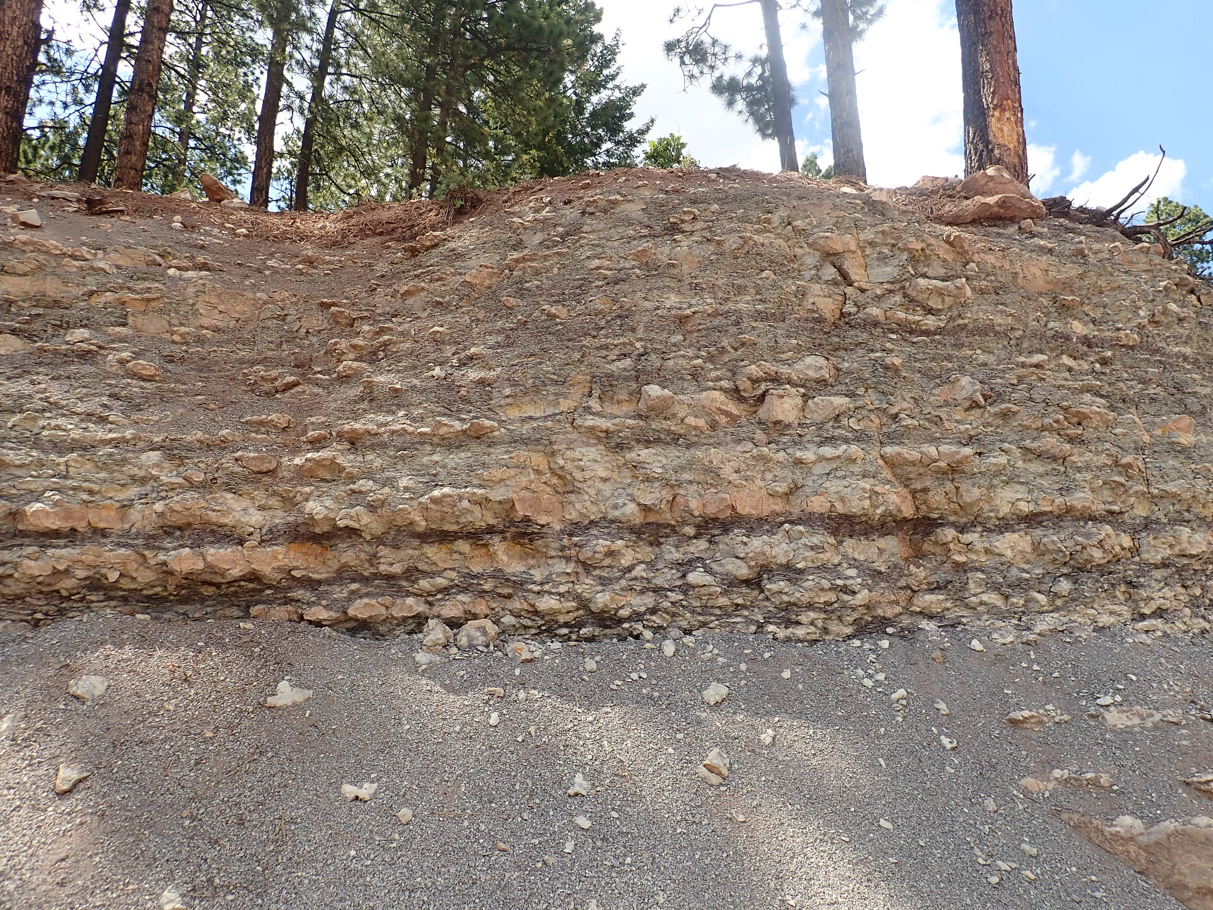
The base of the Sandia Formation at Guadelupe Box is a very coarse sandstone, of which a sample is shown above. The individual grains are obvious even to the naked eye. Under the loupe, these appear to be angular bits of yellowish quartz, all roughly the same size, with occasional fragments of feldspar or of clay formed by prolonged weathering of feldspar. There is some hematite between the grains, giving the rock its reddish to tan color, but the grains are not cemented primarily with hematite. The acid test shows no calcite present, and the rock is quite tough, so the grains are most likely cemented with silica. There is considerable pore space; this rock would make an excellent aquifer or reservoir rock for petroleum.
The description I've just given of this sandstone hits on most of
the classification criteria used by geologists to describe clastic
sedimentary rock, that is, sedimentary rock composed
primarily of broken fragments (clasts) of source rock
rather than precipitated minerals. The first criterion is clast
size. Sedimentary rock whose clasts are mostly in the range of 2mm
to 0.0625mm is classified as sandstone. Rock with larger clasts
(up to boulder size) is known as conglomerate or breccia,
depending on whether the clasts are rounded (conglomerate) or
angular (breccia.) Sedimentary rocks with smaller clasts are known
as siltstones, mudstones, or shales. We'll see examples of most of
these other kinds of sedimentary rocks later in the book.
This sample is a sandstone, because its grains are all between 0.5 mm and 2mm in size.
Another classification criterion is the mineral content. Most sandstones are composed largely of quartz, because quartz is the hardest and most stable common mineral under conditions at the Earth's surface. Feldspar is less chemically stable than quartz, slowly decomposing under atmospheric conditions into clay minerals, and it tends to shatter easily along its cleavage planes. Nevertheless, it is the second most common mineral in sandstone. A sandstone containing substantial feldspar (more than 25%) is called an arkose sandstone. Our sample here contains less than 25% feldspar and so is not an arkose.
Fine-grained material between the larger clasts of a sedimentary rock, usually deposited at the same time as the larger clasts, is called matrix, while minerals deposited later from solution in groundwater are known as cement. It is the presence of strong cement that produces the hardest (most indurated) sedimentary rocks. Sandstones with considerable pore space are known as arenites. They are distinguished from wackes that contain 15% or more clay minerals between the grains. Because our sample has open pores with almost no visible clay matrix, it is a quartz arenite.
Quartz arenites are considered mature sandstones, meaning they are formed from sediment that has undergone considerable weathering that has removed almost everything but the quartz. Our Sandia Formation sandstone is a bit unusual in that its grains are large, angular, and do include some bits of feldspar. It is thus not a supermature sandstone composed of almost pure quartz grains of nearly identical size (well-sorted) that are well rounded. Our sample is not particularly well-sorted for a sandstone. It is otherwise typical of sandstones that form deep in the interior of stable continents, where well-weathered sediments can accumulate slowly over long periods of time. Most likely this sandstone was deposited in a beach environment during a marine transgression, with the large size and angular character of the grains suggesting they weathered from a nearby granitic highland -- the San Luis Uplift.
As one goes higher in the Sandia Formation, the sandstone tends to give way to softer siltstone and shale and then the limestone of the Madera Formation. This is a typical fining sequence of a marine transgression. The sandstone is laid down in a near-shore environment, then, as the epicontinental sea advances, siltstone and mudstone is laid down in water further from shore. The transgression sequence ends with deposition of limestone.
Here is a paleotopographic map of the Jemez in the early Pennsylvanian, when the Sandia Formation was laid down.
Paleotopographic map of Sandia Formation
This shows that a large region north and west of the exposures of
Sandia Formation has Madera Formation, the next youngest
formation, resting directly on Precambrian rocks. This must still
have been high ground during the early Pennsylvanian, but became
submerged in the middle Pennsylvanian, when the Madera Formation
was laid down.
Map of Sandia Formation exposures in the Jemez
area
Above the Sandia Formation is the Madera Formation, the principle
Pennsylvanian formation in the Jemez Mountains (and much of the
rest of New Mexico.) It was deposited during a time when much of
New Mexico was covered with a shallow sea, though sediments
continued to be eroded off the San Luis Uplift and other ranges of
the Ancestral Rocky Mountains. The Madera Formation is exposed in
the valleys of the Rio
Guadalupe and Rio de las Vacas and in Cañon
de San Diego in the southwest Jemez, north of Soda Springs,
as well as the Gallina
area and underlying the Crest
of Montezuma.
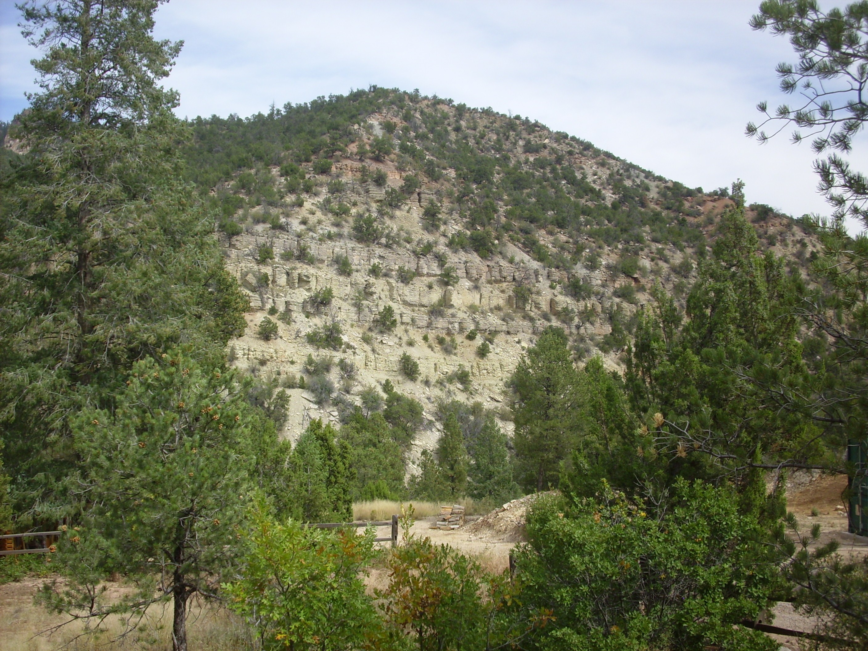
There has been an unusual amount of controversy over the nomenclature for the Pennsylvanian limestones of the Jemez area. The Madera Limestone was first named in 1903, by C.R. Keyes. In 1946, the first geologists to properly map the Jemez area assigned its Carboniferous limestone beds to the Madera Formation, noting that the lower beds are a gray limestone and the upper beds are arkosic limestone. Arkosic limestone contains substantial amounts of feldspar. More recently, geologists have suggested promoting the Madera Formation to group status and designating the lower and upper beds as Grey Mesa Formation and Atrasado Formation. Other geologists had proposed abandoning the name Madera completely and assigning the upper beds to the Guadelupe Box Formation. This name appears on some more recent maps of the area. The Guadelupe Box Formation is further divided into the San Diego Canyon Member and the Jemez Springs Shale Member. Because the name Madera Formation or Madera Group remains the most common in maps and papers, I'll stay with that here.
There is a very thick section of Madera Formation atop the Sandia Formation in Guadelupe Canyon north of Guadelupe Box. The boundary between the two formations is placed at the first substantial marine limestone bed. We've seen some photographs already, but here is a better look.
Madera Formation in west side of Holiday Mesa. View to
the northwest from 35
44.307N 106 46.040W
Sandia Formation forms the tan beds at the base of Holiday Mesa, and the mesa is capped with Bandelier Tuff. Almost everything between is Madera Formation, which is hundreds of feet thick here. Such great thicknesses of a single formation reflect ample accomodation space due to rapid subsidence, which creates the room for the sediments to pile. In the case of the Madera Formation beds here, this reflects the deformation associated with the rise of the Ancestral Rocky Mountains.
This area is reputed to be a paleontologist's playground, with
some areas covered with gravel composed mostly of fossilized
mollusks and brachiopods that have weathered out of the rock.
However, the Rio Guadelupe is difficult to cross, and the climb up
to the fossil beds is strenuous.
Madera Formation continues to line the canyon walls for miles to the north, with a particularly fine exposure in the north side of Bale Canyon.
Madera Formation in north rim of Bale Canyon. View to
the north-northeast from 35
49.441N 106 49.144W
Madera Formation in northern Cebolla Canyon. 35
51.424N 106 45.595W
Such exposures continue into the northern Sierra Nacimiento and
Jarosa area. This exposure is prominent in a road cut along State
Road 126.
Madera Formation in northern Sierra
Nacimiento. 35
59.696N 106 48.958W
These beds are found near a limestone quarry.
The quarry itself has a beautiful exposure of limestone interbedded with limy shale, suggestive of a delta deposit.
Madera limestone forms cliffs along several miles of Cañon de San Diego north of Soda Dam.
Madera Formation in cliffs north of Soda Dam. View to
the northwest from 35
47.911N 106 41.136W
Madera Formation. Looking north from 35
48.009N 106 41.492W
Madera Formation. Looking east from 35
48.544N 106 40.466W
The highway climbs to the level of this particular set of beds a
few miles up the road from Soda Dam, where there is a beautiful
accessible exposure.

Madera Formation along the side of State Road 4. 35
48.390N 106 40.724W
The limestone here is coarsely crystalline with occasional crinoid fossils.
Madera Formation.. 35
48.390N 106 40.724W
Not all of the Madera Formation is this coarsely crystallized. It
is probably this unusually coarse crystallization that makes these
particular beds so resistant to erosion and thus so prominent in
the canyon wall. Such limestone, known as sparry limestone,
is typical of high-energy environments, such as shallow water near
the shore that is churned by waves.
There are also some large boulders of very coarse sandstone in
this area, showing that the Madera Formation is not purely
limestone, but contains some sandstone and shale as well.
Nevertheless, in the Jemez, the Madera is mostly limestone.
The uppermost Madera Formation beds are exposed along the hiking trail at the foot of Battleship Rock.
The Madera Formation limestone is rich in fossil brachiopods,
mollusks, and crinoids, and I have collected some fossils from a
number of sites west of State Road Four in this general area.
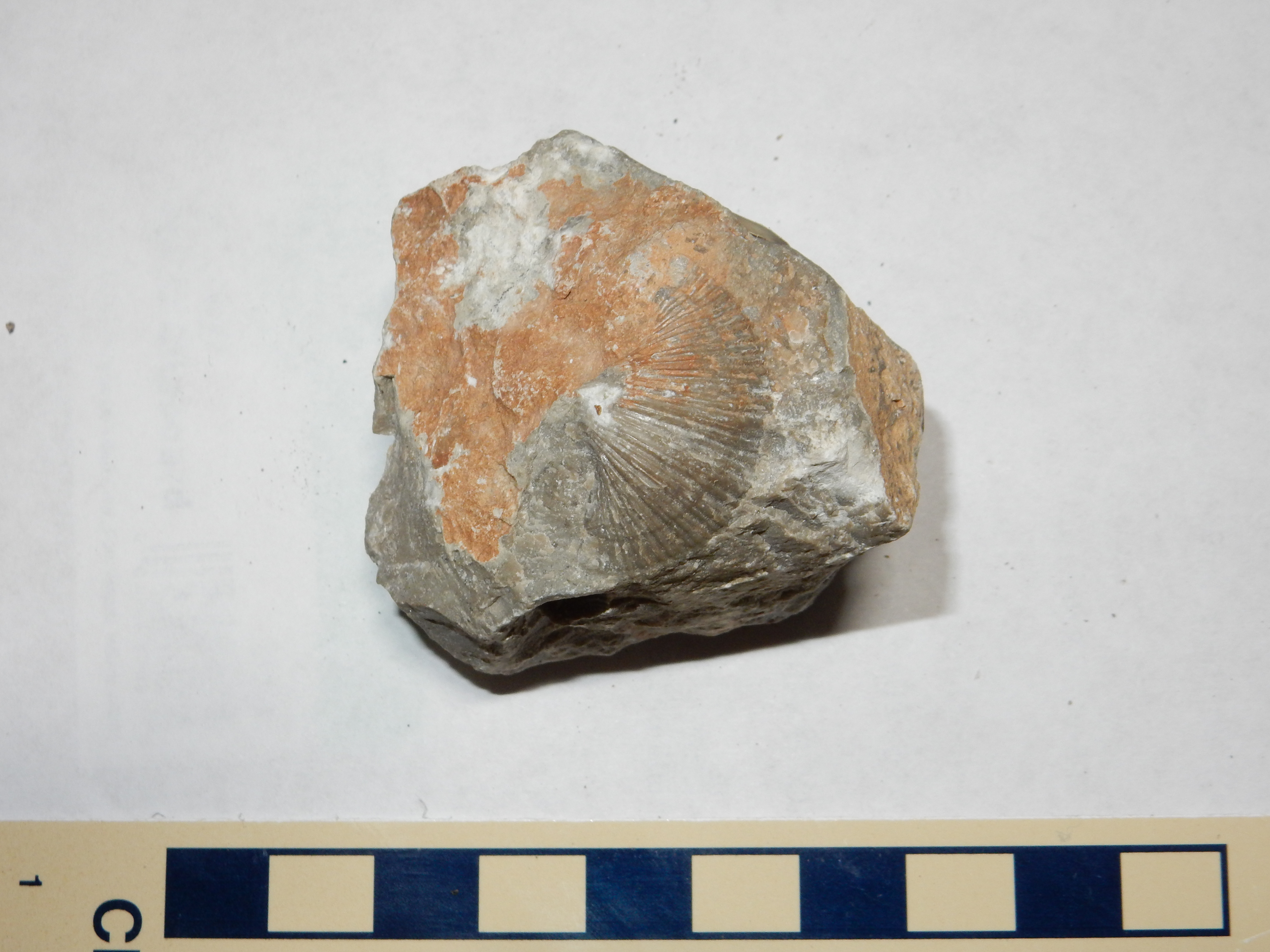
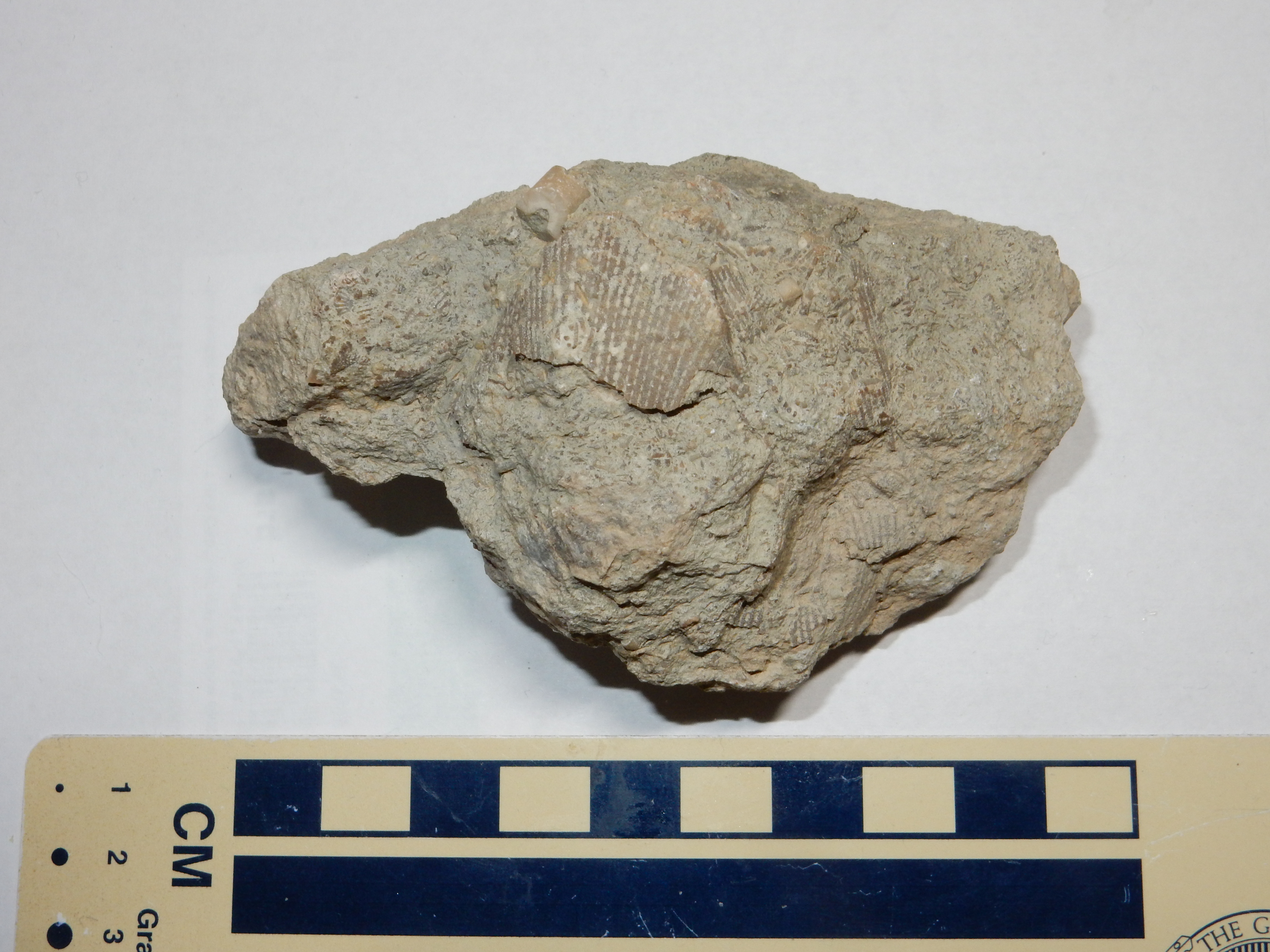
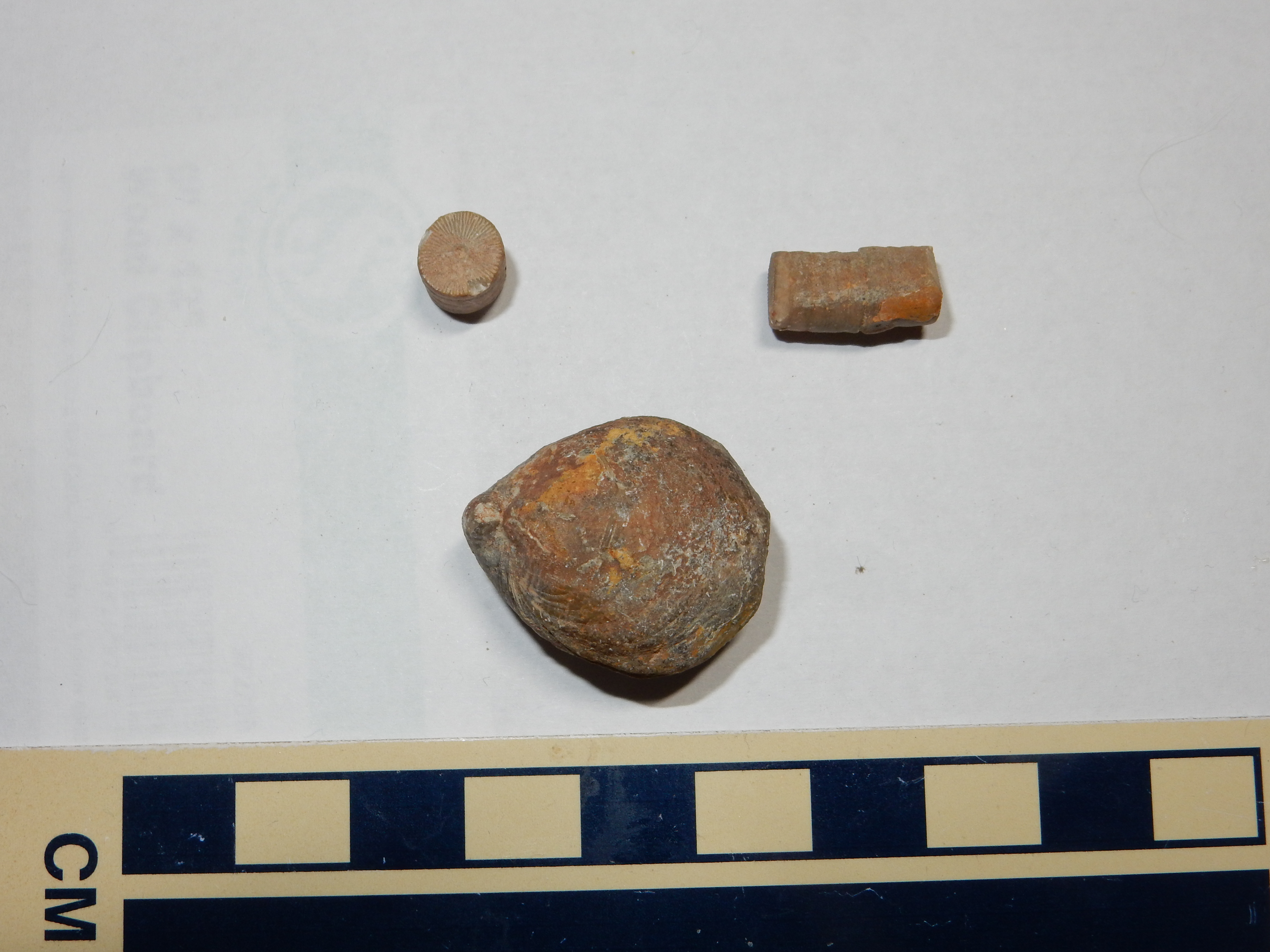
Fossils weathered from Madera Group limestone. Crinoid
stem fragments at top; brachiopod at bottom.
Here is a sample from the Jarosa area showing a whole assemblage of fossils.
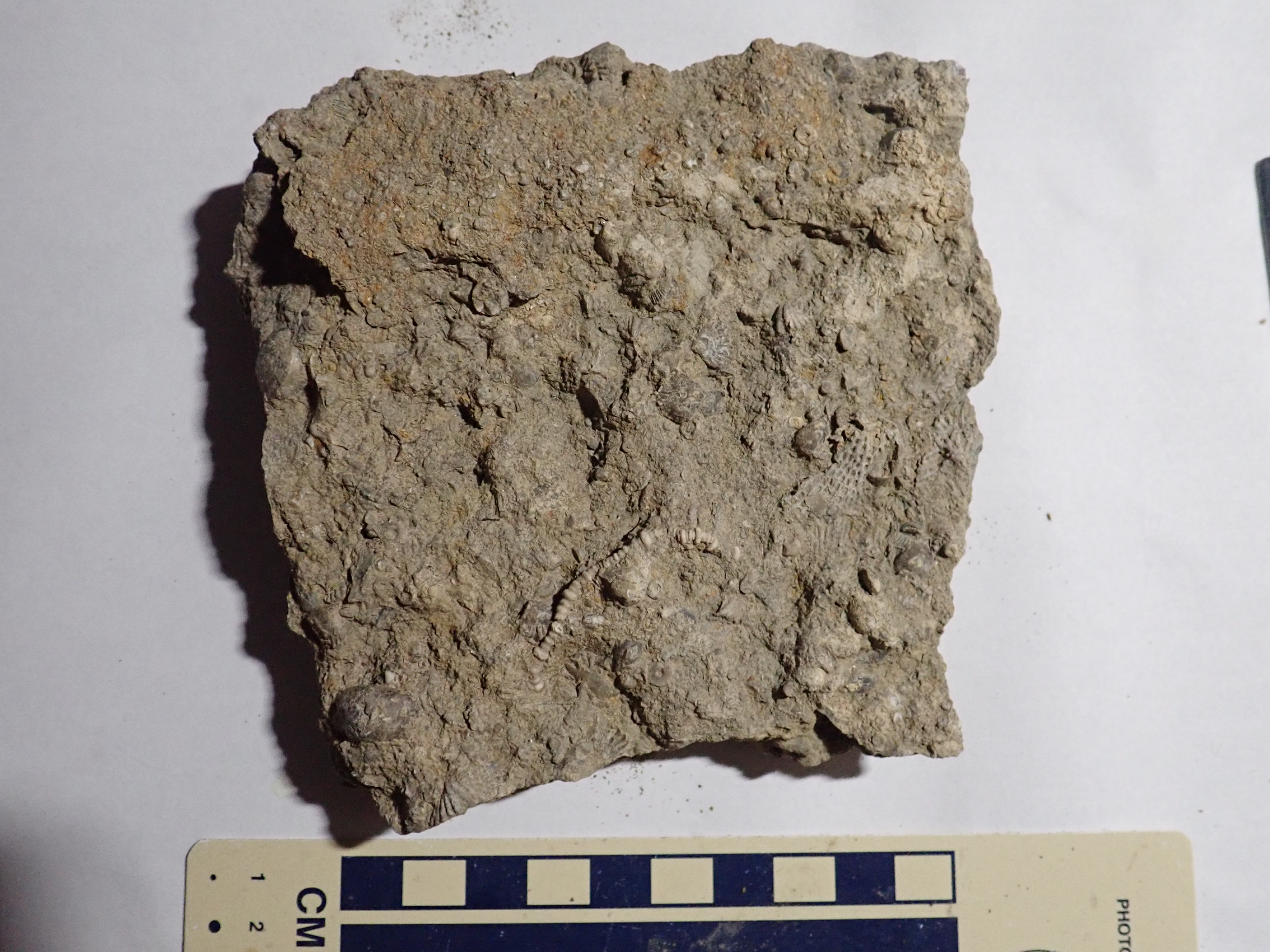
Madera Formation limestone rich in fossils. \36.0307143N
106.723381W
These include a likely crinoid feeding frond at lower center,
crinoid stem segments, bryozoans, and either small brachiopods or
large ostracods.
This sample from south of Jarosa contains an uncommon fossil.
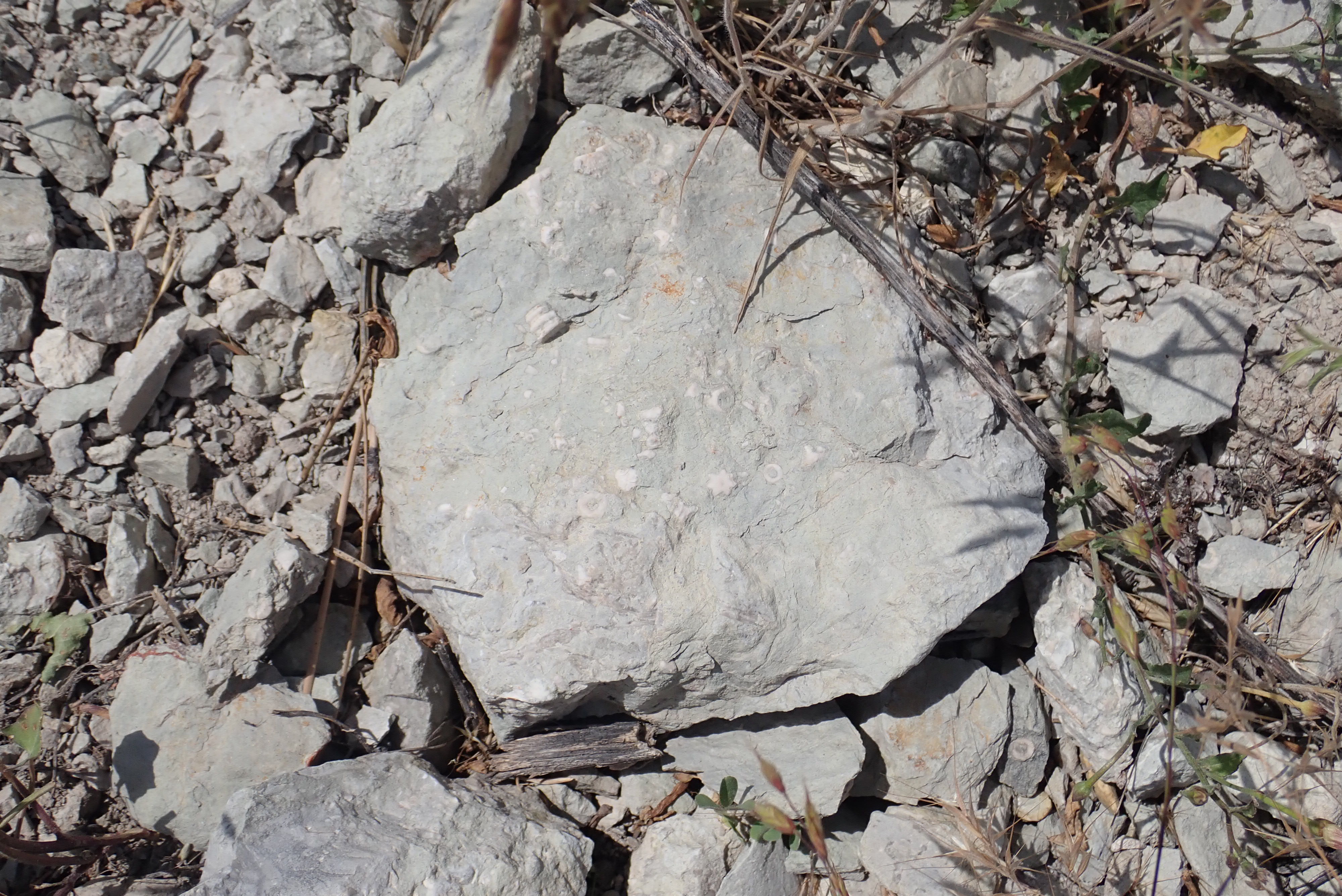
Madera Formation limestone with unusual fossil. 35.9999795N
106.7350477W
The fossil is a star-shaped object near the center of the sample:
Crinoid stem segments with a star shape are not unknown, being
assigned to order Isocrinidae, but these typically have
fivefold symmetry (producing a five-pointed star shape.) The star
here has seven points. I did not notice this fossil when I
photographed this rock, and so did not bother to take it with me;
I could kick myself.
There is a slight chance this may be an unusual bryozoan called Evactinopora.
Here is a partial trilobite fossil.
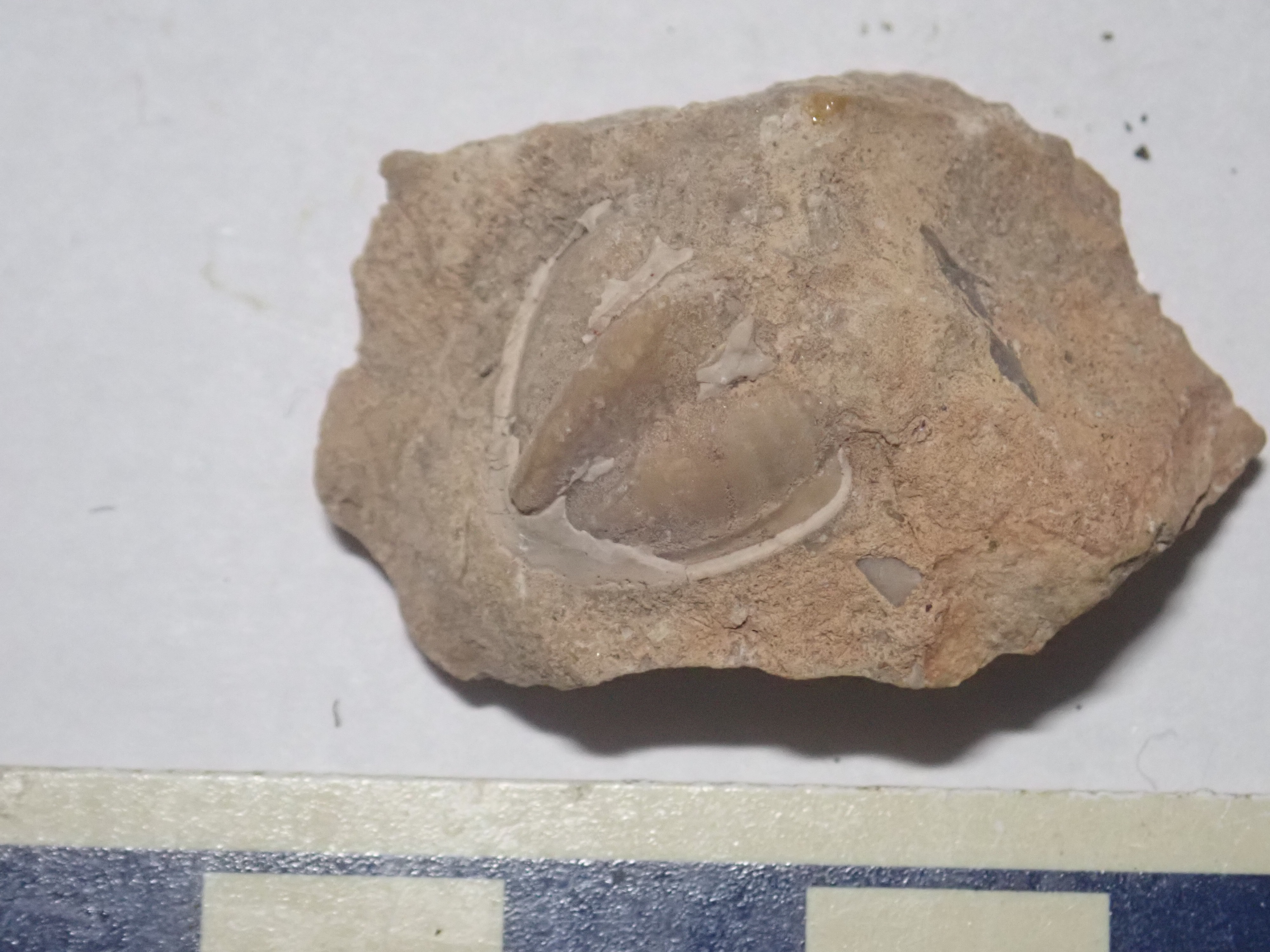
Trilobite fossil, likely Servillea. Near 35.827303N
106.6579708W
Trilobite fossils are rare, but not unknown, in the Pennsylvanian beds of the Jemez.
A large colony of bryozoans.
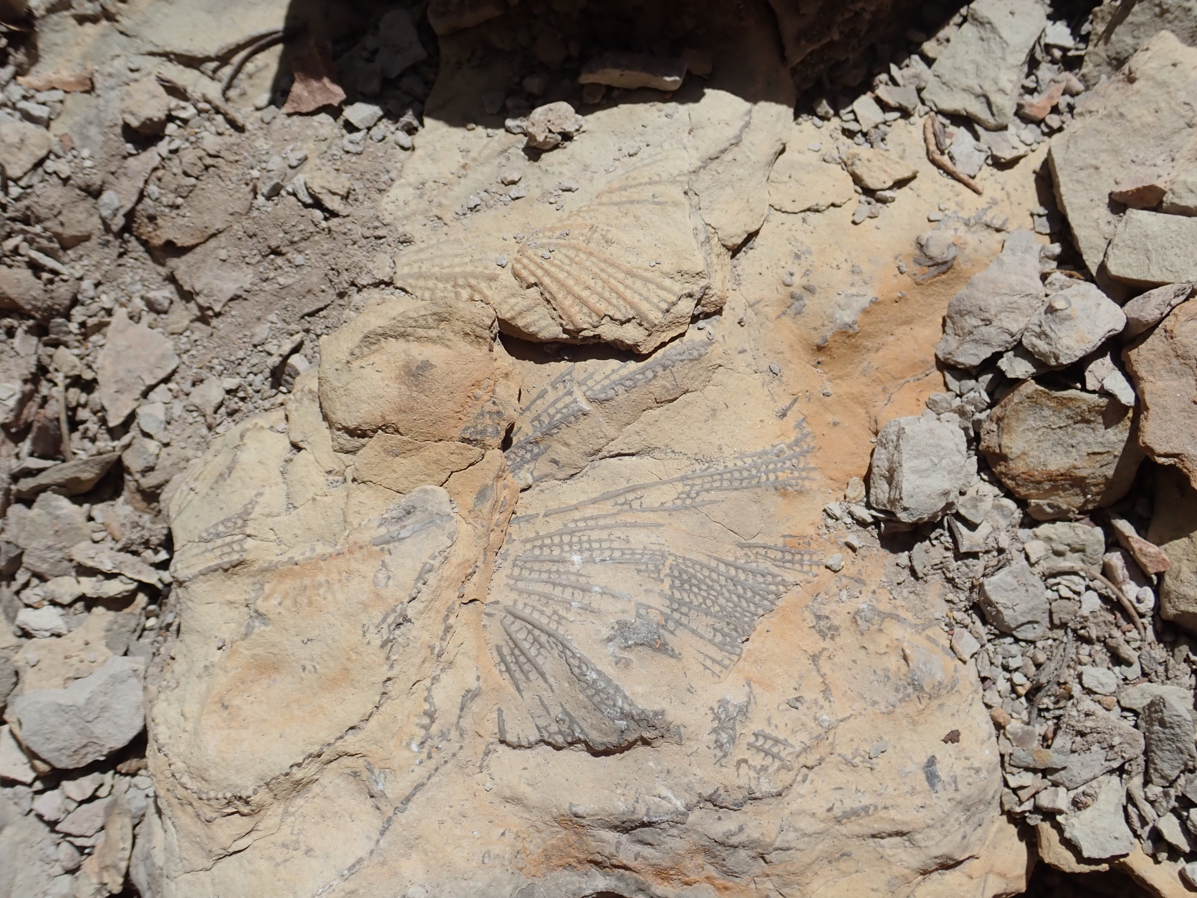
Bryozoan colony. Near 35.827303N
106.6579708W
This one proved impossible to extract intact. I have photographed it on location.
Finally, a nest of fusilinids.
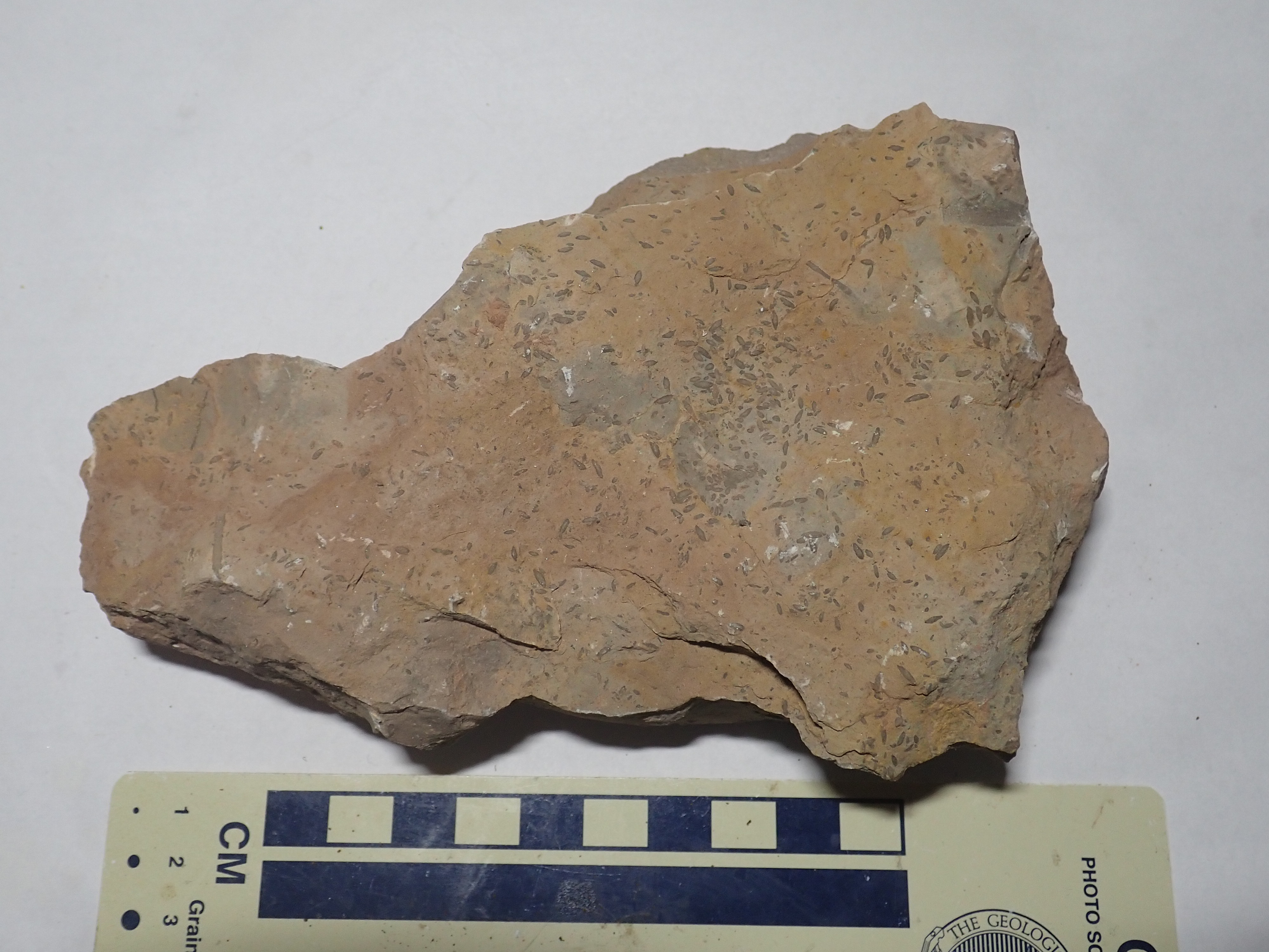
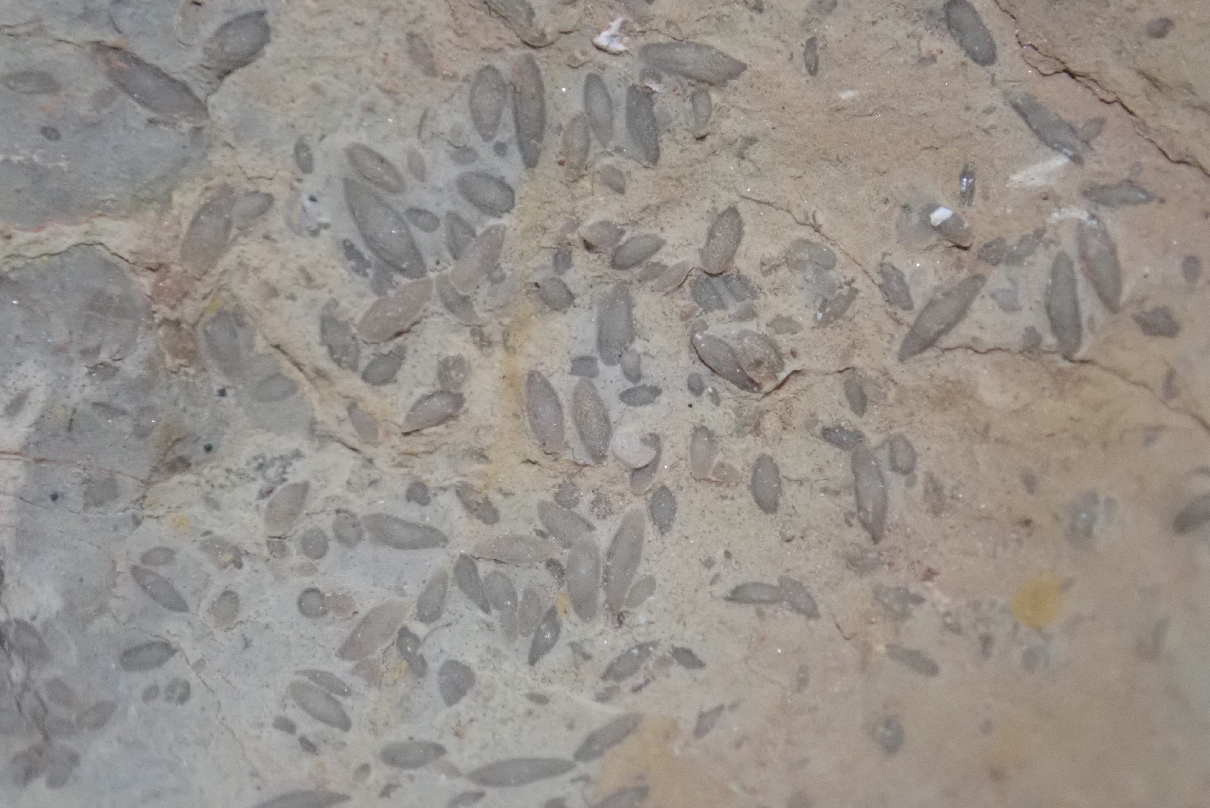
Fusilinids. Near 35.827303N
106.6579708W
It should be clear from these photographs just how extensive the Madera Formation is in the western Jemez area, and how rich its fossil beds. It dominates the Carboniferous exposures mapped in red in the relief map at the start of this section.
The Mississippian marked the emergence of the first reptiles, which were able to lay eggs on dry land. The armored fish of earlier periods were largely displaced by sharks and bony fish, and, during the Pennsylvanian, arthropods (animals such as insects and spiders, having exoskeletons and jointed legs) swarmed across the landscape. Vegetation of the Carboniferous included tree ferns and other large non-seed-bearing plants, but early seed-bearing plants such as cycads were also present. However, because New Mexico was under a shallow sea, these forms are not present as fossils in the Jemez. Instead, we find shallow marine fossils, dominated by bryozoans, brachiopods, mollusks, and crinoids.
Bryozoans are distant relatives of both mollusks and annelid
worms, first appearing in the fossil record in the early
Ordovician (about 480 million years ago.) They are microscopic
animals (up to 0.5mm in size) that form large colonies of various
forms. Those found as fossils in the Jemez created calcified
"fronds" like that in one of photographs above. These were covered
with bryozoans living in their own individual pockets, somewhat
like a coral. However, bryozoans are not close relatives of coral.
There is some functional specialization among the individual
bryozoans in a colony, so that they are not truly independent
animals, in the way that individual polyps in a coral reef are.
Mollusk fossils in the Jemez are mostly bivalves, that is,
mollusks with two symmetrical shells, resembling modern clams or
scallops. I once accompanied a den of Webelos Scouts (Boy
Scouts in larval form) on a fossil hunt in which one of the
boys found a marine snail fossil, but they are not common in the
Jemez. The first unambiguous molluscs appear in the fossil record
in the Cambrian, 500 million years ago, but mollusc-like animals
may go back to the Ediacarian Period of the late Neoproterozoic,
580 million years ago. Our lineage split off from that of all
invertebrates less closely related than echnoderms about 650
million years ago, and the acestors of molluscs split from the
ancestors of arthropods around 610 million years ago.
More common are brachiopods, distant relatives of mollusks,
which at first glance look like a variety of clam. However,
brachiopods have asymmetrical shells, as you can see in the
photograph above. This is most evident around the hinge, which
lies to one side. The edges of the shell are also typically curved
in a distinctive way. This asymmetry reflects a significant
difference from bivalve mollusks: Bivalve mollusks have shells on
either side of their soft bodies, while brachiopods have shells on
the top and bottom of their soft bodies. There are significant
differences in their internal anatomy as well. Brachopods have an
"arm" or lophophore of fine, cilia-covered tentacles
within their shells that is unlike anything among the molluscs.
Brachiopods first appeared at about the same time as the molluscs,
but are actually more closely related to bryozoans. Fossil
brachiopods are found in the Arroyo Peñasco Formation, but are
almost embarrassingly abundant in the Madera Group. In the modern
world, mollusks remain abundant in many environments, but
brachiopods are restricted to deeper, colder ocean waters.
Crinoids are relatives of starfish, sea urchins, and sea cucumbers. These first appear in the fossil record in the Ordovician. The crinoids of the Carboniferous were mostly relatives of the modern sea lily, which attaches to the ocean floor by a long stalk and has a cluster of tentacles surrounding its mouth. Fossil fragments of crinoids are typically from the stalk and take the form of distinctive segmented cylinders. However, the tentacles or "fronds" were sometimes preserved as fossils, though the only likely frond I have ever found is the one in the Jarosa sample above.
Modern crinoid. Via Wikimedia
Commons
Less common Carboniferous fossils found in the Jemez are echinoderm plates (in the Arroyo Peñasco Formation), trilobites, and fusilinids. Trilobites are among the earliest arthropods, the group of animals that includes insects, spiders, and crustaceans. Trilobites are highly diverse, but almost all have distinct head (cephalon) and tail (pygidium) joined by a segmented thorax. They get their name from a lateral segmentation into left, right, and center lobes. The trilobite shown above is missing the cephalon and some of the thorax. Trilobites ruled the earth in the Cambrian, but a mass extinction in the late Devonian left only order Proetida, of which Servillea is a member.
Fusilinids are among the largest single-celled organisms to have ever lived. Giant relatives of amoebas, they secreted characteristic tests or shells of calcite resembling grains of rice in size and shape. You can see numerous such tests covering the rock surface in the photograph above. Fusilinids lived over a relatively narrow range of time, first appearing in the upper Mississippian, about 330 million years ago. They were completely wiped out by the “Great Dying”, the catastrophic mass extinction at the end of the Permian, 252 million years ago, which we'll discuss in more detail later. Their presence immediately tells even an amateur rockhound that the beds in which they are found are upper Paleozoic, between 330 and 252 million years old. A paleontologist can make a thin section of a fusilinid, which has an elaborate pattern of internal partitions that identify an exact species and make fusilinids good index fossils for determining the exact age of a bed.
A few fusilinid species reached 60mm (2.5 ") in length. Their gigantic size reflected the high oxygen levels of the Carboniferous, and also a highly successful symbiotic relationship with algae.
If you are thinking of hunting for fossils in the Jemez, be aware
that the regulations governing fossil collection on public lands
are a bit murky since the passage of the Paleontological Resources
Protection Act of 2009. You are perfectly fine collecting fossils
on private land with permission of the landowner. At the other
extreme, if you collect any kind of fossil on National Park or
National Monument land, then Heaven have mercy on your soul. If
you encounter a vertebrate fossil on any public land, my best
advice is to treat it like a rattlesnake: Do not disturb it; back
away slowly.
The uncertainty is over how the Act affects amateur fossil hunters engaged in casual collection of common invertebrate fossils. My best read of the current state of regulations is that it is legal for rock hounds to collect a reasonable number of invertebrate fossils for personal study on National Forest or BLM land. However, it's always a good idea to be mindful of those who will come after you, and interpret "reasonable" conservatively, restricting yourself to a few choice specimens that you don't have to excavate for. If your fossil collecting involves large crates or the use of excavating equipment, you're over the line.
The paleotopography map for the Madera Formation is shown below.

Paleotopography map of Madera Formation
This map shows that there was still high terrain in the Sierra Nacimiento in the late Pennsylvanian, with a sizable ancestral range to the north and a much smaller ancestral range to the south. These are fairly unambiguous; the Madera Formation is thick and distinctive everywhere else, but in these areas the next younger formations, the Abo and Cutler Formations, rest directly on Precambrian rocks. Geologists G.H. Wood, Jr., and S.A. Northrop, who surveyed the area for the U.S. Geological Survey in 1946, first recognized that the Sierra Nacimiento was high ground during the Pennsylvanian based on their observations of the Permian beds. This ancient uplift is known as the Penasco uplift, and indications are that the ground here began rising in the early Pennsylvanian, during the deposition of the Sandia Formation.
Some Madera Formation beds in the San Pedro Mountains were clearly deposited close to an ancient uplift.
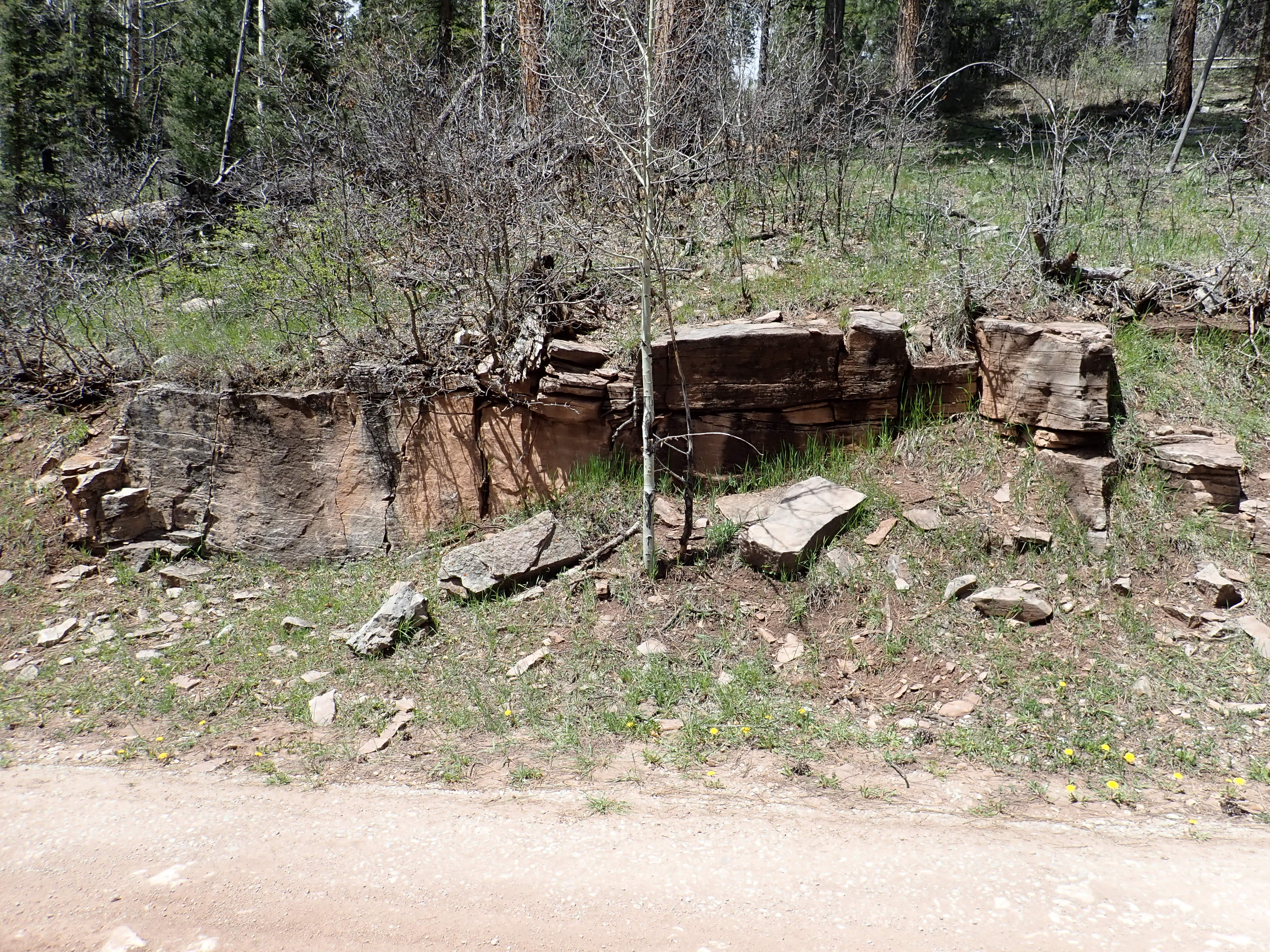
Arkosic Madera Formation outcrop. 36.032252N
106.726469W
This outcrop so resembles the Cutler Group which lies atop the Madera Formation in this area, that only close examination proves that it is Madera Formation.

Arkosic Madera Formation sample 36.032252N
106.726469W
The matrix is a calcareous limestone under the loupe, composed
mostly of poorly sorted grains of quartz and feldspar, albeit with
ample calcite cement. The circular structures are crinoid stem
fossils, showing that this is not a terrestrial sandstone, but a
marine sandstone and so part of the Madera Formation. It is rare
for body fossils to be preserved in a sandstone, even ones as
poorly preserved as these. (Trace fossils, which we'll come to in
the next chapter, are another matter.)
The Penasco Uplift was remarkably similar to the modern Sierra
Nacimiento. The uplift seems to have been tilted to the east, and
the western boundary was a fault less than a kilometer (0.7 miles)
east of the fault that marks the western edge of the modern range.
By the middle Pennsylvanian, sea levels were rising again relative to the Ancestral Rockies. The evidence for this is that the Madera Formation has indications of onlap, where younger beds extend further onto the underlying Precambrian basement than older beds. The higher terrain must have had low relief, because there is little indication that much coarse material was shed into the surrounding basins, as would be expected if there were any rugged mountains present. It was likely already eroded down to the flat Precambrian peneplain surface in the basement granites.
On land, towards the end of the Pennsylvanian, for reasons still not fully understood, the great lycophyte forests of the Mississippian suffered ecological collapse. This event is known as the Kasimovian crisis. Lepidodendron and its kin disappeared abruptly, leaving a forest of relatively small seed ferns and conifers. Large tree ferns and sigillarian lycophytes then evolved to restore the forests. However, the new tree ferns had abundant true leaves that changed the character of the forests. Whereas lycophytes had small leaflets that did not block out the sun, the new tree ferns had true leaves that produced the first dense forest canopies, shading out the ground underneath for the first time since plants first invaded the dry land.
Several theories have been proposed to explain the end of the lycophyte forests. Perhaps there was a climate change they could not cope with. Or perhaps a fungal plague killed off the lycophytes in a geological blink of an eye. Possibly the lycophyte forests were doomed by their own success, driving oxygen levels so high and carbon dioxide levels so low that they could no longer carry out photosynthesis, effectively smothering themselves.
Guadelupe Box has the most complete column of Carboniferous rocks on the west side of the Rio Grande Rift in the Jemez area. There is another good exposure, though slightly less complete, on the east side of the Rift at the Crest of Montezuma.
Crest of Montezuma. Looking east from 35
18.437N 106 24.790W
The Crest of Montezuma is a horst on the east side of the
Las Huertas graben. The hill I'm standing on to take this
photograph is the west horst of the graben.
A graben is a fault-bounded valley formed where crustal extension
is pulling the upper crust apart. The usual picture of a graben
has the center block dropping like the keystone of an arch that is
being pulled apart:
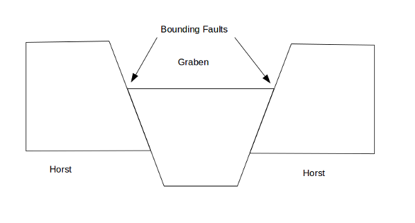
The walls of the graben, called the horsts, are fault escarpments of the bounding faults. The terms graben and horst are German and were first used to describe the geologic structure of the Rhine Valley.
The East La Huertas Fault runs along the base of the Crest of
Montezuma, where it separates Permian Abo Formation beds from
older Precambrian or Carboniferous beds. The entire valley floor
here, where it is not covered with alluvium, exposes red beds of
the Abo Formation. The lowest part of the Crest towards its north
end (to the left in the photograph) is Precambrian quartzite.
Above this are Arroyo Peñasco Group limestone beds, including the
Del Padre Sandstone and Espiritu Santo Formation but no Tererro
Formation. There may be a thin bed of Log Springs Formation above
this, but too thin to map. Then comes a slope of Sandia Formation
sandstones and mudstones above the limestone beds of the Arroyo
Peñasco Group and below the first massive limestone bed of the
Madera Group. The section here is missing the Osha Canyon
Formation and most of the Log Springs Formation.
North of the Jemez proper is the Chama Basin, a mild downwarp of the Earth's crust between the Tusas Mountains to the east and the Archuleta Anticlinorium to the west. It is regarded as the far eastern end of the Colorado Plateau. The southern part of this basin is buried beneath the volcanic rock of the Jemez Mountains between Canones and Coyote. Here relatively young lava flows have formed a resistant cap that has preserved the more ancient rock beds beneath.
The oldest beds exposed in the southern Chama Basin belong to the El Cobre Canyon Formation.
Even as marine limestone of the Madera Group continued to be deposited east of what is now the Nacimiento Mountains, sediments eroded off the Ancestral Rocky Mountains filled what is now the southern Chama Basin. These beds of sediments are assigned by geologists to the Cutler Group. The lower formation of the Cutler Group, the El Cobre Canyon Formation, is exposed in Red Wash Canyon and Canyon del Cobre.

Red Wash Canyon. Looking northwest from
36
14.740N 106 22.057N
This shows the westernmost wall of Red Wash Canyon. Canyon del Cobre is located beyond the ridge towards the right. The El Cobre Canyon Formation is exposed in the lower canyon walls and floor. It straddles the Pennsylvanian-Permian boundary, and its lowermost beds in Canyon del Cobre include some of the best known assemblages of fossilized Pennsylvanian tetrapods (amphibians and reptiles).
The El Cobre Canyon Formation is exposed close to the highway west of Coyote.
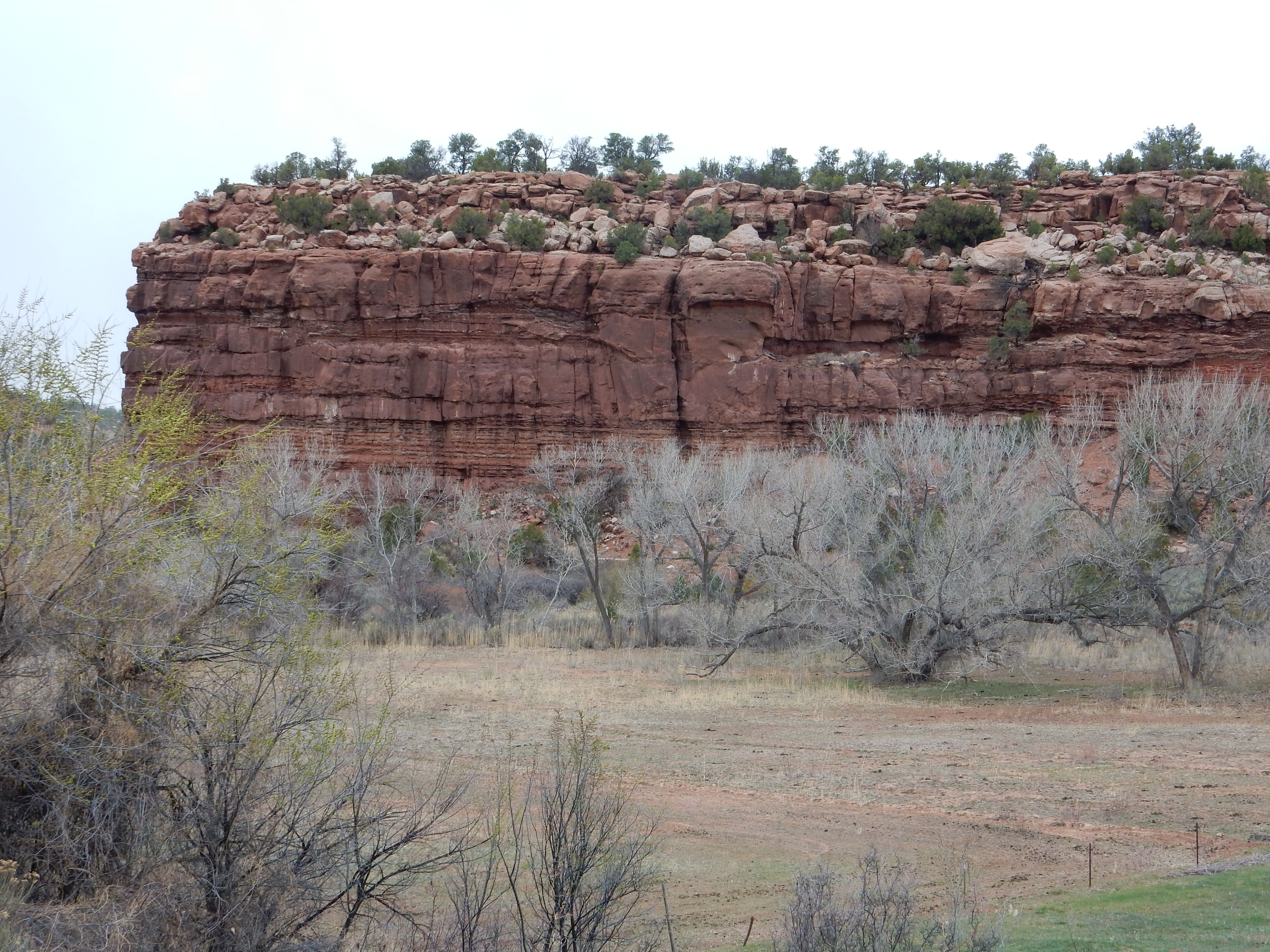
This area is notable both for fossil quarries and for uranium
prospects.
We've now seen several formations that consist at least in part of mudrock. Mudrock is clastic sedimentary rock whose clasts are less than 0.0625 mm in size. if the clasts are mostly between 0.0625 mm and 2 microns in size, the more precise term is siltstone. If the clasts are mostly clay particles less than 2 microns in size, the more precise term is claystone. If the rock is a more or less equal mixture of silt and clay, it is a mudstone. If the rock easily splits into thin layers (is fissile), it is described as a shale.
Induration is the geological process of consolidated sediments being converted to solid rock. Consolidation is the process of the clasts becoming tightly packed together under the weight of overlying beds. Excess water is expelled from the sediments and pore space is minimized. The individual clasts in the consolidated beds are then cemented together, usually by additional minerals brought in by groundwater. The degree of induration depends primarily on how much and what kind of cement binds the clasts together. The most common cements are clay minerals, calcite, hematite, amorphous silica, and quartz, in order of increasing hardness. A sandstone cemented with abundant quartz is a very hard rock, while a sandstone cemented with sparse clay minerals will be so soft that it crumbles to the touch (it is friable).
Because mudrocks are mostly clay minerals, they tend to be fairly poorly indurated. Some mudrock exposures seem like little more than piles of dirt, albeit piles of dirt millions of years old. Shales also tend to be poorly indurated, but they have a very distinctive texture of thin layers. Individually the layers are well indurated, but they easily come apart, and the overall appearance of the shale is rather like a layered pastry such as baklava. It is uncommon to come across a mudrock that is massive, solid rock, like the Arroyo del Agua Formation mudstone sample in the photograph above. Generally, such mudrock has been deeply buried, to the point where it borders on metamorphic rock, or contains an unusual abundance of fine-grained silica, or else has had an unusual amount of silica-rich groundwater circulate through it.
Clays form a family of minerals related to mica. All are
phyllosilicates, whose basic structure consists of sheets of
silica and aluminum tetrahedrons joined to neighbors at three of
their four corners. The sheets are bonded to metal hydroxide
sheets, sometimes with a phyllosilicate bonded to each face of the
metal hydroxide sheet (a TOT layer), sometimes with a
phyllosilicate sheet only on one face of the metal hydroxide sheet
(a TO layer). We saw the TOT structure earlier.
The T stands for silica or aluminum tetraheda, while the O stands
for metal oxide in which each metal ion is surrounded by an
octahedron of oxygen or hydroxide.
Clay minerals form from igneous or metamorphic rock that is exposed to weathering at the surface of the earth. The minerals in an igneous rock crystallized under conditions quite different than those at the earth's surface. The temperature was much higher, the pressure may have been much higher, and conditions were drier. Minerals stable under these conditions are not necessarily stable under cooler, wetter conditions. For example, potassium feldspar is susceptible to slow weathering by the traces of carbonic acid in normal surface water, which extracts potassium and silica from the feldspar to produce a clay mineral called illite. Illite is quite similar in composition and structure to muscovite, but is generally found in the form of very small flakes, visible only through a powerful microscope. The composition is more variable, and X-ray diffraction shows subtle differences in the mineral structure that indicate that illite is not just very fine-grained muscovite. One of the first indicators of low-grade metamorphism in a clay-bearing rock is that illite begins to convert back to muscovite.
If weathering is intense enough, illite can further degrade into
kaolinite by losing additional potassium. Kaolinite is a
clay mineral characterized by a structure of a single silica sheet
bonded to a gibbsite sheet. These pairs of sheets are electrically
neutral and only very weakly bonded to neighboring pairs. This
makes kaolin clay extremely plastic, ideal for manufacturing
pottery. When kaolin is heated to 1000 F (550 C) or higher in a
kiln, the hydroxyl ions are driven out irreversibly to produce
metakaolin, an amorphous substance which will no longer
disintegrate when exposed to water. This is the minimum kilning
temperature for producing fired earthenware. Heating past 1700 F
(925 C) converts the metakaolinite to a mixture of silica and
aluminum spinel, typical of stoneware, which is much less porous
than earthenware. At 1900F (1050 C) the spinel begins to transform
to mullite characteristic of porcelain, and at 2550 F (1400 C) the
mullite recrystallizes to a needle form that is very strong and
durable, corresponding to the finest porcelain.
The first stage (earthenware) can be achieved by primitive pit firing, which may have originated as long as 25,000 years ago but certainly was in use by 6000 BCE. Kilns capable of producing porcelain were in use in China by 1000 BCE. Roman kilns could sometimes produce stoneware, but not consistently, so Roman earthenware was coated in glaze and fired a second time to seal the pores in the earthenware and make it watertight. Unfortunately for the Romans, the glazes were often lead-based.
Routine manufacture of stoneware in Europe dates only to the
medieval period. The kaolin is generally combined with other
ingredients, such as gypsum, bone ash, or a mixture of quartz and
feldspar, that lower the temperature needed for successful firing.
Plagioclase feldspar weathers to montmorillonite with the loss of silica, sodium, and calcium. Montmorillonite is a clay mineral characterized by a TOT structure resembling muscovite or illite, but the triple layers are bound together mainly by sodium or calcium ions, rather than potassium ions. Montmorillonite varies considerably in its sodium to calcium ratio, like the plagioclase from which it forms, and shows other variations in composition. Clay rich in montmorillonite is known as bentonite and is particularly common in sediments weathered from volcanic ash.
The overall effect of weathering on typical igneous rock is to convert it to clay sediments that are enriched in aluminum. These are described by geologists as pelitic sediments from the Greek pelos ("clay"). When magma forms from deeply buried clay beds, such as by melting of the crust by injected basaltic magma from the mantle, the resulting magma is also enriched in aluminum. Granite formed from such magma is peraluminous and may contain unusual aluminum-rich minerals, such as corundum. Metamorphic rock formed from clay beds typically contains aluminum-rich minerals such as the aluminum silicates we saw in the last chapter.
By the time the U.S. Army occupied New Mexico in 1846, Navajo raids on native American pueblos and Spanish settlements had been a regular occurrence for centuries. U.S. forces were inadequate to protect every vulnerable point, so in the summer of 1849, Lieutenant Colonel John M. Washington, the military governor of New Mexico, prepared to lead a punitive expedition into the Navajo country of northwestern New Mexico. Accompanying the expedition was Lieutenant James H. Simpson, an officer with the Corps of Topographic Engineers. Simpson had helped map the route from Fort Smith, Arkansas, to Santa Fe, which would much later become Interstate 40. A seasoned and perceptive explorer, who was in the field almost nonstop from 1849 until the Civil War, Simpson would give the first detailed account of country that had been previously ignored by Mexican and American authorities. He had with him the artist R.H. Kern, who would provide illustrations of landforms for Simpson's account.
The expedition descended through La
Cienega and the canyon
of the Santa Fe River before crossing the northern part of
the San
Felipe volcanic field. The expedition spent three days at Jemez
Pueblo, where Simpson made the first detailed geologic
observations of Cañon de San Diego. He took particular note of the
old Spanish Queen copper mine, which was delved into beds of "red
argillaceous rocks." The red beds extending throughout the canyon
marked a major change in the tectonics of the Jemez region, in
which the shallow marine environment gave way to continental
deposition in a river environment.
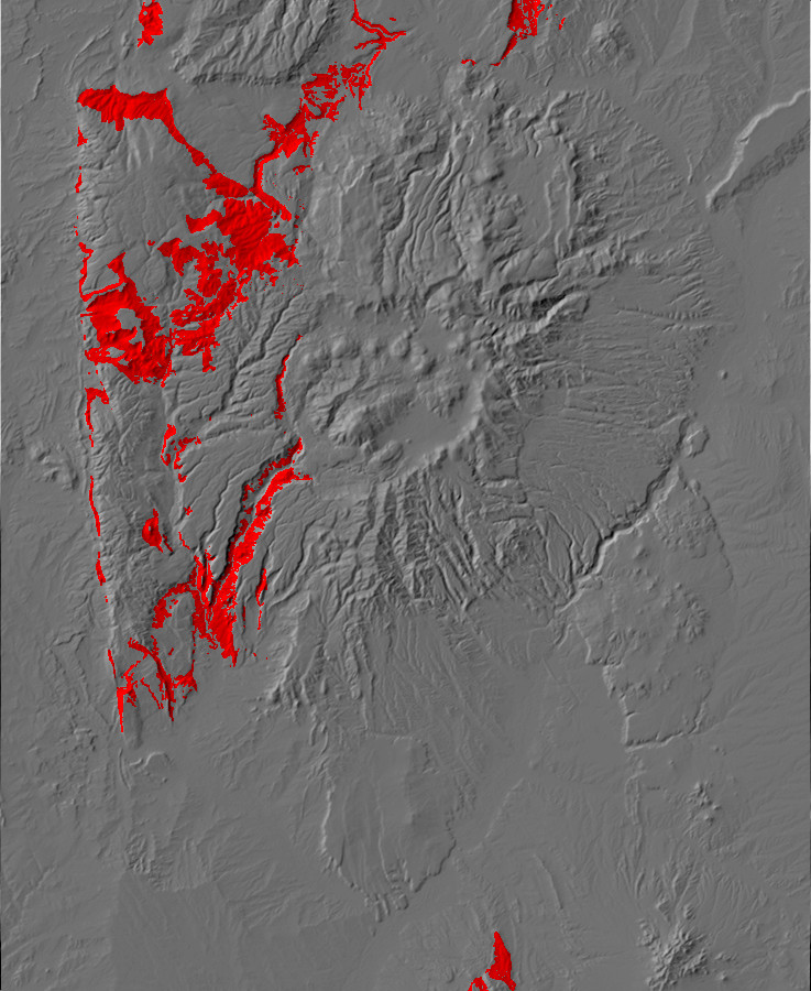
299 million years ago, the Jemez region was a coastal flat
between the Ancestral Rocky Mountains to the north and east and a
shallow sea to the south. Most of the continental crust of the
Earth had finished assembling into the supercontinent of Pangaea.
Uplift associated with the Ancestral Rocky Mountains was drawing
to a close, and the Penasco and southern San Luis uplifts were
already beginning to subside,.
The earth was in the throes of another ice age, a pulse within
the Late Paleozoic Ice Age. The exposed silicate rock where
continents had collided in the assembly of Pangaea absorbed carbon
dioxide from the atmosphere as it weathered, reducing the
atmospheric greenhouse effect. (The same effect has occurred in
geologically recent times, when the rise of the Himalayas produced
the ice ages that the first humans were forced to adapt to.)
Further reductions in carbon dioxide came about from the extensive
coal forests of the Carboniferous. Most of what are now the
southern continents were fused into the large continent of
Gondwanaland, which was located very close to the south pole. It
is in the regions that were once part of Gondwanaland that we find
the geologic evidence for massive glaciation at this time.
The Permian was also marked by lower sea levels and a drier
climate than the Carboniferous, and the vast coal swamps dried out
and were replaced by large deserts in the interior of Pangaea. It
was during this time that the last of the trilobites, so abundant
during the Cambrian, died out. Seed plants, such as pteridosperms
("seed ferns"), primitive conifers, and ginkgoes, became
widespread, in part due to the increasingly dry climate. A single
species of ginkgo, Ginkgo biloba, survives today. Amniotes,
animals laying eggs that could hatch on land, began to
proliferate. These included the first therapsids, ancestors of
modern mammals, of which some (such as Moschops) were
twice the size of a modern cow.
A large area of west Texas and southeast New Mexico was a shallow sea, the Permian Basin, which was periodically flooded with seawater from a narrow channel to the south. Great thicknesses of sediments and salt and gypsum beds were deposited there. This is now oil country, and the salt beds are being exploited for the long-term storage of nuclear waste.
Central North America was dry land during this time, while the
Antler origen had ended and the west coast was once again a
passive continental margin. The Jemez area was very close to the
equator, located between the higher terrain to the east and the
ocean to the west, with river valleys meandering south to the
Permian Basin. Extensive marine and continental sedimentary beds
were laid down, and Permian beds are now exposed over more than
13% of the area of New Mexico.
Much of the sediments that form the Permian formations were
eroded off the San Luis Uplift, which was still prominent to the
north, and the Pedernal Uplift, to the southeast. The Penasco
Uplift, coincident with the modern Sierra Nacimiento, was finally
buried under sediments during the Permian. However, the
Permian beds thin towards the crest of the Sierra Nacimiento in a
way that suggests that the area was subsiding more slowly than its
surroundings.
The transition from Pennsylvanian to Permian time is visible in
the area around Battleship
Rock. Here, in the Cañon de San Diego, the Jemez River has
cut through younger rock to expose the entire geological column in
this area. Across from the Battleship Rock parking lot, the road
cuts into the upper Madera Formation.
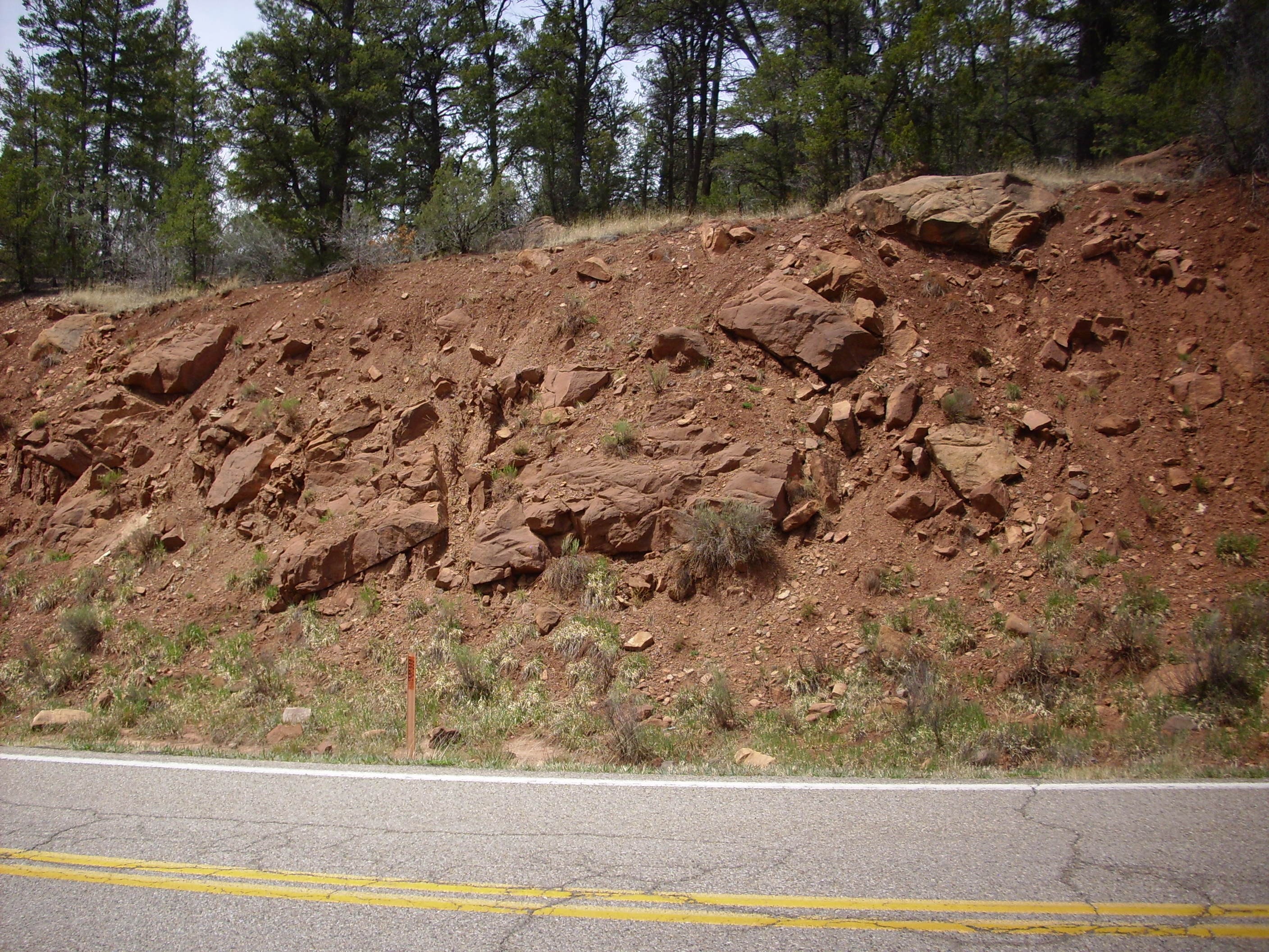
There is no sharp transition from the Madera Formation to the lowest formation of the Permian in the Jemez, the Abo Formation. The sea was receding to the south, but the shore moved back and forth, depositing alternate layers of limestone characteristic of the upper Madera Formation (which are rich in fossils) and of sandstone and mudstone characteristic of the lower Abo Formation. The latter represents deposition of sediments eroded off the San Luis Uplift in a river delta close to the shore. The geologic map of this area maps this road cut as Madera Formation, putting the boundary with the Abo Formation at the highest limestone bed that is more than a meter thick. Well, you have to put the line somewhere.
The vagueness of the boundary between the Pennsylvanian and the
Permian in the Jemez is not unusual.This is perhaps the most
subtle period boundary in the geologic record worldwide.
These alternating beds of fluvial mudstone and sandstone and
marine limestone may be cyclothems. Cyclothems are
alternating beds of marine and continental sedimentary beds, often
including layers of coal, that are extremely well-developed in
Appalachian rocks of late Pennsylvanian and early Permian age.
They are interpreted as resulting from fluctuating sea levels,
which in turn reflect the advance and retreat of glaciers of the
southern hemisphere during the Late Paleozoic Ice Age. When the
glaciers advanced, sea levels dropped and continental sediments
were deposited; when the glaciers retreated, sea levels rose
again, and marine sediments were deposited. There were at least
sixty such episodes of glaciers advancing and retreating during
the Late Paleozoic Ice Age, and each produced a cyclothem in the
Appalachian area.
The cyclothems of the Madera-Abo transition of the Jemez, if that
is what they are, are rather poorly developed examples, but they
do show the basic feature of alternating marine and continental
sedimentary beds. Better examples are found further south, in the
Carrizo
Arroyo area, where six distinct cyclothems have been
identified. The flucuations in sea level are estimated to have
been about 80 meters (250 feet). The fact that cyclothems in the
Pennsylvanian-Permian transition in New Mexico are fewer and less
distinct than those in the east is interpreted as local tectonic
activity having more control over deposition than glacial cycles:
The Ancestral Rocky Mountains were not quite done yet.
There are some limestone beds towards the south end of this road cut.
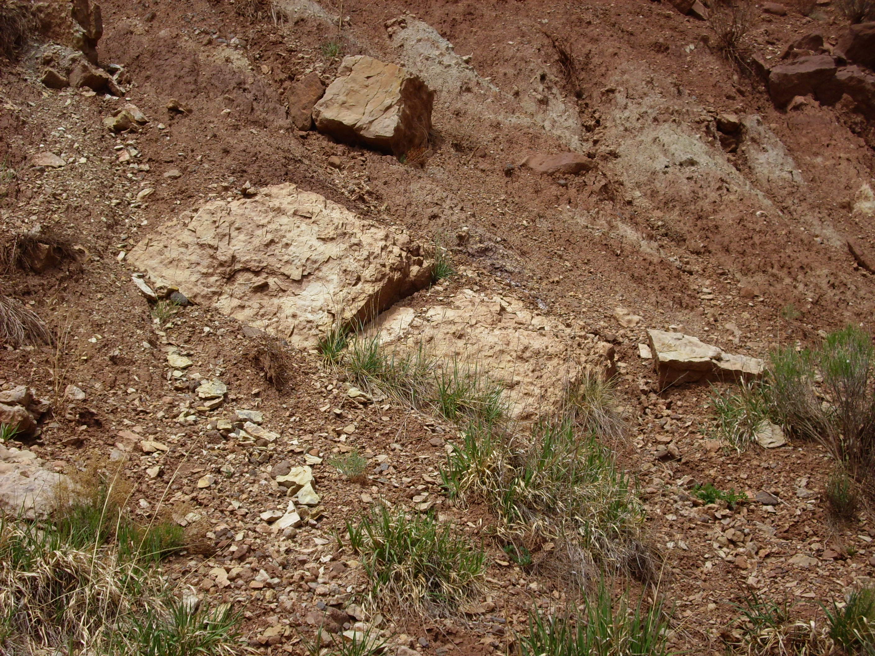
There are also gray patches of mudstone above the limestone, more
typical of the Abo Formation. These patches are beds that
contained enough organic matter to reduce the bright red ferric
iron to soluble ferrous iron, which was then leached away to leave
gray clay minerals.
Further down the road, as you approach Hummingbird Music Camp, it's all limestone and limy shale and definitely Madera Formation.
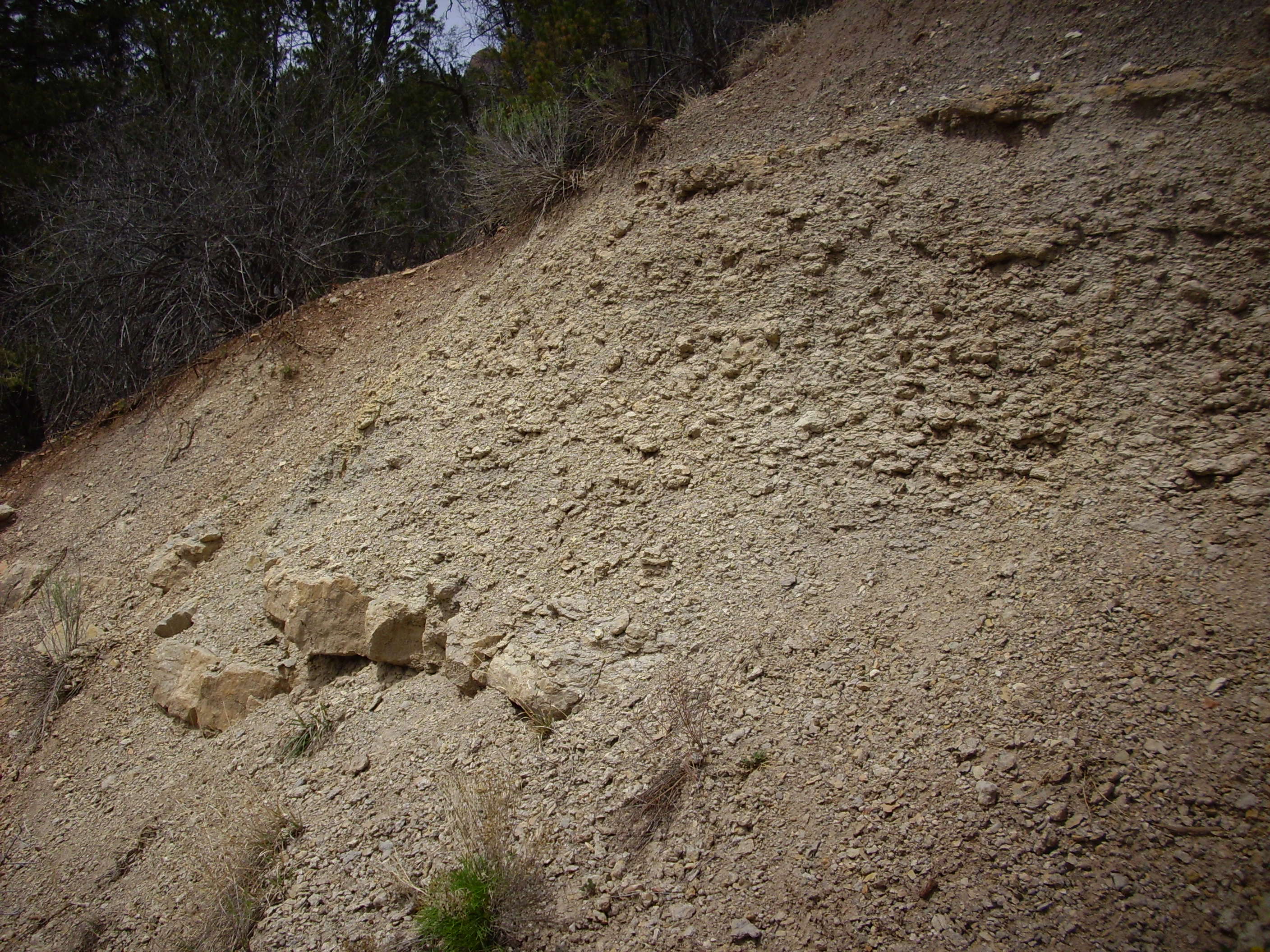
The limy shale here weathers into clasts that I have read
described, quite accurately, as ball bearing clasts. When present
on a hard surface, such as a rock ledge, they pose a very
considerable slip hazard.
East of Battleship Rock, in the valley of the East Fork, Jemez River, the southern valley walls are dominated by Abo Formation.
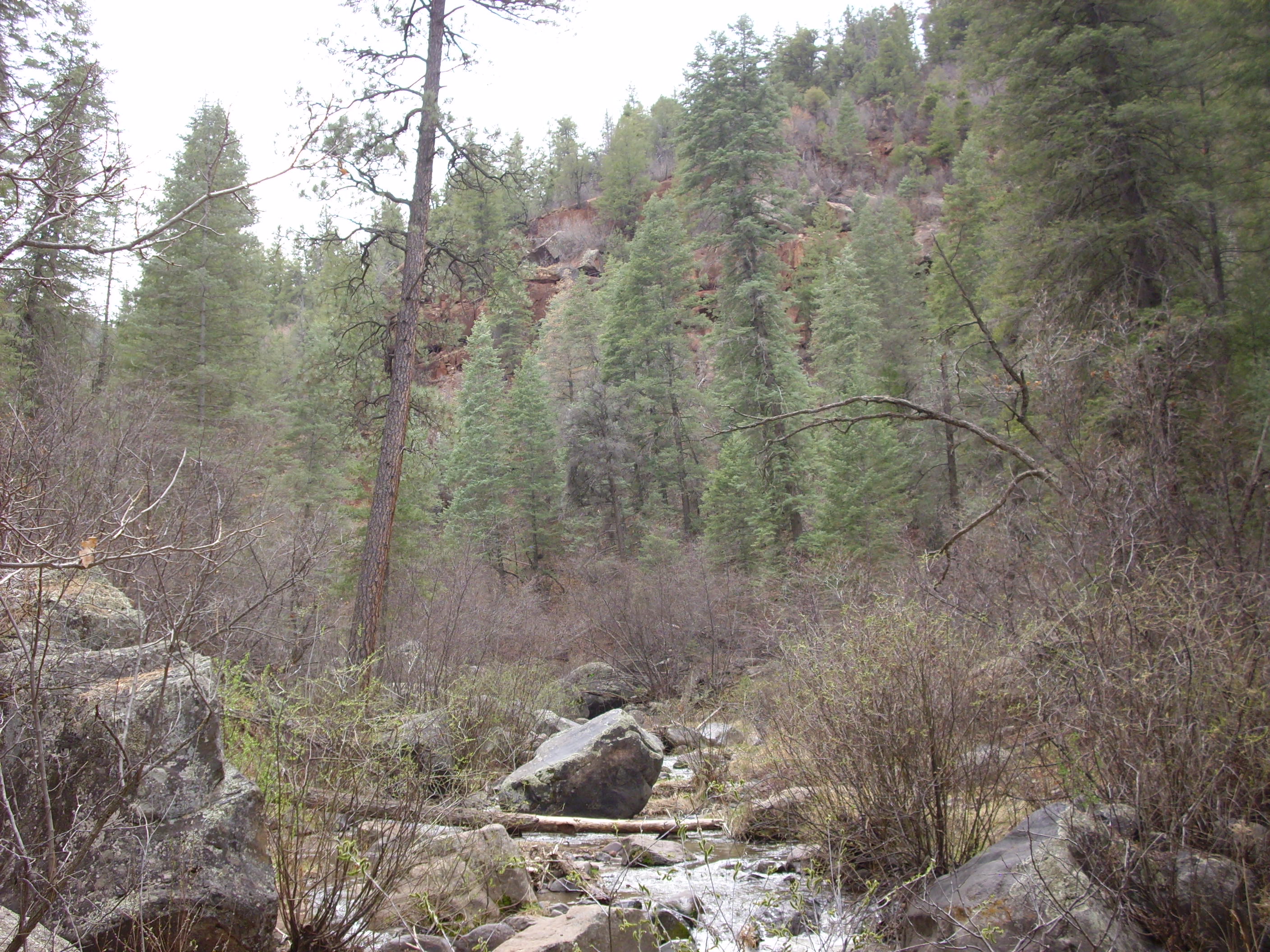

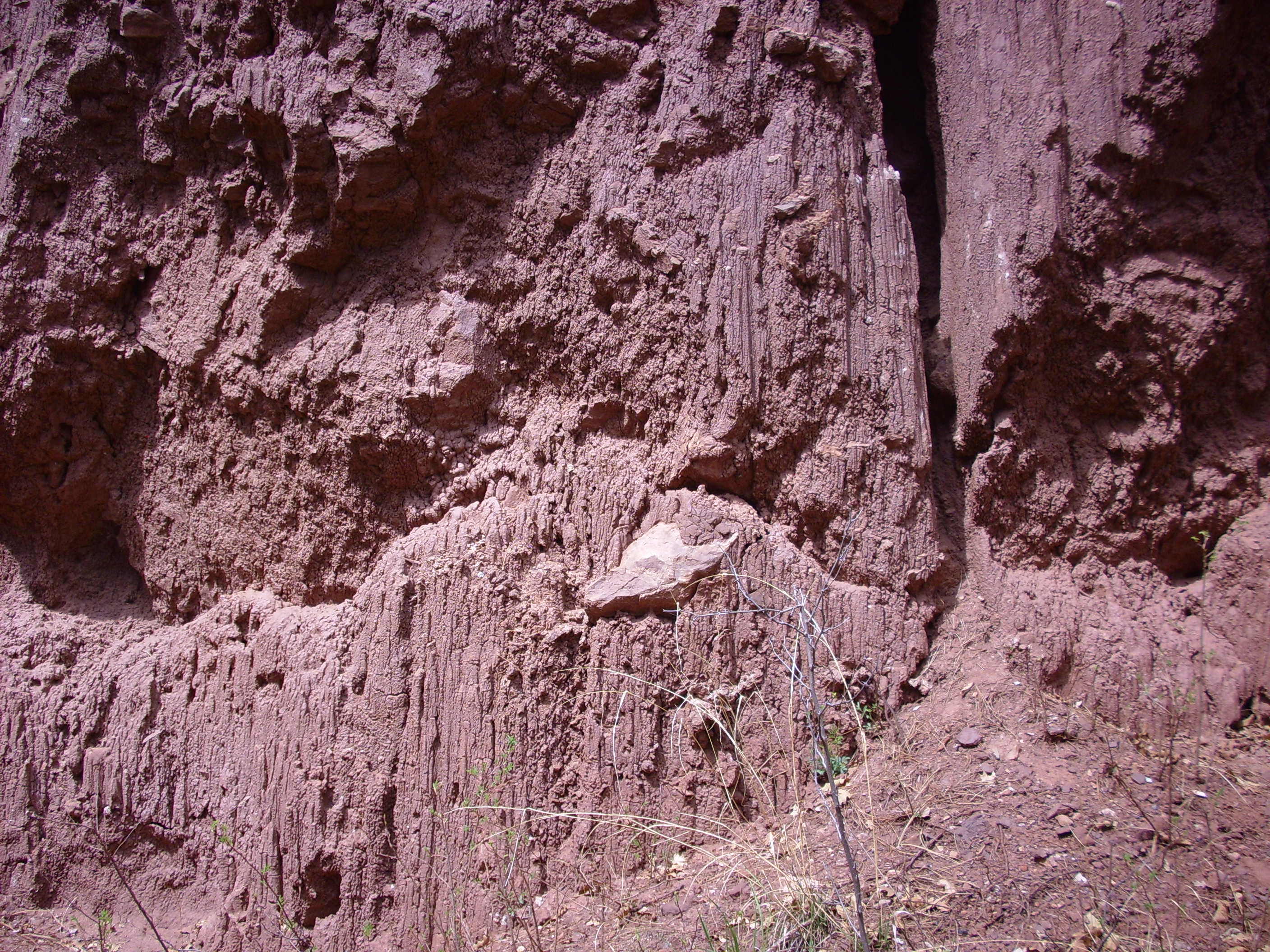
In the southern Chama Basin, north of the Jemez, we've seen that
continental sediments were already being deposited in the late
Pennsylvanian as the El Cobre Canyon Formation. The period
boundary lies somewhere in the middle of this formation, with no
obvious break in deposition that could pinpoint it. Only fossil
evidence shows that the lower portion is late Pennsylvanian and
the upper portion is early Permian.
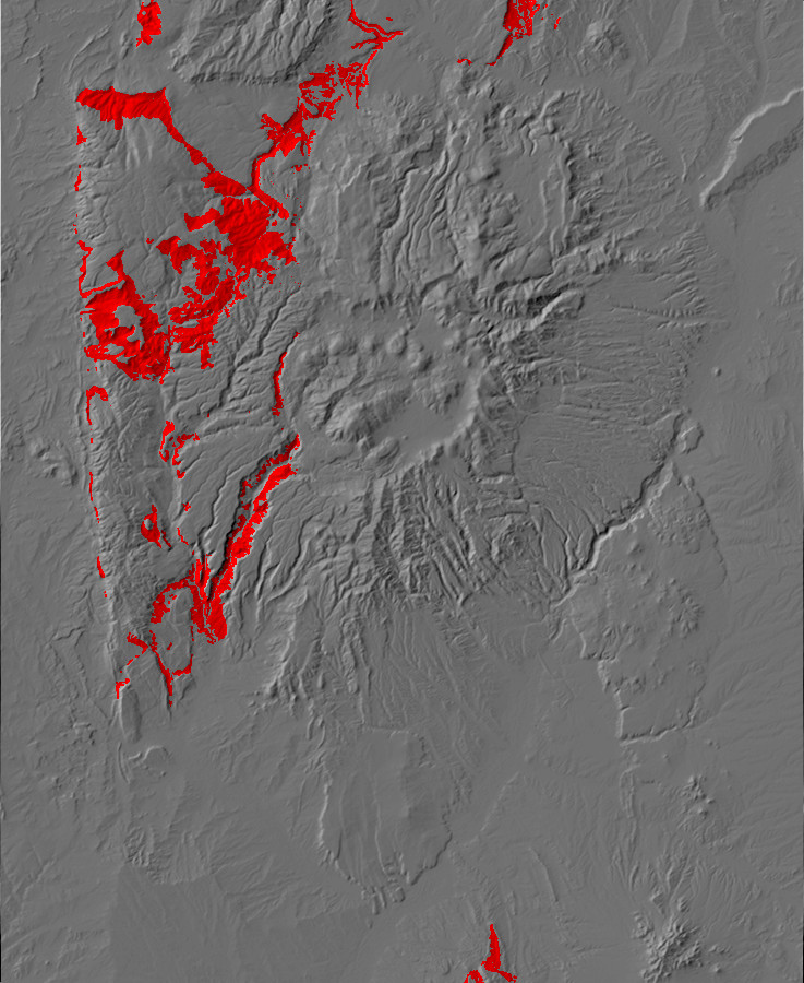
The Abo Formation marks the transition from the shallow marine
environment of the Pennsylvanian to the river delta environment of
the Permian as the world dried out. Limestone is replaced by
numerous thin beds of alternating red sandstone and mudstone.
The Abo Formation is widely exposed in lower Cañon de San Diego. In the next photograph, everything from the foreground hills to the lower slopes of the distant mesas is Abo Formation.
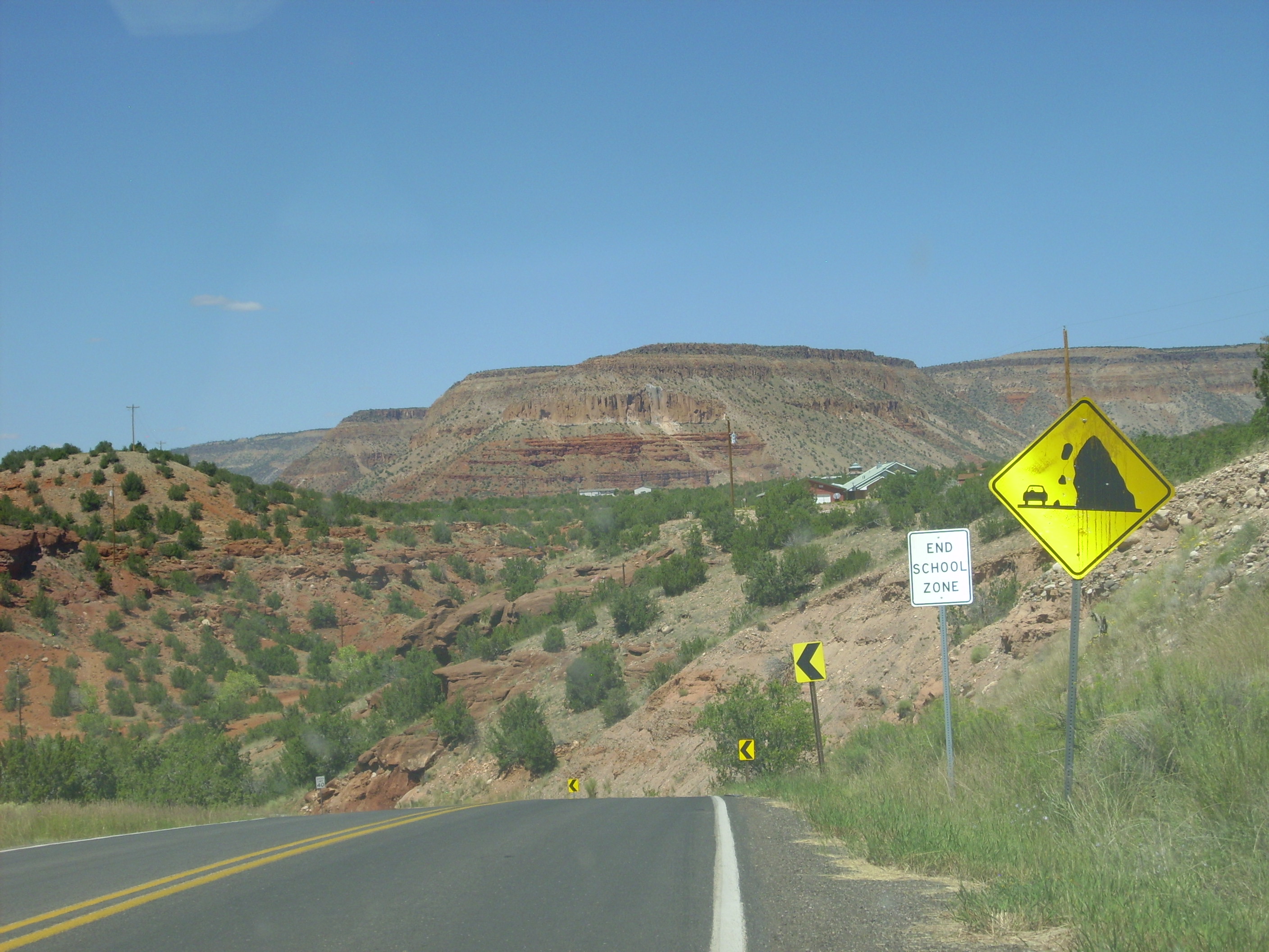
The entire lower portion of southern Mesa de Guadalupe is mapped
as Abo Formation.
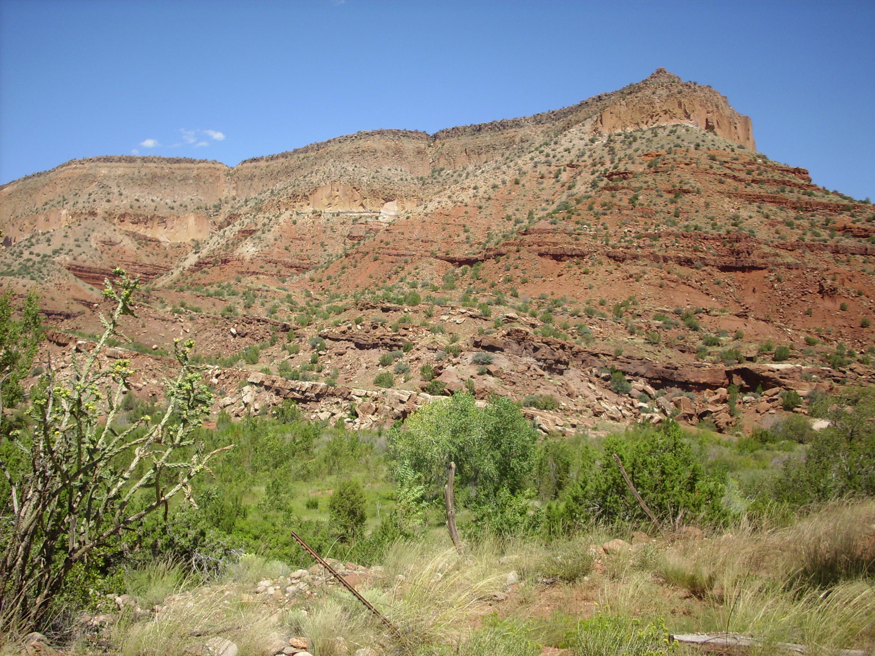
The thin sandstone layers interbedded with softer shale are
characteristic of the upper Abo Formation. Subsidence was
relatively rapid during early Abo time, when well-defined river
channels crossed an extensive muddy floodplain. This produced beds
of mudstone with distinct sandstone channels, assigned to the
Scholle Member. Later, the rate of subsidence diminished, and
periodic flooding left sandstone sheets alternating with mudstone,
which are assigned to the
Cañon de Espinoso Member. The sandstone beds have a composition
suggesting they formed from granite source rocks, and in an
environment with a monsoon climate, with alternating dry and wet
seasons.
The lowest layers exposed at Guadelupe Mesa look limy from this vantage point, suggesting the gradation into the underlying Madera Group, though none of the latter is mapped here. The Abo is capped with Tshirege Member, Bandelier Tuff, a discontinuity of at least 279 million years, showing that erosion had already exposed the Abo here 1.25 million years ago when the Tshirege Member was erupted.
Near here is the Spanish
Queen mine, which was once mined for copper. The mine has
also produced plant fossils and tetrapod bones. Many of the
fossils in the Abo Formation are casts and trace fossils, which
show that the Abo plain was forested with conifers such as Walchia
and seed ferns such as Supaia, the latter likely
concentrated around streams that were subject to seasonal
flooding. Fossils of conchostracans, or clam shrimp, have been
found near Placitas.
These are freshwater shrimp with a pair of shells like those of a
clam, and they are sometimes the only fossils that can be
identified in freshwater sedimentary beds. Further south, species
of snails characteristic of brackish water show that the
southernmost Abo was laid down in a estuarine environment on the
shore of the Permian Basin. Tetrapods include synapsids (the
earliest non-reptilian ancestors of mammals) and lungfish
characteristic of a climate prone to prolonged droughts.
You may have been struck by the fact that the younger Abo
Formation is present in lower Cañon de San Diego, but older Madera
Formation is present in upper Cañon de San Diego at a higher
elevation. The explanation is that the Jemez Fault crosses Cañon
de San Diego near Soda Dam, and the area southeast of the fault
has been thrown down hundreds of feet. This has dropped the
Permian beds below the elevation of the Carboniferous beds to the
northwest.
The Abo Formation crops out throughout the western Jemez. It is found in the western caldera rim, suggesting how far the caldera floor dropped during the Toledo and Valles events.
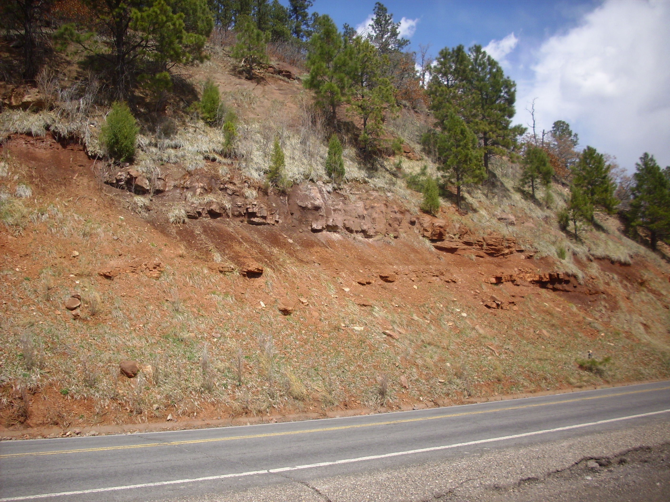
Abo Formation in the western Valles caldera rim. 35
53.212N 106 39.407W
The more resistant beds are partly thin limestone and partly a durable coarse red sandstone.
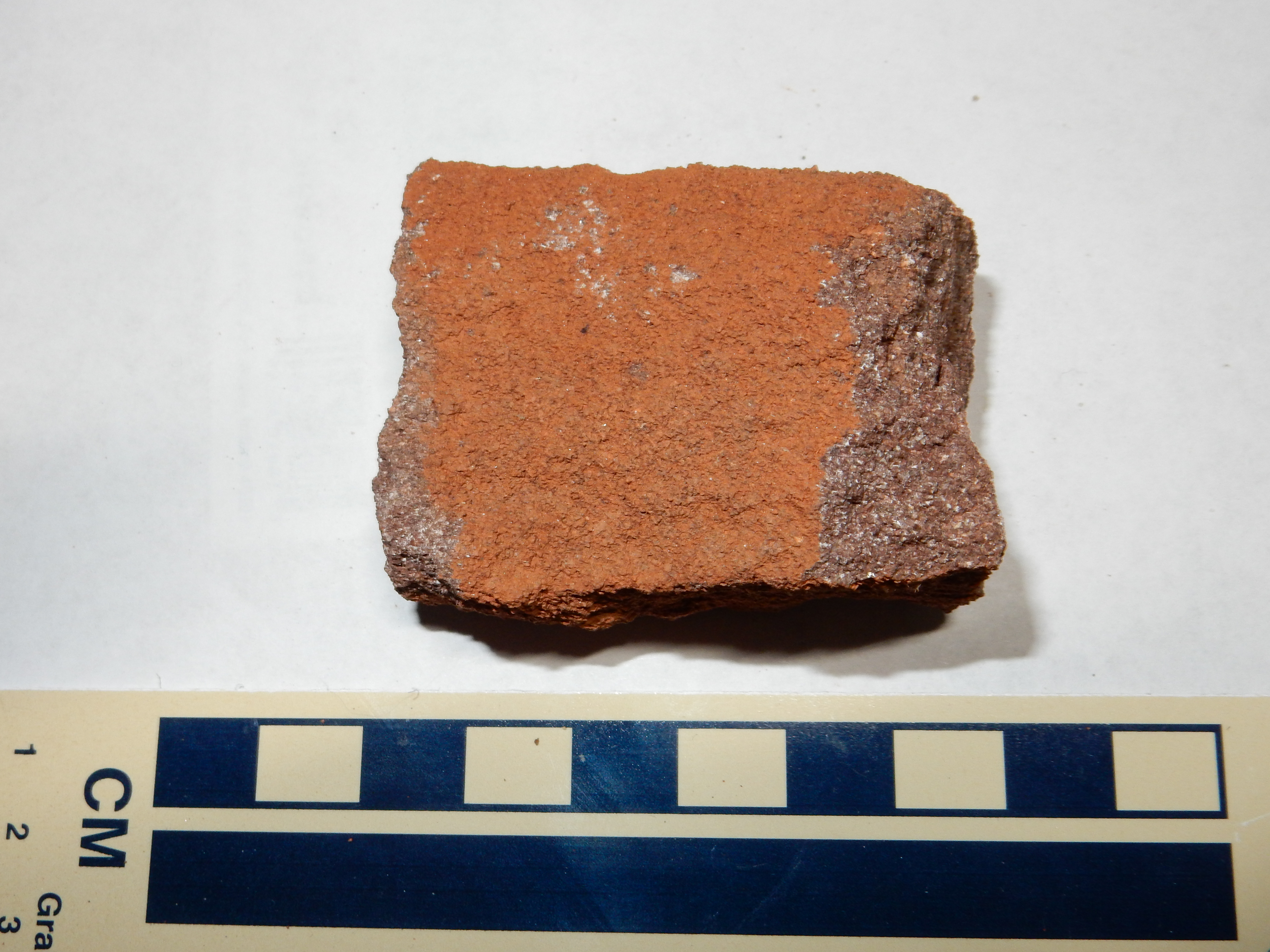
Abo Formation coarse red sandstone. 35
53.212N 106 39.407W
Under the loupe, this sandstone is found to consist of
well-sorted small quartz clasts, but with a considerable amount of
reddish hematite in the pore spaces. When acid is dripped on the
rock, it foams vigorously, showing that calcite is an important
component of the cement holding the grains together. This likely
came from the nearby limestone beds, transported by ground water.
The less resistant slopes in the photograph are a poorly cemented mudstone.
Particularly massive exposures of the Abo Formation are found
along Forest Road 376 in Cebolla Canyon.
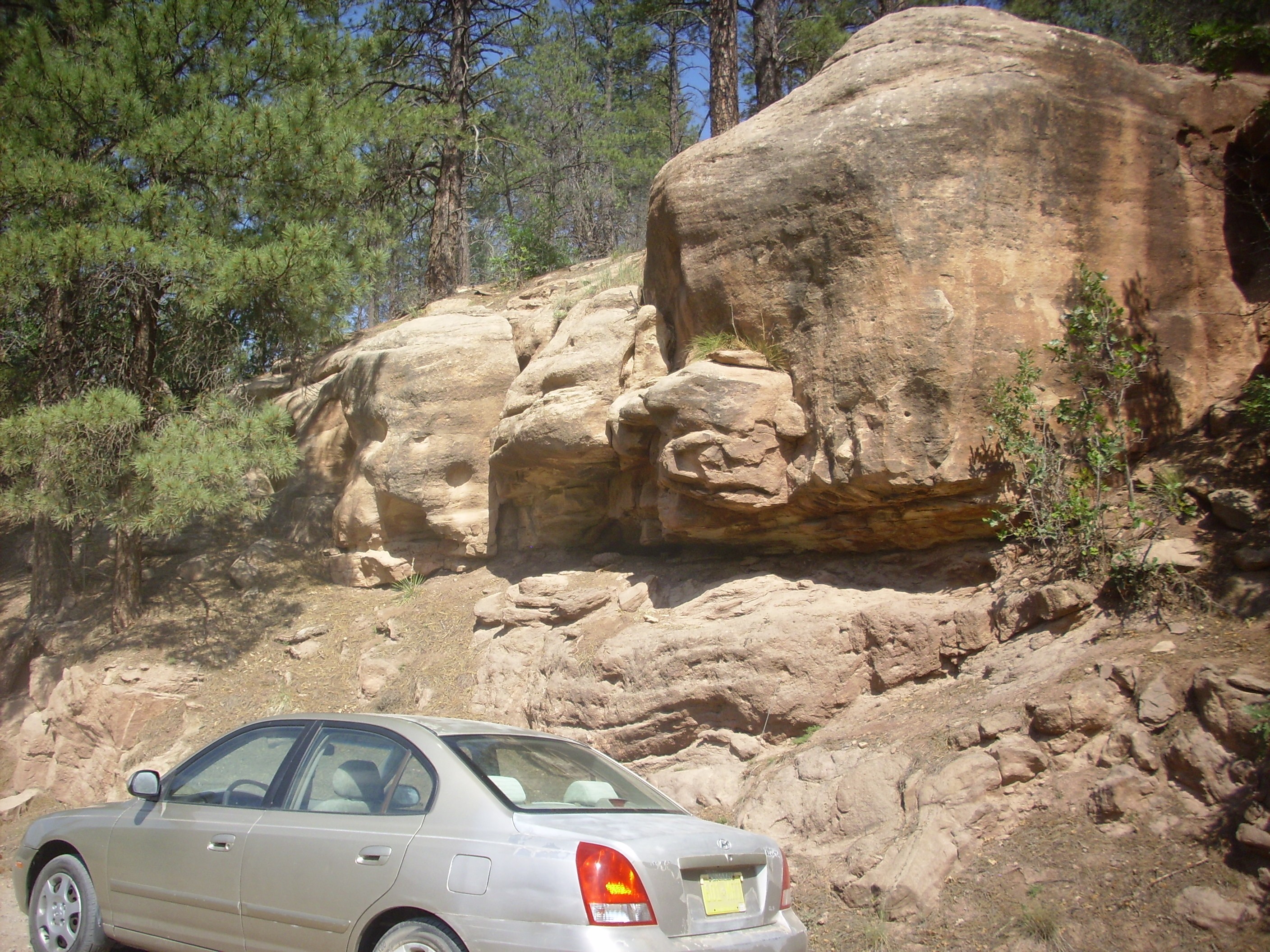
Abo Formation. 35
51.282N 106 45.843W
A close look reveals that the sandstone here is unusually coarse, grading into conglomerate.
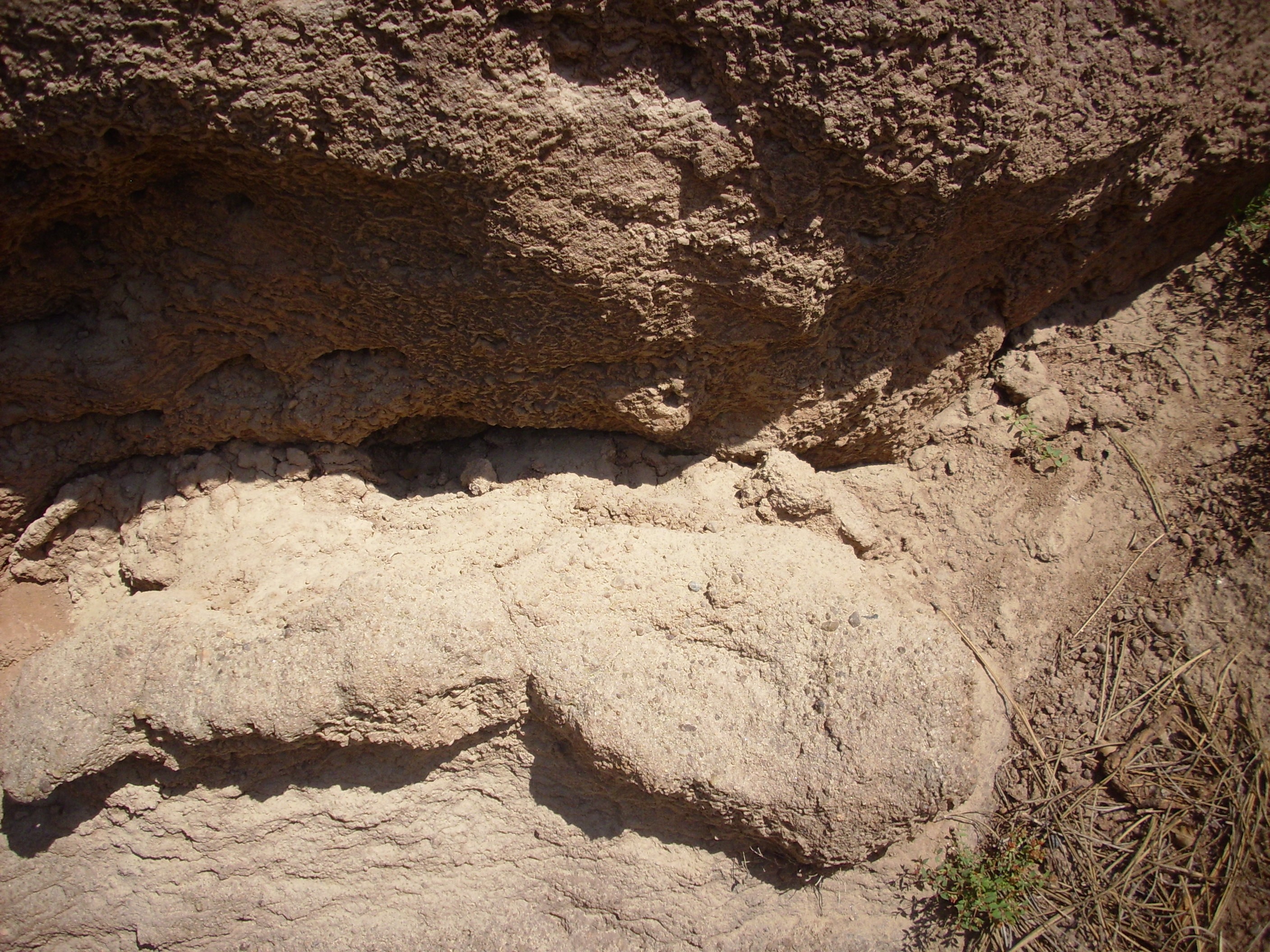
Abo Formation. 35
51.282N 106 45.843W
This suggests proximity to the source rocks early in Abo time.
The massive exposures here, dominated by sandstone, suggests major
river channels in this area.
The northernmost exposures of the Abo Formation, mapped as such,
are in upper San Antonio Canyon. The last clear exposures are not
far from San Antonio Springs.
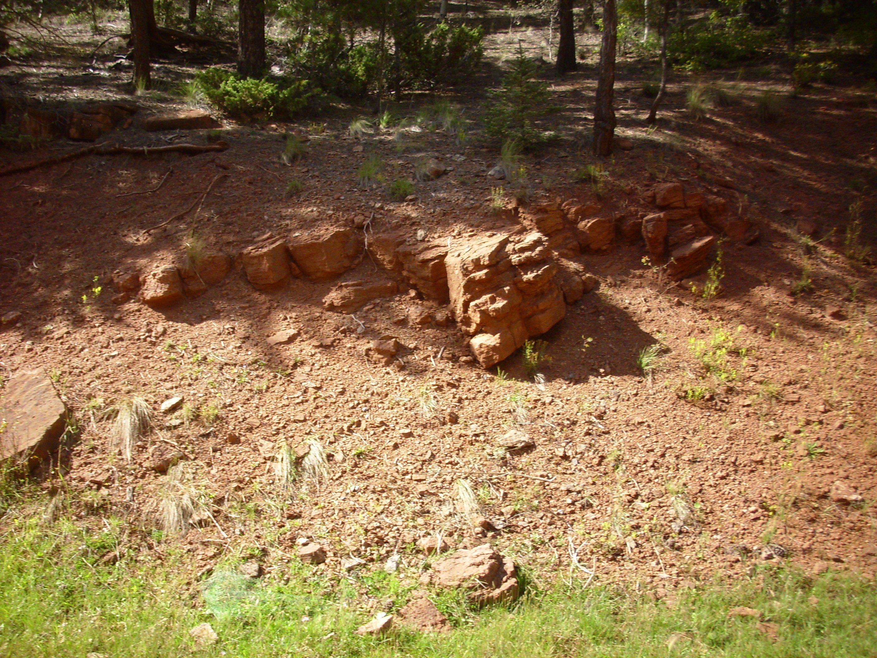
Abo Formation in upper San Antonio
Canyon. 35
56.512N 106 38.938W
Further up canyon, the exposures are very poor, but discernible because of the characteristic red color.
These are the northernmost outcrops, not so much for geologic reasons as for definitional reasons.
The Abo Formation was first identified in 1909 in Abo Canyon, in the southern Manzano Mountains. It took some time for geologists to map this extensive formation, which covers much of central New Mexico. Earlier, in 1906, a different team of geologists identified the Cutler Formation in the Silverton area. Again, it took some time for geologists to recognize that this formation extended far to the south and west. The formation is undifferentiated coarse conglomerate and sandstone close the the ancient Uncompahgre Uplift, but further from its source of sediments, the Cutler can easily be divided into separate formations, each with its own distinctive lithological character, and so it was promoted to group status in Utah. Meanwhile, both names became deeply entrenched in the geologic literature.
This became a bit of a problem when it was realized, by geologists G.H.Wood and S.A.Northrop in 1946, that the Cutler and Abo meet seamlessly at about 36 degrees north latitude in the Jemez region. They are about the same age and they're both fluvial red beds. Wood and Northrop resolved the problem by deciding to map early Permian red beds north of 36 degrees north latitude as Cutler Group and the corresponding beds south of 36 degrees north latitude as Abo Formation. And now you know why the Abo exposures in upper San Antonio Canyon are the northernmost exposures of the Abo: They are located just south of 36 degrees north latitude.
The distinction is not quite as artificial as it sounds. The
Cutler Group north of the Jemez consists of two formations with
distinctive lithology, and the lower El Cobre Canyon Formation
correlates with upper Madera Group limestone and lower Abo
Formation that have different lithologies. The Arroyo del Agua
Formation grades into the upper Abo Formation at the magical 36
north line, but the Arroyo del Agua Formation in the southern
Chama Basin is distinct from the Abo Formation in the northern
Santo Domingo Basin.
Further afield, the Esplanade Sandstone of the Grand Canyon is
identical in age with the Abo Formation and Cutler Group.
Formations of the Cutler Group in southeastern Utah include the
Halgaito Formation, Cedar Mesa Sandstone, and Organ Rock Shale,
which extend from the Four Corners region to the San
Rafael Swell.
The Arroyo Del Agua Formation is beautifully displayed in a number of locations, of which the most accessible is in a road cut west of Abiquiu along the Canones Fault Zone. The Canones Fault Zone marks the boundary between the Rio Grande Rift and the Colorado Plateau, and it is a geologist's playground. We'll come back to this area repeatedly in the pages ahead. For the moment, we will focus on the Permian formations in this area.
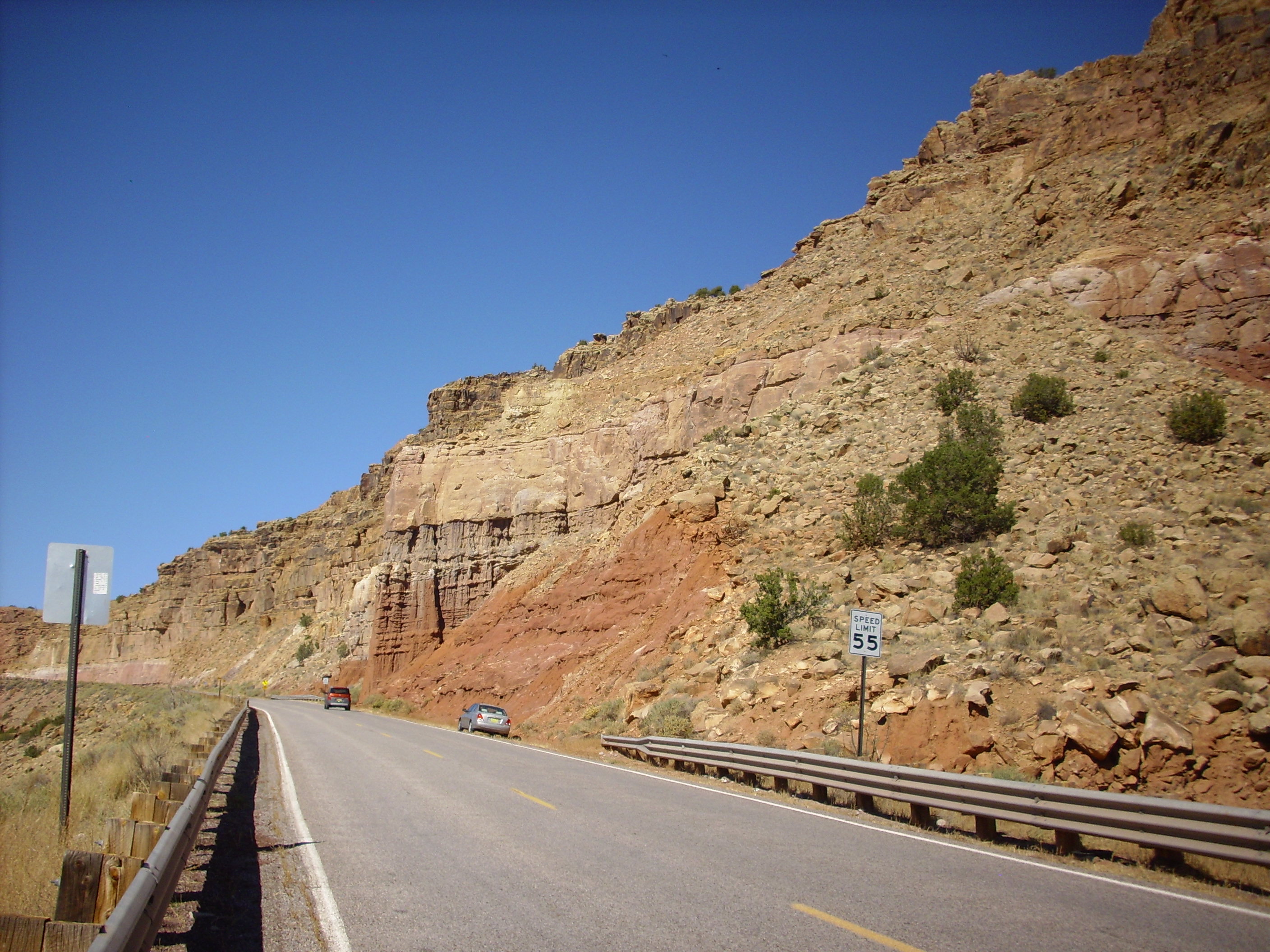
The lowermost red rocks, with the many layers and the column-like structures, belong to the Arroyo del Agua Formation. This is composed of alternating mudstone and sandstone. Sitting on top of the Arroyo del Agua Formation is the Shinarump Formation of the Triassic Chinle Group, which was laid down about 230 million years ago. Thus the contact between the two beds, where the beds are at the same angle and the contact is not necessarily obvious, is a good example of a discomformity. There is a gap of over 50 million years between the two beds.
Most of the Arroyo del Agua Formation is soft mudstone, deep red in color due to its hematite content, but with occasional thin beds of sandstone. Here's a close up shot.
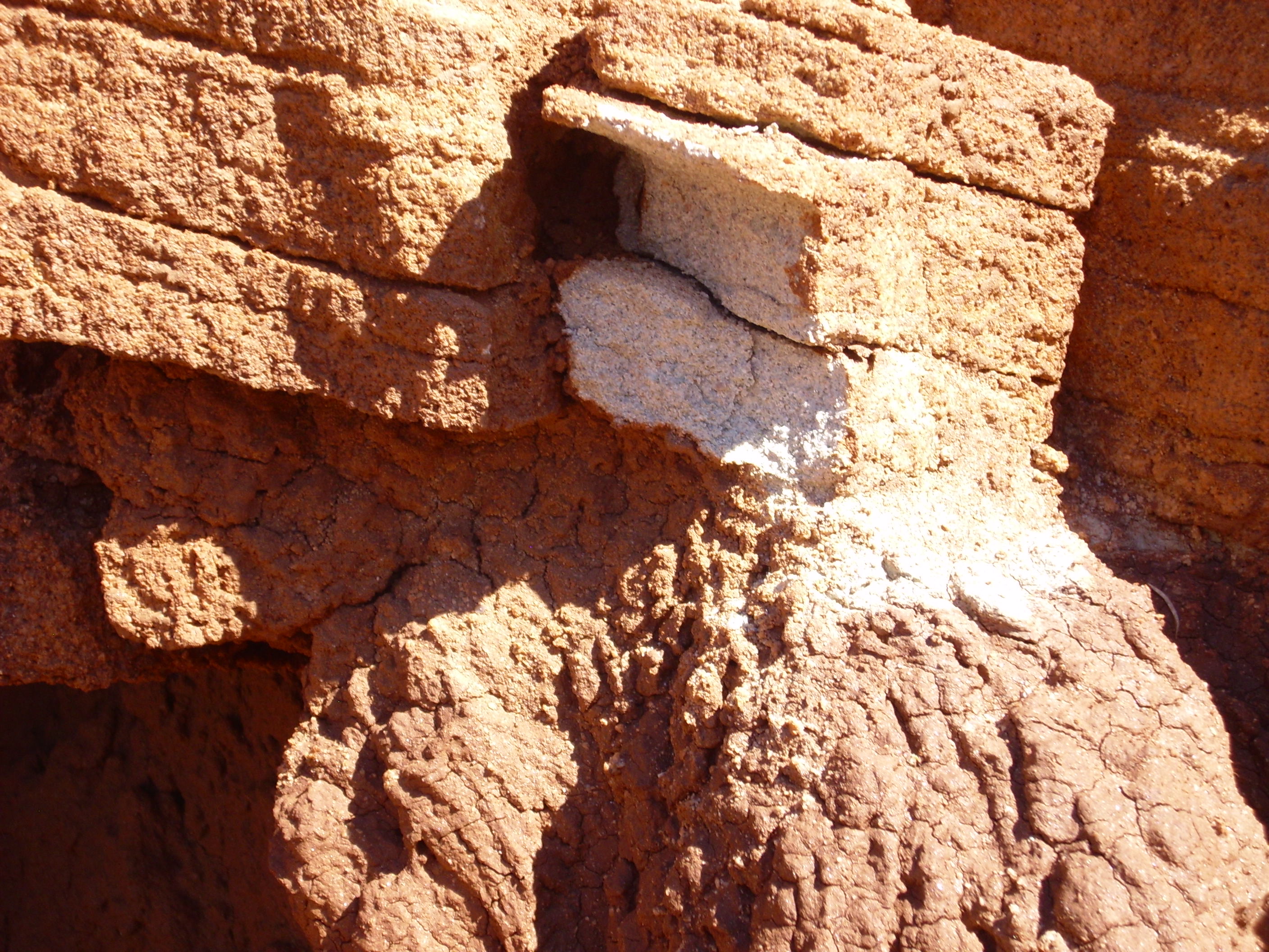
Notice the white color of the fresh fracture surface (where I hammered off a sample). The old surface is coated with a thin layer of red mud from higher up in the formation. However, some of the sandstone beds do contain red minerals. Here are close ups of some samples.
This is a sample of the relatively soft mudstone making up most of the formation. There is a fair amount of sand mixed in with silt and clay.
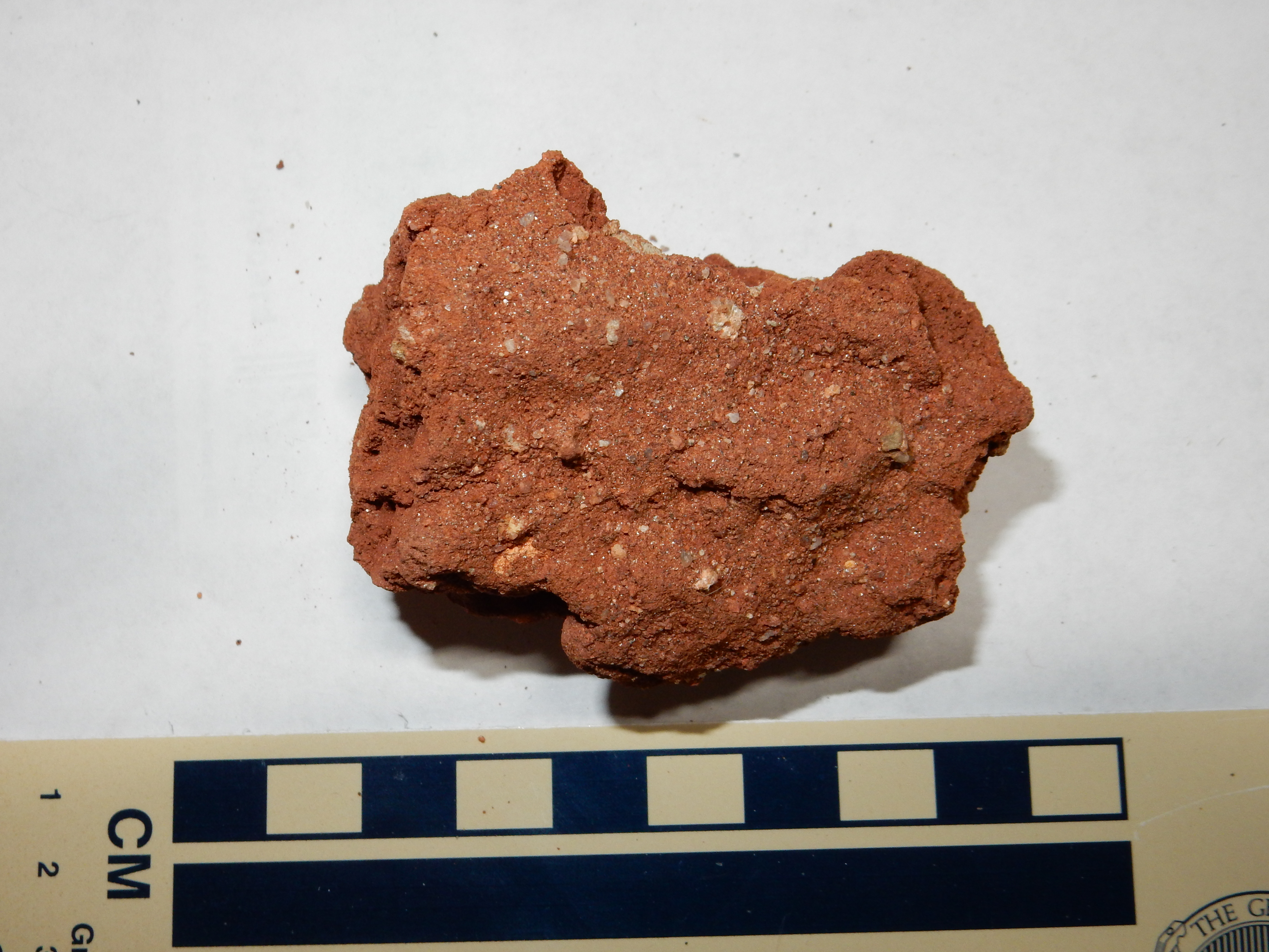
The next sample is from the thin beds of sandstone between the layers of mudstone.
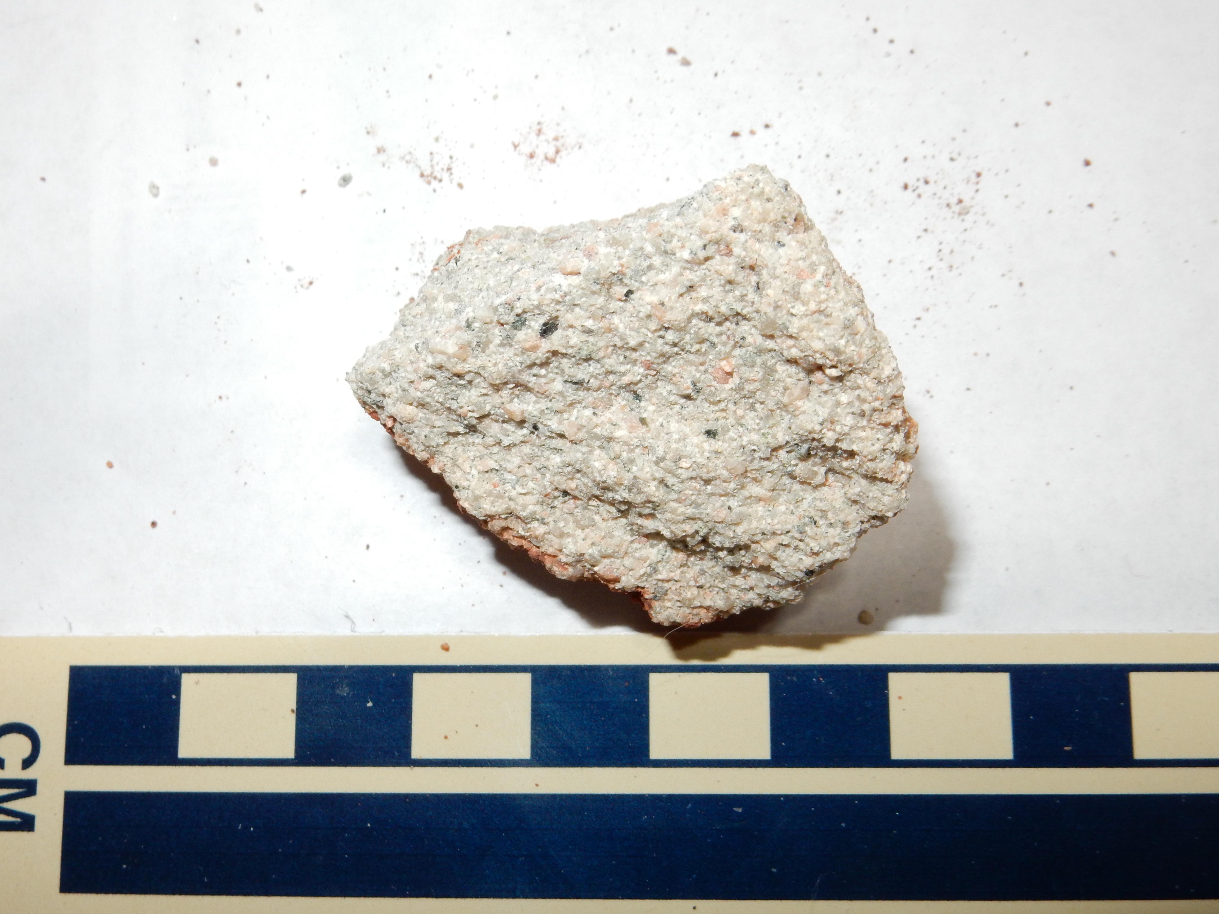
This is harder stone that stands out of the softer mudstone. In this sample, the sandstone is relatively clean of oxidized iron. Generally speaking, the Cutler Group represents sediments eroded from the Uncompahgre Uplift and deposited by rivers approaching the Permian Basin south of what is now the Jemez area. The sandstone layers were probably deposited within the river channel itself, where the sand was washed clean of finer sediments. The preponderance of mudstone in the Arroyo del Agua Formation suggests that the climate had started to dry out at about this time.
Some of the Arroyo del Agua mudstone becomes quite well cemented towards the top of the formation. Here is the contact with the Shinarump close up:
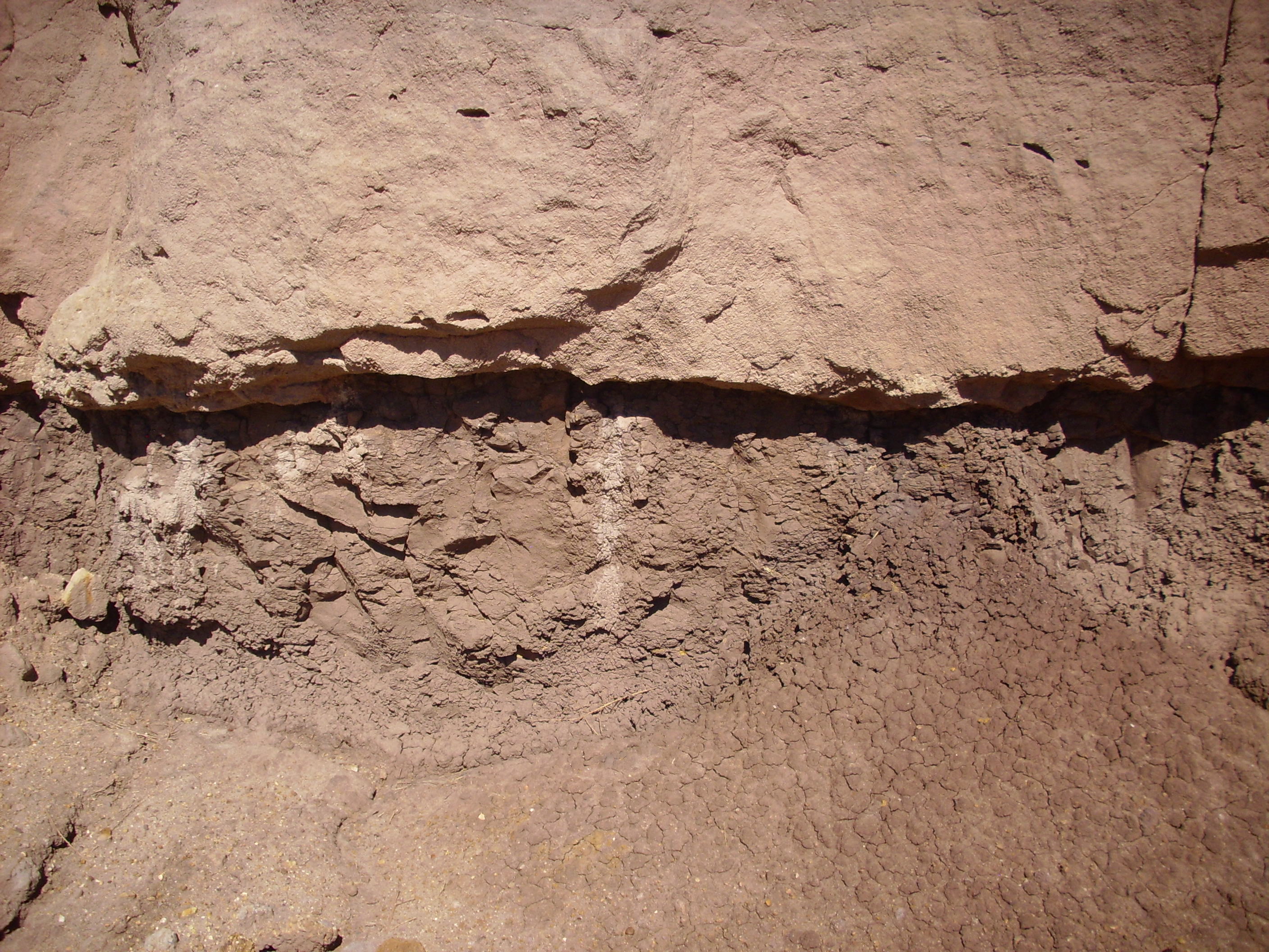
And here's a sample of the very hard mudstone just under the
discomformity.
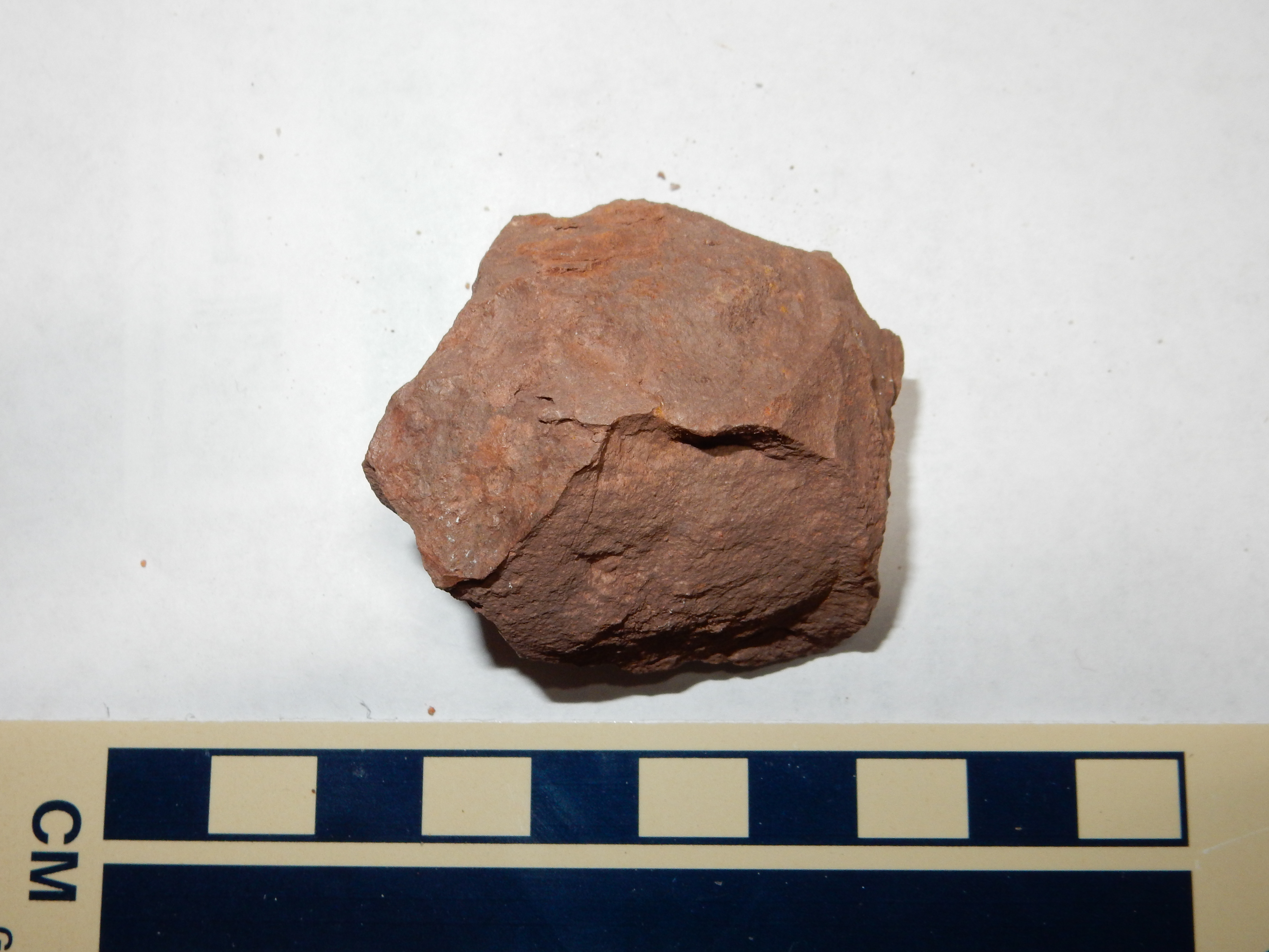
Besides being strongly indurated, this stone has a
peculiar, almost waxy, feel to it.
Though not as convenient to the highway, the exposures of the Arroyo del Agua Formation on the south face of Mesa Montosa west of Coyote are spectacular.
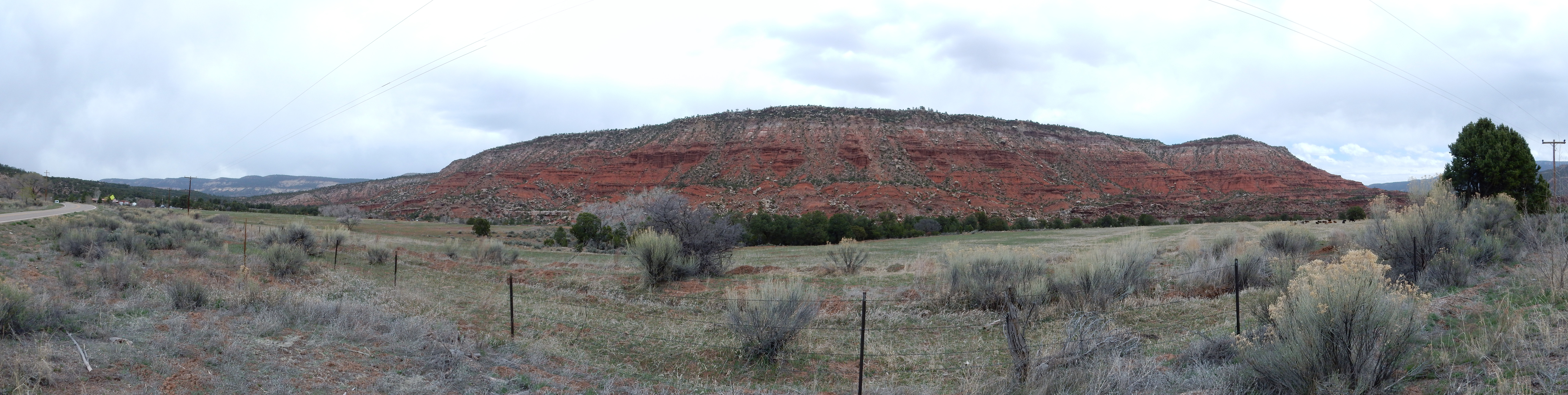
Mesa Montosa. Looking north from 36
10.147N 106 39.906W
There are thin beds of Shinarump and Salitral Formation towards the top of the mesa, then the resistant cap of Poleo Formation; the last three formations are all part of the Triassic Chinle Group.
Inasmuch as I've shown you some of the northernmost exposures of the Abo Formation, it seems appropriate to show one of the southernmost exposures of the Cutler Group.
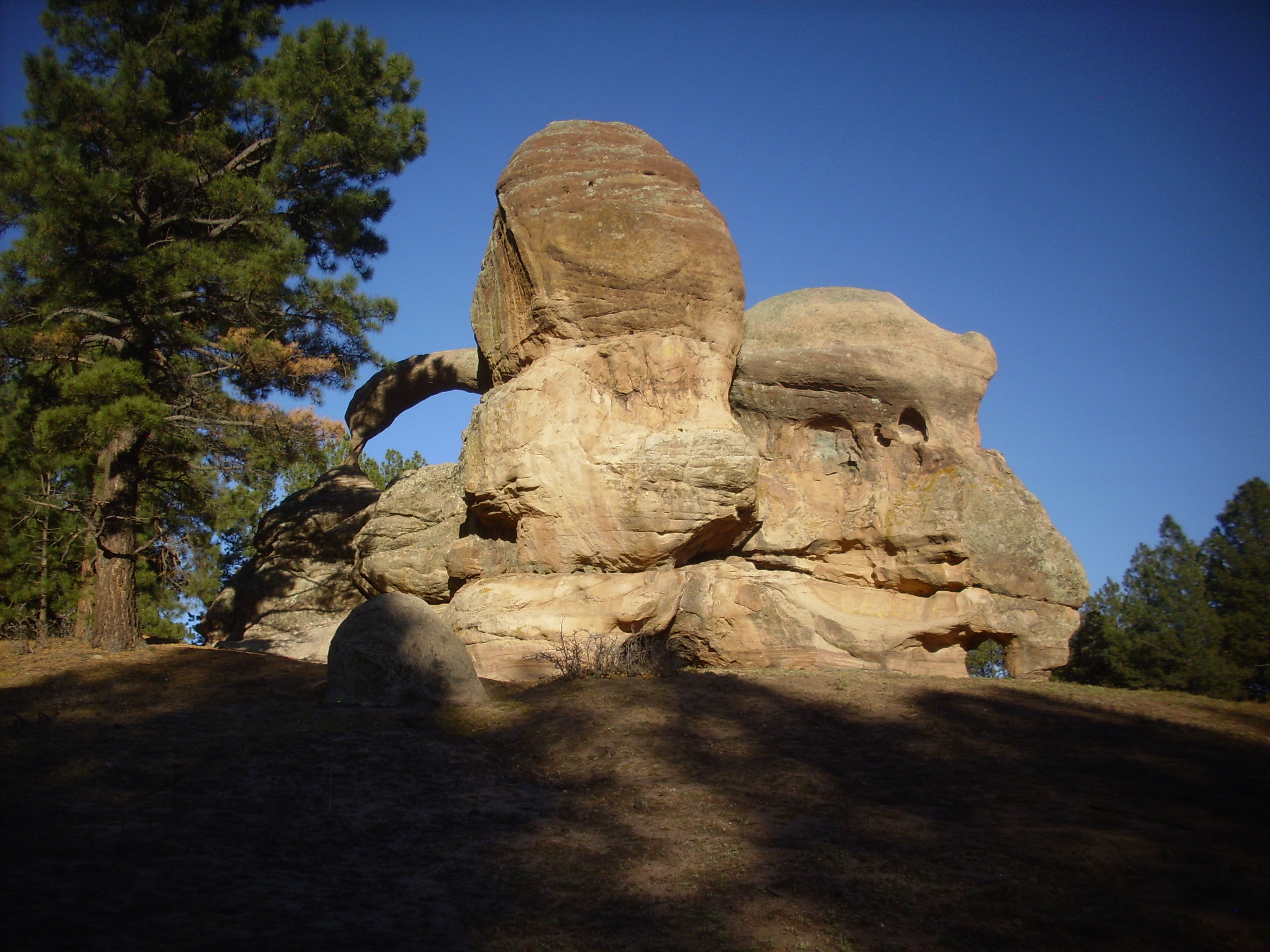
This is Teakettle Rock, found near the settlement of Jarosa. It
is the largest and most dramatic of a number of erosional remnants
of Cutler Formation resting on the upper Madera Formation in the
Jarosa area. The thick stacks of sandstone making up these
remnants more closely resemble El Cobre Canyon Formation than
Arroyo del Agua Formation.
The paleotopographic map of the Abo and Cutler beds is identical with the exposure map. Everywhere where there are exposures of the next youngest formation, the De Chelly Sandstone, we find that it is either resting on Abo or Cutler beds or the lower contact is buried where we can't see it. Does this mean that there was no high ground in the Jemez area 300 million years ago? Not necessarily, because the record is always incomplete; but it appears that there was not much high ground in the area. The Jemez of the early Permian was apparently mostly rather flat river plains.
This implies that the Penasco uplift, the block of crust thrown up as part of the Ancestral Rocky Mountains, was finally buried during Cutler time. Of course, subsequent erosion has stripped much of this cover, and we cannot be certain burial was complete. But the remaining ridges of Cutler Formation atop the San Pedro plateau strongly suggest this.
The road to San Gregorio Reservoir runs roughly along the contact
between Precambrian monzonite and Cutler Formation for much of its
length.

Here the forground bed of Precambrian monzonite still has a couple of Cutler Formation boulders atop it, while the boulders across the road are all Cutler Formation. The ridge to the west (at left in the photo, hidden by trees) is Cutler Group and suggests a minimum depth for the Cutler beds atop the monzonite prior to erosion. A similar picture is seen at San Gregorio Reservoir itself.

There is a fault running roughly along the foot of the ridge across the lake, crossing the ridge just right of the saddle to the left and running out the small valley to the right. The ridge on the far side of the fault is monzonite. You can see the bright red Cutler sediments in the cuts across the lake, on this side of the fault. The Cutler Formation continues to the southwest (left) and underlies Nacimiento Peak, where at least 240 m (800') of Cutler sediments are exposed.
The Cutler beds are coarser here than in most locations, showing
that the sediments were derived locally.
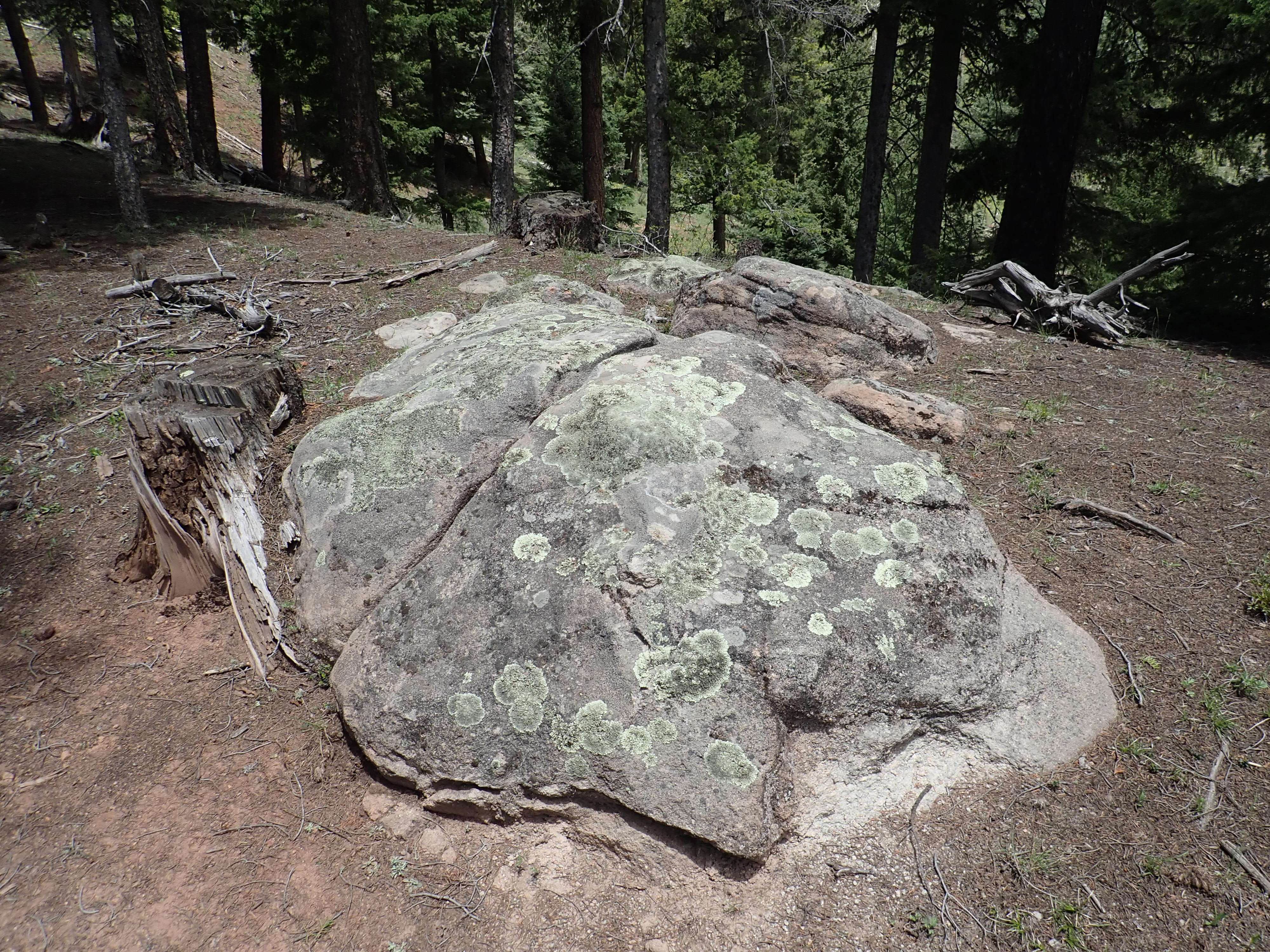

The sample is coarse, poorly sorted, rich in clay, and contains considerable feldspar. In fact, it took me a few moments to convince myself the outcrop was not badly weathered granite. Its identity is clear under the loupe.
This arkose likely is lithified grus. Grus is coarse,
feldspar-rich sediments formed by disintegration of granitic rock.
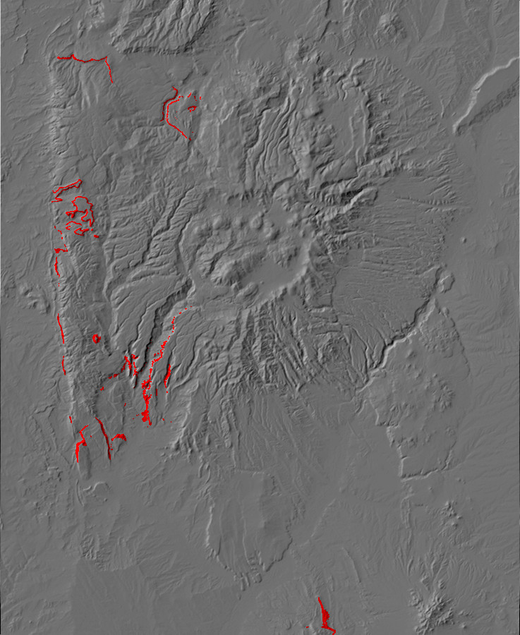
Not all the red rock in lower Cañon de San Diego is Abo Formation. About 280 million years ago, the continuing global drying trend dried up the rivers that deposited the Abo Formation, the Permian Basin sea receded further south, and a field of sand dunes marched across the Jemez. This created the Yeso Group, which looks much like the Abo Formation from a distance. Some of the best exposures of this group are at the Red Rocks rest area just north of Jemez Pueblo.
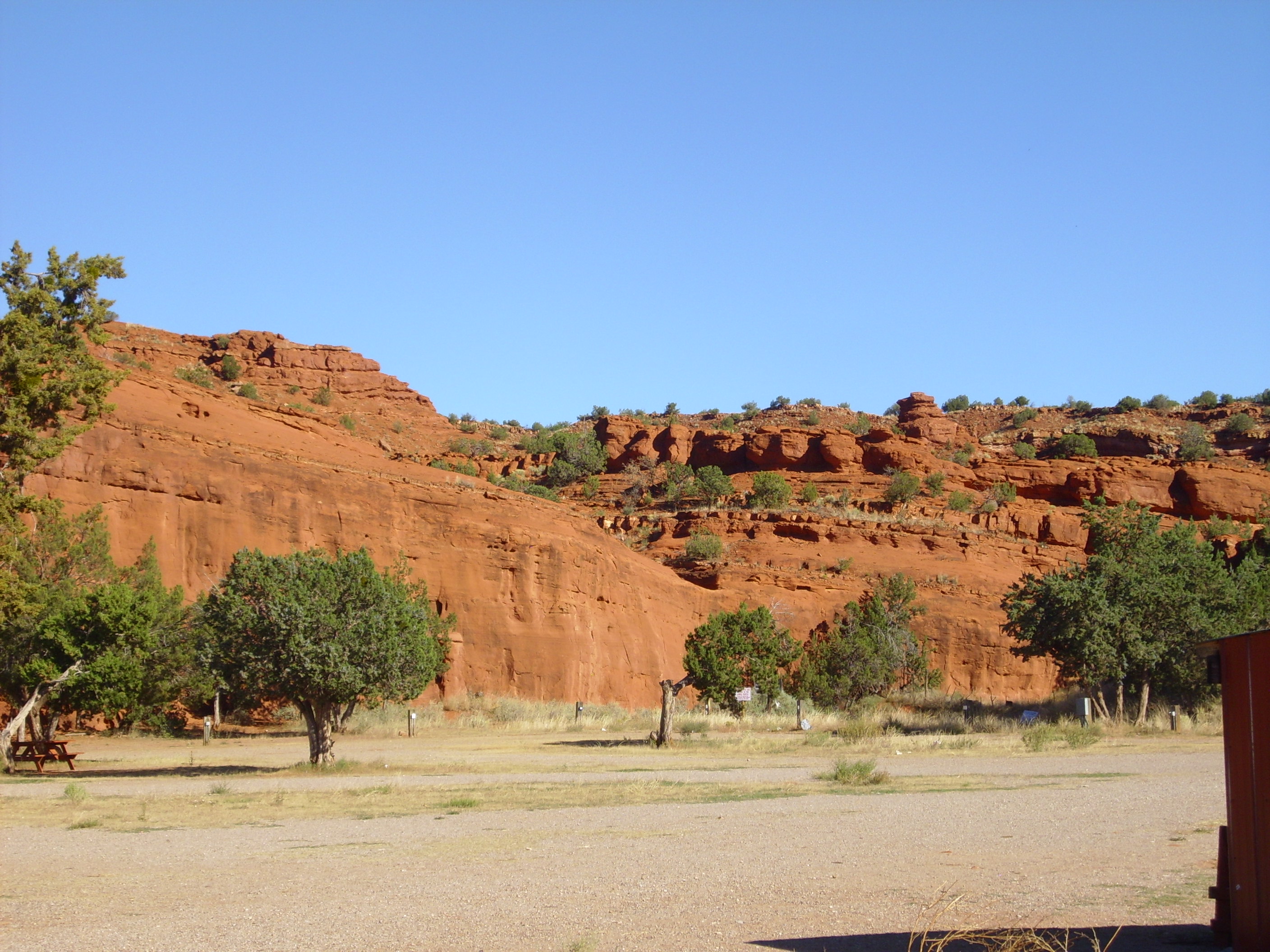
The Yeso Group in the Jemez region is distinguished from the Abo
Formation by being a less dark red, tending toward orange, and in
forming thick beds of sandstone characteristic of eolian
(windswept dune) deposits. This is in contrast with the thinner
fluvial beds, interbedded with mudstone, of the Abo. More
precisely, the Yeso begins with the first non-arkosic,
fine-grained sandstone bed above Abo mudstone or arkosic
sandstone.
The Yeso Group is divided into two formations, with the more massive De Chelly Sandstone at the bottom and the thinner bedded San Ysidro Formation on top. My geological map does not make the distinction, but it looks like the two formations can be distinguished just north of Red Rocks.
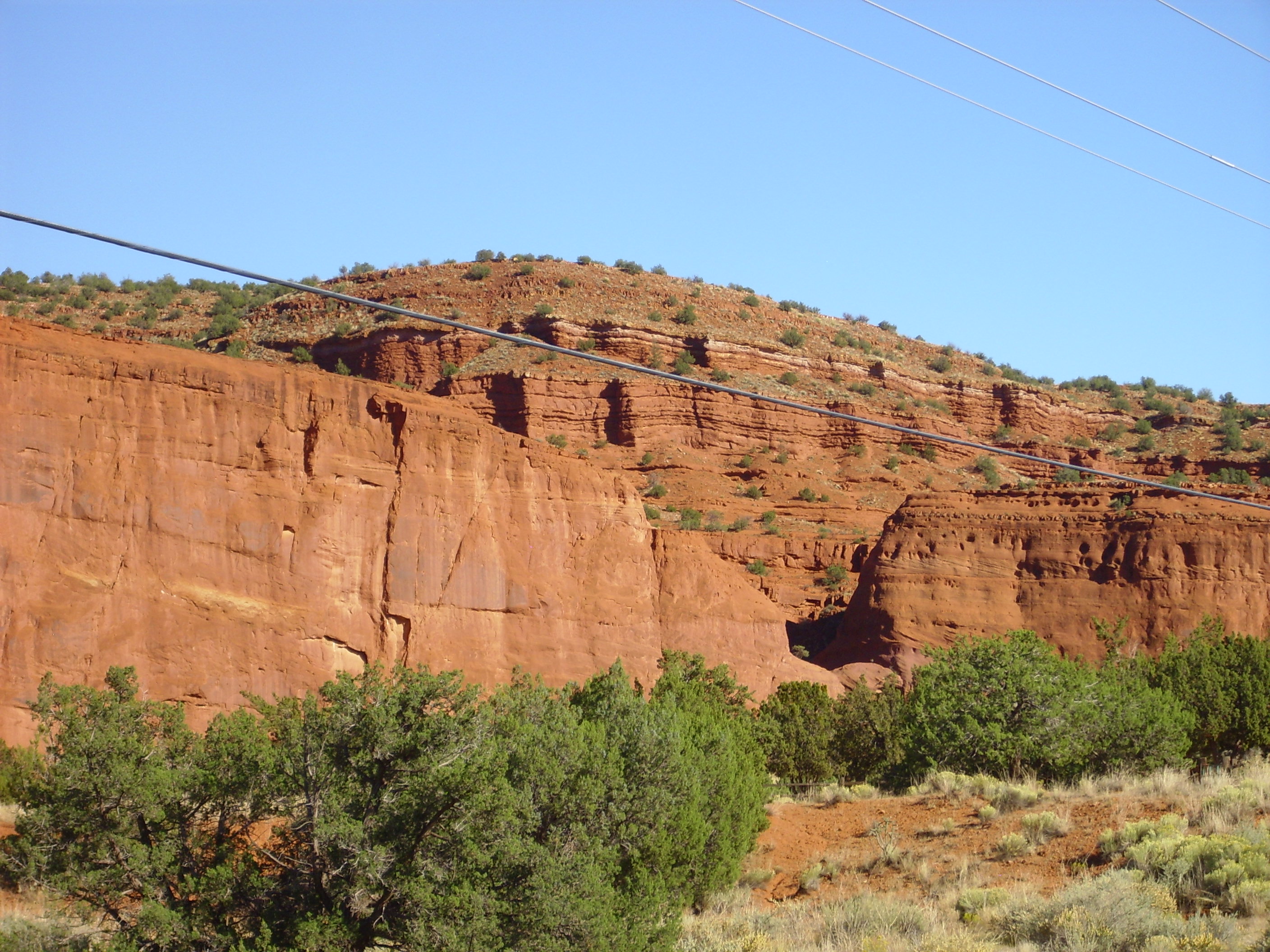
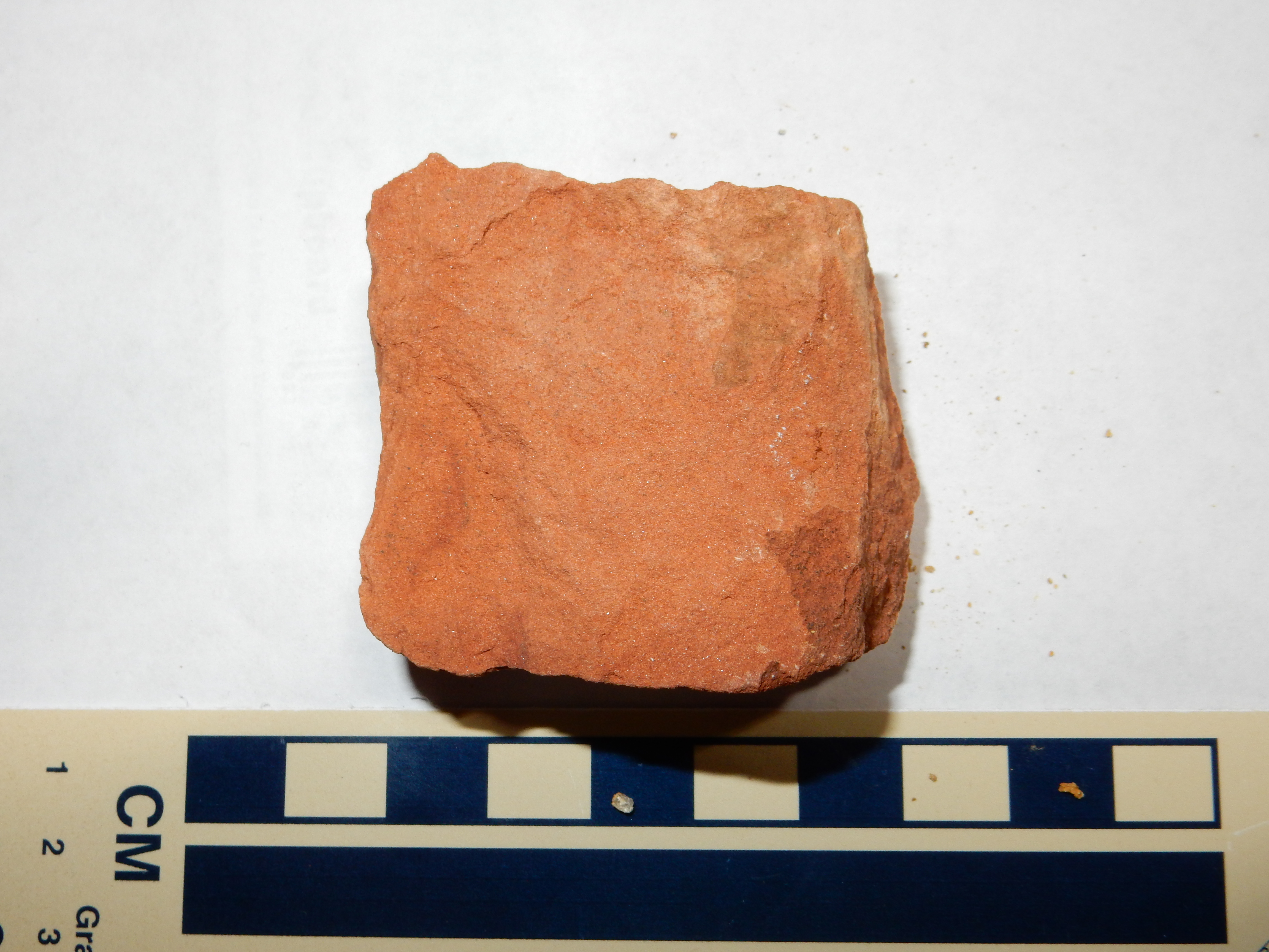
San Ysidro Formation. Near 35
40.126N 106 43.062W
Under the loupe, this is seen to be a well-sorted fine sandstone of rounded quartz grains, though with occasional lithic grains, with abundant hematite cement. This sample was taken further north, from Forest Service land near Meseta Blanca.
The sand grains of the De Chelly Formation have a characteristic
pitting and are described as "frosted grains." This is an
indication that the grains were transported by wind at some point,
during which the grains collided with each other with enough force
to cause the pitting. Grains transported by water are cushioned
enough by the water that they do not collide violently enough to
become frosted.
Angle and quality of lighting can make a considerable difference in how a rock formation appears in a photograph. I took the following photograph under lighting conditions that were perfect to show cross-bedding in the De Chelly Sandstone.
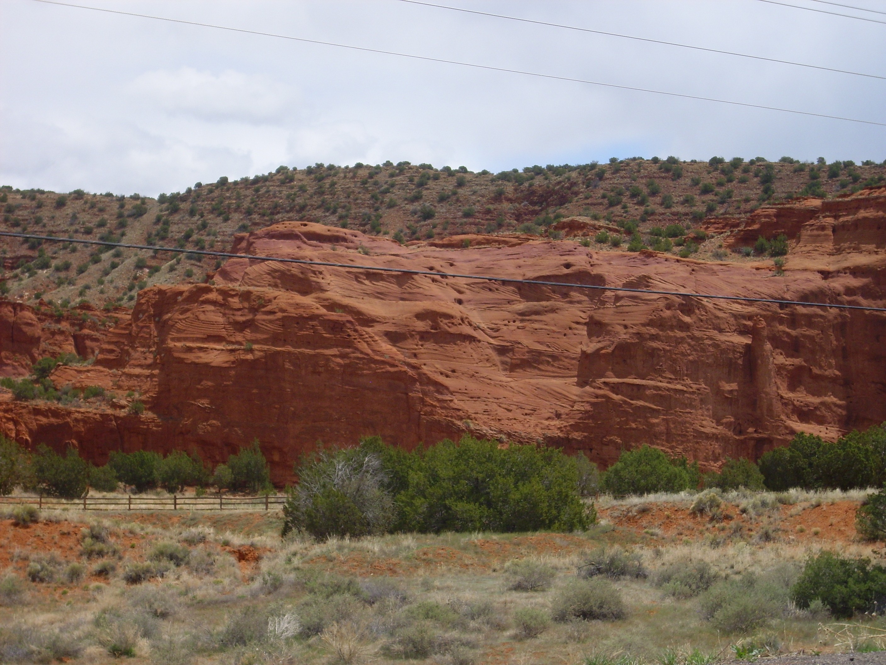
Cross bedding in the De Chelly
Sandstone. Click to enlarge.
Cross-bedding is where larger beds are composed of much smaller beds (cross beds) at an angle to the main beds. You can see several examples in this photograph. Cross beds are usually interpreted as showing that the beds were deposited by a moving fluid, such as a fast-flowing stream or the wind. Since the De Chelly Sandstone is interpreted as an eolian sandstone, deposited by wind, the beds were laid down on the downwind side of dunes. This suggests the prevailing wind was from the north or northeast, which is consistent with other geological evidence that the Jemez area was located in the trade winds belt, just north of the equator, when these beds were laid down in the Permian.
The De Chelly Sandstone was originally mapped in Arizona.
The De Chelly dune sea reached from central Arizona through the
Four Corners region to the Jemez area.
The San Ysidro Formation marks a return to somewhat wetter
conditions, as the shore of the Permian Basin advanced north. This
transformed the Jemez into a coastal environment, which included sabkhas,
coastal salt flats. The uppermost part of the San Ysidro Formation
includes some thin limestone beds likely formed just offshore.
As with the Abo Formation, the paleotopographic map for the Yeso Group shows no instances where the next younger formation, the Glorietta Sandstone, is underlain by anything but Yeso Group. However, the Yeso Group pinches out in the northern Jemez. In other words, the Yeso Formation is thickest in the Socorro area, well to the south of the Jemez, is thinner in Cañon de San Diego, and thins to a knife edge before disappearing just south of the Coyote area. Above the Yeso are significantly younger Triassic beds. This suggests that the edge of the Yeso dune field ran through the northern Jemez.
Further south, the Yeso Formation includes increasing amounts of
gypsum and carbonate suggestive of a coastal or shallow marine
environment.
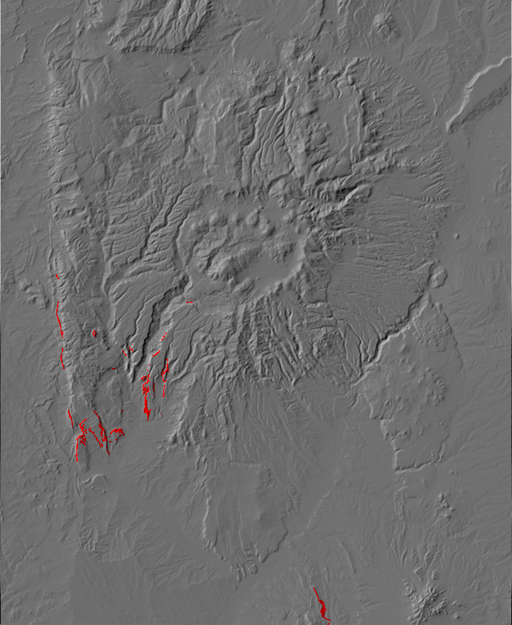
The geological report for the Jemez Springs area mentions a
prominent limestone bed near the top of the San Ysidro Formation.
This is visible in one of the photographs in the previous section.
Above this limestone bed, the sandstone transitions to a thin
sequence of more massive, whiter beds. This is the Glorieta
Sandstone, which was deposited beginning about 275 million years
ago. The Glorieta Sandstone marks the return of the shallow sea to
this area, since it has the characteristics of sandstone laid down
in a shallow marine environment, with lagoons and barrier islands.
Drainage seems to have been from the northeast, marking the
beginnings of a general shift in river direction in New Mexico
from out of the north to from the east. Further east, at its type
section in Glorieta Pass, the Glorietta Formation has
characteristics of wind-deposited coastal dunes.
Looking northwest from this location, we see what is apparently the furthest southwest remaining outcrop of Bandelier Tuff.

The mesa on which this Bandelier Tuff ridge sits is called Meseta Blanca, probably because of the whiter color of the Glorietta Sandstone capping the mesa compared with the red formations underneath. There is a thin bed of Triassic Chinle Group under the Bandelier Tuff, mostly buried under talus; we'll have more to say about the Chinle Group later on. You can see the transition to redder Yeso Group sandstones with that characteristic white limestone bed halfway down the side of the mesa.
The transition from the San Ysidro Formation to the Glorieta Formation is gradual, but this is a fair guess where it should be put.
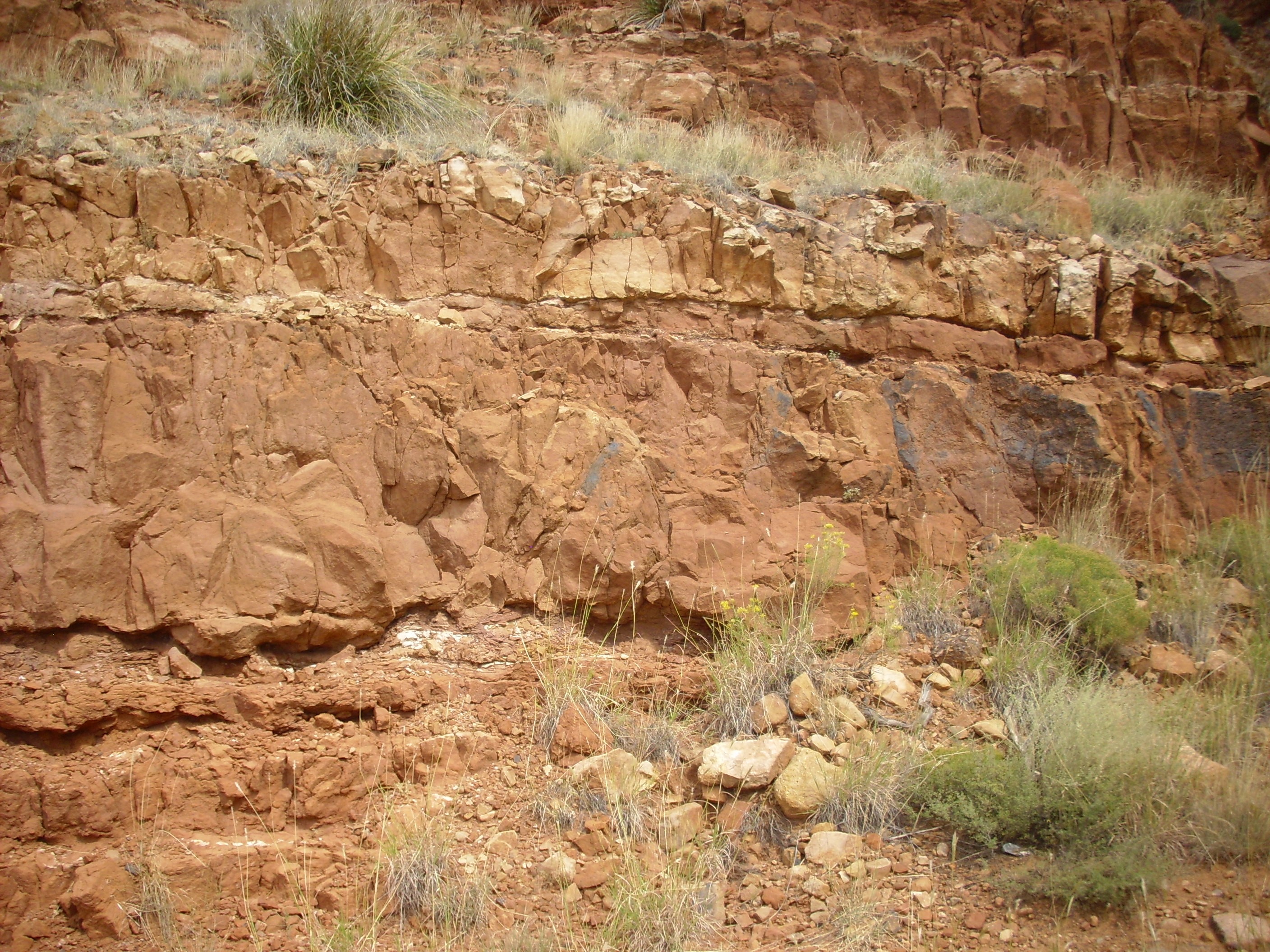
Approximate transition from San Ysidro Formation to
Glorieta Formation. 35
40.016N 106 42.862W
Further up, there is no ambiguity about the formation assignment.
Glorieta Formation. 35
40.049N 106 42.829W
Under the loupe, this is found to be a moderately well sorted medium sandstone of somewhat angular quartz grains with ample pore space that appears to be cemented with silica.
The Glorietta Sandstone is prominent in the Glorietta Pass
southeast of Santa Fe, from which the formation takes its name. It
is correlated with the Coconino Sandstone of northern Arizona, the
Coconino being laid down in a dune sea covering most of northern
Arizona and the Glorietta being its shallow marine equivalent.
Another fine exposure of most of the Permian column is found at
Mesa de las Casas. While not easily reached for close inspection,
it has the merit of being easily viewed from State Road 4.
Mesa de las Casas. Looking southeast from 35
42.091N 106 43.873W
The foreground ridge is underlain by the Abo Formation. The sides of the mesa, working upwards, are De Chelly Sandstone, Yeso Group (the thick, lighter beds at the base); San Ysidro Formation, Yeso Group (the thinner red beds above); Glorieta Sandstone (the lighter beds near the mesa top); Triassic Moenkopi Formation (at the very top of the mesa and under the knoll); and the knoll itself, underlain byTriassic Shinarump Formation, which we'll learn about in the next chapter.
The same sequence is exposed on Mesa Chuchilla.
Panorama of southern Sierra Nacimineto. Looking
southwest to northwest from 35
35.454N 106 44.428W
Mesa Chuchilla is just left of center, and is capped by Tertiary Shinarump Conglomerate and Moenkopi Formation overlying Permian beds. At left, the beds plunge below the surface, and younger Jurassic beds cap White Mesa. At right, in the middle distance, is Hard Rock Ridge, capped with more Shinarump Formation, and on the skyline is Pajarito Peak, underlain by Precambrian metamorphic rocks.
Mesa Chuchilla is the east side of a downwarped plateau capped
with Shinarump Formation; the west side of the plateau is Red
Mesa, which also exposes this sequence of formations.
By the end of the Permian, which is the final period of the
Paleozoic, the supercontinent of Pangaea was nearly fully
assembled. As a result, the Mesozoic would be a period of relative
tectonic quiescence in the Jemez area. Gondwanaland had drifted
off the South Pole and warmer conditions returned, ending the Late
Paleozoic Ice Age.
The uppermost Permian and lowermost Triassic beds are missing
from the geological record in the Jemez. This must have been a
period when the oceans had receded far enough from northern New
Mexico to permit significant erosion. As a result, there is no
direct record in the Jemez of one of the greatest catastrophes in
the history of the Earth.
Next page: The age of the dinosaurs
in the Jemez.
Copyright ©2014-2015 Kent G. Budge. All rights reserved.