
The table of contents may be found here.
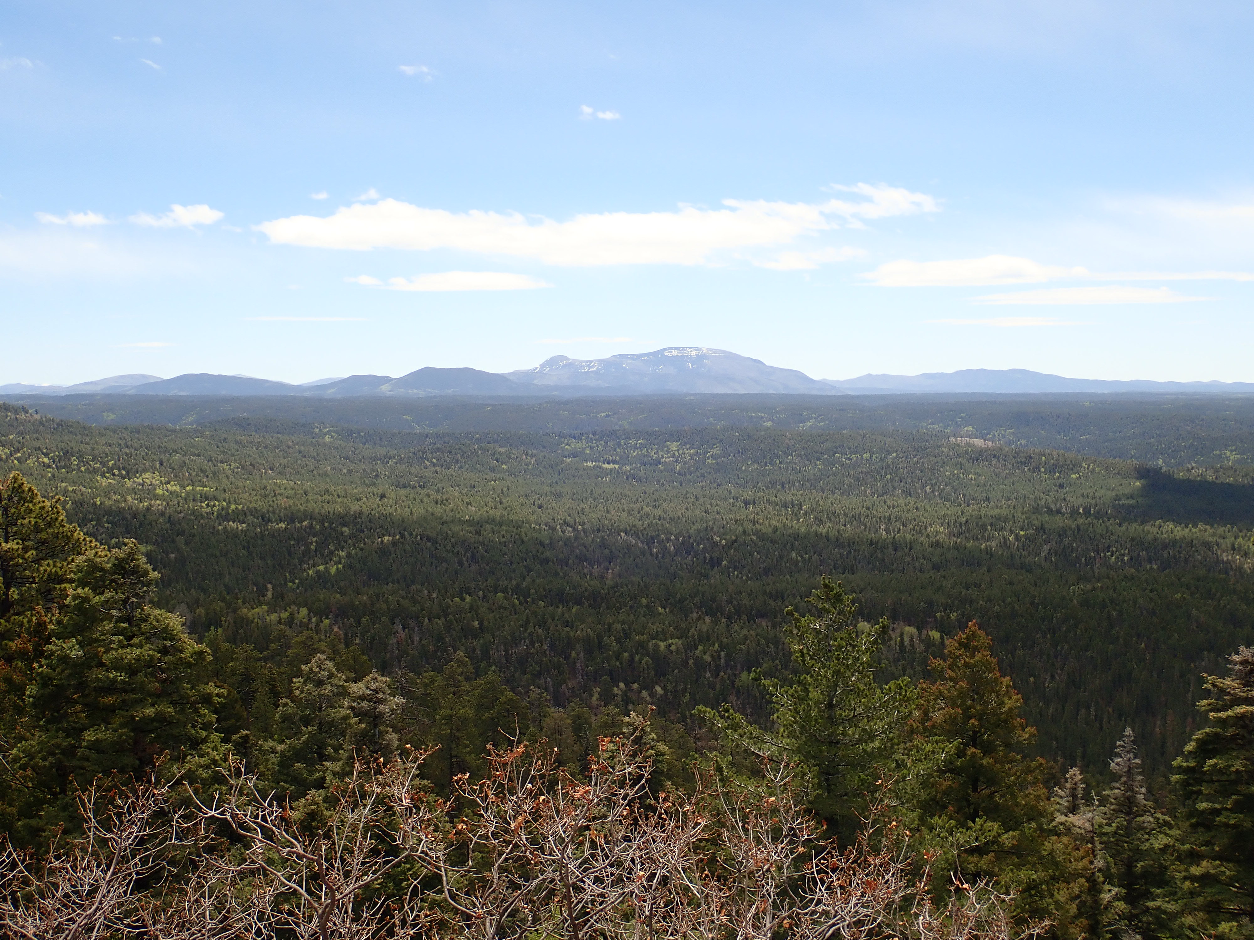
Redondo Peak. Looking northwest from 35
47.946N 106 31.625W
1.25 million years ago, and a few thousand years after the Valles
event, the Valles caldera formed a deep depression in the central
Jemez. The jagged caldera rim had eroded rapidly, producing broad
alluvial fans whose lower slopes were submerged beneath a deep
crater lake. Hydrothermal vents in the lake bottom locally
polluted its otherwise pristine waters, but life had returned to
the caldera and to the broad outflow sheets of Tsherige Member
tuff that had covered the lower terrain around the caldera in all
directions.
The hydrothermal activity showed that the Valles event did not
spell the end of volcanic activity in the Jemez. On the contrary,
large volumes of fresh magma were injected into the emptied magma
chamber almost at once, and soon fed a series of eruptions that
have continued almost to the present day.
In this chapter, we will look at the volcanic activity in the
Jemez volcanic field that occurred shortly after the Valles
event.
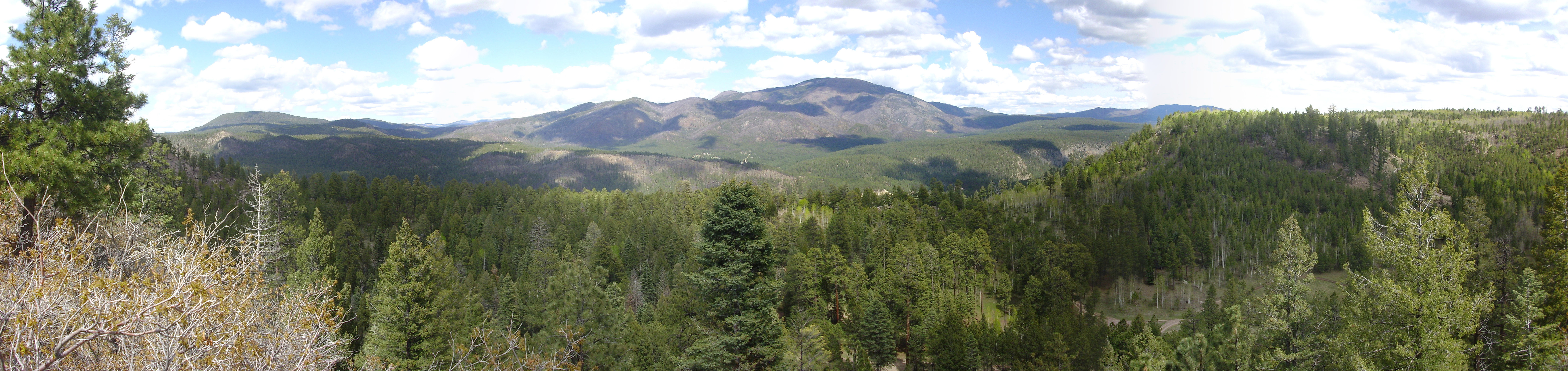
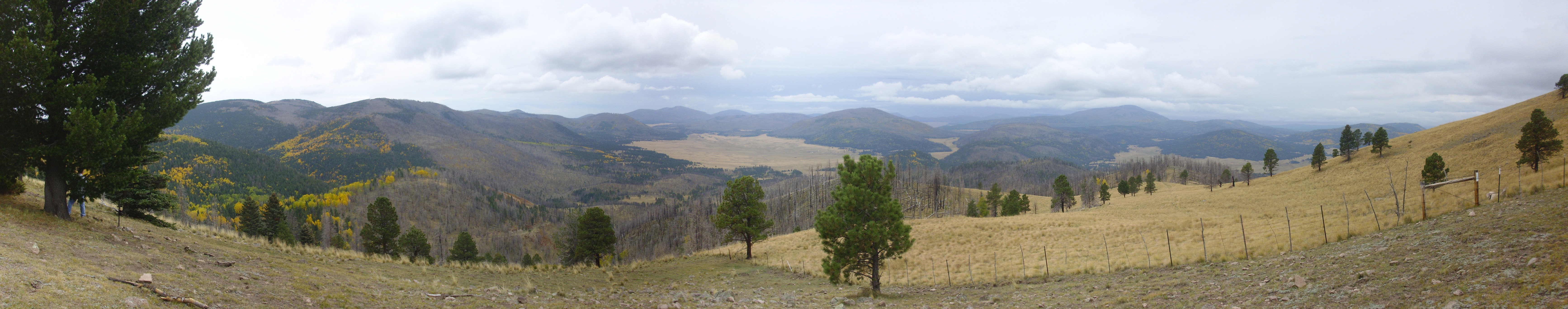
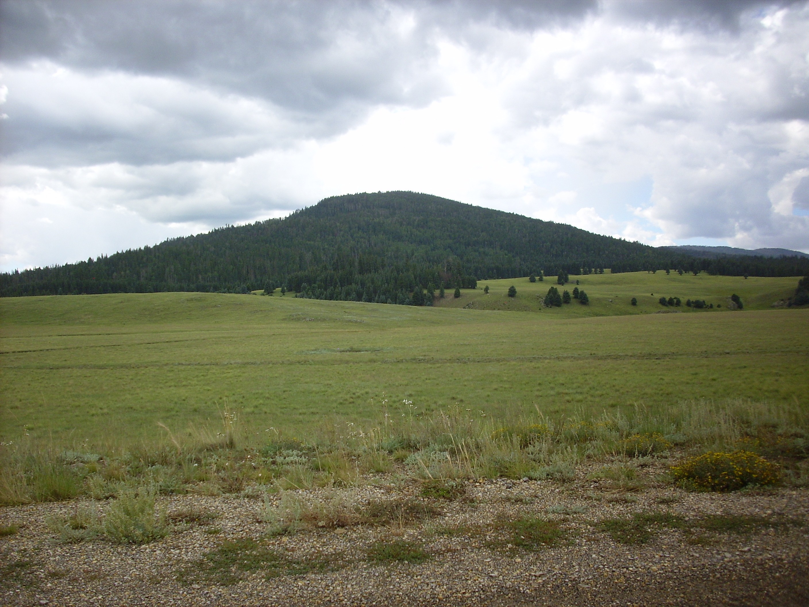
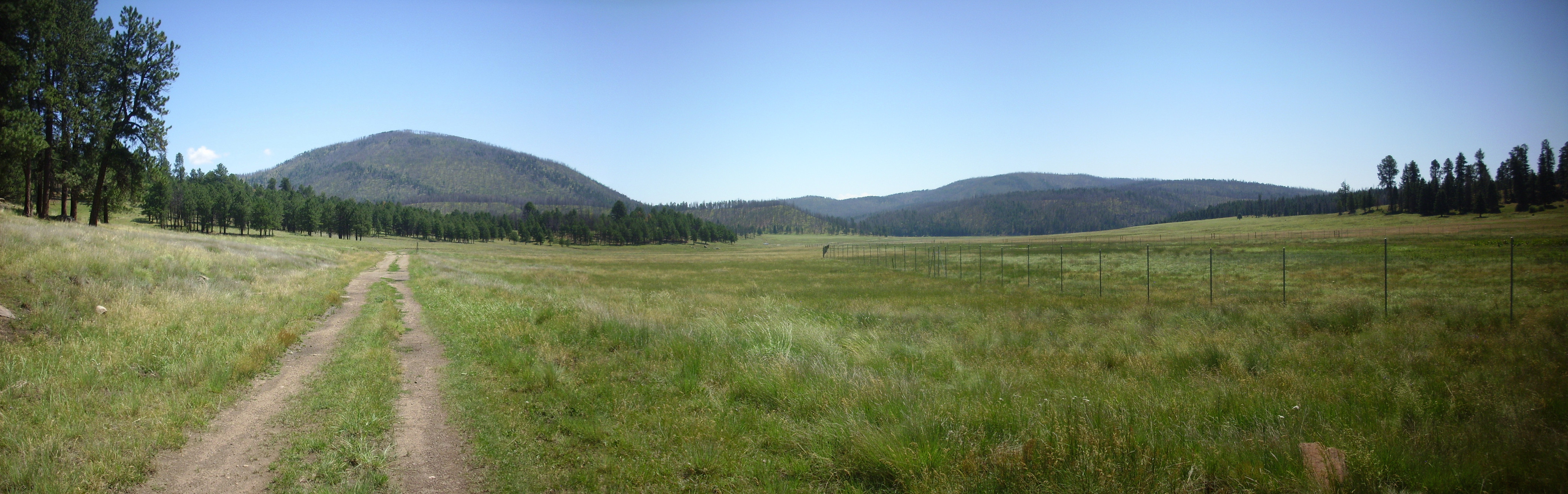
In the last chapter, we saw this panorama of the Valle Grande.

Valle Grande. 35
51.096N 106 27.305W
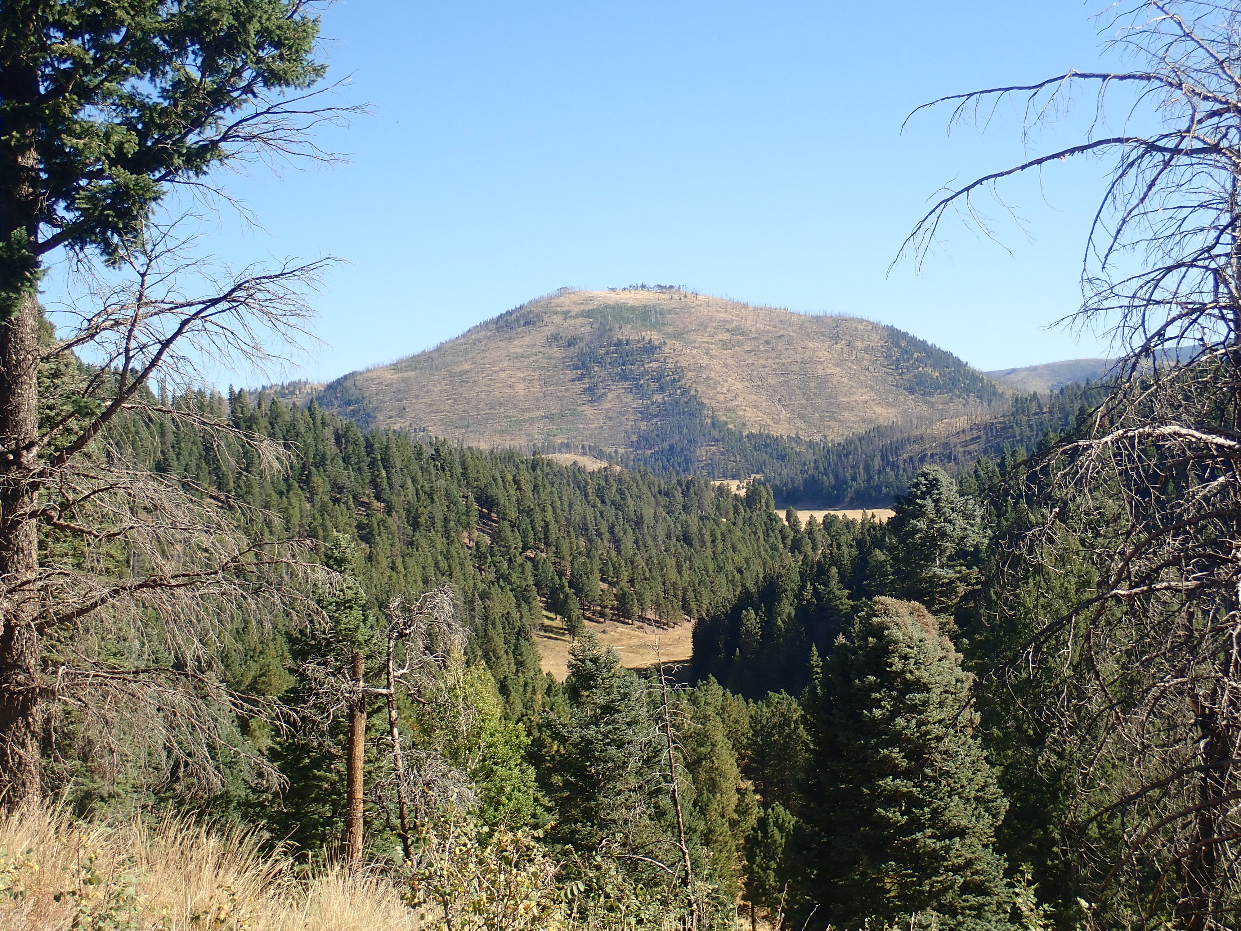
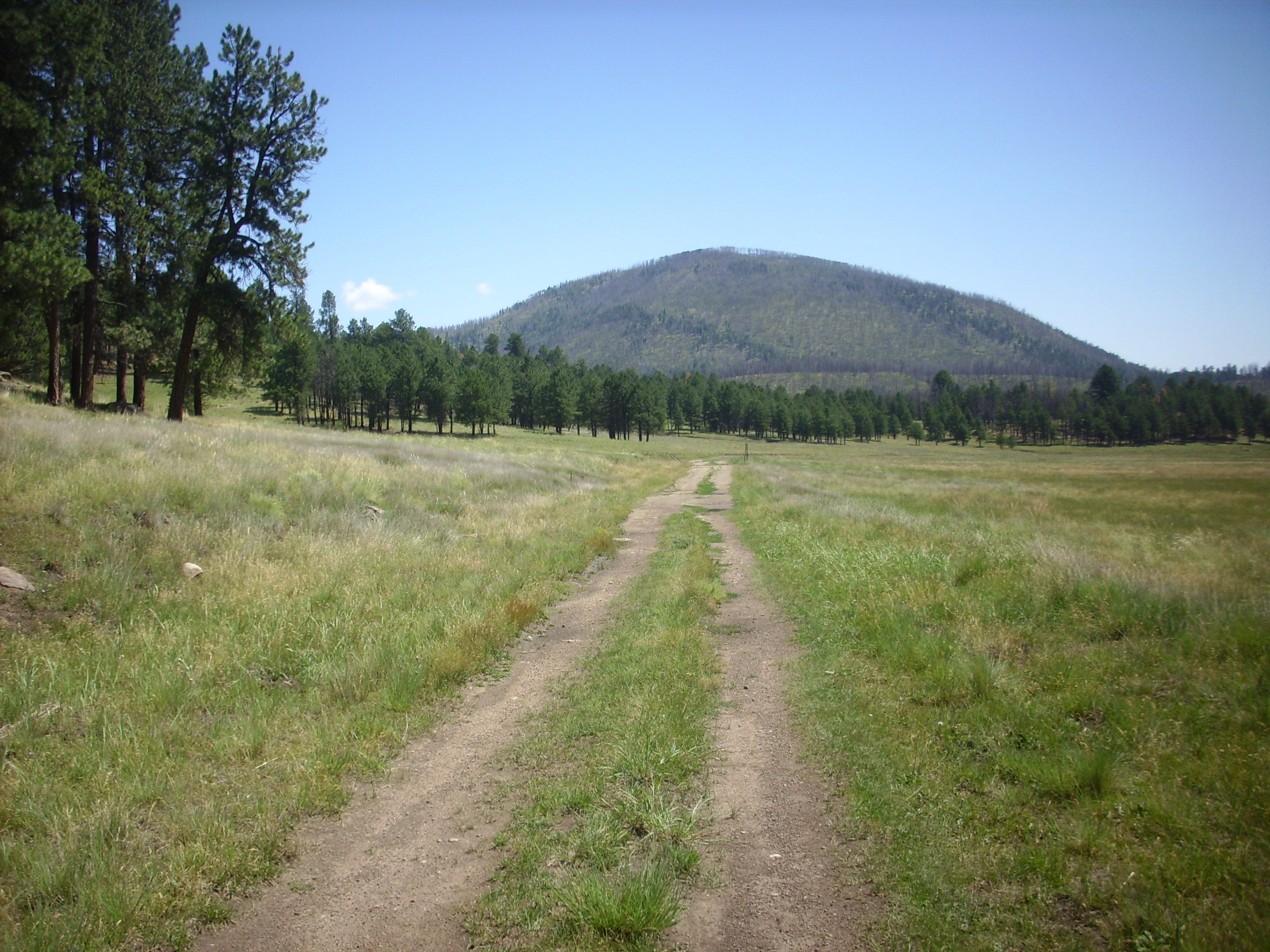
The mountain appearing in the photograph at the start of this
chapter, and to the left in this panorama, is Redondo
Peak, located towards the center of the Valles caldera. It
is equally spectacular viewed from the west.
View east from west caldera rim. 35
52.509N 106 39.871W
The mountain at left is San Antonio Mountain. The main peak to its right is Redondo Peak. Just below Redondo Peak is a shallow valley, the Rendondo Graben, whose west rim (closer to us) is Redondo Border. Then comes the Sulfur Creek valley between Redondo Border and the southern slopes of San Antonio Mountain, and, in the foreground, San Antonio Canyon. The mouth of San Diego Canyon is to the right, and at far right is Cebollita Mesa.
Here's the view of the heart of the caldera from the northwest, on the east slopes of the San Pedro Mountains.
View of the resurgent dome from the northwest. Looking
southeast from 36.0162173N
106.797647W
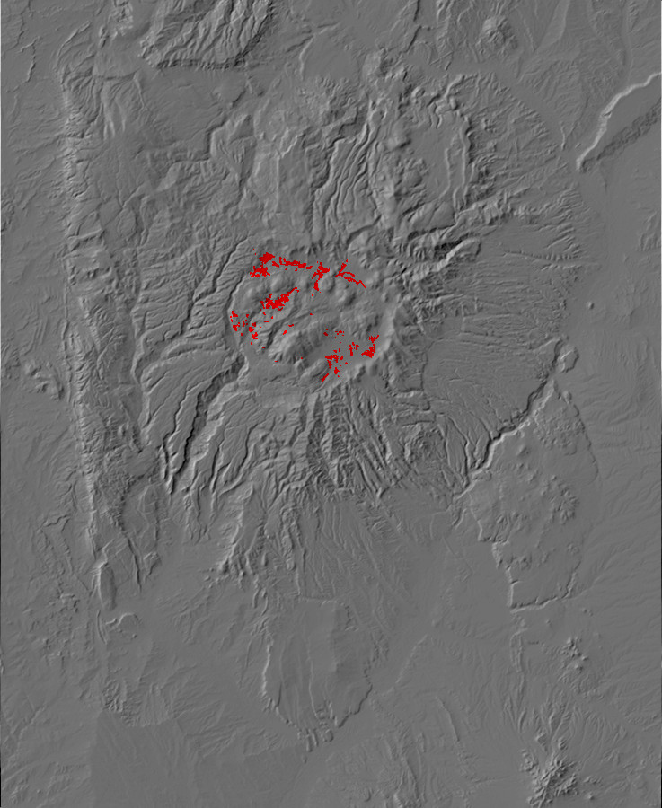
Redondo Peak and Redondo Border together are a resurgent dome, circled in the satellite photograph below.
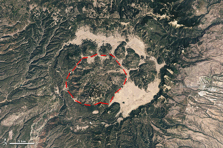
Redondo Peak resurgent dome in Valles Caldera
They are part of the floor of the caldera (which is also
the roof of the underlying magma chamber) that was forced upwards
by injection of fresh magma into the magma chamber very shortly
after it was emptied by the Valles event. And by "very shortly" I
mean that it was pushed up within about 27,000 years of the Valles
event, implying an average rate of growth of over 2 cm (almost 1
inch) a year. For the most part, Redondo rose as a solid mass,
like a piston pushed up from below, just as the caldera floor had
originally dropped like a piston during the Valles eruption.
Redondo Peak is the second highest peak in the Jemez, illustrating
how substantial a resurgent dome can be. It is, in fact, the type
specimen of a resurgent dome, the first one described in a
geological paper, written by geologists R. Smith and R. Bailey
back in 1968.
Curiously, the structure of the resurgent dome as mapped by
drilling suggests that the Toledo Event was not followed by
significant resurgence. In the Jemez, resurgence is unique to the
Valles event.
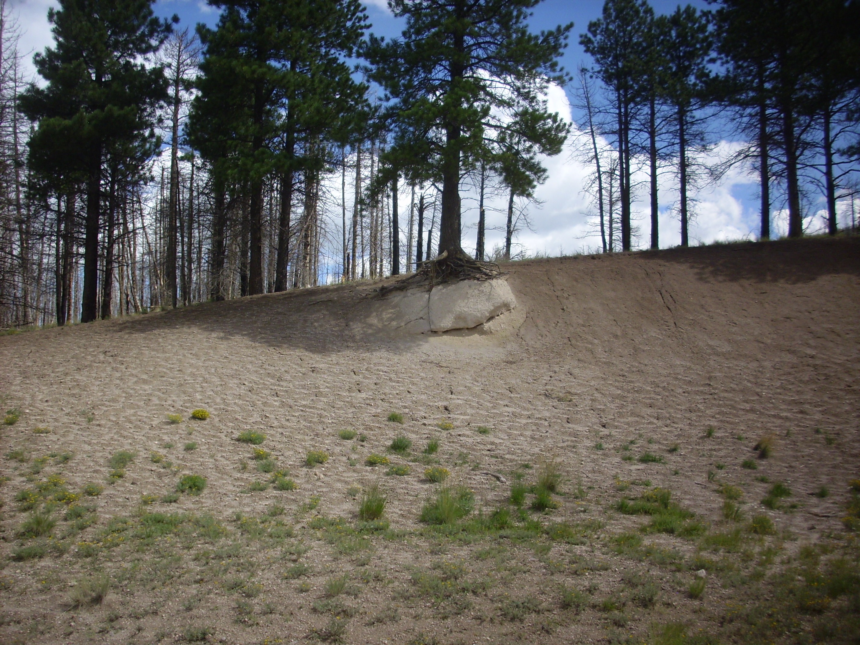
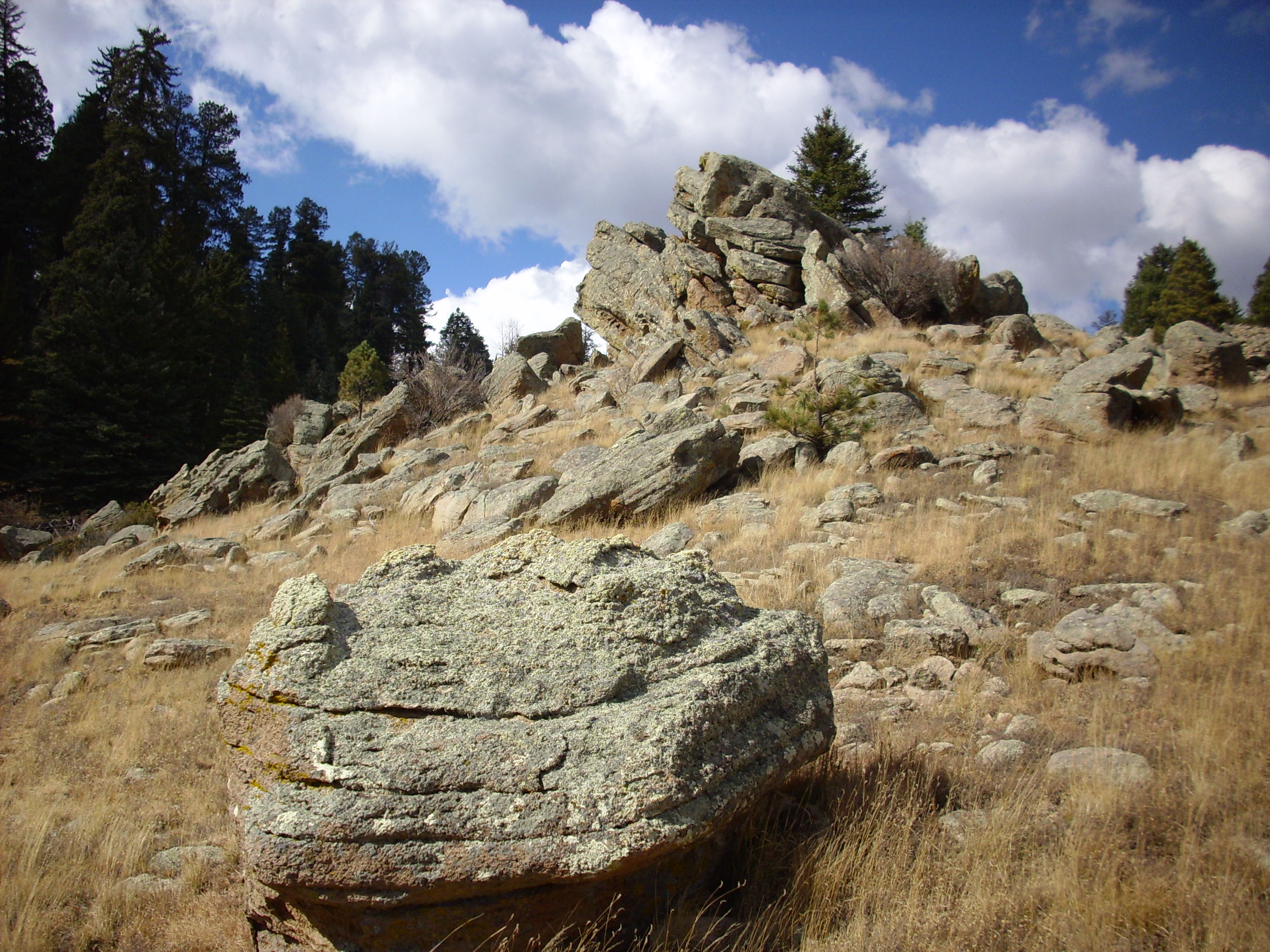
The small knob in the photographs on the north flank of Redondo Peak is called Redondito. It is underlain by Bandelier Tuff, which underlies most of Redondo Peak and Redondo Border as well. The thick beds of Bandelier Tuff atop these mountains were one of the clues that these were originally part of the caldera floor, and not remnants of a central volcano.
The Redondo Graben is a valley bounded by faults to southeast and northwest. It is a little like a very small version of a rift valley, cutting across the resurgent dome. It is common for resurgent domes to show such a feature, which is known as a medial graben. Mallard Lake Dome in Yellowstone, for example, is crossed by a medial graben. These form because the rock beds are stretched as they are pushed up into a dome. The rock is brittle and fractures, typically along parallel faults. The block bounded by the faults drops in place, somewhat like the keystone of an arch if the sides of the arch are pulled slightly apart.
It may be significant that the Redondo graben is aligned with both the Jemez Fault Zone in San Diego Canyon, to the southwest, and the Toledo Embayment, to the northeast. The medial graben likely formed along existing faults.
Alamo Canyon is a smaller medial graben on the north side of the resurgent dome.

Alamo Canyon. Looking east from
35
55.117N 106 36.042W
The floor of the canyon has dropped along faults in the north and south walls.
Although the resurgent dome rose as a solid mass, it was badly
faulted, and these faults provided paths for small quantities of
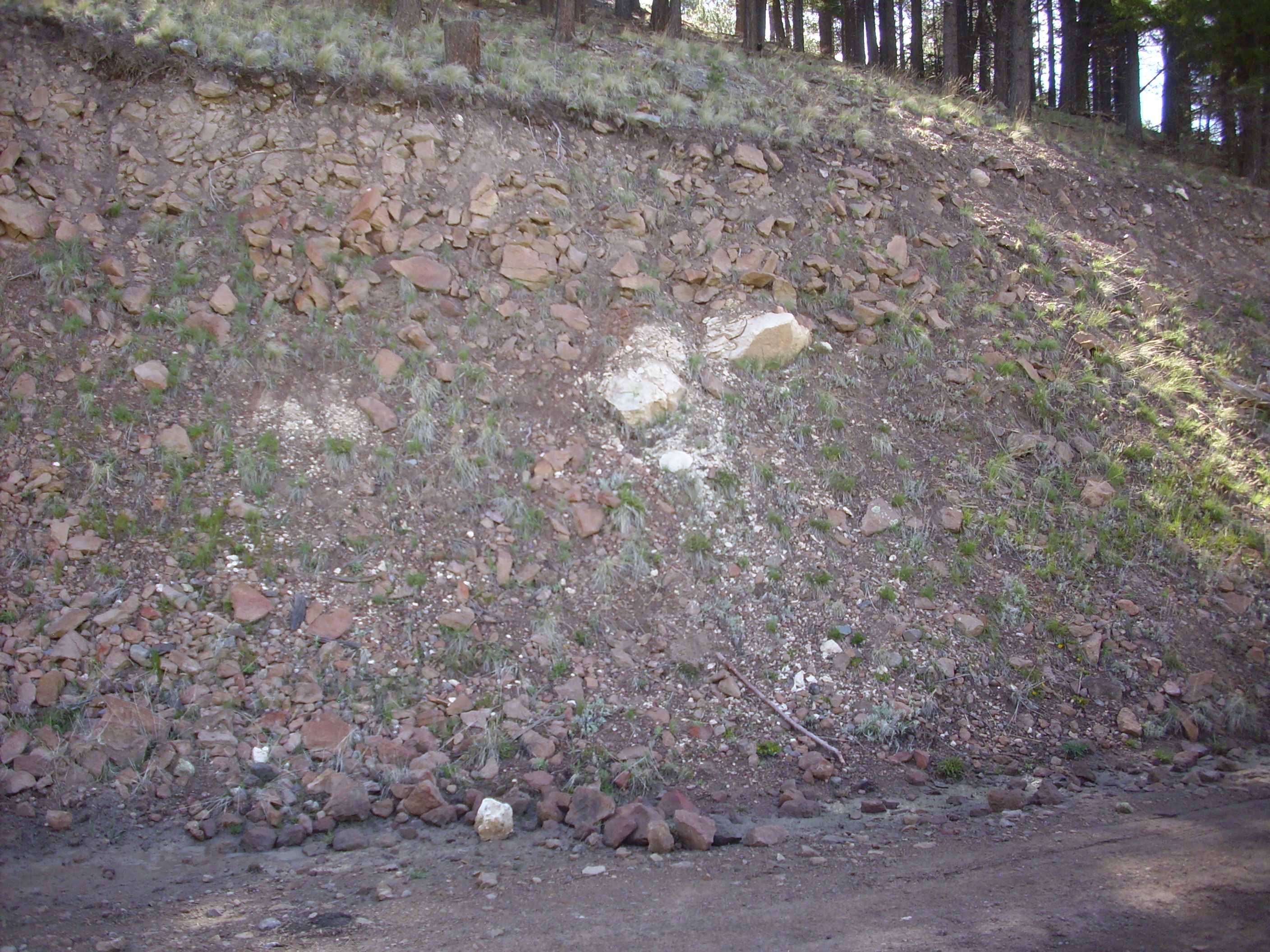
magma to escape from the dome. The earliest of these formations is
the Deer Canyon Member, which is exposed at Cerro
Pinon. Cerro Pinon is underlain by Bandelier Tuff,
Deer Canyon Tuff, and Deer Canyon Member, with an apron of flow
debris on one side. This outcrop on the southwest side, protruding
through broken Tsherige Member, Bandelier Tuff, is Deer Canyon
Tuff.
Deer Canyon Member. 35
53.379N 106 29.693W
Deer Canyon Tuff 35
53.379N 106 29.693W
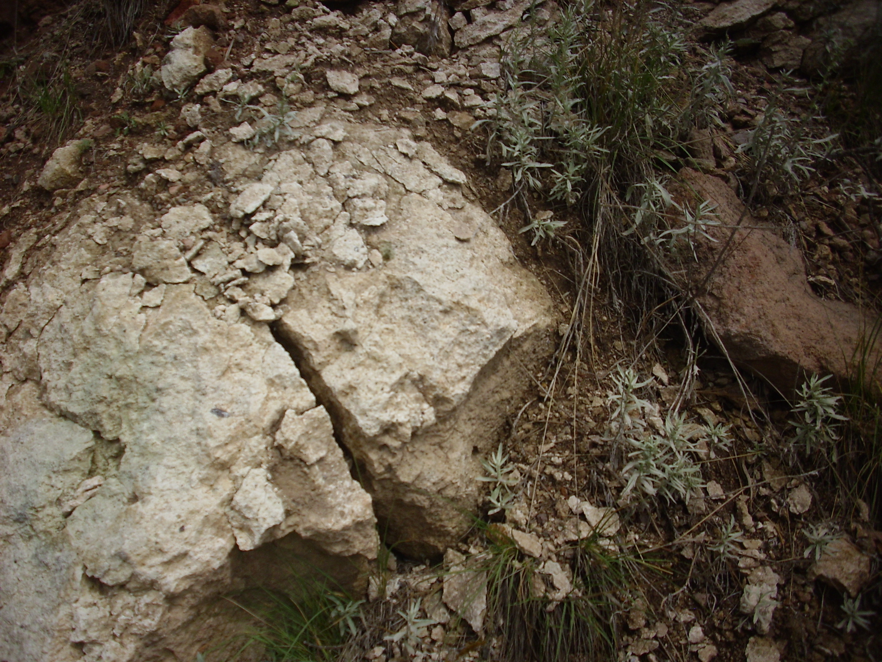
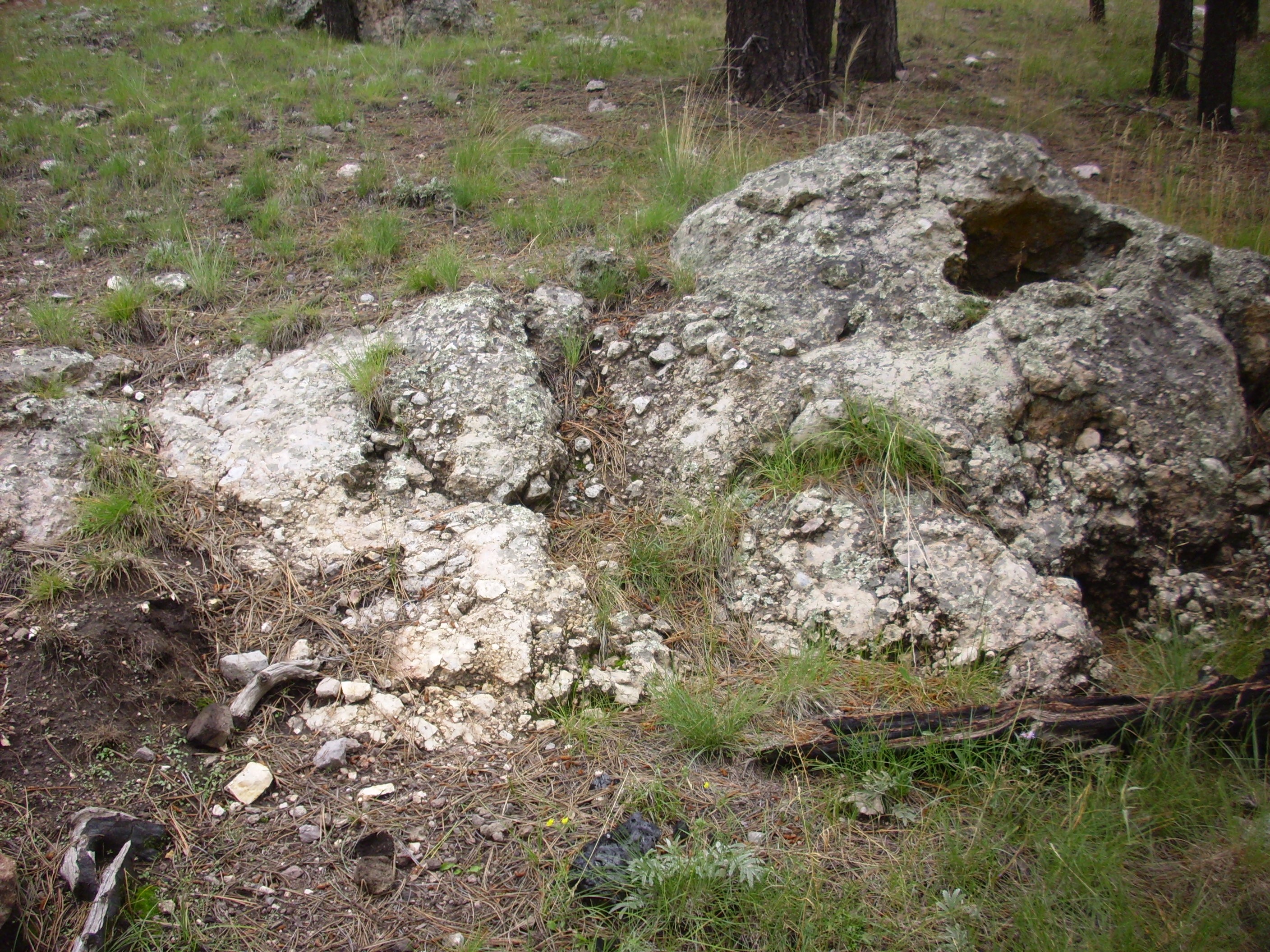
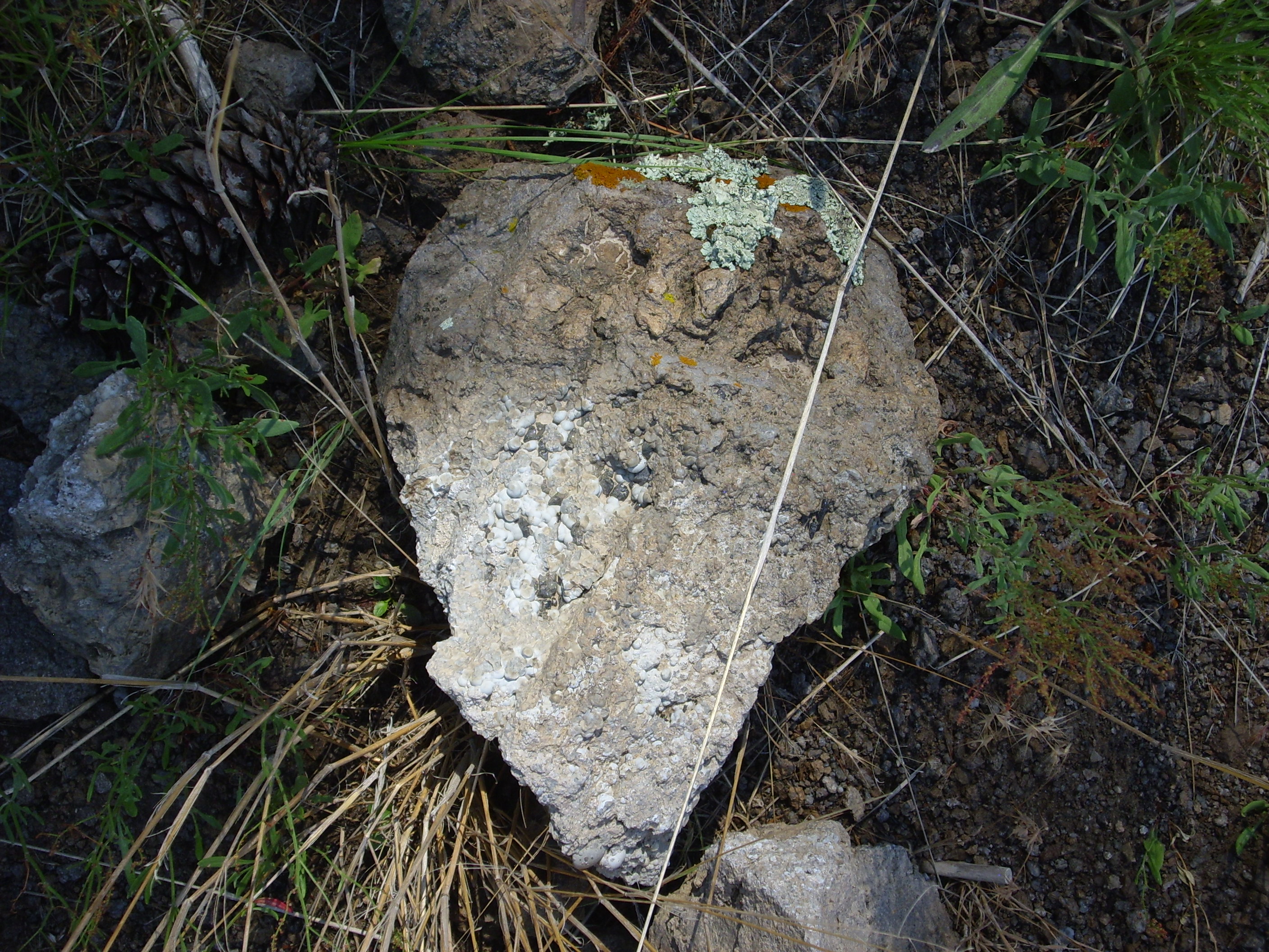
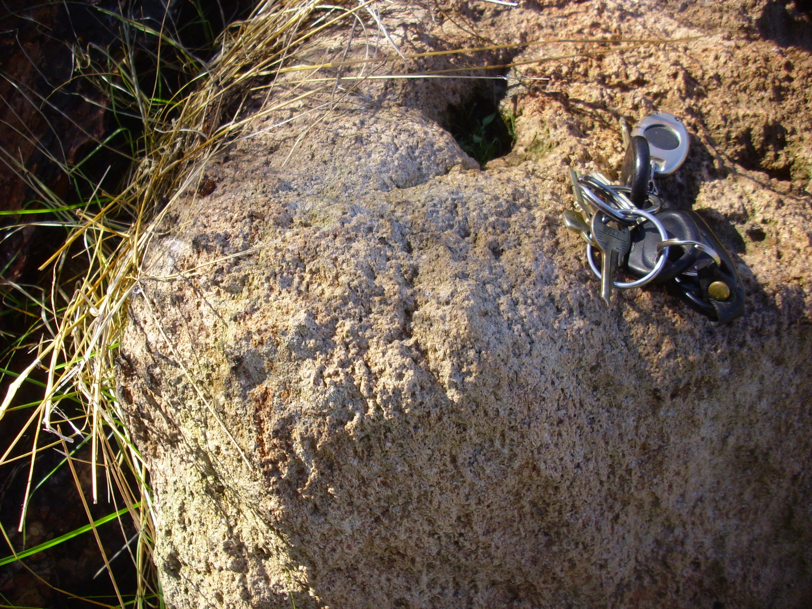
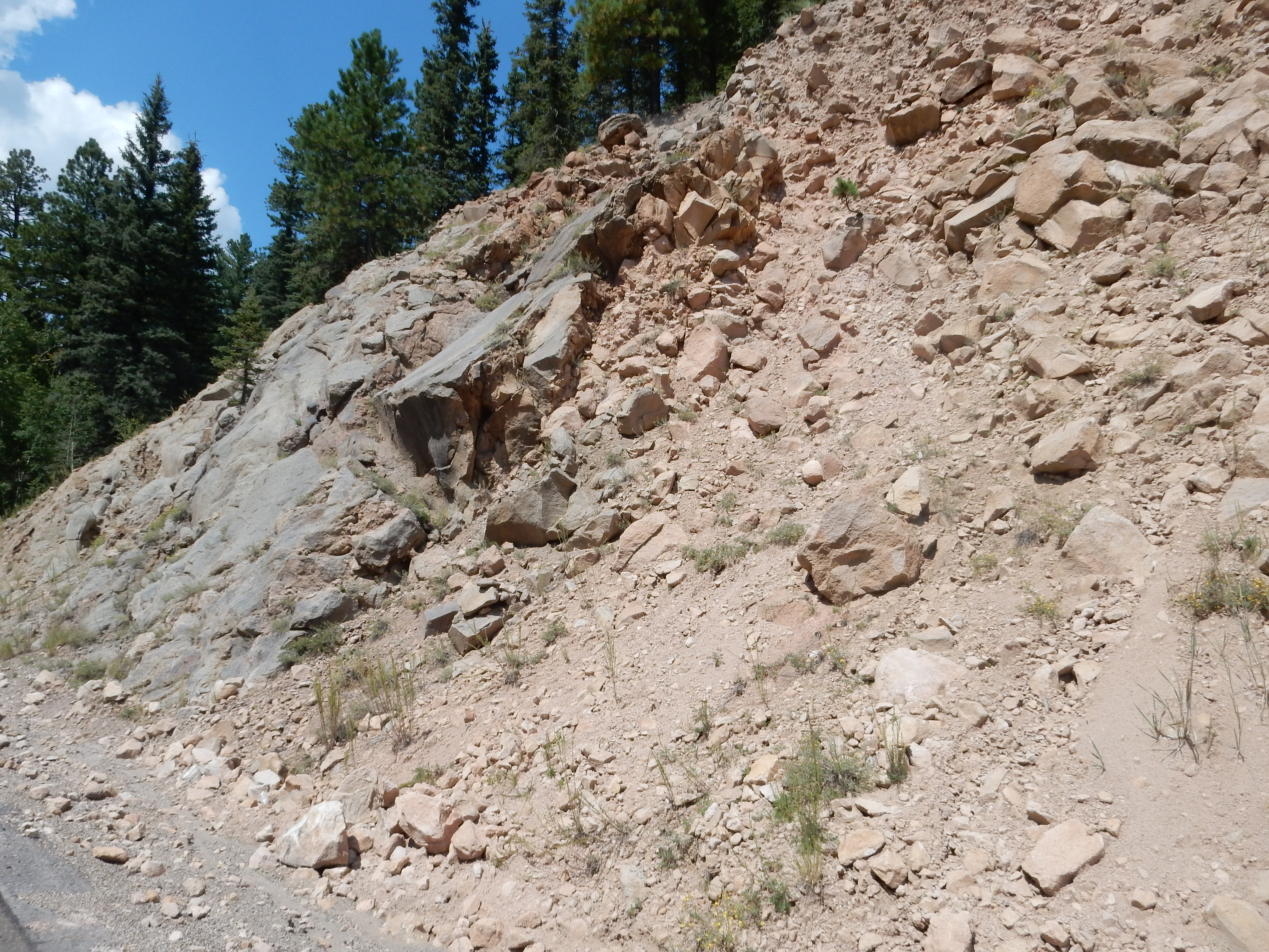
This is a much whiter tuff than the surrounding Tsherige Member and contains some lithic fragments that look like andesite. It’s not hydrothermally altered Tsherige Member. The geologic map shows a vent at this precise location, indicating that the geologists who prepared the map also spotted this outcrop and interpreted it as an eruptive vent of the Deer Canyon Tuff that has been exposed by erosion.
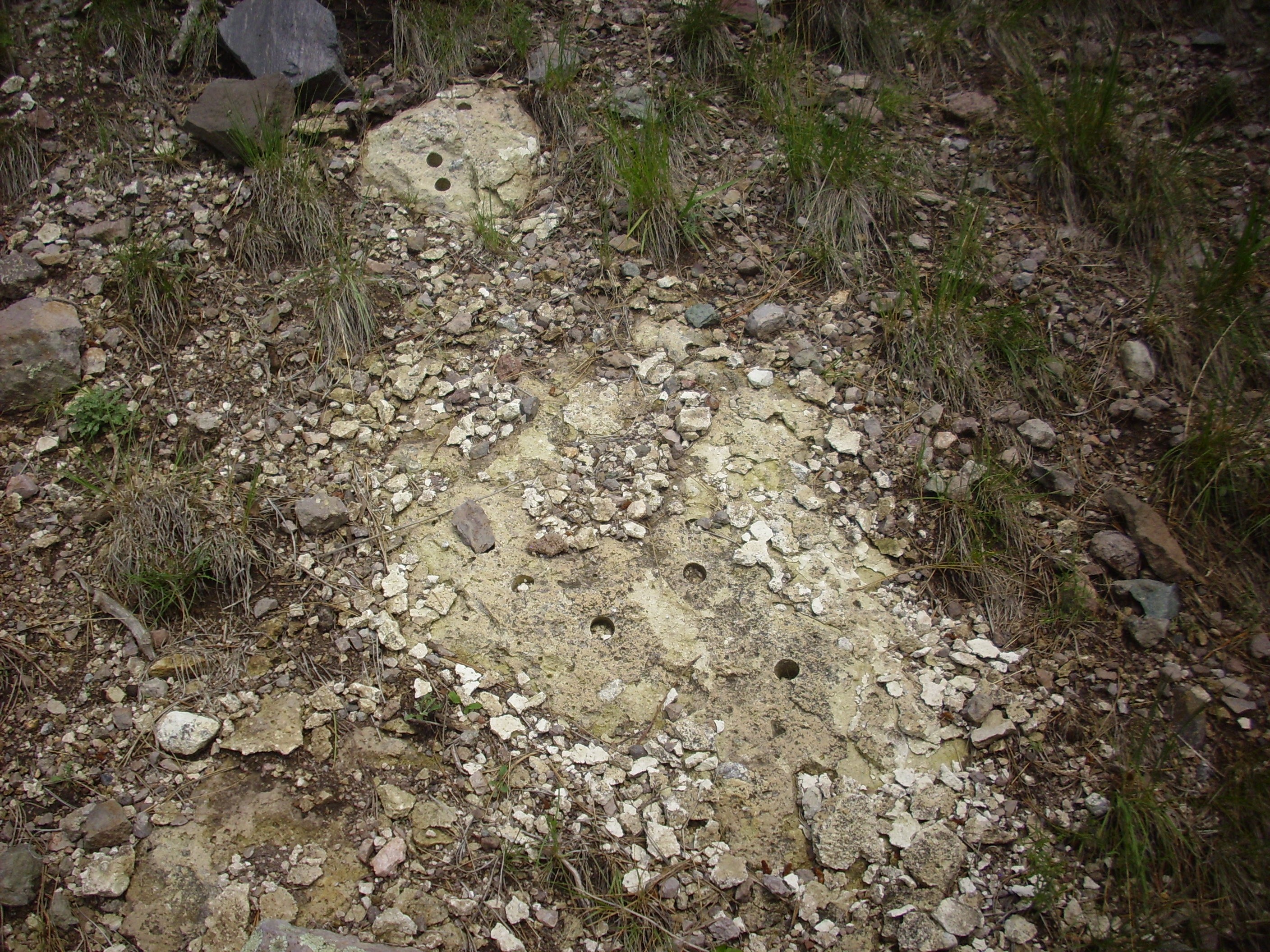
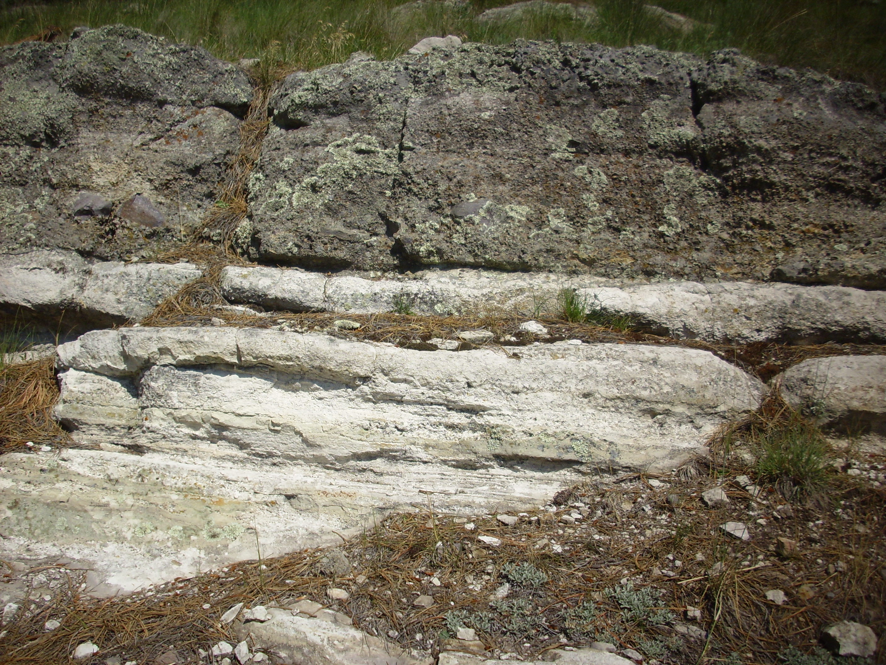
Further up the hill, one encounters the upper surface of the Tsherige Member.
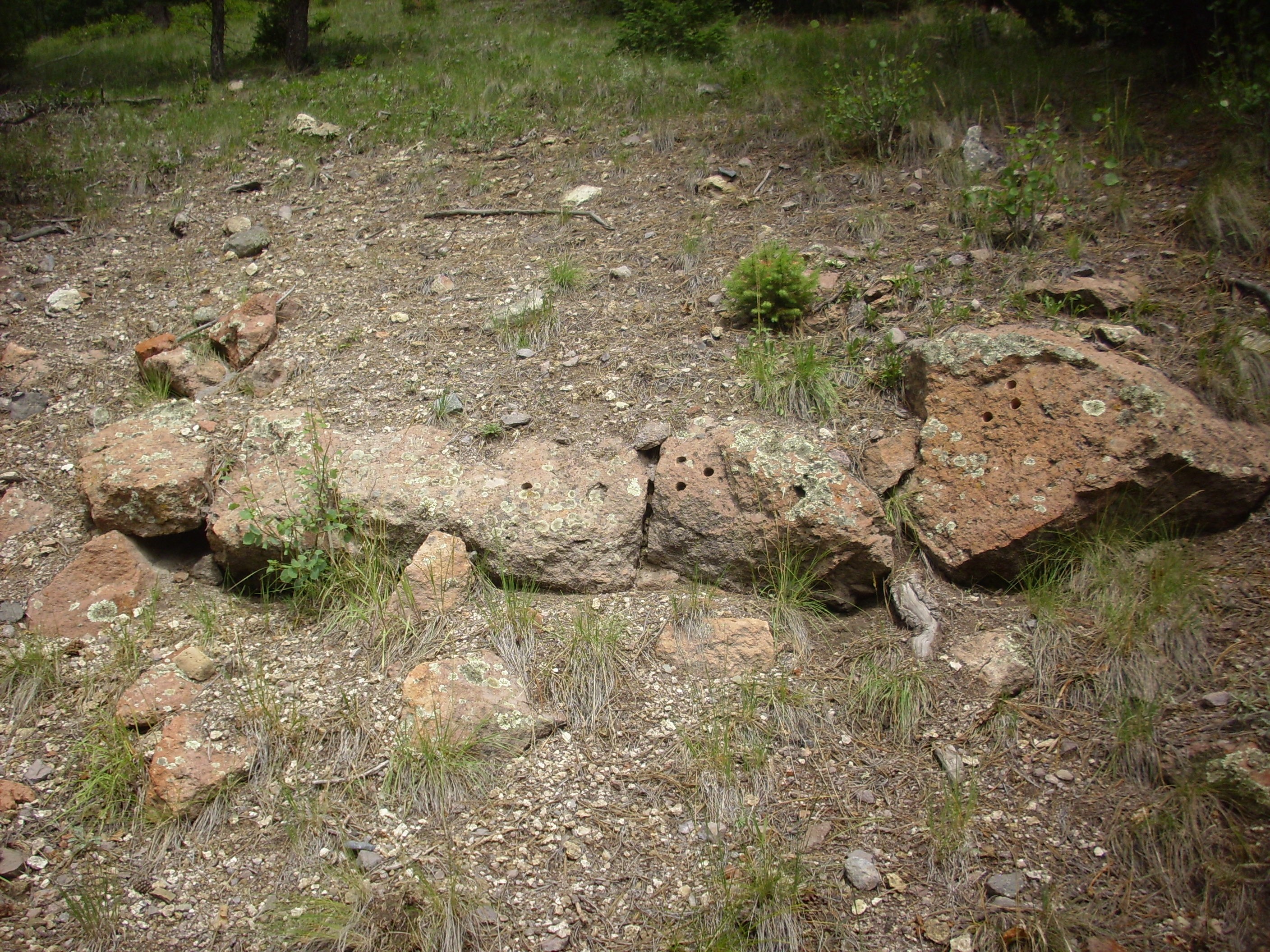
Tsherige Member upper surface on Cerro Pinon. 35 53.476N 106 29.841W
Evidently this outcrop was of considerable interest to some geologist at some point; it has more holes in it than a political party platform. I counted no less than sixteen geologic sample boreholes on this exposure,
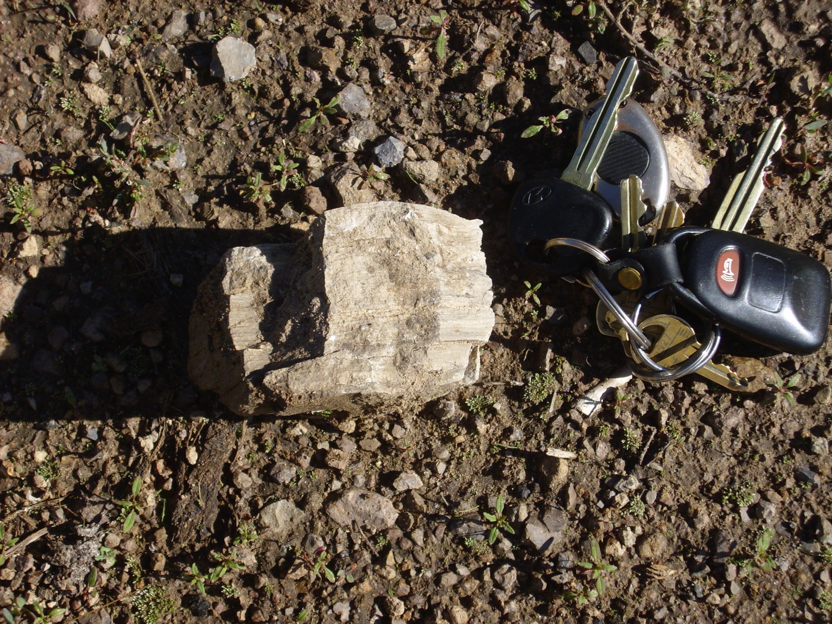
Above this bed is Deer Canyon tuff, though it’s heavily mantled with soil and I had to search along the contact to find a good exposure. Evidently, I was not the first:
Deer Canyon tuff. 35
53.442N 106 29.825W
Close examination shows that this is the same kind of tuff as in the vent below, through which it very likely erupted.
Above the tuff, there are scattered outcrops of massive Deer Canyon Member. Here they are poorly exposed and mingled with debris flow deposits. Better exposures are found to the southwest of Cerro Pinon, just above the main Preserve gravel road in this area.
Deer Canyon Member clast. 35
53.203N 106 29.964W
Deer Canyon Member outcrop. 35
53.193N 106 29.945W
The same sequence is found on a hill southwest of Cerro Pinon. Here beds of Bandelier Tuff

are overlain by Deer Canyon Member tuff beds
while the hill is capped with massive Deer Canyon Member.
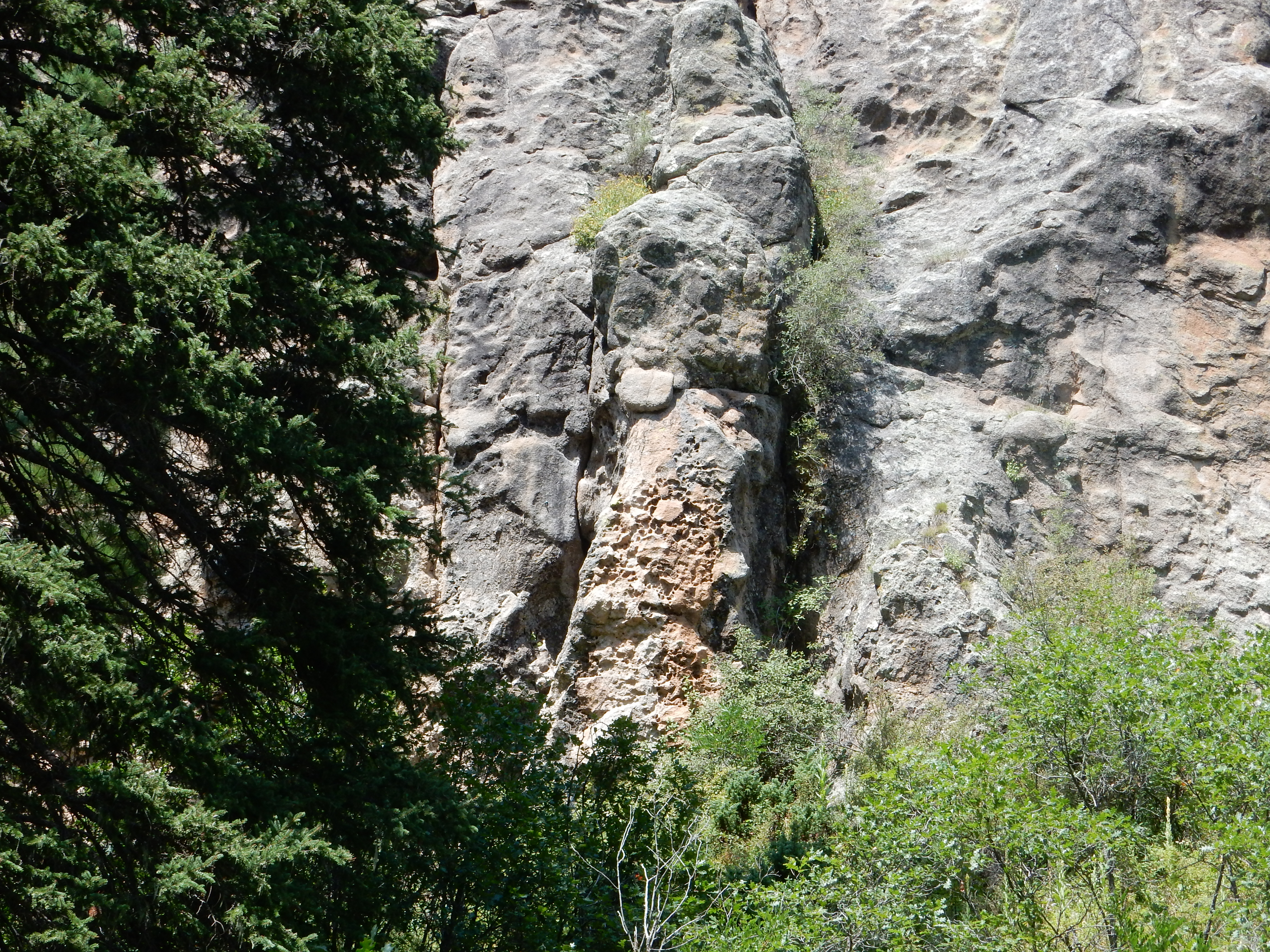
Further south along the east slopes of Redondo Peak, there are additional Deer Canyon vents, some of which produced a more uniform massive rhyolite.

Deer Canyon Tuff also forms the steep western bank of the narrowest portion of Valle Santa Rosa. This is the toe of a flow that erupted from a vent up slope.
The flow underlies the ridge above the road.
The ridge forming the skyline center and left is the flow of Deer
Canyon Member tuff, coming from a vent at upper left. The flow
immediately around the vent is massive rhyolite while the
remainder is tuff.
Exposures of Deer Canyon tuff are almost always overlain by exposures of Deer Canyon massive rhyolite, though the rhyolite often lies directly on older rocks. Both tuffs and massive flows of the Deer Canyon Member are exposed in Valle Jaramillo, though the later are more voluminous.
Deer Canyon Member in road cut. 35
54,147N 106 33.441W
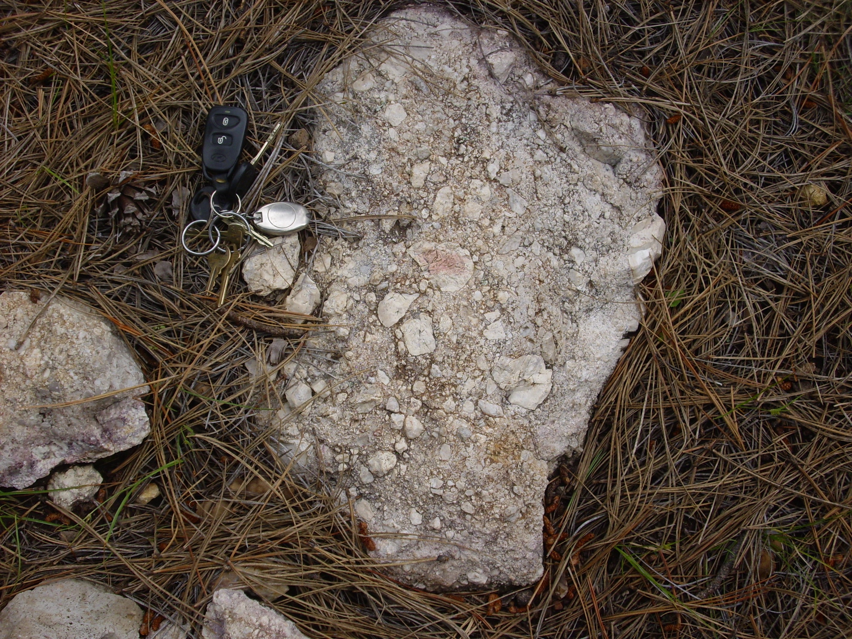
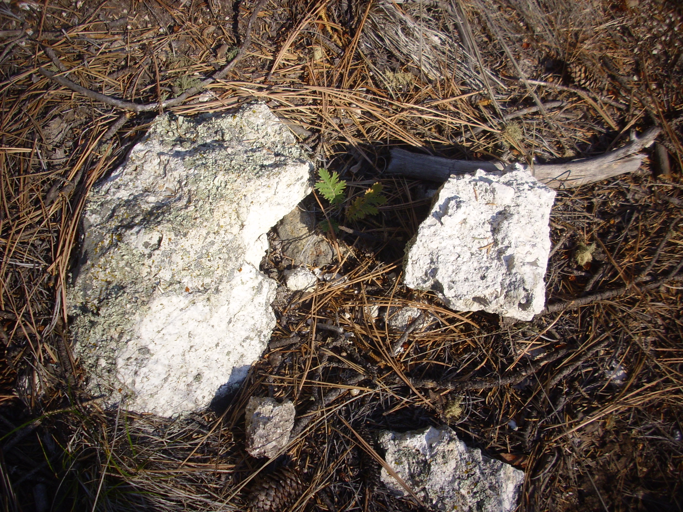
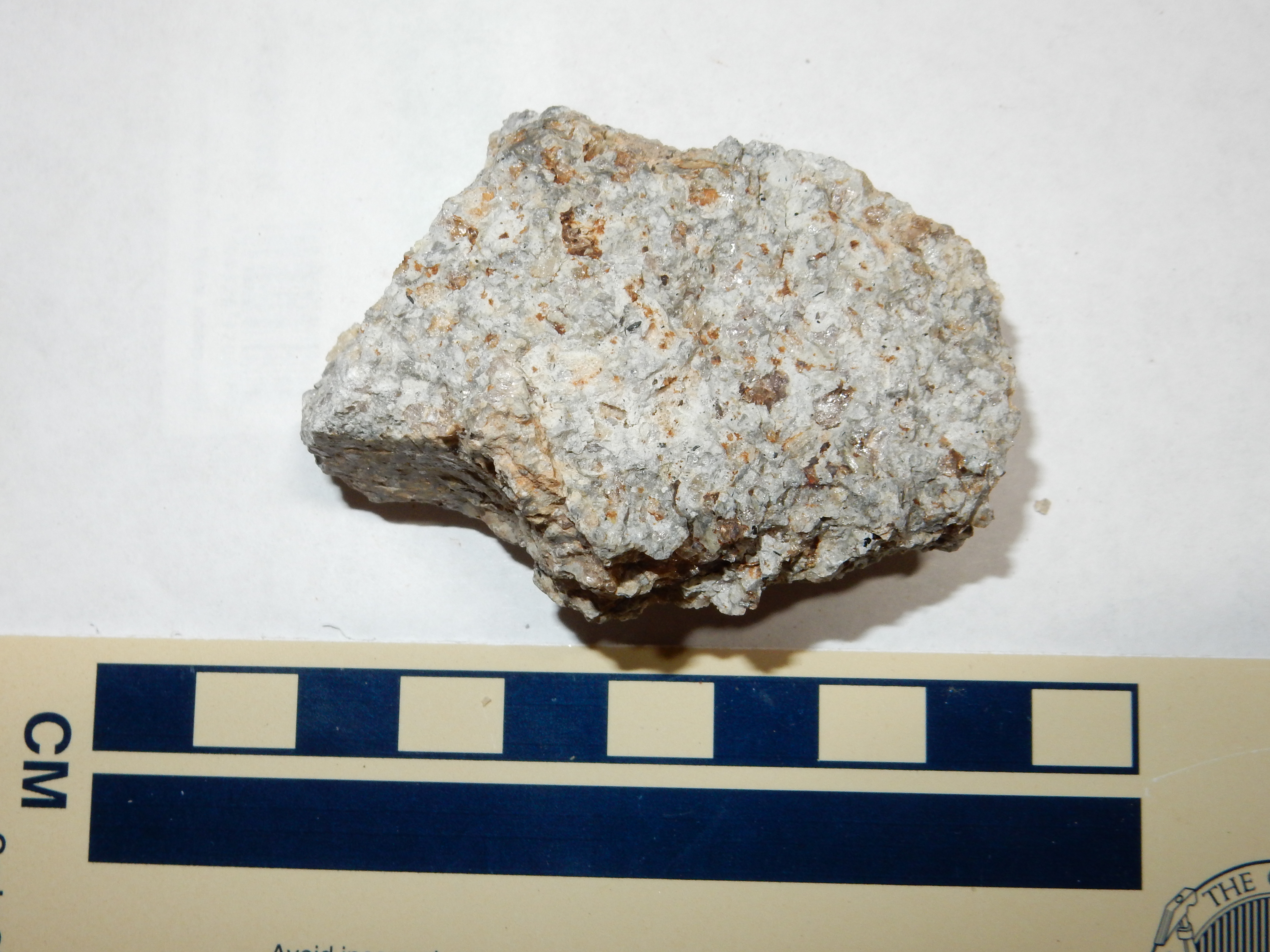
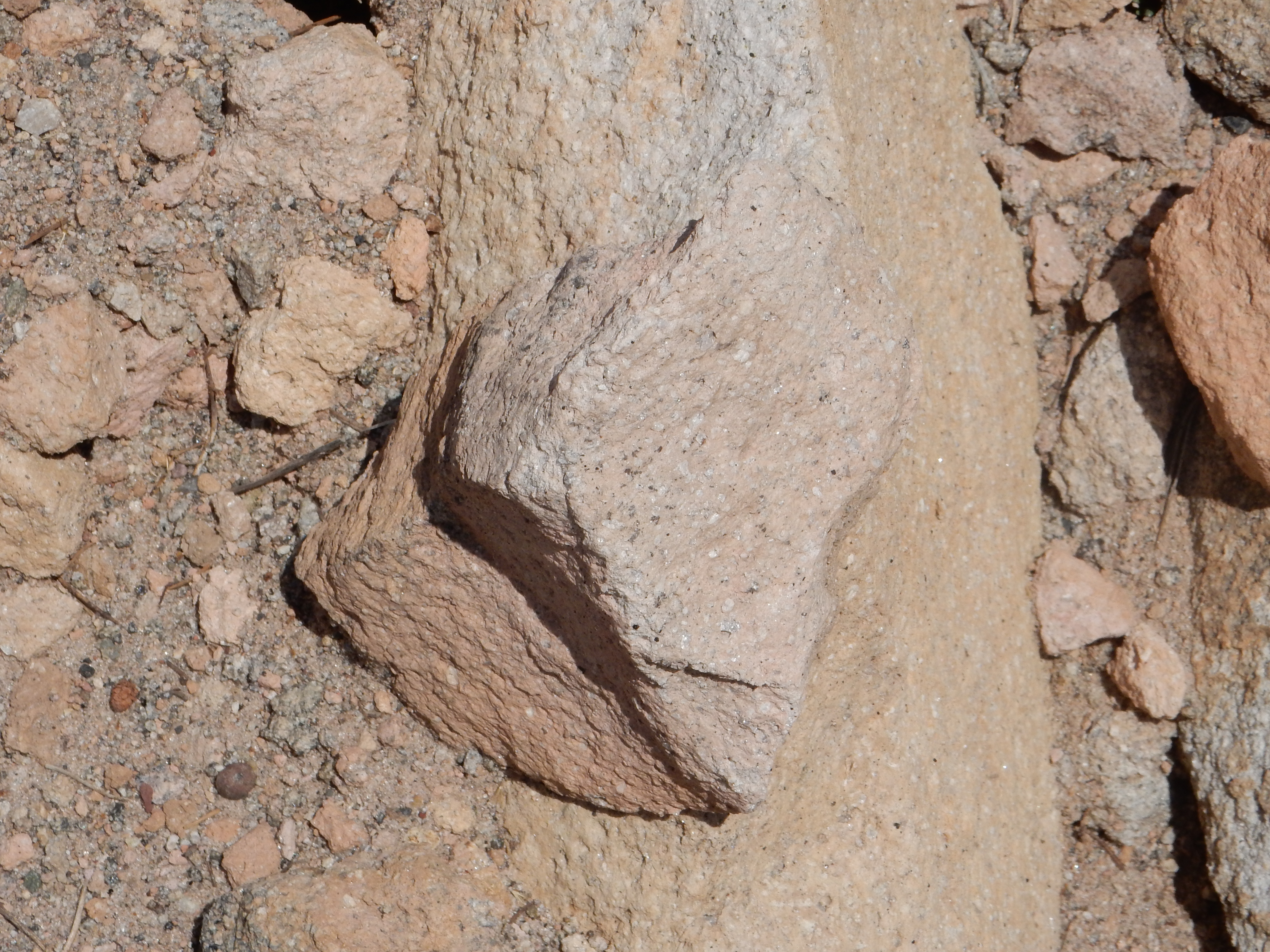
Here massive Deer Canyon Member overlies Deer Canyon tuff. Here’s a close up of shards of each:
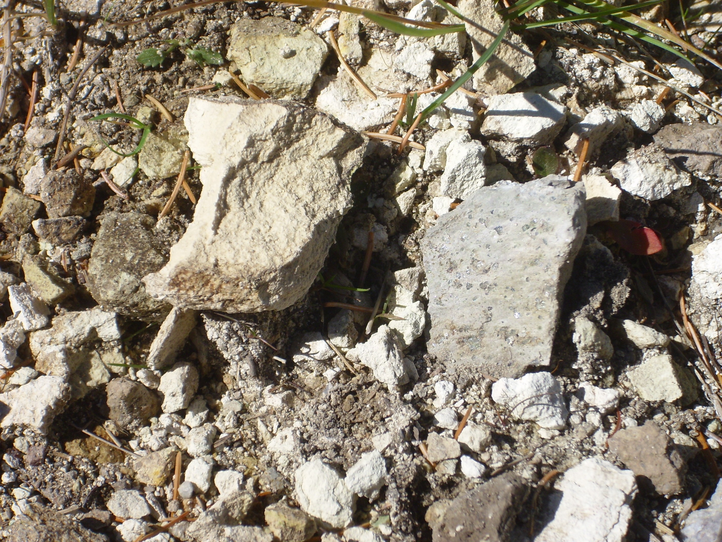
The shard at left is the tuff, which is a very fine-grained,
porous, white rock. The shard at right is the massive rhyolite,
which is chock-full of crystals of quartz. The presence of quartz
confirms that this is Deer Canyon Member and not Redondo Creek
Member.
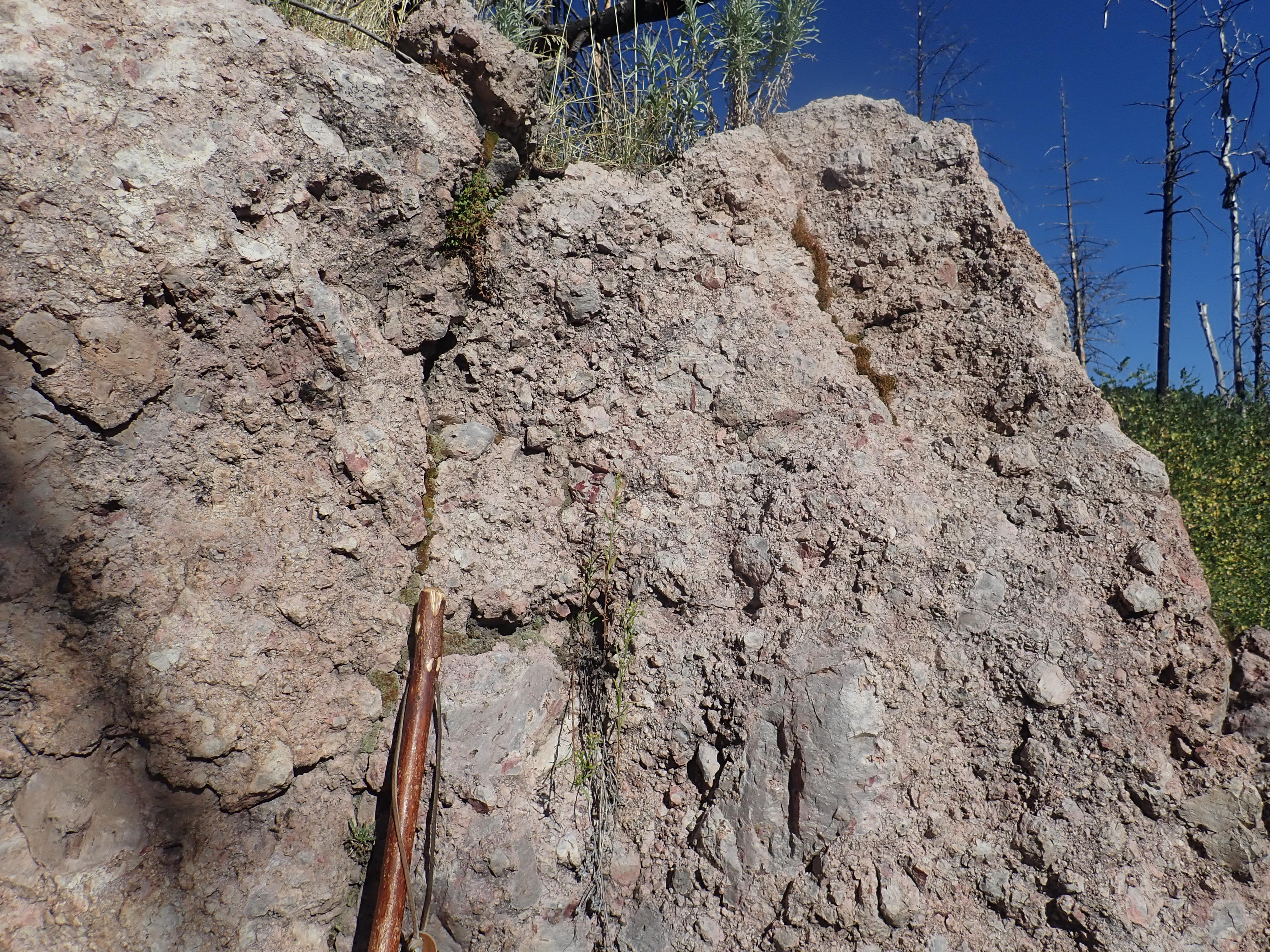
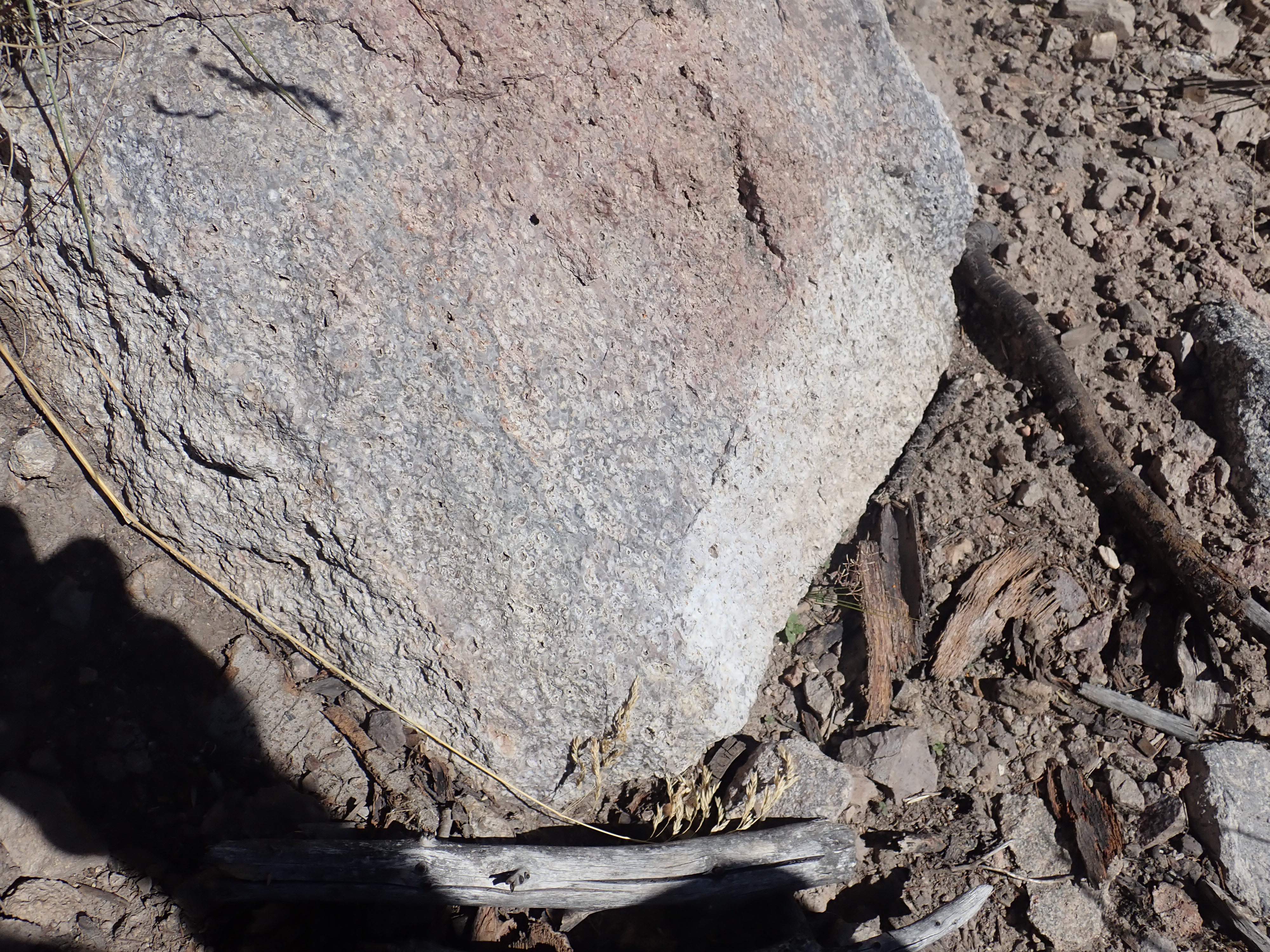
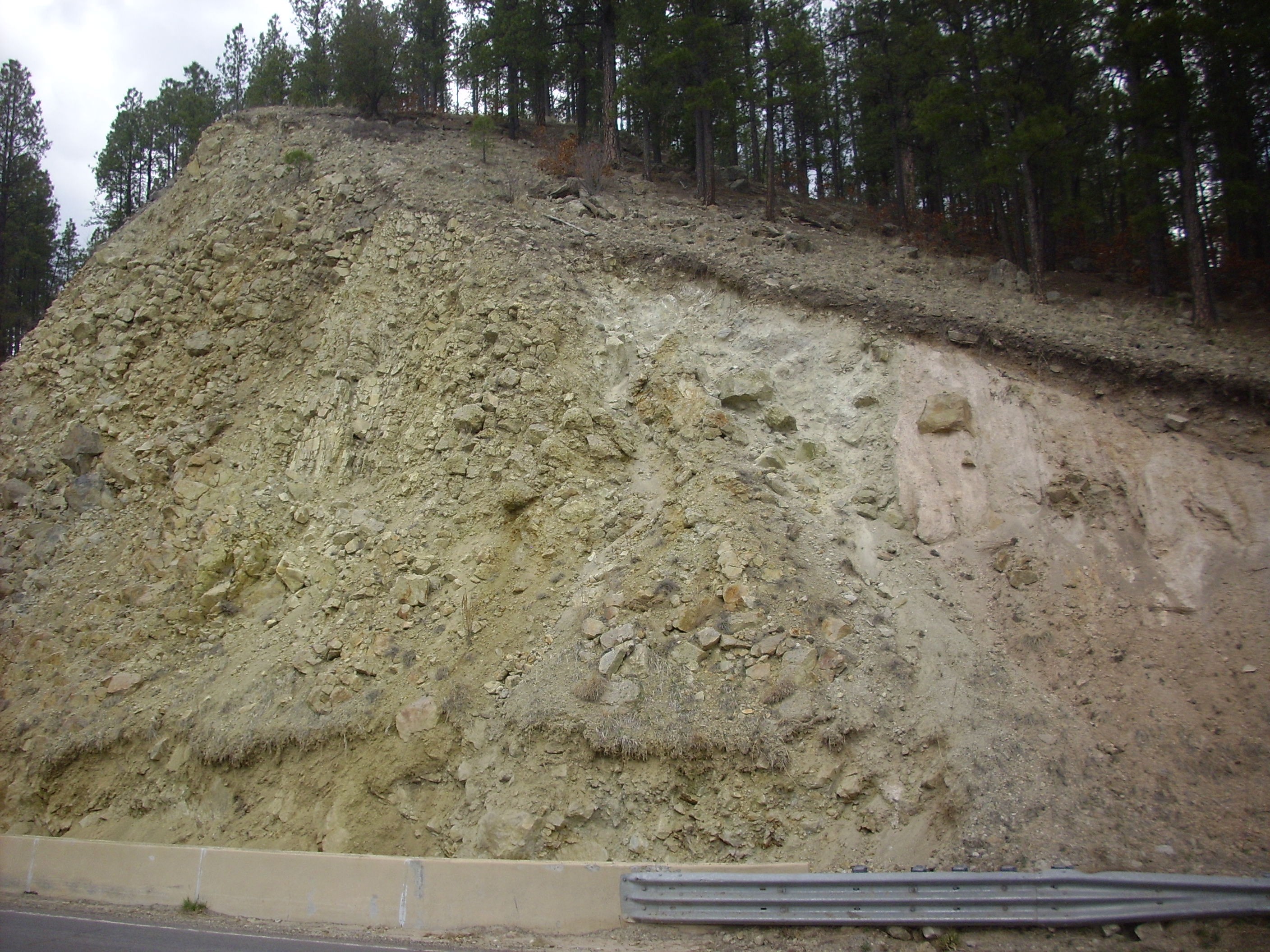
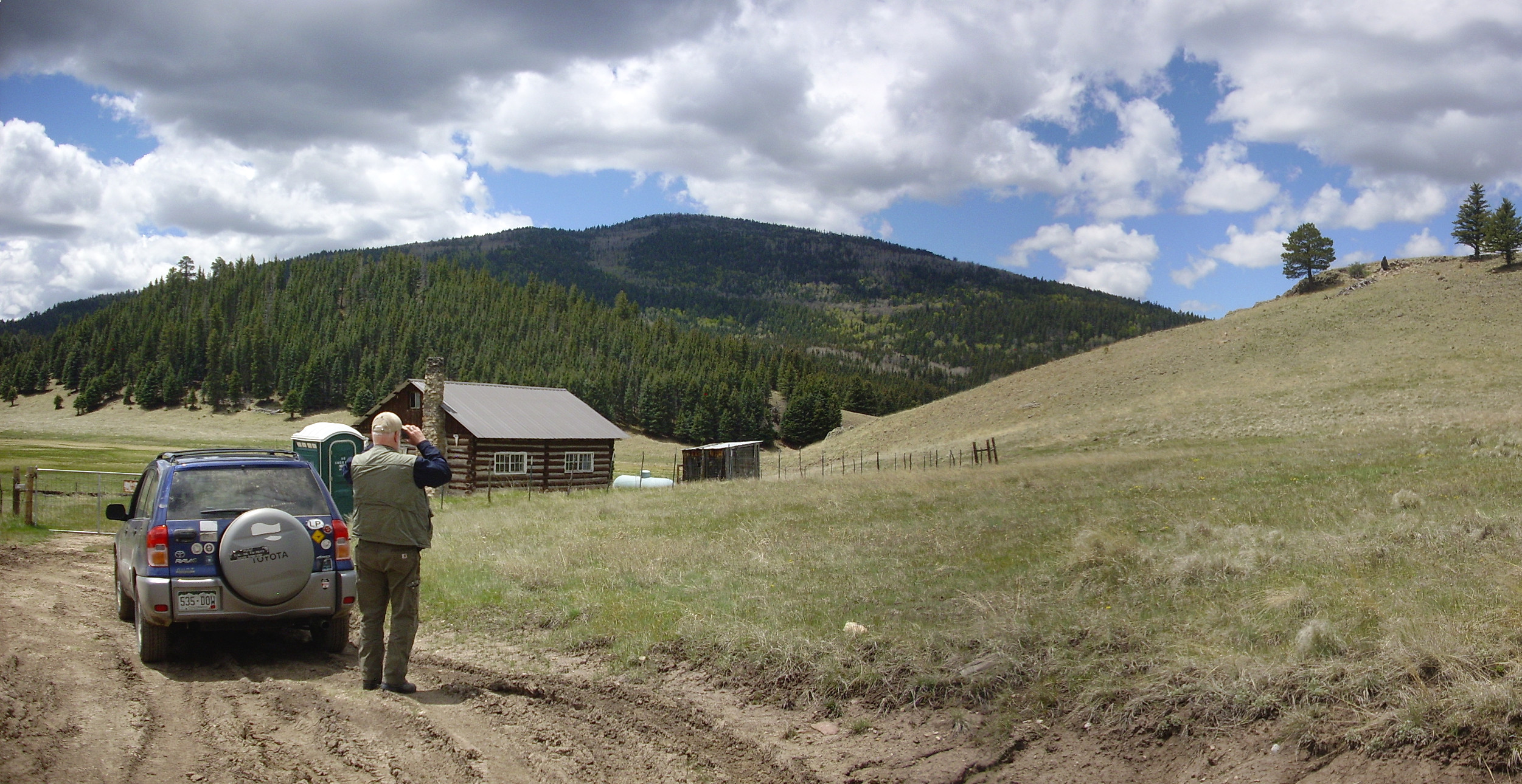
Shortly after the Deer Canyon Formation was erupted, activity seems to have shifted to the west. This produced another early resurgence formation, the Redondo Creek Member, which is found primarily on the flanks of Redondo Border. This crops out at several locations along State Road 4 as one approaches La Cueva.
Radioisotope dating of this outcrop gives it an age of 1.23 million years. Analysis of the magnetite and ilmenite content of the formation indicates that it erupted at a temperature of about 810 degrees Centigrade, compared with 700 Centigrade and 850 Centigrade for the lower and upper flows of the Tsherige Member. The unaltered rhyolite is quite glassy, and, like much volcanic glass, quite dark in color.
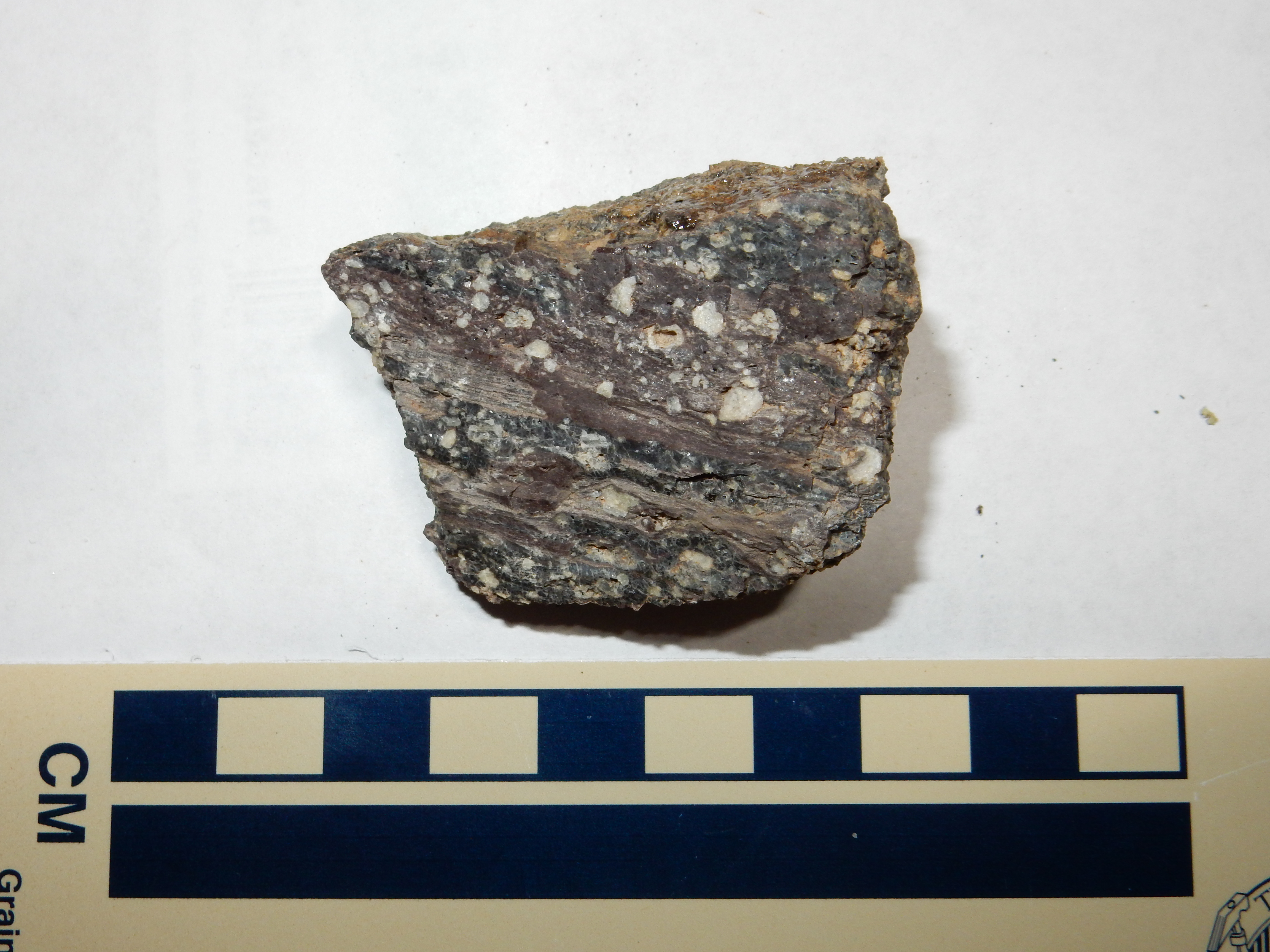
Redondo Creek Member. 35
52.495N 106 38.139W
Note the many plagioclase phenocrysts. The rock has the
composition of a rhyodacite but has no visible quartz. The lack of
quartz phenocrysts distinguishes this rock from the Deer Canyon
Member, as does its stratigraphic position; it overlies the Deer
Canyon Member wherever both formations are found.
This outcropping is fairly solid rock that is little altered from
its original state after cooling and solidifying. Many other
outcrops of the Redondo Creek Member have been extensively
hydrothermally altered. For example, there is a prominent
outcropping on Route 126 just north of its junction with State
Road 4.
To the left in this photograph is the Redondo Creek outcropping,
which shows some flow banding in the center of the outcrop. The
pinkish rock to the right is much younger tuff of the Battleship
Rock flow.

Sample of Redondo Creek Member. 35 52.289N 106 38.511W
The yellow color is from hydrothermal alteration, and suggests
that the Redondo Creek Member erupted into a crater lake that had
formed in the caldera. The Deer Canyon Member is also frequently
altered, and shows that a lake quickly accumulated in the caldera
after it was formed.
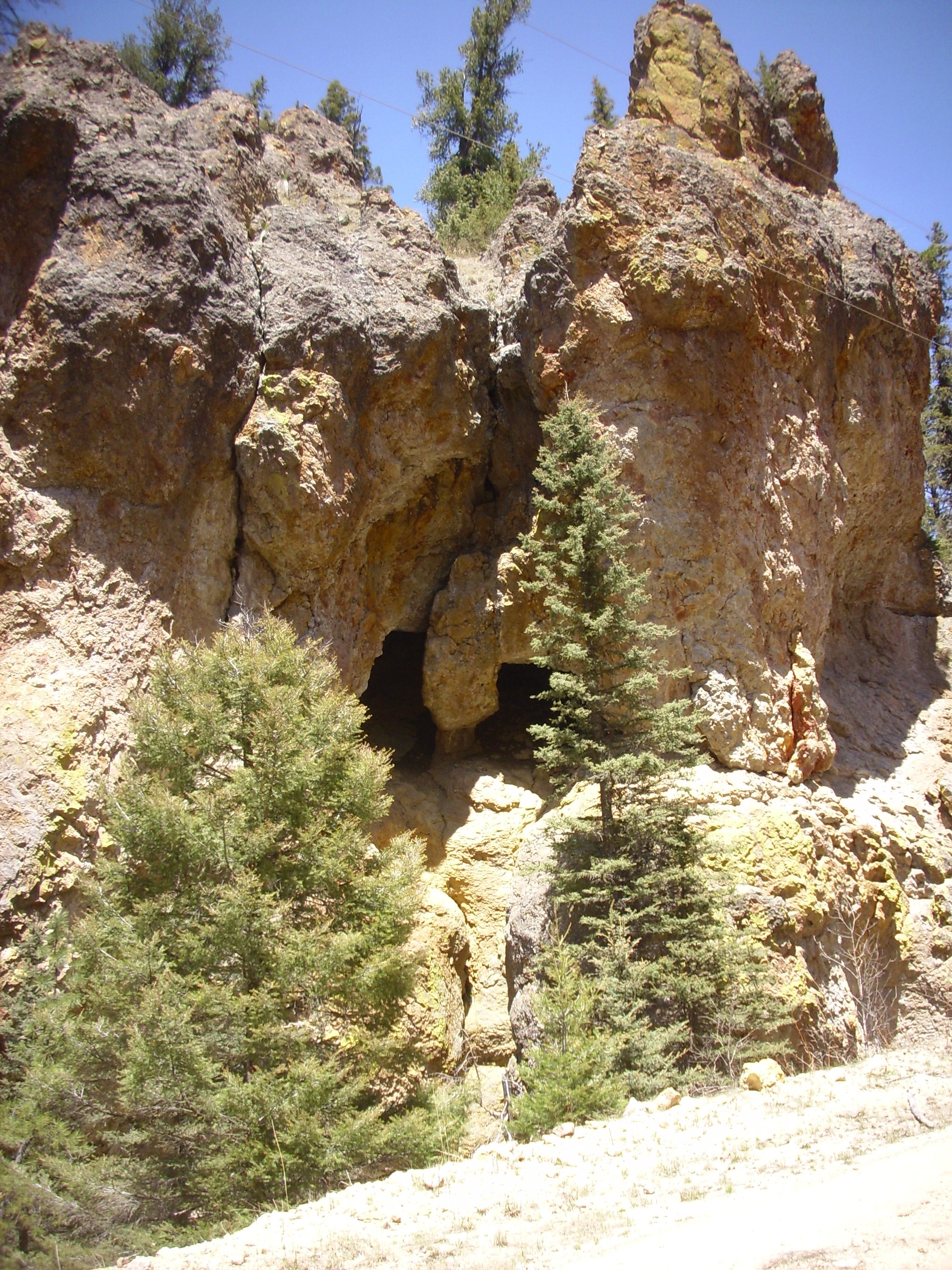
Further north and up slope from Route 126, there are outcrops of Redondo Creek Member that have been altered to the point where the remaining rock is spongy.

Redondo Creek Member outcrop with extensive hydrothermal alteration. 35 53.191N 106 38.544W
This looks like it may originally have been a block and ash flow, as do many other outcrops in the area.
Both Deer Canyon Member and Redondo Creek Member are exposed along Sulfur Creek in the Sulfur Springs area, which is accessible from Forest Road 105 north of State Road 4. Forest Road 105 enters the Valles Caldera National Preserve, and one must park at the gate and have paid the entrance fee to hike along the road to Sulfur Springs. There are some impressive stacks of Redondo Creek Member north of the springs.
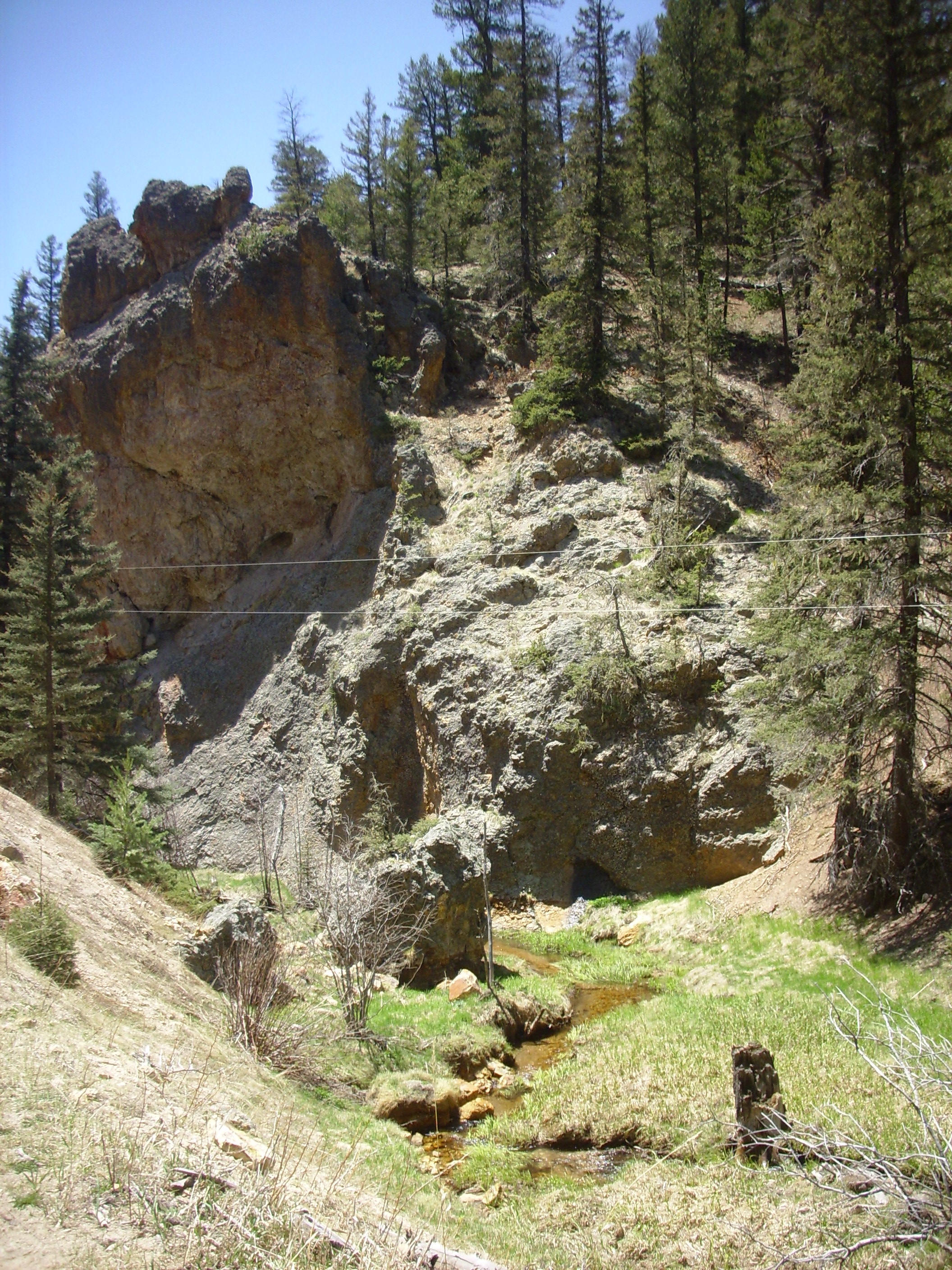
Stacks of Redondo Creek Member along
Sulfur Creek north of Sulfur Springs. 35.914N
106.608W
The yellowish discoloration towards the bottom indicates that
hydrothermal alteration has taken place. Typical alteration
minerals here are alunite and jarosite, which are insoluble
sulfate minerals of aluminum and iron respectively. Alunite has
the formula
KAl3(SO4)2(OH)6, and jarosite shares the same structure, with
ferric iron taking the place of aluminum.
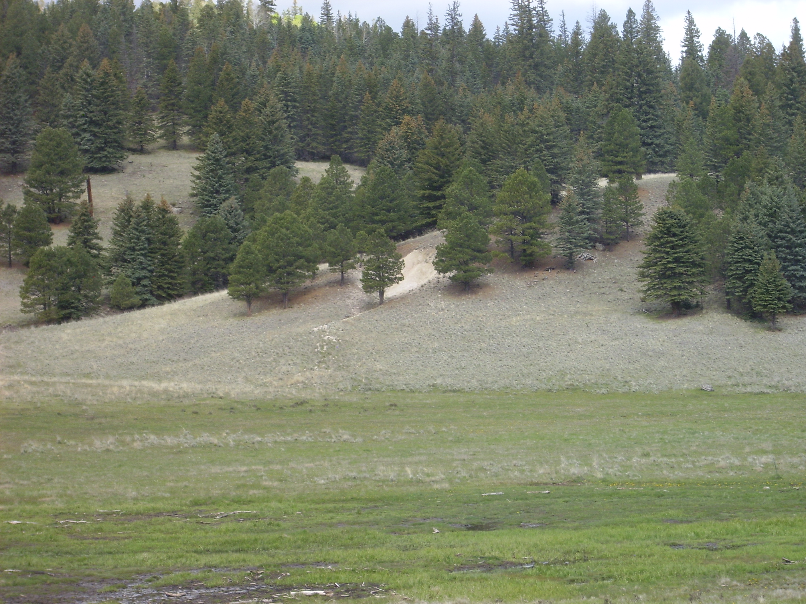
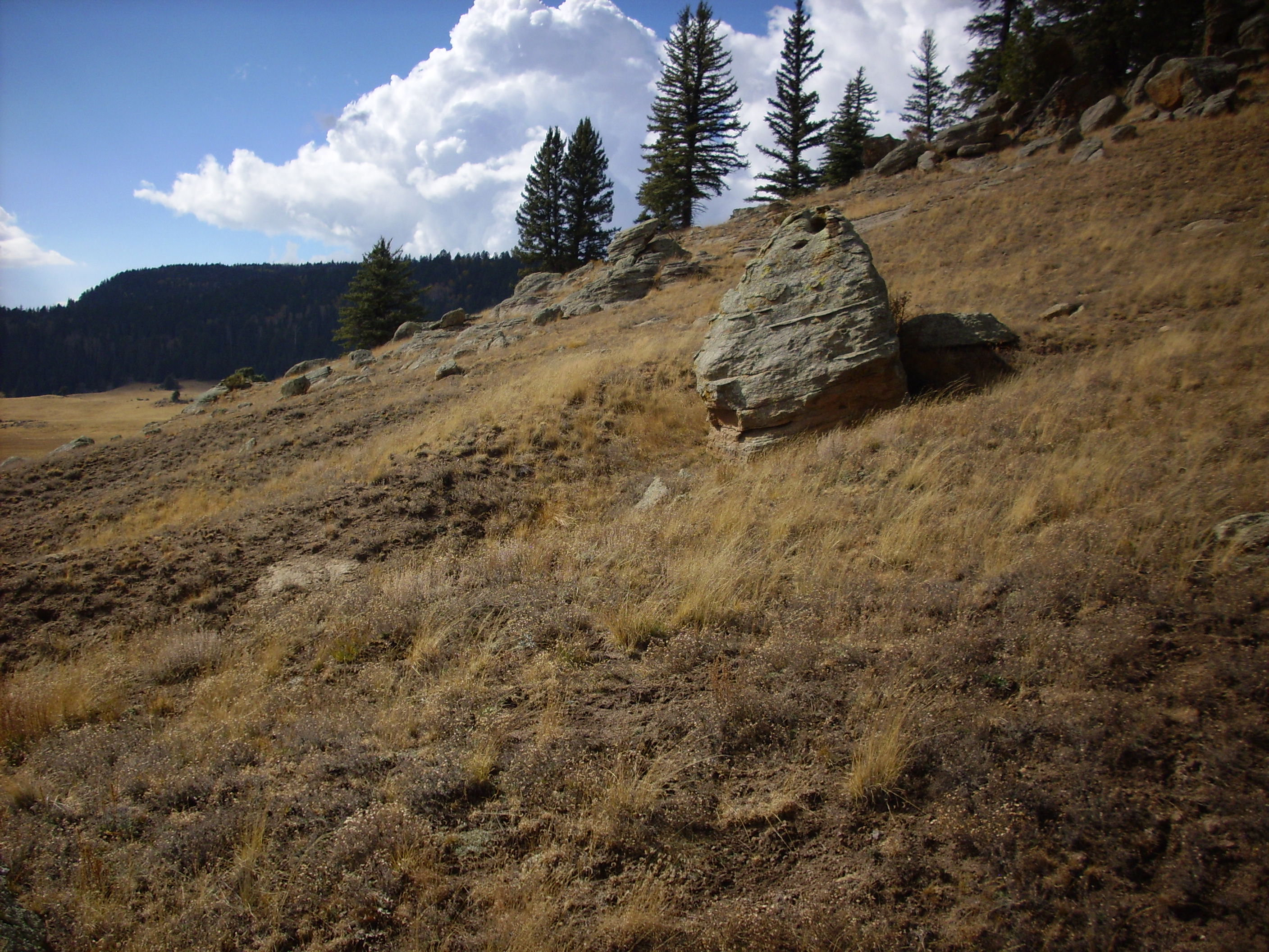
Much of the terrain around the resurgent dome is underlain by
thick sequences of debris flows. For example, much of the ridge
north of Valle Jaramillo is underlain by debris flow deposits.
Debris flow near Valle Jaramillo. 35
54.921N 106 29.955W
The mass of boulders on the ridge is the tip of a debris flow. Here this consists mostly of large boulders of intracaldera Tsherige Member, Bandelier Tuff. This likely eroded off the resurgent dome as it rose.
Here's another debris flow on the valley floor.
Debris flow on floor of Valle Jaramillo.
35
54.792N 106 30.581W
Most of these exposures are lag deposits,where the matrix and finer gravel has been eroded away, leaving the larger boulders. Pristine debris flow exposures are harder to come by, but there is a pristine exposure in a road cut on the saddle between Valle Jaramillo and Redondo graben.
Pristine debris flow deposit. 35
54.093N 106 33.048W
Numerous blocks of mostly pre-caldera rocks are cemented together
by an ash-rich matrix. There was enough silica in the ash to
ensure that this deposit was well cemented, so that this exposure
is quite solid rock, and not the loose colluvium it appears to be
at first glance.
The Valles panorama near the start of this chapter show Cerro
del Medio, the oldest and largest of the ring fracture domes
in the caldera, to the northeast of Redondo Peak. Other domes can
be seen in the distance between Cerro del Medio and Redondo.
The ring fracture domes are circled in the photograph below.
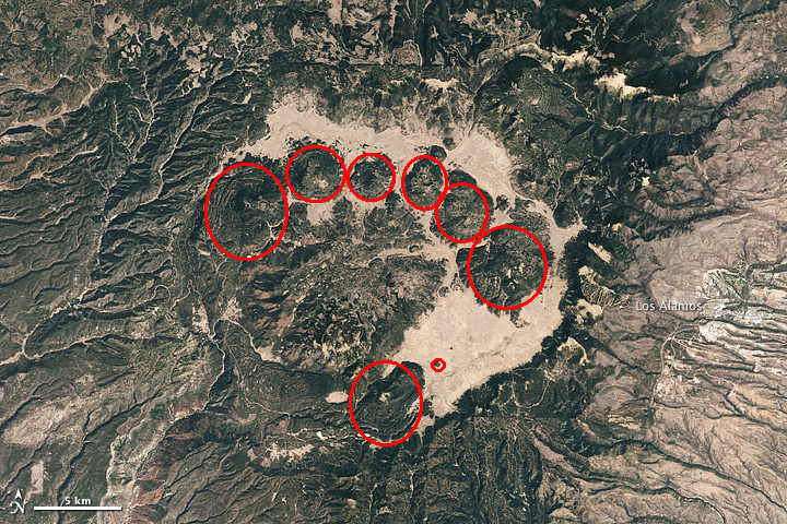
RIng fracture domes in Valles Caldera
Unlike the Redondo Peak resurgent dome, which consists of existing rock pushed up by the injection of fresh magma below, these smaller domes formed from freshly erupted magma that seeped up through the ring fracture. This magma was high in silica but low in dissolved gases, so it erupted relatively gently. Significant quantities of pumice were erupted that are now found scattered throughout the Los Alamos area. Much of the lava that erupted was so high in silica and low in water vapor that it formed obsidian flows.
It may seem peculiar that an eruption though the ring fracture would be concentrated at individual vents. This is actually very typical of eruptions along a long fissure. Eruptions in Hawaii sometimes begin with a "curtain of fire" spread along a fissure, but the eruption quickly concentrates at a single vent. This is because the lava cools quickly to plug the narrower parts of the fracture, forcing more lava through the wider parts, which are eroded and made even wider by the passage of the lava. The same process took place in the Valles caldera.
Geologists do not believe that the Valles and Toledo eruptions
and the subsequent dome eruptions came from a single long-lived
magma body. Rather, the evidence from subtle differences in
chemistry is that each eruption came from a separate batch of
magma formed from freshly melted crust that entered the magma
chamber.
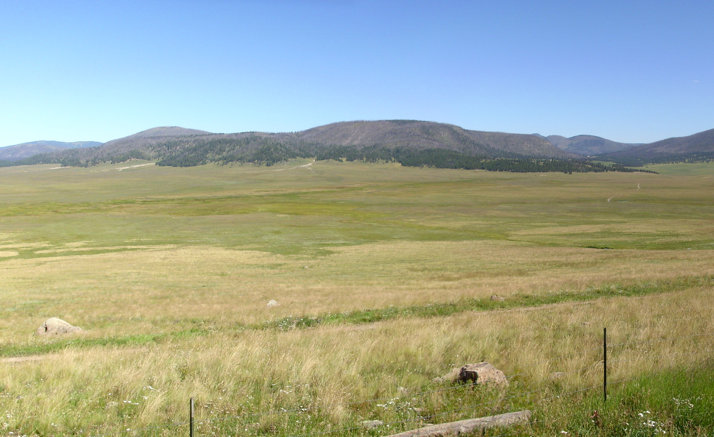
The valley between these domes and the north rim of the caldera is sometimes described as the northern moat. Here's a panorama from the north rim:

At far left is Polvadera Peak, and to its right is the north rim
of the Toledo Embayment. Tshicoma Peak just peeks over the should
of Cerro Toledo, then comes Turkey Ridge across the mouth of the
Embayment. To its right is Valle Toledo, with Cerro Posos at the
southeast end of the valley, To its right, on the skyline, are
Pajarito Mountain and Cerro Grande. These two mountains form part
of the eastern rim of the caldera. A thin sliver of Valle Grande
is visible at their feet. Cerro del Medio is at the south end of
Valle Toledo, and Cerros del Abrigo lies along the southwest of
Valle Toledo. If you click to get the full resolution image, you
can just make out Pipeline Road running in front of Cerros del
Abrigo. This road follows the natural gas pipeline from the Cuba
area to the city of Los Alamos. A narrow valley separates Cerros
del Abrigo from the Cerro Santa Rosa complex, with part of Valle
Grande, the south caldera rim, and Sandia Crest visible in the far
distance along the narrow valley.
The mass of hills in the middle distance at center is Cerros de
Trasquilar. Above the narrow valley between Cerros del Abrigo and
Cerros de Trasquilar is another distant view of Valle Grande, and
beyond that, the south caldera rim, with Sandia Crest west of
Albuquerque in the far distance.
To the right is Valle San Antonio, with Redondo Peak beyond. Just
northwest of Redondo Peak is Redondo Border, while north of
Redondo Peak is Cerro San Luis. To its west is Cerro Seco and San
Antonio, with the caldera west rim and the Sierra Nacimiento
beyond. At far right in the middle distance is Cerro de la Garita
on the caldera north rim.
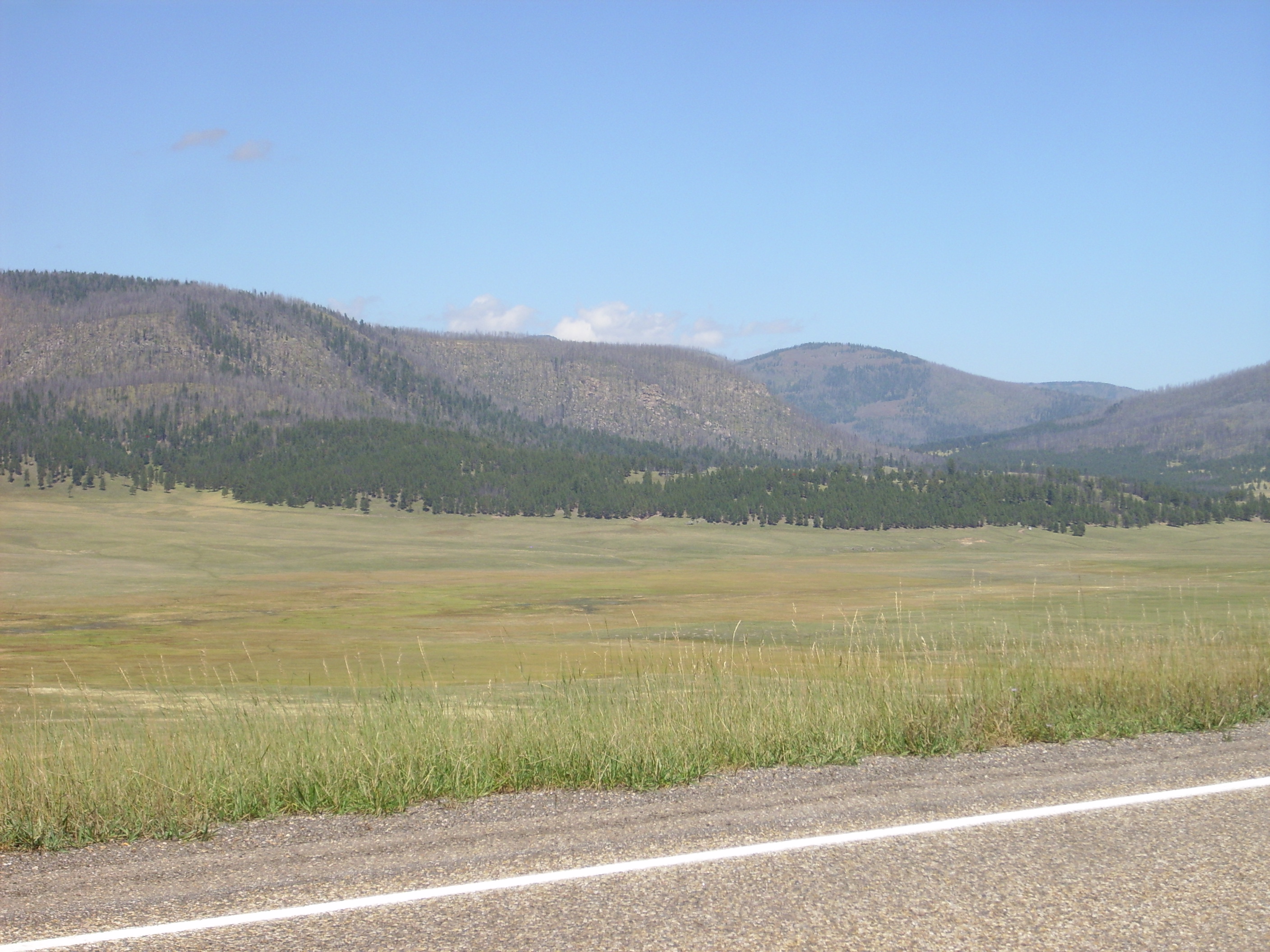
The second panorama is from a point a little further east.
North moat of Valles Caldera. 35
59.995N 106 29.540W
The weather is muddier and there is a shoulder of the north rim
blocking some of the view west, but this gives a better view into
the Toledo Embayment. And the fall colors are lovely.
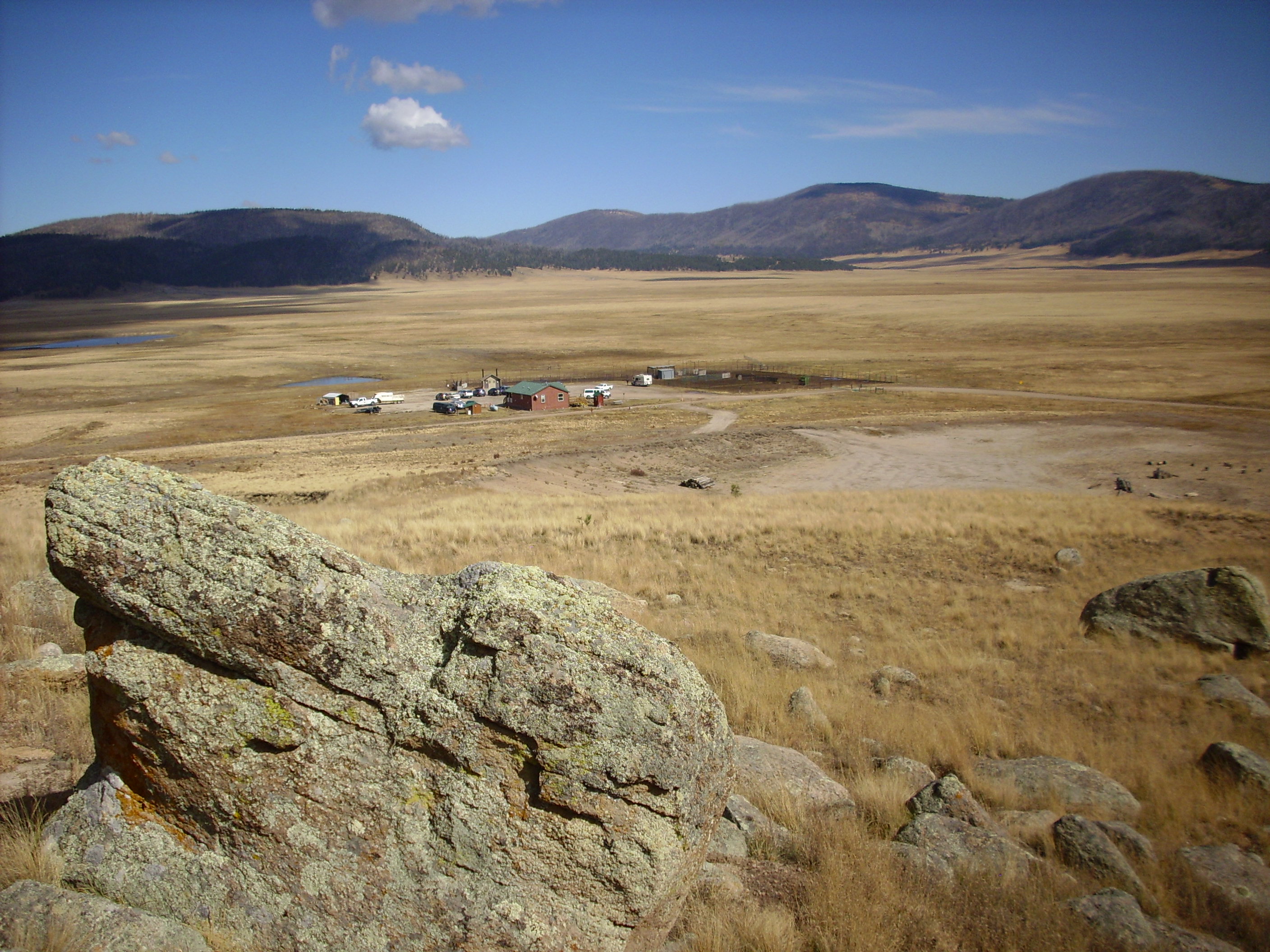
There is apparently good fishing in the creeks in the north moat. When I spoke to the Valles National Preserve staff at the headquarters about touring the geology of the north moat in 2015, the best they could offer was to sell me a fishing permit that would give me access to the north moat. The Preserve has since moved to a different use model, and I was able to get a back country vehicle pass to take many of the photographs in this book.
The domes did not erupt all at the same time. Cerro del Medio
erupted about 1.17 million years ago, very shortly after the
Valles caldera eruption, and there is a steady progression in age
counterclockwise around the ring fracture: Cerros
del Abrigo at 0.97 million years, Cerros
de Trasquilar at 0.93 million years, Cerro
San Luis and Cerro
Seco at 0.80 million years, San
Antonio Mountain at 0.56 million years, and South
Mountain and Cerro
la Jara at 0.52 million years.
Cerro del Medio was the first of the ring domes to erupt, at around 1.17 million years ago. The first eruptions were pyroclastic flows exposed along the Valles Preserve road west of Cerros del Abrigo.
Cerro del Medio early pyroclastic flow.
35
55.332N 106 30.219

A very pretty lithic tuff, exposed in a borrow pit.
There were at least six subsequent pulses of activity, building up a low dome of considerable size.
Cerro del Medio. 35 51.099N 106 27.312W
Cerros del Medio is centered in this short panorama, with Cerros del Abrigo looking over its left shoulder and the east rim of the caldera to its right. The dome has a lower aspect (height to width) than the later domes, suggesting the lava was less viscous, perhaps because it was hotter or richer in volatiles in this early eruption than those that followed.
Here's a closer view of the southeast part of the dome, showing the rugged exposures of rhyolite:
Southeast face of Cerro del Medio.
Looking north from 35
50.999N 106 27.915W
This shows just how steep a rhyolite flow can become (a high-aspect flow) due to the extremely high viscosity of rhyolite magma.
The road to the north moat skirts the western edge of Cerro del
Medio. Here the devitrified obsidian beds of the earliest dome
flows are exposed.
Devitrified obsidian flows. 35
54.655N 106 29.102W
This part of Cerros del Medio has been radioisotope dated as 1.21 million years old. The beds also show no distortion, in spite of the fact that they nearly lap onto the edge of the resurgent dome. It is this observation that leads us to the conclusion that the resurgent dome formed very quickly after the caldera eruption: If resurgence was still taking place after these flows were erupted, they should show extensive faulting or other disturbances.
Cerro del Medio is particularly noted for its many prehistoric obsidian quarries. Obsidian can still be found in the area.
The rock contains numerous spherulites, some of which have not yet devitrified from obsidian. There are also bits of obsidian in the nearby roadbed, such as this one.
This sample is about three inches across.
Large boulders of only partially devitrified obsidian are found
around the north flank of Cerro del Medio an in "Obsidian Valley",
the valley between Cerro del Medio and Cerros del Abrigo.
Partially devitrified obsidian boulder. 35.9292375N
106.4501922W
There are impressive clasts of obsidian in the bed of the old ranch road in this area.
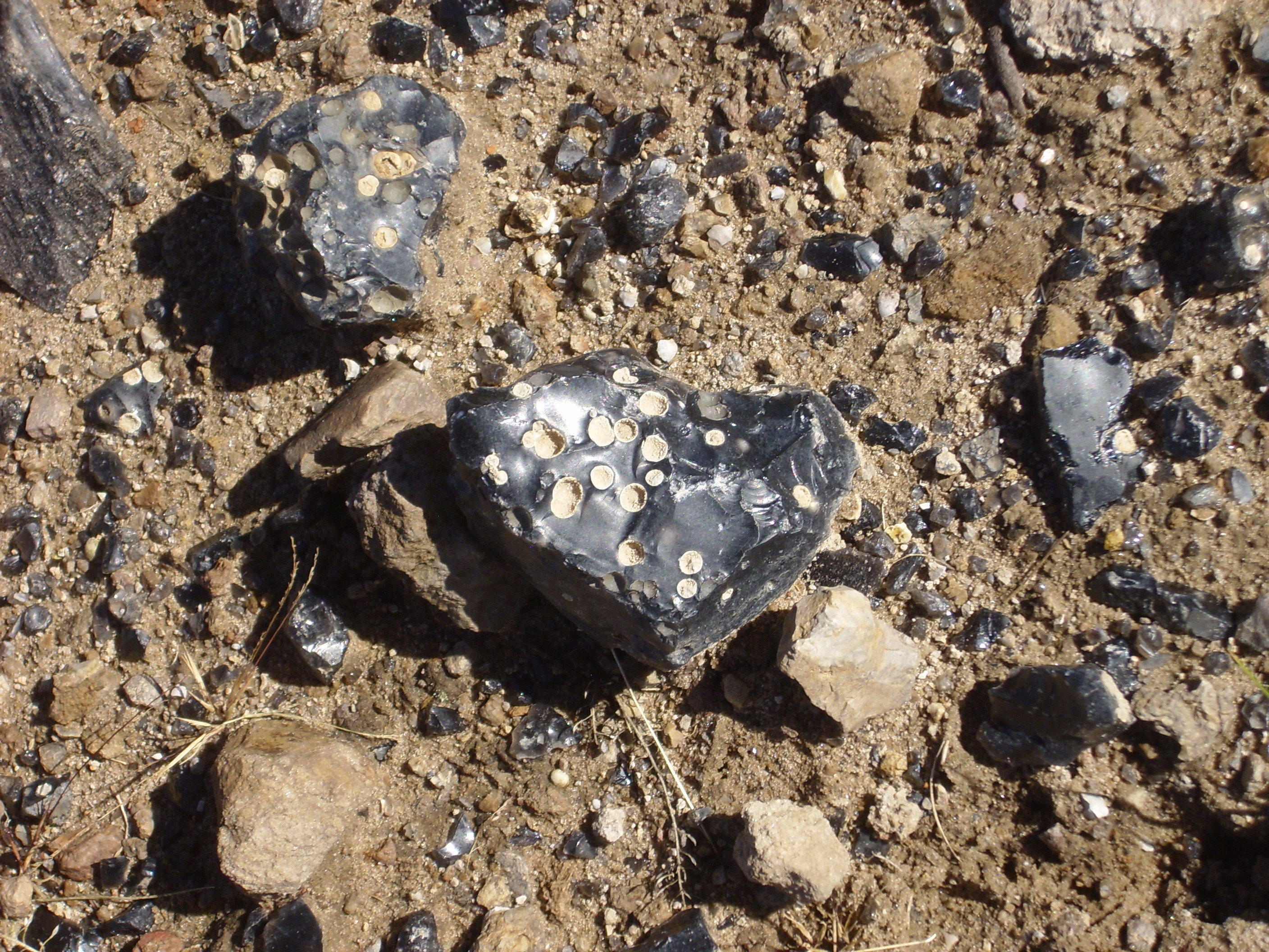
Spherulitic obsidian clast. 35.9313543N
106.442922W
This is a particularly nice specimen of spherulitic obsidian that
has not devitrified.
The next dome complex is Cerros
del Abrigo with a radiometric age of 0.97 million years.
Cerros del Abrigo viewed from the southwest. 35.887137N
106.5007917W
Cerros del Abrigo viewed from the west. 35
54.848N 106 30.333W

Cerros del Abrigo viewed from the south. 35.9170376N
106.478372W
This dome is much steeper than Cerro del Medio, suggesting the magma from which it formed had become significantly more viscous over the 200,000 years separating its eruption from that of Cerro del Medio. On the other hand, the dome was built up from four eruptive pulses, and the first produced significantly lower-aspect flows than the later flows. These rhyolite flows are exposed along the trail up to the dome.
Outcrop of rhyolite of Cerros del
Abrigo. 35
55.072N 106 29.591W
This is typical of the Valles Rhyolite, rich in phenocrysts of feldspar and quartz in a light, highly vesicular groundmass. The Valles Rhyolite also takes the form of massive, flow-banded rhyolite, such as this sample from further up the dome.
There is some confusion in terminology for the next dome complex. Geologists use the name Cerro Santa Rosa for the main dome complex and Cerros de Trasquilar for the small dome to the north that appears to be part of the complex, but has been shown to have a significantly older radiometric date. However, the topographic map for this area reverses the name, using Cerros de Trasquilar for the entire complex, Cerro Santa Rosa for a large dome at the north of the complex but south of the moat, and assigning no name to the the small dome to the north of the moat.
Cerros de Trasquilar. Looking north from 35 55.494N 106 30.294W
This dome complex is 0.93 million years old, only slightly younger than Cerros del Abrigo. Geologists recognize two eruptive pulses for this dome.
The next two dome complexes erupted at almost the same time, both
having radiometric ages of 0.80 million years.
Serro San Luis. Looking south from 35
58.319N 106 32.351W
Serro San Luis was built up in two pulses of activity. On its northeast flank, it rests on ignimbrites from the older Santa Rosa dome complex.
On its west flank, flows of Serro San Luis fill a paleovalley in older debris flow and lake terrace deposits.
Cerro Seco is also 800,000 years old, and was built up from at
least two pulses of activity.
Cerro Seco. Looking southwest from 35
58.327N 106 33.638W
The massive flows rest on pyroclastic beds that include
hydromagmatic beds, showing that the caldera floor in this
vicinity was covered by a lake at the time of the first eruptions.
The westernmost ring dome is San Antonio Mountain.

San Antonio Mountain. Looking southwest
from near 35
58.359N 106 35.013W
The mountain lies atop Deer Creek Rhyolite and Redondo Creek
Member, which we have already seen exposed in the Sulfur Creek
valley. Unlike the previous dome complexes, this one produced no
known pyroclastic flows, being built up from two main pulses of
activity plus a possible smaller pulse of activity.

Sulfur Point. Looking west from near 35
54.568N 106 36.682W
This is Sulfur Point, a possible smaller eruptive center of the
San Antonio Member of the Valles Rhyolite, located on the south
flank of San Antonio Mountain.
San Antonio Mountain is also accessible from the west side, along San Antonio Valley, which lies mostly on National Forest lands.

San Antonio Mountain. Looking east from
35
54.570N 106 39.844W
San Antonio Mountain is at center, with the prominent cliffs on the east rim of San Antonio Canyon across the frame. The distant mountain on the skyline at left is Cerro Pelon on the La Grulla Plateau.
There are accessible exposures of the rhyolite of San Antonio
Mountain in the area around San Antonio Springs. Some larger
boulders of this rock are visible along the trail leading to the
springs, which are a popular bathing site for tourists.
San Antonio Rhyolite boulders along
trail to San Antonio Springs. 35
56.464N 106 38.783W
You can see flow banding in these rocks. Here's a sample shard
from along the trail.
Like most rock assigned to the Valles Rhyolite, this is a light
vesicular rhyolite with numerous visible quartz crystals.
The next ring dome is South Mountain, which nearly fills the southern moat southeast of Redondo Peak. South Mountain erupted about 520,000 years ago, with four pulses of activity recognized by geologists. The earliest flows filled a paleovalley nearly coincident with the current East Fork Jemez River valley, and, as with the other ring domes, later eruptions were of a more viscous lava that built domes close to the source vent.
South Mountain. Looking northwest from 35 49.438N 106 29.989W
South Mountain and Cerro la Jara viewed
from the northwest. 35
50.198N 106 33.135W
In this panorama, Cerro del Medio is visible beyond the trees at left; beyond it is the caldera east rim. The small, isolated hill is Cerro la Jara, with South Mountain to its right in the foreground.
South Mountain Rhyolite can be seen in spectacular exposures north of State Road 4 at Las Conchas. Here the East Fork Jemez River has incised a canyon in the flows.
The flow in this area is the second of four flows erupted from
the South Mountain vent, and a sample from near this location
yielded a radiometric age of 520,000 years.
Notice how the river has undercut the cliffs.
The vertical cliffs here are favored by local rock climbers.
State Road 4 cuts through the flow just west of Las Conchas,
The pink rock at right is most typical of the South Mountain Rhyolite.
The darker rock to the left is an unusual glassy patch of South
Mountain rhyolite, full of small beads of obsidian that give it
its darker color. It is identified as a pyroclastic flow deposit
in one guide to the area.
Up river, near a favored climbing location called Easy Bake Alcove, there is evidence of autobrecciation.
State Road 4 road runs south of South Mountain and Banco Bonito, and Forest Road 10 branches off south into the Valle de los Indios between Banco Bonito and the southern caldera rim.


This outcropping probably came from the same flow seen at Las
Conchas. Most of South Mountain is in the Valles preserve and off
limits for collecting, but this outcropping is located on a right
of way just outside the preserve. It closely resembles the sample
of San Antonio Rhyolite we saw earlier.
The Valles Preserve offers a short hike around Cerro La Jara. This is a small volcanic
dome well out on the caldera floor, close to the visitors center,
and hiking around it takes about an hour if you explore a little
on the way. Since this hike is an excellent introduction to the
geology of rhyolite domes, it's worth describing the hike in some
detail here.
First, the view from the visitor's center:
That's Cerro La Jara in the background. It may not look like much, but that's because you don't realize until you get up close that the trees are yuuuuge. The trail crosses the caldera floor, which is infested with badger burrows. I didn't think to take a picture. Think gophers on steroids.
Like the other ring fracture domes, Cerro La Jara formed from
very high-silica lava that oozed out of the ring fracture. Cerro
La Jara is virtually the same age as South Mountain, 530,000
years, and was formed from a single eruptive pulse.
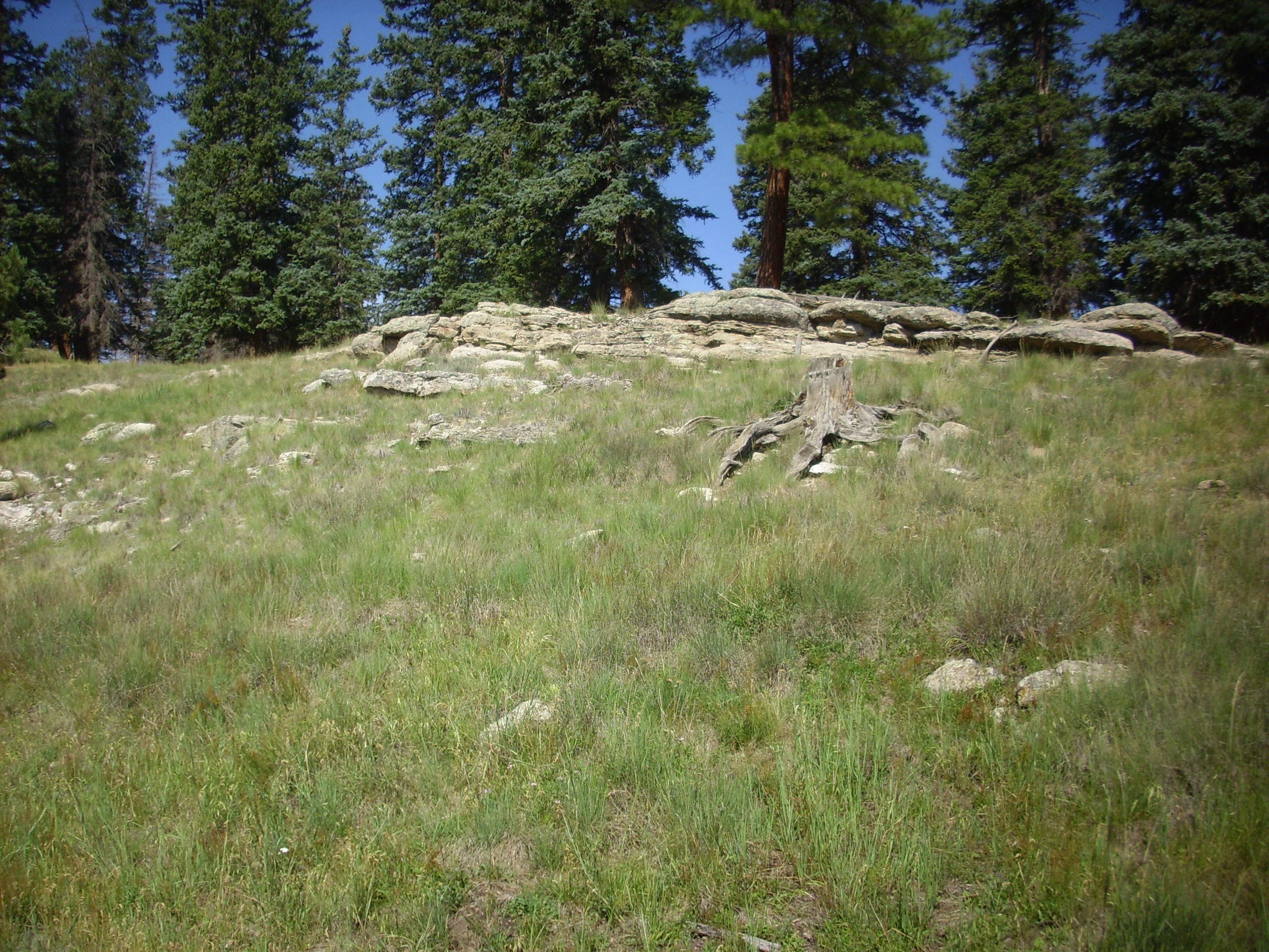
Here you see some rhyolite boulders on the slope of the dome. The layers of lava are clearly visible under all the lichen. Such flow banding is a frequent feature of rhyolite flows.
A view back to the visitor's center from atop that knoll,
showing part of the Valle Grande from a different angle.
The mountains on the skyline to center and right are the Sierra
de los Valles. All are underlain by Tschicoma Formation dacites
and rhyodacites. The rounded peak to the right is Cerro Grande,
and at center is Pajarito Mountain. The nearer mountain on the
left is Cerro del Medio, the youngest of the ring fracture domes.
The forested area extending southeast of Cerros del Medio is one of the oldest flows from this vent and has been very precisely dated as 1.21 million years old. This was just 40,000 years after the Valles event. However, most of Cerros del Medio is younger than the southern and western flows, with an age of about 1.17 million years.
Here is a close up of the rhyolite, with a quarter dollar for scale:
It looks a lot like Bandelier Tuff, which is not surprising given that the composition is almost exactly the same. However, rhyolite is much harder, since it formed from liquid lava rather than from a cloud of partially solidified lava fragments.
Or, at least, it may have formed from liquid lava. As I
mentioned in earlier chapters, there's a school of thought that
rhyolite like this is really just extremely densely welded tuff.
Here's some boulders sticking up above the southern side of the dome:
It's interesting that the layers in the rock almost match the
slope of the ground.
This shot shows an eroded cliff face on the south side of the dome:

You can see the many layers of flows and their inclination around a central axis. If these were sedimentary beds, this would be described as an anticline; I'm not sure the term is appropriate in vulcanology.
Extremely viscous rhyolite magma could not have formed such thin
flows by extruding from a vent. The dome is clearly an endogenous
dome, such as I described earlier in the book. The dome grows from
magma injected into its interior from a vent, with a semisolid
layer near its surface that is stretched into thin layers as the
dome expands. The outermost surface of the dome was originally
mantled with solid rhyolite debris, long since eroded away.
The amenities:
This hike was a unique experience in that I was not only not told to stay on the trail, but was actually encouraged to avoid any kind of trail. The Valles Preserve doesn't want a beaten path here. On the down side, this meant some stickers in my socks. People being how they are, you can see that a faint trail is starting to be beaten into the grass at the left.
Older geologic maps of the Los Alamos area show almost the entire town site underlain by Tsherige Member, Bandelier Tuff. This is not wrong, but construction in the town often exposes thinly bedded deposits of pumice and sediments overlying the Tsherige Member. These are mapped on the most recent geologic maps as "old alluvium", and they have been informally named the Golf Course Alluvium, since these beds are particularly thick at Los Alamos Municipal Golf Course. A superb and easily accessible exposure is found in a driveway cut for the Caballo Apartments complex on Canyon Road in Los Alamos.
Golf Course Alluvium. 35
52.996N 106 18.681W
The Golf Course Alluvium has been interpreted as a fluvial
deposit from before the current system of canyons was incised in
the Los Alamos area. The sediments include considerable quantities
of reworked pumice erupted from the Cerro del Medio dome, which is
directly west of the golf course.
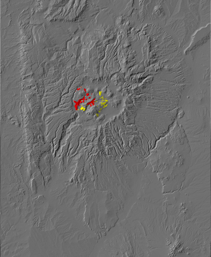
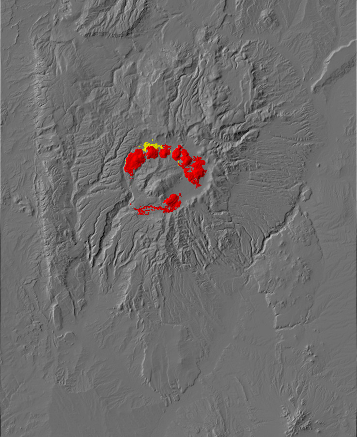
Relief map of the Jemez with lake bed deposits
highlighted in red.
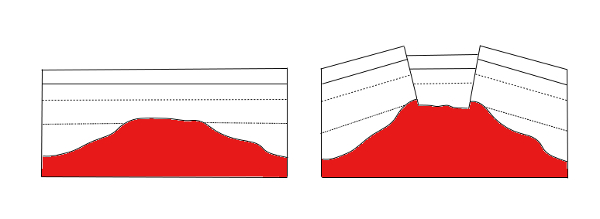
A young caldera creates a topographic depression in which meteoric water (water derived from rain or snow) can accumulate. Crater Lake in Oregon is a superb example, but Yellowstone Lake is the largest of several lakes in the Yellowstone caldera, and Lake Toba and Lake Taal are other examples of lakes in large calderas. The Valles Caldera likewise was filled by a lake shortly after its formation, which was drained after the Jemez River eroded through the rim of the caldera to form Cañon de San Diego. The lake returned at least twice when dome eruptions (of San Antonio Mountain and South Mountain) blocked the river channel. The most recent lake was formed after the El Cajete eruptions 74,000 years ago. Lake deposits are found across the caldera floor, along with phreatomagmatic tuffs like those we saw at the Warm Springs dome in the previous chapter.
The Valle Grande itself is a former lake bed, and it is the thick
layers of fine sediments that accumulated on this lake that
partially account for the lack of forest cover. Shallow-rooted
grasses are able to take hold, but the thick clay layers are
impenetrable to tree roots. Another important factor is the
tendency for cold air to accumulate in the low terrain during
times when it lacks snow cover to protect small saplings.
The lake deposits take two forms. The first are phreatomagmatic tuff beds like those we saw at Warm Dome. The other kind of lake deposit is lake bars, which are benches of sediments that once accumulated around the edges of the lake. Some of these, particularly from the earliest lakes, are well cemented, while the younger beds tend to be less well consolidated.
The first and likely deepest lake formed immediately after the
caldera collapsed. The water filling this lake was locally hot but
neither acidic nor lifeless, for freshwater diatom fossils are
found in some of the sedimentary beds deposited in this lake.
Diatoms would have thrived in the nutrient-rich water, which would
have included abundant dissolved silica from which to build their
characteristic tests. Examples of these sedimentary lake beds are
found throughout the caldera.
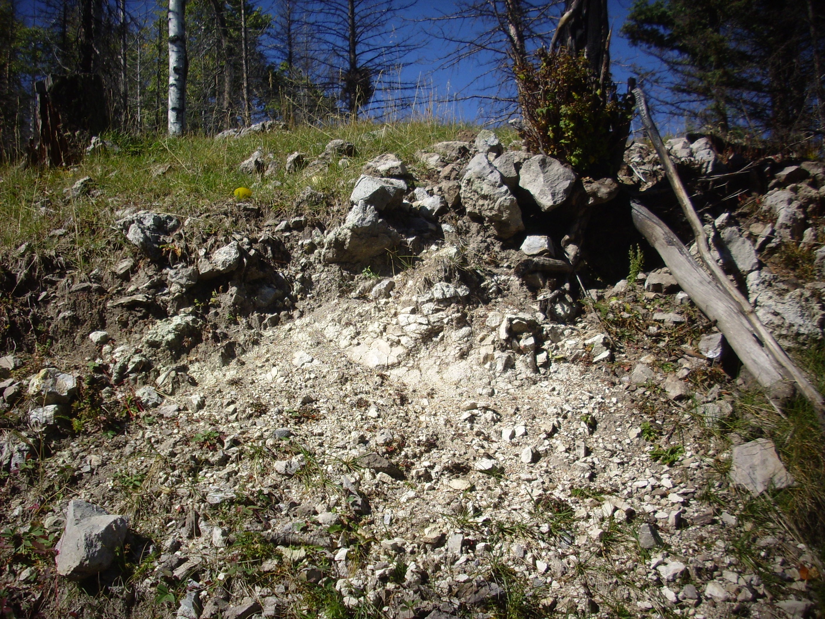
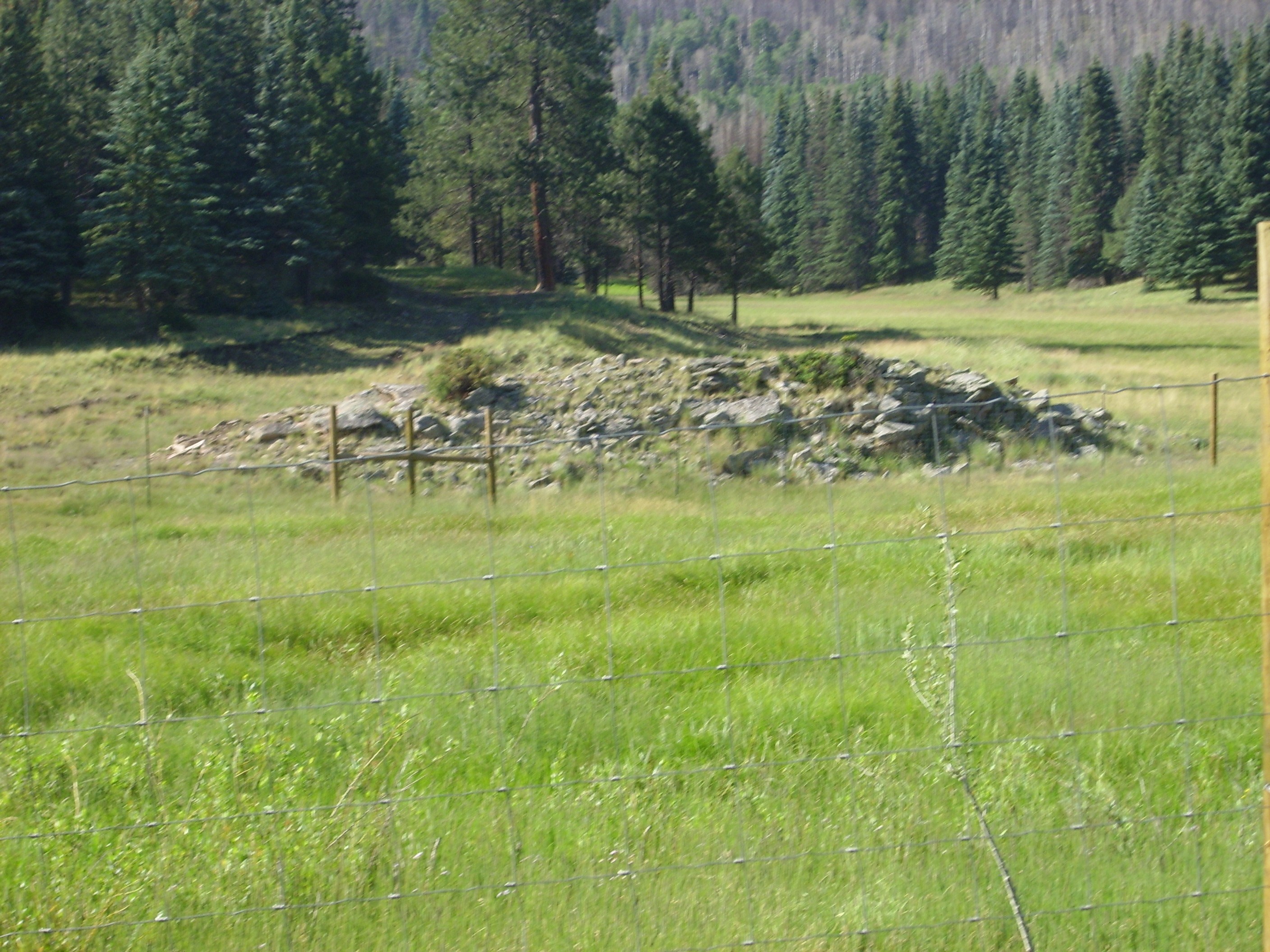
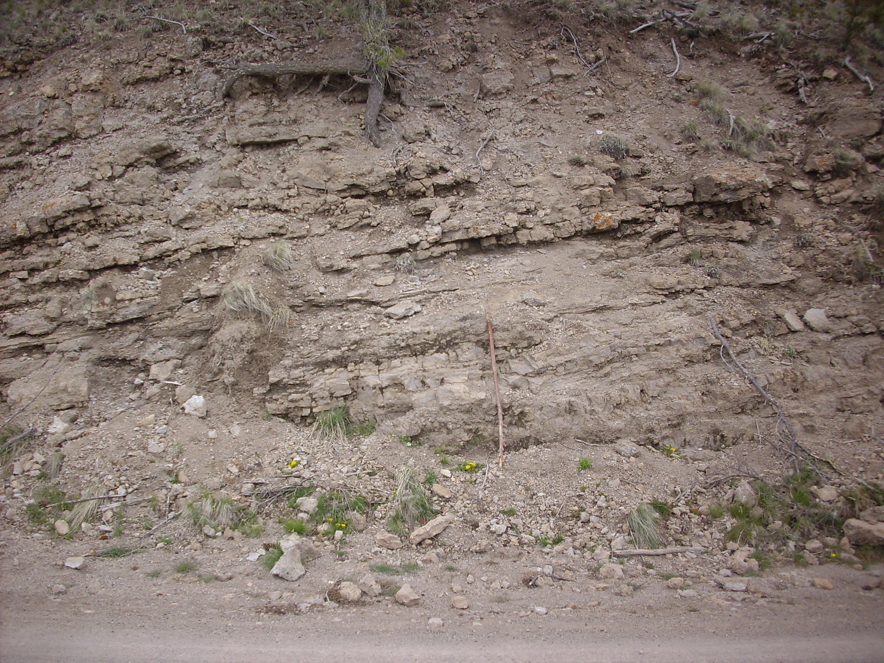
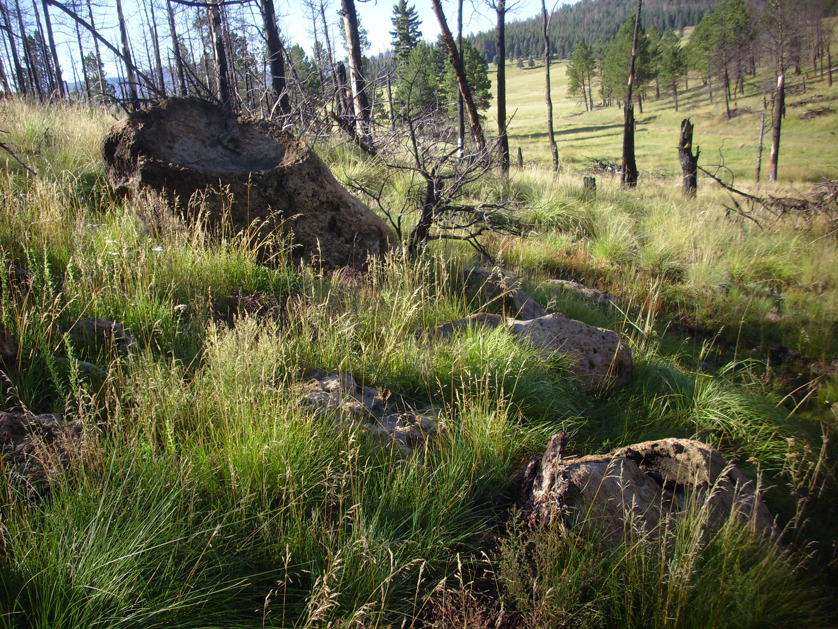
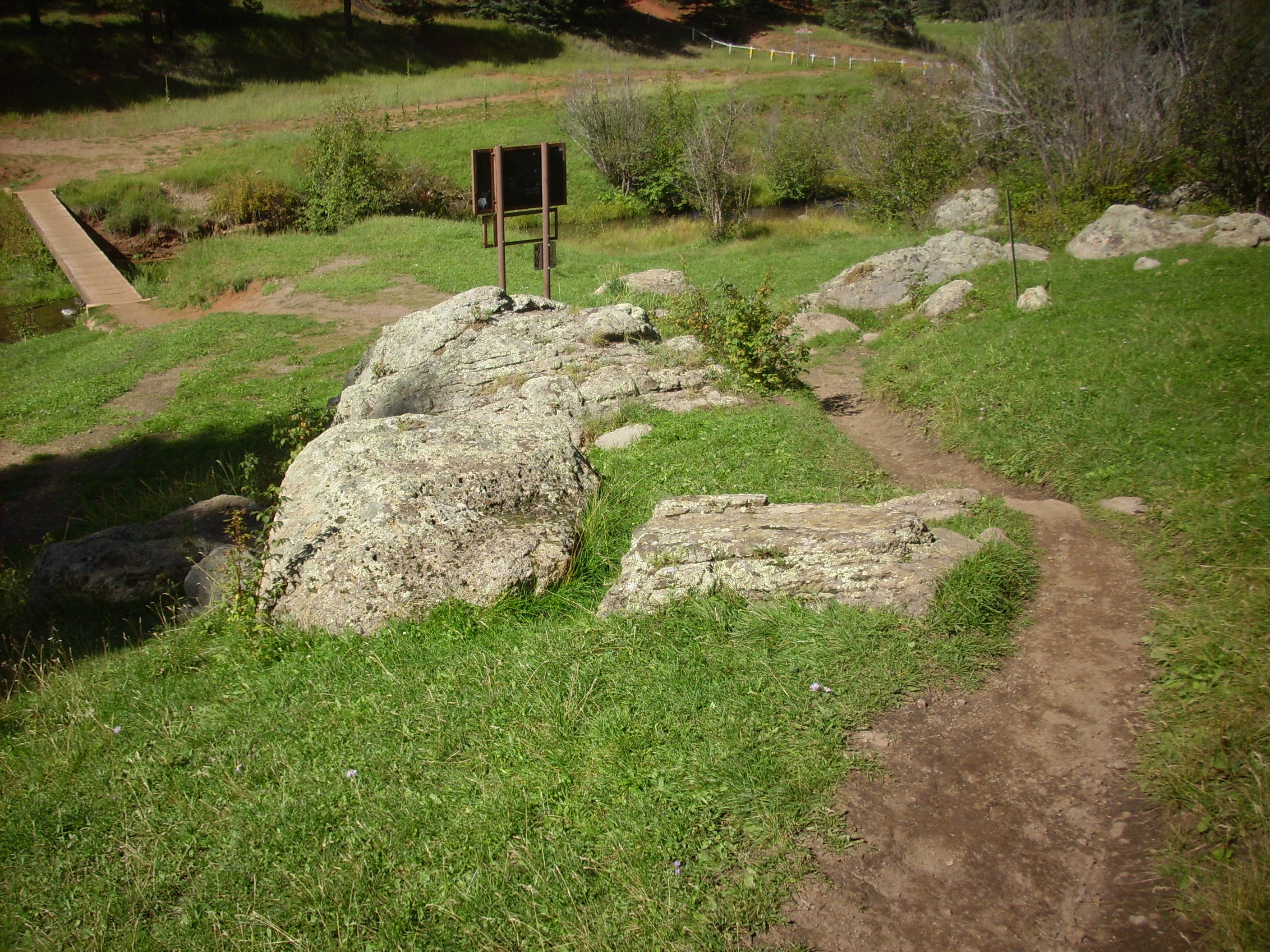
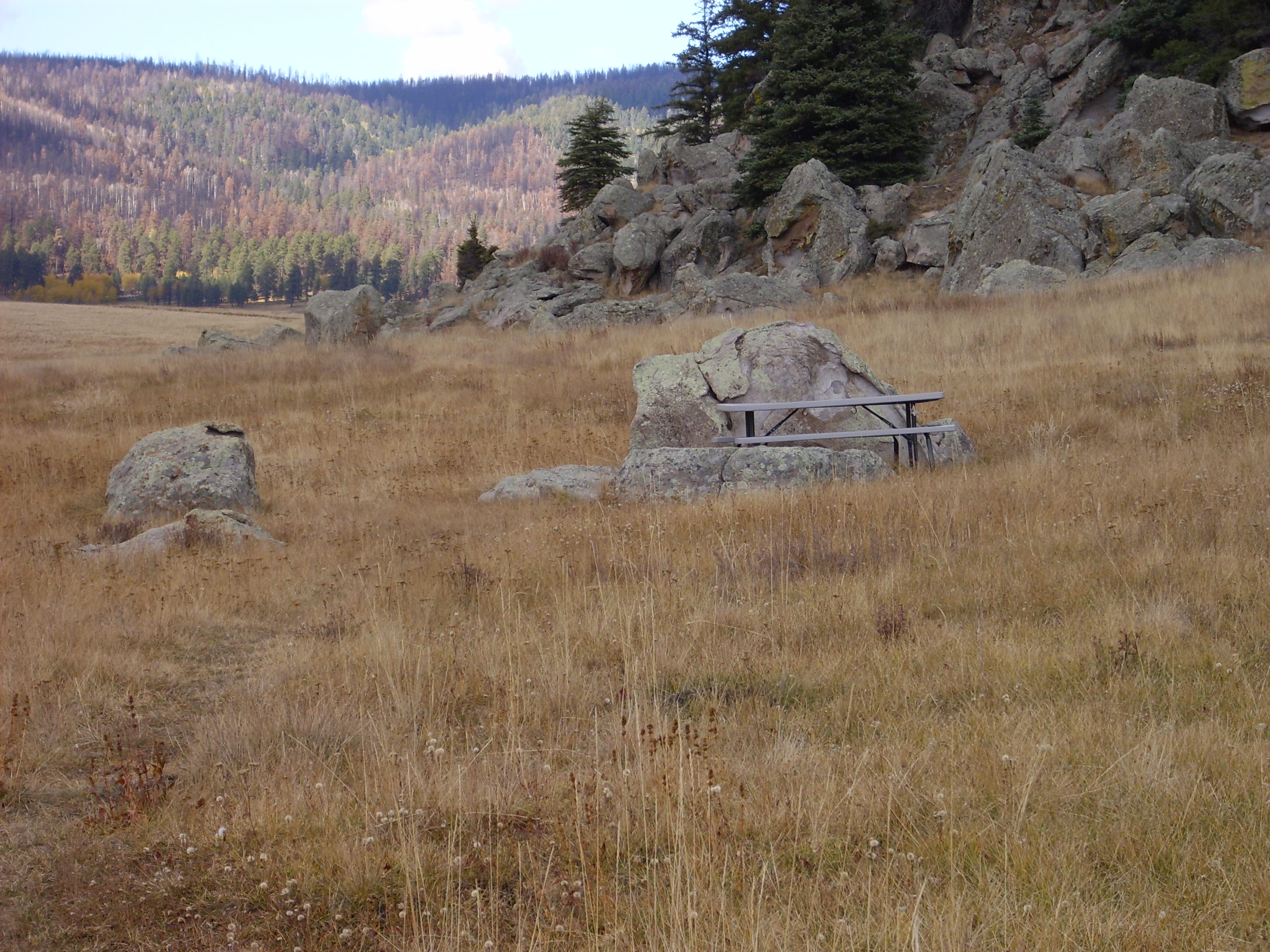
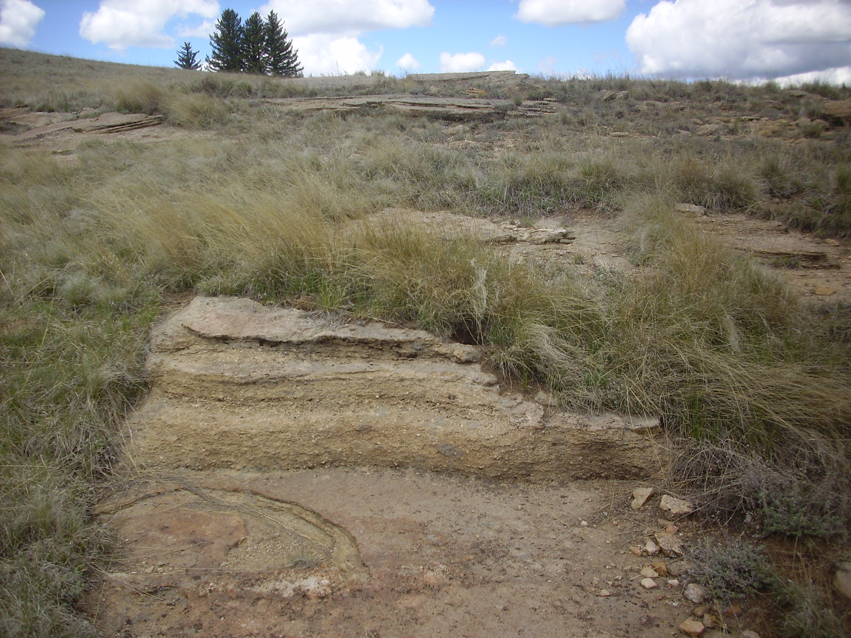
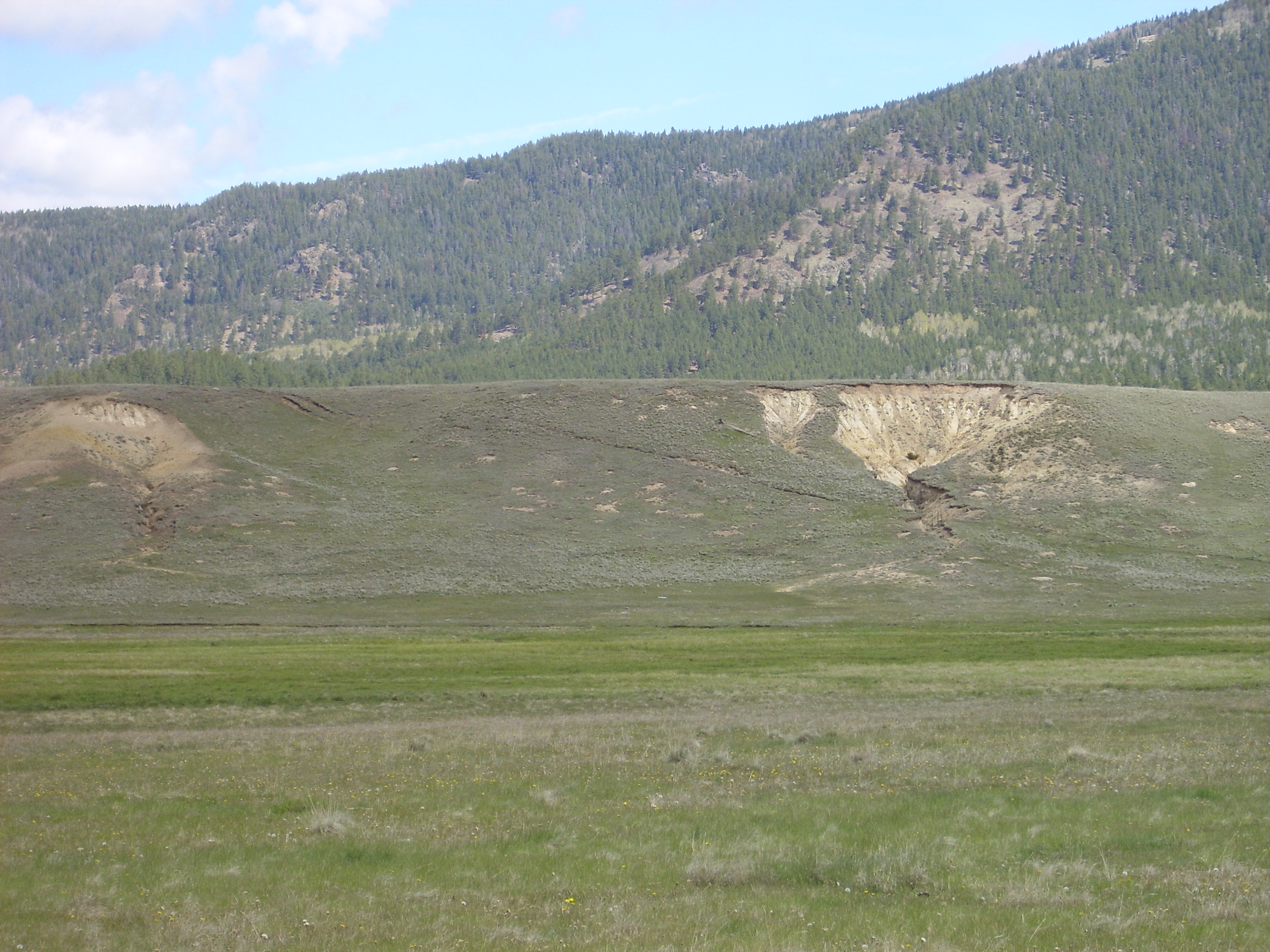
One such set of beds is found in Valle Jaramillo, next to the megabreccia block we saw earlier.

Early lacustrine beds. 35
54.626N 106 31.899W
You can see some thinly bedded layers of reworked ash at the bottom and a darker conglomerate at top. These beds remind me of nothing so much as the Abiquiu Formation. This is unsurprising, given that the Abiquiu Formation is also reworked volcanic ash, albeit much older.
These beds are thoroughly cemented. Considering that they were laid down in hot water saturated with silica, this is not terribly surprising. The beds also dip significantly to the northeast. This suggests they were laid down before resurgence was complete; that is, within 37,000 years of the Valles event.
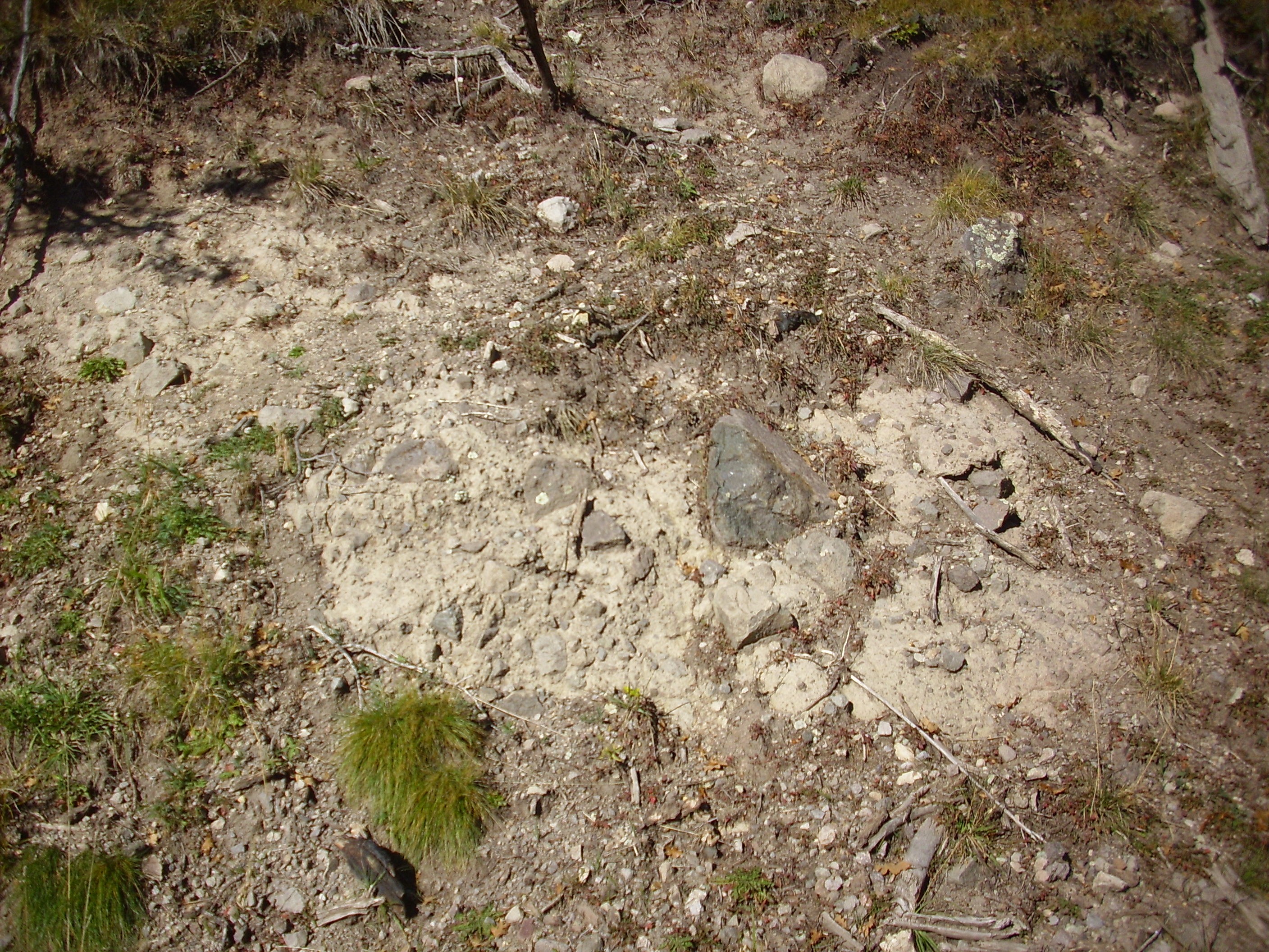
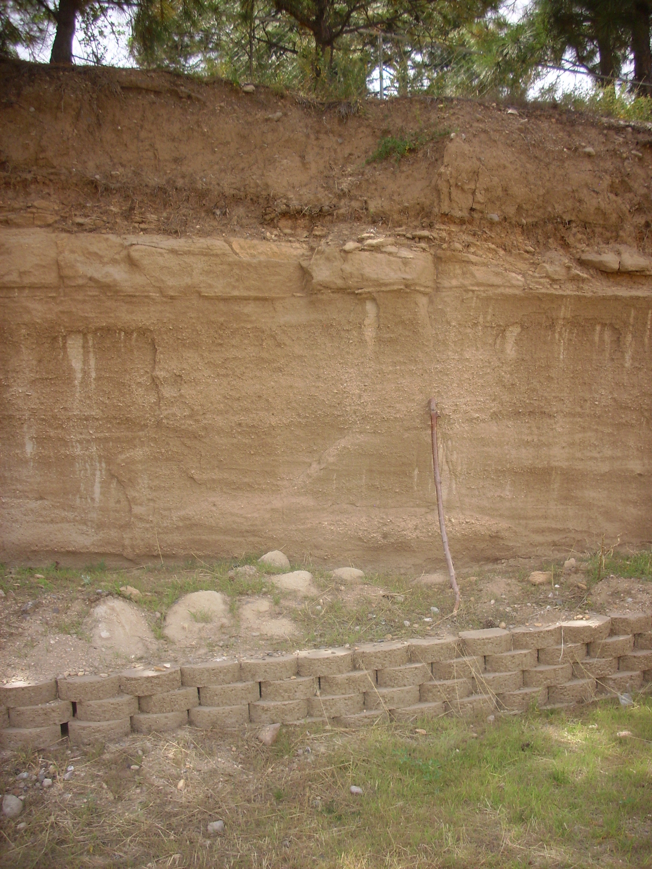
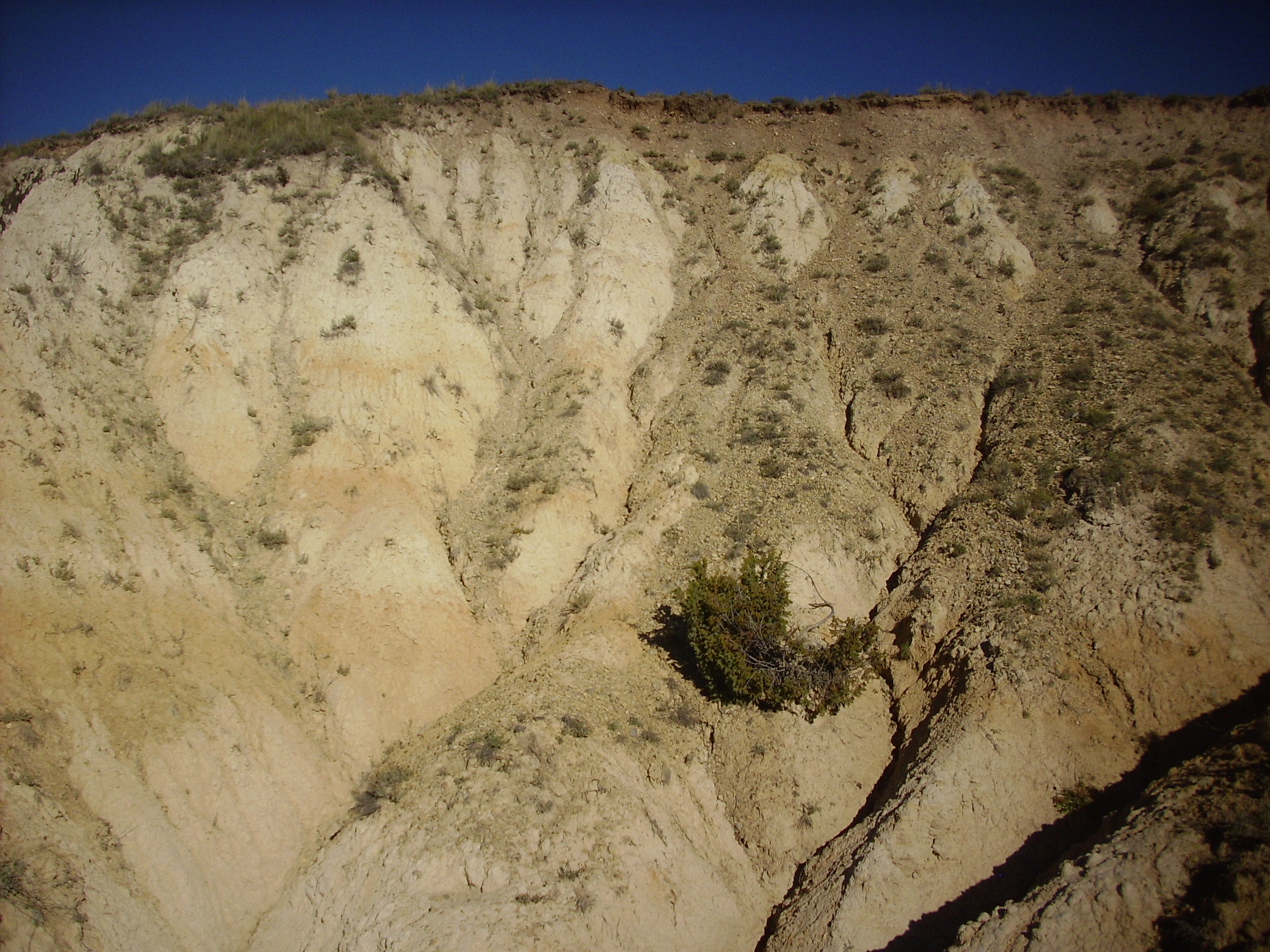
Another outcrop of early lake deposits is found in the northwest
corner of the caldera, where they are exposed along San Antonio
Creek just inside the western boundary of the Valles preserve.
Early lacustrine deposits along San
Antonio Creek. 35
57.918N 106 37.038W
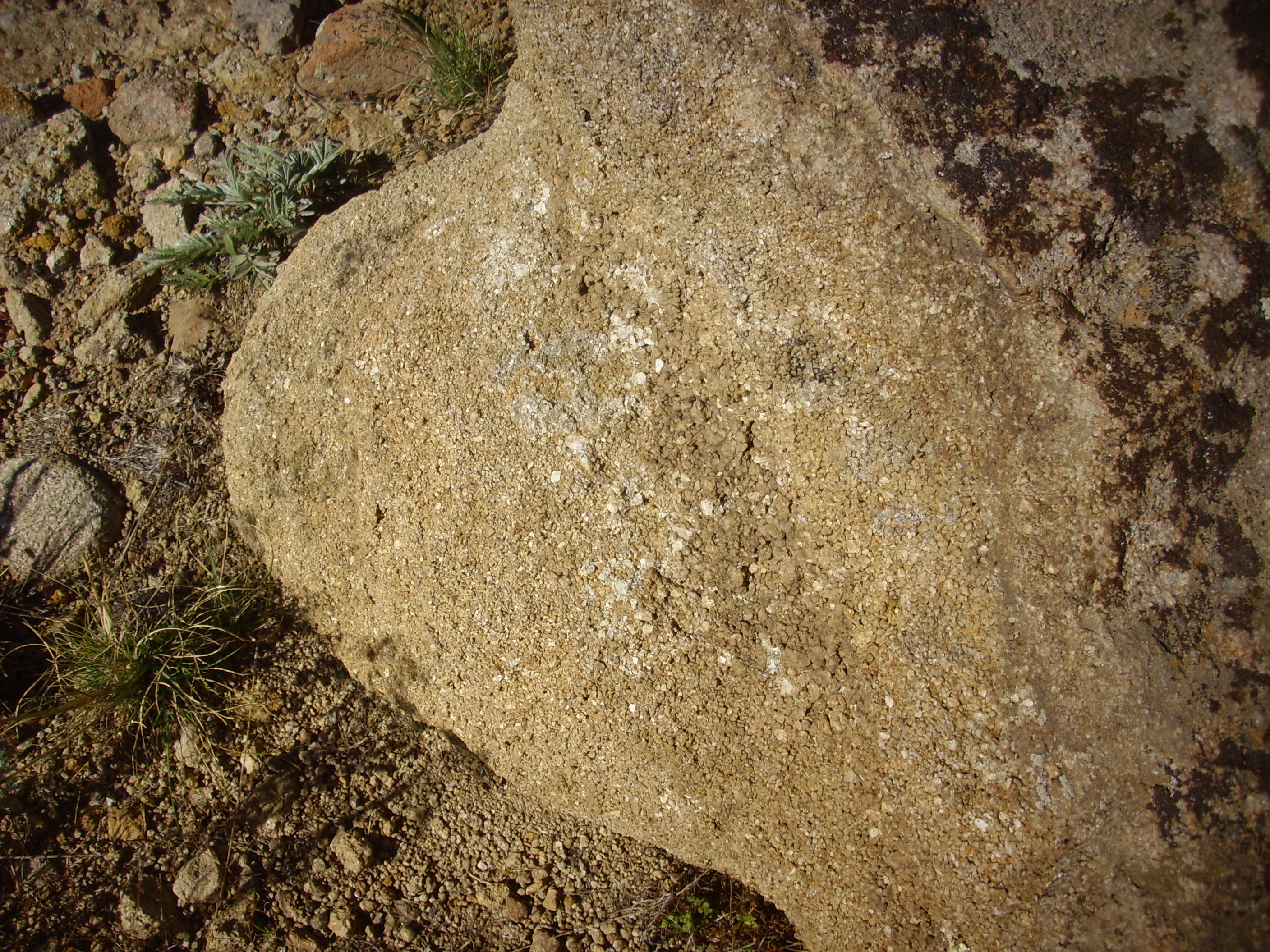
Some of the beds have the appearance of well indurated sandstone.

Some clasts are so heavily silicified that they could easily be mistaken for Pedernal Chert of the Abiquiu Formation.
Abiquiu Formation is, in fact, found nearby. A careful check of
the GPS coordinates against the geologic map is required to
confirm that this outcrop is mapped as very early lake sediments.
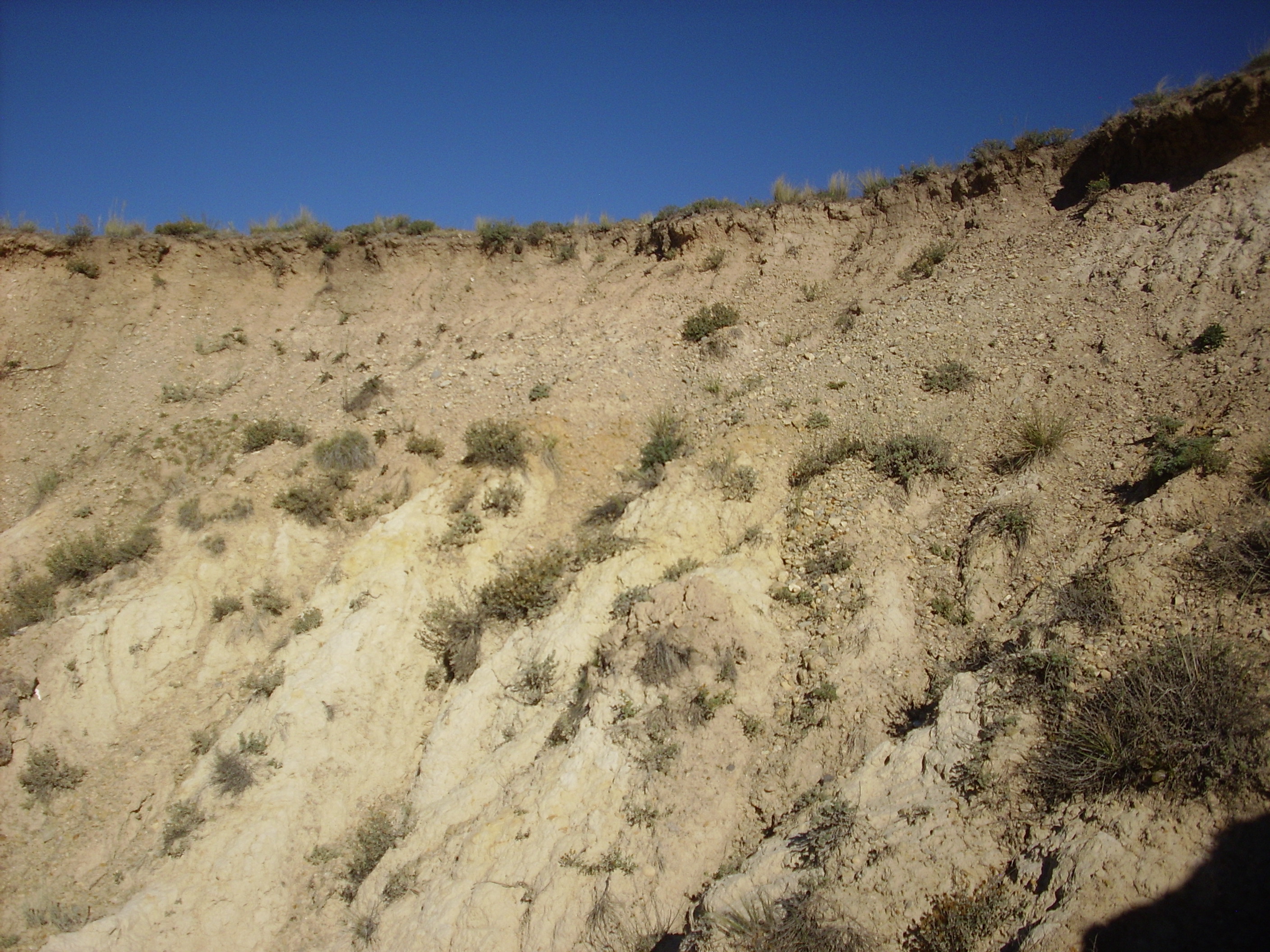
Additional beds are found south of San Antonio Creek further up
stream:
Early lacustrine beds. Looking south
from 35
58.050N 106 36.789W
The first lake was partially displaced by the rise of the resurgent dome, then mostly drained as the ancestral Jemez River cut through the caldera rim at what is now the mouth of Cañon de San Diego.
There is still active research and debate on just how deep and long-lasting the original lake was. There are indications that the lake was very deep indeed. One such is what appears to be a wave-cut bench high on the south slopes of Cerros del Abrigo.
The low bench left of center in this panorama is interpreted by
some geologists as a surface cut by waves of a crater lake. This
lake could not be older than Cerros del Abrigo, but it is
difficult to put a lower limit on its age. The current estimate is
that the lake that cut these terraces filled the caldera around
800,000 years ago and lasted over 100,000 years.
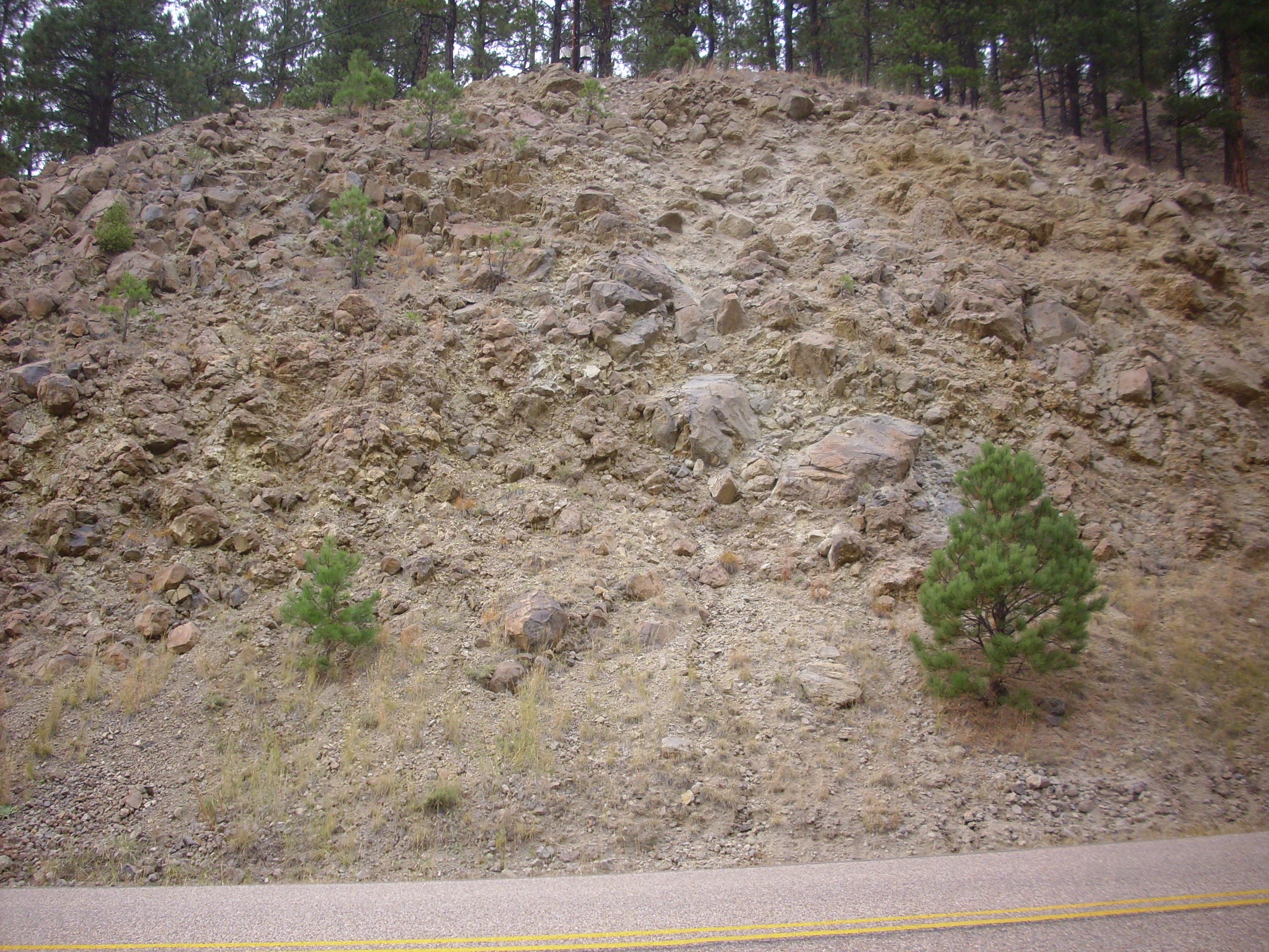
The Warm Springs dome shows indications of wave terracing on its south flank, but its north flank is partially buried in phreatomagmatic deposits from Cerro Seco. These are beds of small rock fragments produced when lavas from Cerro Seco came into contact with the lake that filled this part of the caldera 0.78 million years ago, with explosive results. The phreatomagmatic beds are well exposed on the north part of the dome. The Warm Springs dome was apparently buried in such beds, which subsequently were eroded off the south flank of the dome by San Antonio Creek.
Hydromagmatic beds on north side of Warm Springs dome. 35
58.340N 106 33.702W
The beds slope up the hill and are composed of fine bits of pumice cemented together. Because this is on the Valles Preserve, I could take no samples. However, the beds here resemble the maar beds of the Cerros del Rio that we saw in the last chapter. The chief difference is that surface water rather than groundwater was involved here, and the lava was high-silica rhyolitic magma rather than low-silica basaltic magma.
Near the top of the dome, the phreatomagmatic beds give way to
large broken pieces of rhyolite, presumably from the Warm Springs
dome itself.
Warm Springs Dome. 35
58.298N 106 33.728W
The caldera again became filled with a lake or series of stream-connected lakes with the eruption of San Antonio Mountain 560,000 years ago, whose flows ponded against the western rim of the caldera. By this time, hydrothermal activity in the caldera was diminished enough that this was likely a clear mountain lake, whose sediments were less heavily cemented by silica from the lake water. However, the bars and terraces that formed around the lake are still discernible.
The headwaters of San Antonio Creek arise from Valle de los Posos, the easternmost part of the moat. There is a distinct terrace where the creek (usually dry most of the year) enters Valle Toledo.

Terrace along upper San Antonio Creek. Looking northwest
from 35.942771N
106.4486054W
These continue into the north moat and are prominent along San
Antonio Creek south of La Garita.
San Antonio lake deposits. Looking northwest from 35
57.479N 106 31.134W
The material here was deposited by Lake San Antonio. When the
lava dam was finally eroded through by San Antonio Creek, the lake
drained and further erosion shaped the terraces here.
San Antonio lake deposits. 35.961021N
106.5249238W
Most of the deposit is very fine sediments, silt and clay, that easily crumbles to very fine powder. There are some redder layers, which include occasional better cemented reddish sediments.
The rim of the gully is a coarser gravel, with a base of the more
cemented reddish sediments.
San Antonio lake deposits. 35.961021N
106.5249238W
This is mapped as old river terrace gravel, likely deposited by a creek entering the caldera lake at this spot. It seems likely that the presence of the gravel cap here is what accounts for the preservation of the very soft sediments beneath,
Please don't go around telling folks that you have photographic proof I've been hanging out at a San Antonio bar without providing the full explanation.
San Antonio Lake may have cut a bench into Warm Springs dome.
Warm Springs wave bench?. 35.9715271N
106.5624507W
Notice the remarkably level surface around the cap of the dome.
This reaches more than halfway around the dome on its south side,
towards San Antonio Creek. I interpret this is a wave bench cut by
one of the lakes that occupied the caldera in the past — likely
the San Antonio lake, since the Cerro Seco deposits appear to have
also been eroded.
The erosion of San Antonio Creek along the boundary between the caldera rim and the San Antonio Rhyolite produced the spectacular walls of San Antonio Canyon.

Caldera rim across from San Antonio
Springs. 35
56.387N 106 38.741W
We saw this in the last chapter.
Here’s San Antonio Creek, the agent of that erosion.
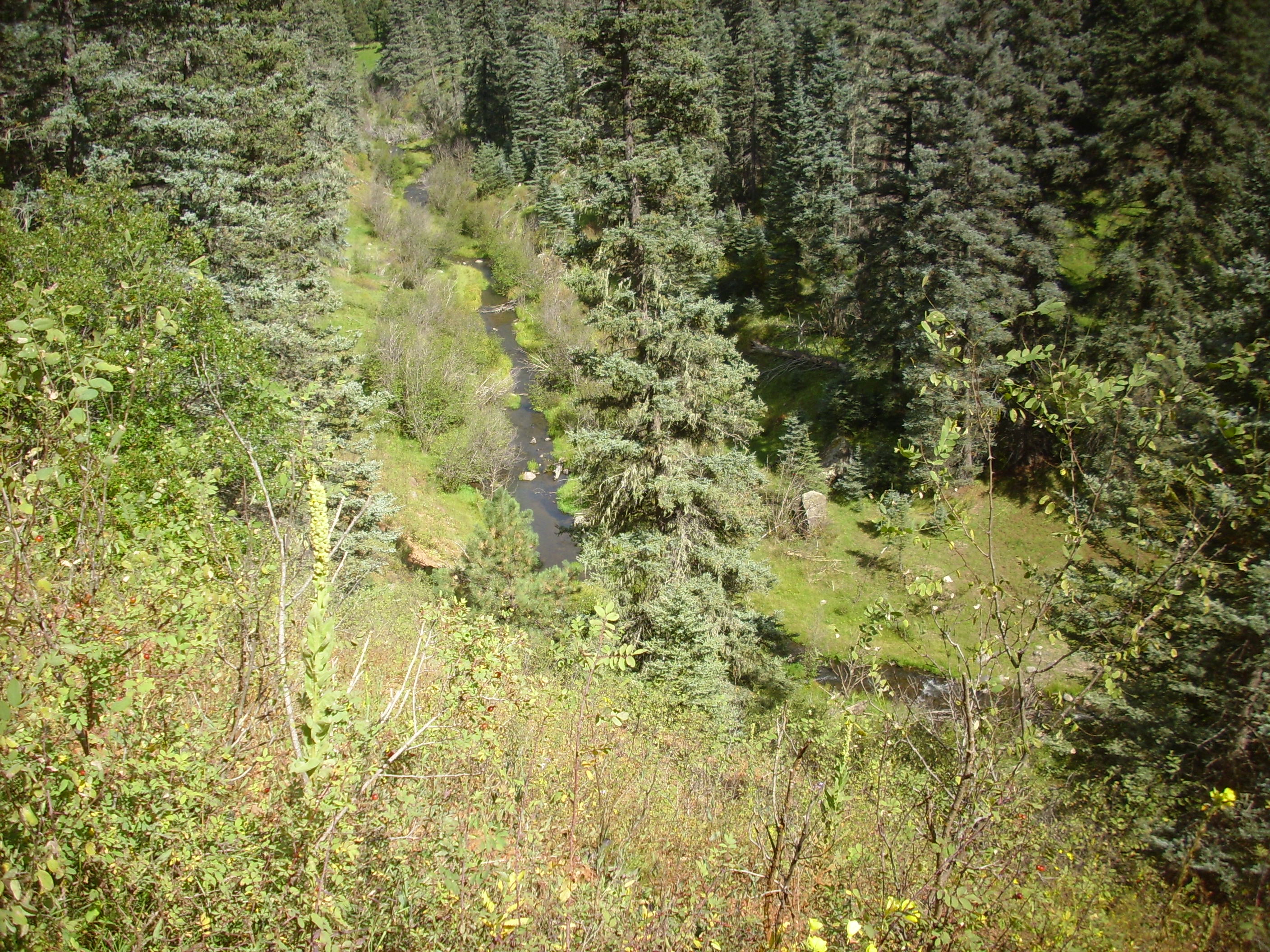
Seems pretty harmless, no? They say it’s always the little guy you have to watch out for.
South Mountain was erupted very shortly after San Antonio
Mountain, producing a lake in the Valle Grande that lasted at
least 170,000 years. This period included at least two full
glacial-interglacial cycles of the current ice age. Geologists
have drilled cores in the Valles Grande to obtain pollen counts
and isotope measurements that will help us better understand
long-term natural climate change in the Jemez area.
The final known intracaldera lake was produced by the eruption of
the El Cajete Pumice, which we will examine more closely in the
next chapter.
Next page: Shaping today's landscape
Copyright © 2015 Kent G. Budge. All rights reserved.