The table of contents be found here.
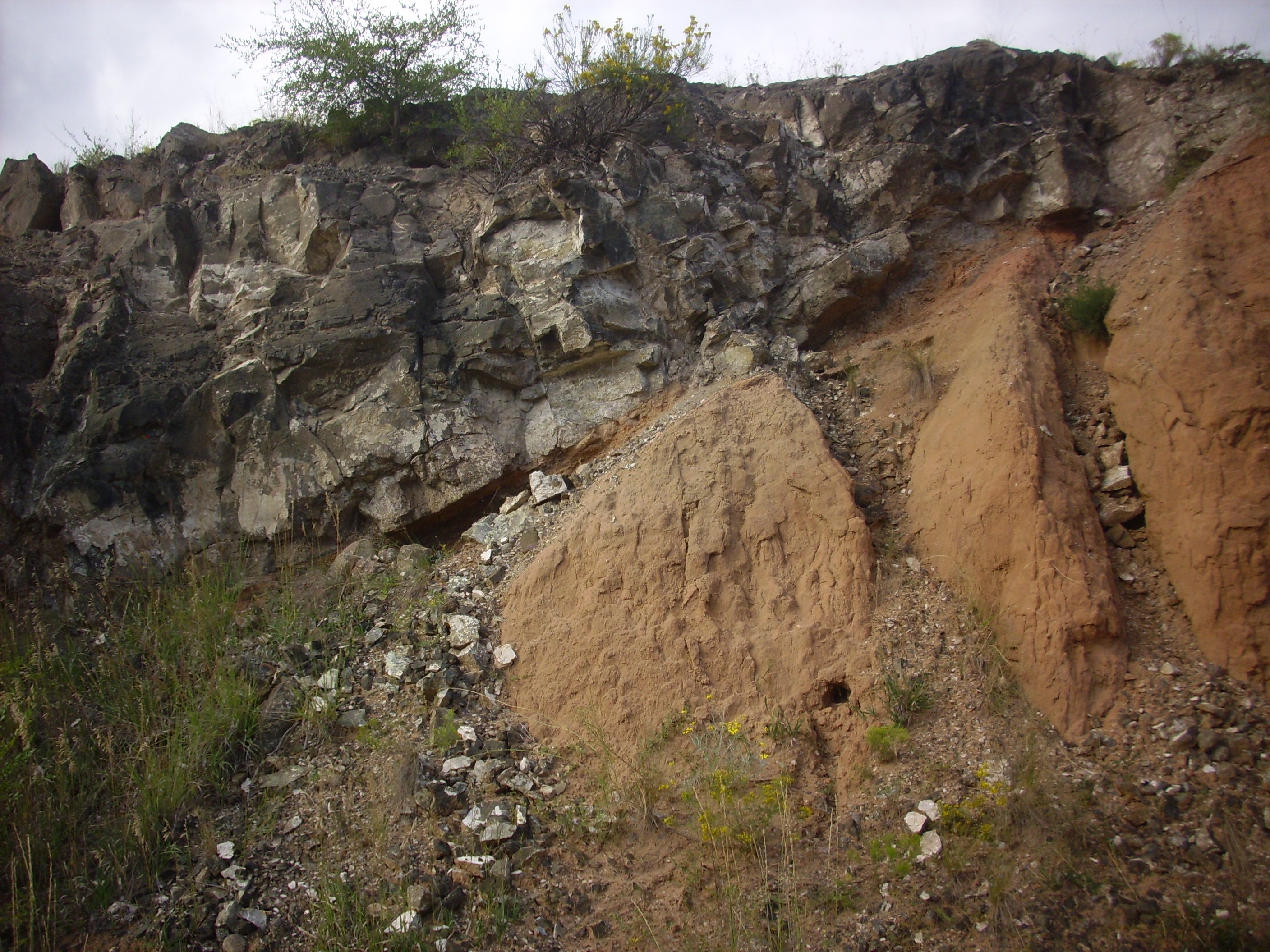
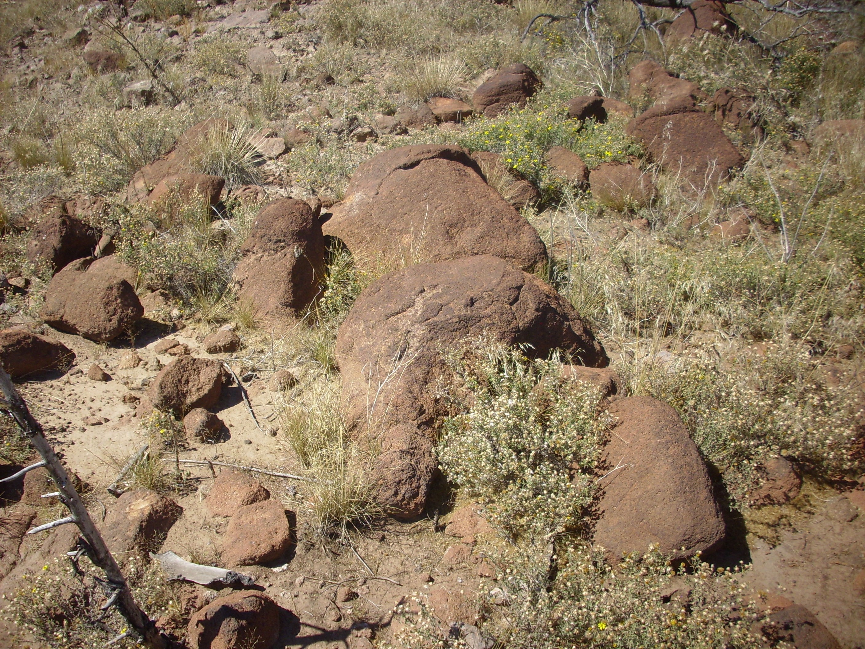
Digitally modified photograph of Craters
of the Moon, showing what the young Jemez volcanic field might
have looked like.
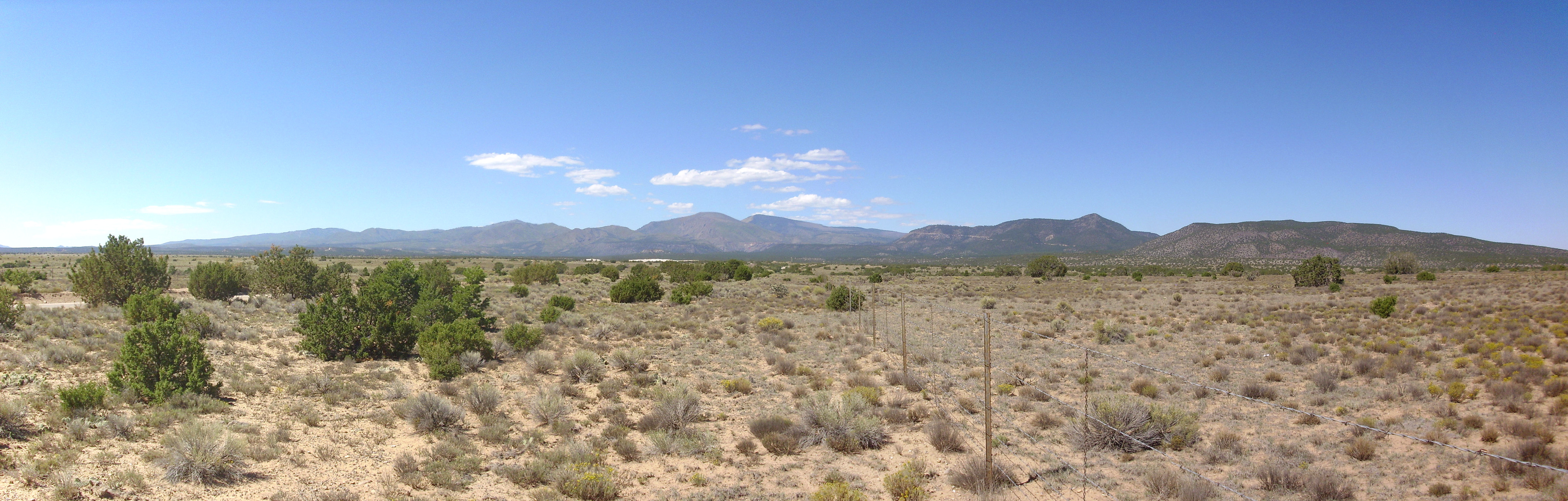
Fifteen million years ago, the continents had largely taken their present shape, and the climate was steadily cooling as carbon dioxide was absorbed into the great masses of silicate rock exposed in the growing Himalaya Mountains. The Rio Grande Rift was occupied by the fertile flood plain of the ancestral Rio Grande, where ancient relatives of elephants, rhinoceroses, camels, and horses grazed.
Deep below the surface, hot asthenosphere rising into the rift
provided heat to generate magma from the fertile rocks of the
Jemez Lineament. The faulting along the western side of the rift
provided a path for this magma to rise towards the surface.
In this chapter, we will look at the birth of the
Jemez volcanic field during the late Tertiary Period.
With the change from compressional to extensional tectonics twenty to thirty million years ago, the intersection of the Jemez Fault Zone, bounding the west side of the Rio Grande Rift, and the Jemez Lineament, marking an ancient suture zone, began to stir to life. Deep fracturing of the crust in an area of longstanding weakness and possibly "fertile" deep crustal rocks, with a lower than usual melting point, meant that large bodies of magma would repeatedly work their way to the surface here.
It is hard to pin a specific date on the first eruptions of the Jemez volcanic field. There was volcanism associated with the opening of the Rio Grande Rift 25-30 million years ago, and some of this was close to the Jemez area. Small volumes of alkaline mafic magma were erupted in what is now the southeastern Jemez from 25 to 18 million years ago, forming basanite flows that are interbedded with Santa Fe Group beds on the southeast flank of the San Miguel Mountains. Similar small volumes of basalt were erupted in the northern Jemez around 19 to 20 million years ago, forming the Cerrito de la Ventana dike system we visited in the last chapter. This means that "first Jemez eruption" is partly a matter of definition. But most geologists place the beginnings of the Jemez Volcanic Field at about 14 million years ago.
The first phase of rifting along the Rio Grande Rift lasted from
about 30 to about 20 million years ago. It was during this first
phase of rifting that the Cieneguilla Basanite was erupted. Hot
aesthenosphere rising into the Rift supplied the necessary heat
energy, and the decompression of the mantle rock as it approached
the surface allowed the hot rock to partially melt. From the
alkaline character of the magma that was erupted, we can deduce
that only a small fraction of the rock melted and that it did so
at a relatively great depth. Alkaline magma is relatively low in
density, and this gave it the buoyancy necessary to penetrate the
overlying crust along fissures opened by rifting. However, the
supply of magma was soon exhausted and the fissures were sealed by
their own effusions.
Rifting slowed for the next four million years. When rifting resumed 14 million years ago, the most active displacement in the Espanola Basin became focused on the Jose fault zone. This is reflected in the displacements associated with the Cat Mesa Fault to its west. The Cat Mesa Fault, which runs along much of the eastern wall of Canon de San Diego, displaces Yeso Formation beds by about 240 meters (790 feet), but the earliest Jemez volcanic beds on the fault are displaced by less than 10 meters (30 feet) and the young Bandelier Tuff by less than two meters (six feet). This tells us that the Cat Mesa Fault was an early rift fault, largely inactive by the time volcanism really got going in the Jemez. This narrowing of the active rift zone, and development of major fault zones bounding the rift, marked a shift from ductile extension to brittle extension as the crust cooled. Deep faulting along the western margin of the Rift intersected another, more mysterious feature, the Jemez Lineament. We discussed this feature in the second chapter of this book. The key part of that discussion is that the Jemez Lineament seems to correspond with the hydrous subduction scar where the Yavapai and Mazatzal Precambrian provinces were sutured together. The mantle here seems to be fertile for production of magma.
As the rift continued to open, hot aesthenosphere continued to rise into the rift. Where the rift crossed the Jemez Lineament, the heated mantle rock was particularly easily melted, allowing great volumes of magma to accumulate. Meanwhile, the overlying crust was still cooling in the aftermath of Ortiz volcanism. Colder crust is more dense, and this increases the buoyancy of any magma within the crust. The deep faulting accompanying rifting provided natural conduits for the rising magma.
The magma pooling in the upper mantle was likely basaltic and alkaline in composition. Small volumes of this magma periodically found a path to the surface, and the Rio Grande Rift has numerous small volcanic fields, most of which erupted just a few times and are unlike to erupt again. The basaltic magma was low in viscosity and formed small cinder cones and extensive flows rather than large volcanic mountains. We see all of these processes at work in the early stages of Jemez volcanism.
Similar small volcanic fields are found all along the Jemez Lineament. One wonders if the Lineament has become a zone of incipient rifting. If so, then it becomes easy to understand why volcanism is so highly focused in the Jemez. Here the crust is pulling apart not just in one, but in two directions. The result may be that the crust has thinned here more than at any other place in the Southwest, resulting both in greater magma generation and in easier access for the magma to the surface.
Geologists divide the volcanic rock erupted in the Jemez over the last fourteen million years into three groups. The Keres Group are formations of the southern Jemez dating from before the first known supervolcano eruption, 1.85 million years ago. The Polvadera Group are formations of the northeastern Jemez dating from roughly the same time period as the Keres Group. The Tewa Group are formations younger than about 1.85 million years old, which dominate the central Jemez. There is now debate over whether the Polvadera Group and Keres Group are really distinct, since they are about the same age and similar in composition, differing mostly in the accident of being on opposite sides of the Valles caldera. Some recent geologic works abandon the Polvadera Group, assigning all the older volcanic rocks of the Jemez to the Keres Group.
The first phase of volcanism in the Jemez was eruption of highly
fluid basaltic magma. This began slightly earlier in the northern
Jemez than the southern Jemez.
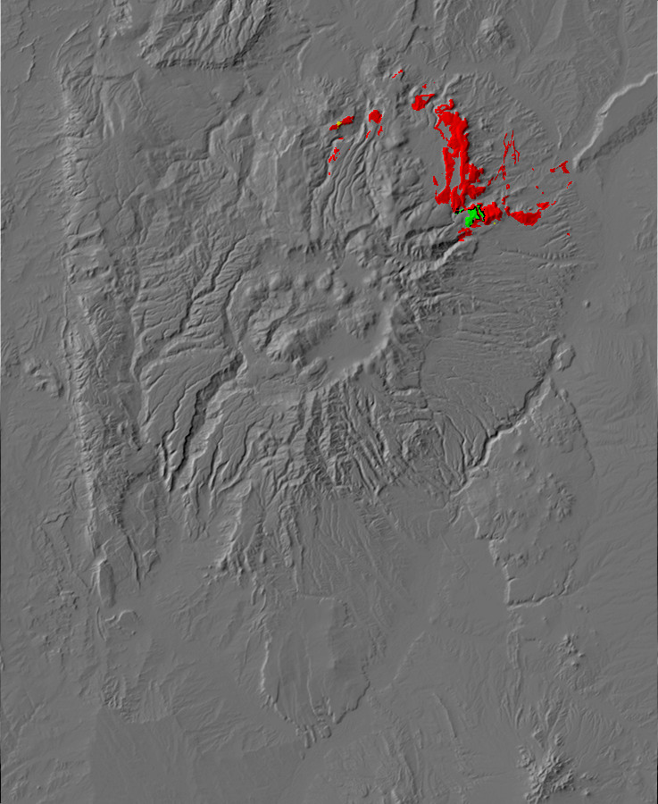
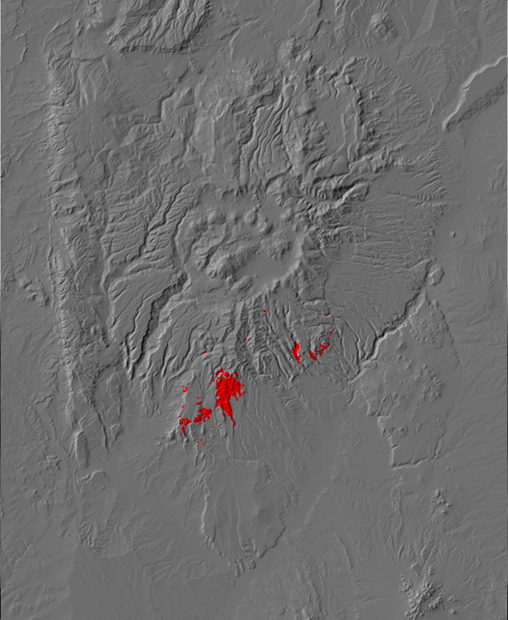
Relief map of the Jemez with Lobato Formation
outcroppings highlighted in red (basalt), yellow (andesite),
and green (dacite)
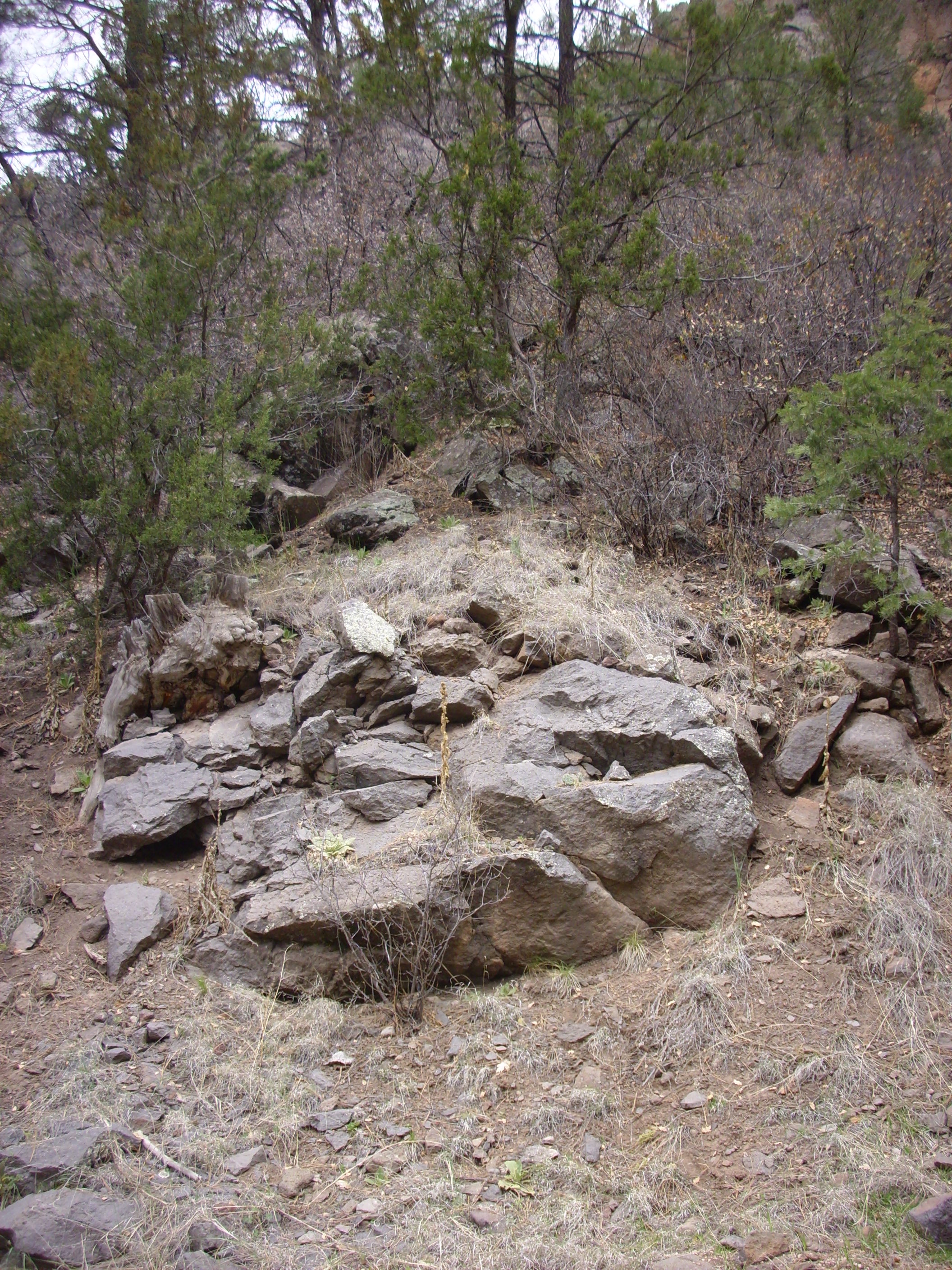
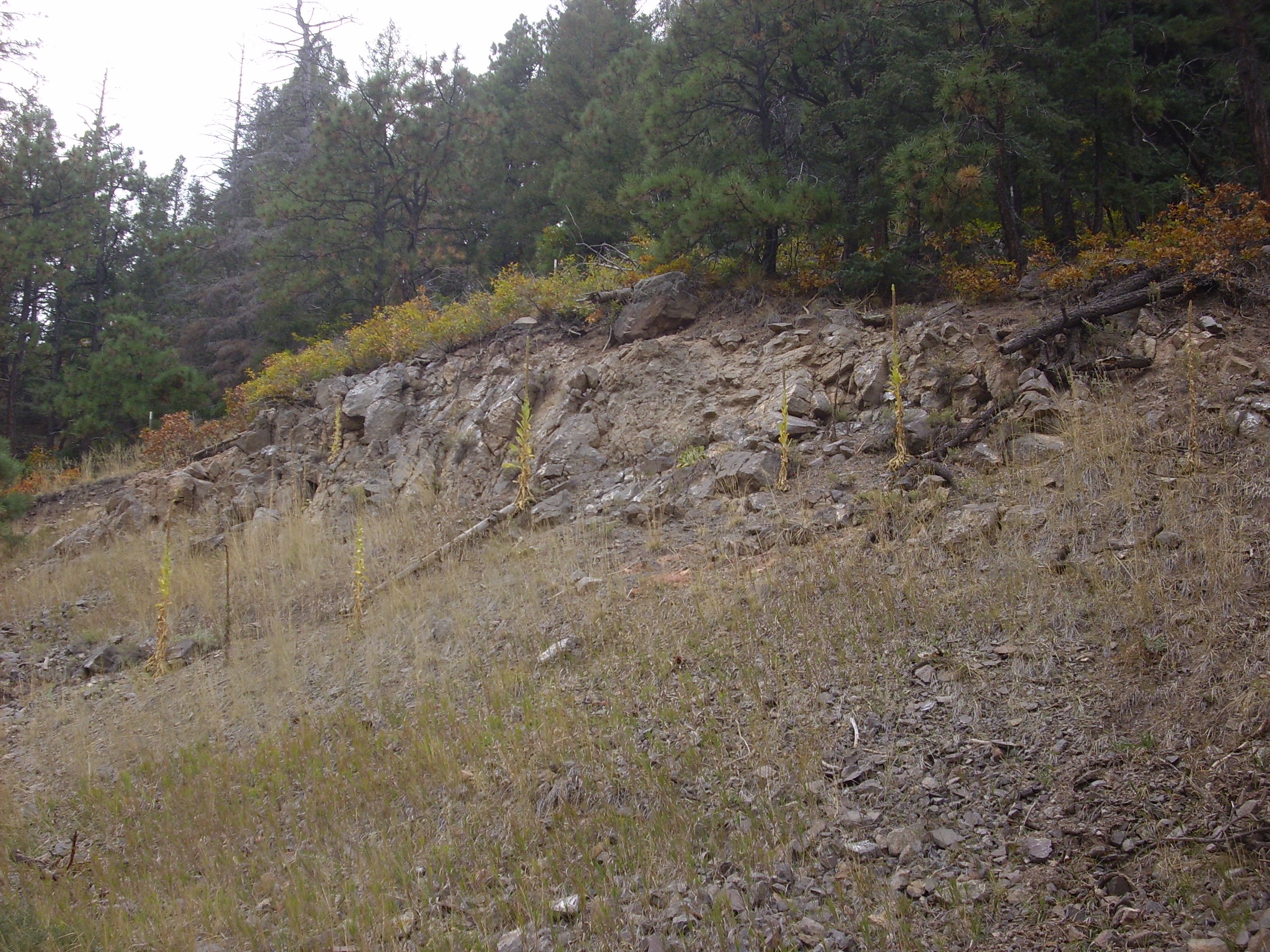
Thirteen million years ago, a volcanic fissure opened in the broad river valley between the Sierra Nacimiento and the Sangre de Cristo Mountains. Highly fluid alkaline basaltic lava poured out of the fissure, accompanied by fountains of gas and molten rock. The lava spread quickly, drowning the surrounding county and exploding into cinder and steam whenever the lava entered one of the many small streams crossing the valley floor. However, the eruption soon ended, and the lava hardened into black rock like that of the malpais seen today near Grants and Carrizozo.
Time passed, and fresh sediments accumulated, burying the lava
flow. The cycle repeated itself, with increasing frequency, as the
Rio Grande Rift continued to open. The eruptions continued even as
regional uplift caused the accumulation of sediment to slow to a
halt and give way to erosion.
Geologists have assigned the series of mafic lava flows representing the earliest volcanism of the northern Jemez to the Lobato Formation. The Lobato Formation was erupted between 14.1 million and 7.6 million years ago, with the period of highest activity from 10.8 to 9.2 million years ago. It consists mostly of olivine basalt flows found throughout the northeastern Jemez. The formation takes its name from Lobato Mesa, where the hard basalt has protected the underlying poorly cemented Santa Fe Group sediments from erosion to produce a high plateau. Lobato Formation basalt overlies the Abiquiu Formation but is interbedded with the Santa Fe Group, showing that sediments were still accumulating in the Espanola Basin when the first Lobato flows were erupted.
The oldest Lobato Mesa flow is located in Santa Clara Canyon and
has a radioisotope age of 13.2 million years. Santa Clara Canyon
is on tribal lands of the Santa Clara Pueblo, and the pueblo holds
this area particularly sacred. Permission to visit has rarely been
granted even to professional geologists, so much of the canyon has
never been mapped in detail.
There is evidence that the earliest eruptions of the Lobato
Formation may have included lavas higher in silica that are now
either eroded away or buried under younger flows. Geologists have
identified a Lower Coarse White Ash Zone in the Chamita Formation
which contains silica-rich volcanic ash with a radiometric age of
around 13 million years. These beds are thickest east-northeast of
the northern Jemez Mountains. There are also spotty gravel beds
below the oldest Lobato basalt flows containing dacite clasts that
are also about this age. This suggests that some of the earliest
volcanic activity in the northeast Jemez came from a dacitic vent
that is now buried under younger flows.
We will introduce ourselves to the Lobato Formation at a somewhat
younger but easily accessible basalt flow found northwest
of the village of Hernandez, where mesas of the Chamita
Formation of the Santa Fe Group are topped by Lobato Formation
basalt.
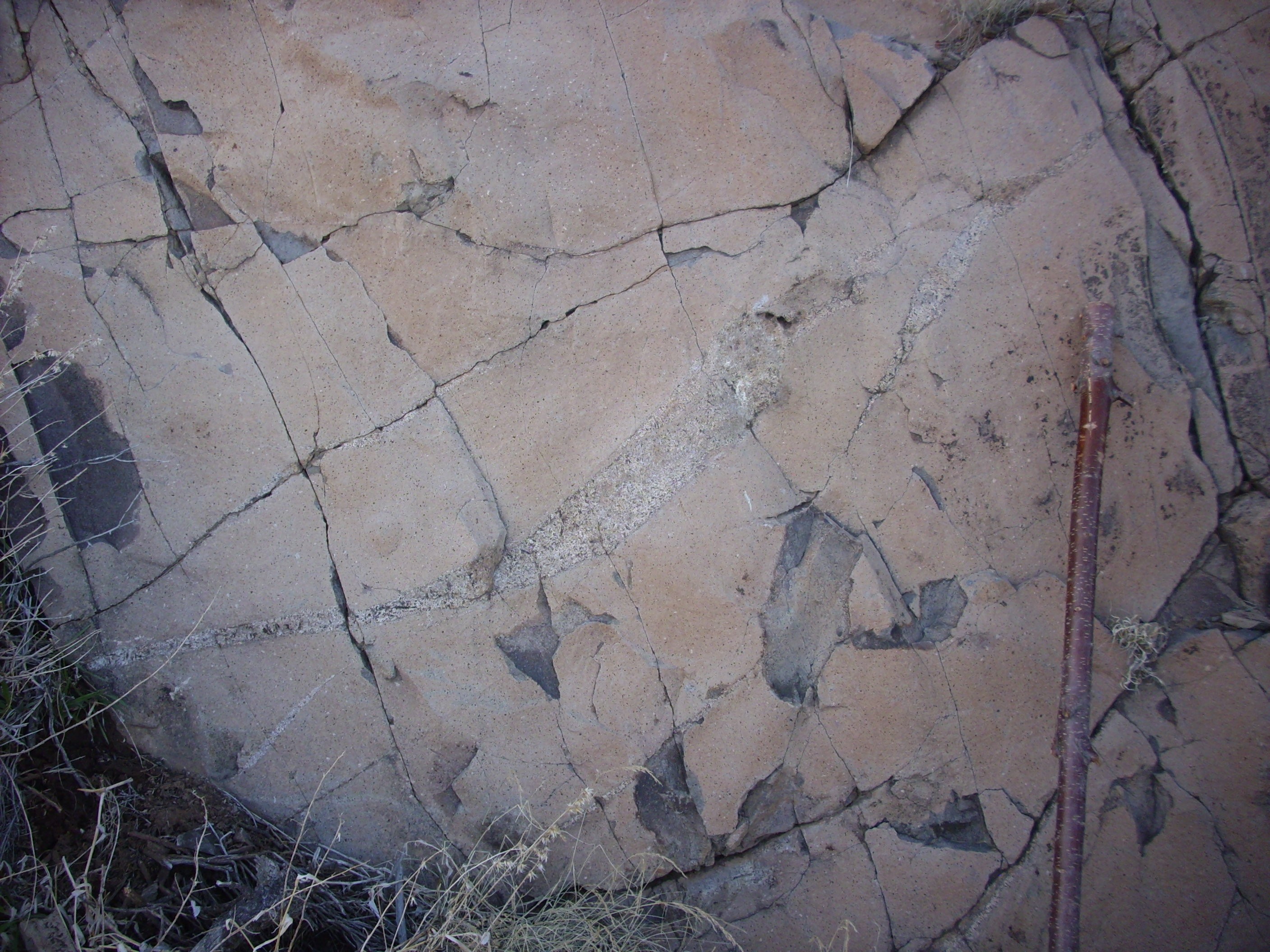
These particular beds were probably nearly level when laid down, and have been tilted to the northeast by continuing rifting in the Rio Grande Rift. The bottom of the flow has irregularities showing that the Chamita Formation had already begun to erode due to regional uplift when it was drowned in lava.
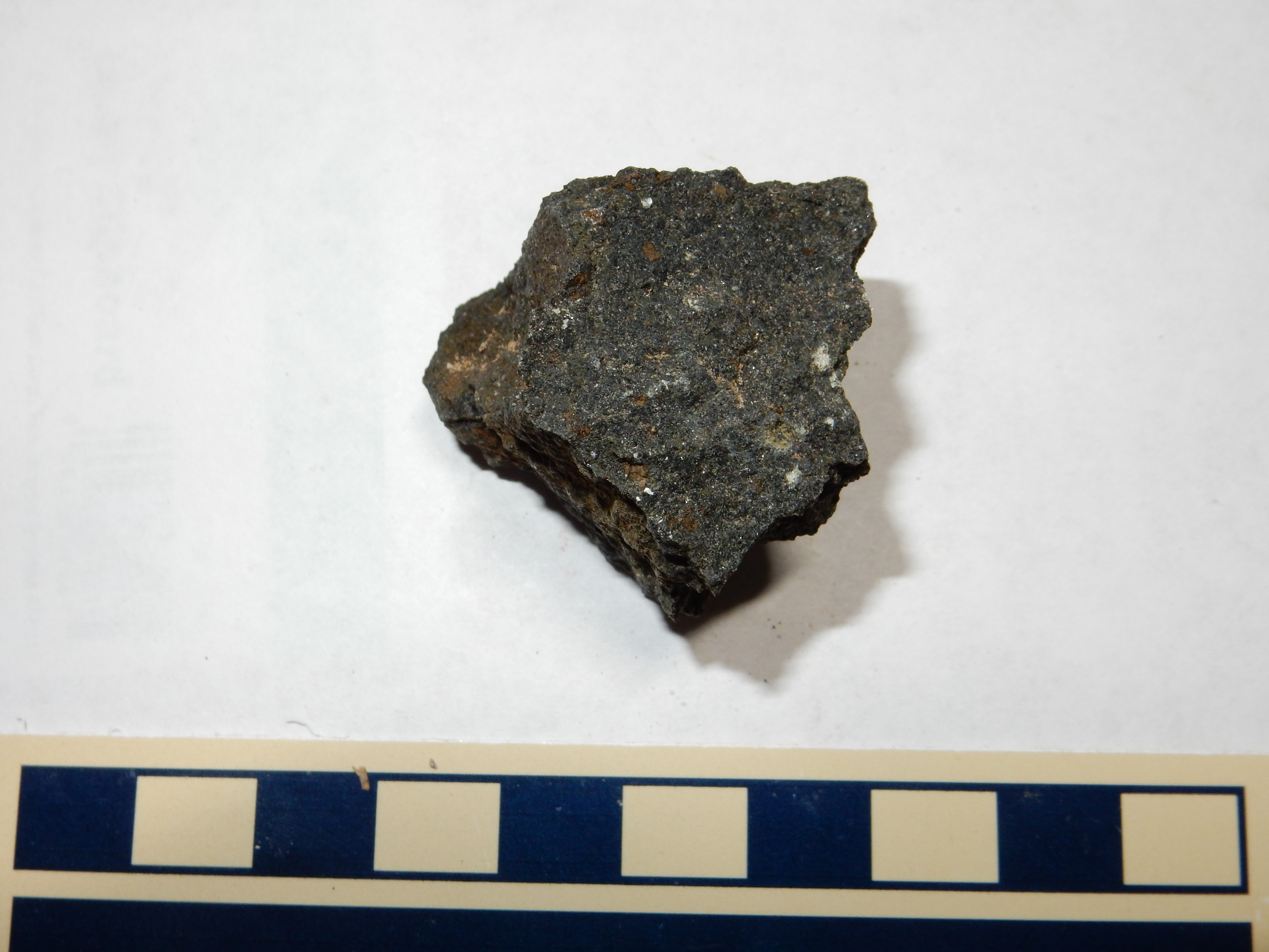
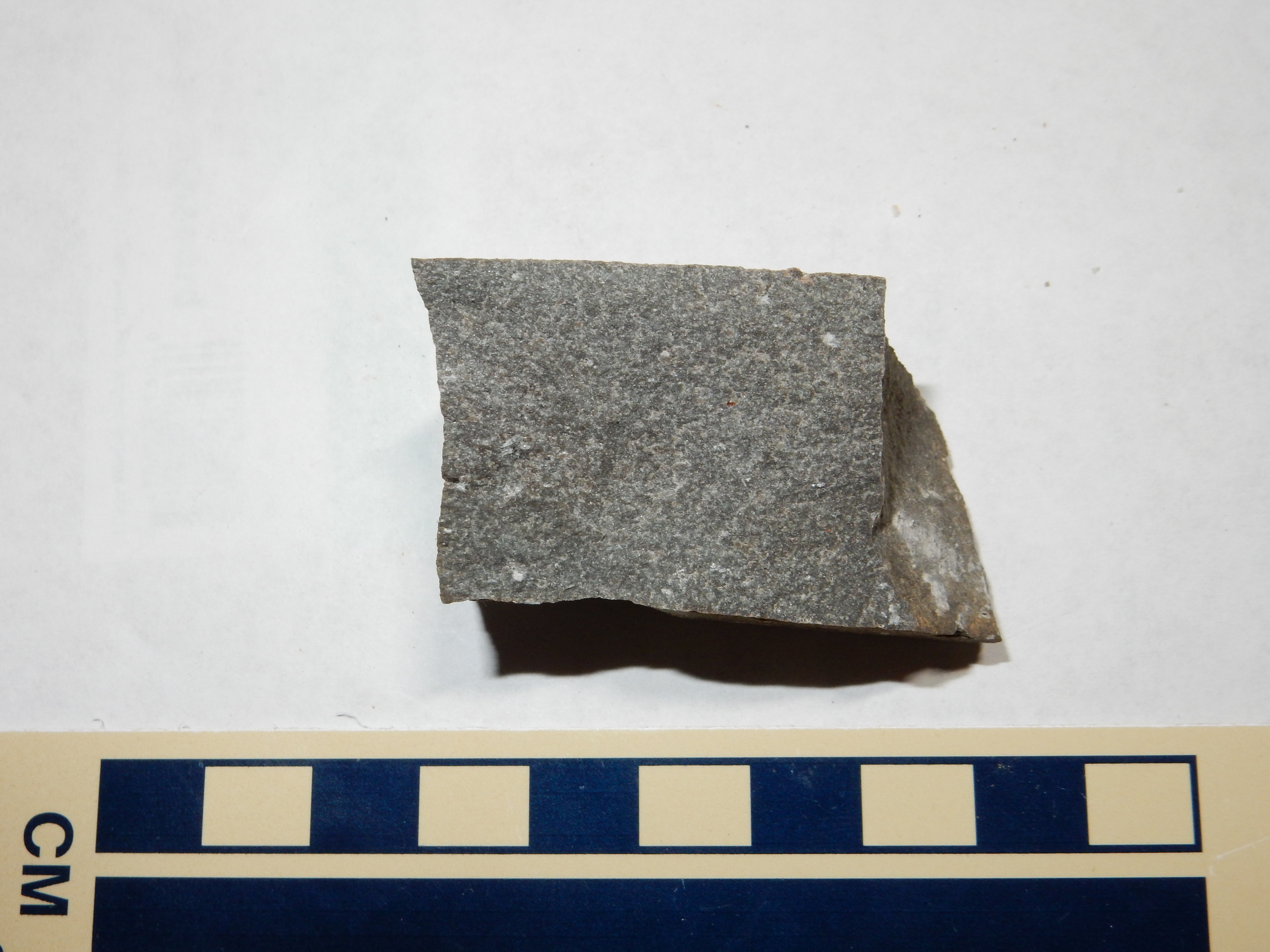
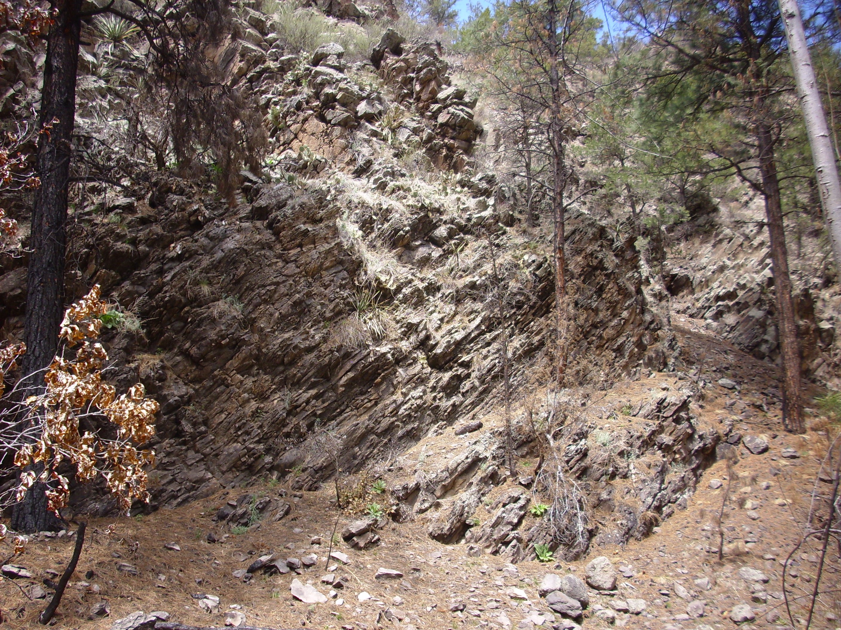
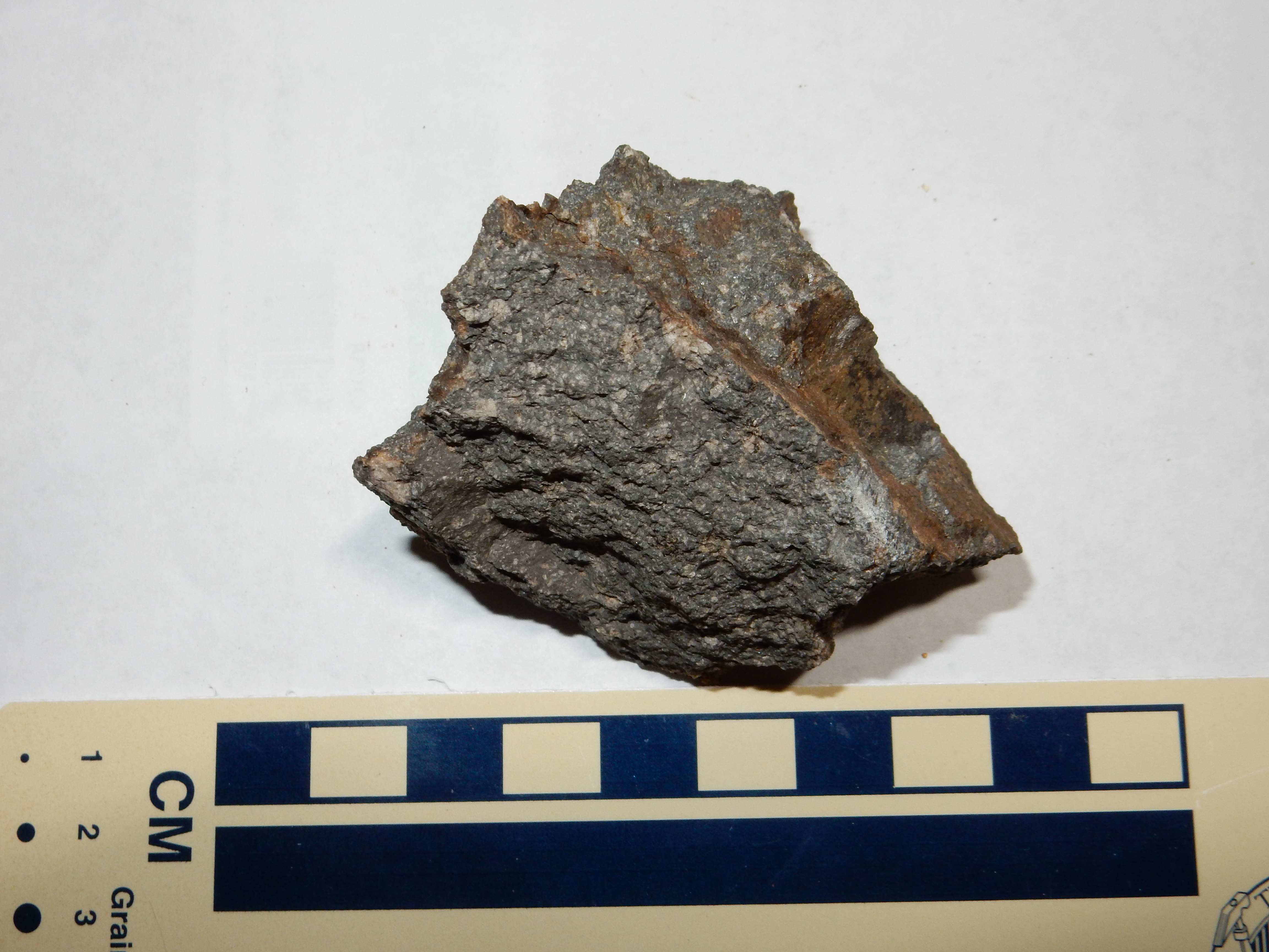
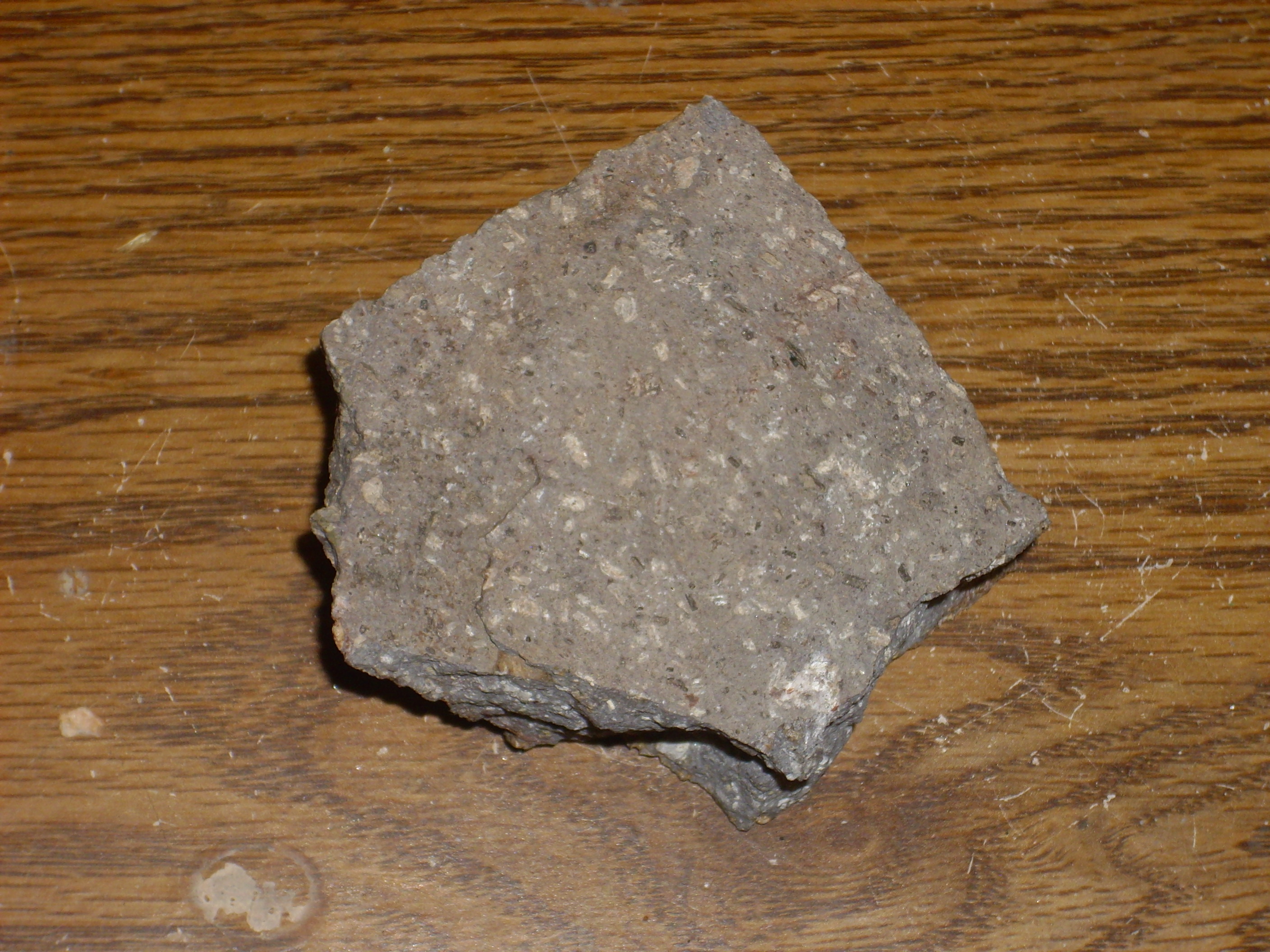
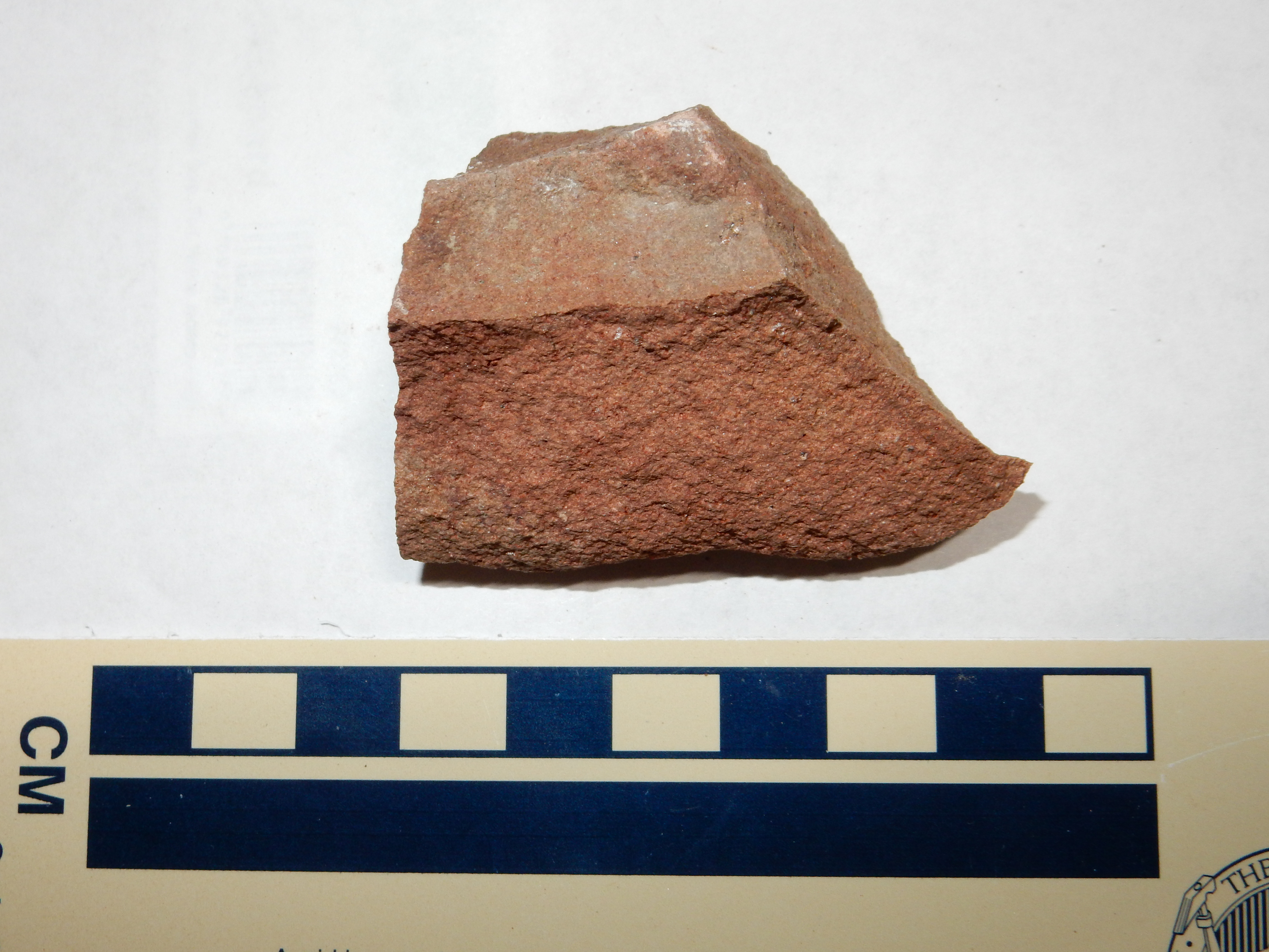
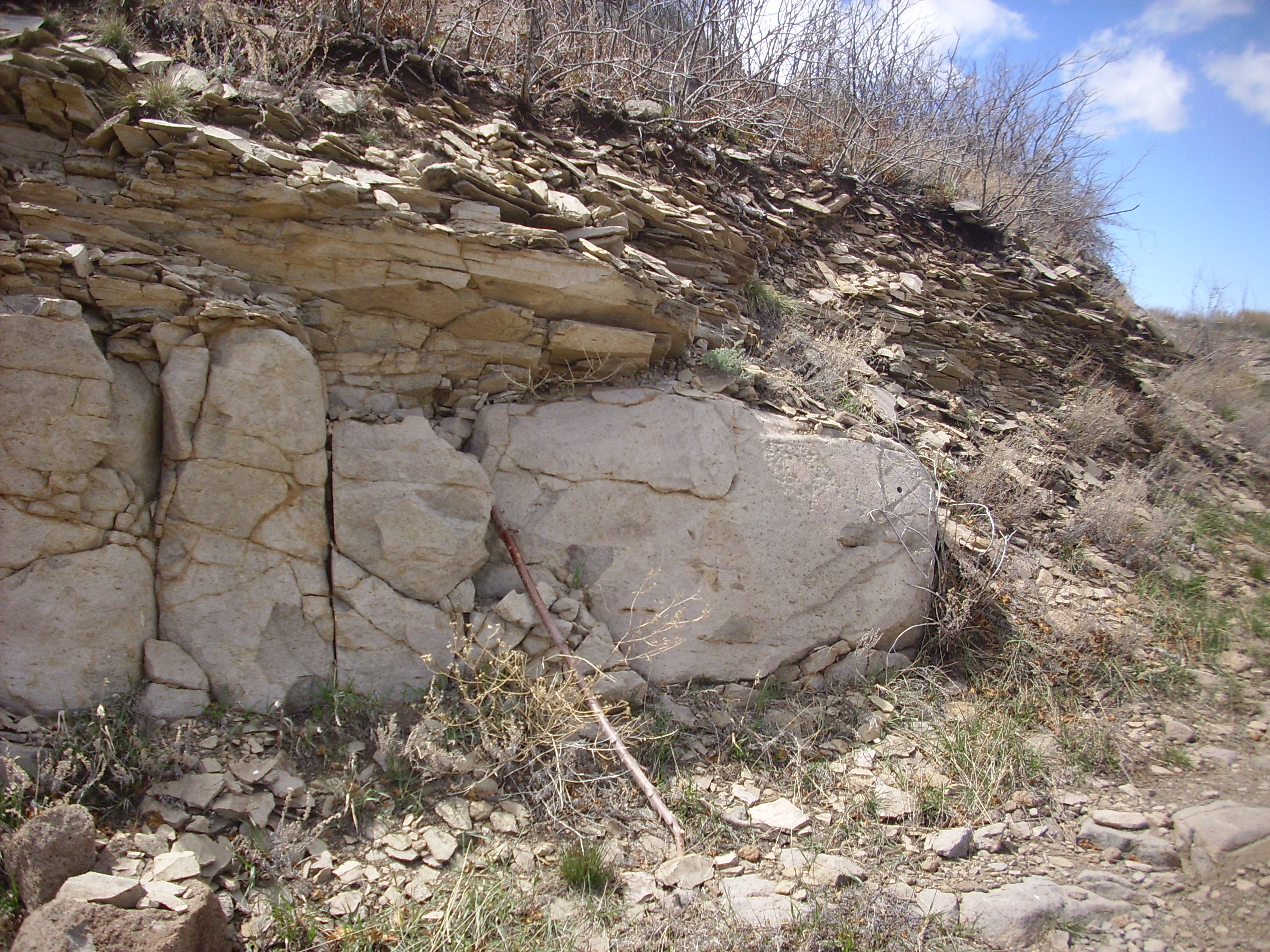
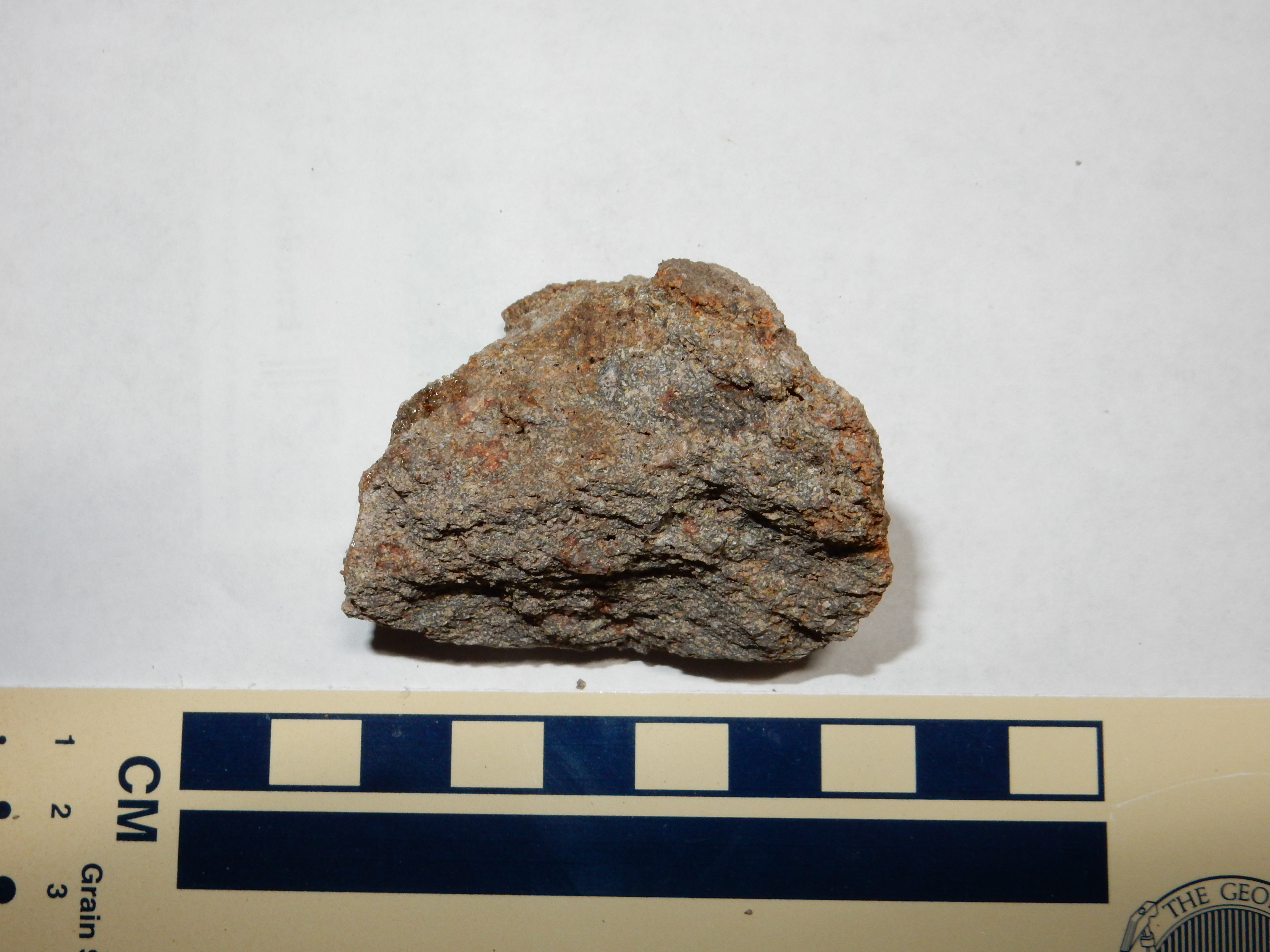
The flow is exposed in a road cut.
Early Lobato Basalt flow.
36 5.958N 106 8.391W
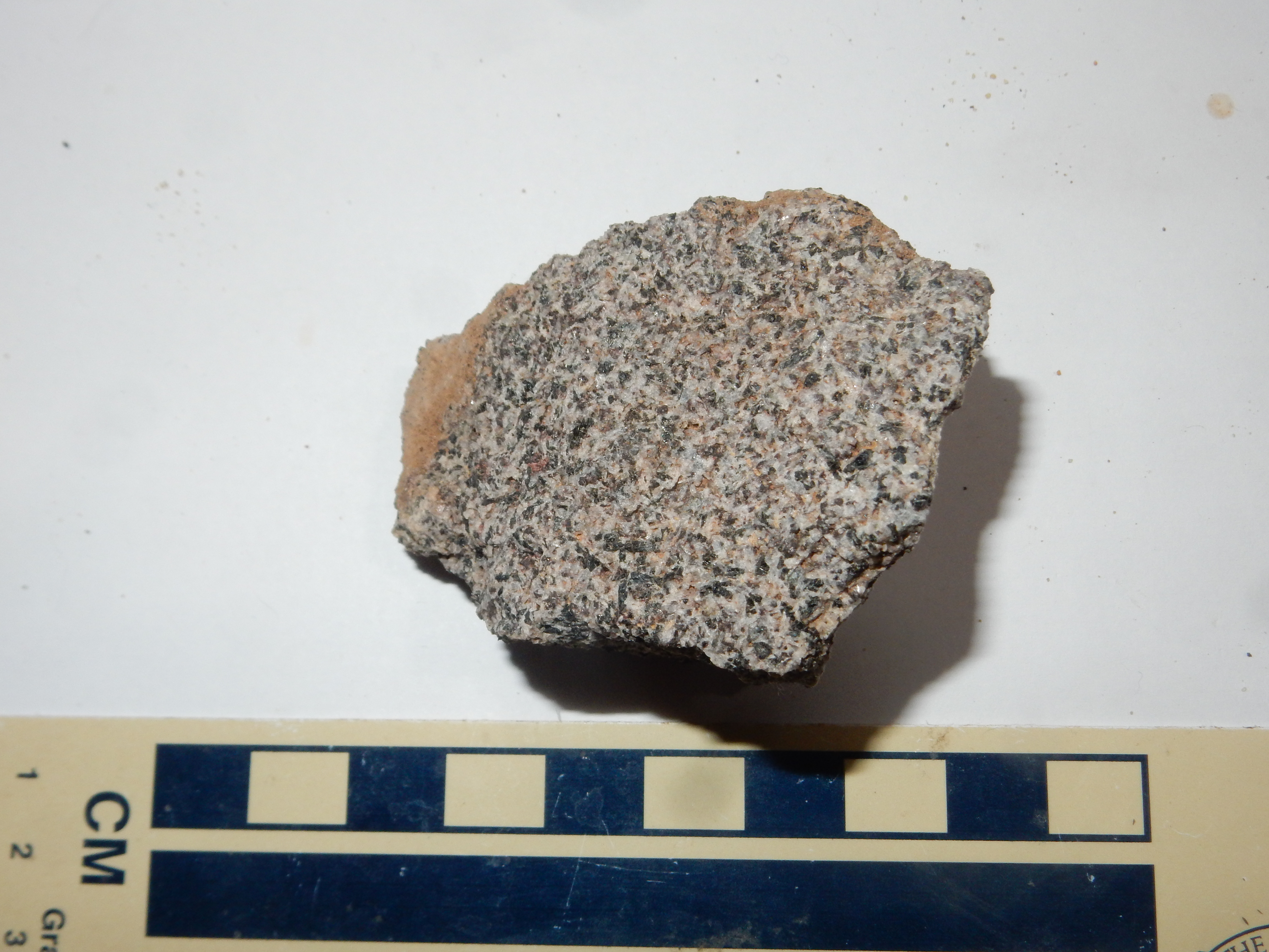
Notice the thin baked zone in the Chamita Formation beds underlying the flow. The flow has been dated as about 9.6 to 10 million years old.
Early Lobato Basalt flow.
36 5.958N 106 8.391W
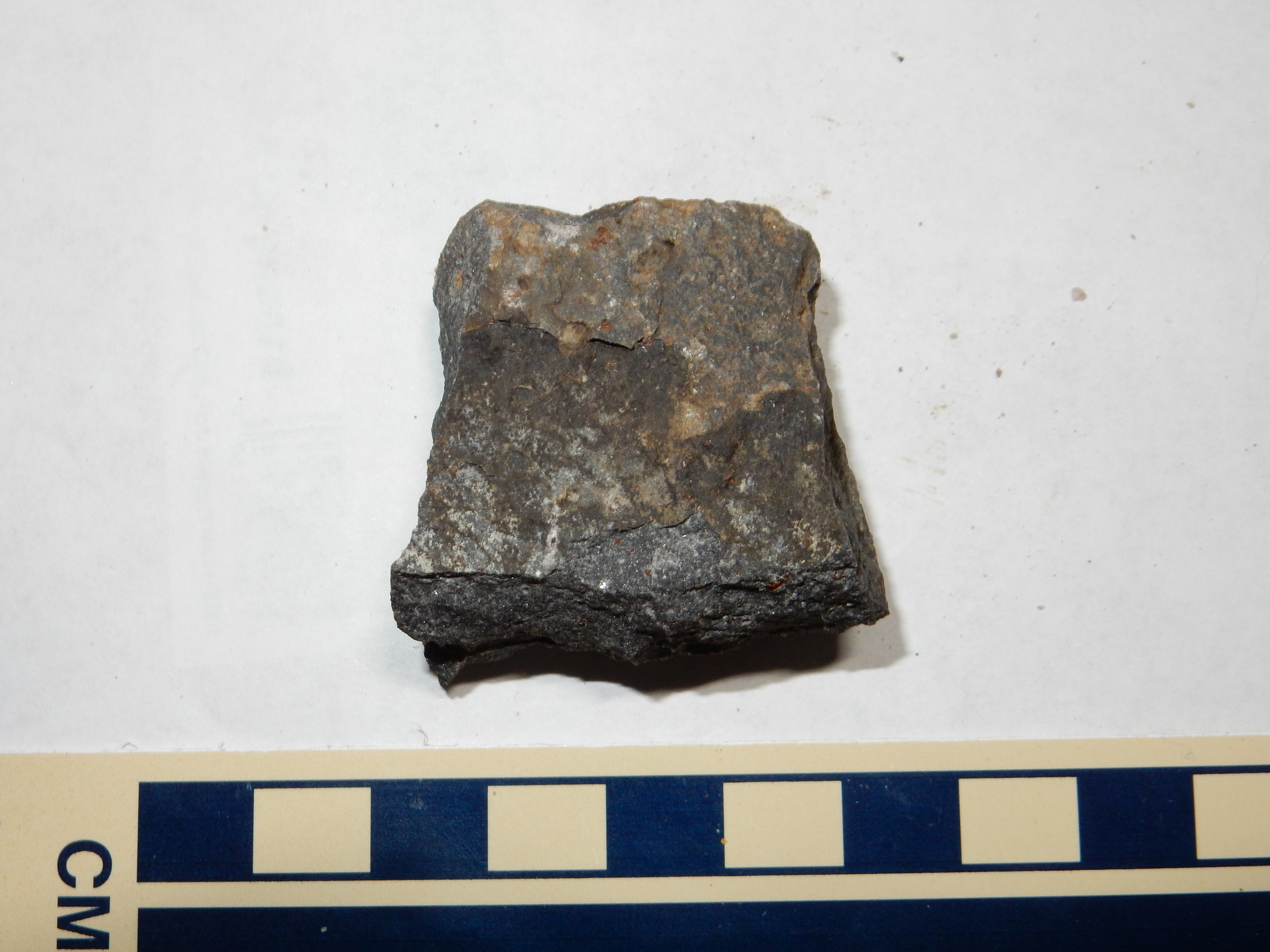
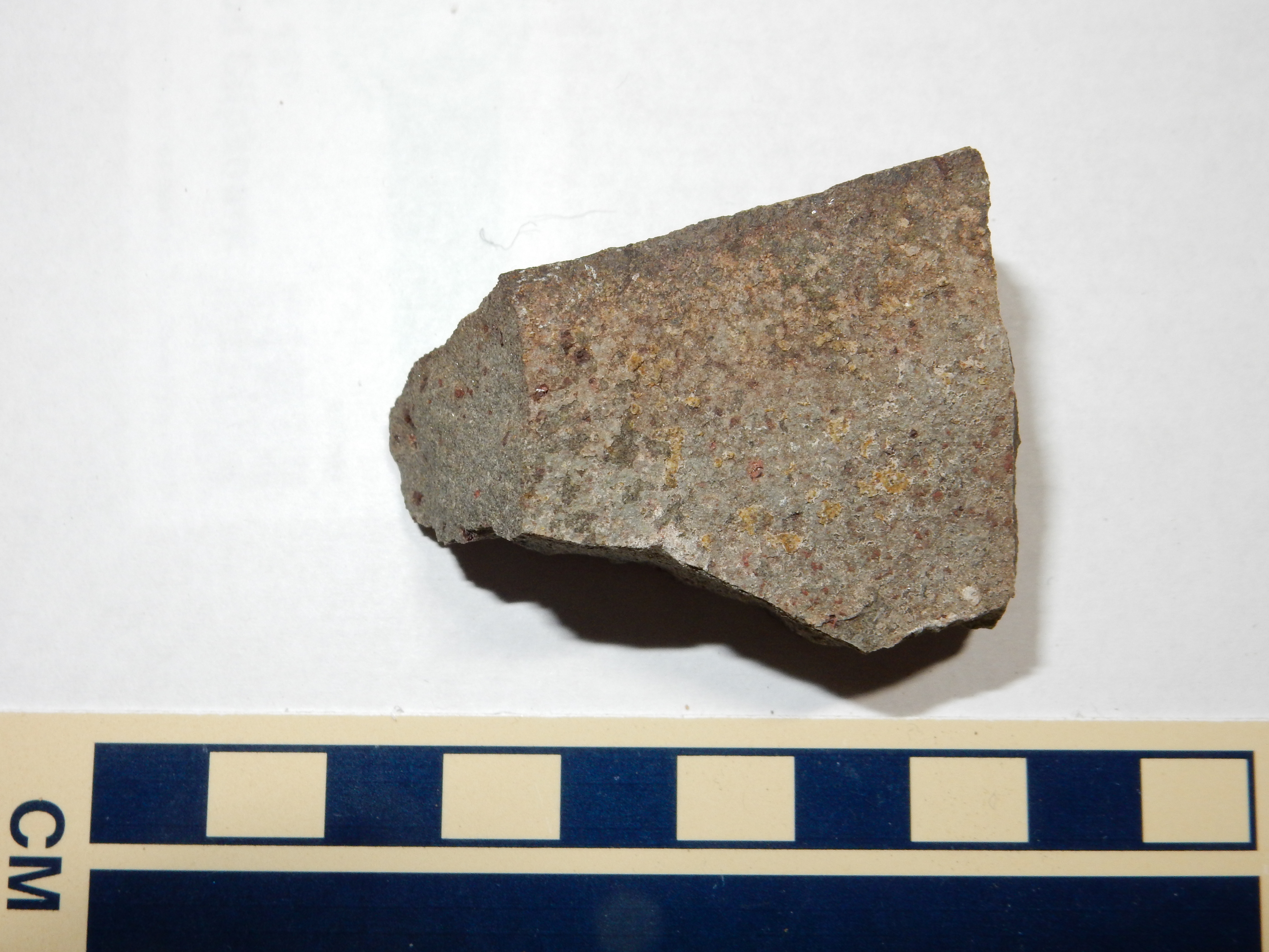
Under the loupe, the rock shows visible
phenocrysts of (probably) augite and plagioclase, with oxidized
spots that were probably olivine. The very dark color suggests
that this is a low-silica olivine basalt.
I introduced basalt in the first chapter of this book, but it's
time now to make a closer acquaintance with this important
character in our story.
Geologists define basalt as an extrusive igneous rock (a rock that solidifies from magma that reaches the surface) containing 45% to 52% silica and not more than 5% oxides of the alkali metals, sodium and potassium. This is a mafic composition, rich in magnesium and iron, and it is a composition that can be produced from partial melting of the upper mantle. The basalt of the Lobato Mesa Formation likely came from partial melting of the hot mantle rock that rose into the Rio Grande Rift, which produced magma that reached the surface relatively undifferentiated and uncontaminated by crustal rock.
Magma more enriched in silica forms basaltic andesite, while
magma poorer in silica (which is rare) forms picrobasalt. Magma
more enriched in alkali metals forms trachybasalt. Most basaltic
magma is relatively "dry", with a water content between about 0.1%
and 1.5%. The more alkaline basaltic magmas tend to have the
higher water content.
Basalt consists mostly of plagioclase feldspar and pyroxenes. There are often a few small phenocrysts visible in a sample, and these are used to further classify basalts. Most of the basalt of the Lobato Mesa Formation is olivine basalt. The Lobato Formation also contains a few flows of quartz basalt and plagioclase basalt, the latter containing phenocrysts of plagioclase in addition to the plagioclase in the ground mass.
Because of its relatively low silica content, basalt lava is low in viscosity, having about the consistency of ketchup. It tends to flow away from the eruption center rather than piling up to form a steep mountain.
I described plagioclase in the
second chapter of this book. Pyroxenes are distantly related
to amphiboles, which I also described in Chapter Two.
Like amphiboles, pyroxenes are inosilicates (chain silicates) rich in iron and magnesium, but their backbone consists of a single rather than a double chain of silica tetrahedra:
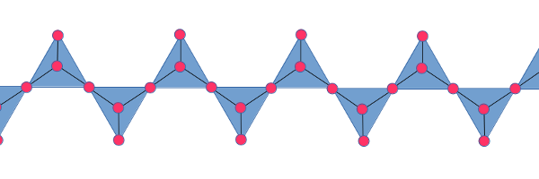
These chains are held together by metal atoms, typically iron or
magnesium, though some varieties contain calcium, sodium, or
aluminum. Aluminum is less likely to substitute for silicon than
in amphiboles. Examples of pyroxenes are orthopyroxene, (Fe,Mg)SiO3;,
sometimes called hypersthene in older publications; diopside,
CaMgSi2O6; and augite,
(Ca,Na)(Mg,Fe,Al)(Si,Al)2O6. The arrangement
of the silica chains resembles that of amphiboles, but the single
chains produce narrower "I-beams" than the double chains of
amphiboles.
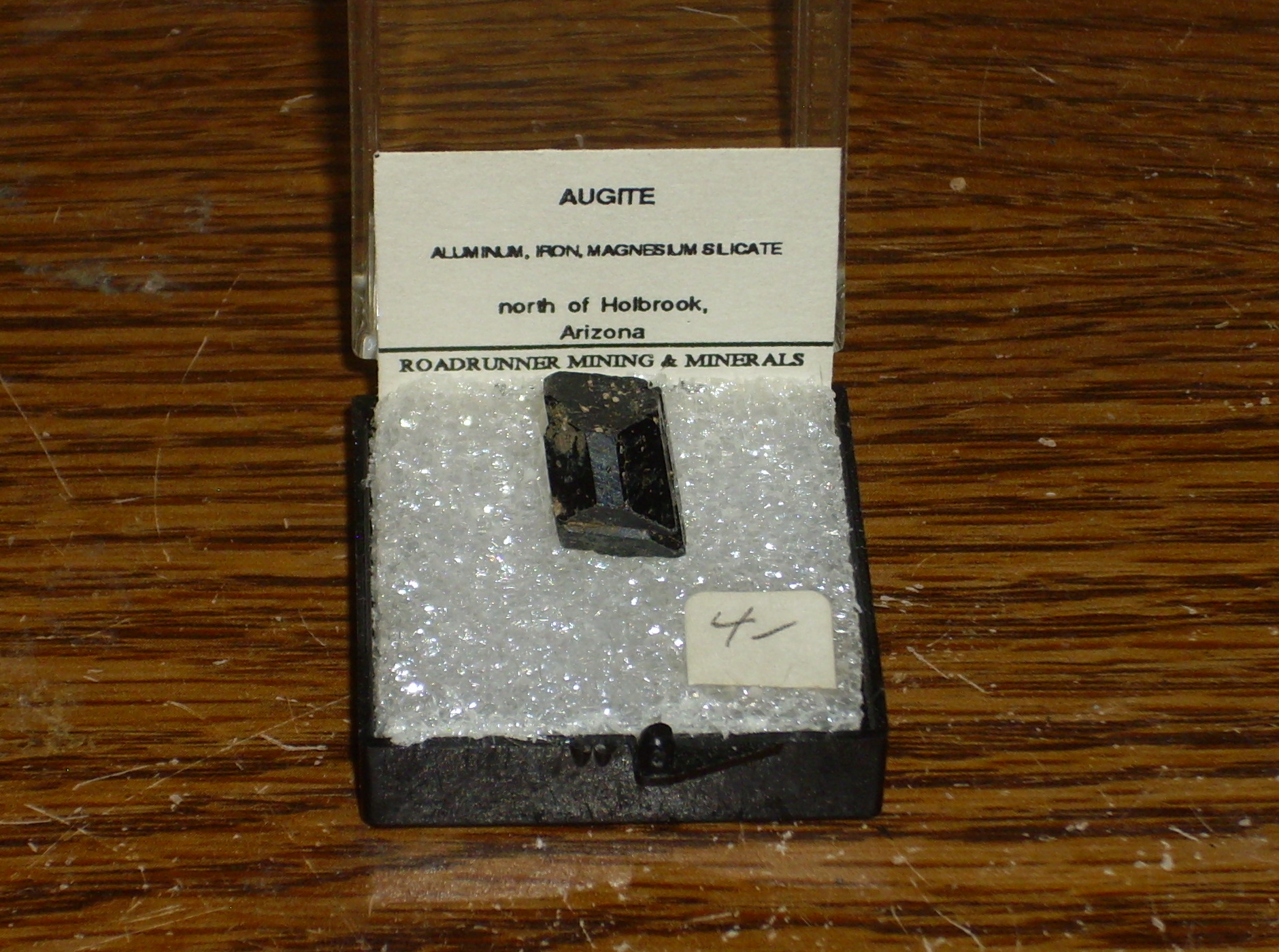
Here is a single large crystal of augite.
Unlike amphiboles, pyroxenes contain no water in their structure, and crystallize from hotter and drier magmas. They can sometimes be distinguished under the loupe from amphiboles by their shorter crystals. Amphiboles tend to form long, needle-like crystals.
Olivine varies in composition between Fe2SiO4
(fayalite) and Mg2SiO4 (forsterite),
with magnesium freely substituting for iron in the structure. It
is a nesosilicate, containing isolated silica tetrahedra
that are not connected to each other. The negative charge on these
isolated tetrahedra is balanced by the iron and magnesium. Olivine
crystals are typically deep green to dark brown in color, but are
unstable under surface conditions, slowly oxidizing to quartz,
magnesium oxide, and hematite (a mixture which, while not a true
mineral, is called iddingsite.) The basalts of the Lobato
Mesa Formation are old enough that almost all the olivine in them
has oxidized to iddingsite.
The presence of forsterite indicates that a volcanic rock is quite low in silica. In particular, quartz is almost never found in the same volcanic rock as forsterite. The excess silica required to form quartz would instead react with the olivine to form pyroxenes. In fact, one sometimes sees a reaction rim of pyroxene around olivine phenocrysts, where an increase in the chemical activity of silica in the magma converted the outer layer of the olivine crystals to pyroxene.
As a magma cools, the olivine that crystallizes from it becomes increasingly iron-rich. Unlike forsterite, fayalite is stable in the presence of excess silica, and one occasionally finds both quartz and fayalite phenocrysts in an igneous rock.
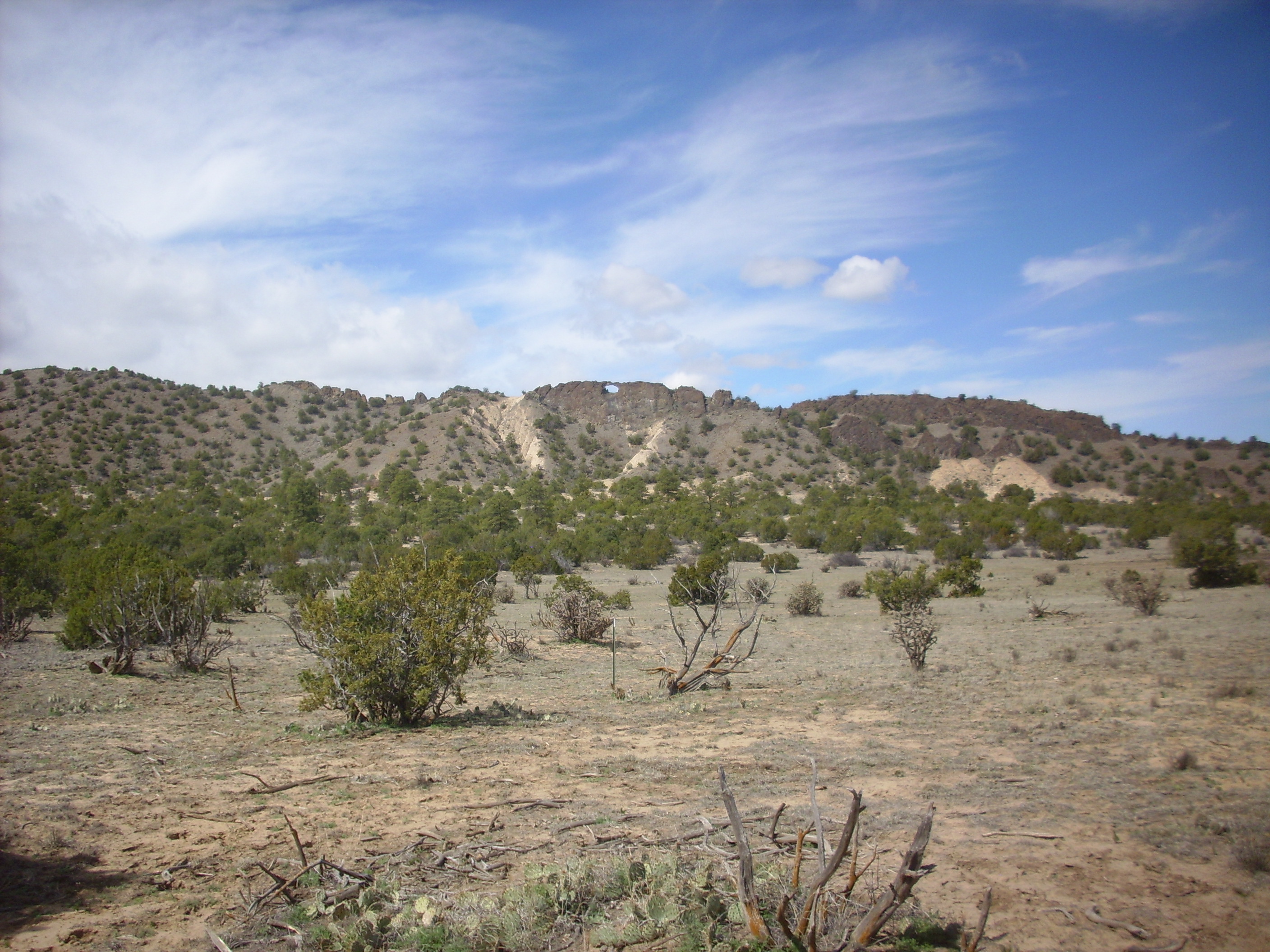
Here's a zoomed in map of the northwest Jemez showing major Lobato outcrops. This will help us stay oriented as we examine this formation more closely.
Major locations for Lobato Formation
The road cut we visited earlier, to introduce ourselves to the Lobato Formation, is the easternmost exposure on this map. The bulk of the formation lies to its west, and for the most part it is exposed on high ground, as small mountains or mesa tops, well away from the main highways. There has been a lot of erosion since this formation was erupted, and it has cut deeply into the relatively soft Tesuque Formation sediments on which the Lobato Formation sits.
The erosion has exposed some of the deeper plumbing of the Lobato Formation as a series of dikes, of which Window Dike is a popular destination for hikers.
Not far north of the little village of Chili is the trailhead
for the Lemitas Trail. In good weather, during the cooler
part of the year, this is a very pleasant hike through badlands of
the Ojo Caliente Formation. About four miles in, the trail reaches
Window Dike.
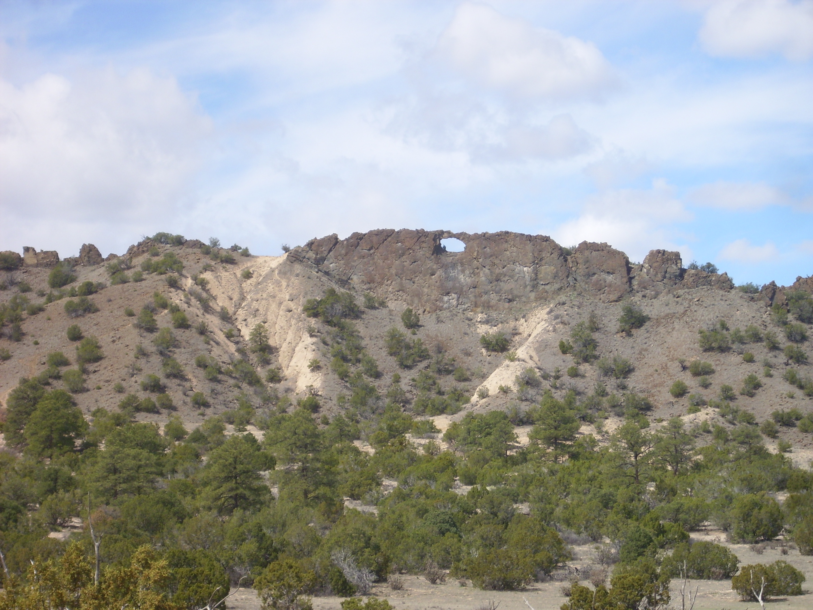
The dike is composed of rather coarsely crystalline basalt.
Window Dike is the easternmost of a group of four or five dikes trending north. Another is visible west of Window Dike.
Radiometric dates from the southern portions of these dikes range from 9.7 to 10.7 million years, similar to most of the Lobato Formation. Here hot basaltic magma ascended through fissures in the Ojo Caliente beds towards the surface.
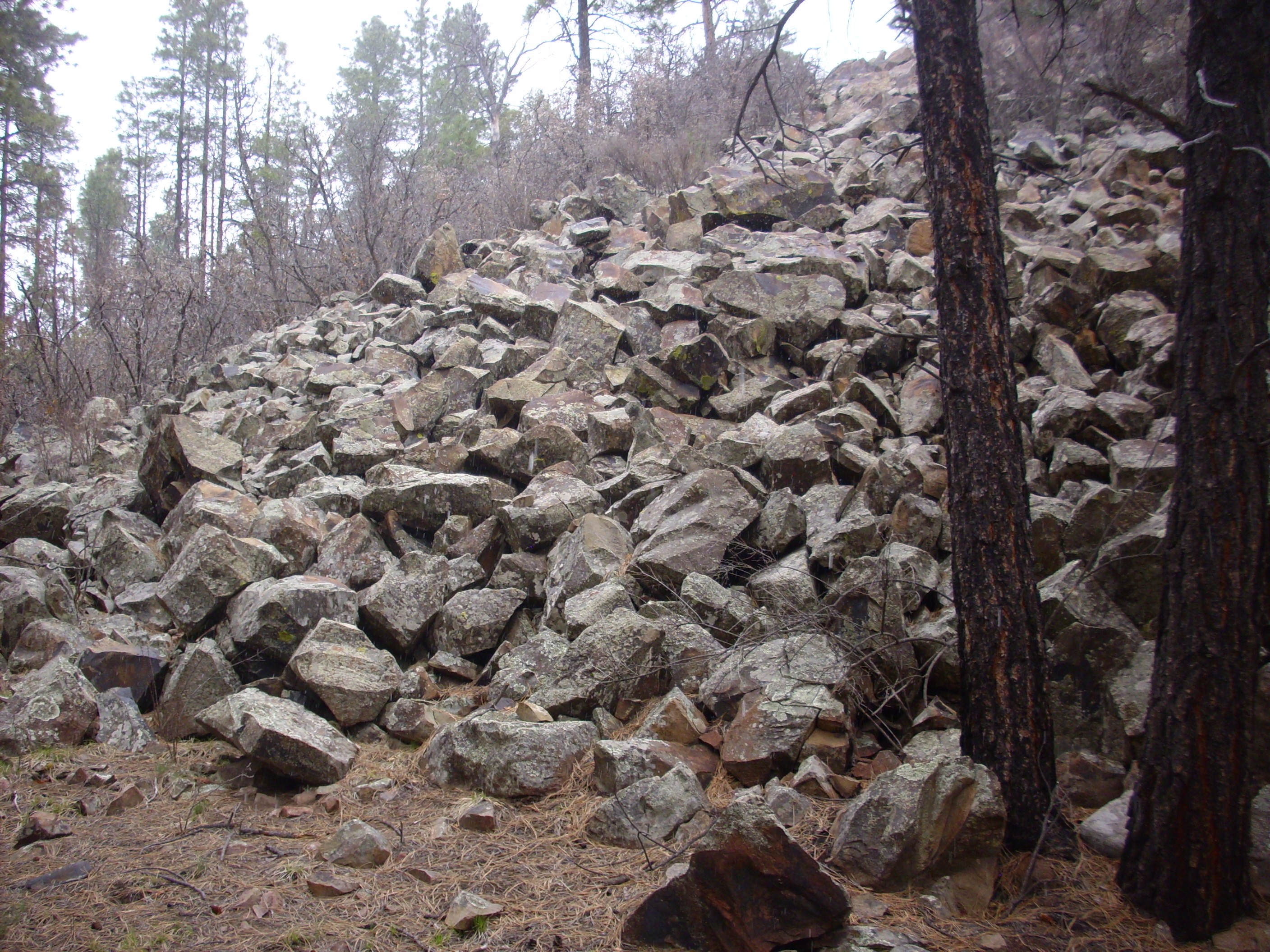
How much of the magma actually reached the surface? There are
fields of basalt cobbles near the dikes that suggest that the
dikes produced some surface flows, but they could not have been
extensive.
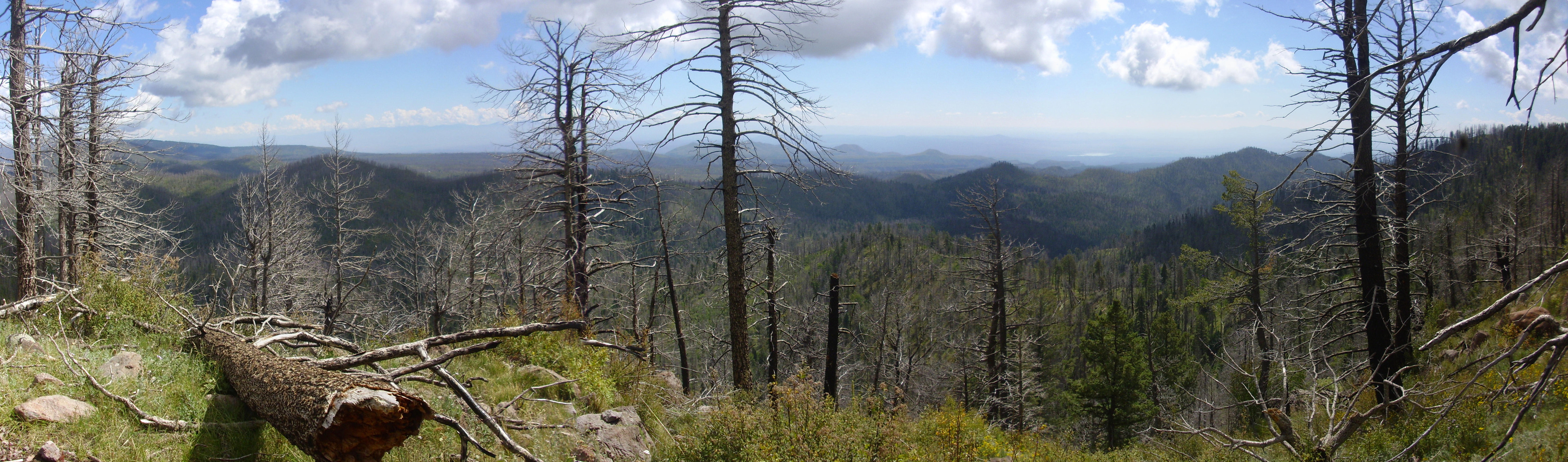
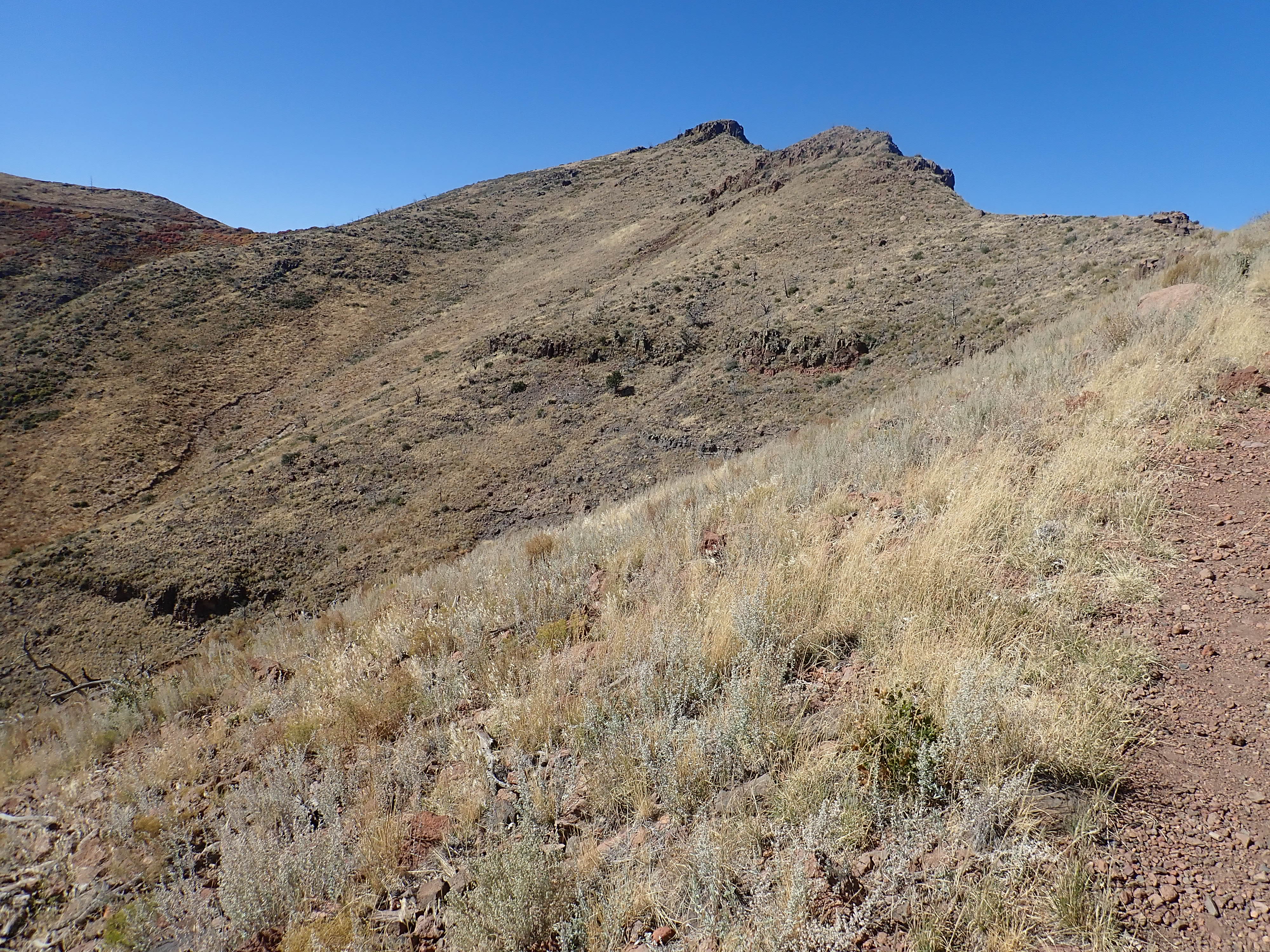
South and west of the dikes are the Santa Clara Mountains and Lobato Mesa itself. Seen from the east, Lobato Mesa is an impressive escarpment.

Gallina Mesa. Looking west from near 36.116275,N
106.2019713W
Lobato Mesa is at right, with La Sotella forming the high point of Lobato Mesa just right of center. The distant peak with a blanket of late spring snow is Tschicoma Peak, the highest point in the Jemez and namesake of the Tschicoma Formation, which we will visit in due course. Clara Peak and Cerro Roman are left of center.
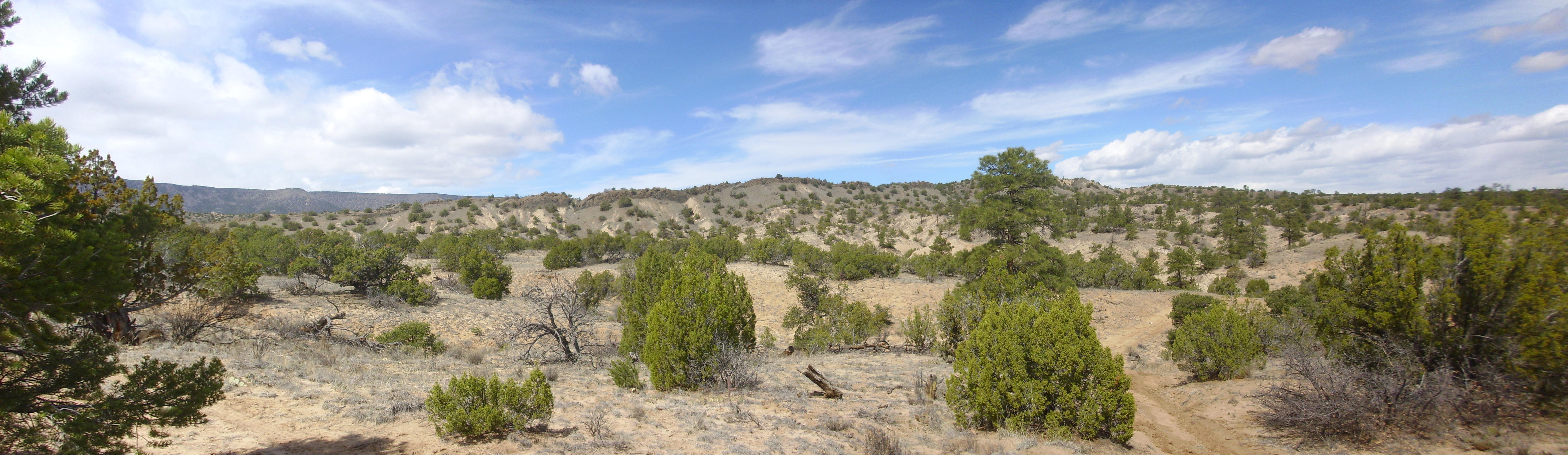
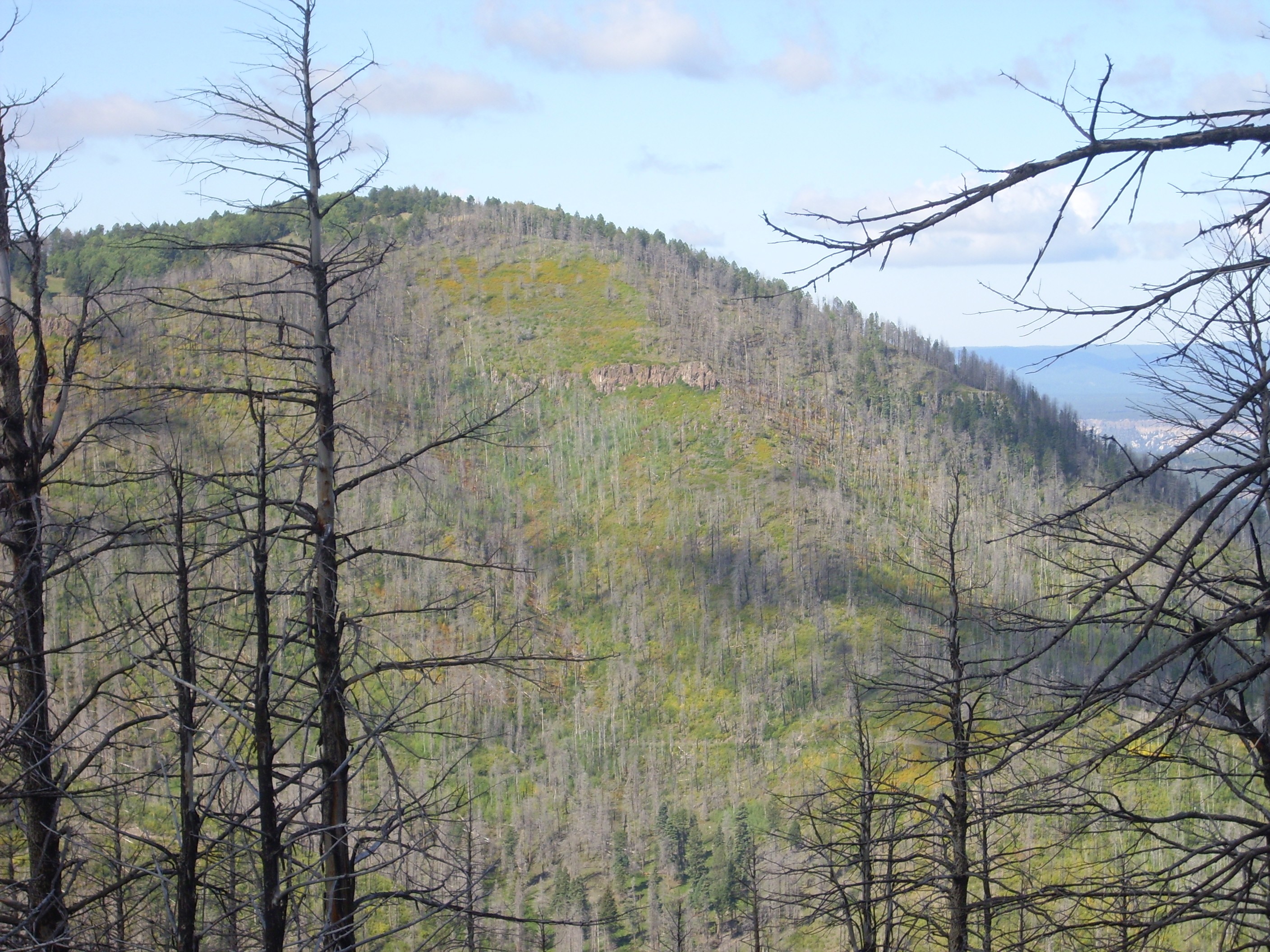
Lobato Mesa is the eastern margin of El Alto, a high plateau underlain by Lobato Formation basalt. El Alto may be viewed from 31 Mile Road (Forest Road 565) where it crosses Gallina Mesa.
The series of meadows and ridges in the middle distance is El Alto. The parallel ridges trending north are fault blocks, with the block furthest to the east forming Lobato Mesa itself. El Alto is mostly private land belonging to the merced or land grant community of Abiquiu and, while there is a good gravel road from Abiquiu to the mesa, visitors are restricted to the road and its branches until they reach National Forest land to the southwest, south, and east.
El Alto was originally a nearly flat plateau of Lobato Formation basalt. This erupted from fissures like those of Window Dike, but here the flows were voluminous enough to form a thick and extensive sheet that resisted erosion. It was broken into fault blocks much later, possibly in connection with Tshicoma volcanism, of which we'll learn much more later in the book.
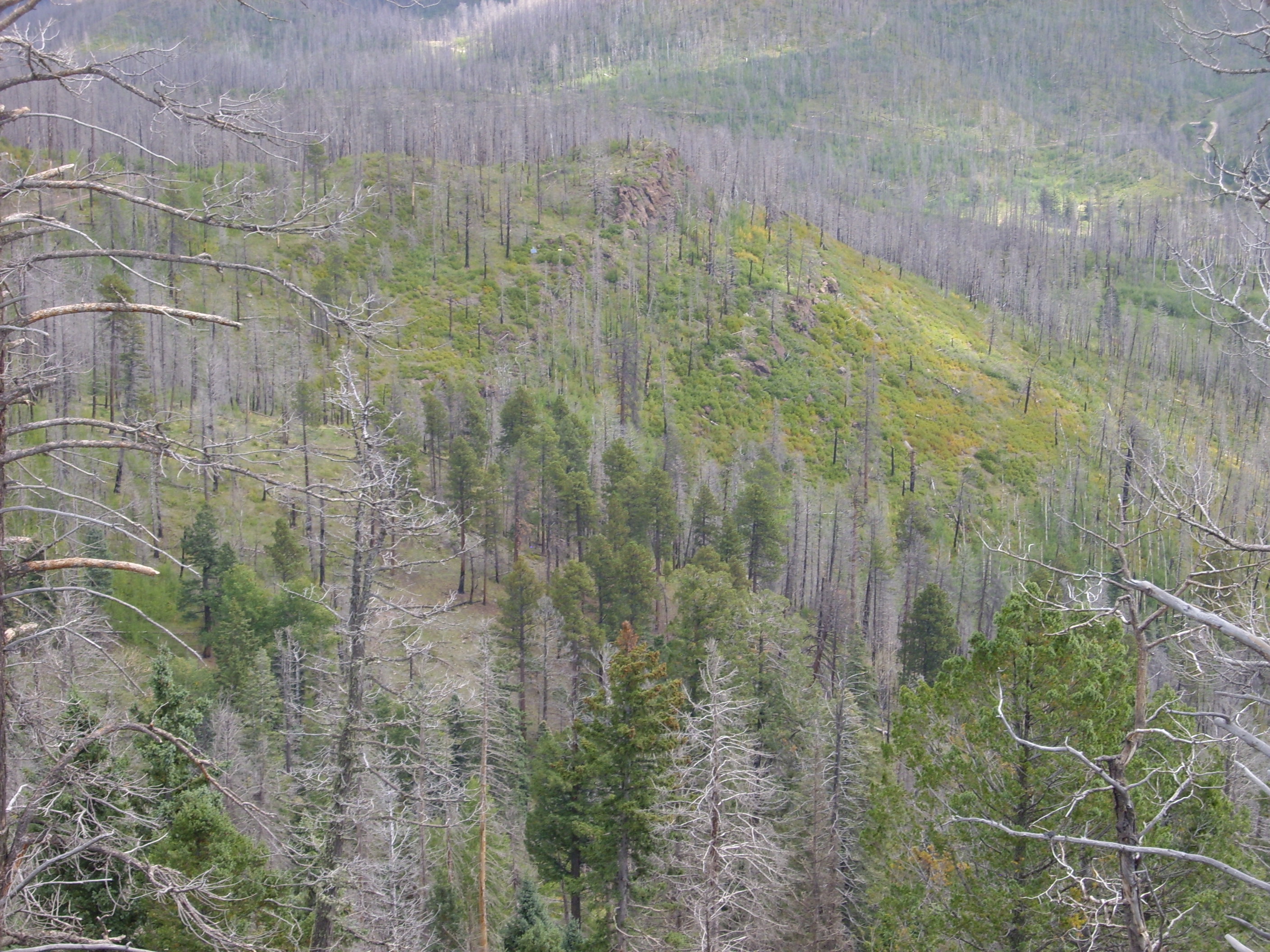
Forest Road 31 south of Abiquiu ascends El Alto, and is a beautiful drive through the Abiquiu merced. The road branches to the east and passes onto National Forest land as one approaches the west side of Lobato Mesa. Here the road ascends the mesa and affords a wonderful view of El Alto to the west.
El Alto Mesa seen from Lobato Mesa. 36
06.092N 106 18.039W
The Tschicoma Highlands forms the skyline in the left half of the panorama. Here younger volcanism of the Tschicoma Formation has deeply buried the Lobato Formation. In the middle distance, running almost the length of the panorama, is a series of forested hills. This is the western edge of a fault block, similar to the one from which the photograph was taken, that is tilted to the east.
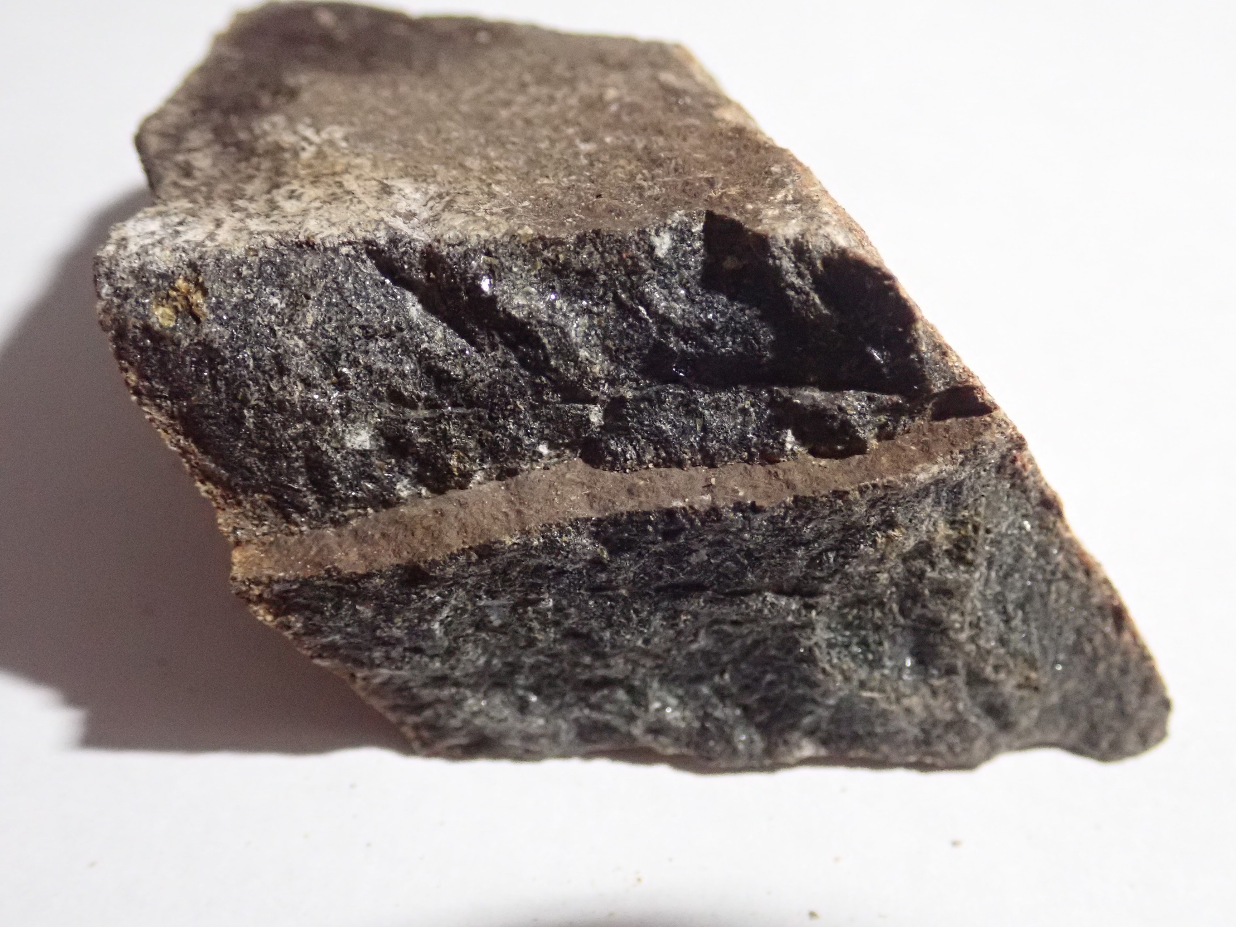
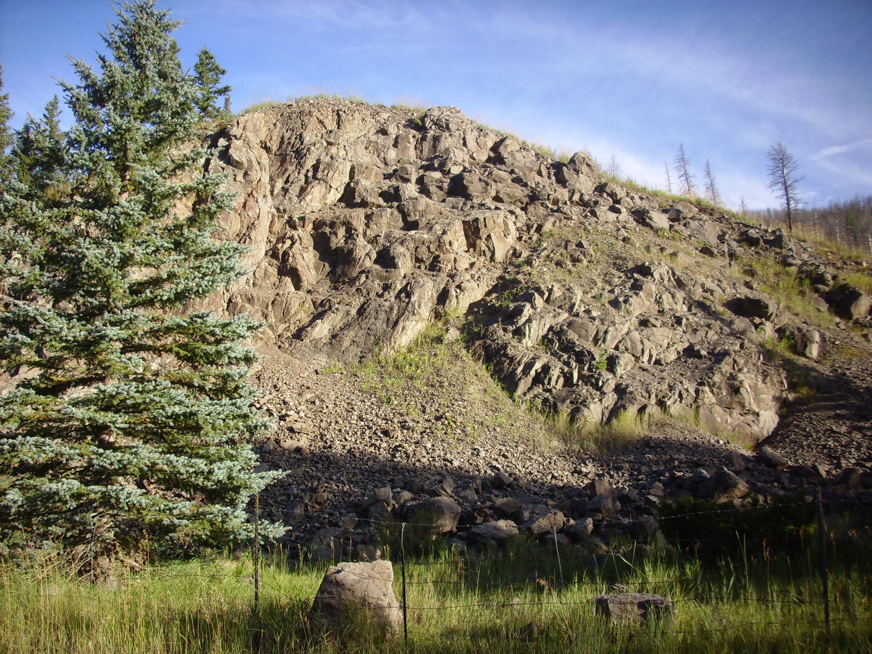
The cap of Lobato Mesa is a light gray basalt.
Olivine basalt capping Lobato Mesa. 36
06.018N 106 17.841W

The basalt has dark brown flecks of iddingsite formed from
alteration of olivine phenocrysts. This makes this a fairly
low-silica rock. Based on dates of nearby formations and field
relations, this rock must be around 10 million years old. The
relatively light color may be a consequence of weathering, or it
may indicate a relatively low iron content consistent with this
being an alkaline basalt (trachybasalt). While the older
flows of the Lobato Formation are mostly olivine basalt, the upper
flows tend to be trachybasalt.
The road fades out atop the mesa, but it is a short hike to the
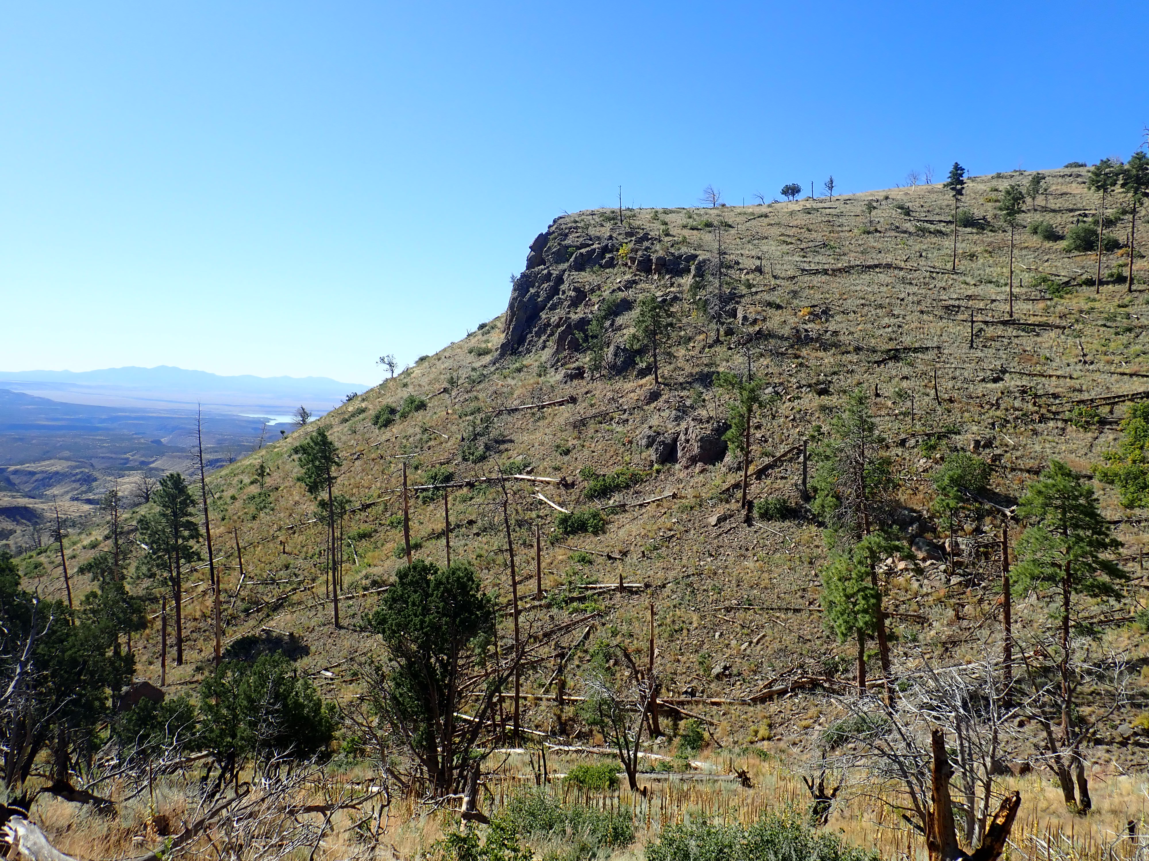
eastern escarpment.
Looking east from Lobato Mesa. 36
06.189N 106 17.499W
To the left, we look north along an escarpment, with the Tusas Mountains in the background. The escarpment itself is not a fault escarpment, or at least no evidence of a controlling fault has been found; the faults here tend to be down to the west anyway. This is an erosional scarp, formed because hard Lobato Mesa basalts rest on very soft sediments of the Ojo Caliente Member, Tesuque Formation, Santa Fe Group. In the distance just to the right of the escarpment is Sierra Negra.
To the northeast, one sees Chama-El Rio Member, Tesuque
Formation, in the valley floor, with a prominent ash bed. Beyond
are hills
of Ojo Caliente Member, with a fault on their western side.
This fault is thrown down to the east. We saw a closer view of
this area in the last chapter. Further to the east are ridges
cored with the basalt dikes of the Window Dike swarm.
The plateau to the right looks like a basalt plateau thrown down by a fault, but the geologic map has it underlain by Santa Fe sediments and shows no fault. It looks like an erosional surface, left over from a time when the Rio Grande had not cut down nearly as deeply as it now does. It must be quite an ancient surface given its height above the current river level; I won’t even venture a guess.
At far right is La Sotella, a remnant of an ancient shield volcano of the Lobato Mesa Formation. The lower plateau just beyond La Sotella to its left is a separate flow, thrown down by a fault.
La Sotella is made up of numerous thin flows, which unfortunately barely show up in this lighting.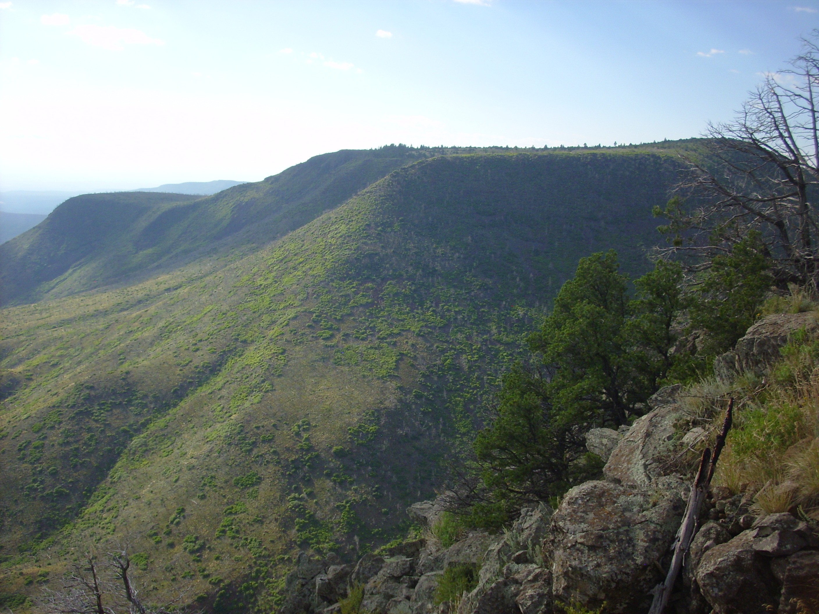
The flows can be made out through binoculars. These flows range
from 10.2 to 10.8 million years old and are composed of olivine
basalt with sizable feldspar phenocrysts.
La Sotella and the high terrain immediately to its south are
examples of a new phase in Lobato volcanism, in which activity
focused on a few vents centered around Clara Peak.
To the east of Gallina Mesa is the Clara
Peak volcanic center of the Lobato Mesa Formation. Like La
Sotella, Clara Peak is a remnant of a shield volcano, formed from
successive eruptions of low-viscosity basalt, and the Santa Clara
Fault has dropped the south flank of the volcano and exposed its
interior.
Tschicoma Highlands and Santa Clara Mountains. Looking
west from near 36.0060623N
-106.1709557W
At left are the Tschicoma Highlands, which are underlain by
younger rocks of the Tschicoma Formation. At right and closer to
the camera are the Santa Clara Mountains. Clara Peak is the high
point at right center, while Cerro Roman is the hill at far right.
This area is heavily faulted, with faults generally trending
towards the northeast. The Santa Clara Fault runs to the south of
both peaks, while another fault runs between Cerro Roman and Clara
Peak. Other faults cut across these main faults. As a result, the
original form of the Santa Clara shield volcano or volcanoes has
been severely deformed and the area deeply eroded.
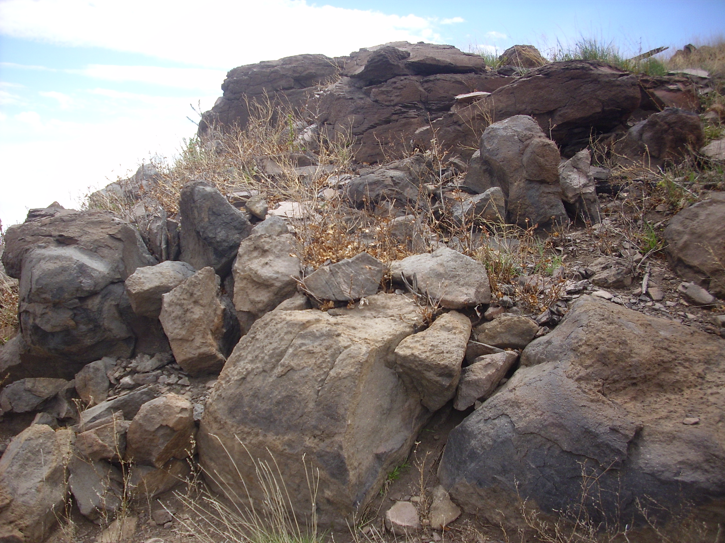
31 Mile Road runs up the south flank of Clara Peak, where the
interior of the volcano has been exposed by faulting and erosion.
One can see numerous thin basalt flows separated by clinker
in the road cut on the southwest flank of Los Cerros, at the
western end of the volcanic center:
A flow is an individual bed of volcanic rock produced by a single
eruption of lava. It generally cools to solid rock as a single
body, crystallizing from the base and top towards the
middle. A shield volcano is built up of numerous thin flows
like these, produced by numerous eruptions over a long period of
time from a long-lived vent.
Crack open any dictionary
of geological terms, and the first entry will be for aa.
This is one of the two forms that flows of basaltic lava commonly
take on land, the other being pahoehoe. Aa is lava whose
surface is rough, jagged, and crumbly, while pahoehoe is lava
whose surface is smooth and ropy. Hot lava fresh from the vent
tends to be pahoehoe, but it can quite abruptly change to aa,
probably as a result of cooling and losing dissolved gases.
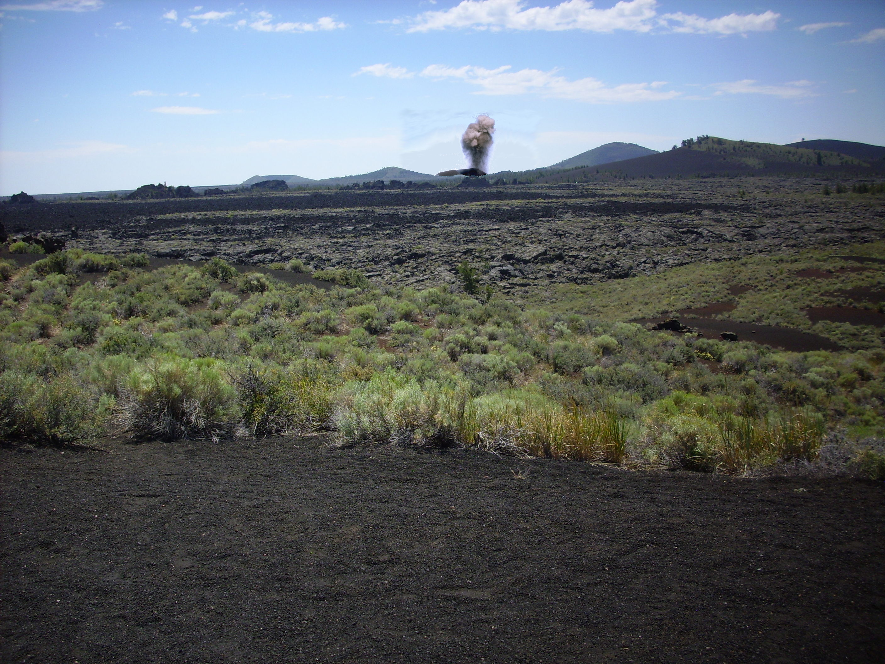
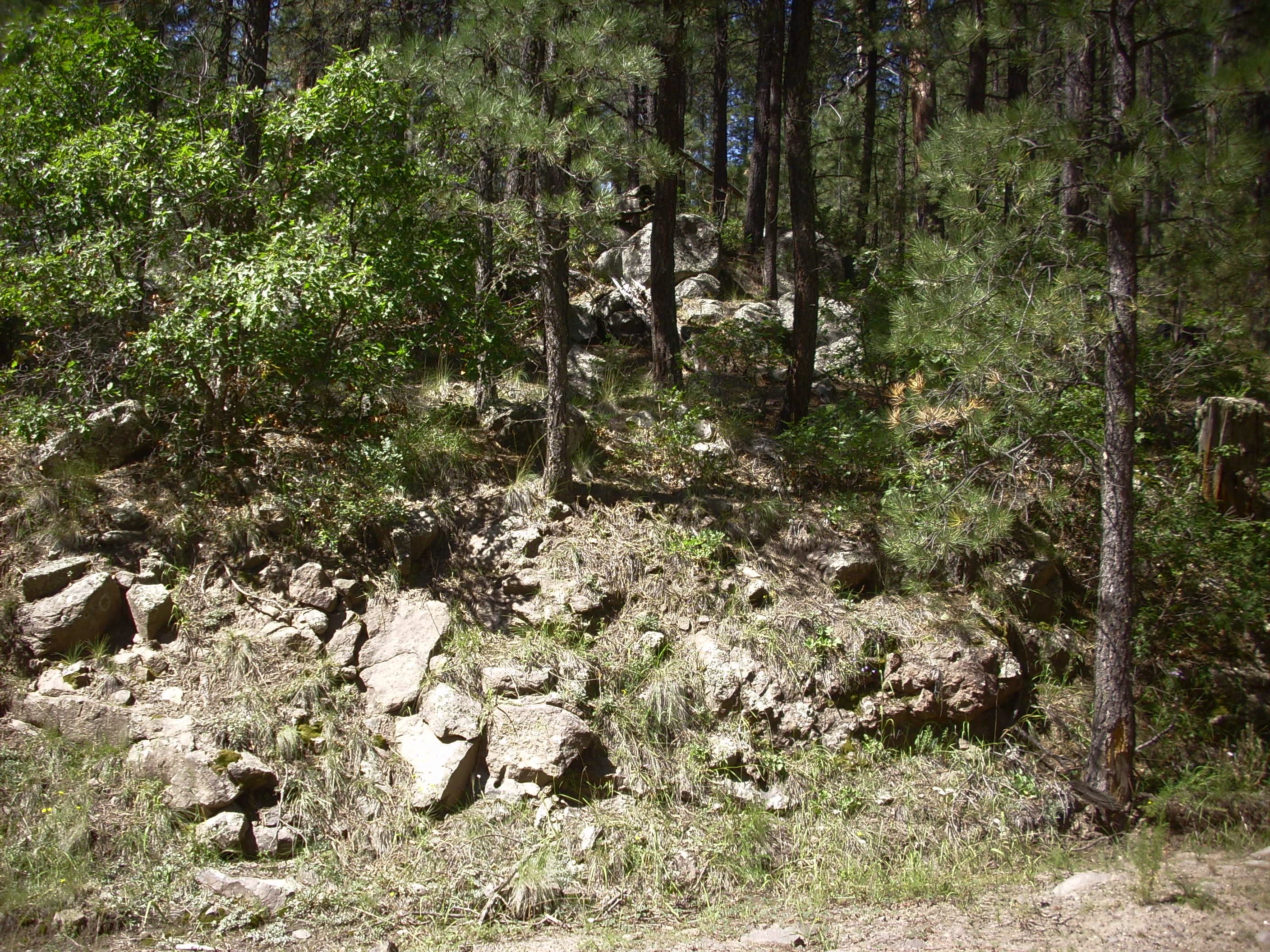
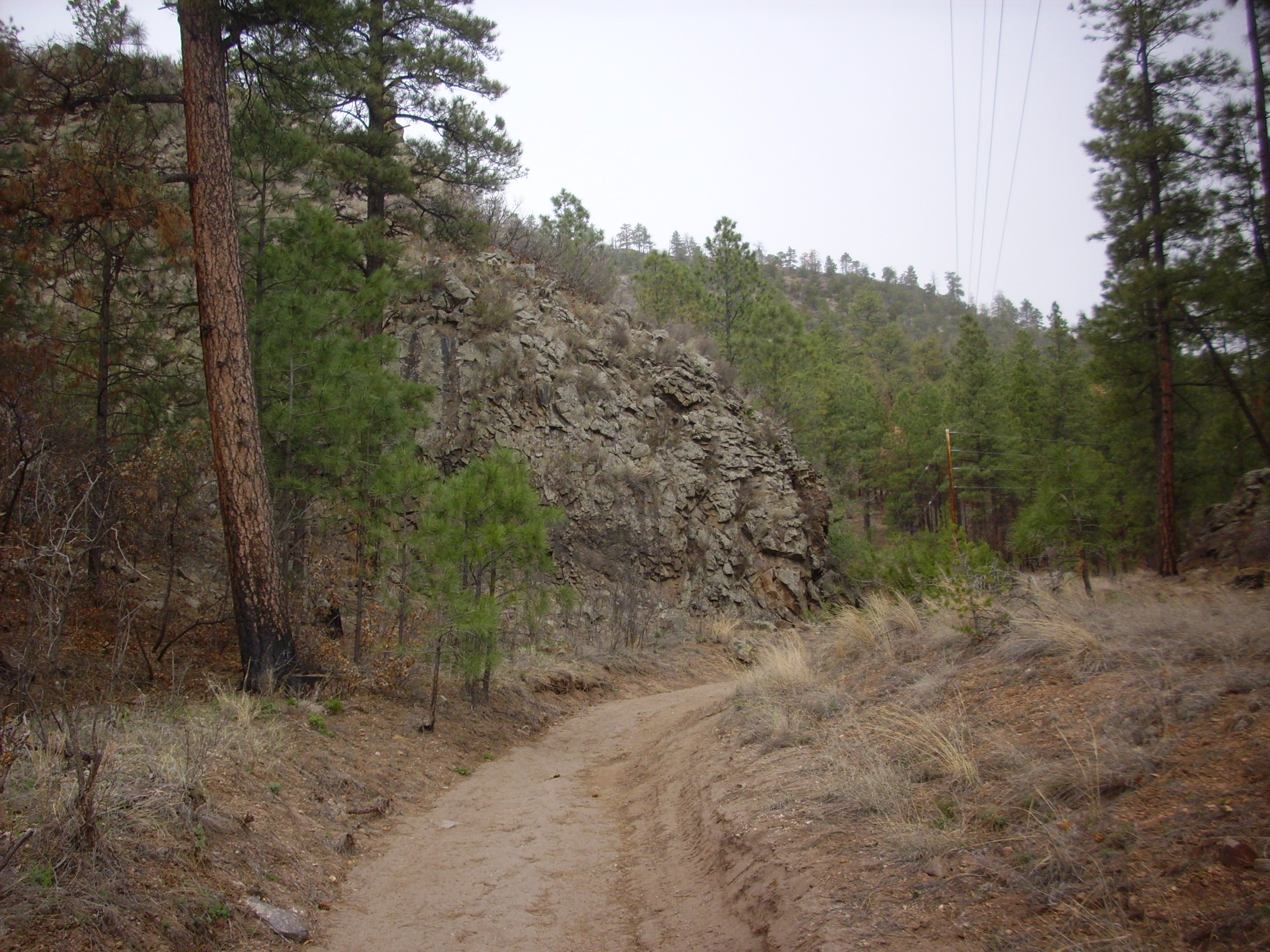
Few lava flows in the Jemez area are fresh enough to show the contrast clearly. One must visit a more recently active basaltic volcanic field to see the best examples. One such example is Craters of the Moon in Idaho, whose youngest flows are less than two thousand years old. Here one can find both pahoehoe flows
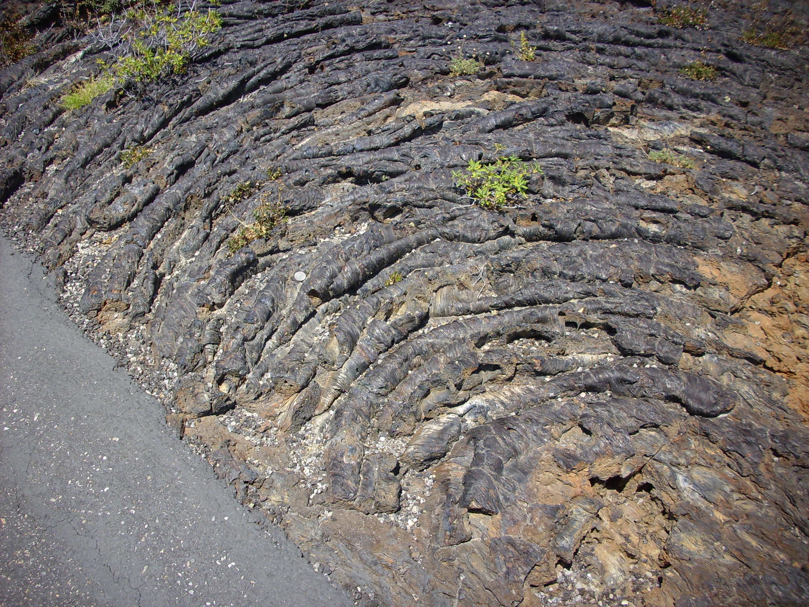
Pahoehoe flow at Craters of the Moon, Idaho. Near
43.457N
113.560W
and aa flows:
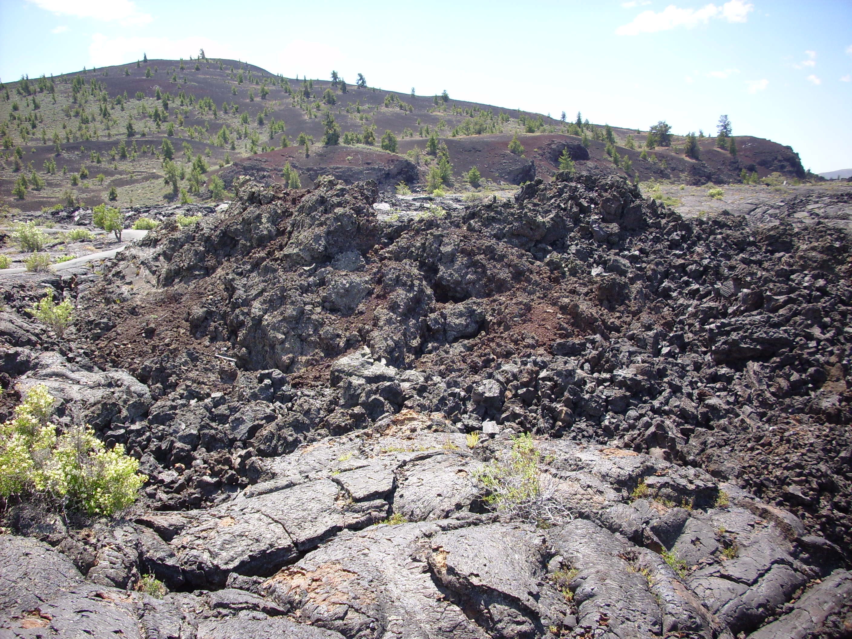
Aa flow at Craters of the Moon, Idaho. Near
43.458N
113.561W
Compare the aa in the second picture with the pahoehoe in the
foreground.
The broken clasts of volcanic rock that cover aa flows are known
as clinker. The solid surface shatters under the forces
generated by the still-liquid magma flowing beneath, then the
clasts are carried to the front of the flow, where they is buried
by the advancing flow. In effect, the aa flow advances on a carpet
of its own clinker. Returning to the photograph of the road cut at
Los Cerros, we can see the carpet of clinker beneath each flow,
suggesting that these were aa flows. The layer of clinker that
forms on top of an aa flow is known as top breccia, while the
carpet of clinker beneath is known as basal breccia. Clinker left
to the sides of an advancing narrow aa flow form marginal
levees. Thus clinker surrounds a massive center on all
sides.
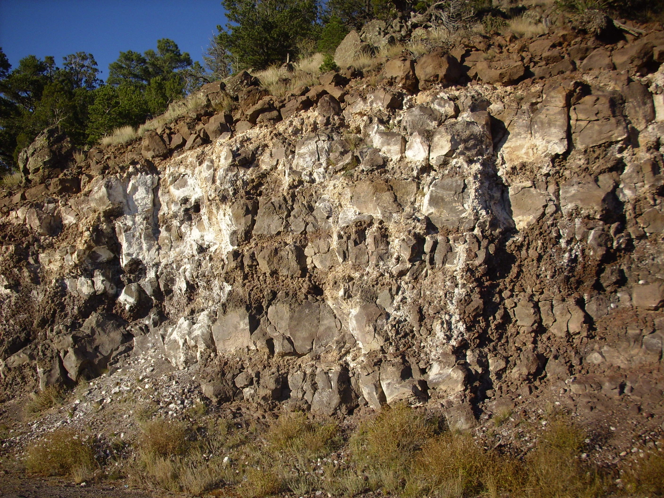
The Los Cerros photograph also shows numerous white patches of caliche on the road cut. Caliche is composed primarily of calcite and can be thought of as a kind of limestone, but it is not formed by the same processes as more conventional limestone. It forms in the subsurface in arid climates (such as the modern Jemez) from slow weathering of calcium-rich parent rock. Caliche typically includes a fair amount of sand, silt, and clay that is bound into the calcite matrix.
Just east of here, the flows are thicker and are separated by more distinct beds of clinker. For example:
Thick basalt flows on Los Cerros. 36
01.374N 106 15.667W
There is a quite massive flow on top and another just exposed at road level, with a thick bed of clinker between.
Further down the road, there is a massive bed of cinder.
Cinder beds along 31 Mile Road, Looking north from
36.0257763N
106.2587937W
Closer view of cinder beds with dike. 36
01.604N 106 15.400W
Where there are flows, there is cinder, and vice versa. Almost all magma contains dissolved gas, and when basaltic magma reaches the surface, the gas comes boiling out, creating a great fountain of lava and hot gas the breaks the lava up into small, foamy blobs. Some of these cool and solidify while still in the air, landing as bits of rock that are full of vesicles or frozen bubbles. Cinder tends to pile up around a vent that is erupting basalt magma, forming a structure called a cinder cone, while the remaining degassed magma pools as lava that flows under the sides of the cinder cone and away from the vent.
Cinder cones are very short-lived geological structures, because the loose cinder is easily eroded away. The cinder cone that produced the beds shown is long gone, but the beds remain, most likely because they were rapidly buried by subsequent lava flows. Here the cinder is intruded by a younger basalt dike. There are no really well-preserved cinder cones in the Jemez area, though we'll see some recognizable examples later in the book. There are some excellent young cinder cones in other locations in the Southwest, such as Capulin Mountain.
Here is some scoria from the cinder beds.

Scoria is the mafic counterpart of pumice, having the same composition as basalt or andesite but rich in gases that have bubbled out to form numerous cavities in the rock. It is characteristically found near the volcanic vent, where the lava retains much of its gas content, and is most common towards the top of flows, where the lighter bubbly lava accumulates. Unlike cinder, scoria solidifies on the surface of the ground rather than as small blobs blown into the air. Lava found further from the vent has usually lost its gas content while still molten and shows fewer cavities.
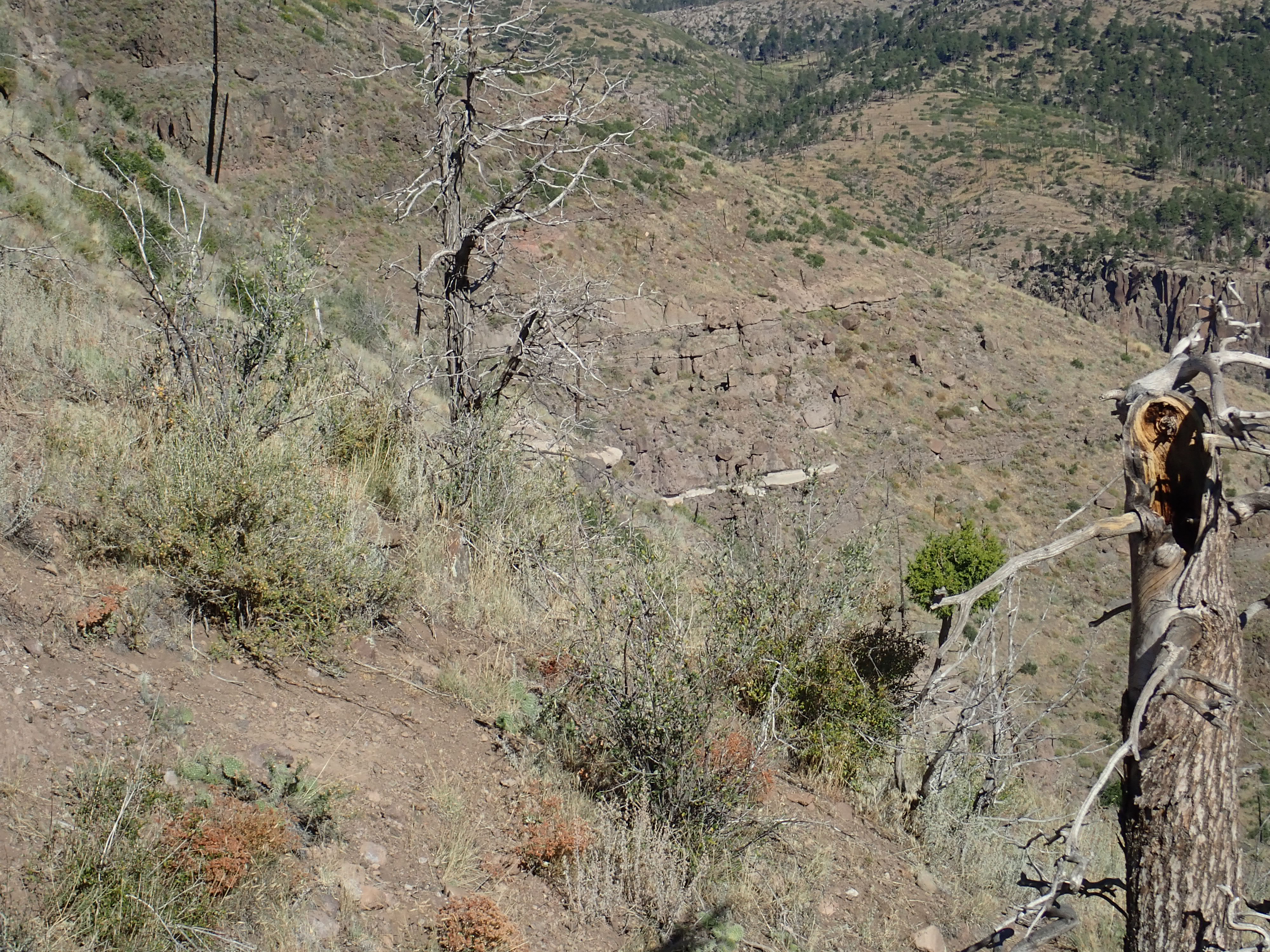
As we continue descending the road to the east, we reach the heart of the shield volcano.
The reddish rock to the left is well compacted beds of basaltic cinder. These extend for about thee hundred feel along the road to the west. The gray mass to the right is gabbro, which has the same composition as basalt, but cooled slowly enough to form visible crystals. This is likely the main vent within the volcano, which cooled very slowly after the final eruptions.
In the center of the intrusion, we see some particularly nicely crystallized gabbro.

The gabbro becomes relatively fine grained further to the east,
likely because it cooled more rapidly, and could be described as
microgabbro. An older name still sometimes used is diabase.
The rock consists largely of feldspar and pyroxenes with some
olivine phenocrysts, which have mostly altered to iddingsite from
exposure to moisture and oxygen. This is the same composition as
an olivine basalt. The distinction is entirely in the much larger
size of the grains in the rock.
The surrounding basalt is notable for the presence of some lenses of gabbro.
Veins of gabbroic pegmatite, Los Cerros. 36
01.645N 106 15.152W
These veins were presumably injected into the surrounding rock
from the magma body in the central vent.
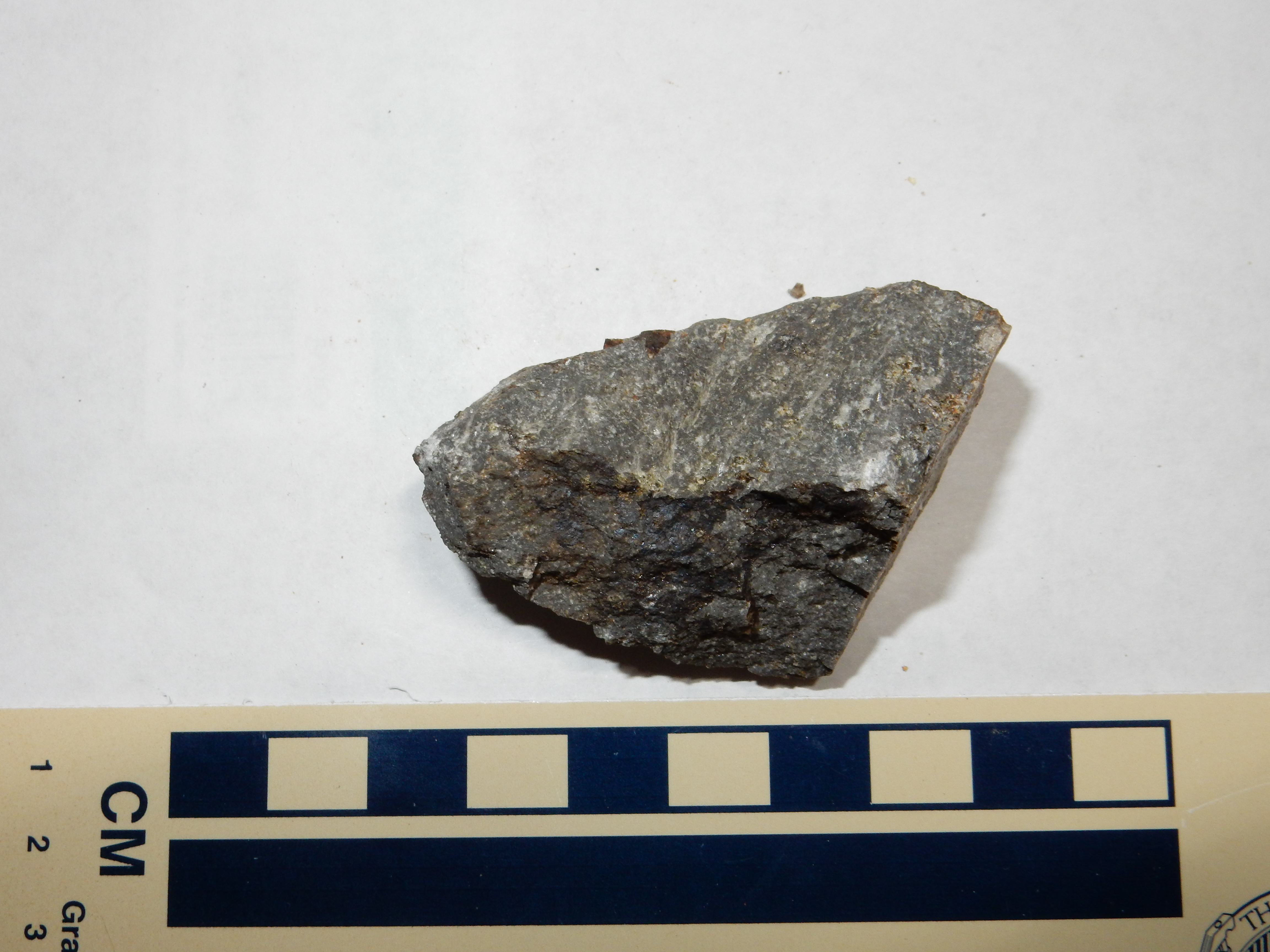
Here's a sample of the surrounding basalt.
Note the large white patch of caliche.
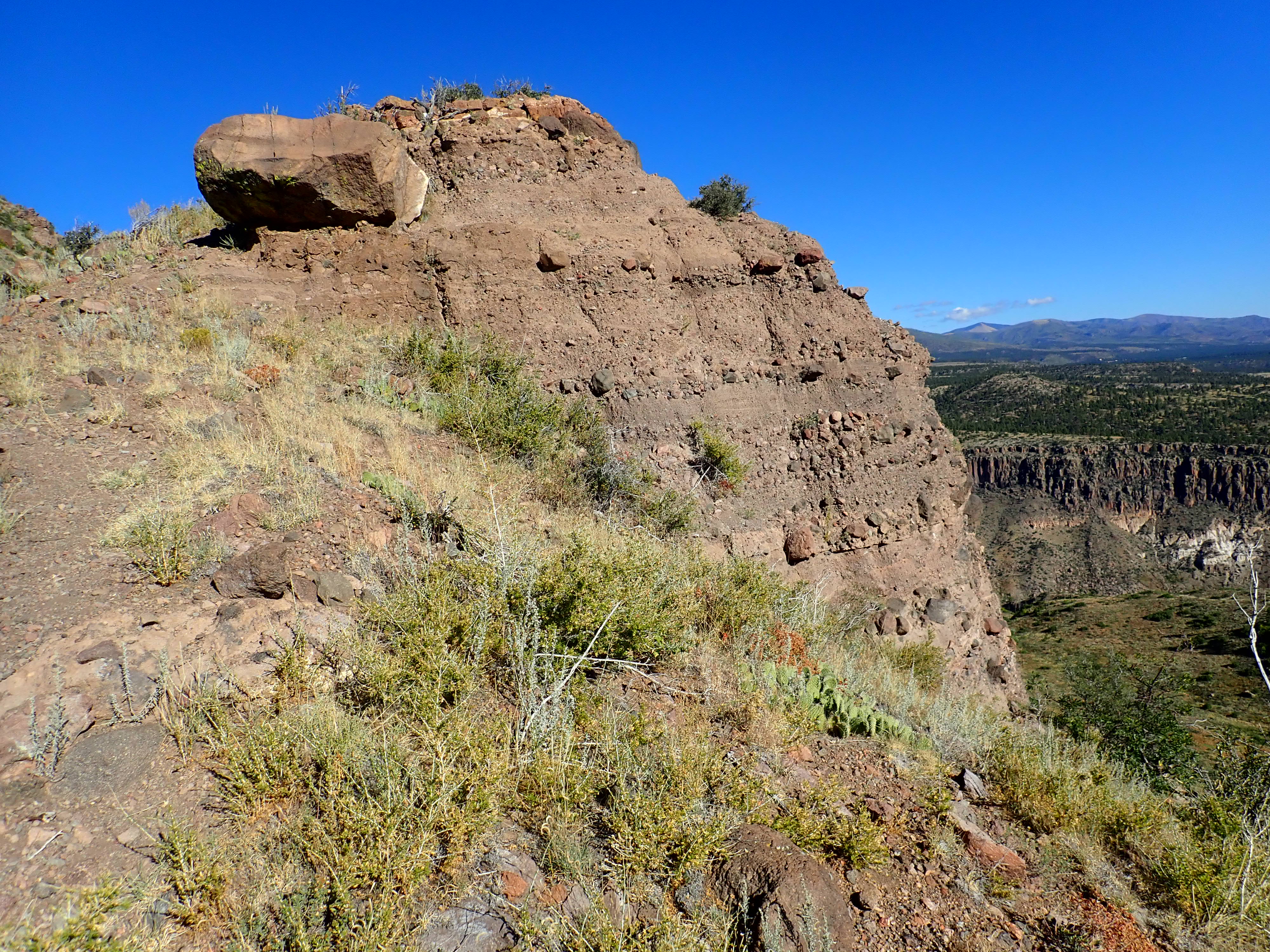
Basalt outcrops on the southeastern flank of the mountain are more massive, with no obvious cinder beds.
Massive basalt of the Lobato Formation, 36.0273876N
106.2543054W
These more massive beds likely erupted as pahoehoe flows.
Some of the uppermost beds of the Lobato Formation are dacite, a
rock considerably richer in silica than basalt is. However, the
dacite is a minor component of the formation. This is not true of
the Keres Group to the south or of the La Grulla Formation to the
west, where early basaltic volcanism was followed by more
voluminous intermediate volcanism. Keres Group volcanism
began almost the same time as Lobato volcanism, but lasted longer
and progressed to more evolved magmas before ending around
6 million years ago.
Within about a million years of the first Lobato Formation flows, volcanism had spread to what is now the southern Jemez. Curiously, as with the northeastern Jemez, some of the earliest flows took the form of rhyolite, a rock high in silica. However, these flows were quite small. The first really voluminous eruptions were of basalt, followed by a pulse of felsic volcanism, and thereafter the eruption products varied considerably in composition, with some tendency for the later eruptions to produce more silica-rich lava. There was also a definite tendency for activity to shift to the east over time.
The bulk of the older volcanic rock in the southern Jemez is
mapped as the Paliza Canyon Formation, which has a diverse
composition ranging from basalt through andesite to dacite. Ages
for these rocks range from 13 million years to 7 million years,
with a peak from 9 to 7.5 million years. These rocks are now
exposed as peaks, ridges, and domes rising above the surrounding,
much younger Bandelier Formation or found at the bottoms of
canyons cutting through the Bandelier Formation.
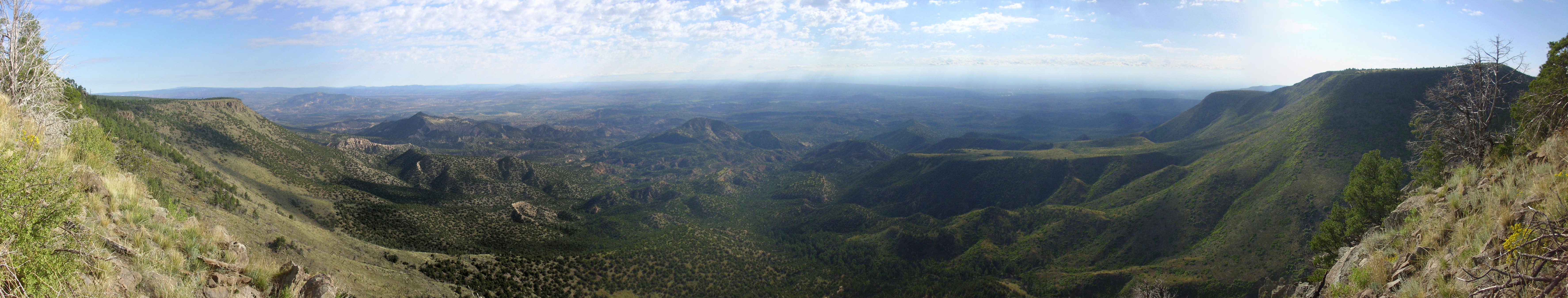
Southern Jemez Mountains. Looking north from 35
33.149N 106 17.585W\
The Paliza Canyon Formation is the largest in the Jemez and
accounts for as much as half of the original volume of the Jemez
volcanic field.
Early basalt flows have been discovered in wells drilled in the
Pajarito Plateau. The GR-4
well, drilled at the mouth of Rendija Canyon where it joins
Guaje Canyon, intersected five basalt flows. The youngest was
dated at 11.55 million years and the oldest at 13.22 million
years. These may represent some of the oldest flows that can
plausibly be assigned to the Paliza Canyon Formation, though they
might also plausibly be assigned to the Lobato Formation.
The lower flows of the Paliza Canyon Formation tend to be olivine basalt, similar to those of the Lobato Formation. These are most prominently exposed in the mesas east and southeast of the village of Ponderosa. The oldest of the Paliza Canyon flows in the Ponderosa area is Chamisa Mesa.
Chamisa Mesa is capped with a basalt flow dating back 9.9 million
years. Underneath are rift fill sediments of the Santa Fe Group.
The basalt of Chamisa Mesa was long thought to be the oldest
volcanic formation of the southern Jemez Mountains, and it has
sometimes been mapped as a separate formation from the Paliza
Canyon Formation. However, the basalt of Chamisa Mesa is now
assigned to the Paliza Canyon Formation.

Borrego Mesa. Looking east
from near 35
39.958N 106 39.878W

Paliza Canyon basalt on Borrego Mesa. 35
42.373N 106 37.319W
Paliza Canyon basalt of Borrego Mesa. 35
42.373N 106 37.319W
Similar basalt flows were erupted along a line of vents west of Bear Springs Peak. These flows cover a substantial area, reaching from Church Canyon near Jemez Springs to Bodega Butte on Zia Pueblo.
Paliza Canyon basalt is exposed southwest of Cerro del Pino along
Forest Road 10.

The Paliza Canyon Formation in this area sits on top of Tertiary
Abiquiu Formation volcaniclastic sandstones, which sit on Triassic
Chinle Formation sediment beds. This column is exposed in San Juan
Canyon, just west of Forest Road 10, which is reached by a long
but easy hike along the canyon or a much shorter but steeper hike
from southwest of Cerro del Pino.

San Juan Canyon. 35
45.290N 106 37.260W
The area to the left is landslide deposits through which there are some exposures of Abiquiu Formation, seen in the last chapter. To the right, the west face of San Juan Canyon is Bandelier Tuff overlying Paliza Canyon Formation andesite and basalt, which in turn overlies Abiquiu Formation. These beds are partially mantled by soil, but here is a good exposure of Abiquiu Formation just below the contact with the Paliza Canyon Formation:
Abiquiu formation in west wall of San Juan Canyon. 35
45.551N 106 37.440W
and, a short distance further up slope, exposures of Paliza
Canyon Formation two-pyroxene andesite.
Paliza Canyon formation in west wall of San Juan Canyon.
35
45.552N 106 37.465W
It would not seem right to discuss the Paliza Canyon Formation without showing some of the outcropping of basalt in Paliza Canyon itself. This outcrop is found along an old logging road not far from Forest Road 10.
Basalt of the Paliza Formation in Paliza Canyon. 35 43.009N 106 37.146W
Further up Paliza Canyon, there are some strikingly flow-banded basalt outcrops.
Flow-banded basalt of Paliza Formation.
35
43.134N 106 37.115W
Such structure in basalt usually indicates that the basalt was very cool and nearly solidified when it reached this point.
Perhaps the most accessible outcropping of Paliza Canyon Formation for the casual visitor is the basalt flow at the base of Las Conchas, just across from the Las Conchas recreational area, which is cut by State Road Four.
Paliza Formation basalt at Las Conchas. 35
48.838N 106 31.533W
Paliza Formation basalt at Las Conchas. 35
48.838N 106 31.533W
Note the dark patches of iddingstine, showing that this is an
olivine basalt. This outcrop has a relatively young radiometric
age of 8.05 million years, but this is significantly younger than
some flows that appear to overlie this flow further south. Much of
the basalt nearby shows hydrothermal alteration, and this has
likely thrown off the radiometric dating.
Many of the flows of the Paliza Canyon Formation thicken abruptly
across faults. This shows that the Rio Grande Rift was continuing
to open even as the Paliza Canyon lavas were erupted, with the
focus of both rifting and volcanic activity steadily moving east.
Paliza Canyon Formation underlies much of the southern rim of the Valles caldera and the area to the south. This is a region of rugged north-south canyons and ridges, some still heavily forested, with only limited access by rough gravel road. Geologists have dubbed this the Keres Highlands, since it is the type area for most of the formations making up the Keres Group.
The Keres Highlands reflects a new phase in Keres volcanism. Not
only had activity shifted to the northeast, but the erupted lava
was increasingly silicic. The previous basalt eruptions had
heatened and softened the crust, and this made it increasingly
difficult for magma to find a path to the surface. Magma stagnated
deep in the crust, slowly losing heat to the surrounding country
rock. As it did so, silica-poor minerals crystallized out, as we
discussed in the first chapter of the book. Some of the heated
country rock melted as well, adding silicic material to the magma.
However, chemical clues in the magma shows that not much crustal
material was assimilated, and most of the evolution of the magma
was due to differentiation through fractional crystallization of
low-silica minerals that settled out of the magma.
When enough of the heavier minerals had crystallized out, the magma became buoyant again, and continued rifting towards the northeast gave the magma a better chance to force its way to the surface. Large volumes of andesitic magma were erupted, and these magmas were considerably more viscous than the basalt that preceded them. They tended to form large volcanic cones, or stratovolcanoes, composed of alternating layers of andesite flows and volcanic debris, with occasional flows of lower-silica basalt or higher-silica dacite. The Keres Highlands is a mass of coalesced stratovolcanoes, which have since been deeply faulted and eroded.
Andesite is an extrusive igneous rock with a silica content
between 57% and 63% and not more than about 6% alkali metal
oxides. This is described as an intermediate composition, with
more mafic magmas forming basaltic andesite, more felsic magmas
forming dacite, and more alkali-rich magmas forming
trachyandesite. Much of the "andesite" of the Paliza Canyon
Formation is sufficiently alkaline to qualify as trachyandesite.
Because andesite contains more silica than basalt does, an
andesitic magma is considerably more viscous, with about the
consistency of smooth peanut butter. It can flow away from
an eruptive vent, but only with difficulty, so that andesitic
eruptions form volcanic hills and mountains rather than
wide-spreading flows.
Like basalt, andesite is composed primarily of plagioclase and pyroxenes, though with more plagioclase and less pyroxene than basalt and with some of the pyroxene replaced with hornblende. Another distinction is that andesite usually has abundant and sometimes sizable phenocrysts, whereas phenocrysts are small and scattered in most basalts.
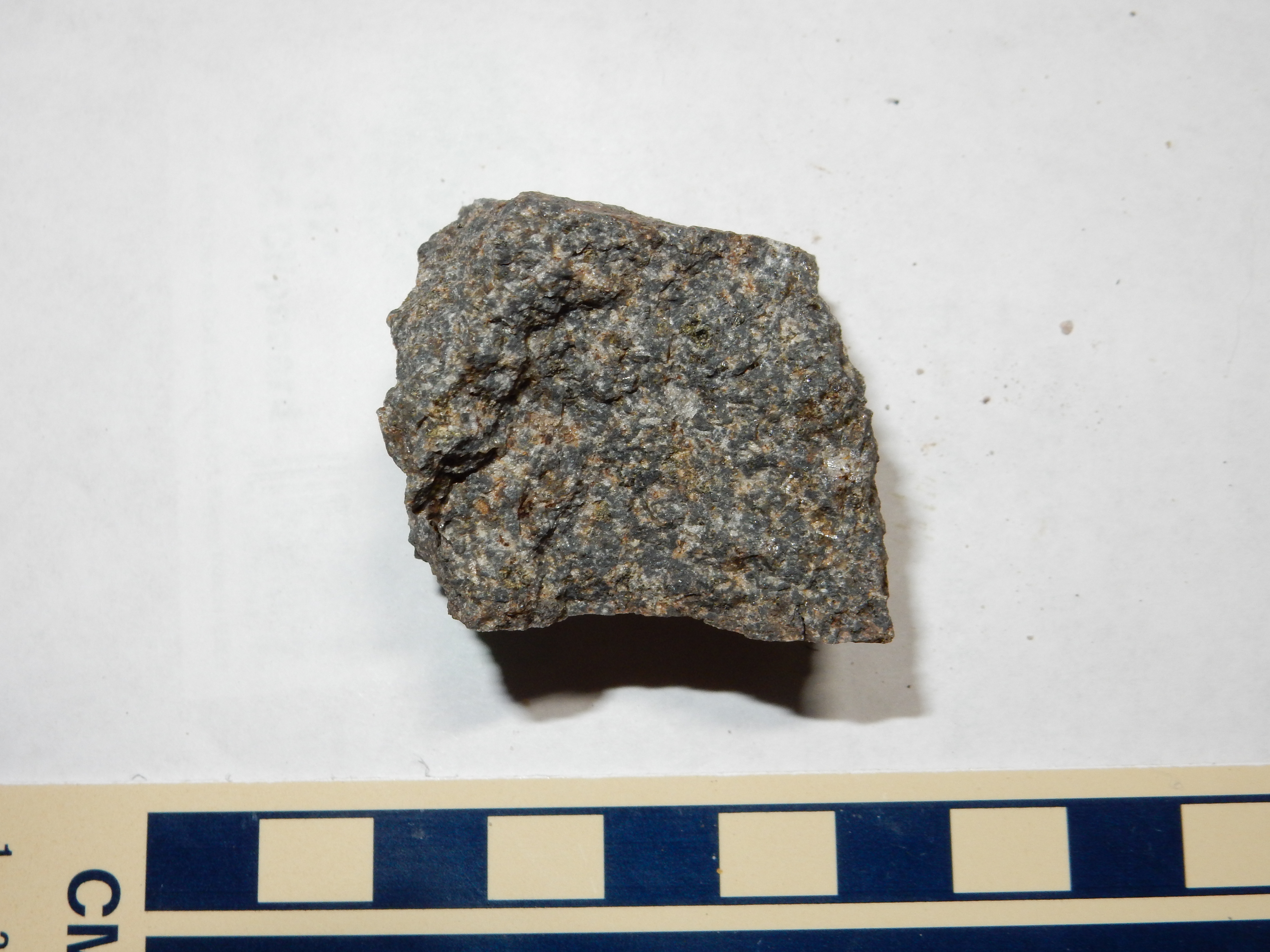
Here's a sample of the andesite underlying the summit of St.
Peter's Dome.
Andesite from road cut near summit of St. Peter's Dome.
35
45.453N 106 22.239W
This is a classical porphyritic andesite, with large phenocrysts of plagioclase and much smaller phenocrysts of pyroxene.
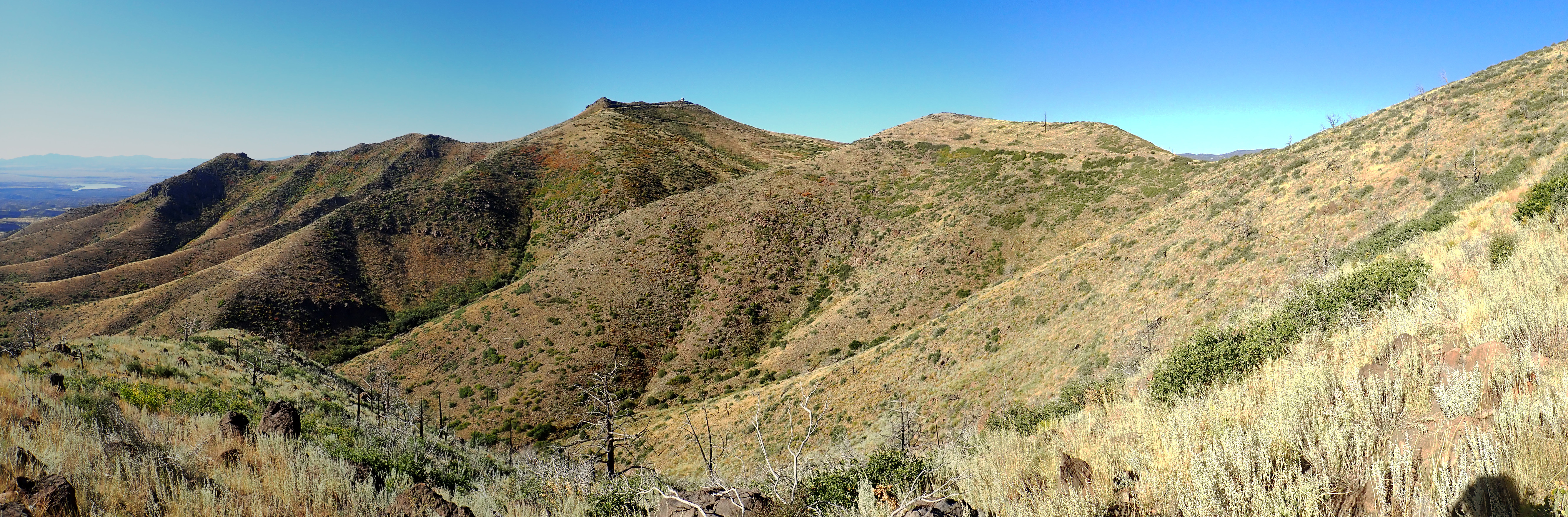
The eastern side of the Keres Highlands is visible from State Road Four as it turns north along the east side of upper Frijoles Canyon.

Keres Highlands. Looking west from 35
50.149N 106 24.309W
The ridge on the skyline is Aspen Ridge, the easternmost ridge of the Keres Highlands, Peeking over Aspen Ridge in a few places is the next ridge to the west, Peralta Ridge. The peak at the southern end of Aspen Ridge (at left) is Bearhead Peak.
East of the Keres Highlands, the Paliza Canyon Formation is
buried under younger Bandelier Tuff, with only occasional outcrops
in canyons. The eastern half of the Keres Highlands is dominated
by Aspen Ridge and Peralta Ridge. Here is a panorama from a knob
on Aspen Ridge:

Panorama from east side of Aspen Ridge.
35
47.888N 106 30.012W
The panorama begins to the west, and Aspen Ridge extends across the left side of the panorama. You can see the road I came in. Redondo Peak is prominent on the skyline, and Cerros del Abrigo and Cerro del Medio are visible to its right, with the north caldera wall behind. Rabbit Mountain dominates the south caldera wall. On the other side of the foreground trees, we see the San Miguel Mountains in the distance, with mesas of Bandelier Tuff in the middle distance. Towards the right side of the panomara, we look almost directly down Bland Canyon. At the right end of the panorama is the southern part of Aspen Ridge.
West of Aspen Ridge is Peralta Canyon, and then Peralta Ridge.
Here's the view looking east from a convenient vantage point on
Peralta Ridge.
Peralta Canyon and Aspen Ridge viewed
from Peralta Ridge. 35
47.341N 106 31.700W
Aspen Ridge stretches across the entire panorama, with Peralta Canyon in the foreground. Cerro Pico and Cerro Balitas are visible in the distance near the center of the panorama. The prominent knoll at center right is Woodard Ridge. The high knolls on the right sided of the panorama make up Bearhead Ridge, which extends to Bearhead Peak further south.
The topographic high point of the south rim is Los Griegos at 3085 meters (10,121 feet). Just to its south is Cerro Pelado, while the peak to its east is Las Conchas Peak at the north end of Peralta Ridge.

Los Griegos and Cerro Pelado. Looking east from near 35
48.670N 106 37.247W
Los Griegos is visible right of center, with the knobby peak of Las Conchas nearly centered behind and to the left of Los Griegos. The peak just to the right of Los Griegos is Cerro Pelado. All are underlain by Paliza Canyon andesite dating to between 8.78 and 9.44 million years old. Los Griegos also has an exposed basalt beds along its eastern flank, showing that occasional eruptions of basalt continued to take place, as fresh magma from the depths sometimes found a path to the surface along an active rift fault.
Basalt flow on east flank of Los
Griegos. Looking west from 35
47.879N 106 31.644W
Similar basalt beds are found on the east side of Peralta Ridge.
Basalt flow on east flank of Peralta Ridge. Looking northeast from near 35 47.879N 106 31.644W
The cliffs here seem to be part of the same basalt flows that we
saw on the east flank of Los Griegos. They’re at a lower elevation
here, because the Paliza Canyon Fault has thrown down this area
relative to Los Griegos. Most of the canyons of the southern Jemez
appear to be structurally controlled; that is, they are aligned
with major faults, which produce a zone of crushed rock that is
susceptible to erosion. The most extreme example of this
phenomenon is San Juan Canyon, which turns sharply twice to follow
cross-cutting faults. These faults are aligned with the Canada de
Cochiti fault zone, to which the focus of rifting shifted during
the eruption of the Paliza Canyon andesites.
The heart of the Keres Highlands is relatively inaccessible. However, the western slopes of the highlands are skirted by Forest Road 10, the main forest road through the southern Jemez, and there are good outcroppings of Paliza Canyon andesite along the road north of Cerro del Pino.
Geological papers on the Paliza Canyon Formation describe this as
a glassy two-pyroxene andesite. It's widespread throughout the
southern Jemez. Two-pyroxene andesite contains both clinopyroxene,
Ca(Mg,Fe)Si2O6, and orthopyroxene, (Mg,Fe)2Si2O6.
As with many other minerals, magnesium and iron freely substitute
for each other. The presence of both forms of pyroxene in the
andesite is thought to point to a specific range of conditions
under which the andesite differentiated underground, though there
is disagreement about how reliable this "thermometer" is.
A little further down the road is more andesite on the hillside, showing flow banding.

Forest Road 10 provides a spectacular view across the southwestern Jemez as it begins its descent towards Paliza Canyon.

Panorama of southwestern Jemez. 35
43.740N 106 37.222W
Andesite flows of the Paliza Canyon Formation make up much of
the the skyline to the east (left side of panorama.) To the
south is Borrego Mesa, underlain mostly with Paliza Canyon basalt
with a single small andesite flow forming the dome right of
center. The canyon to the left of the rise in the right side of
the panorama is Paliza Canyon and to the canyon to the right is
San Juan Canyon.
The Keres Highlands formed a topographic barrier to the Bandelier
Tuff pyroclastic flows, which flowed around them to the southeast
(in the Cochiti area) and to the southwest (forming the prominent
cliffs to the right in the panorama.)
Paliza Canyon volcanism likely extended north into what is now
the Valles caldera, and included flows now found at the base of
the north caldera rim. The rim is best viewed from the northern
caldera moat, which is the area between the topographic rim of the
caldera and the ring of domes along the caldera ring fracture.
We'll visit these features again in later chapters, but, for now,
our interest is in the rocks underlying the north rim.
The caldera north moat. 35
57.479N 106 31.134W
The panorama is centered on the north caldera rim, with Cerro de la Garita as the summit. The top of this mountain is porphyritic dacite and andesite of the La Grulla Plateau that is about 7.5 million years old, while most of its slope is Paliza Canyon Formation andesite that is about 8 million years old. This crops out at the base of the rim.

Paliza Canyon andesite at base of north rim. 35
58.403N 106 32.102W
The Paliza Canyon andesite in the lower part of the north rim is extensively hydrothermally altered, as we'll see later in the book, and it is separated from the overlying La Grulla Formation by thin sedimentary beds interpreted as an erosional surface. The La Grulla Formation shows no signs of hydrothermal alteration.
The later Paliza Canyon magmas were increasingly silicic,
progressing from andesite to dacite. Dacite is so rich in silica
that it forms steep knobs and domes, with occasional short stubby
flows. Dacite underlies much of the highest terrain in the
southern Jemez.
Dacite is an extrusive igneous rock formed from lava that is
fairly rich in silica, about 63%-77%, with less than about 8%
alkali oxides. Magma with less silica forms andesite and magma
with more alkali oxides forms trachyte. If the magma is rich in
silica (70% or more) and crystallizes with more alkali feldspar
than plagioclase, it is classified as rhyolite rather than dacite.
Dacite contains enough silica that dacitic lava is highly
viscous, with about the consistency of Silly Putty. Such viscous
lava does not flow easily away from its eruptive centers. As a
result, most dacite eruptions take the form of a large dome with a
semisolid crust that grows from within, rather like bread rising
(an endogenous dome.)
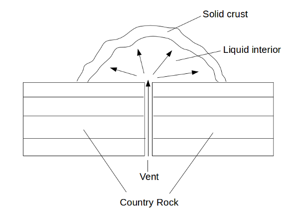
Diagram of endogenous dome
When such a dome forms over a vent in a crater floor or on a lava
flow, it is sometimes known as a tholoid dome.
Occasionally enough dacite erupts to form thick, stubby flows
extending from the eruptive center, which solidify into high
ridges. These are spoken of by geologists as high-aspect flows
because of their steep faces.
Cerro del Pino is a dome of Paliza Canyon Formation
biotite-hornblende dacite with a radiometric age of 9.42 million
years. This is one of the older dacite flows in the southern
Jemez. The high-silica lava forms lumpy domes and high-relief
flows, which in this case extend to the east along what was likely
a paleocanyon.
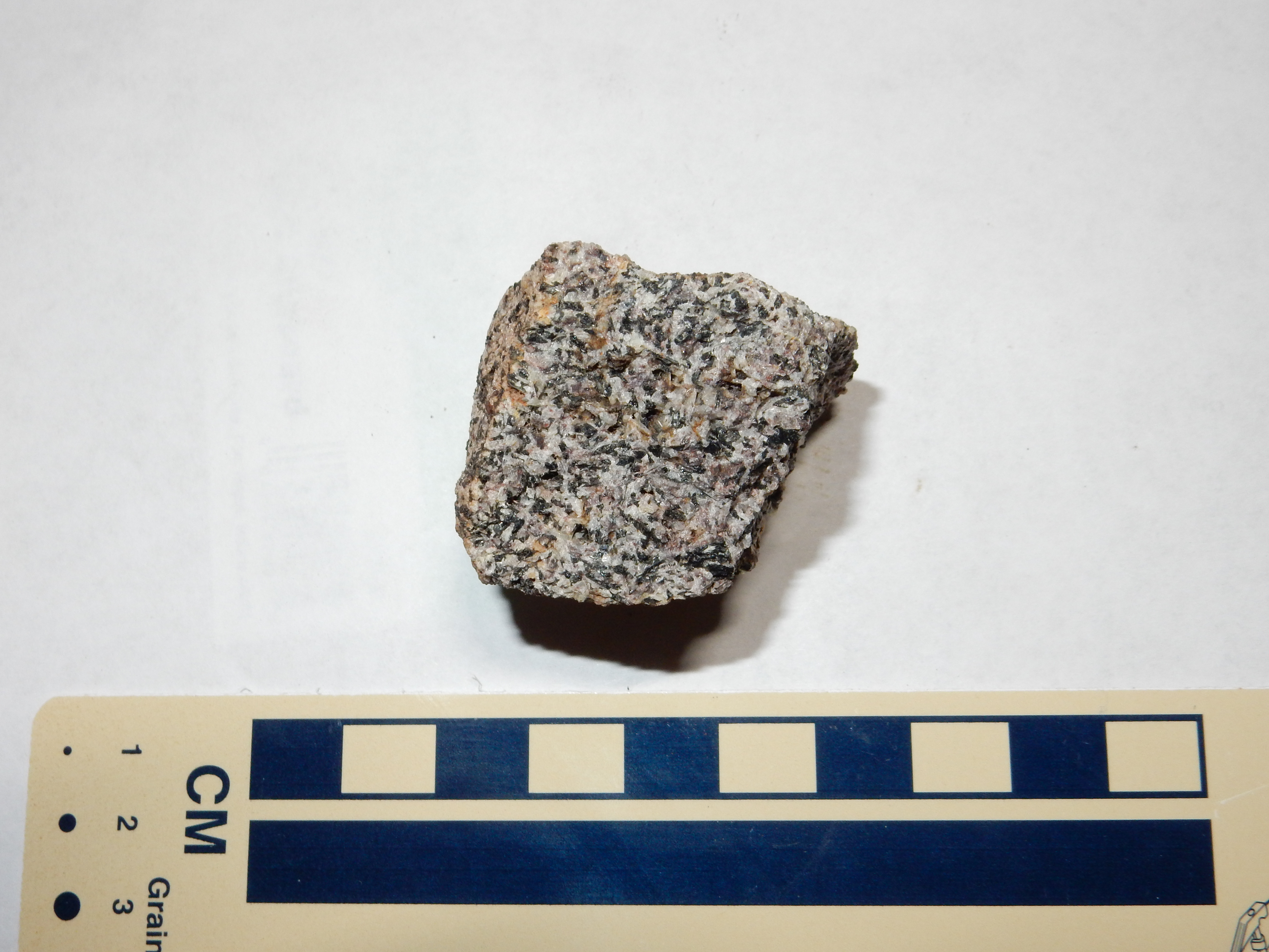
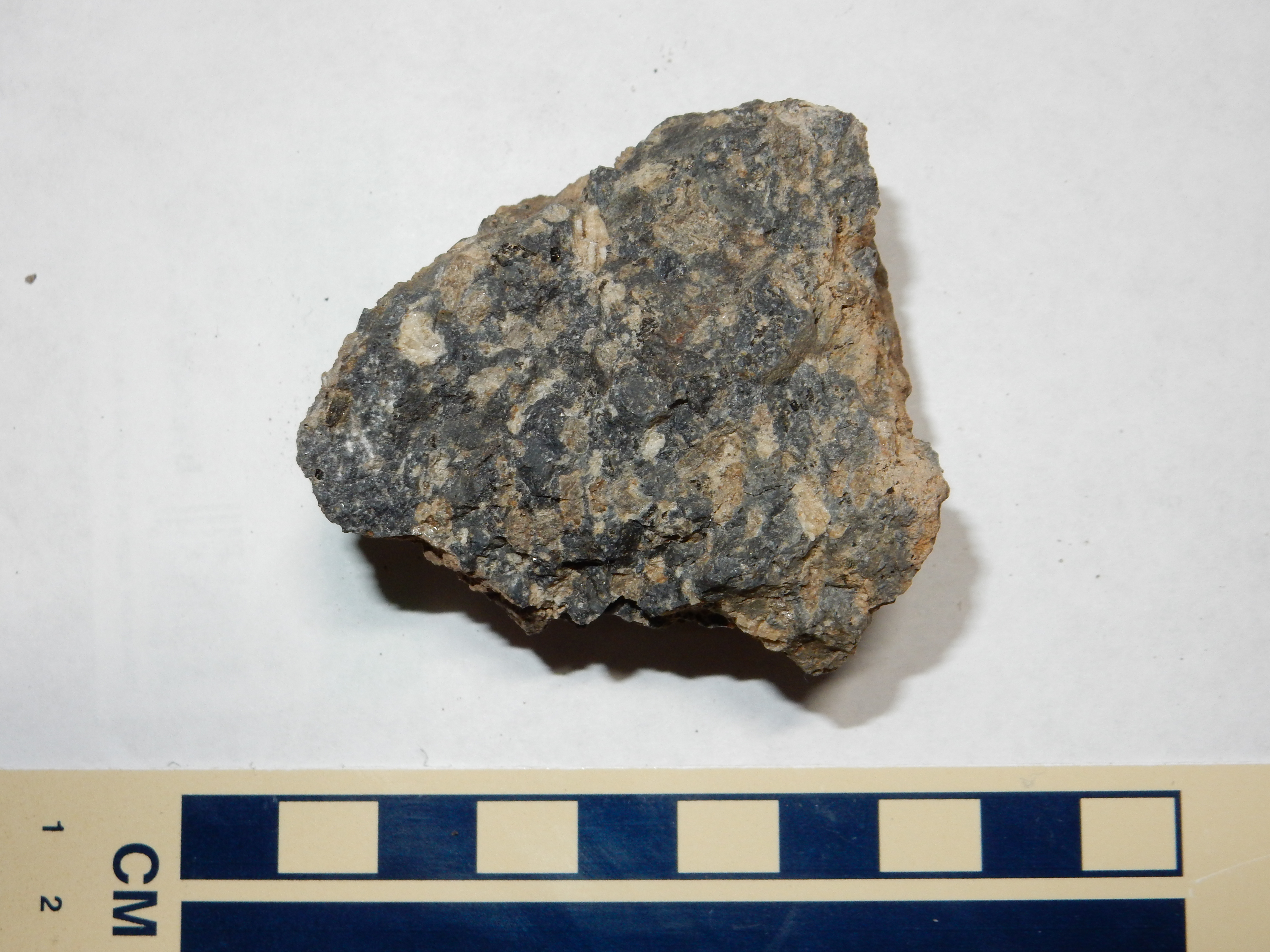
The dacite here is quite distinctive.
Cerro del Pino dacite. From near 35
45.188N 106 36.771W
The sample is rich with large plagioclase phenocrysts. The loupe reveals sparse needlelike crystals of hornblende, and sparser tiny flakes of biotite.
Both Los Griegos and Las Conchas have a cap of hornblende dacite
8.71 million years old.

Hornblende dacite of Las Conchas and Los
Griegos. 35
47.844N 106 31.686W
The dacite is choked with white plagioclase phenocrysts. This thick mush of crystals in a viscous matrix would have had considerable difficulty just emerging from its vents, yet it is present both here and on neighboring Los Griegos.
On the eastern flank of Aspen Ridge, one encounters a very pretty Paliza Canyon hornblende dacite
Hornblende dacite of Paliza Canyon
Formation. 35
47.642N 106 29.122W
At first glance, this looks little different than the andesite further up the ridge. On closer examination, however, the plagioclase phenocrysts (white patches) are seen to have a distinct lath shape (they are euhedral) and they form clumps. Furthermore, the clumps incorporate a few black crystals of hornblende at their centers.
Where State Road Four enters the Valles caldera from the east, it crosses the north slopes of Rabbit Mountain. Rabbit Mountain is a dome of the much younger Cerro Toledo Rhyolite, but basalt and andesite of the Paliza Canyon Formation is exposed on its northwest flank, at the base of the caldera rim.
Paliza Canyon Formation. 35
49.886N 106 28.942W
South of Rabbit Mountain is an extensive area of biotite-hornblende dacite of the Paliza Canyon Formation. This relatively silica-rich flow is also one of the youngest in the Paliza Canyon Formation, at about 6.5 million years old.
Paliza Canyon Formation. Looking
north from 35 48.5785N 106 27.897W
The knobby appearance of this flow is again typical of
high-silica lava. Here's a closer look at a sample
Paliza Canyon Formation
The plagioclase phenocrysts are obvious, but, under the loupe, fresh surfaces show needlelike crystals of black hornblende and a few small flakes of biotite.
North of Paliza Canyon is a small dacite dome that has not been dated, but is likely one of the youngest dacite domes of the southern Jemez. Northeast of the dome is an impressive high-aspect flow.
High-aspect dacite flow of the Paliza
Formation. 35
43.213N 106 37.227W
This dacite is chemically similar to the dacites of the Tshicoma
Formation, which underlie the mountains just west of Los Alamos.
The dacite shows signs of having formed from a mixture of
partially differentiated magma from the upper mantle and melted
crust. A sample seems to have a quite low specific gravity, and
the general look and feel suggests a tuff. However, it is
extremely tough rock (no pun intended). It does not much resemble
dacites of the Tschicoma Formation or of Cerro los Pinos, which
have prominent phenocrysts.
Dacite of the Paliza Formation. 35
43.213N 106 37.227W
Across the road is a large boulder field, apparently part of the same flow.
Dacite flow of the Paliza Formation. 35
43.254N 106 37.236W
This has the appearance of a pristine high-silica flow. Such
flows tend to be covered with boulders like these, which conceal
the liquid interior of the flow. Most such flows are quickly denuded
of this rubbly coating, which is easily eroded off. Here it
looks like the rubble has somehow been preserved.
Sample of dacite boulder from flow. 35 43.254N 106 37.236W\
As the stratovolcanoes built a great stack of increasingly
silicic volcanic rock, volcanic debris began to form an vast apron
around the volcanic centers. This apron is preserved as volcaniclastic
beds.
Volcaniclastics are present in quantity in Paliza Canyon. This particular outcrop is prominent in the south wall of the canyon.

Volcaniclastics in south wall of Paliza
Canyon. Looking northeast from 35
43.179N 106 37.029W
Volcaniclastics in south wall of Paliza
Canyon. Looking south from 35
43.293N 106 36.978W
Volcaniclastics are also present in the north wall of the canyon.
Volcaniclastics in north wall of Paliza
Canyon. Looking west from 35
43.352N 106 36.918W
The exposures here are at the southwestern limit of the volcaniclastic beds of the Paliza Canyon Formation.
To the northwest, in upper San Diego Canyon, thick Lobato Formation volcaniclastic beds are present in the canyon walls near Hummingbird Music Camp.
Paliza Canyon debris avalanche. Looking
north from near 35
52.299N 106 40.151W
The Paliza Canyon exposure is the very dark rock below the cap of
lighter Bandelier Tuff. This exposure is particularly interesting
because it is composed of a jumble of Paliza Canyon Formation
andesite boulders that appears to fill a paleovalley in the
underlying Abo Formation. This valley extends south some distance
and parallels the modern canyon. The exposure is interpreted as a
debris avalanche that came off the flank of a Paliza Canyon
volcano to the north that later foundered into the Valles caldera.
The debris transitions abruptly to solid andesite flows just south
of La
Cueva.
Paliza Canyon basalt and andesite that may have erupted from the same stratovolcano is exposed in the west and north rims of the Valles caldera, where it overlies Santa Fe Group rift fill sediments and is overlain by Tshicoma dacite (of which we'll have much more to say in Chapter 8.) Exposures are readily accessible along SR 126.
Paliza Canyon outcrop in western caldera rim. Looking
north from 35
53.029N 106 39.780W
Exposures continue north along Forest Road 376 on the face of the caldera rim.
Paliza Canyon Formation basalt in
caldera west rim. 35
53.850N 106 39.755W
This looked like basalt, but the area is mapped as Tertiary sediments. However, the stratigraphic position corresponds to Paliza Canyon basalt, so that’s probably what this is.

Paliza Canyon Formation basalt in
caldera west rim. 35
53.654N 106 39.767W
Also basalt, but this time the location is at the edge of a mapped Paliza Canyon basalt outcropping.
The thickest and most extensive beds of Paliza Canyon Formation
volcaniclastics are found in the southwest Jemez, in the vicinity
of the San Miguel Mountains.
The southeasternmost Paliza Canyon Formation exposures are in the San Miguel Mountains, which are prominent on the skyline west of Frijoles Canyon Overlook at Bandelier National Monument.
Panorama of Frijoles Canyon from Frijoles Overlook. 35
46.385N 106 15.714W
We saw this picture in the last chapter, where our attention was
focused on the Pajarito Escarpment at the base of the mountains.
It is probably no coincidence that the San Miguel volcanic center
is located nearly on the fault, which has dropped the eastern side
of the volcanic center to expose a cross section of the volcano.
Alas, this is heavily eroded and it is not easy to pick out the
various formations at this distance.
A few features do stand out. At left are pink cliffs of what
looks like more Bandelier Tuff. However, the geological map
identifies this as a a much older tuff, the Peralta Tuff, which is
about 6.8 million years old. The Peralta Tuff overlies Paliza
Canyon flows in much of the southern Jemez, and we'll have more to
say about it later.
At the center of the panorama is St Peter's Dome itself. There is an old ranger station at the summit that is just visible in the full resolution image. The sharp peak to the right is Boundary Peak, so called because it is located almost exactly on the boundary between National Forest land to the west and Bandelier National Monument to the east. Both St Peters Dome and Boundary Peak are underlain by andesite of the Paliza Canyon Formation.
The small conical hill at right is Rabbit
Hill, a dome underlain by Bearhead Rhyolite. The Bearhead
Rhyolite is a high-silica Keres Group formation that was erupted
through the lower-silica Paliza Canyon Formation about 6 to 7
million years ago. We'll come back to this in the next chapter.
For a closer look at the San Miguel Mouintains, one must take the
Dome Road (Forest Road 298), which branches
off State Road 4 and passes Graduation
Flats, so called because it is a traditional site for
various post-graduation bacchanalia for Los
Alamos High School students. The road continues south from
Graduation Flats across mesas of the Bandelier Formation, through
which small domes and ridges of Paliza Canyon Formation protrude.
There is a nice view of the San Miguel Mountains from the ridge to the west.
San Miguel Mountains from the west. 35
46.807N 106 25.042W
The foreground ridge at left is underlain by Paliza Canyon
Formation hornblende andesite and extends east to Rabbit Hill. The
Sangre de Cristo Mountains are visible on the distant skyline to
its right. St. Peter's Dome is the summit of the San Miguel
Mountains, with Cerro Picacho and Cerro Balitas to the right and
with Cochiti Reservoir visible in the distance between the two. In
the distance, left of Cerro Picacho, is Tetilla Peak in the Cerros
del Rio south of White Rock. Sandia Crest is at right in the far
distance, while Bearhead Peak is visible at far right peeking over
the road cut.
Here's a sample of hornblende andesite from the foreground ridge.
Hornblende andesite. 35
46.373N 106 25.290W
White plagioclase phenocrysts are visible in the photo. Under the
loupe, numerous small needelike crystals of black hornblende are
also visible.
Here's a close-up panorama of the San Miguel Mountains:
San Miguel Mountains from the west. 35
46.807N 106 25.042W
From here it's on to St. Peter's Dome itself. Taking the turnoff onto Forest Road 289, one heads east.
A warning to the adventurous: The main Dome Road is suitable for passenger vehicles in good weather as far as the Dome turnoff. Forest Road 289 is another matter; it is rocky just east of the turnoff, and downright lousy close to the summit of St. Peter's Dome. The first rough patch can be handled by passenger vehicles if you go slowly. There is a very large mudhole further on, but passable in dry weather. The rough spots on the peak ... well, we'll get to those presently.
Most of this road crosses a surface of Tshirege Member, Bandelier
Tuff. As one ascends St. Peter's Dome, one encounters dark
andesite of the Paliza Canyon Formation that is in striking
contrast to the Tshirege Member.
Notice the chocolate brown color in contrast with the light gray
color of the hornblende andesite sample. This demonstrates that
color is not a completely reliable guide to classifying volcanic
rocks.
And then the road gets really bad.
If you take a passenger vehicle this far, I recommend hiking the rest of the way. It's only about 300 meters to the parking area, where you should stop anyway.
The road continues past a metal gate into an area underlain by
very coarse, poorly consolidated gravel. Do not drive past the
gate, which marks the boundary of the Bandelier Wilderness Area,
which is off-limits to vehicles.
Paliza Canyon volcaniclastics. 35
45.620N 106 22.335W
The San Miguel Mountains are located near where the four corners
of four quadrangles meet, and the geologic maps of this area
disagree slightly on what to call these gravel beds. Three of the
quadrangle maps map this as Tertiary volcaniclastics of the Paliza
Canyon Formation. The fourth maps this as Quaternary sediments of
the Cochiti Formation. It probably comes down to a matter of
semantics: Either way, it's rock eroded from the highlands of the
Paliza Canyon Formation. We'll have more to say about both the
Paliza Canyon volcaniclastics and the Cochiti Formation later on.
The abandoned fire lookout is visible on top of the summit. There
are numerous such lookouts throughout the Jemez area, from a time
when they were the main line of defense against wildfires.
Nowadays the Forest Service relies on aerial spotters and citizens
with cell phones, which is much more cost effective.
The knob east of the summit (left in the photograph) is a wonderful place to take a panorama, if you don't mind scrambling and aren't bothered too much by heights.
Panorama from St. Peter's Dome. 35
45.441N 106 22.135W
The left edge of the panorama looks almost directly west, with
Aspen Ridge on the skyline to the right of the ranger station.
Redondo Peak peeks over the nearer terrain to the right of Aspen
Ridge. To its right is Rabbit Mountain, then Sawyer Dome. Then
comes the remaining peaks of the Sierra de los Valles. Clara Peak
is visible on the skyline ito their right. As we look north into
the Rio Grande valley, Boundary Peak dominates the foreground,
with beds underneath dipping to the west. There are two flows
beneath the summit that form particularly resistant beds; the
upper is andesite and the lower is hornblende dacite. One gains
the impression that the center of the volcano lay east of the
present summit and has been cut away by the Pajarito Fault, so
that its remnants are buried under the Bandelier Tuff to the east.
This is supported by studies of the volcaniclastic beds in the
area, which show that volcanic debris was shed to the southwest
from a source somewhere to the northeast. However, the beds
have also been tilted to the west by movement along the fault.
Looking east, we see red beds of the Gallisteo Formation at the foot of the San Miguel Mountains. This older formation has been exposed by the extensive displacement on the Pajarito Fault. In effect, we are looking at a complete cross section of the San Miguel volcano on this side of the mountain.
Towards the southeast is Tetilla Peak in the far distance and the southeast spur of St. Peter's Dome in the foreground. Cochiti Reservoir is visible as well.
To the south is Cerro Picacho, and, to its right, Cerro Balitas.
Notice the cliffs on the east side of Cerro Picacho, formed from
the Peralta Tuff of the Bearhead Rhyolite. This is the same unit
that forms most of the tent rocks at Kasha-Katuwe
Tent Rocks National Monument. We'll revisit this again in
the next chapter.
Here's a closer view of the Gallisteo Formation red beds. We saw these in the last chapter.
Gallisteo Formation from St. Peter's Dome. 35
45.441N 106 22.135W
There is a road cut in the andesite just below the ranger station.
Road cut near summit of St. Peter's Dome. 35
45.453N 106 22.239W
Note the thin beds dipping to the west, from a possible vent just to the east. The rock here is a porphyritic andesite, with large phenocrysts of plagioclase feldspar. If you click to get the full resolution version of this picture, you can make out a bore hole on the boulder right of center where a geological sample was taken. This outcrop has been dated as 8.69 million years old.
An outcrop just south of the parking area is mapped as clotted andesite:
Andesite outcrop near St. Peter's Dome. 35
45.910N 106 22.033W
Clotted andesite from near St. Peter's Dome. 35
45.910N 106 22.033W
Clotted andesite is andesite containing large clumps of phenocrysts. My sample happens not to have any clots in it, alas.
The character of the San Miguel Mountains is evident from the trail from the parking area past Boundary Peak. Looking south:
St. Peter's Dome. Looking south from 35.765407N
106.3629086W
The top “layer” of the mountains is identified as clotted andesite. Beneath is a rugged layer of biotite dacite, which is somewhat richer in silica than andesite and contains biotite (iron mica) in small quantities. Below that are smoother slopes of volcaniclastics, with a thin bed of plain vanilla andesite towards the bottom. The same beds are visible on the ridge to the north.
St. Peter's Dome. Looking west from 35.764275N
106.3591687W
The volcaniclastics have a much subtler bedding, but it visible when the light is at the right angle.

St. Peter's Dome. Looking south from 35.764095N
106.3566617W
This layering is entirely typical of stratovolcanoes.
How long did it take Nature to construct this edifice? There is a hornblende dacite plug on the northeast slopes of the San Miguel Mountains
Dacite plug. Looking south from 35.76409N
106.3521437W
that has been cut in half by a strand of the Pajarito Fault on its east side. It has a radiometric date of 9.48 million years. This vent is like the source of a dacite ash bed near the base of the mountain on its north side.
Dacite ash bed. Looking northwest from 35.76573N
106.3594503W
Ash beds are particularly excellent for dating, because they often contain potassium feldspar crystals that can be analyzed with great precision. An intrepid geologist fetched a sample of this ash bed and it was dated at 9.47 million years old, indistinguishable from the vent. Since the beds atop St. Peter’s Dome have been dated at 8.69 million years, it took a little under a million years for the entire thick sequence of volcanic beds from low in Capulin Canyon to high atop St. Peter’s Dome to be erupted.
The volcaniclastic beds that make up much of the volume of the San Miguel Mountains are well exposed west of Boundary Peak.
Volcaniclastic beds. Looking northwest from 35.76573N
106.3594503W
Similar beds crop out at many locations along the Boundary Peak
trail and the St. Peter's Dome trail to Cerro Picacho and beyond.
The beds generally show numerous broken clasts of volcanic rock in
a well-cemented ashy matrix.
To the south of the San Miguel Mountains, in the area around
Cerro Pico and in Sanchez
Canyon, there are exposures of some of the oldest volcanic
rocks of the Jemez field. These are overlain by thick beds of
Paliza Canyon volcaniclastics.

Panorama from southeast of Cerro Balitas. 35
43.360N 106 23.082W
Cerro Picacho dominates the left side of the panorama, while to the right, we look down Sanchez Canyon to its confluence with White Rock Canyon.The volcaniclastics form the very rugged terrain south of Cerro Picacho. There are great thicknesses of volcaniclastic beds of the Paliza Canyon Formation stretching west from the San Miguel Mountains.
Some of the old volcanic rocks in Sanchez Canyon have radioisotope ages in excess of 12 million years, but these may be mistaken; more recent dating makes them much younger, around 9.6 million years old. Older still are some basanite flows on the southeast flank of the San Miguel Mountains that are interbedded with Santa Fe Group sediments; these have been dated to 18 million years old or older, and may represent the very earliest beginnings of Jemez volcanism. However, because they are interbedded with Santa Fe Group sediments, and because their chemistry is distinctly different from any younger Jemez flows, they are usually regarded as pre-Jemez flows. The geology of the San Miguel Mountains is complex and of considerable scientific interest, but the area south and east of the mountains is designated wilderness area with no roads, few trails, and challenging hiking that makes it difficult to investigate.
The ridge from which this photograph was taken has exposures of one of the more unusual rocks of the San Miguel Mountains, olivine andesite:
Olivine andesite. 35
43.360N 106 23.082W
Olivine andesite. 35
43.360N 106 23.082W
Under the distinctive rusty weathering surface, the rock does indeed look like an andesite. It is somewhat vesicular, typical for the top of a flow, and there are scattered blobs of what looks like iddingsite, indicating that this is an olivine andesite.
Olivine andesite is of special interest because it breaks the rules. There isn't a reasonable composition for magma that gives you the intermediate silica content of andesite in equilibrium with olivine. Olivine is normally found only in low-silica rocks. Geologists have concluded that this is a non-equilibrium composition, probably formed when a basaltic magma containing phenocrysts of olivine mixed with a high-silica magma on its way to the surface. The olivine phenocrysts didn’t have time to react with the excess silica in the surrounding magma to convert to pyroxenes, which is strong evidence that the mixing occurred just before the eruption of this magma. Such non-equilibrium compositions are so common that some volcanologists believe that magma mixing is one of the most important triggers for an eruption.
Although the San Miguel Mountains stand out from the remainder of
the southern Jemez, and were clearly an important and long-lived
eruptive center, they are not distinct from the rest of the Keres
Group either in age or composition. The volcanic beds here are
particularly impressive from a combination of subsidence around 9
million years ago that allowed volcaniclastics to accumulate,
followed by tilting and uplift of the San Miguel Mountain block
around 6 million years ago that has exposed an impressive cross
section of the beds.
I mentioned that thick volcaniclastic beds extend west of the San Miguel Mountains. These are beautifully exposed in upper Cochiti Canyon, which is easily viewed from the Dome Road.
Cochiti Canyon. 35
45.999N 106 25.150W
The canyon is rimmed with Bandelier Tuff, but the slopes and wild terrain in the bottom of the canyon are Paliza Canyon Formation volcaniclastics. A thin ash bed in the canyon wall, just visible halfway down the slope to the left, has been dated at 9.5 million years old, indistinguishable from the dacite vent we saw earlier in the San Miguel Mountains.. You can see that the terrain over which the Bandelier Tuff erupted was heavily eroded and quite irregular. The upper part of the modern canyon, to the right, coincides with a paleocanyon that was later filled with a great thickness of Otowi Member, Bandelier Tuff.
The next picture shows Tshirege Member, Bandelier Tuff, to the right, sitting directly on a topographic high of the Paliza Canyon Formation volcaniclastics beds.

Bandelier tuff on Paliza volcaniclastics. Looking
northwest from 35
45.087N 106 24.716W
Volcaniclastics come in several varieties, and geologists who have closely studied this area have divided the beds accordingly. Autoclastic flow breccia are beds of broken andesite with occasional layers of massive lava. Typically 70% of the bed will be broken rock and 30% will be massive lava. These beds are typical of the central peak of a composite volcano. Their presence here confirms that one or more andesitic volcanoes erupted very close to this area.
Pyroclastic flow deposits in this area probably resulted from collapse of andesitic or dacitic domes, which send red-hot rock and ash tumbling down the slopes of the volcano as block and ash flows. These are characterized by igneous clasts in a well-cemented ashy matrix. The clasts often show fracturing that is interpreted as cooling fractures, showing that the clasts were red-hot when the beds were deposited. We'll see some excellent examples of these later in the book.
Debris-flow deposits have more rounded clasts and a less
well-cemented matrix indicating that the material was cool and
probably water-saturated when deposited. We saw such deposits in
the Espinaso Formation in the last chatper, and we'll see more
examples later on. A few such flows are almost entirely ash and
pumice and represent explosive eruptions.
Hyperconcentrated-flow deposits were deposited from a
mixture of water and volcanic debris in which water predominated.
They resemble stream deposits, but from a particularly swift and
muddy stream rich in material eroded off the volcano.
The volcaniclastic beds may extend for great distances in the
subsurface to the north and east. Drilling on the Pajarito Plateau
has revealed subsurface beds composed of volcaniclastics of the
Paliza Canyon Formation.
The area northeast of Cochiti Canyon and west of the San Miguel Mountains contains several exposures of Paliza Canyon Formation andesite and dacite protruding above the Bandelier Tuff.
Forest Road 298 south of Graduation Flats passes a dome of hornblende dacite.

This sample show large white crystals of plagioclase in a dark matrix, with some smaller crystals of hornblende clearly visible in the geologist's loupe. Most dacite has fairly large plagioclase phenocrysts, but the ground mass is unusually dark in this specimen.
We have seen that the flows of the Paliza Canyon Formation
overlie rocks as young as the Tertiary Santa Fe Group (in the
southern Jemez) and as old as the Permian Abo Group (in the
western Jemez.) Rifting had already thrown down and buried the
older rocks further east, whereas they were exposed at the surface
by erosion to the west. The Paliza Canyon Formation also thickens
dramatically from west to east, from the thin beds in the west rim
of the caldera to the very thick volcaniclastic beds of Cochiti
Canyon. This reflects the vertical displacement across the western
margin of the Rio Grande Rift.
If the Lobato Formation is the oldest rock unambiguously associated with the Jemez volcanic field, first erupting about 14 million years ago; and the volcanic activity then spread south, with the Paliza Canyon Formation first erupting 13 million years ago; then what came in the area between? Most geologists think that mafic volcanism occurred in the entire area from Lobato Mesa to Borrego Mesa from about 13 to 8 million years ago. However, the area between the southern Jemez and the northeastern Jemez is taken up by the Valles Caldera to the west, the Sierra de los Valles further east, and, beyond that, the Pajarito Plateau. These features are all significantly younger than the Lobato and Paliza Canyon Formations, and they have mostly buried or destroyed any older rocks. However, there are outcroppings of andesite in Guaje Canyon (9.6 million years old) and in Santa Clara Canyon (7.8 million years old). All these outcroppings are presently inaccessible because of flood damage to the access roads or because they are on tribal lands.
Los Alamos Canyon is a deep canyon located just south of the city of Los Alamos. The canyon is crossed by Omega Bridge, which connects the city with Los Alamos National Laboratory and the road to the Jemez Mountains. The laboratory ran a small research reactor in the lower canyon for many years, while the city built an ice skating rink near the bridge, where the steep canyon walls shelters the rink from the winter sun. Further up the canyon, a small reservoir was constructed, with a beautiful hiking trail and some picnic areas.
From its upper reaches to just below the reservoir, the canyon bottom exposes older rocks of the Jemez volcanic field. An exposure of andesite buttresses the south end of the Los Alamos Reservoir dam.
Paliza Canyon Formation andesite buttressing Los Alamos
Reservoir dam. 35
52.987N 106 21.234W
This andesite has been dated at 8.72 million years old. It has the right age and composition to be an outcrop of the Paliza Canyon Formation, and is part of a flow that is elsewhere buried under younger rocks of the Pajarito Plateau.
Across the canyon, a large outcrop of andesite towers over the reservoir
Paliza Canyon Formation andesite north of Los Alamos
Reservoir dam. 35
53.041N 106 21.285W
This outcrop sits just to the right of a fault that cuts across the canyon, with the downthrown side to the left (west). Here a small sliver of crust has dropped a few tens of feet.
Younger flows are found interbedded with the Santa Fe Group sedimentary beds in wells drilled in the Buckman area. These are about 8 to 9 million years in age, the same as the Paliza Canyon Formation. Whether they should be included in the Keres Group or the Santa Fe Group is a question for which there is no definitive answer.
Relief map of the Jemez with Canovas Canyon Rhyolite
outcroppings highlighted in red
On the southern end of Borrego Mesa, two basalt flows of the Paliza Canyon Formation are exposed, the older correlating with the basalt of Chamisa Mesa. Between the flows is a substantial bed of rhyolite tuff, formed from high-silica volcanic ash. There are additional extensive exposures of rhyolite flows, domes, and tuff beds south and east of Borrego Mesa, particularly around Bear Springs Peak, and more isolated outcrops as far east as the San Miguel Mountains. These are collectively known as the Canovas Canyon Rhyolite.
With limited radiometric dating, it was natural for geologists to conclude that the basalt of Chamisa Mesa was the oldest in the southern Jemez, and was followed by the Canovas Canyon Rhyolite. This in turn was followed by the oldest basalt flows of the Paliza Canyon Formation. Improved mapping, dating, and petrological analyses have largely shattered this pretty picture. It now appears that the Canovas Canyon Rhyolite includes flows with ages from over 12 million years to around 8 million years in age, roughly the same age range as the Paliza Canyon Formation. The two formations erupted over the same extended period of time.
However, the Canovas Canyon Rhyolite is chemically distinct from
the Paliza Canyon Formation. If one extrapolates the composition
of Paliza Canyon Formation dacites into the rhyolite field, the
resulting composition differs in subtle but significant ways from
the Canovas Canyon Rhyolite. Geologists interpret this to mean
that, whereas the Paliza Canyon Formation magmas originated in the
mantle before differentiating as they rose to the surface, the
Canovas Canyon Rhyolite formed from lower crustal material that
was melted by the heat of basaltic magma that did not make it to
the surface.
The Lobato Mesa Formation and Paliza Canyon Formation basalts were formed from magma that originated in the hot asthenosphere rising into the Rio Grande Rift. Because this primitive magma was significantly less dense than the surrounding solid rock from which it melted, it was subject to buoyant forces that drove it towards the surface.
However, the journey was likely neither swift nor uninterrupted.
As the magma rose, the country rock around it became increasingly
less dense. At first, this did not matter much, since the magma
was also expanding and becoming less dense as the pressure
dropped. However, the magma eventually reached the Moho, the
boundary between crust and mantle, where the density of the
country rock jumped from the 3.4 g/cm3 of the upper
mantle to the 3.0 g/cm3 of the lower crust. This is
close to the density of primitive magma, and so it is likely that
most primitive magmas stagnate at the lower boundary of
the crust, underplating the crust. Only in rare cases is the magma
able to continue rising through deep fractures in especially cold,
dense crust to form unusually silica-poor rocks such as basanite.
We saw an example of a basanite in the La Cienega area in the last
chapter, and some basanite flows are interbedded with Santa Fe
Group beds on the southeast flank of the San Miguel Mountains.
Magma that stagnates at the Moho slowly cools, and it may also assimilate small amounts of material from the lower crust. The two are connected: Heat lost by the cooling magma goes into heating the country rock. Either way, the effect is to increase the silica content of the magma, by adding new silica-rich material and by crystallizing out silica-poor minerals. This can lower the density of the magma enough for it to regain buoyancy. Where the crust is thin and highly fractured, as it is along the Rio Grande Rift, the magma can rise in quantity to the surface and erupt as basalt lava.
Such eruptions are self-limiting in most continental settings.
Basalt lava has a maximum density of about 3.1 g/cm3,
while the rocks of the upper crust have a density of less than 2.7
g/cm3. The magma is able to make it to the surface only
because the country rock is rigid enough to form a "pipe" for the
heavy magma, and because the magma contains considerable dissolved
gas, which begins bubbling out as the pressure drops. The gas
bubbles lower the effective density of the magma and help drive it
to the surface. But as the country rock begins to soften, it tends
to seal up the path to the surface, and the release of gas in an
eruption increases the density of the remaining magma. The
eruption ceases long before the supply of magma is exhausted. The
magma remaining in the vent effectively plugs it, so that
subsequent eruptions usually find a different path to the surface.
As a result, continental basaltic volcanic fields are typically monogenetic,
meaning that they are composed of many small eruptive centers,
most of which only erupt a few times. Each such cone is relatively
small, typically from 0.25 to 2.5 km (0.15 to 1.5 miles) in
diameter.
The remaining magma deep underground will tend to spread out at
the level where its density matches the country rock. In some
cases the magma quietly cools and solidifies at this level,
forming various kinds of intrusive bodies. If the magma spreads as
a relatively thin layer sandwiched between the beds of the country
rock, it forms a sill.
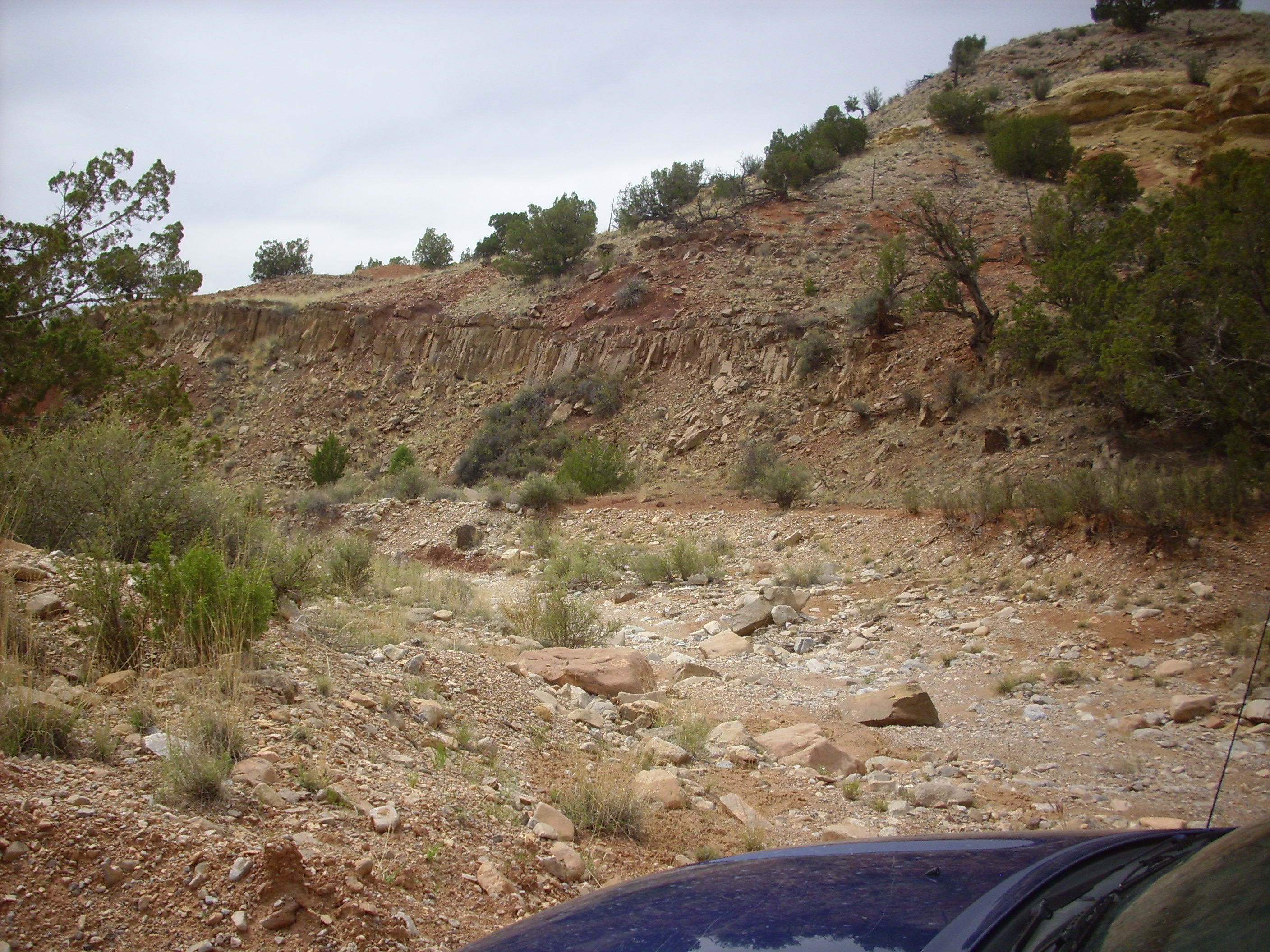
There are likely some sills underlying the Jemez volcanic field, but because the field is young, these have not been exposed by erosion yet. The sill here is significantly older than the Jemez, at around 30 million years old, but much younger than the Triassic beds it has intruded.
Magma stagnating in the crust can undergo additional
differentiation as it cools and low-silica minerals crystallize
out. It can also assimilate more crust material. The body of
cooling magma, known as a magma chamber, may eventually
become buoyant enough to resume its rise to the surface, and can
erupt as andesite or dacite. This was the origin of most of the
flows of the Paliza Canyon Formation. But the magma can also melt
a significant amount of high-silica crustal rock without mixing.
The magma becomes zoned, with a layer of low-silica magma from the
mantle at the bottom and a layer of high-silica magma from melted
crust at the top.
This is a plausible explanation for a common geological phenomenon called bimodal volcanism. It is surprisingly common for a volcanic field to erupt low-silica lava followed by high-silica lava, often with little intermediate-silica lava. The southern Jemez are not the most extreme example; here the the first eruptions have compositions ranging all the way from basalt to dacite, followed by rhyolite. In other volcanic fields, such as Yellowstone, and in other parts of the Jemez, there is much less of the intermediate composition rocks. The low-silica magma shows chemical signatures of having come primarily from the mantle, while the high-silica magma shows chemical signatures of having formed from melted crust rather than from differentiation of mantle magma.
Melting of crustal rock by underlying stagnated mafic magma also
explains how so much rhyolite can be produced in continental
volcanism. Simple differentiation of primitive magma from the
mantle is an inadequate source, since fully 90% of a basaltic
magma must crystallize out before the remainder has a rhyolitic
composition.
Rhyolite is the most silica-rich of all extrusive volcanic rocks, with a silica content of at least 69% (more for rhyolite that is poor in alkali oxides). It is normally very fine-grained or even glassy (having no discernible crystal structure at all), though it may contain phenocrysts of quartz, feldspar, hornblende, or biotite.
The high silica content makes rhyolite magma extremely viscous, with about the consistency of cold roofing tar. Rhyolite magma can hardly make it out of its eruptive vent intact. Instead, the dissolved gases in the magma typically turn it into a froth of tiny bubbles that blows itself apart on contact with air, forming volcanic ash that consists of vast numbers of tiny fragments of solidified bubble fragments. Under the microscope, these appear as concave bits of volcanic glass. When the ash falls to the surface while still hot enough to be soft, it can compact under its own weight to form a solid rock called tuff. It is very common, though, for the ash to fall some distance from the vent as solid particles, or to form the deadliest of all volcanic phenomenon, the pyroclastic flow.
The viscosity of rhyolitic magma depends strongly on the content
of dissolved gases. Rhyolitic magmas are quite "wet", with a water
content of up to 7%. This is because the minerals that crystallize
first from a primitive magma are "dry" minerals with no room for
water in their structure, so the water is concentrated in the
residual melt. As I discussed in Chapter 1,
water tends to break up silica networks and lower the viscosity of
magma, so as a rhyolitic magma loses its gas content, it becomes
even more viscous. On the other hand, carbon dioxide tends to make
a magma more viscous, but carbon dioxide has low
solubility in silica melts and tends to bubble out of the magma
while it is still underground. This may actually be a factor in
triggering high-silica eruptions.
The exposures of the Canovas Canyon Rhyolite tend to be located in some of the most inaccessible terrain in the southern Jemez, much of which can be reached only by difficult forest roads or on tribal lands closed to the public. However, one of the largest exposures, at Bear Springs, is accessible without too much difficulty via Forest Road 266. The intrepid explorer is advised to map out the route in advance and use a GPS system to navigate, since there are a number of poorly marked forks in the road.
The most prominent exposure of the Canovas Canyon Rhyolite is probably Tres Cerros West, located not far northeast of Bear Springs.
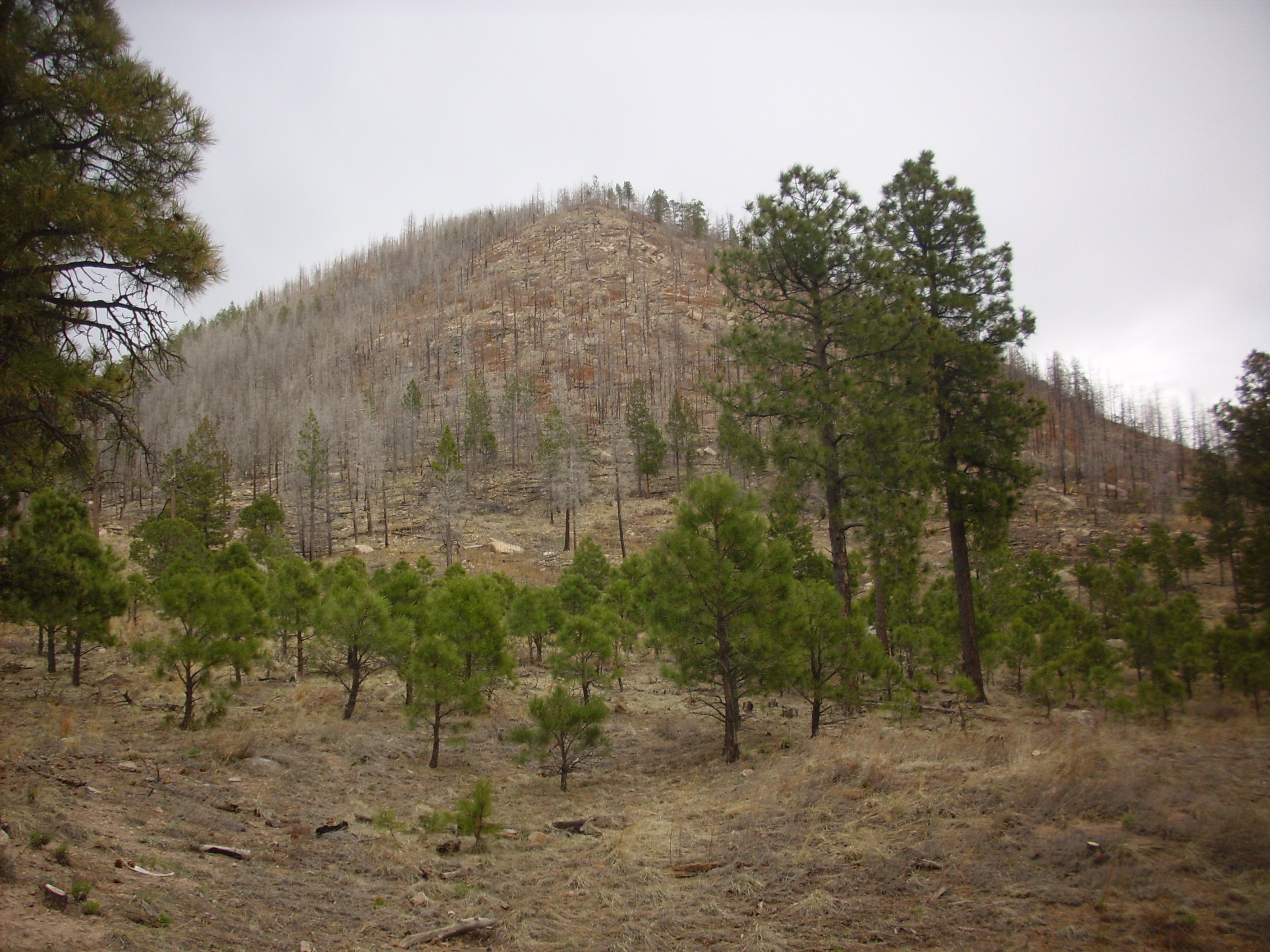
Tres Cerros West. Looking east from 35
41.796N 106 33.696W
The mountain is underlain by massive rhyolite, while there are rhyolite tuff beds exposed in a road cut to the southwest.

Canovas Canyon Rhyolite tuff bed in
roadcut. 35
41.517N 106 33.652W
Canovas Canyon Rhyolite crops out on the hill just to the north of the Bear Springs ranger station.
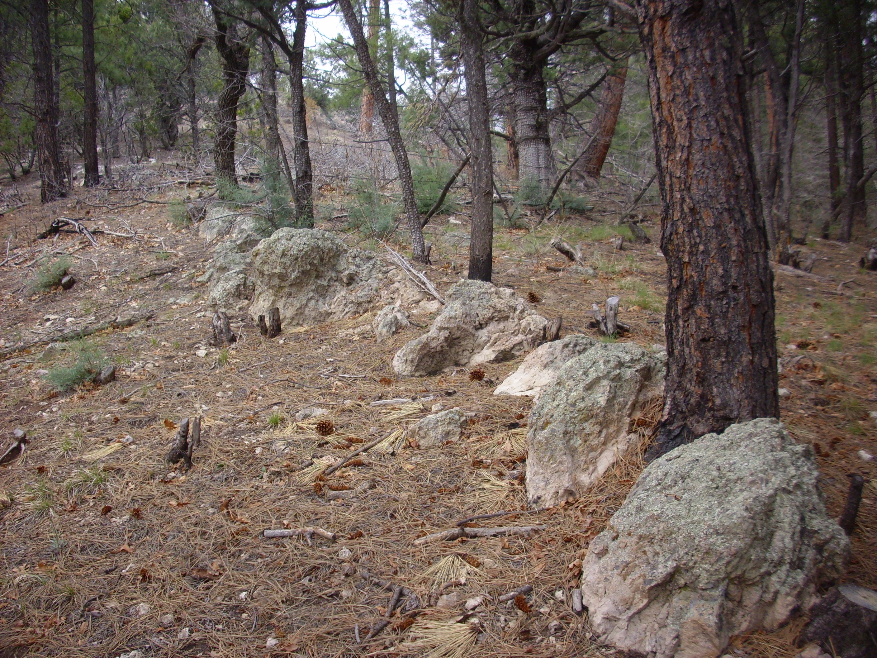
Canovas Canyon Rhyolite just north of
Bear Springs. 35
40.501N 106 33.012W
Samples from the area include lithic tuff
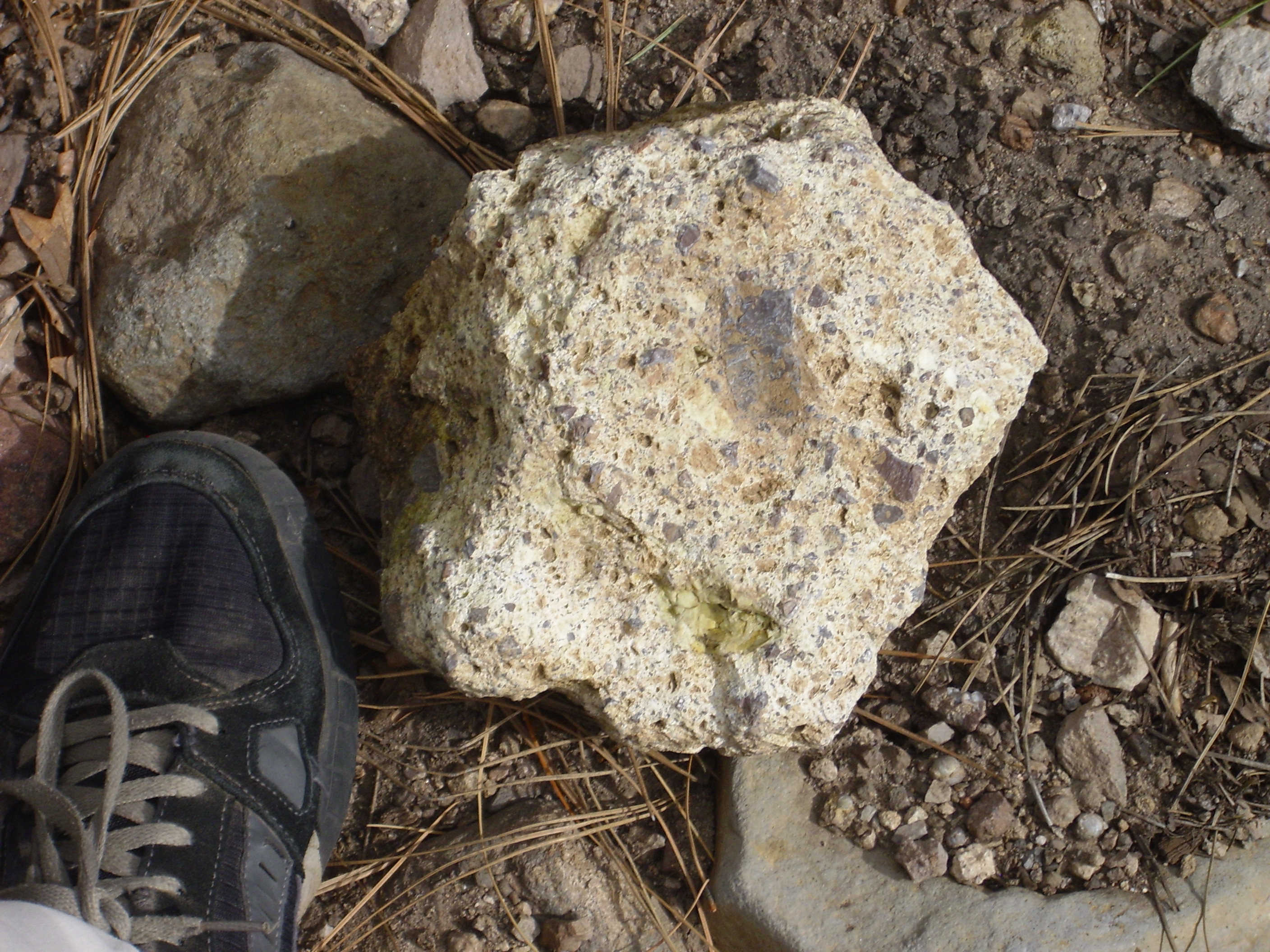
and flow banded massive rhyolite.
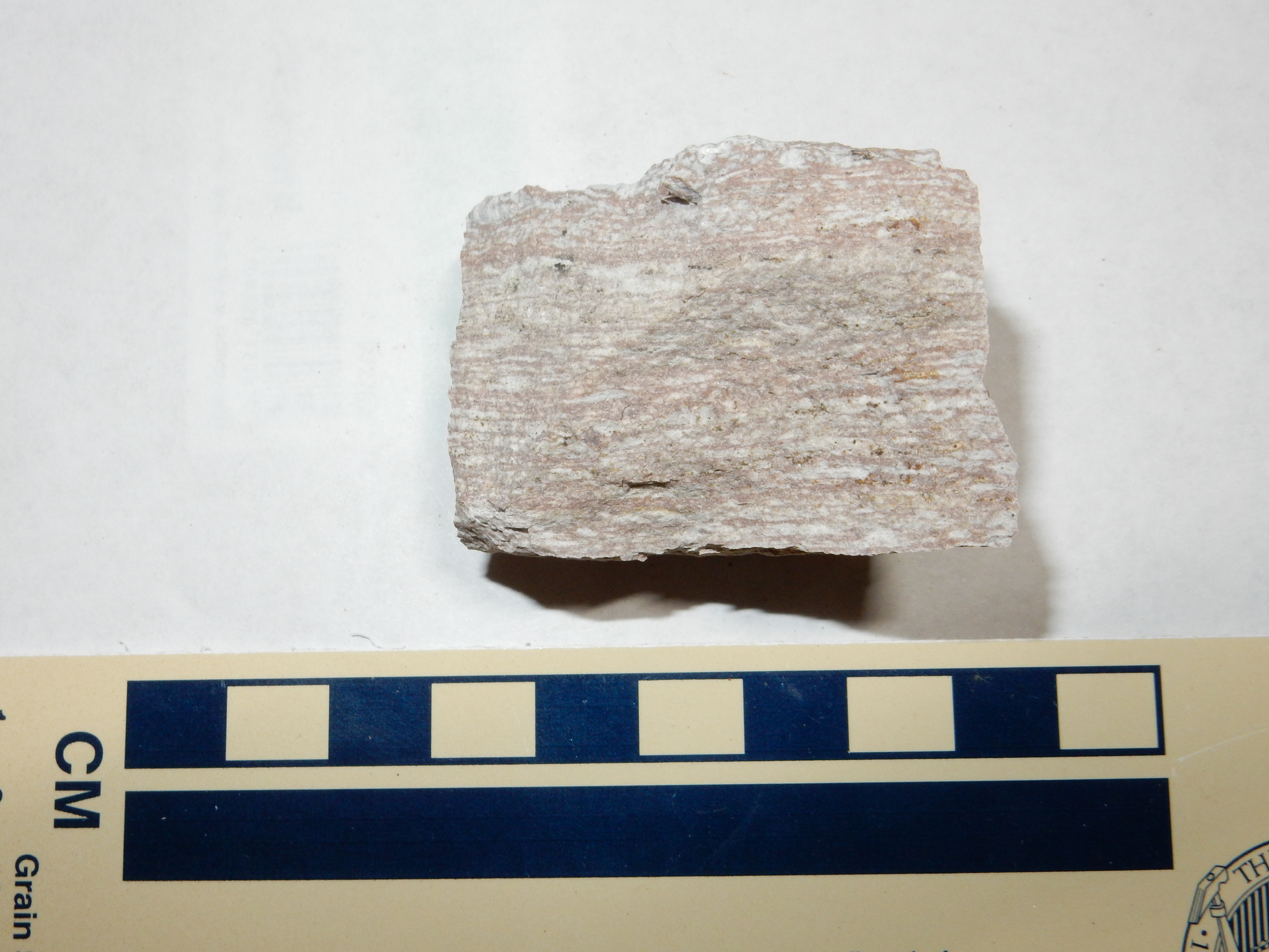
The Canovas Canyon Rhyolite is very thick in this area, though since its base is not exposed, we do not know the full thickness. The lower beds and the peaks corresponding to eruption centers are massive flows, with tuff beds overlying the massive flows in valley bottoms where the hot ash apparently ponded. The transition between the two is gradual enough to suggest that the two erupted together. This is rather unusual for rhyolite, as is the thinness of the flows; rhyolite is usually so viscous that it can barely make it out of the ground, and it usually forms very steep flows and domes. One wonders if the rhyolite was unusually hot or wet or both.
In any case, the rhyolite eruption appears to have been effusive rather than explosive, in contrast with the rhyolite that produced the Bandelier Tuff. Geologists have speculated that the crust was being rifted apart here so quickly 8 to 10 million years ago that magma had no time to build up for a big explosion. It was released gradually and relatively gently through the many fissures produced by the rifting.
Further west, the thick beds of Canovas Canyon Rhyolite at Bear
Springs disappear under younger and less silicic flows of the
Paliza Canyon Formation. This is the field criterion for
identifying a tuff or rhyolite in the southern Jemez as Canovas
Canyon Formation. A good example is an outcrop of tuff in the
nothern wall of middle Paliza Canyon.

Canovas Canyon Rhyolite tuff beds in
upper Paliza Canyon. 35
43.907N 106 35.747W
These beds are identified as part of the Canovas Canyon Rhyolite by their stratigraphic location: The skyline visible above the tuff is Paliza Canyon basalt. Dark boulders of Paliza Canyon basalt from the upper cliffs litter the colluvium apron below the tuff beds. Few fragments of tuff are present here; they are much softer and quickly erode away.
There is a very large block of tuff on the slope with a rather striking surface.
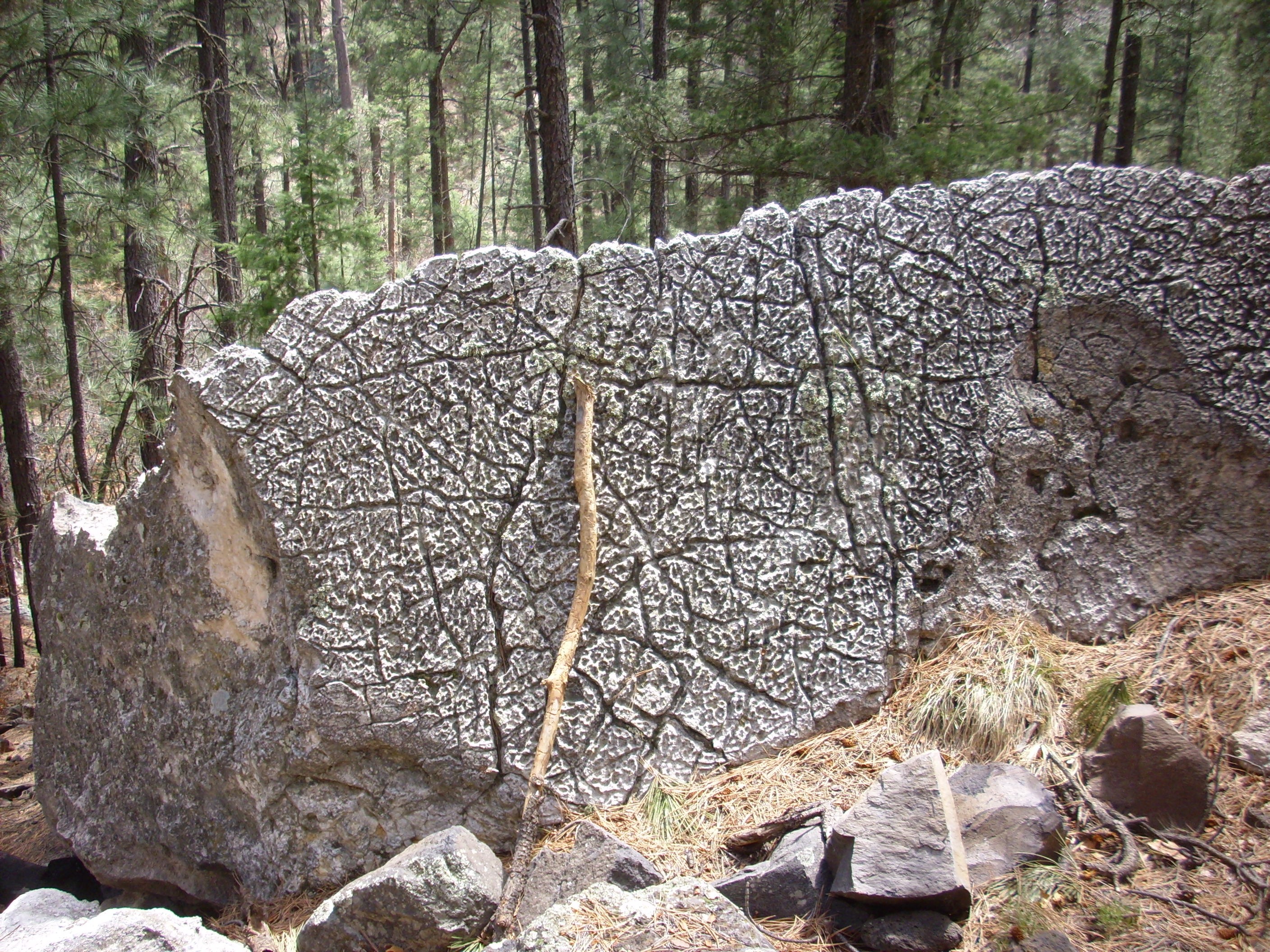
Here are the beds close up.


The beds include some that are very lithic-rich.
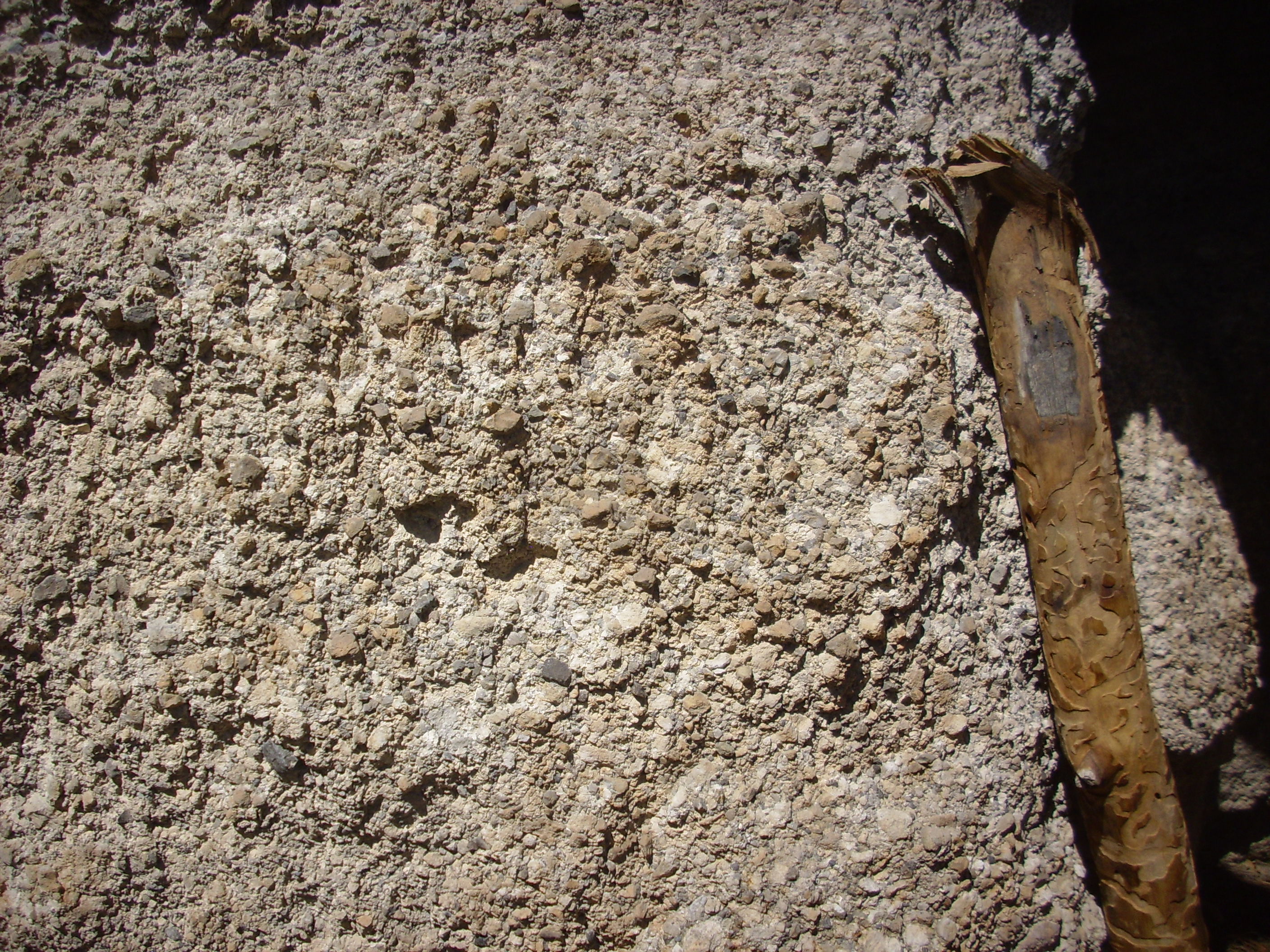
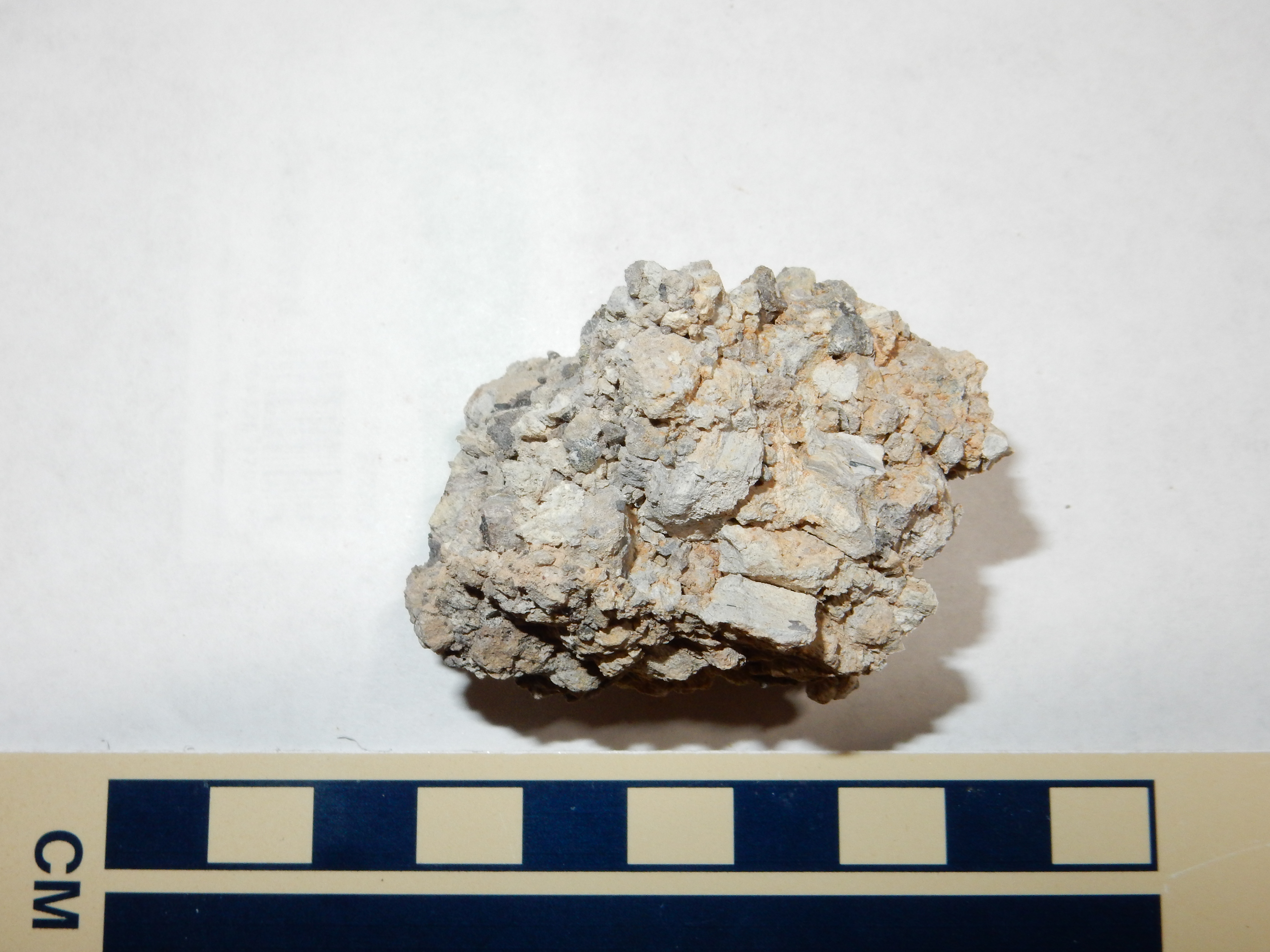
This fine-grained bed looks like a surge deposit.

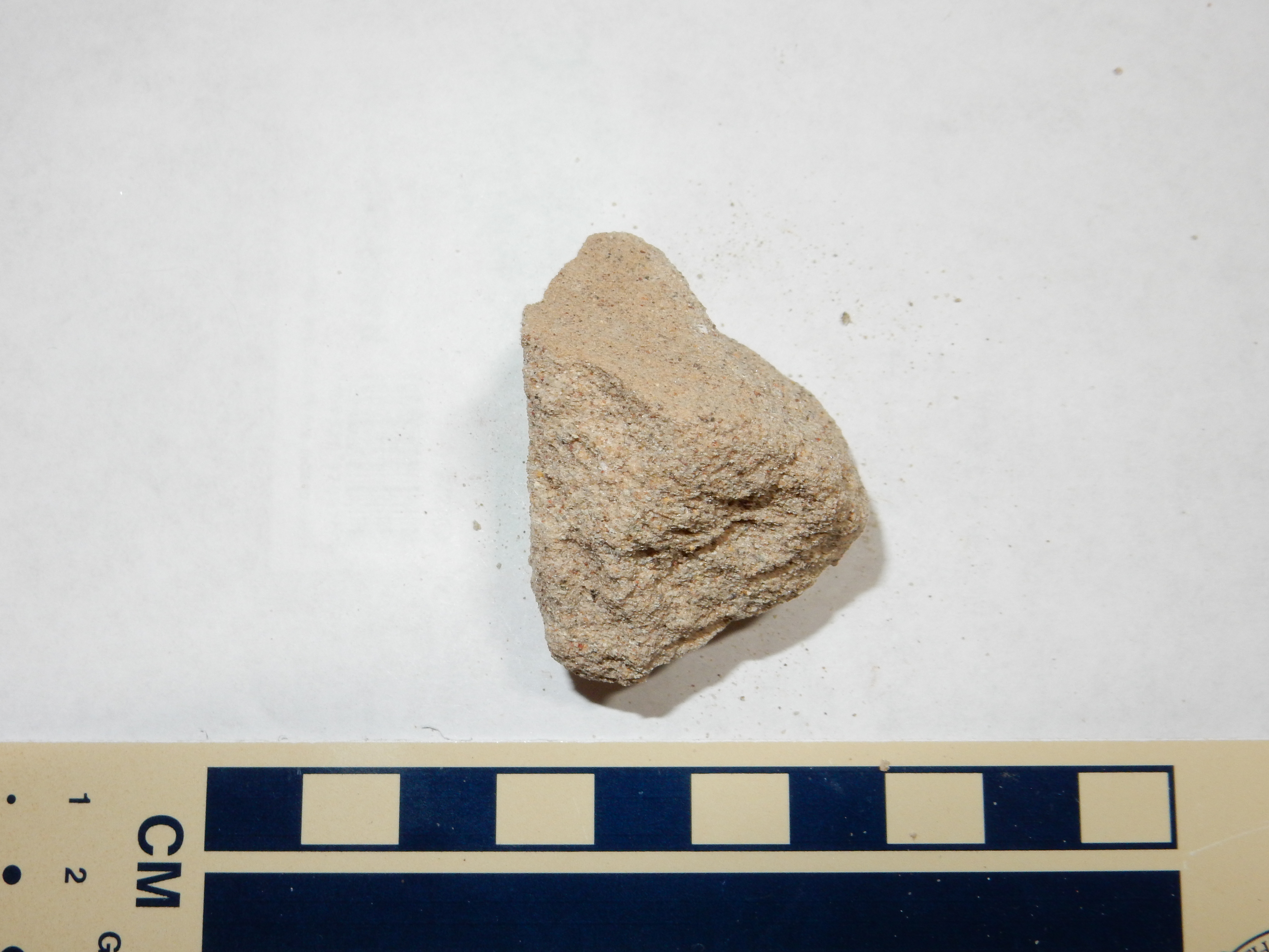
while the upper beds are more massive.

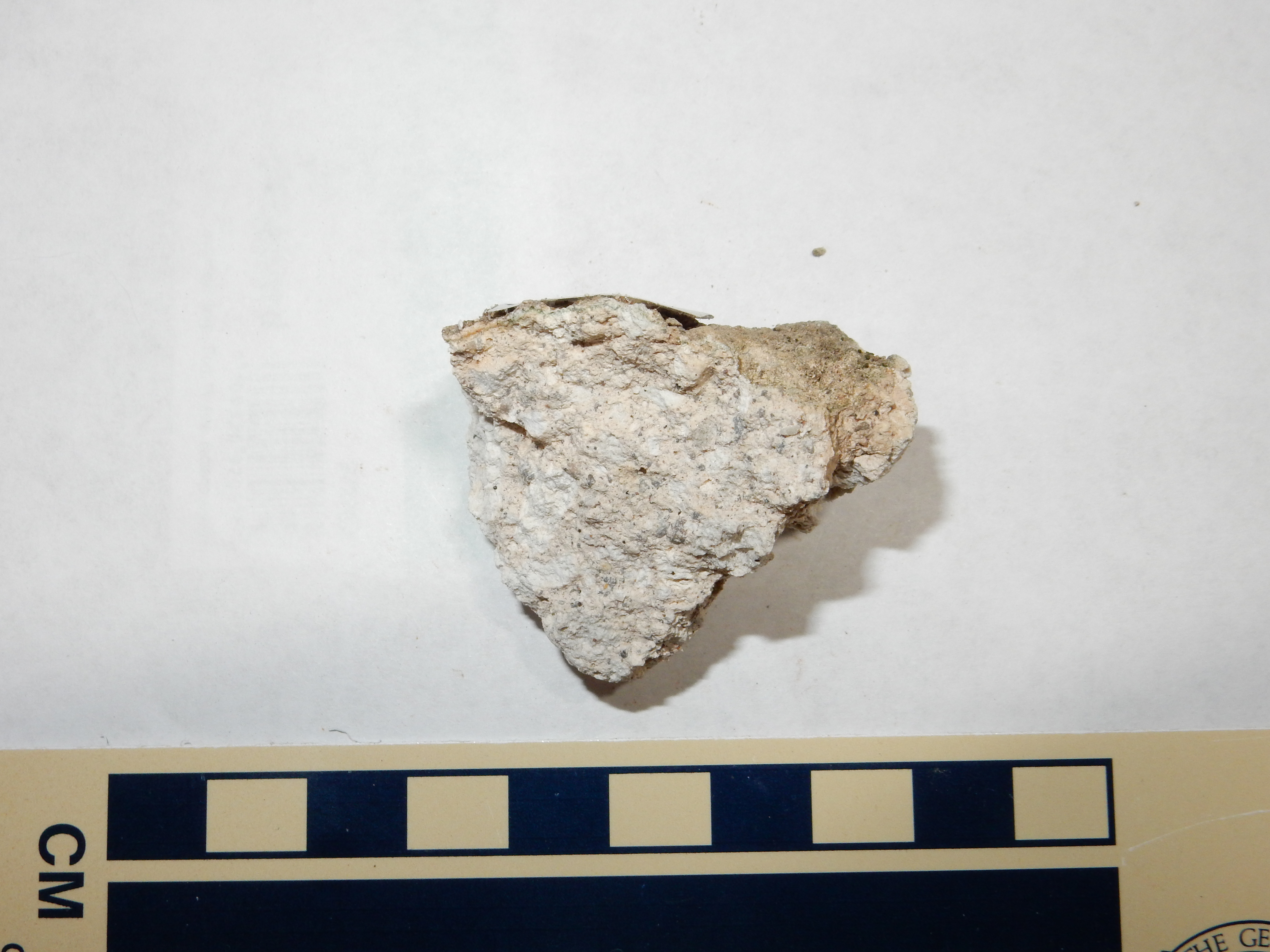
Nearby, on the west escarpment of Borrego Mesa, reworked volcanic ash assigned to the Canovas Canyon Formation overlies much older beds of Jurassic age.
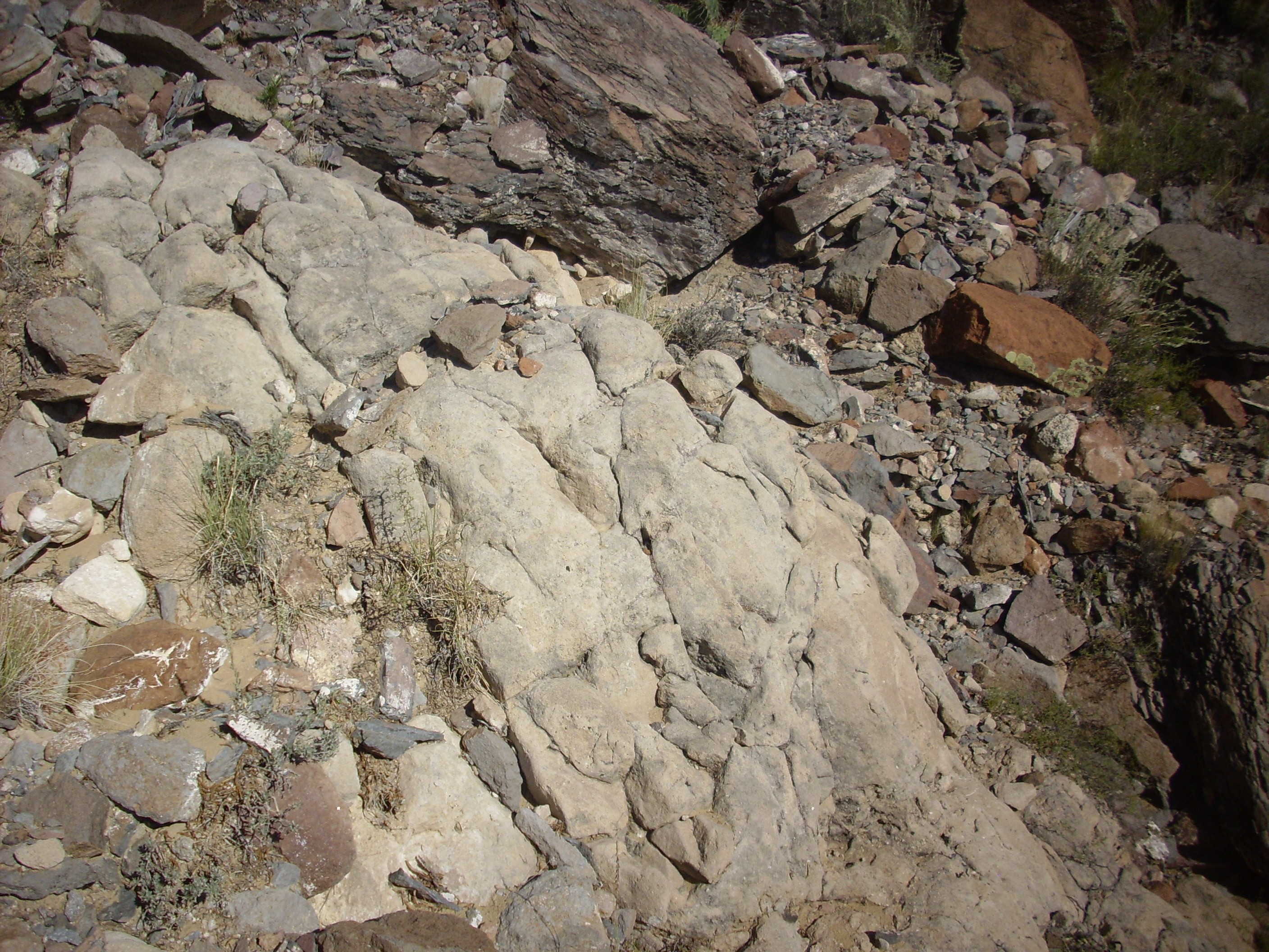
Canovas Canyon Rhyolite on Borrego Mesa. Near
35
40.631N 106 38.612W
Another outlying area of exposure of Canovas Canyon Rhyolite is found far to the east, in the San Miguel Mountains. The most accessible dated exposure is southeast of Cerro Balitas, and can be reached by a short if strenuous hike from the Dome Road.
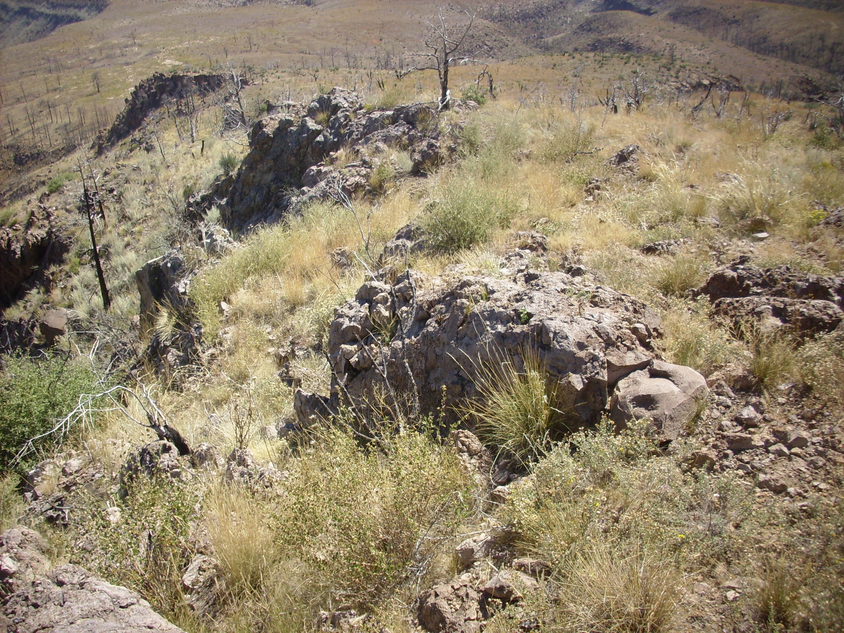
Canovas Canyon Rhyolite southeast of Cerro Balitas. Near
35
43.301N 106 22.991
The outcrop here is very close to the point where my geologic map indicates Canovas Canyon Rhyolite was sampled and dated at 10.5 million years in age. Here's a sample.
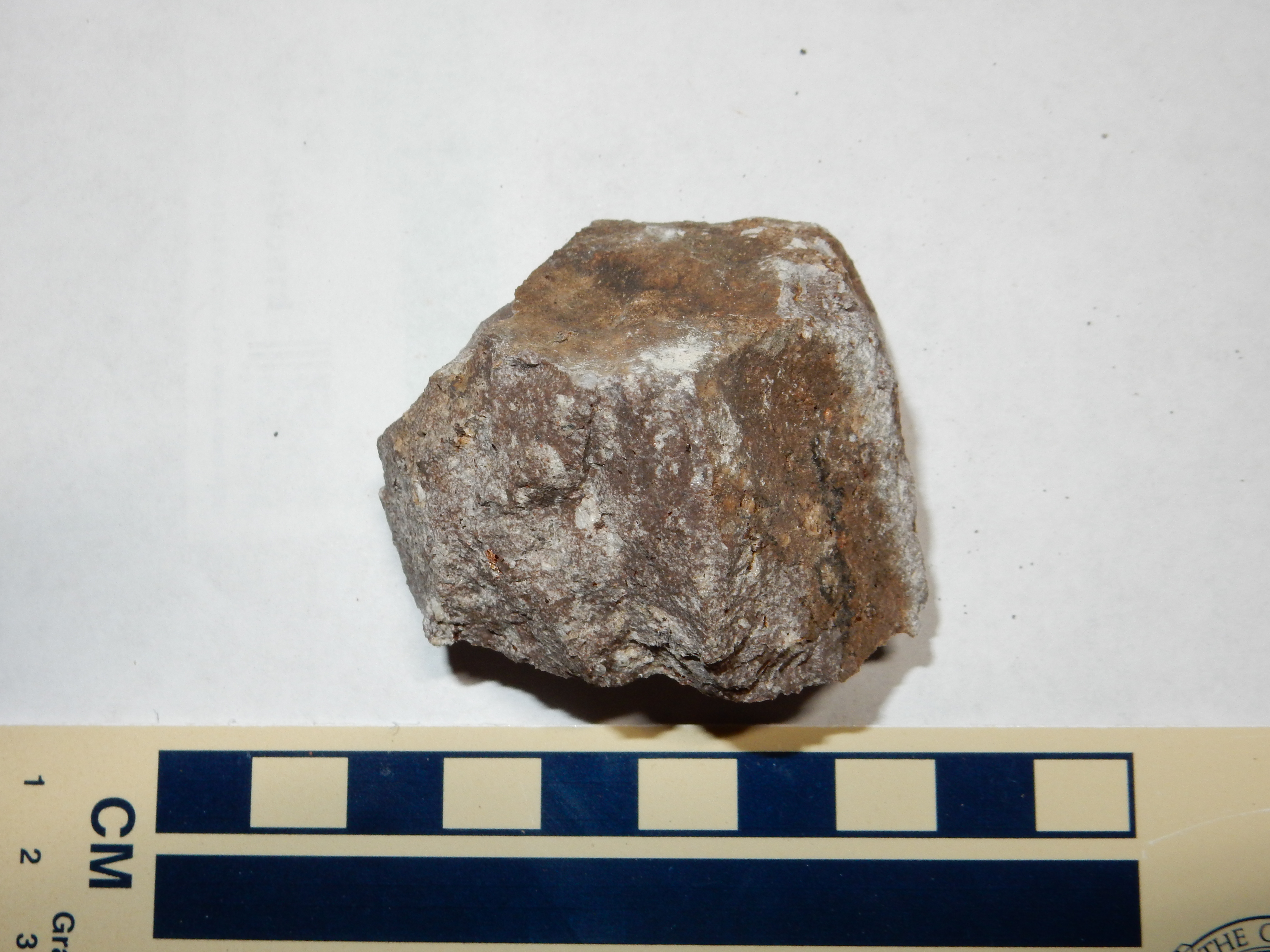
Canovas Canyon Rhyolite southeast of Cerro Balitas. Near
35
43.301N 106 22.991
Under the loupe, the sample shows phenocrysts of feldspar and blebs of what appears to be iddingsite, but it is particularly striking for the numerous sizable flakes of biotite. It looks more like a dacite than a rhyolite, but the Canovas Canyon Rhyolite does include some low-silica rhyolites bordering on dacite.
The furthest northeast exposure of Canovas Canyon Rhyolite is found on the northeast foot of the San Miguel Mountains, where it has been exposed in a landslide scarp.
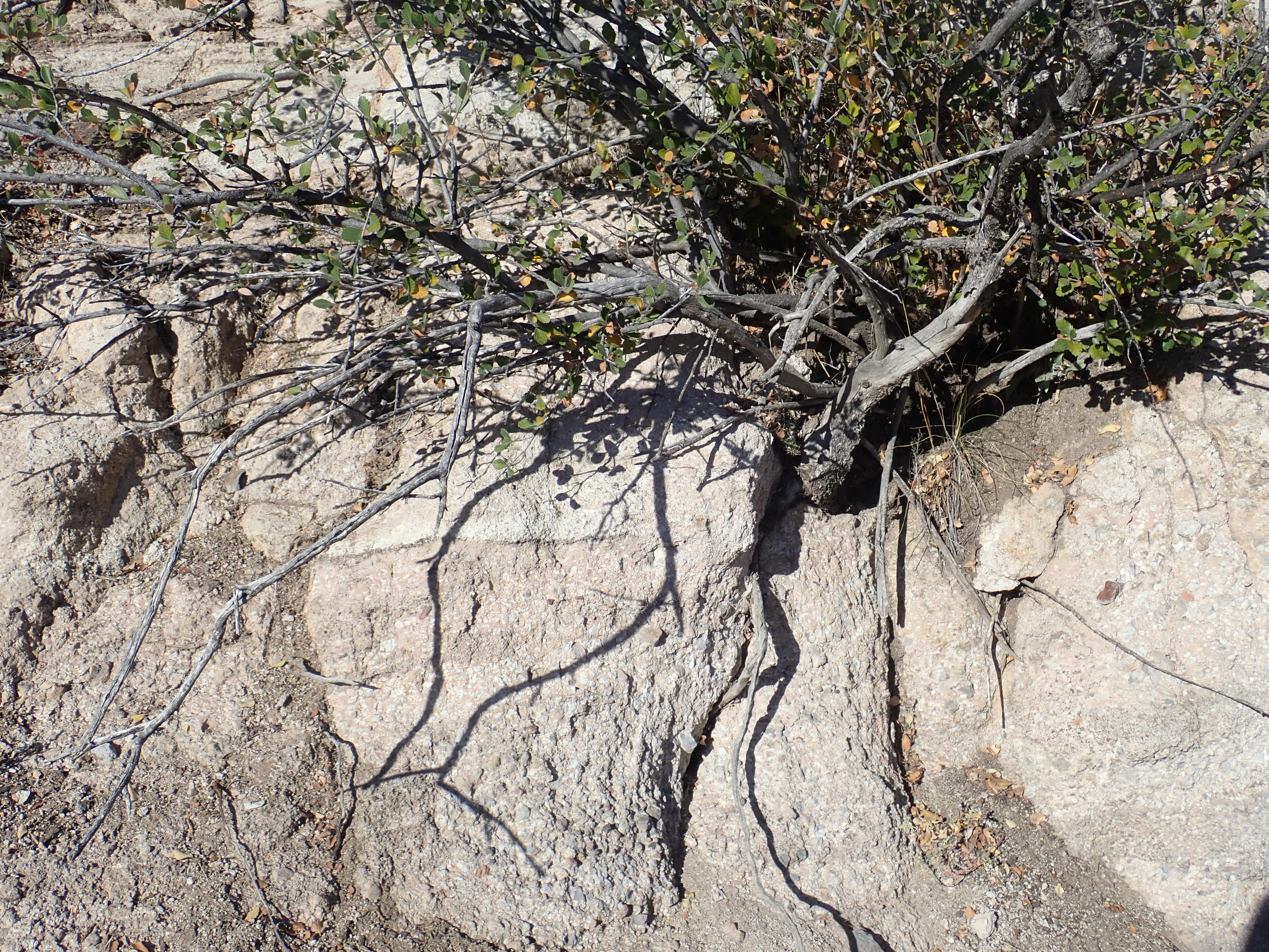
Canovas Canyon Rhyolite on northeast foot of San Miguel
Mountains. Near 35.76424N
106.3505707W
Notice the resemblance to some of the Canovas Canyon tuff beds in Paliza Canyon, shown earlier. Further to the east the rhyolite is exposed in a small arroyo.
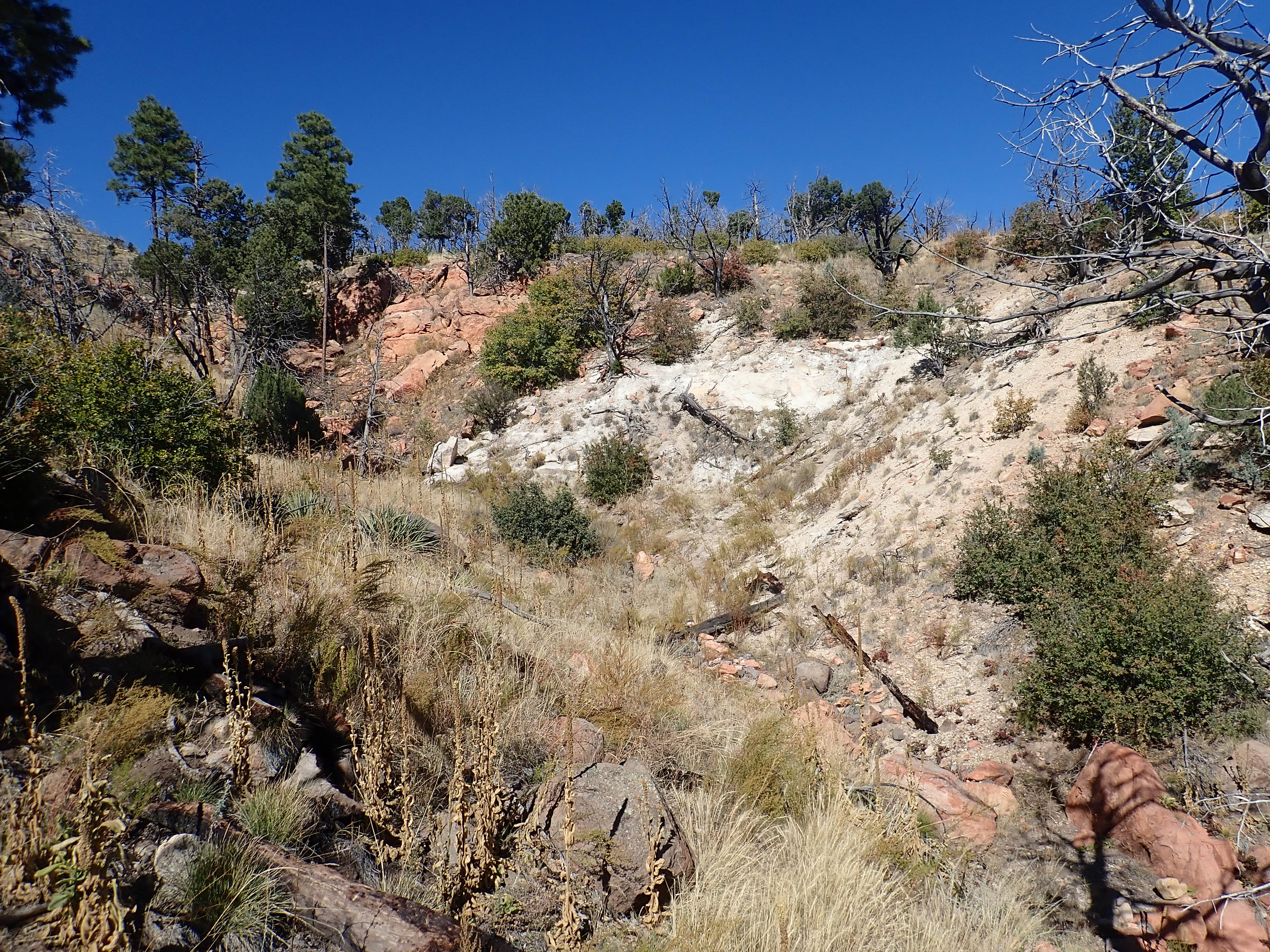

Canovas Canyon Rhyolite east of San Miguel Mountains.
Near 35.761738N
106.3453987W
This outcrop appears to lie below sandstone beds mapped as
Tertiary Santa Fe Group beds. It has not been dated but may be an
intrusion younger than the beds, or the beds may be relatively
young rift fill.
The picture we have so far of Keres volcanism is of initial low-silica eruptions coming almost directly from the upper mantle. This hot magma softened the crust through which it passed, sealing the fissures through which it had formerly erupted, and hot magma began to accumulate in pockets deep in the crust. This magma cooled and differentiated, with low-silica minerals crystallizing out to leave andesitic magma. Further rifting in the area allowed this magma to reach the surface, along with high-silica magma formed as independent pockets of melted crust, which erupted as Canovas Canyon Rhyolite. Finally, some of the andesitic and rhyolitic magma mixed to form relatively small quantities of dacitic magma that erupted as domes and short flows.
Much of the magma solidified underground, and some of this was eventually exposed by erosion to form one of the more economically interesting outcrops in the southern Jemez, the Bland intrusion. We'll learn more about the Bland intrusion in the next chapter.
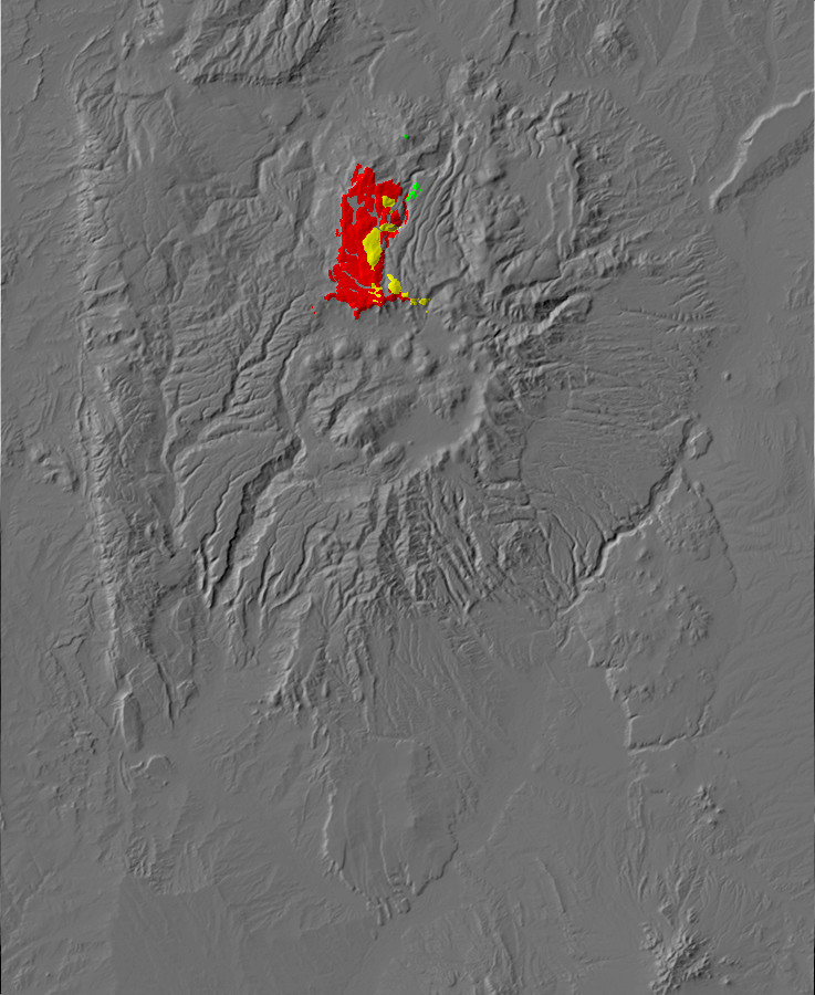
The La Grulla Plateau is a large subalpine plateau that is reached via Forest Road 100 from Youngsville. As the road begins to ascend the plateau, there is a beautiful view across Canones Canyon towards Polvadera Peak to the southeast.
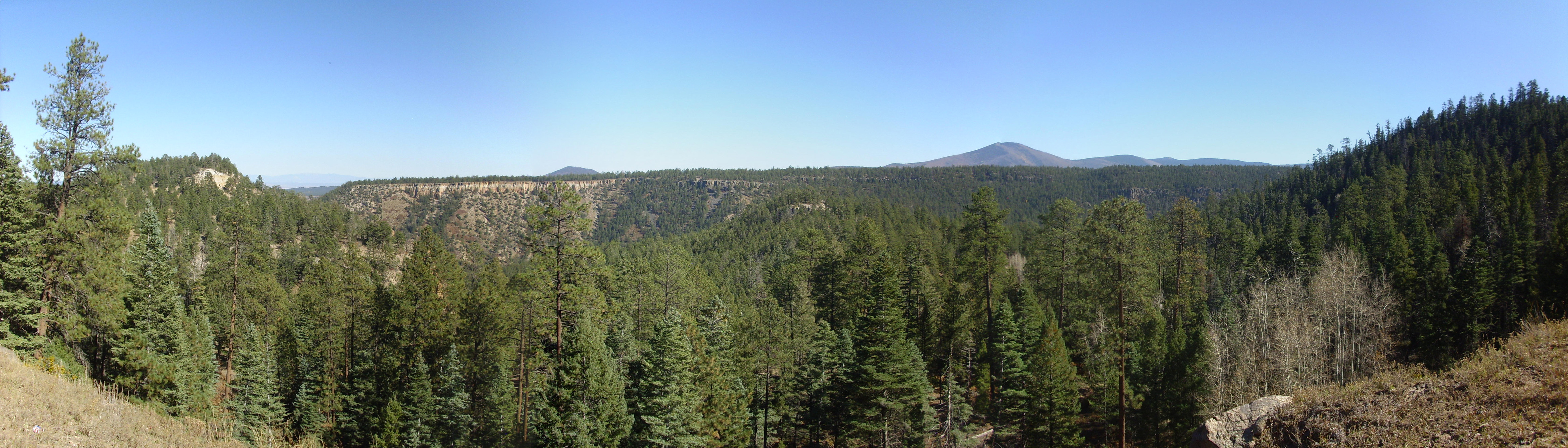
The mesa across Canones Canyon is Mesa del Medio. To the left one sees the mesa underlain by Santa Fe Group with a cap of Bandelier Tuff. To the right this gives way to basalt flows of the La Grulla volcanic center. Polvadera Peak is right of center and Cerro Pelon is the smaller peak just left of center. Both are dacite domes of the Tschicoma Formation.
Nearby the road cuts through andesites of the La Grulla Plateau. These were long lumped together with the Lobato Mesa Formation to the east or the Tschicoma Formation to the southeast, but geologists now think these were separate pulses of volcanic activity, with the La Grulla eruptions peaking a bit later than Lobato, about 7.5 million years ago. This reflects a general shift in the Jemez from volcanism along a northeast-southwest line from Borrego Mesa to Lobato Mesa to a north-south line from the Keres Highlands to the La Grulla Plateau. There are also chemical differences between the La Grulla flows and the Lobato Mesa flows. The Grulla Plateau andesites and dacites are richer in alkali metal oxides than their Tschicoma Formation counterparts. Geologists have concluded that the La Grulla andesites and dacites formed from straightforward differentiation of primitive magmas while the Tshicoma Formation formed from differentiated magma that mixed with basalt magma.
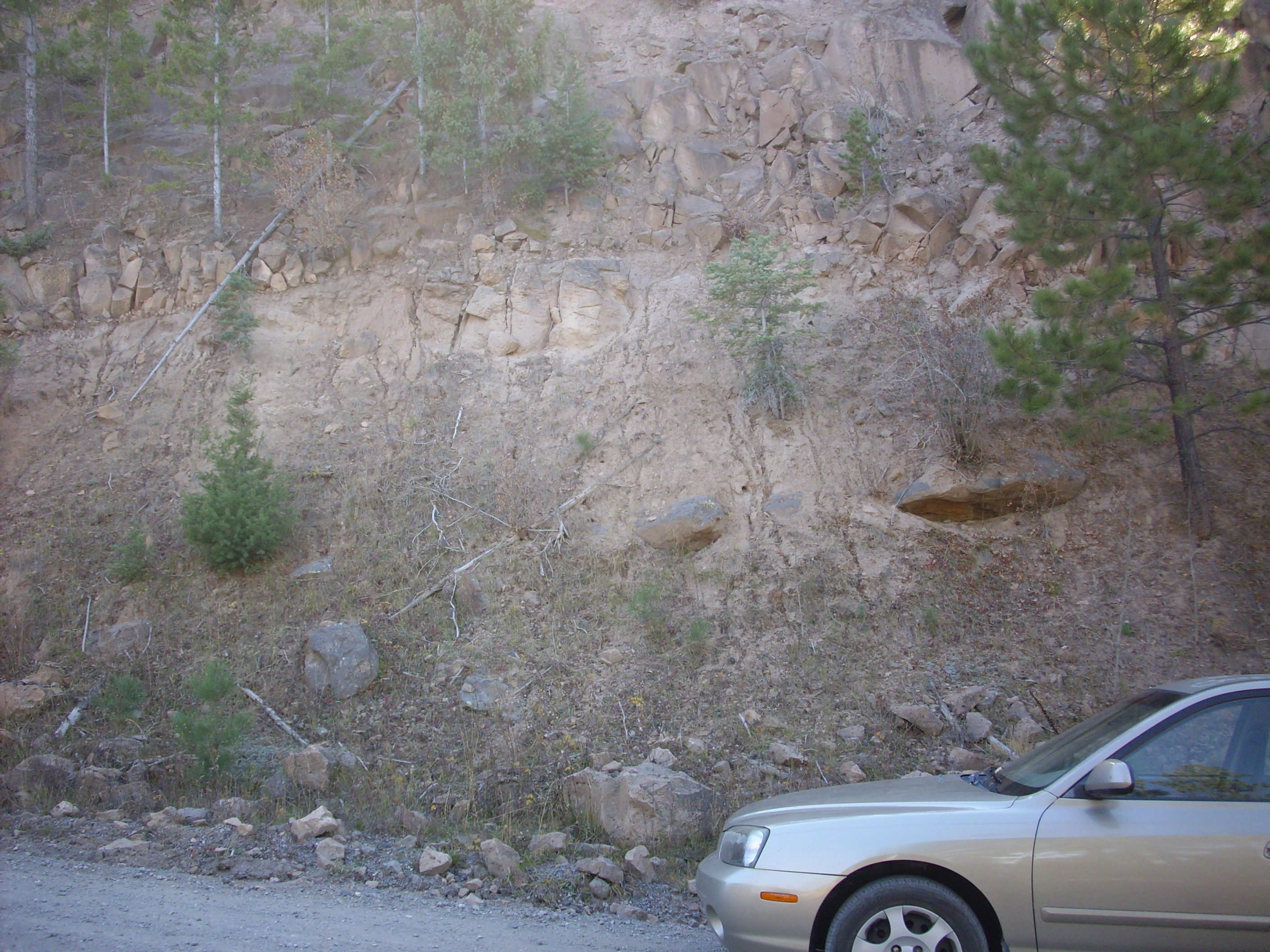
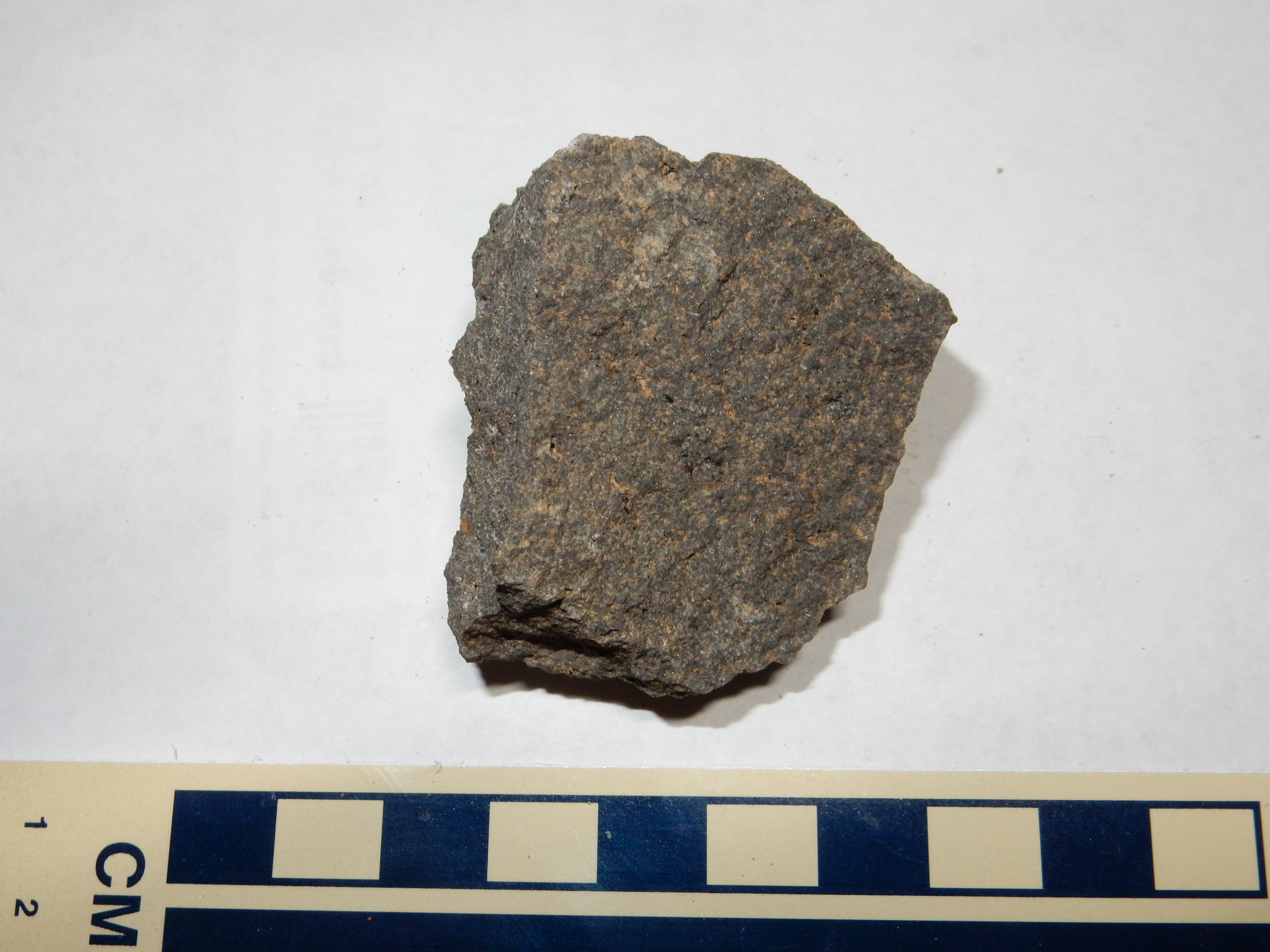
The La Grulla Plateau formed from an area that was flooded with basalt and andesite lava. The resistant lava protected the area from erosion, and subsequent faulting to the east and west left the plateau standing more or less by itself except on the south, where it was buried under Tschicoma lava that now forms the Valles Caldera north rim. The plateau has low rolling hills and long meadows marking faults, mostly trending north or northeast. It's a wonderful place to camp.
Here is a fault valley with a small lake.
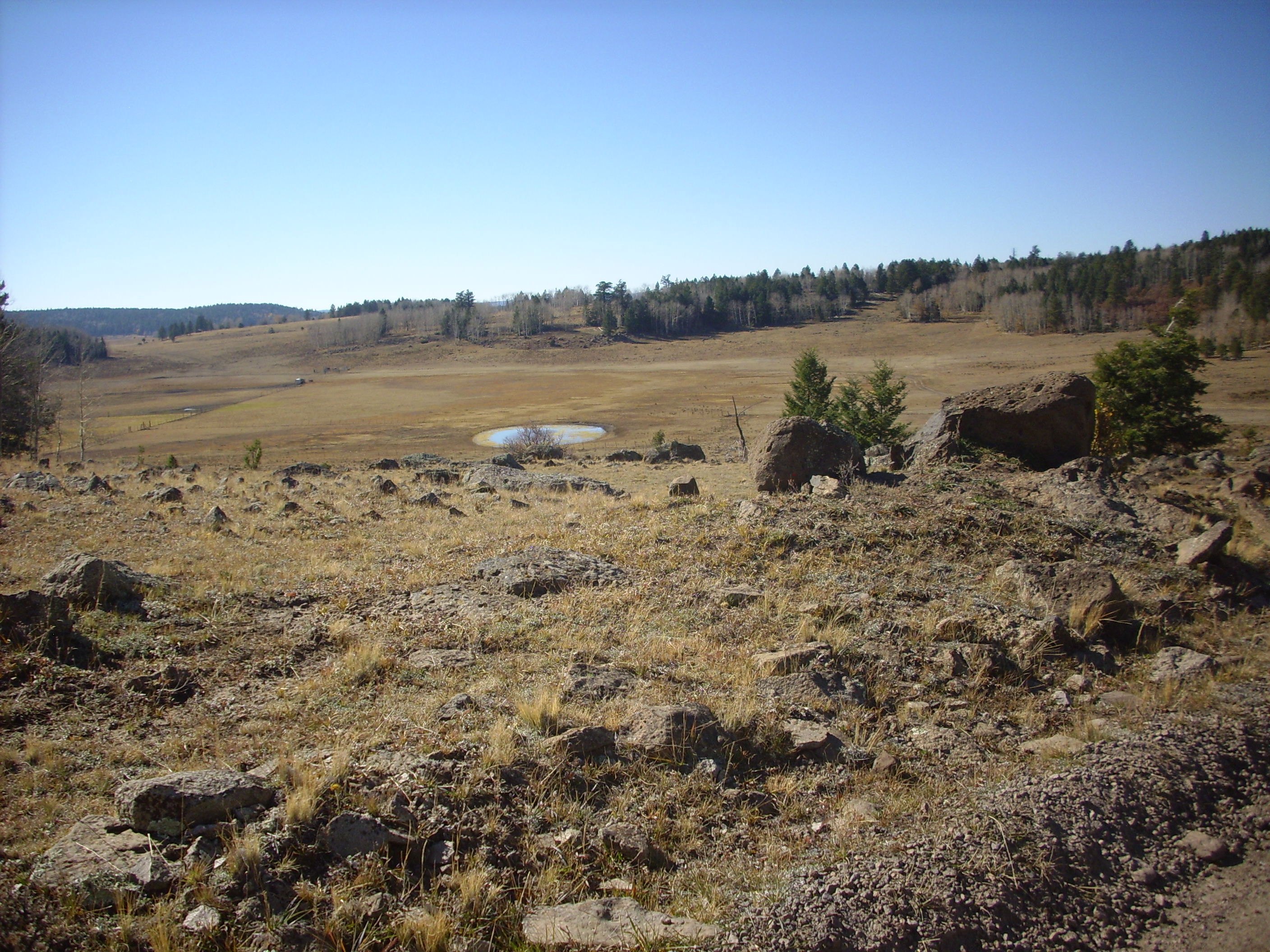
And here is a photo looking along a fault meadow.
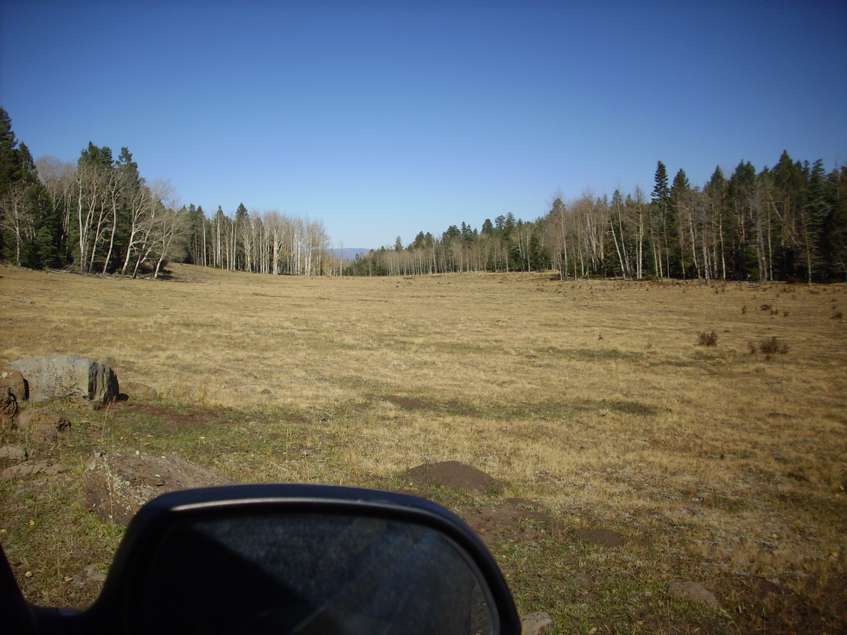
There is a spectacular lookout at Encino
Point which provides a view of much of the interesting
geology in the area. Here's a panorama.
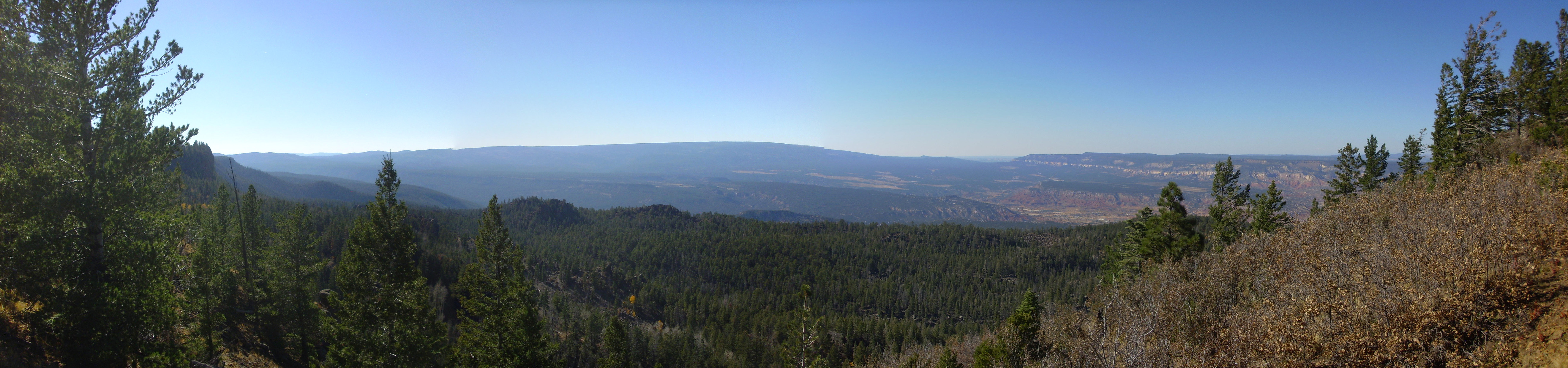
On the far skyline is the San Pedro Mountains, a northern extension of the Sierra Nacimiento, where a huge block of crust has been thrust up by tectonic forces. Mesa Naranja is visible to the right, and above it on the skyline is Mesa Alta. Both mesas are underlain by Permian and Triassic sedimentary rocks.
Underneath the ranger lookout, the escarpment exposes a cross section of an endogenous dome associated with the La Grulla eruptions.
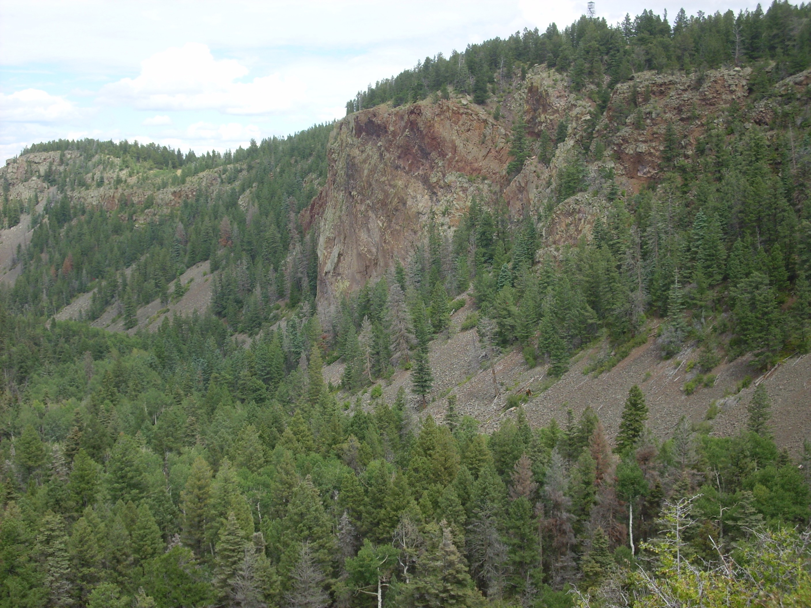
Encino dome. Looking north from 36
7.197N 106 33.495W
The dome is located at the center of the picture. It consists of
a mass of dacite which pushed up from beneath while in the liquid
state. One can see that the andesite beds have been forced upwards
above the dome. (Click to enlarge.) This suggests that this dome
never reached the surface.
Looking northwest, one sees the basalt dikes of Los Barrancos, the rugged area below the escarpment. This was long thought to be a landslide area, but we now know that the slabs of hardened lava are actually dikes and that this area was a volcanic center that was broken up by faulting and eroded to its current form.

Encino barrancos. Looking northwest from 36
7.197N 106 33.495W
At the northern end of La Grulla Plateau, the andesite flows lie
atop an extensive hydromagmatic deposit, produced when magma
intruded rock that was saturated with water. The magma and rock
exploded (a phreatomagmatic eruption) to leave large
chunks of country rock embedded in a matrix of cinders.

Hydromagmatic deposits. Near 36
07.924N 106 32.712W

Hydromagmatic deposits. Near 36
07.924N 106 32.712W
Hydromagmatic deposits. Near 36
07.924N 106 32.712W
The continuing heat from the eruption and steam from groundwater
tended to bake the whole mess together; in this case, the cement
is largely calcite, which forms occasional large crystals of
dogtooth spar.
On the way out, the road passes another
mountain meadow strewn with andesite boulders.
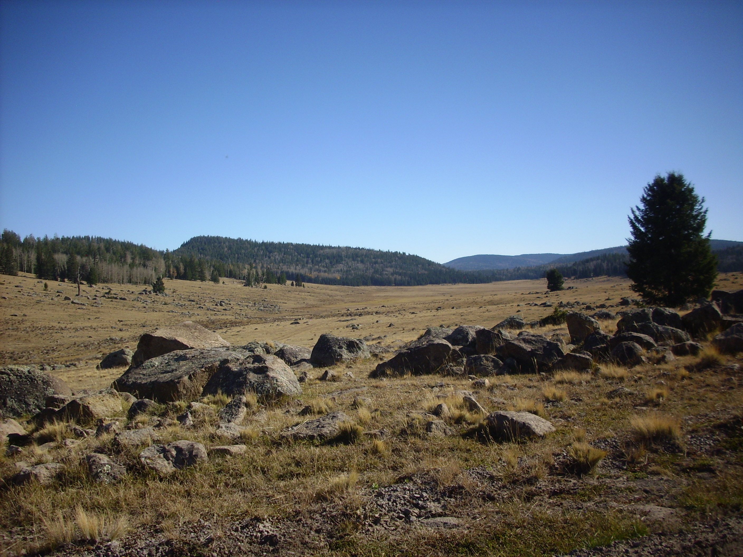
The broad hill in the middle distance is part of the Four Hills
eruptive center, and is underlain by hornblende dacite 7.35
million years old. Beyond is the north rim of the Valles caldera.
The vista from the headwaters of Polvadera Creek, near here,
shows one of the most famous landforms created by the La Grulla
eruptions, Cerro
Pedernal.

That's Cerro Pedernal in the center, and Polvadera Peak again off to the right.
Closer up:
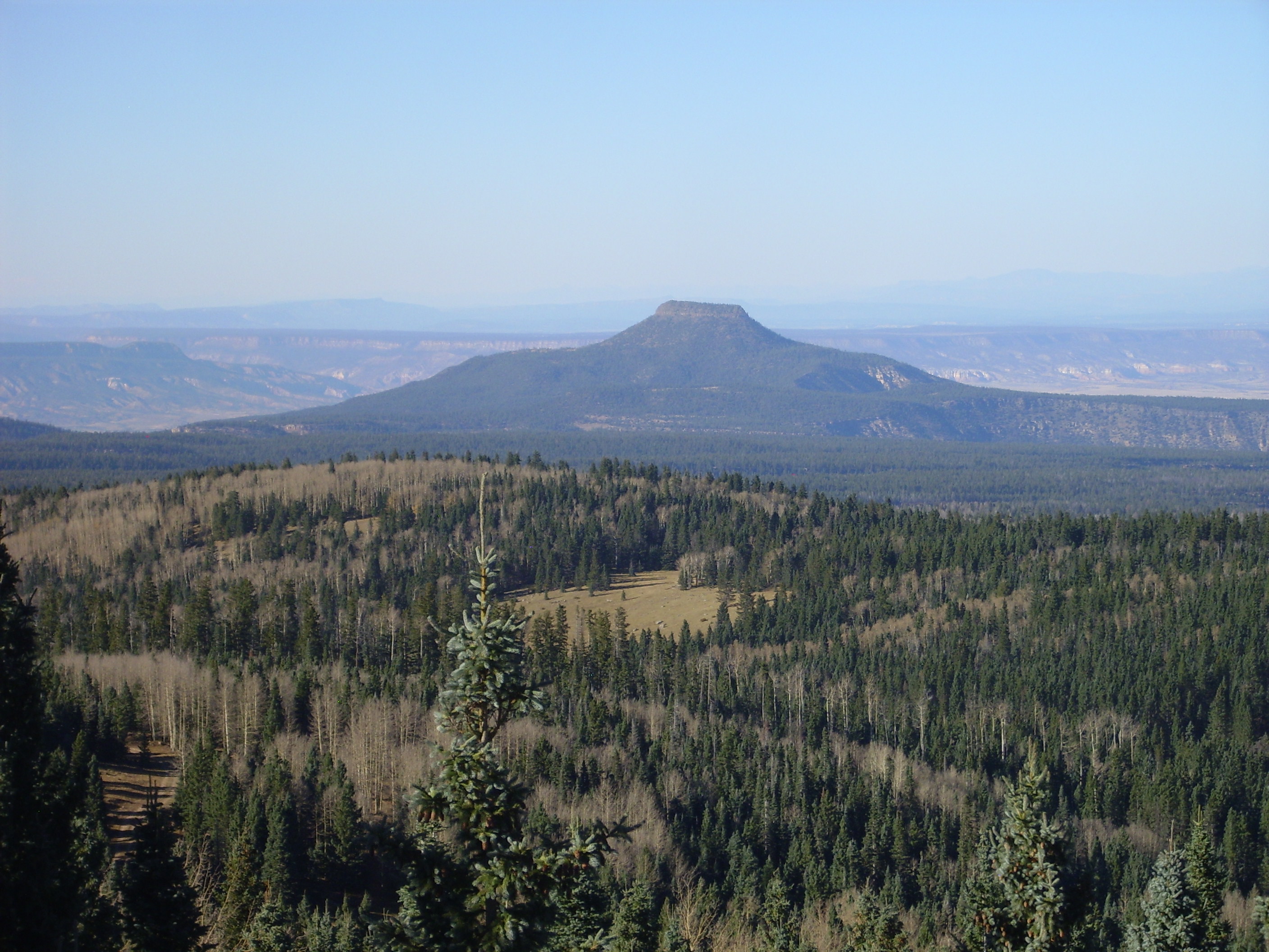
Cerro Pedernal has a hard cap of La Grulla basalts underlain by an impressive rock column of Permian, Triassic, Cretaceous, and Tertiary sediments, covering some 300 million years of the Earth's history. However, there are a number of gaps (unconformities) in the rock column. We discussed some of these in earlier chapters of this book.
The La Grulla flows extended south into what is now the Valles caldera, and La Grulla andesite is exposed in the north rim of the caldera.
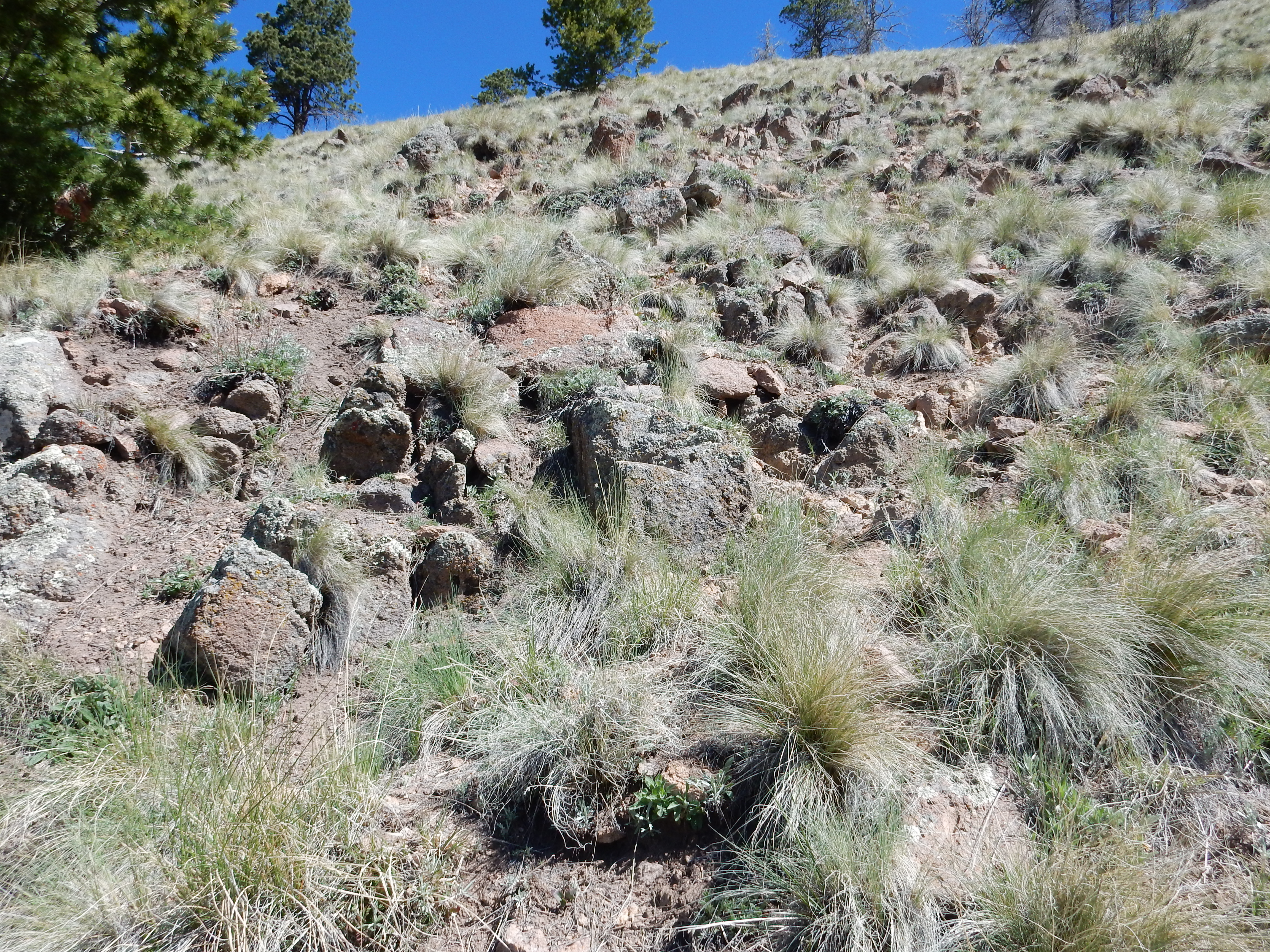
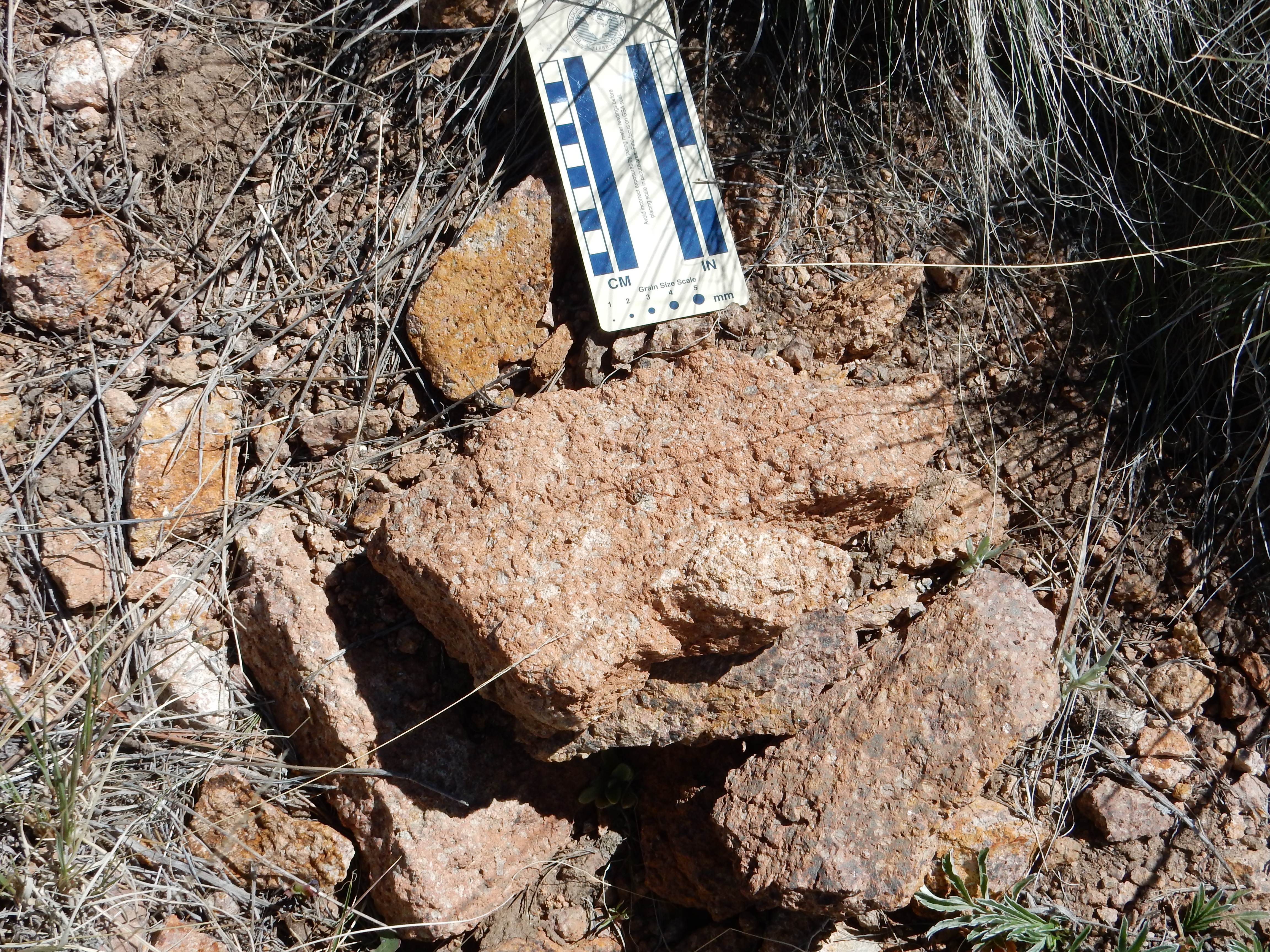
La Grulla andesite in caldera north rim. 35
59.995N 106 30.127W
There are multiple flows making up the plateau and the rim of the caldera. A higher flow show similar prophyritic character but a gray rather than red color.
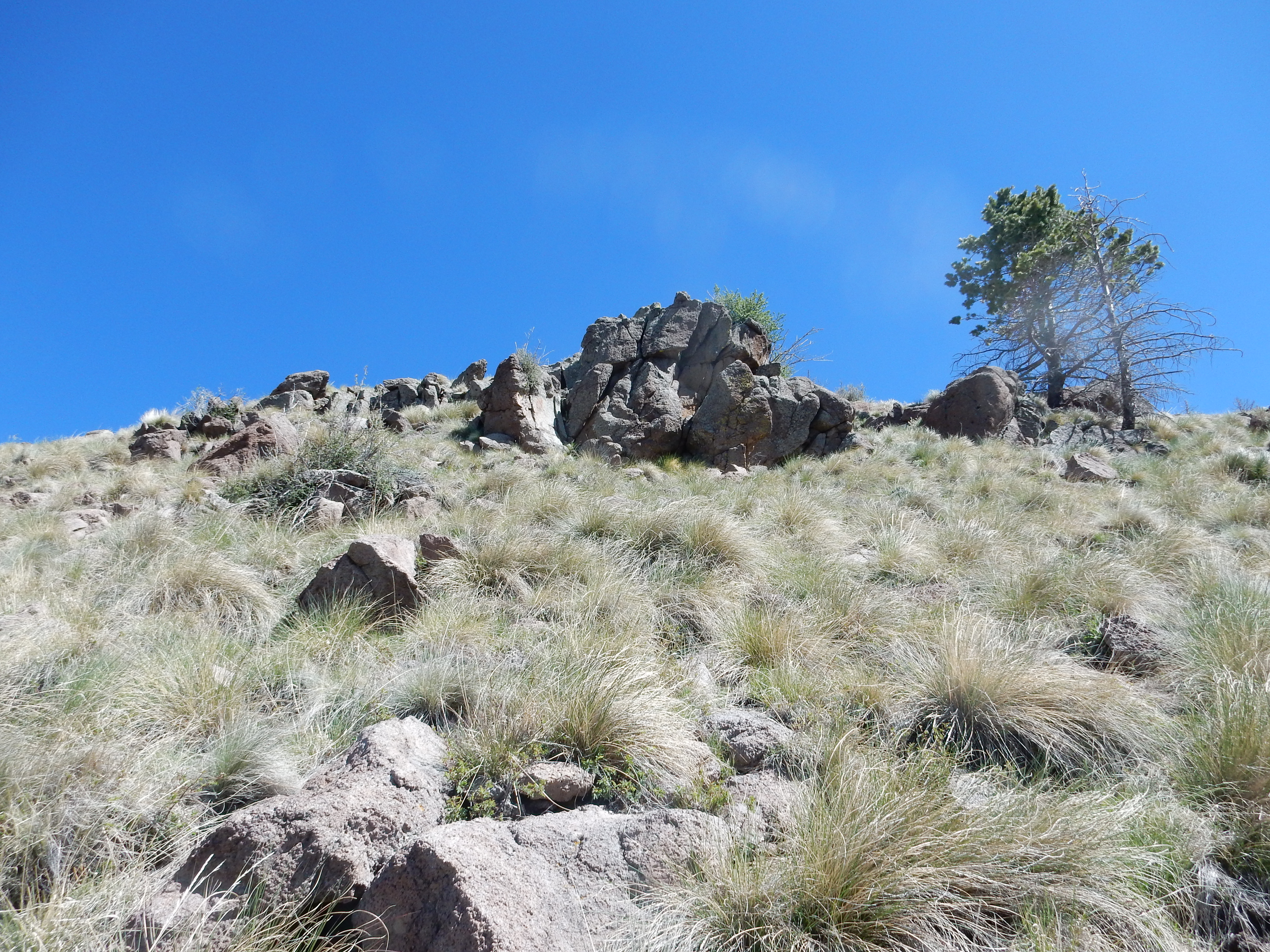
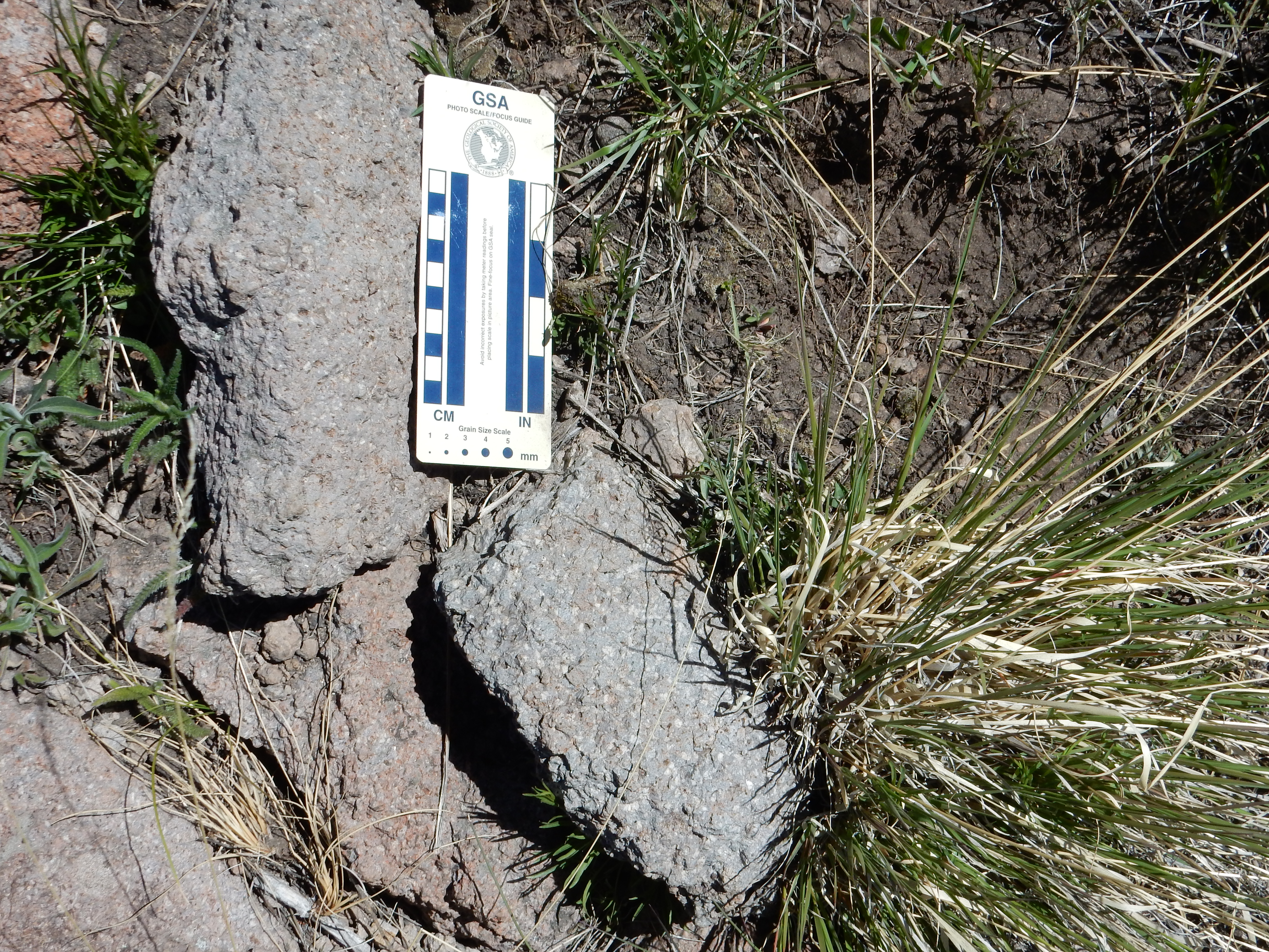
La Grulla andesite in caldera north rim. 36
00.037N 106 30.109W
This is a reminder that color is often the least diagnostic feature of an igneous rock. Further east along the rim, the flows transition to a biotite-hornblende dacite that is more silica-rich, more massive, and has sparser phenocrysts.
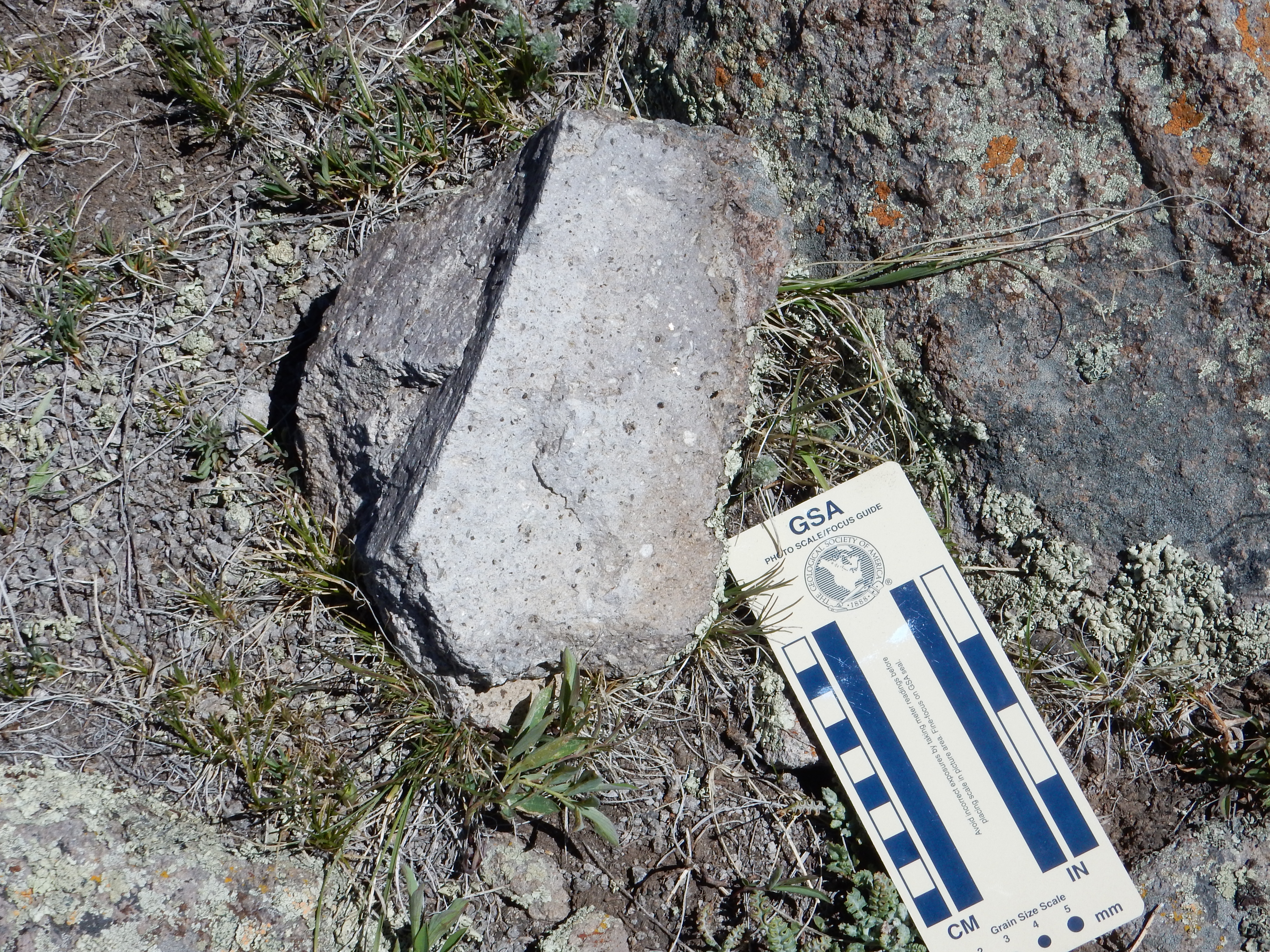
La Grulla dacite in caldera north rim. 35
59.983N 106 29.766W
The transition from La Grulla dacites to Tschicoma dacites occurs somewhere east of this point and is poorly defined.
This map shows the lower units of the Keres Group (Lobato Mesa, Paliza Canyon, Canovas Canyon, and La Grulla) and the age ranges of the beds they rest on.
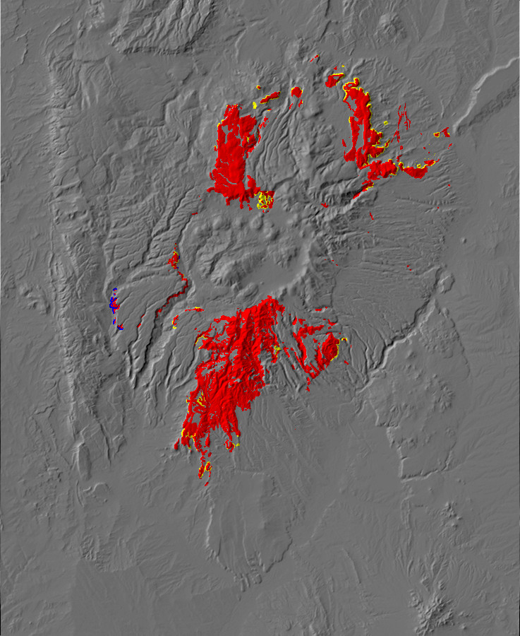
Paleomap of
Keres Group. Keres Group in red, Santa Fe Group contacts in
yellow, pre-Rift Tertiary and Mesozoic contacts in green,
Paleozoic contacts in blue
Next page: What goes up must come down
Copyright © 2014-2015 Kent G. Budge. All rights reserved.